Title 102 Administration
Title 103 (Reserved)
Title 104 Zones
Title 105 (Reserved)
Title 106 Subdivisions
Title 107 (Reserved)
Title 108 Standards
Title 109 (Reserved)
Title 110 Signs
Chapter 101-2 Definitions
State Law reference—County Land Use, Development, and Management Act, U.C.A. 1953, § 17-27a-101 et seq.; authority of county board of commissioners to enact land use ordinances and a zoning map for the use and development of land within the unincorporated area of the county, U.C.A. 1953, § 17-27a-501.
Sec 101-1-2 Purpose
Sec 101-1-3 Interpretation
Sec 101-1-4 Conflict
Sec 101-1-5 Effect On Previous Ordinances And Maps
Sec 101-1-6 Rules Of Construction
Sec 101-1-7 (Reserved)
Sec 101-1-8 Amendments To Code; Effect Of New Ordinances; Amendatory Language
Sec 101-1-9 Supplementation Of Code
Sec 101-1-10 Catchlines Of Sections
Sec 101-1-11 Altering Code
Sec 101-1-12 Severability Of Parts Of Code
Sec 101-1-13 (Reserved)
Sec 101-1-14 Certain Ordinances Not Repealed Or Affected By Adoption Of Code
This title shall be known as the "Uniform Land Use Code of Weber County, Utah" and may be referred to as the "Land Use Code," "this Code," or the "LUC." The planning area planning commission or other entity designated herein shall be the land use authority, with due responsibility to administer the Land Use Code. Appeals from decisions of the land use authority will be heard by the appeal authority designated in this Land Use Code.
(Ord. of 1956, § 1-1; Ord. No. 2008-9; Ord. No. 2010-3; Ord. No. 2012-7, § 1(1-1), 5-1-2012; Ord. No. 2015-22, Exh. A, 12-22-2015)
This title is designed and enacted for the purpose of promoting the health, safety, morals, convenience, order, prosperity and welfare of the present and future inhabitants of Weber County, State of Utah, including amongst other things, the lessening of congestion in the streets, or roads, securing from fire and other dangers, providing adequate light and air, classification of land uses and distribution of land development and utilization, protection of the tax base, securing economy in governmental expenditures, fostering the county's agricultural and other industries, and the protection of both urban and non-urban development.
(Ord. of 1956, § 1-2; Ord. No. 2008-9; Ord. No. 2010-3)
In interpreting and applying the provisions of this title, the requirements contained herein are declared to the minimum requirements for the purpose set forth. Specific uses listed as permitted or conditional uses in a zone are allowed; uses not listed are not allowed in that zone.
(Ord. of 1956, § 1-3; Ord. No. 2008-9; Ord. No. 2010-3)
This title shall not nullify the more restrictive provisions of covenants, agreements, other ordinance or laws, but shall prevail notwithstanding such provisions which are less restrictive.
(Ord. of 1956, § 1-4; Ord. No. 14-92; Ord. No. 2008-9; Ord. No. 2010-3; Ord. No. 2012-7, § 1(1-4), 5-1-2012)
The existing ordinances of the county covering the zoning of areas and districts in the county, in their entirety and including the maps heretofore adopted and made a part of said ordinances are hereby superseded and amended to read as set forth herein; provided, however, that this Land Use Code, including the attached maps, shall be deemed a continuation of previous ordinances, and not a new enactment, insofar as the substance of revisions of previous ordinances is included in this Land Use Code, whether in the same or different language; and this Land Use Code shall be so interpreted upon all questions of construction, including but not limited to questions of construction, relating to tenure of officers and boards established by previous ordinances and to questions of conforming or nonconforming use, buildings and structures, and to questions as to the dates upon which such uses, buildings or structures become conforming or nonconforming.
(Ord. of 1956, § 1-5; Ord. No. 2008-9; Ord. No. 2010-3)
- Generally. The words used in this Code shall be construed to effect the intended purposes. Definitions of various words and phrases used throughout the Code are provided in this title. Other definitions may be found in specific sections of the Code and apply only to that section or portion of the Code. All words or phrases not specifically defined shall be given their common and usual meanings as determined by general usage and standard dictionary references (Webster's Merriam Collegiate Dictionary, 11th edition, 2003).
- Usage; general rules of construction. The following general rules of interpretation shall apply:
- The present tense includes the future, and, where appropriate, the past.
- The singular number includes the plural, and vice versa. The male gender includes the female, and vice versa.
- The word "shall" is mandatory; the word "may" is permissive.
- Reference in one section of this Code to another section of this Code or the Weber County Code of Ordinances by section number shall include all subsections within that section.
- Where appropriate to the context, words and terms defined in Utah Code § 17-79-102 shall apply here.
- Where appropriate to the context, words not included herein but defined in Title 1 ("General Provisions") of the Weber County Code of Ordinances shall be construed as defined in title 1 ("General Provisions") of the Weber County Code of Ordinances.
- Words not included herein but defined in the building code or other county codes shall be construed as defined therein.
- References to the Ogden Valley area also include the Ogden Canyon area.
- Some sections of this Code contain separate definitions sections intended primarily for use in connection with the relevant section or portion of the Code.
Editors note: This Section 101-1-7 Definitions was moved to Chapter 101-2 Definitions as a nonsubstantive formatting change. Any remaining references in this Land Use Code to Section 101-1-7 Definitions is referring to Chapter 101-2 Definitions. August 4, 2020.
- All ordinances passed subsequent to this Code which amend, repeal or in any way affect this Code may be numbered in accordance with the numbering system of this Code and printed for inclusion herein. When subsequent ordinances repeal any chapter, section or subsection or any portion thereof, the repealed portion may be excluded from this Code by omission from reprinted pages.
- Amendments to any of the provisions of this Code shall be made by amending the provisions by specific reference to the section of this Code in substantially the following language: "Section ___ of the Land Use Code of Weber County, Utah, is hereby amended to read as follows: … (Set out new provisions in full)."
- When the commission desires to enact an ordinance of a general and permanent nature on a subject not heretofore existing in the Code, which the commission desires to incorporate into the Code, a section in substantially the following language shall be made a part of the ordinance:
"Section ___. It is the intention of the county commission and it is hereby ordained that the provisions of this ordinance shall become and be made a part of the Land Use Code of Weber County, Utah, and the sections of the Code and this ordinance may be renumbered to accomplish that intention." - All sections, articles, chapters or provisions of this Code desired to be repealed shall be specifically repealed by section or chapter number, as the case may be.
- Where necessary to avoid a conflict with existing provisions of this Code, amending ordinances may be renumbered by the official codifier for the county to carry out the intent of the commission, provided that no such numbering change shall be made without prior approval of the county.
- By contract or by county personnel, supplements to this Code shall be prepared and printed whenever authorized or directed by the commission. A supplement to the Code shall include all substantive permanent and general parts of ordinances passed by the commission during the period covered by the supplement and all changes made thereby in the Code. The pages of a supplement shall be so numbered that they will fit properly into the Code and will, where necessary, replace pages which have become obsolete or partially obsolete, and the new pages shall be so prepared that, when they have been inserted, the Code will be current through the date of the adoption of the latest ordinance included in the supplement.
- In preparing a supplement to this Code, all portions of the Code which have been repealed shall be excluded from the Code by the omission thereof from reprinted pages.
- When preparing a supplement to this Code, the codifier (meaning the person, agency or organization authorized to prepare the supplement) may make formal, nonsubstantive changes in ordinances and parts of ordinances included in the supplement, insofar as it is necessary to do so to embody them into a unified code. For example, the codifier may:
- Organize the ordinance material into appropriate subdivisions;
- Provide appropriate catchlines, headings and titles for sections and other subdivisions of the Code printed in the supplement, and make changes in such catchlines, headings and titles;
- Assign appropriate numbers to sections and other subdivisions to be inserted in the Code, and, where necessary to accommodate new material, change existing section or other subdivision numbers;
- Change the words "this ordinance" or words of the same meaning to "this chapter," "this article," "this division," etc., as the case may be, or to "sections ___ to ___" (inserting section numbers to indicate the sections of the Code which embody the substantive sections of the ordinance incorporated into the Code); and
- Make other nonsubstantive changes necessary to preserve the original meanings of ordinance sections inserted in the Code; but in no case shall the codifier make any change in the meaning or effect of ordinance material included in the supplement or already embodied in the Code.
The catchlines of the several sections of this Code printed in boldface type are intended as mere catchwords to indicate the contents of the sections and shall not be deemed or taken to be titles of such sections, nor as any part of such sections, nor, unless expressly so provided, shall they be so deemed when any of such sections, including the catchlines, are amended or re-enacted.
It shall be unlawful for any person in the county to change or amend by additions or deletions, any part or portion of this Code, or to insert, or delete pages or portions thereof, or to alter or tamper with such Code in any manner whatsoever which will cause the law of the county to be misrepresented thereby.
It is hereby declared to be the intention of the county commission that the sections, paragraphs, sentences, clauses and phrases of this Code are severable, and if any phrase, clause, sentence, paragraph or section of this Code shall be declared invalid or unconstitutional by the valid judgment or decree of any court of competent jurisdiction, such invalidity or unconstitutionality shall not affect any of the remaining phrases, clauses, sentences, paragraphs and sections of this Code, since the same would have been enacted by the county commission without incorporation in this Land Use Code of any such invalid or unconstitutional phrase, clause, sentence, paragraph or section.
Editor's note—Ord. No. 2019-14, Exh. A, adopted July 30, 2019, repealed § 101-1-13, which pertained to general penalty; continuing violations and derived from the original codification of this Code.
- Nothing in this Code or the ordinance adopting this Code shall be construed to repeal or otherwise affect the validity of any of the following:
- Any offense or act committed or done or any penalty or forfeiture incurred or any contract or right established or accruing before the effective date of this Code;
- Any ordinance or resolution promising or guaranteeing the payment of money for the county or authorizing the issuance of any bonds of the county or any evidence of the county's indebtedness;
- Any contract or obligation assumed by the county;
- Any ordinance or resolution fixing the salary of any county officer or employee, unless superseded;
- Any ordinance or resolution establishing and/or prescribing employment, benefits, and/or personnel policies and procedures;
- Any right of franchise granted by the county to any person, firm, or corporation;
- Any ordinance or resolution dedicating, naming, establishing, locating, relocating, closing, opening, widening, paving, widening, vacating, etc., any street or public way in the county;
- Any ordinance or resolution establishing and prescribing the street grades of any street in the county;
- Any appropriation ordinance;
- Any ordinance or resolution which, by its own terms, is effective for a stated or limited term;
- Any ordinance or resolution providing for local improvements and assessing taxes therefor;
- Any zoning ordinance or amendments thereto, and any ordinance establishing an Appeal Authority or Planning Commission, including joint commissions;
- Any ordinance or resolution dedicating or accepting any subdivision plat or providing for subdivision regulations;
- Any ordinance or resolution describing or altering the boundaries of the county or annexing property to the county;
- The administrative ordinances or resolutions of the county not in conflict or inconsistent with the provisions of this Code;
- Any ordinance levying or imposing taxes not included in this Code;
- Any ordinance or regulation prescribing traffic regulations for specific locations concerning through streets, parking limitations, parking prohibitions, one-way traffic, limitations on loads of vehicles or loading zones, not in conflict or inconsistent with this Code;
- Any ordinance or resolution of agreement with another political subdivision;
- Any provision regarding the title of an ordinance adopted by the county commission; and
- Any other ordinance or resolution, or part thereof, which is not of a general and permanent nature; or which is referred to elsewhere in this Code as continuing in effect.
- Nor shall the repeal of any such ordinance or resolution be construed to revive any ordinance, resolution or part thereof that has been repealed or superseded by a subsequent ordinance or resolution which is repealed or superseded by this title. All such ordinances are hereby recognized as continuing in full force and effect to the same extent as if set out at length in this Code.
Sec 101-2-2 A Definitions
Sec 101-2-3 B Definitions
Sec 101-2-4 C Definitions
Sec 101-2-5 D Definitions
Sec 101-2-6 E Definitions
Sec 101-2-7 F Definitions
Sec 101-2-8 G Definitions
Sec 101-2-9 H Definitions
Sec 101-2-10 I Definitions
Sec 101-2-11 J Definitions
Sec 101-2-12 K Definitions
Sec 101-2-13 L Definitions
Sec 101-2-14 M Definitions
Sec 101-2-15 N Definitions
Sec 101-2-16 O Definitions
Sec 101-2-17 P Definitions
Sec 101-2-18 Q Definitions
Sec 101-2-19 R Definitions
Sec 101-2-20 S Definitions
Sec 101-2-21 T Definitions
Sec 101-2-22 U Definitions
Sec 101-2-23 V Definitions
Sec 101-2-24 W Definitions
Sec 101-2-25 X Definitions
Sec 101-2-26 Y Definitions
Sec 101-2-27 Z Definitions
(Ord. of 1952, title 26, §§ 1-3, 3-1; Ord. of 1956, §§ 1-6, 36B-2; Ord. No. 9-65; Ord. No. 11-67; Ord. No. 4-71; Ord. No. 14-73; Ord. No. 7-75; Ord. No. 12-77; Ord. No. 7-78; Ord. No. 9-81; Ord. No. 21-83; Ord. No. 24-85; Ord. No. 6-86; Ord. No. 15-86; Ord. No. 17-87; Ord. No. 2-89; Ord. No. 16-89; Ord. No. 15-90; Ord. No. 12-91; Ord. No. 16-91; Ord. No. 6-92; Ord. No. 10-92; Ord. No. 14-92; Ord. No. 2-93; Ord. No. 8-94; Ord. No. 95-19; Ord. No. 2000-15; Ord. No. 2000-24; Ord. No. 2001-8; Ord. No. 2001-13; Ord. No. 2003-2; Ord. No. 2003-8; Ord. No. 2004-6; Ord. No. 2008-8; Ord. No. 2008-9; Ord. No. 2009-20; Ord. No. 2010-3; Ord. No. 2010-22, § 2, 9-14-2010; Ord. No. 2011-17, § 4, 10-11-2011; Ord. No. 2012-1, § 1, 1-3-2012; Ord. No. 2012-7, §§ 1(1-6), 4, 5-1-2012; Ord. No. 2012-10, § 101-1-7, 7-3-2012; Ord. No. 2012-19, pt. 2, 12-18-2012; Ord. No. 2013-16, pt. 2, 6-18-2013; Ord. No. 2013-31, § 3, 12-10-2013; Ord. No. 2014-6, § 2, 4-1-2014; Ord. No. 2014-7, § 2, 4-1-2014; Ord. No. 2015-7, Exh. A, 5-5-2015; Ord. No. 2015-8, Exh. A, 5-5-2015; Ord. No. 2015-13, Exh. A, 8-25-2015; Ord. No. 2015-19, § 2, 12-1-2015; Ord. No. 2015-22, Exh. A, 12-22-2015; Ord. No. 2016-4, Exh. A2, 5-24-2016; Ord. No. 2016-17, Exh. A, 11-8-2016; Ord. No. 2017-11, Exh. A, 5-9-2017; Ord. No. 2017-12, Exh. A, 5-9-2017; Ord. No. 2017-13, Exh. A, 5-9-2017; Ord. No. 2017-16, Exh. A, 5-9-2017; Ord. No. 2017-24, Exh. B, 6-27-2017; Ord. No. 2017-31, Exh. A, 10-31-2017; Ord. No. 2018-2, Exhs. A, B, 2-6-2018; Ord. No. 2018-5, Exh. A, 5-1-2018; Ord. No. 2018-6, Exh. A, 5-8-2018; Ord. No. 2019-2, Exh. A, 2-5-2019; Ord. No. 2019-14, Exh. A, 7-30-2019; Ord. No. 2019-15, Exh. A, 8-6-2019)
Editors note: This chapter 101-2 Definitions was moved here from Section 101-1-7 as a nonsubstantive formatting change. Any remaining references in this Land Use Code to Section 101-1-7 Definitions is referring to the content of this chapter. August 4, 2020.
When used in this Code, the following words and phrases have the meaning ascribed to them in this section, unless the context indicates a different meaning.
Sec 101-2-2 Ac-Definitions
Sec 101-2-2 Ag-Definitions
Sec 101-2-2 Ai-Definitions
Sec 101-2-2 Al-Definitions
Sec 101-2-2 Am Definitions
Sec 101-2-2 An-Definitions
Sec 101-2-2 Ap-Definitions
Sec 101-2-2 Au-Definitions
Sec 101-2-2 Av-Definitions
Abandonment. The term "abandonment" means to cease or discontinue a use or activity for a period of one year, but excluding temporary or short-term interruptions to a use or activity during periods of remodeling, maintaining, or otherwise improving or rearranging a facility, or during normal periods of vacation or seasonal closure.
Abutting. The term "abutting" means having a common border with, or being separated from such a common border by a right-of-way.
Accessory dwelling unit. See dwelling unit, accessory.
Accessory dwelling unit, internal. See dwelling unit, internal accessory.
Accessory dwelling unit, detached. See dwelling unit, detached accessory.
Acreage, adjusted gross. The term "adjusted gross acreage" means a total of all land area that lies within a project boundary and is classified as developable by this or any other county, state, or federal law, ordinance, or regulation.
Acreage, gross. The term " gross acreage" means a total of all acreage that lies within a project boundary.
Acreage, net developable. The phrase "net developable acreage" means the total acreage within a project boundary, subtracting acreage unsuitable for development, as defined by this section or as otherwise provided in this Land Use Code. When calculating net developable acreage, the area encumbered or proposed to be encumbered by a street right-of-way or other required right-of-way providing primary access to a lot is considered area unsuitable for development. The term "net developable area" shall have the same meaning, unless the context clearly indicates otherwise.
Acreage, productive agri-tourism. The term "productive agri-tourism acreage" means agriculturally productive land area used for the combined purpose of cultivating agricultural products and hosting active tourism attractions (e.g., pumpkin patch, corn maze, U-pick, U-cut Christmas trees, crop tour, bird watching, hunting, horseback/sleigh/wagon rides etc.).
Acreage unsuitable for development. The phrase "acreage unsuitable for development," means the area within a project that has extraordinary circumstances that under existing county, state, or federal laws render development on it very unlikely. The applicant bears the burden to prove an area does not meet this definition.
Amended by Ord. 2020-27 on 12/22/2020
Amended by Ord. 2023-01 on 1/10/2023
Amended by Ord. 2023-35 on 12/5/2023
Agricultural arts center. The term "agricultural arts center" means a facility designed for the purpose of offering public education, enjoyment, and enlightenment through artistic expression and/or a translation of concepts related to art, art history, and art theory. In a conducive agricultural setting, it acts as a venue for the community to experience, appreciate, and consume art in a variety of forms, including, but not limited to, visual or media art, literature, music, theatre, film, or dance. Agricultural land, prime. The term "prime agricultural land" means the area of a lot or parcel best suited for large-scale crop production. This area has soil types that have, or are capable of having, highest nutrient content and best irrigation capabilities over other soil types on the property, and are of a sufficient size and configuration to offer marketable opportunities for crop-production. Unless otherwise specified by this Land Use Code, actual crop production need not exist onsite for a property to be considered to contain prime agricultural land. Agricultural building. The term "agricultural building" means a structure used solely in conjunction with an onsite agricultural use. Agricultural parcel. The term "agricultural parcel" means a single parcel of land, at least five acres in area if vacant, or five and one-quarter acres with a residential dwelling unit.
Agricultural Produce Sales, Onsite. The phrase "Onsite Agricultural Produce Sales" means farm-produce sales that are part of an onsite agricultural operation. Offerings for sale must include agricultural products and goods derived from the agricultural operation on which the store is located, and may only include other farm-produce derived from other agricultural operations in Weber County. An Onsite Agricultural Produce Sales operation does not consist of multiple vendors.
Agriculture. The term "agriculture" means use of land for primarily farming and related purposes such as pastures, farms, dairies, horticulture, aquaculture, animal husbandry, and crop production, but not the keeping or raising of domestic pets, nor any agricultural industry or business such as fruit packing plants, fur farms, animal hospitals or similar uses.
Agritourism. The term "agritourism" means a use, accessory to an agricultural use, which can provide a means of diversifying agricultural income through broadening an agricultural operation’s offerings with an agriculture-oriented tourism attraction. An agritourism use provides product, activities, and other uses that are clearly related and incidental to the agricultural operation to which it is accessory.
Agritourism Events Facility. The term "agritourism events facility" means an agritourism use that provides the opportunity for agritourists to rent an area that can act as a venue for events, including, but not limited to, birthdays, weddings, family reunions, small scale fundraisers, or corporate picnics or outings that do not constitute a special event as defined by Title 38.
Agritourism Farm Tour. The term "agritourism farm tour" means an agritourism use that offers opportunities for the public to learn how a farm functions and where and how food, fiber, fuel, and other agricultural products are produced. Farm tours frequently highlight the history of the subject farm and, in general, educate the public about agricultural practices and technology.
Agritourism Fee Fishing. The term "agritourism fee fishing" means an agritourism use, approved by the appropriate local, state and federal agency, which provides the opportunity for anglers to pay a fee for the right to fish on a farm.
Agritourism Glamorous Camping. The term "agritourism glamorous camping" means an agritourism use that provides the opportunity for agritourists to rent, on a nightly basis, fully furnished tents or rustic cabin sites that are characterized by furnishings, amenities, and comforts offered by that of a luxury hotel room. Furnishings, amenities, and comforts may include but are not limited to luxurious decor, beds, linens, baths, veranda, spa services, concierge, dining, and chef.
Agritourism Health Farm. The term "agritourism health farm" means a farm building designed for the purpose of providing proactive health and wellness education or physical exercise and diet regimens that can improve one's quality of life in a rural or spa-like environment. Health and wellness opportunities may consist of, but are not limited to, general and specialized exercise, wellness, and nutritional classes and consultations, organic cooking classes or workshops, yoga, meditation, and massage therapy.
Agritourism Hunting Preserve. The term "agritourism hunting preserve" means an agritourism use, approved by the appropriate local, state and federal agency, which provides the opportunity for an individual or group to pay a fee for the right to hunt on a farm.
Agritourism You-Pick Operation. The term "agritourism you-pick operation" means an agritourism use/ or activity that provides the opportunity for customers to pick or harvest fruits and vegetables directly from the plant grown on a farm location.
Agroecology Research and Education Center. The term "agroecology research and education center" means a facility designed for the purpose of providing academic training in the techniques of agroecology and sustainable agricultural systems. An Agroecology Research and Education Center conducts theoretical and applied research and community outreach while offering academic education, practical experience, training, and public service and instructional opportunities for audiences ranging from school children to international agencies.
Airport hazard. The term "airport hazard" means any structure or natural growth or use of land which obstructs or restricts the airspace required for the safe flight of aircraft in landing, taking off or maneuvering at or in the vicinity of an airport, or is otherwise hazardous to such landing, taking off or maneuvering of aircraft.
Alley. The term "Alley" means a public thoroughfare of less width than the typical public street right-of-way, and which provides access to the inside of a Street-Block where no street is otherwise planned or required.
Amusement park. The term "amusement park," also referred herein as a "carnival operations," means a facility, primarily located outdoors, that may include structures and buildings where there are various devices for entertainment, including rides, booths for the conduct of games or sale of items, and buildings for shows, entertainment, restaurants, and souvenir or gift sales.
Animal feeding operation. The term "animal feeding operation" means a lot or facility where the following conditions are met:
- Animals have been, are, or will be stabled or confined and fed or maintained for a total of 45 days or more in any 12-month period; and
- The area of confinement devoted to the feeding of the animals does not sustain grazing vegetation during the normal growing season for the purpose of feeding the confined animals.
Animal feeding operation, large concentrated. The term "large concentrated animal feeding operation" means the same as provided in the Large Concentrated Animal Feeding Operations Act of State Code.
Animal grazing. The term "animal grazing" means the pasturing or ranging of animals for the purpose of grazing at an animal density that does not exceed the land’s ability to perpetually sustain vegetation for grazing during the normal growing season.
Animal/veterinary hospital. The term "animal/veterinary hospital" means any building or structure used for medical and/or surgical care, treatment of animals, including boarding of domesticated animals. The term "animal/veterinary hospital" does not include an animal rescue facility, nor an animal sanctuary. Antenna. The term "antenna" means any system of wires, poles, rods, reflecting discs, or similar devices used for the transmission or reception of electromagnetic waves external to or attached to the exterior of any building and including the supporting structure; includes, but is not limited to amateur radio antennas, television antennas, and satellite receiving dishes.
Appeal authority. The term "appeal authority" means a person, hearing officer, board, commission, agency, or other body designated to decide an appeal of a decision of a land use application, variance, or fee charged in accordance with Utah Code § 17-79-804.
Automobile recycling (parts dismantling). The term "automobile recycling (parts dismantling)" a process carried out within a completely enclosed building, of systematically disassembling or dismantling automobile vehicles for their component parts which are cleaned, refurbished, catalogued, and shelf stored as inventory for the purpose of resale. It includes the storage, both inside and outside the building, of not more than 40 disused or damaged vehicles awaiting movement to within the building for disassembly. The process also includes the immediate removal from the site of the vehicle body hulk and other waste material.
Automobile repair/auto body shop (nonmechanical). The term "automobile repair/auto body shop (nonmechanical)" means any building, structure or premises used for the external/non-mechanical repair of automotive vehicles, including the facilities for the incidental storage of damaged vehicles in connection with the operation of external body repairs and/or painting of automotive vehicles within an enclosed structure.
Automobile repair shop (mechanical). The term "automobile repair shop (mechanical)" means any building, structure or premises used for the mechanical repair of automotive vehicles, including the facilities for the incidental storage of damaged vehicles in connection with the operation of mechanical repairs of automotive vehicles within an enclosed structure.
Automobile service station. The term "automobile service station" means any building or premises used primarily for the retail sale of gasoline and lubricants, but which may also provide for the incidental servicing, of motor vehicles including grease racks, tire repairs, battery charging, hand washing of automobiles, sale of merchandise and supplies related to the servicing of motor vehicles and minor replacements, for which all work takes place within an enclosed building or structure, but excluding body and fender work, engine overhauling, painting, welding, storage of autos not in operating condition, or other work involving the creation of a nuisance to adjacent property.
Average percent of slope. The term "average percent of slope" means the average percent of the slope of terrain of a given area. It shall be calculated as follows: (0.00229 × I × L) / A = S, where "S" is the average percent of slope, "I" is the contour interval in feet, "L" is the combined length of all contours within the given area in feet, and "A" is the acreage of the given area. As may be approved by the county engineer, alternative methods of calculating the average percent of slope are permissible provided the calculations render similar results and address the entire given area.
Sec 101-2-3 Be Definitions
Sec 101-2-3 Bl Definitions
Sec 101-2-3 Bo Definitions
Sec 101-2-3 Br Definitions
Sec 101-2-3 Bu Definitions
Barn. The term "barn" means an agricultural structure used for the storage of produce, animals, and/or agricultural vehicles and equipment.
Base density. The term "base density" means the number of residential development rights allowed within a described area. The base density shall be calculated as the net developable acreage, as defined herein, for development types that permit more dwelling units than otherwise allowed by the lot development standards of the zone, divided by the minimum lot area of the zone, except when a greater area would otherwise be required by the Weber-Morgan Health Department due to lack of sanitary sewer or culinary water, when the greater area shall be used. This calculation can be observed by this formula: ((net developable acreage) / (minimum lot area)) = base dwelling unit density. The result shall be rounded down to the nearest whole dwelling unit.
Basement/cellar. The term "basement/cellar" means a story having more than one-half of its height below natural grade. The portion below the natural grade shall not be counted as part of the building height.
Bed and breakfast dwelling. The term "bed and breakfast dwelling" means an owner-occupied dwelling in which not more than two rooms are rented out by the day, offering overnight lodgings to travelers, and where one or more meals are provided by the host family, the price of which may be included in the room rate.
Bed and breakfast hotel. The term "bed and breakfast hotel" means an owner or host-occupied building in which at least six but not more than 20 guest rooms are rented out by the day offering overnight lodging accommodations and service to travelers with one or more meals provided, the price of which is included in the daily room rate.
Bed and breakfast inn. The term "bed and breakfast inn" means an owner or host family occupied dwelling in which not more than seven sleeping rooms are rented out by the day, offering overnight lodging to travelers with one or more meals provided by the host family, the price of which is included in the room rate.
Block. See "street block."
Boardinghouse. See Lodginghouse. Bona fide division or partition of agricultural land for agricultural purposes. The phrase "bona fide division or partition of agricultural land for agricultural purposes" means the division of agricultural land into lots or parcels of five acres or more in area whose principal use is the raising and grazing of animals or agriculture as that use is defined in the Land Use Code and provided that no dedication of any streets shall be required to serve any such lots or parcels of agricultural land; the agricultural parcels shall not be further divided into parcels of less than five acres without being subdivided in accordance with the subdivision regulations of the county; no dwellings shall be permitted unless all subdivision, zoning and health requirements are met.
Breezeway. The term "breezeway" means a structure with a roof and open sides that connects two buildings.
Brewery, small. The term "small brewery" means a brewer who manufactures less than 60,000 barrels of beer, heavy beer, and flavored malt beverages per year.
Brewpub. A restaurant that prepares handcrafted natural beer, ale, distilled spirits, etc. as an accessory use intended for consumption on the premises. Production capacity shall be limited to less than 5,000 barrels (one barrel equals 31 gallons) per year. The area used for brewing and/or bottling shall not exceed 30 percent of the total floor area of the restaurant's space. Wholesaling shall be permitted, but is limited to 30 percent of the total sales of the restaurant.
Buffer area. The term "buffer area" means perimeter areas within a resort that are formally landscaped and/or left natural. These areas are intended to act as an undeveloped transition area in between resort buildings/parking lots and adjacent lands that are not a part of the resort.
Buildable area. The term "buildable area" means a portion of a lot, parcel or tract of land which is to be utilized as the building site and which complies with the following:
- The average percent of slope within the buildable area as defined by this section shall be less than 25 percent;
- The gross land area of the buildable area shall contain at least 3,000 square feet and be configured such that it can contain one 40-foot by 40-foot square;
- It shall not contain any geologic or other environmental hazards, as determined by the county engineer;
- It shall not contain any easements or setbacks; and
- It shall be denoted on a subdivision plat as the only area in which building may take place on a lot or parcel.
Building, accessory. The term "accessory building" means a detached subordinate building located on a lot or parcel with a main building the use of which is incidental to the use of the main building.
Building area. See "Buildable area."
Building envelope. The term "building envelope" means a portion of a lot, parcel, or tract of land which is to be utilized as the building site as may be required by the cluster subdivision ordinance or as otherwise volunteered on a subdivision plat. "Building envelope" shall not be construed to mean "buildable area" as provided in this section.
Building, height of. The phrase "height of building," or any of its variations, normally means the vertical distance between the highest point of the building or structure and the average elevation of the land at the exterior footprint of the building or structure using the finished grade. See section 108-7-5 for supplemental height provisions.
Building, main. The term "main building" means the principal building or one of the principal buildings located on a lot or parcel designed or used to accommodate the primary use to which the premises are devoted. Where a permissible use involves more than one structure designed or used for the primary purpose, as in the case of apartment groups, each such permitted building on one lot as defined by this title shall be deemed a main building.
Building parcel designation. The term "building parcel designation" means two or more lots within an approved subdivision are recognized as one lot for building purposes.
Building, public. The term "building, public" means a building owned and operated, or owned and intended to be operated by a public agency of the United States of America, of the State of Utah, or any of its subdivisions.
Cabaret/nightclub. The term "cabaret/nightclub" means a business establishment open to public patronage where food and drink is prepared, served or offered for sale or sold for human consumption on or off the premises, and whose patrons may be entertained by performers who sing or dance or perform theatrical acts, and where the patrons may or may not dance.
Campground. The term "campground" means a private, public or semi-public open area with sanitary facilities for overnight camping and may include the parking of camping trailers, tent trailers or other vehicle types intended for camping purposes.
Cemetery. The term "cemetery" means land used or intended to be used for the burial of the dead and dedicated for such purposes, including columbariums, crematoriums, mausoleums, and mortuaries when operated in conjunction with and within the boundaries of such premises.
Church. The term "church" means a permanently located building or structure, together with its accessory buildings commonly used for religious worship. A church is not a "public building."
Clinic, medical/dental. The term "clinic, medical/dental" means a building wherein a staff of one or more doctors and/or medical staff conducts the examination and treatment of out-patients, excluding the performance of surgical procedures which require overnight stays.
Club or fraternal lodge/organization, private. The term "club or fraternal lodge/organization, private" means a non-profit association of persons who are bona fide members which owns or leases a building or portion thereof, the use of such premises being restricted to members and their guests.
Cluster of residential lots. The phrase "cluster of residential lots" means a grouping of residential lots, as provided title 108 chapter 3 of this Land Use Code, that are contiguous and uninterrupted by other nonresidential parcels except parcels required for a street and other allowed access or as otherwise allowed by this Land Use Code.
Code. The term "Code" means the Land Use Code of Weber County, Utah.
Commercial use. The term "commercial use" means an occupation, employment or enterprise that is carried on for profit by the owner, lessee or licensee.
Common area open space. See "Open space, common area."
Common area open space easement. See "Open space easement, common area."
Community center. The term "community center" means a place, structure, area, or other facility used for and providing religious, fraternal, social, and/or recreational programs generally open to the public and designed to accommodate and serve significant segments of the community.
Compatible. The term "compatible" means capable of orderly efficient integration and operation with adjacent developments. A development is compatible with an existing on or off-site development or property if its architectural features, building height and materials, approved uses, intensity of such use and other features are complementary and do not have a significant adverse economic and aesthetic impact on the existing development or property.
Complete street. The term "complete street" means a transportation facility that is planned, designed, operated, and maintained to provide safe, convenient, and inviting mobility for all users of the facility, including pedestrians, bicyclists, transit vehicles, and motorists.
Conditional use. See Use, Conditional.
Condominium. See Dwelling Unit, Condominium.
Condominium dwelling unit. The term "condominium dwelling unit" means an individual living/dwelling unit located within a residential condominium project.
Condominium project. The term "condominium project" means a real estate condominium project, a plan or project whereby two or more units, whether contained existing or proposed apartment, commercial or industrial buildings or structures or otherwise, are separately offered or proposed to be offered, for sale. The term "condominium project" shall also mean the property where the context so requires.
Condominium rental apartment (condo-tel). The term "condominium rental apartment (condo-tel)" means a condominium residential project in which the units, when not occupied by the owner, may be placed in a management rental pool for rent as transient living quarters similar to a motel operation. Because of the transient rental characteristics, a condominium rental apartment is classified as a use category separate and distinct from a condominium dwelling unit.
Condominium unit means a separate physical part of the property intended for any type of independent use, including one or more rooms or spaces located in one or more floors (or part or parts of floors) in a building or a time period unit, as the context may require. A convertible space shall be treated as a unit in accordance with 57-8-13.4, U.C.A., 1953, as amended (U.C.A. 1953, § 57-8-13.4).
Conference/education center. The term "conference/education center" means a facility designed for the purpose of conducting meetings for consultation, exchange of information and/or discussion which results in enhanced personal, business and/or professional development. A conference/education center may provide office facilities and schedule a range of business related and/or leisure activities (e.g., training workshops, seminars, retreats and similar type meetings). Such a facility may serve meals and offer day use and/or overnight lodging facilities.
Conservation easement. The term "conservation easement" means: An easement granting a right or interest in real property that is appropriate to retaining land or water areas predominately in their natural, scenic, open or wooded condition; retaining such areas as suitable habitat for fish, plants or wildlife; or maintaining existing land uses.
Convalescent home. The term "convalescent home" means a facility for the care of children, the aged, infirm, or convalescent of any age. See also Nursing home.
Convenience store. The term "convenience store" means any retail establishment offering for sale prepackaged food products, household items, and other goods which are commonly associated, may be in conjunction with gasoline sales, and having a gross floor area of less than 5,000 square feet.
Corral. The term "corral" means a fenced enclosure used for the close confinement of large animals with hay or grain feeding in contrast to pasture feeding.
Cost benefit analysis (CBA). The term "cost benefit analysis" (CBA) means a formal discipline used to help appraise, assess, or evaluate the desirability of a project or proposal. The CBA shall itemize, quantify, consider and weigh the total expected (tangible and intangible) costs against the total expected (tangible and intangible) benefits of one or more actions in order to demonstrate the viability, efficiency and compatibility of a particular proposal.
County health officer. The term "county health officer" means the administrative and executive officer of the county health department and local registrar of vital statistics or his duly authorized representatives.
Cross-access. The term "cross-access" means a logical, convenient, and safe two-way vehicle and pedestrian ingress and egress between a lot or parcel and an adjoining lot or parcel.
Cross-access easement. The term "cross-access easement" means an easement for the purpose of cross-access on a lot or parcel that contains or will contain a cross-access.
Cul-de-sac The term "cul-de-sac" means a minor terminal street provided with a turnaround.
Custom exempt meat cutting. The term "custom exempt meat cutting" means the cutting, wrapping, and preparation of meat for human consumption; provided, however, that the source of meat shall be limited to animals that are part of one or more livestock operation(s) in Weber County, and/or wild game.
Amended by Ord. 2020-11 on 8/4/2020
Amended by Ord. 2020-27 on 12/22/2020
Amended by Ord. 2021-6 on 3/23/2021
Dairy. The term "dairy" means a commercial establishment for the manufacture or processing of dairy products.
Dark sky. The term "dark sky" means a nighttime sky that is substantially free of interference from artificial light.
Day care. The term "day care" means the supervision of children, unaccompanied by parent or guardian, or adults in need of supervision by other than legal guardian, for periods of less than 24 hours. The term "day care" is inclusive of kindergartens, preschools, day care (child), nursery schools and all other similar facilities specializing in the education and/or care of children prior to their entrance into the first grade, other than facilities owned and/or operated by the public school system.
Day care (adult) facility. The term "day care (adult) facility" means any building or structure used for the purpose of furnishing care, supervision and guidance for three or more elderly, developmentally and/or emotionally disabled adults for periods of less than eight hours per day.
Day care (child) center. The term "day care (child) center" means a building or structure, other than an occupied residence, where care, protection and supervision are provided.
Day care (child) home. The term "day care (child) home" means an occupied residence where care, protection, and supervision are provided to no more than eight children at one time, including the caregiver's children under six years of age.
Density, base. See Base Density.
Detached lockout. See Lockout, Detached.
Development. The term "development" means all structures and other modifications of the natural landscape above and below ground or water, on a particular site; the division of land into one or more parcels, the construction, reconstruction, conversion, structural alteration, relocation or enlargement of any structure; any mining, excavation, landfill, or land disturbance; and any use or extension of the use of land.
Development master plan. The term "development master plan" means a plan of a development which encompasses an entire site under one or more ownerships which is designed to accommodate one or more land uses, the development of which may be phased, and which could include planned residential unit development, clustered subdivision, and planned commercial development.
Development right. The term "development right" means the right to develop property.
Development right, residential. The term "residential development right" means the right to develop one residential dwelling unit in accordance with the lot development standards of the zone, development type, or definition of "base density" as provided herein.
Distillery. The term "distillery" means a manufacturing operation to distill, brew, rectify, mix, compound, process, ferment, or otherwise make alcoholic products for personal use or for sale or distribution to others.
Dude ranch. The term "dude ranch" means a commercial vacation ranch operation that provides activities related to a ranch lifestyle, which may include camping, horseback riding, and wrangling, and which may also offer a lodging house for guests engaged in these activities.
Duplex. See Dwelling, Two Family.
Dwelling. The term "dwelling" means a building or portion thereof, which is constructed in compliance with the county's adopted building codes and designed as a place for human habitation. This does not include a hotel or hotel room, condominium rental apartment (condo-tel), boardinghouse, lodging house, tourist court or apartment court.
Dwelling, four-family. The term "four-family dwelling," also referred to as a "quadplex," means a building arranged or designed to contain only four dwelling units with approximately the same floor area, and occupying one lot or parcel.
Dwelling, group. The term "group dwelling" means two or more dwellings arranged around a court.
Dwelling, multiple-family (multi-family). The term "multiple-family dwelling," also referred to as a "multi-family dwelling," means a building or portion thereof arranged or designed to contain more than four dwelling units, including an apartment building and condominium building.
Dwelling, primary. The term "primary dwelling" means a single-family dwelling comprising a single building, not attached to other buildings, and is the building designed to be the main dwelling on the lot. Typically, the main dwelling is in the building that is most visually prominent when viewed from the front lot line.
Dwelling, single-family. The term "single-family dwelling," also referred to as "single-family detached dwelling," means a building or portion thereof arranged or designed to exclusively contain only one dwelling unit, unless specified otherwise by this Land Use Code, and occupying one lot or parcel.
Dwelling, single-family attached. The term “single-family attached dwelling,” means a building containing two or more dwelling units attached by a common wall or walls, where each dwelling unit is located on a separate lot. This is traditionally known as a townhome or townhouse.
Dwelling, single-family detached. See Dwelling, Single-Family.
Dwelling, three-family. The term "three-family dwelling," also referred to as a "triplex," means a building arranged or designed to contain only three dwelling units with approximately the same floor area, and occupying one lot or parcel.
Dwelling, two-family. The term "two-family dwelling" also referred to as a "duplex," means a building arranged or designed to contain only two dwelling units with approximately the same floor area, and occupying one lot or parcel.
Dwelling unit. The term "dwelling unit" means any building or portion thereof that contains living facilities, including provisions for sleeping, eating, cooking and sanitation, for not more than one family.
Dwelling unit, accessory. The term "accessory dwelling unit," also referred to as an "ADU," means a dwelling unit, as defined by this chapter, that is incidental and accessory to a main use of a lot or parcel, as may be allowed in this Land Use Code.
Dwelling unit, condominium. The term "condominium dwelling unit" means an estate in real property consisting of an undivided interest in common with other purchasers in a portion of a parcel of real property, together with a separate interest in space in a residential building, such as an apartment. A condominium may include, in addition, a separate interest in other portions of such real property.
Dwelling unit, detached accessory. The phrase "detached accessory dwelling unit" means an accessory dwelling unit that is located in an accessory building.
Dwelling unit, internal accessory. The phrase "internal accessory dwelling unit" means an accessory dwelling unit that is created within the footprint of a primary dwelling unit for the purpose of offering a long-term rental.
Dwelling unit, owner occupied. The phrase "owner occupied dwelling unit" means a dwelling unit that is occupied by the owner of record for a minimum of seven months of the calendar year, except that temporary leave for religious, military, or other legitimate purposes does not disqualify owner occupancy. A primary dwelling, as designated by the County Assessor, qualifies as an owner occupied dwelling unit, unless clear evidence exists to the contrary.
Dwelling unit, townhome. See Dwelling, Single-Family Attached.
Amended by Ord. 2022-20 on 8/16/2022
Amended by Ord. 2023-01 on 1/10/2023
Amended by Ord. 2023-35 on 12/5/2023
Amended by Ord. 2024-21 on 11/5/2024
Earth-toned. The term "earth-toned" means any local naturally occurring color originating from the earth, usually containing brown hues or tinted with gray.
Easement. The term "easement" means that portion of a lot or lots reserved for present or future use by a person or agency other than the legal owner or owners of said property or properties. The easement may be for use under, on, or above said lot or lots.
Educational institution. The term "educational institution" means a place where people of all ages gain an education, including preschools; elementary, middle, and high schools; and institutions of higher education.
Emergency services plan. The term "emergency services plan" means a document that describes, in general, the emergency facilities and level of staffing that are part of (or will provide services to) a proposed resort. The plan is supplemental to an overall master plan and consists of but is not limited to the following sections: an executive summary, list of facilities (e.g., fire/sheriff) and phasing schedule describing emergency personnel staffing and anticipated time and general location of facility construction if applicable.
Entertainment facility, indoor. The term “indoor entertainment facility” means an indoor facility providing entertainment for a fee, including such activities as dance halls, theatrical productions, bands, orchestras, and other musical entertainment; bowling alleys and billiard and pool establishments; rinks, and racetracks; mini-golf course; coin or bill operated devices, membership sports and health clubs, swimming pools, riding academies, expositions, and game parlors.
Entertainment facility, outdoor. The term “outdoor entertainment facility” means an outdoor facility providing entertainment for a fee, including the same or similar activities as an indoor entertainment facility, and also including commercial facilities such as an arena; horse rides; tubing hill, or court or field sport oriented complex.
Estate lot. The term "estate lot" means a lot within a subdivision, intended for the use of a dwelling unit, that contains at least three acres.
Family. The term "family" one or more persons related by blood, marriage, or adoption, plus domestic employees serving on the premises, or a group of not more than four persons who need not be so related, living together as a single nonprofit housekeeping unit.
Family food production. The term "family food production" means the keeping of animals or fowl for the purpose of producing food for the family living on the property.
Fence. The term "fence" means any artificially constructed barrier of any material or combination of materials erected to enclose or screen areas of land, which is used as a boundary or means of protection or confinement. Materials generally include chainlink, vinyl, wood, masonry, concrete, wire, ornamental iron, steel, pipe, rail or composite.
Fence, non-climbable. The term "fence, non-climbable" means a fence meeting the "non-climbable" barrier requirements of the current International Building Code.
Financial guarantee. The term "financial guarantee" means in lieu of actual installations of the improvements required by the Weber County Land Use Code, the applicant shall guarantee the installation of improvements by depositing the financial guarantee funds into the Weber County engineer's escrow in an amount equal to the future cost (plus ten percent contingency) of the installation of the improvements, as determined by the county engineer and/or planning director, and approved by the county attorney, to assure the installation of such improvements within a period of time.
Flag. The term "flag" means any fabric or other flexible material attached on one edge to or designed to be flown from a flagpole or similar device.
Flea market. The term "flea market" means an occasional or periodic sales activity held within a building, structure or open area where groups of individual sellers offer new, used, handmade, homegrown, handcrafted, obsolete or antique items for sale to the general public, not to include private garage sales.
Full-time equivalent employee (FTEE). The term "full-time equivalent employee (FTEE)" means the minimum number of employees required to provide a particular service based on the type and intensity of the service. Where employee generation values or FTEEs are not provided by ordinance and a workforce consists of a combination of full- and part-time employees, the FTEE shall be calculated by adding up the total number of employee hours worked during a weekly pay period and then dividing that number by 32 hours to get the full-time equivalent employee number.
Amended by Ord. 2021-6 on 3/23/2021
Amended by Ord. 2023-01 on 1/10/2023
Amended by Ord. 2023-35 on 12/5/2023
Geologic And Geotechnical Definitions
Gf-Gz Definitions
Garbage. The term "garbage" means household waste, food waste, and any other manner of refuse, rubbish, or trash.
Garage, private. The term "private garage" means a garage shall be considered part of a dwelling if the garage and dwelling have a roof and/or wall in common. Areas such as garages are not considered livable space. The term "private garage" means an accessory building designed or used for the storage of:
- Single-family: Not more than four automobiles owned and used by the occupants of the building to which it is accessory and in which no business, commercial service or industry is carried on;
- Multiple-family: Provided that on a lot occupied by a multiple-family dwelling, the private garage may be designed and used for the storage of 1½ times as many automobiles as there are dwelling units in the multiple-family dwelling.
Geologic and geotechnical terms.
Active fault. The term "active fault" means a seismic (earthquake) fault displaying evidence of greater than four inches of surface displacement along one or more of its traces during the Holocene time (approximately 10,000 years ago to the present).
Active landslide. The term "active landslide" means a landslide which is known to have moved or deformed and which has not been proven to be stable by a geotechnical investigation.
Aquifer. The term "aquifer" means a geological unit in which porous and permeable conditions exist or a geologic unit of stratified drift, and thus are capable of yielding usable amounts of water.
Aquifer recharge. The term "aquifer recharge" area means an area that has soils and geological features that are conducive to allowing significant amounts of surface water to percolate into groundwater.
Area of deformation. See "zone of deformation."
Critical acceleration. The term "critical acceleration" means the minimum amount of ground acceleration during seismically induced ground movement required to induce liquefaction or other forms of ground disruption.
Critical facilities. The term "critical facilities" means:
- Lifelines such as major communication, utility and transportation facilities and their connection to emergency facilities;
- Essential facilities, such as:
- Hospitals and other medical facilities having surgery and emergency treatment areas;
- Fire and police stations;
- Tanks or other structures containing, housing, or supporting water or other fire suppression materials or equipment required for the protection of essential or hazardous facilities, or special occupancy structures;
- Emergency vehicle shelters and garages;
- Structures and equipment in emergency-preparedness centers;
- Standby power generating equipment for essential facilities;
- Structures and equipment in government communication centers and other facilities required for emergency response;
- Hazardous facilities such as structures housing, supporting or containing sufficient quantities of toxic or explosive substances to be dangerous to the safety of the general public if released; or
- Special occupancy structures, such as:
- Covered structures whose primary occupancy is public assembly (capacity greater than 300 persons);
- Buildings for schools through secondary or day care centers (capacity greater than 50 students);
- Buildings for colleges or adult education schools (capacity greater than 50 students);
- Medical facilities with 50 or more resident incapacitated patients, but not included above;
- Jails and detention facilities;
- All structures with occupancy greater than 5,000 persons;
- Structures and equipment in power-generating stations and other public utility facilities not included above, and required for continued operation;
- Unique or large structures whose failure might be catastrophic, such as dams holding over ten acre-feet of water.
Debris flow. The term "debris flow" means a mass of rock fragments, soil, and mud which, when wet, moves in a flow-like fashion. Debris flows will follow a confined channel, but may alter course if present on an alluvial/debris fan surface.
Engineering geologist. The term "engineering geologist" means a geologist who, through education, training and experience, is able to assure that geologic factors affecting engineering works are recognized, adequately interpreted and presented for use in engineering practice and for the protection of the public. This person shall have:
- At least a four-year degree in geology, engineering geology, or a related field from an accredited university;
- At least three full years of experience in a responsible position in the field of engineering geology; and
- A Utah State Professional Geologist's license.
Engineering geology. The term "engineering geology" means the application of geological data and principles to engineering problems dealing with naturally occurring rock and soil for the purposes of assuring that geological factors are recognized and adequately interpreted in engineering practice.
Fault. The term "fault" means a fracture in the earth's crust forming a boundary between rock or soil masses that have moved relative to each other (also see "active fault").
Fault scarp. The term "fault scarp" means a steep slope or cliff formed directly by movement along a fault.
Fault trace. The term "fault trace" means the intersection of the fault plane with the ground surface.
Fault zone. The term "fault zone" means a corridor of variable width along one or more fault traces.
Geotechnical report. The term "geotechnical report" means a technical report or study prepared by a geotechnical professional who is qualified in the field of expertise examined and analyzed in such a report. A person shall be considered "qualified" upon presentation of credentials providing recognition in the professional field, an academic degree from an accredited college or university in geology, geotechnics and/or geotechnical engineering.
Landslide. The term "landslide" means a general term for the down slope movement of a mass of soil, surficial deposits or bedrock.
Liquefaction. The term "liquefaction" means a process by which certain water saturated soils lose bearing strength because of ground shaking and increase of groundwater pore pressure. Liquefaction potential categories depend on the probability of having an earthquake within a 100-year period that will be strong enough to cause liquefaction in those zones. High liquefaction potential means that there is a 50 percent probability of having an earthquake within a 100-year period that will be strong enough to cause liquefaction. Moderate means that the probability is between ten percent and 50 percent, low means that the probability is between five percent and ten percent, and very low means less than five percent.
Natural hazard. The term "natural hazard" means any hazard listed in section 108-22-2, including, but not limited to, liquefaction, surface fault rupture, rock fall, debris flow, flood, tectonic subsidence, landslide and other hazards.
Natural hazard map. The term "natural hazard map" means any map that has been published by a qualified professional or applicable governmental agency, which contains the best available information, as determined by the county engineer, and which delineates a potential natural hazard.
Natural hazard study area. The term "natural hazard study area" means any area identified on any natural hazard map or within any natural hazard studies or reports as having potential for being a natural hazard. In addition, the county engineer has discretion to identify a natural hazard study area as a new hazard or potential hazard becomes known.
Rock fall. The term "rock fall" means the gravity-induced drop of a newly detached segment of bedrock or perched rock of any size from a cliff or steep slope.
Structure designed for human occupancy. The term "structure designed for human occupancy" means any residential dwelling or any other structure used or intended for supporting or sheltering any use or occupancy which is expected to have occupancy rate of more than 2,000 person-hours per year.
Zone of deformation. The term "zone of deformation" means the zone along a fault in which natural soil and rock materials are disturbed as a result of movement along the fault.
Glare. The term "glare" means light, originating from a direct artificial light source, or any light reflected off a reflective surface, that causes visual discomfort or reduced visibility.
Grade, finished. The term "finished grade," or any of its variations, means the final slope of the ground after being altered from natural grade.
Grade, natural. The term "natural grade," or any of its variations, means the slope of the ground as it existed immediately prior to any grading or recontouring done as part of or in anticipation of approval of a land use permit.
Gross acreage. See "acreage, gross."
Guest house. The term "guest house" means a separate dwelling structure located on a lot with one or more main dwelling structures and used for housing of guests or servants and not rented, leased, or sold separate from the rental, lease or sale of the main dwelling.
Handicapped person (persons with a disability). The term "handicapped person (persons with a disability)" means a person who has a severe, chronic disability attributable to a mental or physical impairment or to a combination of mental and physical impairments, which is likely to continue indefinitely, and which results in a substantial functional limitation in three or more or the following areas of major life activity: self-care, receptive and expressive language, learning, mobility, self-direction, capacity for independent living, or economic self-sufficiency; and who requires a combination or sequence of special interdisciplinary or generic care, treatment, or other services that are individually planned and coordinated to allow the person to function in, and contribute to, a residential neighborhood.
Hazardous waste. The term "hazardous waste" means a solid waste or combination of solid wastes which, because of its quantity, concentration, or physical, chemical, or infectious characteristics may cause or significantly contribute to an increase in mortality or an increase in serious irreversible or incapacitating reversible illness or may pose a substantial present or potential hazard to human health or the environment when improperly treated, stored, transferred, disposed of, or otherwise managed.
Hearing officer. The term "hearing officer" means an administrative law judge or similarly qualified person appointed under this ordinance (1) to serve as an Appeal Authority for decisions applying and interpreting this Land Use Code and Zoning Maps and for applications for variances from the requirements of this Land Use Code and (2) to provide recommendations from fees charged in accordance with Utah Code § 17-79-804 to the Appeal Authority.
Heliport. The term "heliport" means an area designed to be used for the landing or takeoff of helicopters, which may include terminal facilities and facilities for maintenance, loading and unloading, refueling, and storage. A heliport may operate as a private commercial business for use by those who have received permission from the owner/operator, but may not operate for use as a public heliport.
Historic site. The term "historic site" means a structure and/or a site in or on which historic events occurred or having special public value because of notable architectural or other features relating to the cultural or artistic heritage of the community, of such significance as to warrant conservation and preservation.
Home occupation. See title 108, chapter 13.
Homeowner's association. The term "homeowner's association" means a formally constituted private, non-profit corporation made up of the property owners and/or residents of a fixed area for the purpose of owning, operating, and maintaining various common properties and/or facilities.
Horse. The term "horse" means:
- Horse, miniature, means defined by size as being less than 38 inches in height as measured from the withers, with three miniatures being equivalent to one standard horse.
- Horse, pony, means defined by size as being less than 48 inches in height as measured from the withers, with two ponies being equivalent to one standard horse.
- Horse, standard, means defined by size as being over 48 inches in height as measured from the withers.
Hospital or out-patient facility. The term "hospital or out-patient facility" means any building or portion thereof used for the accommodation and medical care, including surgical care, of the sick, injured or infirm persons and including sanitariums, alcohol or drug rehabilitation facilities, or institutions for the treatment of emotional illnesses.
Hotel. The term "hotel" means a building consisting of 16 or more sleeping units designed for temporary lodging for compensation, in which no provision is made for cooking in any individual room or suite, and may or may not provide meals.
Household pets. The term "household pets" means animals or fowl ordinarily permitted in the house, and kept for company or pleasure, such as dogs, cats and canaries, but not including a sufficient number of dogs to constitute a kennel as defined in this title, and excluding exotic animals.
Impact fees. The term "impact fees" means a payment of money imposed upon new development activity as a condition of development approval in order to offset the financial burden for off-site impacts such as schools, provision of services, or infrastructure. (The term "impact fee" does not mean a tax, a special assessment, a building permit fee, a hookup fee, a fee for project improvements, or other reasonable permit or application fee.)
Important wildlife habitat. The term "important wildlife habitat" means the land and water base necessary to ensure the long-term survival of wildlife populations.
Independent living facility. The term "independent living facility" means specially planned, designed and managed multi-unit housing with self-contained living units. A retirement community for senior citizens, age 55 or older, designed to provide supportive environments, but also to accommodate an independent lifestyle. A limited number of support services, such as meals, laundry, housekeeping, transportation and social/recreational activities, may be provided; however, no medical services are provided.
Inoperable or abandoned vehicle. The term "inoperable or abandoned vehicle" means any motor vehicle or trailer not currently registered and licensed in this state or another state; or any motor vehicle or trailer that cannot be operated in its existing condition because the parts necessary for safe and lawful operation, such as tires, windshield, engine, drive train, driver's seat, steering wheel or column, or gas or brake pedals are removed, destroyed, damaged, deteriorated, or nonconforming.
Junk. The term "junk" means all discarded metals, scrap metals, iron, glass, paper, wood, building materials, plastics, or fiberglass which may have value secondhand but not in their present condition; unused or discarded bicycles, tricycles, or other similar items or parts thereof; waste paper products; unused or discarded building materials, machinery, machinery parts, or lumber; accumulations of dirt, gravel, ashes, or fire remains; inoperable or abandoned vehicles or vehicle parts; or any other waste materials.
Junkyard. The term "junkyard" means the use of any lot, portion of lot, or tract of land for the storage of salvage materials, keeping or abandonment of junk, including but not limited to, scrap metals or other scrap material, debris, or for the dismantling, demolition or abandonment of automobiles, or other vehicles, or machinery or parts thereof; providing that this definition shall not be deemed to include such uses which are clearly accessory and incidental to any agricultural use permitted in the zone.
Kennel. The term "kennel" means the land or buildings used in the keeping of four or more dogs, at least four months old.
Sec 101-2-13 Li Definitions
Sec 101-2-13 Loc - Lod Definitions
Sec 101-2-13 Lot Definitions
Land use authority. The term "land use authority" means a person, board, commission, agency, or other body designated by the local legislative body to act upon a land use application.
Landscape plan. The term "landscape plan" means:
- Detailed plans depicting the layout and design for landscaping, including, but not limited to location, height and materials of walls, fences, hedges and screen plantings;
- Ground cover plantings or other surfacing to break monotony of building materials, concrete and asphalt;
- Number, type, maturity, and planted size of all landscape plantings; method of watering, location of water meter, piping, pumps, timers, point of connection and any blow-out or winterizing system; location, type and size of any existing trees over four-inch caliper;
- Location, type and size of any existing landscaping not planned for removal; location, type and size of any decorative lighting systems.
Light, direct artificial. The term "direct artificial light" means any light cast directly to an illuminated area from an artificial light source, as defined by this section, or from any surface on or within the artificial light source's luminaire that is intended to reflect, refract, or diffuse light from the artificial light source. This does not include light reflected, refracted, or diffused from other surfaces such as nonreflective surfaces on or within the luminaire, or the ground or adjacent walls, provided those surfaces are not primarily intended for the reflection, refraction, or diffusion of the artificial light source. See also Section 108-16-9 for a graphic depiction.
Light pollution. The term "light pollution" means any artificial light that is emitted either directly or indirectly by reflection that alters the appearance of the nighttime sky; interferes with astronomical observations: interferes with the natural functioning of native wildlife, or disrupts the community character as defined in the applicable general plan for the area. Light source, artificial. The term "artificial light source" means the part of a lighting device that produces light. See also Section 108-16-9 for a graphic depiction. Light trespass. The term "light trespass" means the projection of any light from a direct artificial light outside the lot or parcel boundary or street right-of-way where the artificial light source is located, unless the projection outside the lot or parcel boundary or street right-of-way is intended, wanted, and lawfully permitted. See also Section 108-16-11 for a graphic depiction. Lighting, outdoor. The term "outdoor lighting" means the illumination of an outdoor area or object by any outdoor artificial light source. Lighting, recreation facility. The term "recreation facility lighting" means outdoor lighting used to illuminate the recreation activity area of a stadium, sports field or court, rink, ski area, swimming pool, theater, amphitheater, arena, or any similar use intended for recreational activity. See also Section 108-16-15 for a graphic depiction. Livestock feed yard. The term "livestock feed yard" means a commercial operation on a parcel of land where livestock are kept in corrals or yards for extended periods of time at a density which permits little movement and where all feed is provided for the purpose of fattening or maintaining the condition of livestock prior to their shipment to a stockyard for sale, etc.
Located behind the dwelling. The term "located behind the dwelling" means the setbacks are measured from the farthest rear location of the dwelling and is parallel to the front lot line.
Lockout, detached. The term "detached lockout" means a detached lockout sleeping room on the same lot with single-, two-, three-, four-, and multi-family dwellings, condominiums, condominium rental apartments (condo-tel), private residence clubs, townhomes, residential facilities, timeshare/fractional ownership units, hotels, accessory dwelling units, and all or any portion of any other residential use, with separate or common access and toilet facilities, but no cooking facilities except for the allowance of a hotplate and/or a microwave, which may be rented independently of the main unit for short-term rental. A detached lockout is accessory to the main use and shall not be sold independently from the main unit.
Lockout sleeping room. The term "lockout sleeping room" means a sleeping room attached to a dwelling unit which has separate or common access and toilet facilities, but no cooking facilities except for the allowance of a hotplate and/or a microwave, and which may be rented independently from the main dwelling unit for short-term rental purposes. Unless specifically addressed otherwise in a development agreement, a lockout sleeping room shall be considered one-fourth of a dwelling unit when calculating density on a parcel of land.
Lodging House. The term "Lodging House," also referred herein as “Boardinghouse,” means a building designed for temporary lodging for compensation, in which no provision is made for cooking in any individual guest room or suite. Unless otherwise more specifically provided in this Land Use Code, a Lodging House has between one and 15 guest rooms.
Long-term rental. See "rental, long term."
Lot. The term "lot" means a parcel of land capable of being occupied by an allowed use, building or group of buildings (main or accessory), and approved for human occupancy either full- or part-time; together with such yards, open spaces, parking spaces and other areas required by this title and the Land Use Code. Except when allowed otherwise in this Land Use Code, not more than one dwelling structure shall occupy any one lot.
Lot area. The term "lot area" means the area contained within the boundary of a lot.
Lot, corner. The term "corner lot" means a lot abutting on two intersecting or intercepting streets, where the interior angle of intersection or interception does not exceed 135 degrees.
Lot coverage. The term "lot coverage" means the percentage of the lot area which is occupied by all building, and other covered structures and impervious surfaces.
Lot, double frontage. The term "double frontage lot" means any building lot which has both the front and rear yard lot line abutting a street.
Lot, flag. The term "Flag Lot" means an "L" shaped Lot comprised of a narrow access strip connected to a street (the flag’s staff) which opens into the Lot area (the flag).
Lot frontage. The term "lot frontage," also referred to herein as "street frontage" or "street frontage of a lot," means the yard lot line abutting one side of a street right-of-way.
Lot, interior. The term "lot, interior" means any building lot other than a corner lot.
Lot, irregular shaped. The term "irregular shaped lot" means any building lot whose boundaries are:
- Comprised of three or more than four lot lines;
- A lot in which the side lot lines are not radial or perpendicular to the front lot line; or
- In which the rear lot line is not parallel to the front lot line.
- Where an irregular shaped lot occurs, the interior angle of intercepting lot lines with an angle of 135 degrees or greater shall be considered the same lot line and yard designation. If the angle is less than 135 degrees, the yard designation shall be determined to be different and the applicable yard requirements would apply.
Lot line adjustment. The term "lot line adjustment" means the relocation of the property boundary line in a subdivision between two adjoining lots with the consent of the owners of record. An amended plat is required to do a lot line adjustment.
Lot, lot line. The term "lot line lot" means the boundary of a lot traditionally prescribed with a front, a rear and two sides. Where two lot lines converge and the lot's line bearing changes, the interior angle of which will determine, if it is greater than 135 degrees, whether the lot line may continue with the same yard designation. When the interior angle is 135 degrees or less, then the lot lines designation shall be different.
Lot line, front. The term "front lot line" means the boundary line of the lot which abuts a public dedicated street or other legal access from which the front yard setback is measured and where ingress and egress generally is made to the lot.
Lot line, rear. The term "rear lot line" means the boundary of a lot which is most distant from, and is most parallel to the front lot line; except that in the case of an irregular shaped lot, the rear lot line is the line within the lot parallel to and at a maximum distance from the front lot line, having a length of not less than ten feet.
Lot line, side, for corner lots. The term "side lot line for corner lots" means all interior lot lines for multi-frontage lots. For other corner lots, that interior lot line which has been designated as the side lot line by the lot owner previously demonstrated by placement of structures.
Lot line, side, for interior lots. The term "side lot line for interior lots" means those interior lines laying opposite each other, running between the front and rear lot lines.
Lot, nonconforming. The term "nonconforming lot" means a lot or parcel that complied with lot standards in effect at the time of the lot's creation and, because of subsequent changes to the Land Use Code, does not conform to the current lot standards. Applicable standards include lot standards of the zone in which the lot is located, lot standards of the subdivision ordinance, and other lot standards of this Land Use Code.
Lot, restricted. The term "restricted lot" means a lot or parcel of land which has an average slope of 25 percent or more and does not contain a buildable area as defined in this section.
Lot of record. A lot of record is defined as any one of the following circumstances:
- A Parcel of real property identified as a building Lot on an unrecorded subdivision plat that has been approved by Weber County and is on file in the Weber County Planning Office; or
- A Parcel of real property identified as a building Lot on a subdivision plat that has been approved by Weber County and recorded in the office of the Weber County Recorder; or
- A Parcel or Lot described in a deed, sales contract or survey that was recorded in the office of the Weber County Recorder before January 1, 1966; or
- A Parcel or Lot described in a deed, sales contract or survey that was recorded in the office of the Weber County Recorder on or before December 31, 1992, which complied with the zoning requirements in effect on the same date; or
- A Parcel or Lot that was created in its current size and configuration and contained a lawfully permitted single-family dwelling prior to December 31, 1992; or
- A Parcel of real property that contains at least 100 acres; or
- A Parcel/Lot that does not fall within any one of the previously listed circumstances but has received a variance from the appropriate Appeal Authority which has otherwise deemed a particular Parcel/Lot as a lot of record; or
- A reconfigured Parcel or Lot that met any one of (a) through (g) of this definition prior to its reconfiguration, as long as:
- The reconfiguration did not make the Parcel or Lot more nonconforming;
- No new Lot or parcel was created; and
- All affected property was outside of a platted subdivision.
- The reconfiguration did not make the Parcel or Lot more nonconforming;
Lot width. The term "lot width" means the width of a lot as measured along a line that runs parallel to the front lot line and is at the minimum building setback applicable to the lot's zone.
Amended by Ord. 2022-09 on 3/29/2022
Amended by Ord. 2022-14 on 5/25/2022
Amended by Ord. 2022-20 on 8/16/2022
Amended by Ord. 2023-10 on 5/16/2023
Amended by Ord. 2026-06 on 3/17/2026
Master street plan. The term "master street plan" means the transportation, street, or road plan, with all associated maps, presented in the transportation section of the general plan for the relevant planning area.
Model home. The term "model home" means a residential dwelling built within a particular subdivision for the purpose of showing an example of possible dwellings to be built on individual lots within that subdivision. A model home, meeting the requirements of title 108, chapter 7 of this Code may be furnished and utilized as a temporary real estate sales office.
Natural waterways. The term "natural waterways" means those areas, varying in width, along streams, creeks, gullies, springs or washes which are natural drainage channels as determined by the county engineer and in which areas no buildings shall be constructed.
Net developable acreage. See "acreage, net developable."
Non-buildable area. The term "non-buildable area" means that area of a lot or parcel of land which has been determined unsuitable for construction of residential buildings and other structures for human occupancy because of extreme slope or identified potential geologic or other environmentally hazardous conditions.
Noncomplying structure. The term "noncomplying structure" means a structure that legally existed before its current land use designation and because of one or more subsequent land use ordinance changes, does not conform to the setback, height restrictions, or other regulations, excluding those regulations that govern the use of land.
Nonconforming building or structure. The term "nonconforming building or structure" means a building or structure or portion thereof, lawfully existing at the time of the effective date of the ordinance from which this chapter is derived, which does not conform to all the height, area and yard regulations herein prescribed in the zone in which it is located.
Nonconforming lot or parcel. See "Lot, nonconforming."
Nonconforming sign. See "Sign, nonconforming."
Nonconforming use. The term "nonconforming use" means a use of land that legally existed before its current land use designation, has been maintained continuously since the time the land use ordinance regulation governing the land changed, and because of one or more subsequent land use ordinance changes, does not conform to the regulations that now govern the use of the land.
Non-developable area. The term "non-developable area" means an area where, due to topographic (e.g., over 30 percent slope), or hazardous conditions (e.g., earthquake, landslide), as defined by Weber County Ordinances, the land is not considered to be suitable for construction of residential, commercial or manufacturing buildings or structures.
Nursery. The term "nursery" means buildings, structures and/or facilities for the growth and sale of plants, landscaping equipment and wholesale and/or retail or commercial gardening supplies.
Nursing home. The term "nursing home" means a building structure and/or facility for the care of children, the aged, infirm, or convalescent of any age. See also Convalescent home.
Open space. The term "open space" means an area which offers amenities such as, but not limited to, undeveloped land, trails, parks, and associated facilities, open space may be owned publically and/or privately.
Open space, common area. The term "common area open space" means open space within or related to a development which is owned in common by the owner's association and is designed, maintained, and intended for the common use or enjoyment of the residents of the development.
Open space, conservation. The phrase "conservation open space" means an undisturbed, public or private use, area that is undeveloped and permanently preserved in order to maintain scenic qualities and habitat values. Conservation open space is intended to preserve natural resources and/or to buffer natural areas including open or wooded lands, wetlands, lakes and watercourses. Typical conservation open space uses and/or designations include: vacant land, scenic viewsheds, agriculture, watershed protection zones, groundwater recharge areas, wildlife habitat and non-motorized trails/pathways including associated maintenance and signage.
Open space easement, common area. The phrase "common area open space easement" means a required right of use easement granted to the county on and over land designated as common area open space in a master planned development, planned residential unit development, or similar type of planned development, which guarantees to the county that the designated common area open space is permanently reserved for access, parking, recreation, and open green space purposes, in accordance with the plans and specifications approved by the approval authority at the time of the development's approval, or as such plans are amended from time to time.
Ordinary high water mark. The term "ordinary high water mark" means the line on the bank to which the high water ordinarily rises annually in season as indicated by changes in the characteristics of the surrounding areas. Where the ordinary high water mark cannot be found, the top of the channel bank shall be substituted.
Outdoor Storage. The term "outdoor storage" means items for sale, storage, or display outside a completely enclosed building for a period greater than 24 hours, which are for or associated with a commercial or manufacturing use, or are stored at a commercial or manufacturing facility.
Overlay zone. The term "overlay zone" means a zone that overlays and encompasses one or more underlying zones, and withappliesadditional requirements or special regulations beyond those applicable in the underlying zone or zones. These additional requirements or special regulations shall take precedence over the provisions of the underlying zone.
Amended by Ord. 2020-24 on 12/15/2020
Amended by Ord. 2021-6 on 3/23/2021
Amended by Ord. 2023-35 on 12/5/2023
Parcel. The term "parcel" or "parcel of land" means a contiguous quantity of land in the possession of, or owned by, or recorded as the property of the same claimant or person.
Primary dwelling unit. See "dwelling unit, primary."
Private access right-of-way. See "shared private lane."
Private residence club. The term "private residence club" means a club (equity or non-equity) made up of members that typically pay a one-time upfront membership fee and annual dues in order to receive benefits and privileges such as gaining access to a variety of luxury homes around the world. These homes can be booked based on availability and reservation priorities.
Product, Agricultural. The term "Agricultural Product" means any raw product which is derived from agriculture, including fruits, vegetables, crops, floriculture, herbs, forestry, animal husbandry, livestock, aquaculture, water plants, horticulture, and other similar products that can be broadly classified as a food, fiber, fuel, or a raw material group. Specific foods may include cereals, fruits, vegetables, and meat. Fibers may include cotton, wool, hemp, silk and flax. Raw materials may include lumber and other plant products.
Protection strip. The term "protection strip" means a line that acts as an encumbrance by which certain land, lying adjacent to a dedicated road right-of-way or other transportation facility, has restricted access. The protection strip, having no specific width, shall be shown on a subdivision plat as a unique line-type on the edge of a dedicated right-of-way and has the general purpose of controlling access across it until such time that the original financier and adjacent landowner can effectively negotiate terms of equitable reimbursement. The protection strip shall expire after ten years in accordance with a separately written and recorded agreement.
Public. The term "public" means buildings or uses owned or operated by a branch of the government or governmental entity and open to the public, such as libraries, schools, parks, other than private facilities.
Public utility substation. The term "public utility substation" has the same definition as the term "utility."
Amended by Ord. 2021-6 on 3/23/2021
Amended by Ord. 2023-10 on 5/16/2023
Amended by Ord. 2023-35 on 12/5/2023
Qualified professional. The term "qualified professional" means a professionally trained person with the requisite academic degree, experience and professional certification or license in the field or fields relating to the subject matter being studied or analyzed.
Quasi-public. The term "quasi-public" means the use of premises by a utility, the utility being available to the general public, such as utility substations and transmission lines (see also "utility"); also a permanently located building or structure, together with its accessory buildings and uses, commonly used for religious worship, such as churches and monasteries.
Recreation facilities plan. The term "recreation facilities plan" means a document that describes, in general, the recreational facilities that are part of a development proposal. The plan is supplemental to an overall master plan and consists of, but is not limited to the following sections: an executive summary, list of facilities and their scale, facility orientation (i.e., public/private), phasing schedule and proposed recreational programs.
Recreation lodge. The term "recreation lodge" means a lodge constructed in a mountainous or forested location, which may include up to 16 guest sleeping rooms for short-term rental lodging, and facilities for guest's meals, providing on-site winter sports amenities such as cross country ski trails, snowmobile trails, ice skating and/or similar activities, and, if open year-round, offers summer recreation amenities such as equestrian trails, mountain biking trails, hiking trails, rock climbing training stations, golf course, putting green, and/or tennis courts. Accessory uses, such as sports equipment rental and repair may be included. The number of horses allowed, in the case of a riding stable, shall be calculated and may be permitted based upon acreage and site plan review, and recommended by the planning commission. Limited day use may be allowed based upon site plan review and approval of the overall project as a conditional use by the planning commission.
Recreational resort. The term "recreational resort" means a planned development which may consist of a combination of short-term rental lodging facilities and/or rental units and/or owner occupied dwelling units, and may include such support facilities as restaurants, gift shops, and personal service facilities (e.g., beauty shop, barbershop, boutique, massage salon), the development of which is designed around a recreational theme and shall offer a variety of outdoor and/or indoor recreation facilities and activities on-site which are designed to attract vacationers as a site destination because of the recreational attractions, both on- and off-site, as well as offering an attractive, vacation-type atmosphere.
Recreational vehicle or travel trailer. The term "recreational vehicle," also known herein as “travel trailer,” means a vehicular unit, other than a mobile home, designed as a temporary dwelling for travel, recreational, and vacation use, which is either self-propelled or is mounted on or pulled by another vehicle including, but not limited to: travel trailer, camp trailer, folding tent trailer, truck camper, or motor home, but not including mobile or manufactured homes.
Rental, long-term. The term "long-term rental" means the rental of a dwelling unit for a time period no less than 30 days.
Rental, short-term. The term "short-term rental" also referred herein as an "STR," means the rental of a dwelling or portion thereof for a time period of less than 30 days.
Reserved future development area (RFDA). The term "reserved future development area (RFDA)" means areas within a described parcel of land and/or proposed irrevocable transfer of development right easement and/or a transferable development right site plan that has been reserved for future development.
Residential facility for disabled persons. The term "residential facility for disabled persons" means a single-family or multiple-family dwelling unit, consistent with existing zoning of the desired location, that is occupied on a 24-hour-per-day basis by eight or fewer persons with a disability in a family type arrangement under the supervision of a house family or manager, and that:
- Conforms to all applicable standards and requirements of the department of human services, and is operated by or operated under contract with that department; and
- Is licensed or certified by the department of human services under Title 62A, Chapter 2, Licensure of Programs and Facilities; or
- Is licensed or certified by the department of health under Title 26, Chapter 21, Health Care Facility Licensing and Inspection Act.
Residential facility for elderly persons. The term "residential facility for elderly persons" means a single-family or multifamily dwelling unit that meets the requirements of section 108-7-15 of the Land Use Code and U.C.A. 1953, § 17-27a-515, but does not include a health care facility as defined by U.C.A. 1953, § 26-21-2.
Residential facility for troubled youth. The term "residential facility for troubled youth" means a residential facility that is occupied on a 24-hour basis by no more than eight qualified youth in a family type arrangement that conforms with applicable standards of, and is inspected and licensed by the state department of human services, and is consistent with section 108-7-14 of the Land Use Code.
Resort (destination and recreation). The term "resort (destination and recreation)" means a destination and recreation resort is a destination place that attracts visitors throughout the year and provides areas and facilities used for relaxation and/or recreation. The resort is entirely contiguous; it consists of at least 1,000 gross acres and is generally self-contained; therefore, capable of providing goods and services that meet most needs of the visitor while remaining on or within the resort. These goods and services may include, but not be limited to resort administration/operations, food, drink, lodging, sports, entertainment, shopping, personal and healthcare/emergency facilities (e.g., market, open-air market, restaurant, package liquor store, owner-occupied dwellings, nightly rentals, indoor/outdoor sports, cultural events, performing arts, miscellaneous retail, athletic/wellness center and clinic).
Ridge line area. The term "ridge line area" means the top, ridge or crest of a hill or slope, plus the land located within 100 feet on both sides of the top, ridge, or crest.
Right, development. See "Development Right."
Right, residential development. See "Residential Development Right."
Amended by Ord. 2023-01 on 1/10/2023
Amended by Ord. 2023-09 on 5/16/2023
Amended by Ord. 2023-35 on 12/5/2023
Sec 101-2-20 Se Definitions
Sec 101-2-20 Sh Definitions
Sec 101-2-20 Si Definitions
Sec 101-2-20 Sl Definitions
Sec 101-2-20 Sm Definitions
Sec 101-2-20 So Definitions
Sec 101-2-20 St Definitions
Sec 101-2-20 Su Definitions
School. The term "school" means a public elementary or secondary school, charter, seminary, parochial school, or private educational institution having a curriculum similar to that ordinarily given in grades one through 12 in the public school system. The term "education institution" for the purpose of this title does not include post high school educational facilities.
Screen. The term "screen" means a wall, partition, fence or hedge for separation of one land use from another.
Screening. The term "screening" means the method by which a view of one site from another adjacent site is shielded, concealed or hidden. Screening techniques include fences, walls, hedges, berms, or other features. The term "screening" shall not include unusual features such as cars, machine parts, junk or other items not generally suited for landscaping or fencing materials.
Seasonal work force housing plan. The term "seasonal work force housing plan" means a document that describes, in general, the seasonal workforce housing needs, facilities, housing development schedule and management strategy for a development proposal. The plan is supplemental to an overall master plan and consists of, but is not limited to the following sections: an executive summary, number of full-time equivalent employees, number of required housing units, number of on-site housing units, number of off-site housing units, unit types (e.g., single-family dwelling, multifamily dwelling, group dwelling, etc.) and a section describing the management plan that will guarantee that the units will be used for affordable workforce housing only and remain affordable in perpetuity.
Shared private lane. The term "shared private lane,” which may also be referred to herein as a “private access right-of-way,” means a lane or driveway, within a recorded private right-of-way easement, to be used as a private access to a Lot or Lots.
Shopping center. The term "shopping center" means a group of three or more separate commercial establishments which share the same site, with common facilities, including parking, ingress/egress, landscaping and pedestrian malls which function as a unit. Distinguishing characteristics of a shopping center may, but need not, include common ownership of the property upon which the center is located, common wall construction, and multiple occupant commercial use of a single structure.
Shoreline. The term "shoreline" means the land and water interface of large water bodies.
Short-term rental. See "rental, short-term."
Sign. The term "sign" means any object, device, display, or structure, or part thereof that is used to advertise, identify, display, direct or attract attention to an object, person, institution, organization, business, product, service, event, or location by any means, including, but not limited to words, letters, figures, designs, symbols, fixtures, colors, illumination, or projected images.
Sign, advertising. The term "advertising sign" means an off-premises sign 20 square feet or less in area.
Sign, animated. The term "animated sign" means a sign employing actual motion, the illusion of motion or light and/or color changes achieved through mechanical, electrical or electronic means.
Sign area. The term "sign area" means the area of a sign that is used for display purposes, including the minimum frame and supports. In computing sign area, only one side of back to back signs covering the same subject shall be computed when the signs are parallel or diverge from a common edge by an angle of not more than 45 degrees. In relation to signs that do not have a frame or a separate background, sign area shall be computed on the basis of the least rectangle, triangle or circle large enough to frame the display.
Sign, athletic field scoreboard. The term "athletic field scoreboard sign" means a sign which is erected at a public or private park or public or private school for the purpose of providing game scores or other information about the game in progress. Advertising by the sign donor shall be limited to 50 percent of the total sign area.
Sign, banner. The term "banner sign" means any sign intended to be hung either with or without frames, possessing characters, letters, illustrations or ornamentations applied to paper, plastic or fabric of any kind.
Sign, billboard. The term "billboard sign" means a sign that identifies or communicates a commercial or non-commercial message related to an activity conducted, a service rendered, or a commodity sold at a location other than where the sign is located. The term "billboard sign" means an off-premises sign larger than 20 square feet in area. Two or more separate advertising spaces structurally connected will be considered one sign.
Sign, business/commercial. The term "business/commercial sign" means any sign with wording, a logo or other representation that directly or indirectly names, advertises or calls attention to a business, product, service, profession, commodity, commercial event, or other commercial activity, or otherwise contains commercial speech.
Sign, campaign. The term "campaign sign" means a temporary sign soliciting support for a person running for public office or a sign supporting, defending or objecting to an issue or proposal being placed before the public.
Sign, canopy. The term "canopy sign" means a sign which is part of or attached to an awning, canopy or other fabric, plastic or structural protective cover over a door, entrance, window, or outdoor service area. A marquee is not a canopy. See definition for Marquee.
Sign, changeable copy. The term "changeable copy sign" means a non-electric sign that is designed so that characters, letters or illustrations can be changed or rearranged without altering the face or the surface of the sign.
Sign, conservation property. The term "conservation property sign" means a sign that is placed on a parcel with a minimum area of ten acres that is encumbered by a conservation easement held by an organization or government entity as authorized by U.C.A. 1953, § 57-18-3.
Sign, construction. The term "construction sign" means construction signs announcing the construction of a building or project naming owners, contractors, subcontractors and architects.
Sign, development. The term "development sign" means a temporary business sign identifying a construction project or subdivision development. The sign may contain the name of the project, name and an address of the construction firms, architect and developer.
Sign, directional. The term "directional sign" means any sign located on private property at or near the public right-of-way, directing or guiding vehicular or pedestrian traffic onto the property and/or toward parking or other identified locations on the property.
Sign face. The term "sign face" means the area of a sign that is designed to present or convey a message or attract attention, exclusive of structural support members.
Sign, flat. The term "flat sign" means a sign erected parallel to and attached to or painted on the outside wall or window of a building and projecting not more than six inches from such wall or window.
Sign, floodlighted. The term "floodlighted sign" means a sign illuminated in the absence of daylight and by devices which reflect or project light upon it.
Sign, freestanding (pole sign). The term "freestanding sign" or "pole sign" means any sign supported by one or more poles or a support that is placed on or anchored in the ground and that is independent, unattached, or not braced from any building or other structure.
Sign, ground/monument. The term "ground/monument sign" means a free-standing ground sign mounted on a base but not attached to any building or wall.
Sign, identification and information. The term "identification and information sign" means an on-premises sign displayed to indicate the name or nature of a building or use, including all professional and business buildings, home occupations, apartment complexes, and public and semipublic buildings. Temporary and development signs are classified in this category only.
Sign, illuminated. The term "illuminated sign" means a sign which has characters, letters, figures, designs, or outline illuminated by electric lights or luminous tubes as a part of the sign.
Sign, marquee. The term "marquee sign" means any sign attached to and made part of a marquee.
Sign, master entrance ground. The term "master entrance ground sign" means the primary sign used and approved, with a master sign plan, at the entrance of a multi-occupant commercial complex.
Sign, name plate. The term "name plate sign" means a sign indicating the name and/or occupation of a person or persons residing on the premises or legally occupying the premises or indicated a home occupation legally existing on the premises.
Sign, nonconforming. The term "nonconforming sign" means a sign that legally existed at the time that it was installed under the regulations in effect at that time but does not conform to the current applicable regulations of the area in which it is located and has been maintained continuously since the time the applicable regulations changed to render it nonconforming.
Sign, occasion. The term "occasion sign" means a sign that is intended to support a business activity that is temporary in nature, e.g., construction, real estate, or temporary real estate sales office.
Sign, off-premises. The term "off-premises sign" means a sign, which directs attention to a use, project, commodity or service not related to the premises on which it is located.
Sign, pole. See Sign, freestanding.
Sign, political. The term "political sign" means a temporary sign making a statement either supporting, defending or objecting to an issue or proposal that is not being placed before the public.
Sign, projecting. The term "projecting sign" means any sign other than a wall sign affixed to any building or wall whose leading edge extends beyond such building or wall.
Sign, property. The term "property sign" means a sign related to the property on which it is located and offering such property for sale or lease, or advertising contemplated improvements or announcing the name of the builder, owner, designer or developer of the project, or warning against trespassing.
Sign, public event. The term "public event sign" means a sign that is intended to support public events, e.g., religious, charitable, civic (youth soccer signup), or festive occurrences, or in celebration of some event of religious, national, state, or civic significance or in honor of a visit from a person or persons of note, i.e., public event banners, public event signs, and public event directional signs.
Sign, public necessity. The term "public necessity sign" means a sign installed by a governmental agency informing the public of any danger or hazard existing on or adjacent to the premises.
Sign, roof. The term "roof sign" means a sign erected partly or wholly on or over the roof of a building, but not including, ground signs that rest on or overlap a roof 12 inches or less.
Sign, rustic. The term "rustic sign" means a commercial freestanding or ground sign which is predominantly constructed of natural and/or natural appearing materials, such as brick, textured concrete, glass, natural or chiseled stone, rough hewn, antiqued, sandblasted or carved wood, or metal which is rust resistant, and anodized, stained, painted (natural earth tones) or otherwise treated to prevent reflective glares and includes appropriate landscaping in the overall design.
Sign, seasonal. The term "seasonal sign" means a sign that is intended to advertise a business activity for a designated amount of time, e.g., a farmer's market, Christmas tree lot, or fruit and vegetable stand.
Sign, service. The term "service sign" means a sign which is incidental to a use lawfully occupying the property upon which the sign is located and which sign is necessary to provide information to the public, such as direction to parking lots, location of restrooms, sale of agricultural products produced upon the premises or other such pertinent facts.
Sign, special event. The term "special event sign" means a sign that is intended to support special events, i.e., special event banners, special event signs, and special event directional signs.
Sign, street banner. The term "street banner sign" means any banner sign which is stretched across and hung over a public right-of-way.
Sign, temporary. The term "temporary sign" means any exterior sign, banner, pennant, valance or advertising display constructed of paper, cloth, canvas, light fabric, cardboard, wallboard or other light materials, with or without light frames, intended to be displayed for a short period of time. Examples of temporary signs include a grand opening banner; public event banner; political sign, real estate sign; special event sign.
Sign, wall. The term "wall sign" means a sign which is affixed to an exterior wall of a building or structure and which projects not more than 18 inches from the building or structure wall and which does not extend more than four feet above the parapet, eaves or building facade of the building on which it is located.
Sign, vehicle. The term "vehicle sign" means any sign permanently or temporarily attached to or placed on a vehicle or trailer.
Site plan. The term "site plan" means a plan/document or group of documents, prepared to scale, showing accurately and with complete dimensioning, the boundaries of a site and the location of all buildings, structures, uses and primary site development features proposed for a specific parcel of land, including, but not limited to text, photographs, sketches, drawings, maps and other materials intended to present certain elements of the proposed development, including, but not limited to physical design, siting of buildings and structures, interior vehicular and pedestrian access, the provision of improvements and the interrelationship of these elements.
Slope. The term "slope" means the rate of rise or fall away from a horizontal plane, expressed as a percentage of the ratio of the vertical rise over the horizontal run. Unless specified otherwise in this Land Use Code, the term "slope" is referring to the slope of terrain.
Small subdivision. See "Subdivision, small."
Small wind energy system. The term "small wind energy system" means a wind energy conversion system consisting of a wind turbine, a tower, and associated control or conversion electronics, which will be used primarily to reduce on-site consumption of utility power for an individual parcel.
Solar energy system, large. The term "large solar energy system" means a facility that converts sunlight into electricity for the primary purpose of wholesale or retail sales of generated electricity to be used offsite.
Solar energy system, small. The term "small solar energy system" means a facility that converts sunlight into electricity, clearly being an incidental and accessory use to the main use or structure on the lot or parcel and which only supplies power to other uses or structures on the same lot or parcel. Multiple adjacent lots or parcels developed together under common ownership or management shall be deemed the same parcel for the purposes of this definition.
Solid waste. The term “solid waste” means unwanted or discarded material including waste material including insufficient liquid content to be free flowing. Solid waste disposal facility. The term “solid waste disposal facility” means a facility for the ultimate disposition of solid waste that will not be salvaged or recycled. Solid waste transfer station. The term "solid waste transfer station" means a facility or site used for the temporary deposition and storage of solid waste until such waste is transported to a facility for treatment or disposal.
Stable. The term "stable" means an accessory or main building for the keeping of horses, cattle and other farm animals.
Stable, private horse. The term "private horse stable" means a horse stable which is accessory to a residential dwelling unit or other main building, for the use of the owner/occupant, his friends and guests, not for the purpose of remuneration, hire or sale or any other commercial use nor use by an ad hoc informal association or group.
Stable, public horse. The term "public horse stable" means a stable where the general public may rent, lease, purchase, sale or board horses.
Stockyard. The term "stockyard" means a commercial operation consisting of yards and enclosures where livestock are kept temporarily for slaughter, marketing or shipping, together with necessary offices, chutes, loading and unloading pens.
Story. The term "story" means that portion of a building included between the upper surface of a floor and the upper surface of the floor or roof next above.
Stream. The term "stream" means those areas where surface waters flow sufficiently to produce a defined channel or bed. A defined channel or bed is indicated by hydraulically sorted sediments or the removal of vegetation litter or loosely rooted vegetation by action of moving water. The channel or bed need not contain water year-round. This definition is not meant to include stormwater runoff devices or entirely artificial watercourse unless they are used to store or convey pass through stream flows naturally occurring prior to construction of such devices. Stream watercourses where the definition may apply are those that appear on the U.S. Geological Survey Quad maps excluding irrigation canals and ditches. For instance, an irrigation canal following a natural or jurisdictional watercourse would not be exempt, but others would be exempt.
Stream corridor. The term "stream corridor" means the water's passageway defined by the stream's ordinary high water mark.
Street-Block. The term "Street-Block," also referred to as "Block," means a series of streets that bound, or in the future will bound, land on all sides and that are open for use by the general public, or land which is designated as a Block or Street-Block on any recorded subdivision plat. A temporarily incomplete Street-Block is still a Street-Block for the purposes of this definition.
Street, Arterial (Major). The term "Arterial Street," which may also be referred to as “Major Street,” or “Major Road,” means a street, existing or proposed, which serves or is intended to serve as an Arterial traffic way connecting Collector Streets to the greater regional area. An Arterial Street is usually a controlled-access highway or freeway and is designated on the general plan, master street plan, or similar planning document as an Arterial Street, Major Street, parkway or other equivalent term to identify those streets comprising the backbone structure of the street plan.
Street, Collector. The term "Collector Street" means a street existing or proposed of considerable continuity which is the main means of collecting traffic from Major Neighborhood Streets, Minor Neighborhood Streets, and other local streets, and providing eventual access to an Arterial Street.
Street, Major Neighborhood. The term "Major Neighborhood Street," means a street, existing or proposed, which is of limited community-wide continuity and which serves or is intended to serve the local needs of connecting neighborhoods to each other and to Collector Streets.
Street, Minor Neighborhood. The term "Minor Neighborhood Street," means a street, existing or proposed, which is of limited neighborhood continuity and which serves or is intended to serve the local needs of connecting neighborhoods to Major Neighborhood Streets.
Street or street-route, temporarily terminal. The terms "temporarily terminal street" or "temporarily terminal street-route" means a street, portion of a street, series of streets, or a street-route that has a single point of entry from the greater Public Street network, and is only intended to be terminal temporarily until it connects back into the greater Public Street system through future extension, as shown in an applicable general plan, small area plan, master streets plan, development agreement, or similar legislatively adopted planning document.
Street, Private. The term "Private Street" means a thoroughfare within a subdivision, to be used exclusively by the Lot owners as private access, and complying with the adopted street cross section standards of the county, and maintained by the developer, adjoining Lot owners, or other private agency.
Street, Public. The term "Public Street" means a thoroughfare which has been dedicated or abandoned to the public, or a thoroughfare which has been made public by right of use.
Structural alterations. The term "structural alterations" means any change in supporting members of a building or structure, such as bearing walls, columns, beams or girders.
Structure. The term "structure" means anything constructed or erected which requires location on the ground or attached to something having a location on the ground.
Structure, height of. The phrase "height of structure," or any of its variations, shall have the same meaning as "height of building" as defined in this section.
Amended by Ord. 2021-23 on 7/6/2021
Amended by Ord. 2022-04 on 1/18/2022
Amended by Ord. 2022-21 on 8/16/2022
Amended by Ord. 2023-10 on 5/16/2023
Subdivision. The term "subdivision" means the same as defined in UCA Section 17-27a-103.
Subdivision, cluster. The term "cluster subdivision" means a subdivision of land that organizes lots that are typically smaller than the minimum area allowed by the zone into clusters of lots, and reserves other areas in the subdivision as open space.
Subdivision, small. The term "small subdivision" means:
- A subdivision that has nine or fewer lots;
- An amended subdivision that has nine or fewer lots; or
- A final subdivision subdivision phase that has nine or fewer lots, which has a valid preliminary approval by the planning commission and meets all conditions of preliminary approval, including proposed street layouts and phasing plan.
Suitability determination. The term "suitability determination" means a study carried out under the direction of the planning commission to ascertain if a development at increased densities due to a density transfer from a sensitive area is compatible with development on surrounding or adjacent property.
Supermarket. The term "supermarket" means a store for the retail sale of food and household goods with additional services within the building, such as banking, dry cleaners, real estate sales office and insurance sales.
Tavern. The term "tavern" means any business establishment operating under the Class "C" beer license regulations of the county, where the main purpose is for the sale of beer and mix for drinks to public patrons and the revenue from the sale of beer and mix for drinks exceeds the revenue from the sale of food. The term "tavern" is inclusive of beer parlors and lounges. Such establishments shall be limited to two per lineal one-eighth of a mile distance.
Temporary real estate sales office. The term "temporary real estate sales office" means an office established within a model home or the garage area of a model home on a temporary basis.
Temporary use. The term "temporary use" means a prospective use, not to exceed six months, and not continuing a nonconforming use or building.
Tower. The term "tower" means a structure that is intended to support antennas for transmitting or receiving wireless signals including but not limited to television, cellular, radio, or telephone communication signals. A tower is also a "public utility substation" as defined in this section.
Traffic impact analysis (TIA). The term "traffic impact analysis (TIA)" means a traffic impact analysis specifically identifies the generation, distribution, and assignment of traffic to and from a proposed development. The purpose is to identify the traffic impacts that a proposed development will have on the existing road system network. It determines and makes recommendations of all improvements and/or mitigation measures necessary to:
- Maintain, what the TIA considers to be, an adequate level of service (LOS) at study area intersections; and
- Ensure safe pedestrian and vehicular ingress to and egress from the transportation system.
Transfer company. The term "transfer company" means a company established to provide expert shipping services that include the shipping, receiving, inspection and temporary warehousing of commercial or household goods.
Transfer of development right. The phrase "Transfer of Development Right" means the removal of a Development Right from one lot or parcel which is then transferred to a different lot or parcel.
Transferable development right. The phrase "Transferable Development Right," also known herein as "TDR," means the right to transfer a Development Right from one Lot or Parcel to another.
Transfer incentive matching unit (TIMU). The term "transfer incentive matching unit (TIMU)" means a discretionary development right, or fraction thereof, that may be granted by the county commission, after a recommendation from the planning commission, when a development right is transferred from an area within the Ogden Valley to a Destination and Recreation Resort Zone.
Transfer station. See definition of "Solid Waste Transfer Station."
Transportation plan. The term "transportation plan" means a document that describes, in general, the transportation elements that will be involved as part of a development proposal. The plan is supplemental to an overall master plan and consists of but is not limited to the following sections: an executive summary, traffic impact analysis, list of facilities and modes of transportation, transportation orientation (i.e., public/workforce), phasing schedule and projected ridership.
Troubled youth. The term "troubled youth" means any individual, male or female, between the ages of ten and 18 years of age who by virtue of their arrest, detention or supervision by the state department of human services for offenses other than aggravated assaults, arson, or sex offenses generally and who do not suffer from psychiatric problems which would render them a danger to themselves or others, qualify for placement in homes for troubled youth as determined by the state department of human services.
Amended by Ord. 2022-15 on 5/25/2022
Amended by Ord. 2023-01 on 1/10/2023
Amended by Ord. 2023-09 on 5/16/2023
Use/activity, agriculturally related. The term "agriculturally related use/activity" means a use or activity that is part of a specific agri-tourism operation's total offerings and is primarily tied to that farm operation's agricultural products, buildings and/or equipment. Such agriculturally related uses/activities may include, but are not limited to, petting farm/zoos, corn mazes, pumpkin patches, barn dances, sleigh/hay rides, and educational activities, such as farm tours, food preparation or ecological classes.
Use/activity, non-agriculturally related. The term "non-agriculturally related use/activity" means a use or activity that is part of a specific agri-tourism operation's total offerings but is not tied to farming or that farm operation's agricultural products, buildings and/or equipment.
Use. The term "use" means an activity conducted on a parcel.
Use, accessory. The term "accessory use" means a use of land or structure, or portion thereof, customarily incidental and subordinate to the main use of the land or structure and located on the same lot or parcel with the principal use.
Use, conditional. The term "conditional use" means a land use that, because of its unique characteristics or potential impact on the county, surrounding neighbors, or adjacent land uses, may not be compatible in some areas or may be compatible only if certain conditions are required that mitigate or eliminate the detrimental impacts.
Use, main. The term "main use" means the principal purpose for which a lot, parcel or structure is designed, arranged or intended, or for which it is occupied or maintained as allowed by the provisions of this Land Use Code. Dwellings on parcels meeting the definition of an "agricultural parcel" shall be the main use.
Use, permitted. The term "permitted use" means any use lawfully occupying land or buildings as authorized in the zone regulations and for which no conditional use permit is required.
Utility. The term "utility" means utility facilities, lines, and rights of way related to the provision, distribution, collection, transmission, transfer, storage, generation or disposal of culinary water, secondary water, irrigation water, storm water, sanitary sewer, solid waste, oil, gas, power, information, telecommunication, television or telephone cable, electromagnetic waves, and electricity. See also "quasi-public."
Value added product processing and packaging. The term "value added product processing and packaging" means the process by which consumer appeal and/or the economic value of a raw agricultural commodity is increased. This process includes changing the physical state or form of a raw agricultural commodity (e.g., pumpkin) into a final retail product (e.g., pumpkin pie). Value added product processing and packaging is a non-agriculturally related use.
Variance. The term "variance" means a waiver or modification of the requirements of a land use ordinance set forth in this Land Use Code.
Water, irrigation. The term "irrigation water" means water usually delivered by a non-pressurized pipe or ditch system that is typically used for crop irrigation, but which may also be used for irrigation of other vegetation.
Water, secondary. The term “secondary water” means water delivered by a pressurized water delivery system that is used for crop or landscape irrigation and not treated for culinary drinking water purposes.
Water service provider. The term "water service provider" means a person or entity who owns or operates a public water system, as defined by UCA 19-4-102, or a person or entity that supplies secondary water to more than one lot.
Weeds. The term "weed" means any undesirable plant that the Utah Commissioner of Agriculture designates as noxious, and also including all green debris, such as, but not limited to, poison ivy, thistles, sticker plants, dyers woad, medusa-head rye, leafy spurge, purple loosestrife and other vegetation commonly considered weeds. It also includes ungroomed grasses, but does not include crops grown as a source of food, income, or feed for livestock.
Workforce housing. The term "workforce housing" means moderate income housing, as defined by UCA 17-27a-103. It shall also mean housing that is:
- Occupied or reserved for occupancy by a household in which at least one member is a governmental agency’s full time employee;
- For a household that earns less than 100 percent of the median gross income for households of the same size in the specific planning area; and
- Located within two miles of the primary place of work for the governmental agency’s full time employee.
(Reserved)
Yard. The term "yard" means an open space on a lot, other than a court, unoccupied and unobstructed from the ground upward by permanently parked vehicles, buildings or structures except as otherwise provided herein.
Yurt. The term "yurt" means a circular structure which consists of a fabric cover, tension band, and wood frame that includes a lattice wall, radial rafters, and a framed door. Yurts are accessory to parks, single-family dwellings, agri-tourism, and ski resorts.
(Reserved)
Chapter 102-2 Planning Commission
Chapter 102-3 Appeal Authorities
Chapter 102-4 Permits Required And Enforcement
Chapter 102-5 Rezoning Procedures
Chapter 102-6 Development Agreements
Sec 102-1-2 Planning Director Authority
Sec 102-1-3 Fees For Processing Applications
Sec 102-1-4 Notice Of Decision
Sec 102-1-5 Reserved
Sec 102-1-6 Permits And Licensing
Sec 102-1-7 Appeals
Sec 102-1-8 Temporary Exceptions
Sec 102-1-9 Penalties
The purpose of this section is to establish regulations and procedures for the processing and consideration of applications allowed by this Land Use Code.
(Ord. of 1956, § 31-1; Ord. No. 2009-28; Ord. No. 2010-20; Ord. No. 2012-7, § 7(31-1), 5-1-2012)
- The planning director, or his designee, is authorized to deny, approve, or approve with conditions an application for an administrative approval. Administrative approval can be given for the following applications:
- Site plan approval, when required by this Land Use Code, for which the land use authority is not otherwise specified by this Land Use Code;
- Design review for buildings under 10,000 square feet and which impact an area of less than one acre, as provided in Section 108-1-2;
- Home occupation, as provided in Section 108-13-2;
- Building Parcel designation, as provided in Section 108-7-33;
- Small subdivisions, as provided in Section 106-1-8.030 of this Land Use Code; and
- Access to a land locked Lot or Parcel, as provided in Section 108-7-32.
- The planning director may deny an application for an administrative approval if the use fails to comply with specific standards set forth in this Land Use Code or if any of the required findings are not supported by evidence in the record as determined by the director. At the discretion of the planning director, the planning commission can hear the request for an administrative approval.
- The planning director approval process includes public notice and comment from adjacent property owners, when required by this Land Use Code or state code.
(Ord. of 1956, § 31-2; Ord. No. 2009-28; Ord. No. 2010-20; Ord. No. 2011-17, § 3, 10-11-2011; Ord. No. 2012-7, § 7(31-2), 5-1-2012; Ord. No. 2016-17, Exh. A, 11-8-2016)
Editor's note—Ord. No. 2016-17, Exh. A, adopted Nov. 8, 2016, amended the catchline of § 102-1-2 to read as herein set out. Said catchline formerly read "Administrative authority."
- Fees for processing applications shall be established by ordinance.
- Applications except subdivisions that have been deemed complete and have not been acted on by the appropriate board shall expire after six months. The applicant will have to submit a new application and fees to restart the process.
(Ord. of 1956, § 31-3; Ord. No. 2009-28; Ord. No. 2010-20; Ord. No. 2012-7, § 7(31-3), 5-1-2012)
After reviewing the evidence and considering the application, the land use authority, as designated by this Land Use Code, shall make its findings and decision. It shall then send a Final Written Decision to the applicant at the address or e-mail address given in the application. A Final Written Decision is a written notice of decision signed by the Land Use Authority or their designee as requested by the Land Use Authority or a copy of the written administrative approval signed by the planning director or their designee. A decision by the Land Use Authority is final at the time the Final Written Decision is sent. The Planning Division shall also mail notice of any decisions to any person or agency who, in writing, requested such notification before the decision was rendered.
(Ord. of 1956, § 31-4; Ord. No. 2009-28; Ord. No. 2010-20; Ord. No. 2012-7, § 7(31-4), 5-1-2012; Ord. No. 2016-17, Exh. A, 11-8-2016)
All departments, officials, and public employees of the county, which are vested with the duty or authority to issue permits or licenses, shall conform to the provisions of this chapter and shall issue no permit or license for uses, buildings, or purposes where the same would be in conflict with the provisions of this chapter. Any permit or license issued in conflict with the provisions of this chapter shall be null and void.
(Ord. of 1956, § 31-6; Ord. No. 2009-28; Ord. No. 2010-20; Ord. No. 2012-7, § 7(31-6), 5-1-2012)
Appeals from decisions of a Land Use Authority applying this Land Use Code shall be submitted to the planning division not more than 15 calendar days after the date of the Final Written Decision in accordance with Section 102-3-5. Appeals from decisions of a Land Use Authority applying this Land Use Code shall be heard by the appropriate Appeal Authority.
(Ord. of 1956, § 31-7; Ord. No. 2009-28; Ord. No. 2010-20; Ord. No. 2012-7, § 7(31-7), 5-1-2012)
The county commission has the authority to grant, by motion, temporary exceptions from any term or condition of this Land Use Code for a period not to exceed three months in duration. Time may be extended for an additional three months by the county commission, for a total duration for any one tract of land not to exceed six months. The granting of a temporary exception may be made by the county commission with or without a recommendation from the planning commission. Such temporary exceptions may be granted upon the county commission determining that such a temporary exception is justified because of some extraordinary, or emergency situation, or act of God situation, and that the health, safety, convenience, order, and welfare of the inhabitants of the county will not be substantially affected, if such temporary exception is granted.
(Ord. of 1956, § 31-8; Ord. No. 2009-28; Ord. No. 2010-20; Ord. No. 2012-7, § 7(31-8), 5-1-2012)
Any person, firm, or corporation who intentionally violates this chapter shall be deemed to be guilty of a separate offense for each and every day during which any portion of any violation of this chapter is committed, continued, or permitted. Any person, firm, or corporation that violates the provisions of this chapter shall be guilty of a misdemeanor and punishable as provided by law.
(Ord. of 1956, § 31-9; Ord. No. 2009-28; Ord. No. 2010-20; Ord. No. 2012-7, § 7(31-9), 5-1-2012)
Sec 102-2-2 Planning Advisory Area Boundaries And Planning Commission Jurisdiction
Sec 102-2-3 Planning Commission Membership And Organization
Sec 102-2-4 Powers And Duties Of The Planning Commission
Sec 102-2-5 Decisions Of The Planning Commission
Sec 102-2-6 Meetings
Sec 102-2-7 (Reserved)
Sec 102-2-8 Appointment Of Planning Commission Members
Sec 102-2-9 (Reserved)
Sec 102-2-10 Policies And Procedures
State Law reference—County planning commission, U.C.A. 1953, § 17-79-301 et seq.
This chapter defines the jurisdiction of the Weber County Planning Commission. It also outlines the organization, membership, and powers and duties of the planning commission.
(Ord. of 1956, § 45-1; Ord. No. 2015-22, Exh. A, 12-22-2015)
The unincorporated county is divided into two planning advisory areas. The unincorporated area west of the Wasatch Mountain ridge, except for the Ogden Canyon, shall be the Western Weber County Planning Advisory Area. All of the unincorporated area east of the Wasatch Mountain ridge, plus all of unincorporated Ogden Canyon, shall be the Ogden Valley Planning Advisory Area. Pursuant to state law, Weber County has established a single Weber County Planning Commission that has jurisdiction over all of the unincorporated area in Weber County, comprising both planning advisory areas.
(Ord. of 1956, § 45-2; Ord. No. 2015-22, Exh. A, 12-22-2015)
Editor's note—Ord. No. 2015-22, Exh. A, adopted Dec. 22, 2015, retitled § 102-2-2 from "Township boundaries" to read as herein set out.
- The planning commission shall consist of seven members.
- Each member of the planning commission shall be a registered voter residing within the unincorporated area of Weber County..
- Members shall be nominated by the county commission, from a list of applicants. Appointments shall be approved during a public meeting by a majority vote of the county commission.
- Commission members shall serve for a term of four years, with terms expiring on June 30. Expiration of terms shall be staggered so that an overlapping of terms occurs. Initial appointments, at the time of the creation of the planning commission, may be longer or shorter than four years, but no longer than five years, to account for the need to stagger terms and have them expire on June 30..
- Any mid-term vacancy on the planning commission shall be filled by the county commissioners by appointing a new member to fill the remainder of the unexpired term.
- The members of the planning commission shall regularly attend planning commission meetings.
- Missing three or more planning commission meetings during a six-month period shall be considered grounds for removal from service. If a member misses three meetings within a six-month period, the planning division staff shall notify the county commissioners, who shall then determine, at their sole discretion, by majority vote during a public meeting, whether or not to remove the member from the planning commission.
- Regular in-person attendance is also expected, when planning commission meetings are held in person. A member may attend such meetings via video conference or telephone or other electronic means, with the permission of the planning division director, up to two times per calendar year. If a member requests permission to attend such a meeting electronically more than twice in one year, the planning division director shall communicate the request to the county commissioners, who shall decide whether or not to grant the request.
- Missing three or more planning commission meetings during a six-month period shall be considered grounds for removal from service. If a member misses three meetings within a six-month period, the planning division staff shall notify the county commissioners, who shall then determine, at their sole discretion, by majority vote during a public meeting, whether or not to remove the member from the planning commission.
- The planning commission shall annually elect a chairperson and a vice-chairperson from its membership.
- Members of the planning commission shall be subject to all applicable state and county laws, including laws regarding conflicts of interest and ethics. A violation of such provisions shall be grounds for removal from the planning commission. The planning commission will also be governed by the planning commission rules of order adopted by the county commission. If conflicts exist, state law and county ordinances will prevail over the planning commission rules of order.
- Planning commissioners serve at the will and pleasure of the county commission.
- The county commission may remove or replace any commission member, by a majority vote of the county commission during a public meeting, for any reason or no reason.
- References in this section, or in other parts of the Weber County Code, to circumstances that create grounds for removal of a planning commissioner are not intended to limit the county commission's authority to remove a planning commissioner for any reason or no reason.
- Nothing in the Weber County Code is intended to confer upon planning commissioners any due process rights, or any expectation or entitlement to continued service on the planning commission.
(Ord. of 1956, § 45-3; Ord. No. 2015-22, Exh. A, 12-22-2015)
The planning commission shall have such powers and duties as are or may be prescribed by the Utah Code and as provided in the Ordinances of Weber County.
- The planning commission shall review the general plans and make recommendations to the county commission, as deemed necessary, to keep the general plans current with changing conditions, trends, and planning needs of the county. Before doing so, the planning commission shall obtain the consent of the county commission, to ensure that resources are available and are prioritized appropriately.
- The planning commission shall be an advisory board to the county commission, and shall make recommendations regarding:
- Amendments to the zoning map.
- Land Use Code text amendments.
- The planning commission shall approve land use applications as prescribed in this Land Use Code.
- The planning commission may recommend to the legislative body:
- To support or oppose a proposed incorporation of an area located within Weber County; or
- To file a protest to a proposed annexation of an area located within Weber County.
- The planning commission, in exercise of its power, shall seek to cooperate with other governmental entities and their planning commissions and shall seek to develop compatible plans for the future development of the county.
- The planning commission shall make other recommendations as requested by the county commission or designated by the Utah Code.
(Ord. of 1956, § 45-4; Ord. No. 2015-22, Exh. A, 12-22-2015)
- The decisions of the planning commission shall take effect on the date of the meeting or hearing where the decision is made, except that Section 102-1-4 of the Weber County Code governs the finality of decisions made when the planning commission is acting as a land use authority. The notice of decision shall reflect the decision date.
- Pursuant to Utah Code Section 17-79-502, the county commission may, at its discretion, consider the planning commission's failure to make a timely recommendation on a proposed land use regulation or land use regulation amendment as a negative recommendation. For purposes of this subsection, the planning commission fails to make a timely recommendation if it has not made a recommendation within two months after holding a public hearing on the proposal, or within three months after the county commission makes a written request for the planning commission to make a recommendation on the proposal, whichever occurs first.
(Ord. of 1956, § 45-5)
A quorum of four planning commissioners is needed to conduct the business of the planning commission. Each meeting of the planning commission shall be held in the following manner:
- The planning commission shall meet in the county commission chambers or in some other specified location and at such intervals as may be necessary to orderly and properly transact the business of the planning commission. The adopted rules of order shall govern the times and locations of these meetings.
- Meetings shall be held in accordance with the open meetings law and be properly noticed consistent with state code.
- The minutes of all meetings of the planning commission shall be prepared and filed in the office of the planning division. All public records shall be available for public review and access in accordance with the Government Records and Access Management Act (U.C.A. 1953, § 63G-2-101 et seq.).
(Ord. of 1956, § 45-6)
Appointment preference shall be given to encourage diverse background skills, work experience, and life experience among the members of the planning commission.
(Code 1985, § 6-21-2; Ord. No. 2015-22, Exh. A, 12-22-2015)
Editor's note—Ord. No. 2015-22, Exh. A, adopted Dec. 22, 2015, retitled § 102-2-8 from "Appointment of township planning commission members" to read as herein set out.
(Code 1985, § 6-21-3; Ord. No. 2015-22, Exh. A, 12-22-2015)
- Pursuant to state law, the county commission shall enact an ordinance that defines the planning commission rules of order, including the organization and procedures of the planning commission.
- The board of county commissioners shall also adopt such policies and procedures as it deems necessary to provide for:
- The planning division support staff;
- The funding of necessary and reasonable expenses of the planning commission; and
- Any other purposes considered necessary to the functioning of the planning commission.
(Code 1985, § 6-21-5; Ord. No. 2015-22, Exh. A, 12-22-2015)
Sec 102-3-2 Appointment Of Hearing Officers
Sec 102-3-3 Jurisdiction And Authority
Sec 102-3-4 Criteria, Standard Of Review, And Scope
Sec 102-3-5 Hearing, Notice, And Record
Sec 102-3-6 Time For Appeals And Filing Deadlines
Sec 102-3-7 Final Decision
Sec 102-3-8 Effect Of Final Decision
Sec 102-3-9 Judicial Review
The purpose of this ordinance is to:
- Establish one or more Hearing Officers to:
- Serve as the Appeal Authority for land use decisions applying and interpreting this Land Use Code and Zoning Maps and variances from the requirements of this Land Use Code;
- Provide recommendations from fees charged in accordance with Utah Code § 17-79-804 to the County Commission;
- Establish the County Commission as the Appeal Authority for fees charged in accordance with Utah Code § 17-79-804;
- Provide procedural clarity, due process, and a record-based appeal mechanism in line with Utah Code Title 17, Chapter 79, Part 10; and
- Ensure that decisions are supported by findings of fact and conclusions of law, and that judicial review may proceed only after administrative exhaustion.
(Ord. No. 2012-7, § 6(29-1), 5-1-2012)
- The County Commission shall appoint one or more individual(s) to serve as Hearing Officer(s).
- The Hearing Officer(s) shall have demonstrated no less than five years of experience in the realm of land use law and be an attorney licensed by the State of Utah.
- Hearing Officers serve at the discretion of the County Commission.
- If more than one Hearing Officer is appointed, they shall be used in rotation, unless otherwise determined for a particular case or based on their availability.
- If an appointed Hearing Officer has a conflict of interest or is otherwise unavailable for a case, the County Commission may appoint an alternate Hearing Officer for that case.
(Ord. of 1956, §§ 29-1, 29-2; Ord. No. 2012-7, § 6(29-2), 5-1-2012)
- The appointed Hearing Officer(s) shall serve as the Appeal Authority for requests for variances from the requirements of this Land Use Code, and Appeals from decisions of the Land Use Authority applying this Land Use Code.
- The Hearing Officer is not authorized to hear an appeal of the enactment of a land use regulation.
- The Hearing Officer is not authorized to hear an appeal which is not authorized under CLUDMA.
- The Hearing Officer is not authorized to hear an appeal of any decision unless the decision is a Final Written Decision made by the Land Use Authority as indicated in Section 102-1-4 of this Land Use Code.
- Upon request of the County Commission, the Hearing Officer shall provide recommendations on appeals of fees charged in accordance with Utah Code § 17-79-804.
- The County Commission shall serve as the Appeal Authority for fees charged in accordance with Utah Code. § 17-79-804.
- An Appeal Authority shall act in a quasi-judicial capacity.
(Ord. of 1956, § 29-3; Ord. No. 21-83; Ord. No. 22-85; Ord. No. 96-3; Ord. No. 96-11; Ord. No. 96-43; Ord. No. 98-26; Ord. No. 2002-7; Ord. No. 2003-11; Ord. No. 2012-7, § 6(29-3), 5-1-2012)
Sec 102-3-4.020 Appeal Of Land Use Decisions
Sec 102-3-4.030 Appeals Of Land Use Fees
- Criteria. The Appeal Authority may grant a variance only if it can find that all of the following apply:
- Unreasonable hardship. Literal enforcement of the ordinance would cause an unreasonable hardship for the applicant that is not necessary to carry
out the general purpose of the Land Use Code.
- Relation to property. In determining whether or not enforcement of the ordinance would cause an unreasonable hardship, the Appeal Authority may not find an unreasonable hardship unless the alleged hardship is located on or associated with the property for which the variance is sought, and comes from circumstances peculiar to the property, not from conditions that are general to the neighborhood.
- Self-imposed or economic. In determining whether or not enforcement of the land use ordinance would cause unreasonable hardship, the appeal authority may not find an unreasonable hardship if the hardship is self-imposed or economic.
- Special circumstances. There are special circumstances attached to the property that do not generally apply to other properties in the same zone. In determining whether or not there are special circumstances attached to the property, the Appeal Authority may find that special circumstances exist only if the special circumstances:
- Relate to the hardship complained of; and
- Deprive the property of privileges granted to other properties in the same zone.
- Substantial proμertr right. Granting the variance is essential to the enjoyment of a substantial property right possessed by other property in the same zone;
- General plan and public interest. The variance will not substantially affect the general plan and will not be contrary to the public interest; and
- Spirit of the law. The spirit of the land use ordinance is observed and substantial justice done.
- Unreasonable hardship. Literal enforcement of the ordinance would cause an unreasonable hardship for the applicant that is not necessary to carry
out the general purpose of the Land Use Code.
- Burden of proof. The applicant shall bear the burden of proving that all of the conditions justifying a variance have been met.
- Run with the land. Variances run with the land.
- Use variance not allowed. The Appeal Authority may not grant a use variance.
- Application of additional requirements. In granting a variance, the Appeal Authority may impose additional requirements on the applicant that will:
- Mitigate any harmful effects of the variance; or
- Serve the purpose of the ordinance standard or requirement that is waived or modified.
- Standard of review. The Appeal Authority shall determine whether a Land Use Authority's decision is supported by substantial evidence in the record. Subject to Section 102-3-5(a)(2), the record shall be composed of the approved minutes from the relevant meeting, findings, orders, and if available, a recording of the relevant meeting unless the parties request a true and correct transcript of that meeting.
- Determination of correctness. The Appeal Authority shall:
- Determine the correctness of the Land Use Authority's interpretation and application of the plain meaning of the land use regulations; and
- Interpret and apply a land use regulation to favor a land use application unless the land use regulation plainly restricts the land use application.
- Burden of proof. The applicant bears the burden of proving that the Land Use Authority's decision was in error.
- The Appeal Authority shall determine whether a fee charged in accordance with Utah Code § 17-79-804 reflects only the reasonable estimated cost of:
- Regulation;
- Processing an application;
- Issuing a permit; or
- Delivering the service for which the applicant or owner paid the fee.
- The Appeal Authority may seek a recommendation from a Hearing Officer regarding the fee prior to reaching their final decision.
- Quasi-judicial hearing procedures. Hearings shall be conducted by the Appeal Authority in a quasi-judicial manner.
- A hearing held by the Appeal Authority is not a Public Hearing as the term is defined in Utah Code § 17-79-102, but rather a quasi-judicial hearing.
- The Appeal Authority shall allow oral arguments pertaining only to the record from the applicant and any adversely affected party or affected entity as those terms are defined in Utah Code § 17-79-102. Prior to the hearing, the Appeal Authority in their discretion may allow these participants to submit a brief pertaining to the record. The Appeal Authority may only accept briefs pertaining to the record.
- As a quasi-judicial entity, a Hearing Officer is not a Public Body as the term is defined in Utah Code § 52-4-103.
- Notice. The planning division shall give written notice of an Appeal Authority meeting to:
- The applicant; and
- Any adversely affected party or affected entity whose property interest may be materially impacted (e.g., abutting property owners).
- The County may post notice on the State's public meeting notice website.
- Record of the Appeal Authority. The planning division shall maintain the written record of each Appeal Authority .
(Ord. of 1956, § 29-4; Ord. No. 22-85; Ord. No. 2002-7; Ord. No. 2012-7, § 6(29-5), 5-1-2012)
- Variance Application. An application for a variance shall be submitted to the Planning Division during office hours in accordance with the division's submittal requirements.
- Land Use Decision Appeal Application. An application for an appeal shall be filed with the Planning Division in writing within 15 calendar days of the Land Use Authority's Final Written Decision. The filing shall include:
- A written notice of appeal;
- The grounds for appeal (i.e., what error is alleged); and
- Supporting documentation, arguments and evidence for the appeal, which shall not include any information not already a part of the public record for the case.
- Land Use Fee Appeal Application. An application for an appeal of a fee charged in accordance with Utah Code § 17-79-804 shall be filed with the Planning Division in writing within 15 calendar days of receiving a fee determination by the Land Use Authority. The filing shall include:
- A written notice of appeal;
- The grounds for appeal; and
- Any supporting documentation.
- Application Fee. No application for an appeal or variance shall be deemed complete until after the applicable fee has been paid pursuant to Title 16 Chapter 2. If payment of the fee cannot be received by the Planning Division at the time of the application's filing (i.e., weekend filing, payment system errors, etc.), the payment shall be made as soon as the Planning Division makes it allowable.
- Application Expiration. Applications shall expire 18 months from the date of their submittal.
- If the Appeal Authority finds that the Land Use Authority's decision was legally or factually flawed, the Appeal Authority shall issue a final decision including corrected findings of fact and conclusions of law.
- The Appeal Authority shall not substitute its policy judgments for the discretion of the Land Use Authority beyond the scope allowed by ordinance and statute.
- A decision of the Appeal Authority:
- Becomes final on the date the written decision is issued; and
- Shall be transmitted in writing to the applicant.
Editor's Note: For codification purposes, the alpha-numeric order of Section 102-3-7 and Section 102-3-8 was reordered from that in the adopting ordinance.
- Variance effect. If the Appeal Authority has decided in favor of a variance request, the approval is valid for a period of 18 months. If an approved variance request has not been acted upon within this time frame, the approval shall expire and become void.
- Appeal effect. If the Appeal Authority has made an interpretation to the Zoning Map or Zoning Ordinance, the interpretation is valid until an amendment to the Zoning Map or Zoning Ordinance is made which changes the conditions upon which the interpretation or decision was made.
Editor's Note: For codification purposes, the alpha-numeric order of Section 102-3-7 and Section 102-3-8 was reordered from that in the adopting ordinance.
- A party may seek district court review of the Appeal Authority's decision only after exhausting administrative remedies, in accordance with Utah Code § 17-79-1009.
- A petition for court review must be filed in district court within 30 calendar days after the Appeal Authority's decision is final.
Sec 102-4-2 Land Use Permit Required
Sec 102-4-3 Land Use Permit Revocation
Sec 102-4-4 Code Enforcement
Sec 102-4-5 Building Permit Required
Sec 102-4-6 Permits To Comply With Ordinance
Sec 102-4-7 Powers And Duties Of Building Official
Editor's note—Ord. No. 2015-13, Exh. A, adopted Aug. 25, 2015, amended ch. 4 in its entirety to read as herein set out, including removing, reorganizing, renumbering and enacting entirely new provisions. Former ch. 4, §§ 102-4-1—102-4-7, pertained to land use permit, building permit and certificate of occupancy. Prior legislative history has been retained as applicable in the history notes following sections; see the Code Comparative Table for a detailed analysis of the changes enacted by Ord. No. 2015-13.
The purpose of this chapter is to establish the requirements for land use permits from the planning division and building permits from the building division. This chapter identifies the responsibilities for enforcing the requirements of this Land Use Code and the penalties for violating this Land Use Code.
(Ord. of 1956, § 30-1; Ord. No. 33-78; Ord. No. 22-2001; Ord. No. 2009-28; Ord. No. 2015-13, Exh. A, 8-25-2015; Ord. No. 2019-14, Exh. A, 7-30-2019)
- In order to verify compliance with applicable regulations, all land uses that require a land use permit or conditional use permit by this Land Use Code are prohibited until a land use permit or conditional use permit has received final written approval from the appropriate land use authority.
- No structure, including agricultural structures, shall be constructed, changed in use, or altered, as regulated by this Land Use Code, until and unless a land use permit or, if applicable, a conditional use permit, has received final written approval from the appropriate land use authority.
- No application for permits or approvals governed by this Land Use Code shall be approved for any lot or parcel until all unresolved zoning, subdivision, building, business license, nuisance, or other violations on the lot or parcel, or on any parcel included in any manner as part of the application, are resolved, unless approval of the application will resolve all of the existing violations.
(Ord. of 1956, § 30-4; Ord. No. 33-78; Ord. No. 22-2001; Ord. No. 2009-28; Ord. No. 2015-13, Exh. A, 8-25-2015)
As used in this section, the term "permit" shall mean a land use permit, conditional use permit, license, or any other final written approval that is authorized by this Land Use Code. A permit may be revoked for violation of any part of this Land Use Code related to the specific use or permit in accordance with the following:
- Revocation shall be conducted by the land use authority that is authorized to approve the permit.
- The land owner and, if different, permittee shall be given a notice of the impending permit revocation 14 days prior to final revocation. The notice of the impending permit revocation shall specify the violation, and inform the land owner and, if different, permittee of the right to request a hearing.
- The land owner and, if different, permittee shall have a right to a hearing with the land use authority to show cause for why the permit should not be revoked, if a written request for such is submitted prior to a final written revocation decision. If a hearing is requested, final revocation of the permit shall be stayed until after the hearing. The hearing shall be scheduled at a time specified by the land use authority.
- Revocation of a permit is final upon the issuance of a final written decision. The final written decision may be appealed pursuant to Title 102, Chapter 3.
- Revocation of a permit shall not prohibit prosecution or any other legal action taken on account of the violation, as provided in this Land Use Code or any other applicable law.
(Ord. No. 2015-13, Exh. A, 8-25-2015; Ord. No. 2015-22, Exh. A, 12-22-2015)
- General penalty; continuing violations.
- In this section, "violation of this Land Use Code" or "violation of any provision of this Land Use Code" means:
- Doing an act that is prohibited or made or declared unlawful, an offense, or a misdemeanor by the Land Use Code or by rule or regulation authorized by the Land Use Code;
- Failure to perform an act that is required to be performed by the Land Use Code or by rule or regulation authorized by the Land Use Code; or
- Failure to perform an act if the failure is declared a misdemeanor, an offense, or unlawful by the Land Use Code or by rule or regulation authorized by the Land Use Code.
- In this section, "violation of this Land Use Code" or "violation of any provision of this Land Use Code" does not include the failure of a county government officer or county government employee to perform an official duty unless this Land Use Code specifically provides that failure to perform the duty is to be punishable as provided in this section.
- Unless more specifically provided for in this Land Use Code, the violation of any provision of this Land Use Code may be punished as a class C misdemeanor or by imposition of a civil penalty, or both.
- If prosecuted as a misdemeanor, each day any violation of this Land Use Code continues shall constitute a separate offense. Any violation of this Land Use Code that constitutes an immediate danger to the health, safety, and welfare of the public may be enjoined in a suit brought by the county for such purposes, or addressed through any other lawful action.
- The imposition of a criminal or civil penalty under the provisions of this Land Use Code shall not prevent the revocation or suspension of any license, franchise, or permit issued or granted under the provisions of this Land Use Code.
- The provisions of this Land Use Code may also be enforced and violations punished by any of the following methods:
- To remedy a violation of this Land Use Code, the county may order discontinuance of the use of any land, body of water, or building; the removal of any building, addition, or other structure; the discontinuance of any work being done; or any lawful act.
- Specific provisions of this Code may provide for additional remedies.
- In this section, "violation of this Land Use Code" or "violation of any provision of this Land Use Code" means:
- Authorization of code enforcement official, powers and duties. The county's planning director or designee is designated as the code enforcement official and is, empowered, and directed to enforce this Land Use Code by injunction, mandamus, abatement, civil penalty, or any other remedy provided by law. The county's code enforcement official is hereby authorized empowered, and directed to make inspection of properties within the unincorporated area of the county to determine whether there is any violation of this Land Use Code. This authorization extends to all methods of inspection allowed under the state and federal constitutions.
- Notice of violation, time to comply. When a violation is found, before taking any other enforcement action the code enforcement official shall serve notice of the violation in writing to the owner or occupant of the land. The notice shall:
- Be delivered personally or by certified mail to the owner or occupant at the last known post office address as disclosed by the records of the county recorder or assessor;
- State the specific code or codes being violated and explain the nature and extent of the violation; and
- State that the owner or occupant, as the case may be, shall correct or remove the violation no later than 14 days after notice of the violation has been delivered personally or mailed.
- Alternative time to comply. Within the 14 days as specified in section 102-4-4(c), the owner or occupant may arrange an alternative remedial schedule with the Code enforcement official. The alternative remedial schedule shall be no greater than is reasonable and necessary given the extent of the violation and the owner or occupant's ability to cure.
- Single notice sufficient. One notice shall be deemed sufficient on any lot or parcel of property and the subsequent lapse of the notice period shall empower the county to take other and further action as may be lawful.
- Administrative citation and fines. After issuance of a notice of violation, as specified in Section 102-4-4(c), and at the discretion of the code enforcement official, an administrative citation and fine may be issued for any violation of this code.
- The fine schedule is as follows:
- First administrative citation: $100.00 per violation per day.
- Second administrative citation: $200.00 per violation per day.
- Third or subsequent administrative citation: $400.00 per violation per day.
- An additional administrative citation specified by this section 102-4-4(f) occurs in circumstances when an earlier administrative citation has:
- Not been resolved to the satisfaction of the code enforcement official for a period of 60 days from the date of the previous administrative citation; or
- Been resolved to the satisfaction of the code enforcement official but the same violation reoccurs within 12 months of the first administrative citation.
- If a property owner or occupant fails to pay a fine issued under this section, the county may take reasonable steps to collect the fine. If the fine remains unpaid, the county may petition the applicable court for a judgment against the owner or occupant in the amount of the unpaid fine. If the county also files a petition under section 102-4-4(g), the two petitions may be combined into one action.
- The fine schedule is as follows:
- Abatement. If a property owner or occupant fails to correct or remove the violation from the property after receiving an administrative citation, the county may petition the applicable court for a judicial order enabling the county to remove some or all violations from the property and ordering the property owner or occupant to pay all costs associated with correcting the violation. If any violation of this Land Use Code constitutes a nuisance under the provisions of State Law, the county may take any action as authorized by law in addition to any other penalty imposed pursuant to this section.
- Judgment lien. Once a judicial order has been obtained under this section, ordering a property owner or occupant to pay fines or abatement costs, the code enforcement official shall record a judgment lien against any real property owned by the responsible party, to the extent allowed by law.
- Removal of judgement lien. Once payment is received for all outstanding fines, costs, and penalties, including the county's cost for abatement if applicable, and the terms of the judicial order are deemed satisfied, the code enforcement official shall record a notice of satisfaction of judicial order and shall release the lien as required by law.
- Appeals. A violation determination under this section shall only be appealable to district court.
(Ord. of 1956, § 30-5; Ord. No. 33-78; Ord. No. 22-2001; Ord. No. 2009-28; Ord. No. 2015-13, Exh. A, 8-25-2015; Ord. No. 2019-14, Exh. A, 7-30-2019)
Building permits, as specified by the county, are required for any construction, alteration, repair, removal, or occupancy of any structure. Construction shall not be commenced, except after the issuance of a written permit by the county building official.
(Ord. of 1956, § 30-2; Ord. No. 33-78; Ord. No. 22-2001; Ord. No. 2009-28; Ord. No. 2015-13, Exh. A, 8-25-2015)
The building official shall not grant a permit for the construction or alteration of any building or structure if such construction or alteration is in violation of any provision of this Land Use Code; nor shall any county official grant any permit or license for the use of any building or land if such use would be in violation of this Land Use Code.
(Ord. of 1956, § 30-6; Ord. No. 33-78; Ord. No. 22-2001; Ord. No. 2009-28; Ord. No. 2015-13, Exh. A, 8-25-2015)
It shall be the duty of the building official to inspect or cause to be inspected all setbacks of buildings in the course of construction or repair. The building official shall assist in the enforcement of all provisions of this chapter. The building official shall not issue any permit unless the plans of, and for, the proposed erection, construction, reconstruction, alteration and use fully conform to this Land Use Code.
(Ord. of 1956, § 30-7; Ord. No. 33-78; Ord. No. 22-2001; Ord. No. 2009-28; Ord. No. 2015-13, Exh. A, 8-25-2015)
Sec 102-5-2 Development To Be In Conformance To The General Plan
Sec 102-5-3 Reserved
Sec 102-5-4 Application Requirements
Sec 102-5-5 Concept Development Plan
Sec 102-5-6 Rezone Procedure
Sec 102-5-7 Approved Development Proposals
Sec 102-5-8 Development Agreement
Sec 102-5-9 Rezone Expiration And Reversion
Sec 102-5-10 Rezone Of Property Disconnecting From Incorporated Cities
Every property in the unincorporated area of the county is legally zoned as a result of comprehensive zoning in Western Weber County in the 1950s and the Ogden Valley in the 1960s. The purpose of this chapter is to establish a legislative means by which applications to the county are processed to change zoning. Rezoning is intended to implement the adopted general plans for the different planning areas of the county.
(Ord. of 1956, § 35-1; Ord. No. 2009-29; Ord. No. 2015-22, Exh. A, 12-22-2015)
Rezoning of property should further the purpose of the zoning regulations listed in Title 101, Chapter 2 of the county’s Land Use Code by complying with the county’s general plans.
(Ord. of 1956, § 35-2; Ord. No. 2009-29)
- Application initiation. A rezoning application may be initiated by an owner of any property or any person, firm, or corporation with the written consent of the owner of the property, or be county-initiated.
- Application preparation and submittal requirements. An application for a rezoning shall be prepared and submitted on forms provided by the planning division. The application shall be accompanied with the following information:
- The application shall be signed by the landowner or their duly authorized representative and shall be accompanied by the necessary fee as shown within the applicable fee schedule.
- A conceptual street, pathway, trail, and accessway or Alley connectivity plan showing how the project or a future project can connect to existing, proposed, and potential future streets, pathways, trails, and accessways or Alleys.
- A proposed parks and open space plan, including land, infrastructure, or monetary donations intended to be given to the park district, county, or other entity for the purpose of providing parks or open spaces.
- A narrative explaining the planned or potential future access to culinary and secondary water facilities, and wastewater disposal facilities.
- A proposed rezone may be required to be accompanied by a concept development plan in accordance with Section 102-5-5 of this chapter. A detailed site plan, in lieu of a concept development plan, may be required.
- The applicant shall provide a narrative explaining:
- The vision for the proposed zone change and, if known, the proposed development.
- How the change is in compliance with the general plan, or if not, the public interest the change is intended to address.
- Why the present zoning should be changed to allow the rezone.
- How the change is in the best interest of the public.
- The conditions and circumstances in the general area that have changed to warrant the rezone.
- The reasons or ways the rezone will promote the health, safety and general welfare of the inhabitants of the county.
- Supplemental application requirements.
- For a rezone application of a large master planned area or for a rezone to the Destination and Recreation Resort Zone, the additional information in Subsection (c)(3) of this section shall be submitted with the initial rezone application.
- For a rezone other than those specified in Subsection (c)(1) of this section, after submittal of the initial rezone application, the additional information in Subsection (c)(3) of this section shall be submitted if requested by the Planning Director, Planning Commission, or County Commission at any point during the rezone procedure.
- Supplemental application information.
- A concept development plan, which shall include the project’s conceptual layout and shall include a mapped depiction of sensitive land areas as described/mapped in Title 104, Chapter 28, Ogden Valley Sensitive Lands Overlay Zone and potential geologic hazards as identified in Title 108, Chapter 22.
- If the land is located within an existing or future service area of a local water or sewer service provider, a letter of acknowledgment and conditions of future service.
- A narrative from the project engineer discussing the feasibility for the mitigation of stormwater runoff.
- Traffic impact analysis.
- Cost benefit analysis.
- Recreation facilities plan.
- Workforce housing plan.
- Emergency services plan including a letter of feasibility from the Weber fire district and Weber County sheriff's office.
- Letter of feasibility from the electrical power provider.
- Density calculation table showing proposed density calculations.
- Thematic renderings demonstrating the general vision and character of the proposed development.
- File format. All documents submitted as part of the application shall be in a PDF formatted file.
(Ord. of 1956, § 35-4; Ord. No. 2009-29)
Amended by Ord. 2020-16 on 9/22/2020
Amended by Ord. 2021-6 on 3/23/2021
Amended by Ord. 2022-09 on 3/29/2022
Amended by Ord. 2023-10 on 5/16/2023
- A concept development plan may be required to be submitted with a rezoning application to any zone, as provided in Section 102-5-6. The concept development plan shall supply sufficient information about the development to assist the Planning Commission and County Commission in making a decision on the rezoning application. Information supplied shall include text and illustration identifying or showing:
- Inventory of general land use types located within the project and the surrounding area.
- Approximate locations and arrangements of buildings, structures, facilities and open space.
- Architectural rendering of proposed buildings, structures, facilities and open space within the project.
- Access and traffic circulation patterns and approximate location of parking.
- A written description explaining how the project is compatible with surrounding land uses.
- The existing site characteristics (e.g., terrain, vegetation, watercourses, and wetlands, etc.).
- Existing and proposed infrastructure.
- Project density and mass/scale in comparison to the existing developed area adjacent to the proposed rezone.
- Legal description of the property being proposed for rezone.
- The applicant/owner, and any assignee or successor in interest, is required to develop only in accordance with the proposals outlined in the plan. Any materially different concept, use, building arrangement, etc., will not be approved nor will building permits be issued by the county until such plan is amended by the county commission after recommendation of the planning commission. Minor changes may be approved by the planning director. If the county denies such changes or amendments and/or the concept plan is abandoned, the county may institute steps to revert the zoning to its former or other appropriate zone. The information shown on the concept plan may vary in detail depending on the size of projects.
(Ord. of 1956, § 35-5; Ord. No. 2009-29; Ord. No. 2017-14, Exh. A, 5-9-2017)
- Preapplication meeting; concept plan requirement. Prior to submittal of a rezone application, the applicant shall attend a pre-application meeting in which the proposal is discussed with County planning staff. After the pre-application meeting, the Planning Director or designee may require a concept development plan to be submitted with the application. After application submittal, if no concept plan was previously required, the Planning Director or designee, the Planning Commission, or the County Commission may require a concept development plan or any other information to address emerging impacts.
- Application process. A rezone application is not entitled to be reviewed until it meets the requirements outlined in Section 102-5-4 of this chapter, and after the application is deemed complete by the Planning Director or designee. Once complete, the application is entitled to be processed in the following manner:
- Planning Commission review and recommendation. Upon receiving a recommendation from staff regarding a rezone application, and after holding a public hearing pursuant to State Code, the Planning Commission shall review the application and prepare its recommendation. The Planning Commission may recommend approval, approval with modifications, or denial of the proposed amendment. The Planning Commission’s recommendation shall then be submitted to the County Commission for review and decision.
- County Commission review and decision. Upon receiving a recommendation from the Planning Commission regarding a rezone application, the County Commission shall schedule and hold a public hearing to review and make a decision on the application. Following the public hearing the County Commission may approve, approve with modifications, or deny the proposed amendment. Prior to making a decision that goes contrary to the Planning Commission’s recommendation, the County Commission may, but is not obligated to, remand the application to the Planning Commission with a request for another recommendation with additional or specific considerations.
- Decision criteria. A decision to amend the zoning map is a matter committed to the legislative discretion of the County Commission and is not controlled by any one standard. However, in making an amendment, the County Commission and Planning Commission are encouraged to consider the following factors, among other factors they deem relevant:
- Whether the proposed amendment is consistent with goals, objectives, and policies of the County’s general plan.
- Whether the proposed amendment is compatible with the overall character of existing development in the vicinity of the subject property, and if not, consideration of the specific incompatibilities within the context of the general plan.
- The extent to which the proposed amendment may adversely affect adjacent property.
- The adequacy of facilities and services intended to serve the subject property, including, but not limited to, roadways, parks and recreation facilities, police and fire protection, stormwater drainage systems, water supplies, wastewater, and refuse collection.
- Whether the proposed rezone can be developed in a manner that will not substantially degrade natural/ecological resources or sensitive lands.
- Whether proposed traffic mitigation plans will prevent transportation corridors from diminishing below an acceptable level of service.
- Supplementary approval considerations for a destination and recreation resort zone. The Planning Commission and County Commission are also encouraged to consider the following factors, among other factors they deem relevant, when making an amendment to the DRR-1 zone:
- Whether a professional and empirical study has provided substantial evidence determining that the proposed resort is viable and contributes to the surrounding community's economic well-being.
- Whether the natural and developed recreational amenities, provided by the resort, will constitute a primary attraction and provide an exceptional recreational experience by enhancing public recreational opportunities.
- Whether the proposed resort's seasonal workforce housing plan will provide a socially, economically, and environmentally responsible development.
- One-year period before reapplication if denied. Where a rezoning application has been denied, the County shall not accept a substantially similar zoning amendment application within one (1) year of a denial unless there is a substantial change of conditions since the earlier application. A new application, with the applicable fee, shall be required and processed in accordance with the procedure outlined in this section.
- Planning Commission review and recommendation. Upon receiving a recommendation from staff regarding a rezone application, and after holding a public hearing pursuant to State Code, the Planning Commission shall review the application and prepare its recommendation. The Planning Commission may recommend approval, approval with modifications, or denial of the proposed amendment. The Planning Commission’s recommendation shall then be submitted to the County Commission for review and decision.
- Application expiration. Rezoning applications shall expire 18 months after submittal, if not acted upon. The Planning Director may extend the expiration date for six months for just cause.
- Notice. The first public hearing regarding the rezone shall be noticed as required by State Code, and mailed to the owner of record of each parcel within 500 feet of the boundary of the area proposed to be rezoned. The mailed notice shall be postmarked at least 10 calendar days prior to the first public hearing.
(Ord. of 1956, § 35-6; Ord. No. 2009-29; Ord. No. 2015-22, Exh. A, 12-22-2015)
Amended by Ord. 2020-16 on 9/22/2020
Amended by Ord. 2021-23 on 7/6/2021
Amended by Ord. 2023-10 on 5/16/2023
After rezoning is granted, applications for development within the rezoned area shall be reviewed as required by the Land Use Code. An application for development shall be consistent with the approved concept development plan and development agreement, if applicable.
(Ord. of 1956, § 35-7; Ord. No. 2009-29)
Amended by Ord. 2020-16 on 9/22/2020
Amended by Ord. 2022-09 on 3/29/2022
Amended by Ord. 2023-10 on 5/16/2023
The county commission may require an applicant, at the time of zoning approval, to enter into a zoning development agreement as outlined in Title 102, Chapter 6. Any rezone that is conditioned on a concept development plan requires a development agreement in order for the concept development plan to govern the development.
(Ord. of 1956, § 35-8; Ord. No. 2009-29)
- Unless authorized otherwise in an adopted development agreement, a rezone that is approved based on a concept development plan, as provided in Section 102-5-5, shall by default expire after three years of no substantial construction action toward installing the improvements depicted in the development plan. For the purpose of this section, "substantial construction action" shall mean the actual installation, inspection, and acceptance by the County Engineer of a subdivision or development improvement, as provided in Title 106, Chapter 4.
- A request for an extension, if applicable, shall be submitted to the Planning Division in writing with a new rezone fee. After receiving recommendation from the Planning Commission, the County Commission may extend the rezone expiration timeframe if the County Commission determines that nothing has substantially changed since the original approval that would alter the outcome of a resubmittal of the same rezone application and concept development plan.
- Unless authorized otherwise in an adopted development agreement, upon expiration, the zone shall immediately and automatically revert back to the zone or zones that existed prior to the rezone approval.
- Nothing in this part shall be construed to limit the County Commission's legislative authority to rezone the property in the future.
Amended by Ord. 2020-16 on 9/22/2020
Amended by Ord. 2022-09 on 3/29/2022
Amended by Ord. 2023-10 on 5/16/2023
Properties that disconnect from incorporated cities shall submit a rezone application and fees to the county planning division. Prior to any disconnection, the subject property needs to comply with its current city zoning and approved site plan.
(Ord. of 1956, § 35-10; Ord. No. 2009-29)
Sec 102-6-2 Applicability
Sec 102-6-3 Minimum Requirements
Sec 102-6-4 Development Agreement Procedures
Sec 102-6-5 Effect Of Approval
Sec 102-6-6 Binding Nature Of Development Agreements
Sec 102-6-7 Expenses
Sec 102-6-8 Enforcement
Sec 102-6-9 Modification Or Suspension To Comply With State Or Federal Laws
Sec 102-6-10 Noncompliance
The purpose of this chapter is to provide procedures and minimum standards for the review, consideration, and possible approval of development agreements by the County Commission. A development agreement may only be approved, if in the opinion of the County Commission, such development agreement is found:
- To recognize the intended character of the subject property by tailoring development standards and requirements that provide more desirable land use planning and regulatory standards than would be possible under the county's existing land use ordinances; or
- To advance the policies of the county.
- Unless expressly required elsewhere in this Land Use Code, a development agreement is an optional land use regulatory tool that may be used, at the discretion of the County Commission.
- All persons entering into a development agreement with the county must have a legal or equitable interest in the property that is the subject of the development agreement.
- The county commission may require additional provisions and requirements depending on the nature and scope of the parcel(s) affected and the particular purposes and intent(s) of the development agreement.
All development agreements entered into by the county shall, at a minimum, comply with the following standards:
- Be in writing.
- Provide an accurate legal description of the subject property and the names of all legal and equitable owners.
- Provide a concept plan including, but not limited to, the location and arrangement of all allowed uses, traffic circulation patterns, buildings, and all required dedications and improvements
- Provide the terms of the agreement, including any extension requirement(s).
- Identify all allowed uses for the subject property and the procedures required for the approval of each use.
- Identify development standards that will be implemented, including the timing and obligations associated with the provision of necessary infrastructure and services.
- Provide for the provision and installation of required public infrastructure and services.
- Provide a listing of all features and facilities being voluntarily provided to the county, or other public or private agency.
- Provide a description of any reservation or dedication of lands for public purposes.
- Identify enforcement mechanisms determined necessary to ensure compliance.
- Provide for the recording of the approved development agreement in the office of the Weber County recorder.
- Include any requirements and conditions identified by the County Commission determined necessary to advance the interests of the county or to protect the public health, safety, and welfare, of the county and its residents.
- Include a clause that states that in the event a development agreement is terminated as a result of noncompliance by the subject property owner, the subject property shall revert to the zoning district designation that existed prior to the enactment of the development agreement.
- The County Commission, as the legislative body, shall consider a development agreement at a regular commission meeting. If a development agreement contains any provision proposing to amend the county general plan or land use ordinance, including zoning designation of the subject property, the procedures of the county required for a general plan or land use ordinance amendment shall be followed, including complying with all noticing and public hearing requirements.
- After consideration of materials, the Commission may approve or deny the proposed development agreement, with or without requirements and conditions and with necessary findings. If approved, the county commission chair, on behalf of the county, and the applicant shall sign and execute the development agreement, as approved.
- Within fourteen (14) business days of signature by the County Commission Chair and the applicant, the development agreement shall be recorded in the Office of the County Recorder. The recorded agreement constitutes the official document of the county.
- The County Commission, in considering a development agreement, may request a recommendation of the Planning Commission on planning concerns, allowed uses, or other development matters that may be associated with the proposed development agreement.
- In reviewing a proposed development agreement, the County Commission may consider, but shall not be limited to considering, the following:
- Public impacts and benefits.
- Adequacy in the provision of all necessary public infrastructure and services.
- Appropriateness and adequacy of environmental protection measures.
- Protection and enhancements of the public health, welfare, and safety, beyond what is provided by the existing land use ordinances.
- An approved and recorded development agreement shall be controlling for the subject property, and shall modify the county's land use ordinances to the extent specifically identified by the development agreement.
- Only those county land use ordinance provisions specifically identified by the development agreement shall be modified. All other land use ordinance requirements shall remain in full force and effect.
- A development agreement shall not prevent the county from applying any new provisions or regulations to the subject property that do not conflict with those contained within the development agreement.
All development agreements shall be binding on the county, the applicant, and on all successors and assigns for the term of the agreement.
The county may require the applicant to reimburse the county for all reasonable expenses incurred by the county related to the preparation and adoption of a development agreement.
Violation of a development agreement by an applicant or developer shall constitute a violation of this Land Use Code. The county may utilize all legally available enforcement mechanisms necessary to achieve compliance with this chapter and a development agreement including, but not limited to, the withholding of necessary land use approvals or permits.
In the event that federal or state laws or regulations prevent or preclude compliance with one or more provisions of the agreement, such provisions of the agreement shall be suspended, as may be necessary to comply with the specific laws or regulations preventing or precluding compliance with the agreement.
In the event a development agreement is terminated as a result of noncompliance by the subject property owner, the subject property shall revert to the zoning designation that existed prior to the enactment of the development agreement.
Chapter 104-2 Agricultural Zones AV-3, A-1, A-2, A-3
Chapter 104-3 Residential Estates Zones RE-15 And RE-20
Chapter 104-4 Gravel Zone G
Chapter 104-5 (Reserved)
Chapter 104-6 (Reserved)
Chapter 104-7 (Reserved)
Chapter 104-8 Forest Residential Zones FR-1, FR-3
Chapter 104-9 Forest Zones
Chapter 104-10 Shoreline Zone S-1
Chapter 104-11 Commercial Valley Resort Recreation Zone CVR-1
Chapter 104-12 Residential Zones R1, R2, R3
Chapter 104-13 (Reserved)
Chapter 104-14 Forest Valley Zone FV-3
Chapter 104-15 (Reserved)
Chapter 104-16 (Reserved)
Chapter 104-17 (Reserved)
Chapter 104-18 Residential Mobile/Manufactured Home Park Zone RMHP
Chapter 104-19 Residential Manufactured Home Zone RMH-1-6
Chapter 104-20 Commercial Zones C-1, Cv-1, C-2, Cv-2, And C-3
Chapter 104-21 Manufacturing Zones M-T, MV-1, M-1, M-2, And M-3
Chapter 104-22 Form-Based Zone FB
Chapter 104-23 Traditional Neighborhood Zones TN
Chapter 104-24 (Reserved)
Chapter 104-25 (Reserved)
Chapter 104-26 Open Space Zone O-1
Chapter 104-27 Master Planned Development Overlay Zone MPDOZ
Chapter 104-28 Ogden Valley Sensitive Lands Overlay Zone
Chapter 104-29 Ogden Valley Destination And Recreation Resort Zone DRR-1
Chapter 104-30 Large Solar Energy System Overlay Zone SOZ
Sec 104-1-2 Boundaries Of Zones
Sec 104-1-3 Rules Of Interpretation For Land Use Tables Or Lists Of Uses
Sec 104-1-4 Area Requirements For Parcels Split By Zone Boundaries
For the purpose of this title, the Territory of Weber County to which this title applies is divided into classes of zones as follows:
| ZONE DISTRICT | ZONE CATEGORY | ZONE NAME | |
| Gravel Zone | Gravel | G | G |
| Agricultural Zones | Agricultural | A | A-1 |
| A-2 | |||
| A-3 | |||
| Agricultural Valley | AV | AV-3 | |
| Forest Zones | Forest Valley | FV | FV-3 |
| Forest Residential Single-Family | FR | FR-1 | |
| Forest Residential Multi-Family | FR-3 | ||
| Forest | F | F-5 | |
| F-10 | |||
| F-40 | |||
| Shoreline Zone | Shoreline | S | S-1 |
| Residential Zones | Residential Estates | RE | RE-15 |
| RE-20 | |||
| Single-Family | R1 | R1-5 | |
| R1-10 | |||
| R1-12 | |||
| R1-15 | |||
| Two-Family | R2 | R2 | |
| Multi-Family | R3 | R3-A | |
| R3-S | |||
| Mobile/Manufacturing Home Park | RMH | RMHP | |
| Manufactured Home | RMH-1-6 | ||
| Commercial Zones | Neighborhood Commercial | C | C-1 |
| Community Commercial | C-2 | ||
| Regional Commercial | C-3 | ||
| Neighborhood Commercial Valley | CV | CV-1 | |
| Community Commercial Valley | CV-2 | ||
| Manufacturing Zones | Manufacturing and Technology | M | M-T |
| Light Manufacturing | M-1 | ||
| Medium Manufacturing | M-2 | ||
| Heavy Manufacturing | M-3 | ||
| Valley Manufacturing | MV | MV-1 | |
| Form-Based Zone | Form-Based | FB | FB |
| Traditional Neighborhood | TN | TN-Bennet | |
| Open Space Zone | Open Space | O | O-1 |
| Overlay Zone | Master Planned Development | MPDOZ | MPDOZ |
| Sensitive Lands | SLOZ | SLOZ | |
| Large Solar Energy System | SOZ | SOZ | |
| Recreation Resort | Commercial Valley Resort Recreation Zone | CVR | CVR-1 |
| Ogden Valley Destination and Recreation Resort Zone | DRR | DRR-1 | |
(Ord. of 1956, § 2-1; Ord. No. 2008-20; Ord. No. 2009-15; Ord. No. 2010-09; Ord. No. 2019-2, Exh. A, 2-5-2019)
Amended by Ord. 2021-6 on 3/23/2021
Amended by Ord. 2022-04 on 1/18/2022
Amended by Ord. 2023-10 on 5/16/2023
Amended by Ord. 2024-21 on 11/5/2024
Amended by Ord. 2025-20 on 8/12/2025
- The boundaries of each of the said zones are hereby established as described herein or as shown on the maps entitled "Zoning Map of Weber County", which map or maps are attached and all boundaries, notations and other data shown thereon are made by this reference as much a part of this title as if fully described and detailed herein.
- Where uncertainty exists as to the boundary of any zone, the following rules shall apply:
- Wherever the zone boundary is indicated as being approximately upon the centerline of a street, alley or block, or along a property line, then, unless otherwise definitely indicated on the map, the centerline of such street, alley or block or such property line, shall be construed to be the boundary of such zone.
- Whenever such boundary line of such zone is indicated as being approximately at the line of any river, irrigation canal or other waterway or railroad right-of-way, or public park or other public land or any section line, then in such case the center of such stream, canal or waterway, or of such railroad right-of-way or the boundary line of such public land or such section line shall be deemed to be the boundary of such zone.
- Where such zone boundary lines cannot be determined by the above rules, their location may be found by the use of the scale appearing upon the map.
Editors Note: Ord. No. 2022-06 consolidated the text that was in Section 104-1-3 Rules or Ordinance And Maps into this Section 104-1-2 Boundaries Of Zones, and changed Section 104-1-3 to Rules of Interpretation. - Wherever the zone boundary is indicated as being approximately upon the centerline of a street, alley or block, or along a property line, then, unless otherwise definitely indicated on the map, the centerline of such street, alley or block or such property line, shall be construed to be the boundary of such zone.
(Ord. of 1956, § 2-2; Ord. No. 2008-20; Ord. No. 2009-15; Ord. No. 2010-09)
The Land Use Table or list of permitted uses and conditional uses of each zone are plenary. As such, the following rules of interpretation apply:
- A use that is not explicitly listed as a permitted or conditional use in the respective zone is not an allowed use in that zone.
- The omission of a use from a zone's Land Use Table or a zone's list of permitted or conditional uses shall not be construed in any manner as an allowed use in the zone.
- A use that is specifically listed in one zone's Land Use Table or the zone's list of permitted or conditional uses that is not specifically listed in another zone's Land Use Table or list of permitted or conditional uses is not permitted in the other zone.
Editors Note: Ord. No. 2022-06 consolidated the text that was in this section, which was named Section 104-1-3 Rules or Ordinance And Maps, into Section 104-1-2 Boundaries Of Zones, and changed this Section 104-1-3 to Rules of Interpretation.
(Ord. of 1956, § 2-4; Ord. No. 2008-20; Ord. No. 2009-15; Ord. No. 2010-09)
The more restrictive zone is the zone which has the larger area requirement.
- Where a parcel that is split by a zone boundary contains at least two-thirds of the area required for a lot in the more restrictive zone, the area from the less restrictive zone can be used to meet the total area requirement for the more restrictive zone.
- Where a parcel that is split by a zone boundary contains less than two-thirds of the area required for a lot in the more restrictive zone, the home must be built in the less restrictive zone. The parcel area in the more restrictive zone can be used to meet area requirements in the less restrictive zone.
(Ord. of 1956, § 2-5; Ord. No. 2008-20; Ord. No. 2009-15; Ord. No. 2010-09)
Sec 104-2-2 Preferred Use
Sec 104-2-3 Land Use Table
Sec 104-2-4 Special Regulations
Sec 104-2-5 Site Development Standards
- The AV-3 Zone and A-1 Zone are both an agricultural zone and a low-density rural residential zone. The purpose of the AV-3 Zone and A-1 Zone is to:
- Designate low-intensity farm areas, which are anticipated to develop in a rural residential development pattern;
- Set up guidelines to continue agricultural pursuits, including the keeping of farm animals; and
- Direct orderly low-density residential development in a continuing rural environment.
- The A-2 Zone is both an agricultural zone and a low-density rural residential zone. The purpose of the A-2 Zone is to designate moderate-intensity farming areas where agricultural pursuits and the rural environment should be promoted and preserved where possible.
- The purpose of the A-3 Zone is to designate farming areas where high-intensity agricultural pursuits can be permanently maintained.
Agriculture is the preferred use in all agricultural zones. All agricultural operations shall be permitted at any time, including the operation of farm machinery, and no agricultural use shall be subject to restriction because it interferes with other uses permitted in the zone.
The following tables display the uses permitted, conditionally permitted, or not permitted in the agricultural zones. The letter "P" indicates a permitted use in the zone. The letter "C" indicates a use that requires a conditional use permit, as governed by Title 108 Chapter 4, in the zone. The letter "N" indicates a use that is prohibited in the zone. A use listed is a main use, unless listed in the "accessory uses" table.
- Accessory uses. Unless otherwise specified in the Land Use Code, an accessory use is prohibited unless located on the same lot or parcel as its main use.
AV-3 A-1 A-2 A-3 Special Provisions Accessory building, accessory and incidental to the use of a main building. P P P P Accessory dwelling unit. P P P P See Chapter 108-19. Accessory use, accessory and incidental to the main use. P P P P Agricultural Produce Sales, Onsite. The sales of agricultural products produced onsite, accessory to an agricultural operation. P P P P See Section 104-2-4. 5-acre use. Custom exempt meat cutting, accessory to a residential use. C N N N See Section 104-2-4. 5-acre use. Family food production, accessory to a residential use. P P P P See Section 104-2-4. Home occupation, accessory to a residential use. P P P P See Chapter 108-13. Household pets, accessory to a residential use. P P P P Main building, designed or used to accommodate the main use. P P P P Parking lot, accessory to a main use allowed in the zone. P P P P Parking of large vehicle, accessory to residential use. C C C C See Section 104-2-4. 5-acre use. Parking of construction vehicle. C C C C See Section 104-2-4. 5-acre use. Sugar beet loading or collection station. C N P P Sugar beet dump site. N N P P Temporary building or use, accessory and incidental to onsite construction work. P P P P - Agricultural uses, non-animal.
AV-3 A-1 A-2 A-3 Special Provisions Agriculture. P P P P Agriculture, community-oriented. A crop production operation for use by the broader public, such as a community garden, rental row operation, or you-pick operation. P P P P Agricultural experiment station. P P P P Aquaculture. P P P P Fruit and vegetable storage and packing plant, for produce grown on premises. P P N N 5-acre use. Grain storage elevator. N N N P 5-acre use. Greenhouse and nursery. Sales are limited to plants produced on the premises. P P P P Laboratory facility, for agricultural products and soils testing. C C C C Manure spreading, drying and sales. N N N C - Animal-related noncommercial uses. The following are animal-related uses that do not and shall not typically generate customer-oriented traffic to the lot or parcel.
AV-3 A-1 A-2 A-3 Special Provisions Animal grazing. Animal grazing, as defined in Section 101-2. P P P P See Section 104-2-4. 5-acre use. Animal feeding operation. An animal feeding operation, as defined in Section 101-2. N N N C See Section 104-2-4. 5-acre use. Animal feeding operation, large concentrated. A large concentrated animal feeding operation, as defined in Section 101-2. N N N C See Section 104-2-4. 5-acre use. Apiary. P P P P Aquaculture, animal related. P P P P Aviary. P P P P Chinchilla raising. P P P P Corral, stable or building for keeping animals or fowl. P P P P See Section 104-2-4. Dairy farm, including milk processing and sale, when at least 50 percent of milk is produced on the farm. P P P P 5-acre use. Dairy or creamery. N N N P 5-acre use. Dog breeding, dog kennels, or dog training school. C C C N See Section 104-2-4. 2-acre use. Stable for horses, noncommercial. Horses shall be for noncommercial use only. No more than two horses shall be kept for each one-half acre of land used for the horses. P P P P Slaughterhouse. N N N C Slaughtering, dressing, and marketing on a commercial scale of chickens, turkeys, or other fowl, fish, or frogs, when the animals or fowl were raised on the lot or parcel. C C C C 5-acre use. Slaughtering of rabbits or beavers raised on the lot or parcel. This use is limited to a maximum of 500 rabbits at any one time. C C C C - Commercial uses. The following are uses that typically generate customer-oriented traffic to the lot or parcel.
AV-3 A-1 A-2 A-3 Special Provisions Agri-tourism. C C C C See Chapter 108-21. Airport. N N C C Animal hospital or clinic. C C C N Campground and picnic area. N N C C See Chapter 108-20. Cannabis production establishment, as defined by state code. N N P C See Section 108-7-34. Child day care. C C C C Circus or transient amusement. C C C C Equestrian training and stable facilities. No more than ten horses per acre of land used for horses. C C C P 5-acre use. Golf course, except miniature golf course. P P P P Golf driving range. N N N P 5-acre use. Greenhouse and nursery. Sales are limited to plants, landscaping materials, fertilizer, pesticide and insecticide products, tools for garden and lawn care, and the growing and sale of sod. C C C P Gun club. N N C C 5-acre use. Horse racing and training track, cutter racing track, including indoor concessions as an accessory use. N N C C Outdoor recreation club activities, for horse riding, bow and arrow shooting, snowmobiling, etc. N N C C Stables. N N N P 5-acre use. Skeet shooting range. N N C C 5-acre use. Turf horse jumping course. N N N C - Institutional uses.
AV-3 A-1 A-2 A-3 Special Provisions Dog pound. N N N P 5-acre use. Cemetery. P P P P Convalescent or rest home. P P P P Correctional institution. N N C C Church, synagogue or similar building used for regular religious worship. P P P P Educational/institutional identification sign. C C C C Hospital. N N N P 5-acre use. Public building. P P P P Public park, recreation grounds and associated buildings. P P P P Public school, or private educational institution having a curriculum similar to that ordinarily given in public schools. P P P P Public storage facilities developed by a public agency. C C C C See Chapter 108-10. Sanitarium. N N C P School bus-parking, provided the vehicle is parked at least 30 feet from a public street. C C C C - Residential uses.
AV-3 A-1 A-2 A-3 Special Provisions Residential facility for elderly persons. P P P P See Section 108-7-15. Residential facility for handicapped persons. P P P P See Section 108-7-13. Residential facility for troubled youth. C C C C See Section 108-7-14. Single-family dwelling. P P P P Two-family dwelling. N P N N 2-acre use. - Recreational noncommercial uses. The following are recreational uses that are typically owned or operated by a nonprofit or governmental entity.
AV-3 A-1 A-2 A-3 Special Provisions Campground and picnic area. N N C C See Chapter 108-20. Equestrian training and stable facilities, noncommercial. No more than five horses per acre. C C N N 5-acre use. Private park, playground or recreation area. No privately owned commercial amusement business. P P P P - Utility uses.
AV-3 A-1 A-2 A-3 Special Provisions Public utility substations. C C C C Radio or television station or tower. C C C C Wastewater treatment or disposal facilities. C C C C Small wind energy system. C C C C - Other uses.
AV-3 A-1 A-2 A-3 Special Regulations Mines, quarries, gravel pits, when in compliance with the Weber County Excavation and Clean Fill Ordinance. N N C C - Development types.
AV-3 A-1 A-2 A-3 Special Regulations Cluster subdivision. P P P P See Chapter 108-3.
Adopted by Ord. 2021-6 on 3/23/2021
Amended by Ord. 2022-06 on 2/1/2022
Amended by Ord. 2023-35 on 12/5/2023
The uses listed below correspond with certain uses listed in the Land Use Table in Section 104-2-3. Due to the nature of the use, each shall be further regulated as follows:
- Agricultural Produce Sales, Onsite. The sales of onsite agricultural produce shall be governed as follows:
- Onsite. For the purposes of this use, “onsite” shall mean on the same lot or parcel, or on a parcel that is part of a larger group of parcels, the agricultural operation thereon being under the same ownership.
- Same owner/operator. The sales shall only be operated by the owner or manager of the onsite agricultural operation.
- Limitation on items sold. Sales shall be limited to Agricultural Products, at least one of which must be produced onsite and shall be continuously offered for sale during all times that offsite produce is offered for sale.
- Allowed footprint. If sales occur within a building, the footprint of the building area used for sales shall be limited to no more than 0.025 percent of the total area of the agricultural operation. If sales occur outdoors, the footprint of the area used for sales shall be limited to no more than 1.0 percent of the total area of the agricultural operation.
- Setback requirement. Except warehousing and storage, all sales activities shall be conducted at a minimum distance from an adjoining property. That distance shall be the greater of:
- 10 feet; or
- One foot for every 200 square feet of footprint used for the sales activities, up to 100 feet.
- Animal grazing. This use shall not include the supplementary or full feeding of the animals, except when in compliance with the following:
- It may only be carried on during times that are reasonable and necessary due to lack of natural growing feed as a result of seasonal changes or extreme and temporary meteorological events.
- It shall not exceed a density of 25 head per acre of used land in the AV-3 and A-1 zones, and 40 head per acre of used land in the A-2 and A-3 zones.
- It shall not be closer than 75 feet to any dwelling, public or semi-public building on an adjoining parcel of land.
- Animal feeding operation. This use may include supplemental or full feeding. However, it is prohibited to feed animals any market refuse, house refuse, garbage, or offal that was not produced on the premises. The following additional standards apply for hog feeding:
- All pens and housing for hogs shall be concrete and maintained in a sanitary manner.
- Drainage structures and disposal of animal waste shall be provided and properly maintained as required by the local health department.
- Animal feeding operation, large concentrated. A large concentrated animal feeding operation shall not be located within a half-mile of a zone boundary, unless the boundary is shared with another zone in which this use is allowed. Additionally, the area of confinement devoted to the feeding of the animals in any new large concentrated animal feeding operation shall be set back at least one quarter-mile from every property boundary.
- Corral, stable or building for keeping animals or fowl. This use shall be located no less than 100 feet from a public street and not less than 25 feet from any side or rear lot line.
- Custom exempt meat cutting. This use shall be limited to animals that are part of one or more livestock operation(s) in Weber County. This use shall only occur if it is accessory to a dwelling onsite, completely enclosed within a building with no outdoor storage, and located on and with access directly from a collector or arterial street.
- Dog breeding, dog kennels, or dog training school. This use shall not exceed ten dogs of more than ten weeks old, per acre, at any time. Any building or enclosure for animals shall be located not less than 100 feet from a public street and not less than 50 feet from any side or rear property line.
- Family food production.
- As used in this subsection, a Group A animal is either one pig, one sheep, one cow, or one goat, and Group B animals or fowl are either a set of ten rabbits, ten chickens, ten pheasants, five turkeys, five ducks, five geese, or five pigeons.
- No more than four sets of Group B animals or fowl may be kept on a lot or parcel that is less than 40,000 square feet.
- No more than six combined sets of Group A animals and sets of Group B animals or fowl may be kept on a lot or parcel that is less than two acres. The same applies to a lot or parcel greater than two acres, except that an additional six combined sets of Group A and sets of Group B animals or fowl may be kept per each additional acre greater than two.
- As used in this subsection, a Group A animal is either one pig, one sheep, one cow, or one goat, and Group B animals or fowl are either a set of ten rabbits, ten chickens, ten pheasants, five turkeys, five ducks, five geese, or five pigeons.
- Parking of construction vehicle. The off-site for-profit nonagricultural use of the construction vehicle shall be restricted to the owner or operator of an actively operating agricultural use on the same lot or parcel on which it is parked, or the owner or operator's employee. This use shall:
- Be accessory to an actively-operating agricultural use on the lot or parcel;
- Be restricted to vehicles and related equipment that are used for the actively-operating agricultural use;
- Include no more than one three-axle truck, and no pups.
- Parking of large vehicle. This use shall be restricted to one vehicle, no greater than 24,000 pound GVW, which shall be parked at least 50 feet from a public street. Recreational vehicles are exempt from these restrictions.
- Temporary building or use. The building or use shall be removed upon completion or abandonment of the construction work.
Adopted by Ord. 2021-6 on 3/23/2021
Amended by Ord. 2022-06 on 2/1/2022
Amended by Ord. 2023-35 on 12/5/2023
- Lot area:
AV-3 A-1 A-2 A-3 Minimum for single-family dwelling: 3 acres 40,000 square feet 40,000 square feet 2 acres Minimum for other use: 2 acres Minimum for 2-acre use [see Section 104-2-4]: 2 acres Minimum for 5-acre use [see Section 104-2-4]: 5 acres 5 acres 5 acres 5 acres - Lot width:
AV-3 A-1 A-2 A-3 Minimum lot width: 150 feet 150 feet 150 feet 150 feet Minimum for 2 and 5-acre use [see Section 104-2-4]: 300 feet 300 feet 300 feet 300 feet - Yard setback:
- Front yard setback:
AV-3 A-1 A-2 A-3 Minimum front yard setback: 30 feet 30 feet 30 feet 30 feet - Side yard setback:
AV-3 A-1 A-2 A-3 Minimum for dwelling: 10 feet with total width of 2 side yards not less than 24 feet Minimum for other main building: 20 feet Minimum for side facing street on corner lot: 20 feet Minimum for accessory building: 10 feet except 1 foot if located at least 6 feet in rear of main building Minimum for accessory buildings over 1,000 sq. ft. for storage of personal equipment and materials: See Section 108-7-16. - Rear yard setback:
AV-3 A-1 A-2 A-3 Main building: 30 feet Accessory building: 1 foot except 10 feet where accessory building on a corner lot rears on side yard of an adjacent lot
- Front yard setback:
- Building height:
AV-3 A-1 A-2 A-3 Minimum main building height: 1 story Maximum main building height: 35 feet Maximum accessory building height: 25 feet unless meeting requirements of Section 108-7-16, Large accessory buildings
Sec 104-3-2 Permitted Uses
Sec 104-3-3 Permitted Uses Requiring 40,000 Square Feet Minimum Lot Area
Sec 104-3-4 Permitted Uses Requiring Five Acres Minimum Lot Area
Sec 104-3-5 Conditional Uses
Sec 104-3-6 Conditional Uses Requiring Five Acres Minimum Lot Area
Sec 104-3-7 Site Development Standards For RE-15 And RE-20 Zones
Sec 104-3-8 Sign Regulations
The major purpose of the RE-15 and RE-20 Zones is to provide and protect residential development at a low density in a semi-agricultural or rural environment. It is also to provide for certain rural amenities on larger minimum lots, in conjunction with the primary residential nature of the zone.
(Ord. of 1956, § 3-1; Ord. No. 7-76; Ord. No. 28-82; Ord. No. 2009-15; Ord. No 2011-2, § 3-1, 1-18-2011)
The following uses are permitted in Residential Estates Zones RE-15 and RE-20:
- Accessory building incidental to the use of a main building; main building designed or used to accommodate the main use to which the premises are devoted; and accessory uses customarily incidental to a main use;
- Accessory dwelling unit, in compliance with Chapter 108-19.
- Agriculture and agricultural experiment station;
- Animals and fowl kept for family food production as an incidental and accessory use to the residential use of the lot;
- Church, synagogue or similar building used for regular religious worship;
- Cluster subdivision, in accordance with title 108, chapter 3 of this Land Use Code;
- Corral, stable or building for keeping of animals or fowl, provided such building shall be located not less than 100 feet from a public street, and not less than 25 feet from any side or rear lot line;
- Golf course, except miniature golf;
- Greenhouse and nursery limited to sale of material produced on premises and with no retail shop operation;
- Home occupations;
- Household pets;
- Parking lot accessory to use permitted in this zone;
- Private stables; horses for private use only, and provided that not more than one horse may be kept for each one-half acre of land used for horses within any lot and no horses shall be kept on any lot of less than one-half acre in area;
- Public building; public park, recreation grounds and associated buildings, public schools; private educational institutions having a curriculum similar to that ordinarily given in public schools;
- Single-family dwelling; and
- Temporary building or use incidental to construction work. Such building shall be removed upon the completion or abandonment of the construction work.
(Ord. of 1956, § 3-2; Ord. No. 7-76; Ord. No. 28-82; Ord. No. 14-92; Ord. No. 9-93; Ord. No. 96-35; Ord. No. 2009-15; Ord. No. 2010-20; Ord. No 2011-2, § 3-2, 1-18-2011; Ord. No. 2015-7, Exh. A, 5-5-2015)
The following uses are permitted in the Residential Estates Zones RE-15 and RE-20: Chinchilla raising.
(Ord. of 1956, § 3-3; Ord. No. 7-76; Ord. No. 2009-15; Ord. No. 2011-2, § 3-3, 1-18-2011)
The following uses are permitted in the Residential Estates Zones RE-15 and RE-20:
- Farms devoted to the hatching, raising (including fattening as incident to raising) of chickens, turkeys or other fowl, rabbit, fish, frogs or beaver hatched or raised on the premises;
- Raising and grazing of horses, cattle, sheep or goats, including the supplementary feeding of such animals, provided that such raising or grazing is not a part of, nor conducted in conjunction with any livestock feed yard, livestock sales yard, slaughterhouse, animal by products business or commercial riding academy.
(Ord. of 1956, § 3-4; Ord. No. 7-76; Ord. No. 2009-15; Ord. No. 2011-2, § 3-4, 1-18-2011)
The following uses shall be permitted only when authorized by a conditional use permit as provided in title 108, chapter 4 of this Land Use Code:
- Child day care or nursery.
- Educational/institutional identification sign.
- Private park, playground or recreation grounds and buildings not open to the general public and to which no admission is made but not including privately owned commercial amusement business.
- Public utility substation.
- Residential facilities for handicapped persons meeting the requirements of section 108-7-13 of this Land Use Code.
- Residential facility for elderly persons meeting the requirements of section 108-7-15 of this Land Use Code.
- Water storage reservoir developed by a public agency and meeting requirements of title 108, chapter 10 of this Land Use Code.
- Small wind energy system.
(Ord. of 1956, § 3-5; Ord. No. 3-72; Ord. No. 7-76; Ord. No. 2-79; Ord. No. 28-82; Ord. No. 16-86; Ord. No. 12-91; Ord. No. 14-92; Ord. No. 9-93; Ord. No. 20-94; Ord. No. 30-94; Ord. No. 96-35; Ord. No. 96-42; Ord. No. 2008-8; Ord. No. 2009-14; Ord. No. 2009-15; Ord. No. 2010-20; Ord. No. 2011-2, § 3-5, 1-18-2011)
The following uses shall be permitted only when authorized by a Conditional Use Permit as provided in title 108, chapter 4 of this Land Use Code: Private dog kennel, for noncommercial purposes subject to the following:
- No more than ten dogs older than ten weeks;
- A minimum of 25 feet from any lot line, 100 feet from a property line adjacent to a street, and 75 feet from a dwelling on an adjacent lot.
(Ord. No. 2011-2, § 3-6, 1-18-2011)
The following site development standards apply to the RE-15 and RE-20 Zones:
| RE-15 | RE-20 | |
| Minimum lot area | ||
| Uses listed in 104-3-2 and 104-3-5 | 15,000 sq. ft. | 20,000 sq. ft. |
| Uses listed in 104-3-3 | 40,000 sq. ft. | 40,000 sq. ft. |
| Uses listed in 104-3-4 | 5 acres | 5 acres |
| Minimum lot width | 100 feet | 100 feet |
| Minimum yard setbacks | ||
| Front | 30 feet | 30 feet |
| Side | ||
| Dwelling | 10 feet with total width of 2 side yards not less than 24 ft. | |
| Other main building | 20 feet each side | |
| Accessory building | 10 feet except 1 foot if located at least 6 feet in rear of main building | |
| Accessory buildings over 1,000 sq. ft. for storage of personal equipment and materials | See section 108-7-16 | |
| Side; facing street on corner lot | 20 feet | 20 feet |
| Rear | ||
| Main building | 30 feet | 30 feet |
| Accessory building | One foot except 10 feet where accessory building rears on side yard of adjacent corner lot | |
| Main building height | ||
| Minimum | 1 story | 1 story |
| Maximum | 35 feet | 35 feet |
| Accessory building height | 25 feet unless meeting requirements of section 108-7-16, Large accessory buildings | |
(Ord. of 1956, § 3-6; Ord. No. 3-72; Ord. No. 7-76; Ord. No. 28-82; Ord. No. 14-91; Ord. No. 2002-8; Ord. No. 2009-14; Ord. No. 2010-20; Ord. No. 2011-2, § 3-7, 1-18-2011)
The height, size and location of the following permitted signs shall be in accordance with the regulations set forth in title 108, chapter 7 or title 110 of this Land Use Code.
- Business signs for legal nonconforming commercial or industrial use including flat, freestanding, projecting, temporary or wall type signs.
- Nameplates flat or wall type.
- Identification and information signs directional, flat, freestanding, projecting, temporary or wall type signs.
- Property signs directional, flat, freestanding, projecting, temporary or wall type signs.
- Service signs directional, flat, freestanding, or projecting type signs.
(Ord. of 1956, § 3-7; Ord. No. 7-76; Ord. No. 2010-20; Ord. No. 2011-2, § 3-8, 1-18-2011)
Sec 104-4-2 Conditional Uses
Sec 104-4-3 Area, Width, Lot And Height Regulations
Sec 104-4-4 Additional Requirements
In Gravel Zone G, no building, structure, or land shall be used, and no building or structure shall be erected which is arranged, intended or designed to be used for other than one or more of the following uses:
- Sand and gravel excavation including gravel crushing, subject to all provisions of the Weber County Excavation Ordinance.
- Crushing gravel mined on the premises. See section 104-4-4, Additional requirements.
- Contractor equipment storage yard. See section 104-4-4, Additional requirements.
- Accessory building incidental to the use of a main building; main building designed or used to accommodate the main use to which the premises are devoted; and accessory uses customarily incidental to a main use.
(Ord. of 1956, § 4A-1; Ord. No. 2010-1; Ord. No. 2010-09; Ord. No. 2015-7, Exh. A, 5-5-2015)
The following uses are conditional:
- Clean fill of natural depressions.
- Signs as per title 110 of this Land Use Code.
- Public utility substations.
(Ord. of 1956, § 4A-2; Ord. No. 5-91; Ord. No. 20-94; Ord. No. 30-94; Ord. No. 96-42; Ord. No. 2010-1)
- Minimum lot area: 40,000 square feet.
- Minimum lot width: 150 feet.
- Minimum lot setbacks.
- Front and rear: 30 feet.
- Side.
- Main building: 20 feet each side.
- Accessory building: ten feet except one feet if located at least ten feet in rear of main building.
- Accessory buildings over 1,000 square feet: see section 108-7-16).
- Side, facing street corner lot: 20 feet.
- Building height.
- Minimum: One story.
- Maximum: 35 feet.
(Ord. of 1956, § 4A-3; Ord. No. 2002-24; Ord. No. 2009-14)
- Gravel excavation. Gravel excavation and accessory structures or buildings shall be located and operated not closer than 100 feet from any public street and not closer than 50 feet from any property line, provided that gravel crushers shall be located not closer than 600 feet from a residential zone boundary and 300 feet from any existing residential structure and not closer than 200 feet from any public street.
- Contractor storage yard.
- Additional landscaping standards shall apply to the area where the equipment and material is stored. There shall be a 15-foot landscape buffer with a four-foot high earth berm planted with six feet or larger evergreen trees, such as, Scotch Pines, Douglas Fir, or Blue Spruce. The trees shall be planted every 15 feet on center. The evergreen shrubs may be Junipers, Mugo Pines, or Spreading Yew. The shrubs shall be 36 inches high and there shall be 15 shrubs per 100 linear feet. There shall be five canopy trees per 100 linear feet. These trees may be Maples, Linden, Quaking Aspens, Cottonless Cottonwood, Honey Locust, or Birch trees. The type of trees and shrubs listed are intended to provide year-round screening of the site. The planning area planning commission shall approve the list of trees as part of the site plan review. These trees shall be a minimum of two-inch caliper. This landscaping shall be planted on the crest of the four-foot berm when the property abuts agricultural or residential zones. The additional landscaping requirements can be eliminated if all equipment and material are stored within an enclosed building.
- Hour of operation based on location.
- Access to a state highway or arterial street shall be paved.
- No outside storage of broken or parts of equipment.
- Maintenance and repair of equipment is to be done within an enclosed building.
- Fuel storage is to be in compliance with environmental and fire code requirements.
(Ord. of 1956, § 4A-4; Ord. No. 2010-1; Ord. No. 2015-22, Exh. A, 12-22-2015)
Sec 104-8-2 (Reserved)
Sec 104-8-3 Land Use Table
Sec 104-8-4 Special Regulations
Sec 104-8-5 Site Development Standards
The purpose of the forest residential zone is to provide area for residential development in a forest setting.
- The FR-1 zone is intended to provide low density development, as well as to protect as much as possible the naturalistic environment of the development.
- The FR-3 zone is intended to provide medium density residential uses of apartment clusters or condo-tels adjacent to and in conjunction with major recreational resorts, recreation areas and facilities in the mountain areas of Weber County on the basis that such medium density multiple-family housing is an integral and normal part of a recreational resort complex catering to the needs of both tourists and permanent home ownership. This zone is intended to be used in mountain locations in areas associated with major recreational resorts.
Sec 104-8-3.020 Agricultural Uses
Sec 104-8-3.030 Animal-Related Noncommercial Uses
Sec 104-8-3.040 Commercial Uses
Sec 104-8-3.050 Institutional Uses
Sec 104-8-3.060 Residential Uses
Sec 104-8-3.070 Recreational Noncommercial Uses
Sec 104-8-3.080 Utility Uses
The following tables display the uses permitted, conditionally permitted, or not permitted in the forest residential zones. The letter "P" indicates a permitted use in the zone. The letter "C" indicates a use that requires a conditional use permit, as governed by Title 108 Chapter 4, in the zone. The letter "N" indicates a use that is prohibited in the zone. A use listed is a main use, unless listed in the "accessory uses" table.
Editors Note: The subsections within this section have been renumbered to better fit codification conventions.
Accessory uses. Unless otherwise specified in this Land Use Code, an accessory use is prohibited unless located on the same lot or parcel as the main use to which it is accessory. | FR-1 | FR-3 | SPECIAL REGULATIONS |
|---|---|---|---|
| Accessory building, accessory and incidental to the use of a main building. | P | P | |
| Accessory dwelling unit. | P | P | See Title 108, Chapter 19. |
| Accessory use, accessory and incidental to the main use. | P | P | |
| Family food production, accessory to a residential use. | P | P | See Section 104-8-4. |
| Home occupation, accessory to a residential use. | P | P | See Chapter 108-13. |
| Household pets, accessory to a residential use. | P | P | |
| Lockout sleeping room, accessory to a dwelling unit. | N | C | No more than two per dwelling unit. |
| Main building, designed or used to accommodate the main use. | P | P | |
| Parking lot, accessory to a main use allowed in the zone. | P | P | |
| Temporary building or use, accessory and incidental to onsite construction work. | P | P | See Section 104-8-4 |
| Agricultural uses, non-animal. | FR-1 | FR-3 | SPECIAL REGULATIONS |
|---|---|---|---|
| Agriculture. | P | P | |
| Greenhouse and nursery. | P | P | Onsite sales are limited to plants produced on the premises. |
Animal-related noncommercial uses. The following are animal-related uses that do not and shall not typically generate customer-oriented traffic to the lot or parcel. | FR-1 | FR-3 | SPECIAL REGULATIONS |
|---|---|---|---|
| Animal grazing. Animal grazing, as defined in Title 101, Chapter 2. | P | N | See Section 104-8-4 |
| Apiary. | P | N | |
| Aviary. | P | N | |
| Corral, stable or building for keeping animals or fowl. | P | N | See Section 104-8-4. |
| Stable for horses, noncommercial. | P | N | Horses shall be for noncommercial use only. No more than two horses shall be kept for each one acre of land used for the horses. |
Commercial uses. The following are uses that typically generate customer-oriented traffic to the lot or parcel. | FR-1 | FR-3 | SPECIAL REGULATIONS |
|---|---|---|---|
| Conference or education center. | N | C | |
| Golf course, except miniature golf course. | C | N | |
| Ski resort. | C | N |
| Institutional uses. | FR-1 | FR-3 | SPECIAL REGULATIONS |
|---|---|---|---|
| Church, synagogue, or similar building used for regular religious worship. | C | N | |
| Public building. | C | C | |
| Public school, or private educational institution having a curriculum similar to that ordinarily given in public schools. | C | N | Five acre minimum use in FR-1 Zone. |
| Residential uses. | FR-1 | FR-3 | SPECIAL REGULATIONS |
|---|---|---|---|
| Bed and breakfast dwelling. | C | N | See Section 104-8-4 |
| Bed and breakfast inn. | C | C | See Section 104-8-4 |
| Condominium rental apartment (condo-tel), or timeshare building. | N | C | |
| Dwelling, single-family. | P | P | |
| Dwelling, two-family. | N | P | |
| Dwelling, three-family. | N | P | |
| Dwelling, four-family. | N | P | |
| Dwelling, multi-family. | N | C | |
| Group dwelling. | N | C | See Section 108-7-11 |
| Lodging house. | N | C | See Section 104-8-4 |
| Recreation lodge. | N | C | |
| Residential facility for disabled persons. | P | P | See Section 108-7-13. |
| Short-term rental. | N | P | See Title 108, Chapter 11 |
Recreational noncommercial uses. The following are recreational uses that are typically owned or operated by a nonprofit or governmental entity. | FR-1 | FR-3 | SPECIAL REGULATIONS |
|---|---|---|---|
| Private park, playground or recreation area. No privately owned commercial amusement business. | C | C | |
| Public park, recreation grounds and associated buildings. | C | C |
| Utility Uses. | FR-1 | FR-3 | SPECIAL REGULATIONS |
|---|---|---|---|
| Public utility substations. | C | C | |
| Water storage reservoir, when developed by a utility service provider. | C | N | See Title 108, Chapter 10 |
The uses listed below correspond with certain uses listed in the Land Use Table in Section 104-8-3. Due to the nature of the use, each shall be further regulated as follows:
- Animal grazing. This use shall not include the supplementary or full feeding of the animals, except when in compliance with the following:
- It may only be carried on during times that are reasonable and necessary due to lack of natural growing feed as a result of seasonal changes or extreme and temporary meteorological events.
- It shall not exceed a density of 40 head per acre of used land.
- It shall not be closer than 75 feet to any dwelling, public or semi-public building on an adjoining parcel of land.
- Bed and breakfast dwelling. This use is subject to the following:
- Two parking spaces shall be provided for the owner plus one space for each guest room;
- Proprietor or owner shall occupy the property;
- Meals shall only be served to overnight guests;
- Signs are limited to a nameplate identification sign not exceeding two square feet in area per dwelling;
- Not more than two guests sleeping rooms per dwelling;
- Allowed only in existing dwellings with no exterior additions nor change in residential character; and
- Business license shall be obtained.
- Bed and breakfast inn or lodging house. This use is subject to the following:
- Proprietor or owner shall occupy the premises.
- Two parking spaces shall be provided for the owner plus one space for each guest sleeping room.
- Meals shall be served to registered overnight guests only.
- Signs are limited to one nameplate or one identification sign.
- A business license shall be obtained.
- The following are additional standards applicable in the FR-1 zone:
- Not more than seven sleeping rooms allowed, with all located within the same building as the owner’s residence.
- The lot must be at least 2½ acres in area with frontage on a public street of at least 250 feet in width.
- The lot shall have frontage on a major street as shown on the county general plan (Arterial Street or Collector Street).
- The lot shall not be in a recorded subdivision unless the lot is specifically created for the purpose of a bed and breakfast inn.
- The inn shall be at least 300 feet from the nearest existing dwelling.
- The guest parking shall be in the rear of the inn.
- Signs are limited to one nameplate or one identification sign of not more than eight square feet in area.
- The site shall be landscaped to provide a visual and noise buffer to adjoining property; a landscape plan shall be submitted with site plan.
- The inn shall be of a historic period or other distinguishable architectural style or design so as not to resemble the modern block motel appearance.
- Corral, stable or building for keeping animals or fowl. This use shall be located no less than 100 feet from a public street and not less than 25 feet from any side or rear lot line.
- Family food production.
- As used in this subsection, a Group A animal is either one pig, one sheep, one cow, or one goat, and Group B animals or fowl are either a set of ten rabbits, ten chickens, ten pheasants, five turkeys, five ducks, five geese, or five pigeons.
- No more than four sets of Group B animals or fowl may be kept on a lot or parcel that is less than 40,000 square feet.
- No more than six combined sets of Group A animals and sets of Group B animals or fowl may be kept on a lot or parcel that is less than two acres. The same applies to a lot or parcel greater than two acres, except that an additional six combined sets of Group A and sets of Group B animals or fowl may be kept per each additional acre greater than two.
- Group dwelling. Group dwellings shall be considered as one building for the purpose of setback requirements, with the entire group of dwellings as one unit requiring one front, one rear, and two side yards as specified for dwellings. No two separate dwelling structures shall be closer than 30 feet.
- Lodging house. See bed and breakfast inn.
- Temporary building or use. The building or use shall be removed upon completion or abandonment of the construction work.
- Lot area:
LOT AREA FR-1 FR-3 SEPTIC1 SEWER2 Single-Family Dwelling. The minimum Lot Area for a Single-Family Dwelling shall be: 1 acre 20,000 square feet5 6,000 square feet5 Non-Single-Family Dwelling. The minimum Lot Area for all Dwellings other than a Single-Family Dwelling: 20,000 square feet per building3,5 7,500 square feet per building4,5 Other main building. The minimum Lot Area for a main building other than a Dwelling: 1 For the purposes of this table, “septic” means an onsite individual wastewater system, such as a septic system.
2 For the purposes of this table, “sewer” means an offsite community, group, or shared wastewater system, such as a community sewer system.
3 An additional 8,000 square feet of Lot area is required for each Dwelling Unit in excess of one per building, and there shall not be more than 4 dwelling units per net developable acre.
4 An additional 2,000 square feet of Lot area is required for each Dwelling Unit in excess of two per building, and there shall not be more than 20 dwelling units per net developable acre.
5 An additional 500 square feet of Lot Area is required for each rental or Lockout Sleeping Room, and there shall not be more than 40 rental or Lockout Sleeping Rooms per net developable acre if on sewer, or eight if on septic.
- Lot width:
LOT WIDTH FR-1 FR-3 Minimum for all uses: 150 feet1 60 feet 1The width of lots on the outside of the curved streets or on the ends of cul-de-sacs may be reduced by up to one-third as long as the required minimum lot width is provided when measured at a distance of 70 feet back from the front lot line in the FR-1 Zone. - Yard setback:
FRONT YARD SETBACK FR-1 FR-3 Minimum front yard setback: 30 feet1 25 feet1 1See Section 108-7-10 if Lot abuts an Arterial Street or Collector Street. SIDE YARD SETBACK FR-1 FR-3 Main building: 20 feet 8 feet1 Accessory building: 20 feet 8 feet, except one foot if located at least six feet in rear of main building. Corner lot, side facing street: 20 feet 20 feet 1 The combination of the two required side yards shall not be less than 18 feet, plus one additional foot on each side for each foot of building height greater than 35 feet. REAR YARD SETBACK FR-1 FR-3 Main building: 30 feet 30 feet Accessory building: 10 feet 1 foot, except 8 feet when on a corner Lot and adjacent to the adjoining Lot’s front-yard.
- Building height:
BUILDING HEIGHT FR-1 FR-3 Minimum main building height: 1 story Maximum main building height: 35 feet Maximum accessory building height: 25 feet1 1Except when governed otherwise by Section 108-7-16 Large Accessory Buildings. - Lot coverage:
LOT COVERAGE FR-1 FR-3 The maximum lot coverage of all buildings: N/A 40 percent1 1 At least 40 percent of the lot shall be left in open green space. - Floor to area ratio:
FLOOR TO AREA RATIO FR-1 FR-3 The maximum ratio of total building floor-area to Lot area: N/A 1:1
Sec 104-9-2 (Reserved)
Sec 104-9-3 Land Use Table
Sec 104-9-4 Special Regulations
Sec 104-9-5 Site Development Standards
- The intent of the forest zones is to protect and preserve the natural environment of those areas of the county that are characterized by mountainous, forest or naturalistic land, and to permit development compatible to the preservation of these areas.
- The objectives in establishing the forest zones are:
- To promote the use of the land for forest, fish and wildlife and to facilitate the conservation of the natural resources, vegetation and attractions;
- To reduce the hazards of flood and fire;
- To prevent sanitation and pollution problems and protect the watershed;
- To provide areas for private and public recreation and recreation resorts; and
- To provide areas for homes, summer homes, and summer camp sites.
(Ord. of 1956, § 8-1; Ord. No. 4-71; Ord. No. 99-21; Ord. No. 2009-15)
(Ord. of 1956, § 8-2; Ord. No. 96-35; Ord. No. 99-21; Ord. No. 2001-4; Ord. No. 2003-14; Ord. No. 2009-15; Ord. No. 2010-20; Ord. No. 2014-14, 5-20-2014; Ord. No. 2015-7, Exh. A, 5-5-2015)
The following tables display the uses permitted, conditionally permitted, or not permitted in the forest zones. The letter "P" indicates a permitted use in the zone. The letter "C" indicates a use that requires a conditional use permit, as governed by Title 108 Chapter 4, in the zone. The letter "N" indicates a use that is prohibited in the zone. A use listed is a main use, unless listed in the "accessory uses" table.
- Accessory uses. Unless otherwise specified in the Land Use Code, an accessory use is prohibited unless located on the same lot or parcel as the main use to which it is accessory.
F-5 F-10 F-40 Special Provisions Accessory building, accessory and incidental to the use of a main building. P P P Accessory dwelling unit. P P P See Chapter 108-19. Accessory use, accessory and incidental to the main use. P P P Family food production, accessory to a residential use. P P P See Section 104-9-4. Home occupation, accessory to a residential use. P P P See Chapter 108-13. Household pets, accessory to a residential use. P P P Main building, designed or used to accommodate the main use. P P P Skeet or trap shooting, when accessory to a public or private camp. P P P - Agricultural uses, non-animal.
F-5 F-10 F-40 Special Provisions Agriculture. P P P Aquaculture. P P P - Animal-related noncommercial uses. The following are animal-related uses that do not and shall not typically generate customer-oriented traffic to the lot or parcel.
F-5 F-10 F-40 Special Provisions Animal grazing. Animal grazing, as defined in Title 101, Chapter 2. P P P See Section 104-9-4. Apiary. P P P Aquaculture, animal related. P P P Aviary. P P P Corral, stable or building for keeping animals or fowl. P P P See Section 104-9-4. - Commercial uses. The following are uses that typically generate customer-oriented traffic to the lot or parcel.
F-5 F-10 F-40 Special Provisions Agritourism. C C C See Title 108, Chapter 21. Campground and picnic area. C C C See Title 108, Chapter 20. Conference/education center. C C C Forest industries. Production of forest products. C C C Dude Ranch. C C C Golf course, except miniature golf course. P P P Skeet or trap shooting range. N N C Ski resort. C C C - Institutional uses.
F-5 F-10 F-40 Special Provisions Cemetery. C C C Church, synagogue, or similar building used for regular religious worship. C C C - Residential uses.
F-5 F-10 F-40 Special Provisions Recreation lodge. C C C Single-family dwelling. P P P - Recreational noncommercial uses. The following are recreational uses that are typically owned or operated by a nonprofit or governmental entity.
F-5 F-10 F-40 Special Provisions Private park, playground or recreation area. No privately owned commercial amusement business. C C C Public campground and picnic area. P P P See Title 108, Chapter 20. Public park, recreation grounds, and associated buildings. P P P Recreational vehicle parking P P P See Section 104-9-4 and Section 108-7-20. - Utility uses.
F-5 F-10 F-40 Special Provisions Hydro-electric dam. C C C Public utility substation. C C C Radio or television station or tower. C C C Wastewater treatment or disposal facilities. C C C Water storage reservoir, when developed by a utility service provider. C C C See Title 108, Chapter 10. - Other uses.
F-5 F-10 F-40 Special Regulations Heliport. N N C See Section 104-9-4 Mines, quarries, gravel pits. C C C Compliance with the Weber County Excavation and Clean Fill Ordinance required.
The uses listed below correspond with certain uses listed in the Land Use Table in Section 104-9-3. Due to the nature of the use, each shall be further regulated as follows:
- Animal grazing. No more than one horse or cow per acre of land exclusively devoted to the animal. This use shall not include the supplementary or full feeding of the animals, except when in compliance with the following:
- It may only be carried on during times that are reasonable and necessary due to lack of natural growing feed as a result of seasonal changes or extreme and temporary meteorological events.
- It shall not exceed a density of 40 head per acre of used land.
- It shall not be closer than 75 feet to any dwelling, public or semi-public building on an adjoining parcel of land.
- Corral, stable or building for keeping animals or fowl. This use shall be located no less than 100 feet from a public street and not less than 25 feet from any side or rear lot line.
- Family food production.
- As used in this subsection, a Group A animal is either one pig, one sheep, one cow, or one goat, and Group B animals or fowl are either a set of ten rabbits, ten chickens, ten pheasants, five turkeys, five ducks, five geese, or five pigeons.
- No more than four sets of Group B animals or fowl may be kept on a lot or parcel that is less than 40,000 square feet.
- No more than six combined sets of Group A animals and sets of Group B animals or fowl may be kept on a lot or parcel that is less than two acres. The same applies to a lot or parcel greater than two acres, except that an additional six combined sets of Group A and sets of Group B animals or fowl may be kept per each additional acre greater than two.
- Heliport. This use shall comply with the following minimum standards:
- It shall be located on a single parcel of record which is not less than 40 acres in area.
- It shall be located at an elevation at least 6,200 feet above sea level.
- It shall be located at least 200 feet from any property line. The Land Use Authority may grant exceptions to this setback if it can be demonstrated that locating the heliport closer than 200 feet to the property line provides a more beneficial situation for purposes of safety, noise abatement, access, or other valid reasons as determined by the Land Use Authority.
- The landing surface shall be dust proof and free from obstructions.
- Prior to the issuance of a permit, written approval from the Federal Aviation Administration (FAA) is required, if necessary.
- Recreational vehicle use. No more than one recreational vehicle, or two if on a lot or parcel that is two acres or greater, shall be occupied on a lot or parcel for more than 180 days of any single calendar year. The recreational vehicle use shall be limited to recreational uses only and not for longer term placement or for full-time living. The use may be accompanied by no more than one storage shed no greater than 200 square feet and shall not include electrical or plumbing, one prepared recreational vehicle pad, one raised deck of no more than two feet in height adjacent to the recreational vehicle, one outdoor camp fireplace, and picnic table, chairs, tent-type screen. The following additional conditions shall apply:
- The lot shall meet minimum lot requirements as specified in this Land Use Code, or be a nonconforming lot as specified in Title 108, Chapter 12.
- Health department approval is required for waste disposal by an approved septic tank and drain field with approved connection to the recreation vehicle.
- The lot shall meet minimum lot requirements as specified in this Land Use Code, or be a nonconforming lot as specified in Title 108, Chapter 12.
- Lot area:
LOT AREA F-5 F-10 F-40 Minimum for all uses: 5 acres 10 acres 40 acres - Lot width:
LOT WIDTH F-5 F-10 F-40 Minimum for all uses: 300 feet1 400 feet1 660 feet1 1 The width of lots on the outside of the curved streets or on the ends of cul-de-sacs may be reduced by up to one-third, provided the required minimum lot width is provided when measured at a distance of 100 feet back from the front lot line in the F-5 Zone; 140 feet in the F-10 Zone. - Yard setback:
- Front yard setback:
FRONT YARD SETBACK F-5 F-10 F-40 Minimum for all buildings: 30 feet1 50 feet1 75 feet1 1 See Section 108-7-10 if Lot abuts an Arterial Street or Collector Street. - Side yard setback:
SIDE YARD SETBACK F-5 F-10 F-40 Minimum for all buildings: 20 feet 40 feet - Rear yard setback:
REAR YARD SETBACK F-5 F-10 F-40 Minimum for main building: 30 feet Minimum for accessory building: 10 feet
- Front yard setback:
- Building height:
F-5 F-10 F-40 Minimum main building height: 1 story Maximum main building height: 35 feet Maximum accessory building height: 25 feet1 1 Except when governed otherwise by Section 108-7-16 Large Accessory Buildings.
Editor's note: Ordinance 2023-35 mislabled the yard setback tables with "minimum for all uses." The legislative intent of the ordinance was for this to read "minimum for all buildings" as set forth herein.
Sec 104-10-2 (Reserved)
Sec 104-10-3 Land Use Table
Sec 104-10-4 Special Regulations
Sec 104-10-5 Site Development Standards
- The shoreline zone has been established as a district in which the primary use of the land is for farming and for recreational purposes. In general, this zone covers the portion of the unincorporated area of the county that is occupied by Pineview Reservoir and shores adjacent thereto.
- This zone is characterized by farms and pasture lands situated adjacent to the shore of the Pineview Reservoir and interspersed by dwellings, recreational camps, resorts and outdoor recreation facilities.
- The purposes of the Shoreline Zone S-1 are:
- To promote the use of the land for agriculture and for fish, wildlife and recreational purposes both public and private;
- To facilitate the conservation of water and other natural resources;
- To reduce hazards from floods and fires;
- To preserve open space, natural scenic attractions, natural vegetation, and other natural features within the zone;
- To ensure adequate provision for water supply, domestic sewage disposal and sanitation.
- In order to accomplish these objectives and purposes and to protect the essential characteristics of the zone, the following regulations shall apply in the Shoreline Zone S-1.
(Ord. of 1956, § 9A-1; Ord. No. 6-61)
The following tables display the uses permitted, conditionally permitted, or not permitted in the Shoreline Zone S-1. The letter "P" indicates a permitted use in the zone. The letter "C" indicates a use that requires a conditional use permit, as governed by Title 108 Chapter 4, in the zone. The letter "N" indicates a use that is prohibited in the zone. A use listed is a main use, unless listed in the "accessory uses" table.
- Accessory uses. Unless otherwise specified in the Land Use Code, an accessory use is prohibited unless located on the same lot or parcel as the main use to which it is accessory.
S-1 Special Provisions Accessory building, accessory and incidental to the use of a main building. P Accessory dwelling unit. P See Title 108, Chapter 19. Accessory use, accessory and incidental to the main use. P Family food production, accessory to a residential use. P See Section 104-10-4. Home occupation, accessory to a residential use. P See Title 108, Chapter 13. Household pets, accessory to a residential use. P Main building, designed or used to accommodate the main use. P - Agricultural uses, non-animal.
S-1 Special Provisions Agriculture. P Aquaculture. P - Animal-related noncommercial uses. The following are animal-related uses that do not and shall not typically generate customer-oriented traffic to the lot or parcel.
S-1 Special Provisions Animal grazing. Animal grazing, as defined in Section 101-2. P See Section 104-10-4. Apiary. P Aquaculture, animal related. P Aviary. P Corral, stable or building for keeping animals or fowl. P See Section 104-10-4. - Commercial uses. The following are uses that typically generate customer-oriented traffic to the lot or parcel.
S-1 Special Provisions Agritourism. C See Title 108, Chapter 21. Golf course, except miniature golf course. P - Institutional uses.
S-1 Special Provisions Cemetery. P Church, synagogue, or similar building used for regular religious worship. P - Residential uses.
S-1 Special Provisions Single-family dwelling. P - Recreational noncommercial uses. The following are recreational uses that are typically owned or operated by a nonprofit or governmental entity.
S-1 Special Provisions Private park, playground or recreation area. No privately owned commercial amusement business. C Public campground and picnic area. P See Title 108, Chapter 20. Public park, recreation grounds, and associated buildings. P - Utility uses.
S-1 Special Provisions Hydro-electric dam. C Public utility substations. C Radio or television station or tower. C
- General use regulations. The above specified uses shall be permitted only under the following conditions:
- Public health requirements concerning domestic water supply and sewage disposal shall comply with provisions of Section 108-7-9.
- No building or structure shall be constructed within the boundaries of any public reservoir as determined by the public agency having jurisdiction or within the boundaries of any natural waterway or watercourse as determined by the county engineer wherein no buildings or structures shall be constructed or land subdivided. Where buildings are to be constructed within 50 feet of the exterior boundaries of a flood channel existing at the effective date of the ordinance from which this chapter is derived, adequate measures must be taken as determined by the Weber County Engineer so as to protect the building or structure from damage due to floods and so as not to increase the hazard to surrounding lands and buildings.
- The required yard space shall be kept free of debris, refuse or other inflammable material which may constitute a fire hazard.
- Specific use regulations. The uses listed below correspond with certain uses listed in the Land Use Table in Section 104-10-3. Due to the nature of the use, each shall be further regulated as follows:
- Animal grazing. This use shall not include the supplementary or full feeding of the animals, except when in compliance with the following:
- It may only be carried on during times that are reasonable and necessary due to lack of natural growing feed as a result of seasonal changes or extreme and temporary meteorological events.
- It shall not exceed a density of 25 head per acre of used land.
- It shall not be closer than 75 feet to any dwelling, public or semi-public building on an adjoining parcel of land.
- Corral, stable or building for keeping animals or fowl. This use shall be located no less than 100 feet from a public street and not less than 25 feet from any side or rear lot line.
- Family food production.
- As used in this subsection, a Group A animal is either one pig, one sheep, one cow, or one goat, and Group B animals or fowl are either a set of ten rabbits, ten chickens, ten pheasants, five turkeys, five ducks, five geese, or five pigeons.
- No more than four sets of Group B animals or fowl may be kept on a lot or parcel that is less than 40,000 square feet.
- No more than six combined sets of Group A animals and sets of Group B animals or fowl may be kept on a lot or parcel that is less than two acres. The same applies to a lot or parcel greater than two acres, except that an additional six combined sets of Group A and sets of Group B animals or fowl may be kept per each additional acre greater than two.
- Animal grazing. This use shall not include the supplementary or full feeding of the animals, except when in compliance with the following:
- Lot area:
LOT AREA S-1 Minimum for all buildings: 5 acres - Lot width:
LOT WIDTH S-1 Minimum for all buildings: 300 feet - Yard setback:
- Front yard setback:
FRONT YARD SETBACK S-1 Minimum for all buildings: 30 feet1 1 See Section 108-7-10 if Lot abuts an Arterial Street or Collector Street. - Side yard setback:
SIDE YARD SETBACK S-1 Minimum for all buildings: 20 feet - Rear yard setback:
REAR YARD SETBACK S-1 Main building: 30 feet Accessory building: 10 feet
- Front yard setback:
- Building height:
S-1 Minimum main building height: 1 story Maximum main building height: 35 feet Maximum accessory building height: 25 feet1 1 Except when governed otherwise by Section 108-7-16 Large Accessory Buildings.
Editor's note: Ordinance 2023-35 mislabled the yard setback tables with "minimum for all uses." The legislative intent of the ordinance was for this to read "minimum for all buildings" as set forth herein.
Sec 104-11-2 Submittal Requirements
Sec 104-11-3 Permitted Uses
Sec 104-11-4 Conditional Uses
Sec 104-11-5 Additional Design Requirements
Sec 104-11-6 Minimum Overall Project Development Area, Width, And Yard Regulations
Sec 104-11-7 Signs
- The purpose of this zone is to provide locations in the Ogden Valley and at major recreation resort areas, where service facilities and goods normally required by the public in the pursuit of general recreation activities can be obtained.
- In this role, even though the area is primarily commercial in nature, it should be compatible with the general surrounding natural environment. To this end, the general sitting and architectural design of buildings and structures, the layout of parking areas and landscaping shall be subject to review and recommendations by the public agencies, design review and approval by the planning commission to ensure that the natural environment is preserved to the greatest possible extent.
(Ord. of 1956, § 9C-1; Ord. No. 2006-24)
Detailed plans shall be filed with the planning division staff for review. Site plan submittals shall include all requirements set forth in this chapter, including fully dimensioned architectural elevations, in color, of all proposed structures.
(Ord. of 1956, § 9C-2; Ord. No. 2006-24)
The following uses are permitted in the Commercial Valley Resort Recreation Zone CVR-1:
- Accessory building incidental to the use of a main building; main building designed or used to accommodate the main use to which the premises are devoted; and accessory uses customarily incidental to a main use.
- Art gallery.
- Bank.
- Bookstore/newsstand.
- Beauty shop/barbershop.
- Day spa/fitness center.
- Deli/small grocery store.
- Florist shop.
- Gift shop, boutique.
- Music and video store.
- Restaurants, excluding those with drive-up windows.
- Restaurant: fast food, excluding those with drive-up windows.
- Short-term rental, pursuant to Title 108, Chapter 11.
- Sporting goods store.
- Sports clothing store.
- Public and private swimming pools.
- Vendor, short term.
(Ord. of 1956, § 9C-3; Ord. No. 2006-24; Ord. No. 2015-7, Exh. A, 5-5-2015)
The following uses shall be allowed only when authorized by a Conditional Use Permit obtained as provided in title 108, chapter 4 of this Land Use Code:
- Beer parlor, sale of draft beer.
- Bed and breakfast inn.
- Bed and breakfast hotel.
- Recreation lodge.
- Dry cleaning pickup station.
- Dwelling unit, when a part of a recreation resort development.
- Recreation resort complex.
- Horse rentals (up to ten horses per acre, if stabled), horse feed store and haystack yard.
- Indoor facilities for rental to clubs, private groups, parties and organizational groups for recreation activities, including dancing.
- Liquor store.
- Medical/dental office.
- Outfitters base camp.
- Pet grooming and supply store.
- Public utility substations.
- Real estate office.
- Ski equipment, snowmobile, boat, and bicycle rentals.
- Outdoor skating rink (ice or roller).
- Skateboarding course.
- Snowmobile and Nordic ski trails.
- Equestrian trails.
- Public parks.
- Golf courses, including miniature golf as part of a recreation resort.
- Conference/education center.
- Condominium rental apartment, including lockout rooms.
- Gazebo, pavilion.
- Time share condominiums including lockout rooms.
- Travel agency.
- Dwelling unit as part of a commercial building for proprietor or employee who also serves as a night watchman provided that an additional 3,000 square feet of landscaped area is provided for the residential use.
- Residential property rental and management agency for recreation resort complexes.
- Off road vehicle and recreation equipment sales and service, and rental.
- Service stations.
- Ski resort and ski schools.
- Hotel/motel, including lockout rooms.
- Restaurants, including those with drive-up windows.
- Accessory uses to the above listed.
- Brewpub.
- Reception/banquet facilities.
(Ord. of 1956, § 9C-4; Ord. No. 2001-16; Ord. No. 2006-20; Ord. No. 2006-24; Ord. No. 2013-31, § 2, 12-10-2013; Ord. No. 2015-7, Exh. A, 5-5-2015; Ord. No. 2015-19, § 1, 12-1-2015)
To meet the intent of this chapter the following design standards are required:
- All projects shall consist of a minimum of ten percent commercial area.
- Multiple or mixed uses shall be allowed in a single building. For example, a building housing condominium rental apartments may also include restaurants, gift shops and sports clothing stores.
- In approving site plans, the land use authority shall find that proposed buildings and uses are sized in proportion to the recreational amenities for which they will provide goods and services. For example, a golf or ski resort may have a small grocery and sporting goods store, but neither should be sized to be an attraction independent of the provided recreational amenity. In other words, the recreational amenity remains the attraction.
(Ord. of 1956, § 9C-5; Ord. No. 2006-24)
- Area. The following minimum overall project development area is required for the uses specified, but never less than two and one-half acres:
USE AREA Condominium rental apartment or other overnight lodging use: 7,500 square feet of overall net developable area, as defined in Title 101, Chapter 2, per building, plus 2,000 square feet of overall net developable area for each dwelling unit in excess of two dwelling units per building. Dwelling unit, if approved as part of a MPD overlay zone: 7,500 square feet of overall net developable area, as defined in Title 101, Chapter 2, per building, plus 2,000 square feet of overall net developable area for each dwelling unit in excess of two dwelling units per building. Lockout sleeping room: 500 square feet of overall net developable area. Other uses: None. - Width. 150-foot minimum overall project development width is required, as measured at the yard setback and the street frontage.
- Yard setback. The minimum yard setbacks from the overall project development boundary are as follows:
YARD SETBACK Front: 30 feet Side: 20 feet minimum, except as otherwise required by this or any other county ordinance. Rear: 20 feet minimum, except as otherwise required by this or any other county ordinance. - Building height. The maximum height for a building shall be 50 feet.
(Ord. of 1956, § 9C-6; Ord. No. 2006-24)
Signs shall be as permitted in title 110, chapter 2, Ogden Valley signs.
(Ord. of 1956, § 9C-7; Ord. No. 2006-24)
Sec 104-12-2 (Reserved)
Sec 104-12-3 Land Use Table
Sec 104-12-4 Special Regulations
Sec 104-12-5 Site Development Standards
- The purpose of the R1 zone is to provide regulated areas for Single-Family Dwelling uses at four different low-to-medium density levels. The R1 zone includes the R1-15, R1-12, R1-10, and R1-5 zones. Any R-1-12 and R-1-10 zones shown on the zoning map or elsewhere in the Land Use Code are references to the R1-12 and R1-10 zones, respectively.
- The purpose of the R2 Zone classification is to accommodate a need for moderate density residential districts incorporating both Single-Family Dwellings and Two-Family Dwellings. Any R-2 zone shown on the zoning map or elsewhere in the Land Use Code is a reference to the R2 zone.
- The purpose of the R3 Zone classification is to provide residential areas that will accommodate the development of a wide variety of dwelling types, ranging from Single-Family Dwellings through Multiple-Family Dwellings with their associated necessary public services and activities. The R3 zone includes the R3-A and R3-S zones. The "A" in R3-A stands for attached, and generally allows all types of residential dwellings except stacked residences. The "S" in R3-S stands for stacked, and generally allows all types of residential dwellings, including stacked, but excluding single-family detached. The R3 zone is also to provide an orderly transition from less intensive, lower density uses to more intensive, higher density uses. Any R-3 zone shown on the zoning map or elsewhere in the Land Use Code is a reference to the R3 zone.
(Ord. of 1956, § 10-1; Ord. No. 7-78; Ord. No. 2009-15)
(Ord. of 1956, § 10-2; Ord. No. 96-35; Ord. No. 99-25; Ord. No. 2006-24; Ord. No. 2009-14; Ord. No. 2009-15; Ord. No. 2010-20; Ord. No. 2015-7, Exh. A, 5-5-2015)
Sec 104-12-3.020 Non-Animal Agricultural Uses
Sec 104-12-3.030 (Reserved)
Sec 104-12-3.040 Commercial Uses
Sec 104-12-3.050 Institutional Or Governmental Uses
Sec 104-12-3.060 Residential Uses
Sec 104-12-3.070 Utility Uses
The following tables display the uses permitted, conditionally permitted, or not permitted in the these Residential Zones. The letter "P" indicates a permitted use in the zone. The letter "C" indicates a use that requires a conditional use permit, as governed by Title 108, Chapter 4, in the zone. The letter "N" indicates a use that is prohibited in the zone. A use listed is a main use, unless specifically listed as an accessory use.
Editors Note: The subsections within this section have been renumbered to better fit codification conventions.
(Ord. of 1956, § 10-3; Ord. No. 3-72; Ord. No. 16-86; Ord. No. 20-94; Ord. No. 30-94; Ord. No. 96-42; Ord. No. 2009-15; Ord. No. 2010-20)
Amended by Ord. 2021-6 on 3/23/2021
Amended by Ord. 2023-10 on 5/16/2023
Amended by Ord. 2024-21 on 11/5/2024
ACCESSORY USES An accessory use is prohibited unless located on the same Lot or Parcel as the main use to which it is accessory. | R1 | R2 | R3 | SPECIAL REGULATIONS | ||||
|---|---|---|---|---|---|---|---|---|
| R1-15 | R1-12 | R1-10 | R1-5 | R3-A | R3-S | |||
| Accessory building, when accessory and incidental to the use of a main building and when not otherwise specified in this table. | P | P | P | P | P | P | P | |
| Accessory Dwelling Unit. | P | P | P | P | P | P | N | See Title 108, Chapter 19. This use is only allowed when accessory to one Single-Family Dwelling per Lot. |
| Accessory use, when accessory and incidental to a permitted or conditional use and when not otherwise specified in this table. | P | P | P | P | P | P | P | |
| Cemetery accessory use, including but not limited to a mortuary, crematory, staff housing, service shop, and chapel. | N | N | N | N | P | P | P | |
| Home occupation, when accessory to a residential use. | P | P | P | P | P | P | P | See Title 108, Chapter 13. |
| Household pets, when accessory to a residential use. | P | P | P | P | P | P | P | |
| Main building, which is accessory to, and designed or used to accommodate, a main use. | P | P | P | P | P | P | P | |
| Parking lot, when accessory to a main use allowed in the zone. | P | P | P | P | P | P | P | |
| Temporary building or use, accessory and incidental to onsite construction work typical for the area. | P | P | P | P | P | P | P | The building or use shall be removed upon completion or abandonment of the construction work. |
| NON-ANIMAL AGRICULTURAL USES | R1 | R2 | R3 | SPECIAL REGULATIONS | ||||
|---|---|---|---|---|---|---|---|---|
| R1-15 | R1-12 | R1-10 | R1-5 | R3-A | R3-S | |||
| Agriculture, limited. | P | P | P | P | P | P | P | Limited to noncommercial crop production in private or community gardens no greater than one acre. |
COMMERCIAL USES. The following are uses that typically generate customer-oriented traffic to the Lot or Parcel. | R1 | R2 | R3 | SPECIAL REGULATIONS | ||||
|---|---|---|---|---|---|---|---|---|
| R1-15 | R1-12 | R1-10 | R1-5 | R3-A | R3-S | |||
| Child day care. | C | C | C | C | C | C | C | |
INSTITUTIONAL OR GOVERNMENTAL USES | R1 | R2 | R3 | SPECIAL REGULATIONS | ||||
|---|---|---|---|---|---|---|---|---|
| R1-15 | R1-12 | R1-10 | R1-5 | R3-A | R3-S | |||
| Cemetery. | P | P | P | P | P | P | P | At least half an acre devoted to the cemetery shall be provided. |
| Church, synagogue, or similar building used for regular religious worship. | P | P | P | P | P | P | P | |
| Convalescent or rest home. | N | N | N | N | P | P | P | |
| Private park, playground or recreation area. Fees collected, if any, shall be devoted to operations and maintenance of the park. No commercial venture allowed. | C | C | C | C | C | C | C | A private park and related infrastructure approved as part of a subdivision or development agreement shall be a permitted use provided compliance with the standards of Title 108, Chapter 4. |
| Public building. A building used by a governmental agency, or a nonprofit entity that provides typical governmental or government-sponsored functions. | P | P | P | P | P | P | P | |
| Public park, recreation grounds and associated buildings. | P | P | P | P | P | P | P | |
| Public school, or private educational institution having a curriculum similar to that ordinarily given in public schools. | P | P | P | P | P | P | P | |
.RESIDENTIAL USES | R1 | R2 | R3 | SPECIAL REGULATIONS | ||||
|---|---|---|---|---|---|---|---|---|
| R1-15 | R1-12 | R1-10 | R1-5 | R3-A | R3-S | |||
| Dwelling, Group. A group dwelling, as defined by Title 101, Chapter 2. | N | N | N | N | P | P | P | See Section 108-7-11. No more than 24 Dwelling units allowed per Lot. |
| Dwelling, Single-Family. A Single-Family Dwelling, as defined by Title 101, Chapter 2. | P | P | P | P | P | P | N | |
| Dwelling, Single-Family Attached. A Single-Family Attached Dwelling, as defined by Title 101, Chapter 2. | N | N | N | N | P | P | P | In the R2 zone, no more than two Dwelling Units allowed per Lot. |
| Dwelling, Two-Family. A Two-Family Dwelling, as defined by Title 101, Chapter 2. | N | N | N | N | P | P | P | See Section 104-12-4 |
| Dwelling, Three-Family. A Three-Family Dwelling, as defined by Title 101, Chapter 2. | N | N | N | N | N | P | P | See Section 104-12-4 |
| Dwelling, Four-Family. A Four-Family Dwelling, as defined by Title 101, Chapter 2. | N | N | N | N | N | P | P | See Section 104-12-4 |
| Dwelling, Multi-Family. A Multi-Family Dwelling, as defined by Title 101, Chapter 2. | N | N | N | N | N | P | P | See Section 104-12-4 |
| Residential facility for elderly persons. | P | P | P | P | P | P | P | See Section 108-7-15. |
| Residential facility for handicapped persons. | P | P | P | P | P | P | P | See Section 108-7-13. |
| Residential facility for troubled youth. | P | P | P | P | P | P | P | See Section 108-7-14. |
| Short-term rental. A short-term rental. | N | N | N | N | N | N | N | |
UTILITY USES. | R1 | R2 | R3 | SPECIAL REGULATIONS | ||||
|---|---|---|---|---|---|---|---|---|
| R1-15 | R1-12 | R1-10 | R1-5 | R3-A | R3-S | |||
| Public utility substations. | C | C | C | C | C | C | C | See Section 108-10-2 |
| Water storage reservoir, when developed by a utility service provider. | C | C | C | C | C | C | C | See Title 108, Chapter 10 |
The uses listed below correspond with certain uses listed in the Land Use Tables in Section 104-12-3. Due to the nature of the use, each shall be further regulated as follows:
- Dwelling Unit design standards. All Dwellings except for a Single-Family Detached Dwelling, shall be designed in accordance with the following minimum design standards:
- Rooflines. Rooflines shall be broken every 50 feet, with no less than a 12-inch shift between adjacent rooflines.
- Building massing. The wall massing of building facades shall be broken at least every 30 feet with no less than a six-inch shift in the plane of adjacent walls.
- Building material. Each building facade that faces the street shall consist of brick, stone, or wood, or a faux material, such as fiber cement, that is hard for the Land Use Authority to distinguish from real brick, stone, or wood. Metal may be used for accent material covering less than 25 percent of any facade, excluding area for window and door openings. At least one of the building materials used on the building facade shall also be used on all other sides of the building.
- Colors. At least two muted earth-toned colors generally visible from the site are required.
- Repetitious building facades. When multiple Dwelling Units with substantially similar floor plans will be located on the same Street Block whether mirrored or not, no less than seven unique Dwelling Unit facade patterns that use unique architectural design features and materials shall be used and distributed in a manner that avoids the obvious repetition of the same pattern, whether mirrored or not, within visual proximity of another. This provision shall not apply to a stacked Multi-Family Dwelling or to any Dwelling Unit within a building that has one common street-facing front entrance and a street-facing facade that gives the visual appearance of a Single-Family Dwelling.
- Rooflines. Rooflines shall be broken every 50 feet, with no less than a 12-inch shift between adjacent rooflines.
- Temporary building or use. The building or use shall be removed upon completion or abandonment of the construction work.
(Ord. of 1956, § 10-4; Ord. No. 2002-8; Ord. No. 2009-14; Ord. No. 2009-15; Ord. No. 2013-29, 10-29-2013)
Sec 104-12-5.020 Lot Area
Sec 104-12-5.030 Lot Width And Lot Frontage
Sec 104-12-5.040 Front Yard Setbacks
Sec 104-12-5.050 Side Yard Setbacks
Sec 104-12-5.060 Rear Yard Setbacks
Sec 104-12-5.070 Building Height
Sec 104-12-5.080 Building Width
Sec 104-12-5.090 Floor Area Ratio
The following site development standards apply to the Residential Zones R1, R2, and R3, unless specified otherwise in this Land Use Code.
(Ord. of 1956, § 10-5; Ord. No. 2009-15)
| ALLOWED DENSITY | R1 | R2 | R3 | SPECIAL REGULATIONS | ||||
|---|---|---|---|---|---|---|---|---|
| R1-15 | R1-12 | R1-10 | R1-5 | R3-A | R3-S | |||
| Total allowed units. The total number of Dwelling Units allowed in any given area shall be no more than the gross area divided by: | 15,000 square feet | 12,000 square feet | 10,000 square feet | 5,000 square feet | 4,000 square feet | 3,000 square feet | 1,800 square feet | |
| Maximum allowed units per acre. Maximum allowed Dwelling Units per acre: | 2.9 | 3.6 | 4.3 | 8.7 | 10.9 | 14.5 | 24.2 | Accessory Dwelling Units in compliance with Title 108, Chapter 19 shall not be included in the maximum allowed units per acre. |
| Lot Area | R1 | R2 | R3 | SPECIAL REGULATIONS | ||||
|---|---|---|---|---|---|---|---|---|
| R1-15 | R1-12 | R1-10 | R1-5 | R3-A | R3-S | |||
| Dwelling. The minimum Lot Area for a Dwelling: | 6,000 square feet1 | 5,000 square feet1 | 4,000 square feet1 | 2,500 square feet1 | 2,500 square feet1 | No minimum | If a flag lot, see Section 106-4-4.010 for alternative development standards. | |
Public utility substation: | See Section 108-10-2 for public utility substation site development standards. | |||||||
| Other main building or use. The minimum Lot Area for a main building or use other than a Dwelling: | 15,000 square feet | 12,000 square feet | 10,000 square feet | 9,000 square feet | 9,000 square feet | 8,000 square feet | ||
1 This minimum lot area notwithstanding, at no time shall any subdivision or other development project have a Dwelling Unit density greater than specified in Section 104-12-5.010. After a subdivision or development project has received final approval under these standards, all excess Dwelling Unit density not included in the approval shall be forfeited unless the density in the entire original project area is reconsidered for compliance with density regulations specified in Section 104-12-5.010 and all owners within the affected area consent to the reconsideration.
| LOT WIDTH AND LOT FRONTAGE | R1 | R2 | R3 | SPECIAL REGULATIONS | |||||
|---|---|---|---|---|---|---|---|---|---|
| R1-15 | R1-12 | R1-10 | R1-5 | R3-A | R3-S | ||||
| Dwelling. | Lot Width. The minimum Lot Width for a Dwelling: | 60 feet | 50 feet | 40 feet | 40 feet | 30 feet | No minimum | ||
| Lot Frontage. The minimum Lot Frontage for a Dwelling: | The minimum Lot Frontage shall be the same as the minimum Lot Width except if the Lot Frontage is on the outside curve of a street right-of-way the minimum Lot Frontage shall be reduced by one-third. | If a Flag Lot, see Section 106-2-4.010 for alternative development standards. | |||||||
| Other main building or use. The minimum Lot Width and Street Frontage for a main building or use other than a Dwelling: | 100 feet | 90 feet | 80 feet | 70 feet | 60 feet | 50 feet | |||
| Public utility substation: | See Section 108-10-2 for public utility substation development standards. | ||||||||
| FRONT YARD SETBACKS | R1 | R2 | R3 | SPECIAL REGULATIONS | |||||
|---|---|---|---|---|---|---|---|---|---|
| R1-15 | R1-12 | R1-10 | R1-5 | R3-A | R3-S | ||||
| Dwelling. The minimum Front Yard Setback for a Dwelling: | 15 feet | 12 feet | 10 feet | For surface parking in the R3-S zone, the required parking shall be located on the opposite side of the building than the Public Street on which the building fronts; if a Corner Lot, the predominant Public Street shall be used. | |||||
| Garage door. The minimum Front Yard Setback for a public-street-facing garage door or doors with a cumulative width that is: | 30 percent of the Lot Width or greater: | 30 feet | 25 feet | 20 feet | At no time shall the cumulative width of a public-street-facing garage door or doors be greater than 50 percent of the width of the dwelling's facade when viewed from the public street. | ||||
| Less than 30 percent of the Lot Width: | 20 feet | ||||||||
| Other main building. The minimum Front Yard Setback for other main building: | 30 feet | ||||||||
| Accessory building. The minimum Front Yard Setback for an accessory building: | 30 feet | ||||||||
| Public utility substation: | See Section 108-10-2 for public utility substation site development standards. | ||||||||
| SIDE YARD SETBACKS | R1 | R2 | R3 | SPECIAL REGULATIONS | ||||
|---|---|---|---|---|---|---|---|---|
| R1-15 | R1-12 | R1-10 | R1-5 | R3-A | R3-S | |||
| Dwelling. The minimum Side Yard Setback for a Dwelling: | 5 feet for single story; 7 feet for more than one story1; 10 feet for an attached garage. | 5 feet | No minimum | In the R3 zones, the minimum distance between buildings, both onsite and off, shall be 10 feet. | ||||
| Other main building. The minimum Side Yard Setback for other main building: | 20 feet | |||||||
| Corner Lot. The minimum Side Yard Setback for a side fronting on a street: | Front Yard Setback regulations apply. | |||||||
| Accessory building. The minimum Side Yard Setback for an accessory building: | Same as main building, except 1 foot if located at least 6 feet in rear of main building.2 | No minimum | If an accessory building is greater than 1,000 square feet, see Section 108-7-16 for Side Yard Setback regulations. | |||||
| Public utility substation: | See Section 108-10-2 for public utility substation site development standards. | |||||||
1 More than one story is when any part of a second story exists behind the facade wall that faces the Side Yard, excluding area within a basement. For example, if a second story is under a gabled roof, and the gable faces the subject Side Yard, then that side of the building is more than one story; but if the gable faces the Rear Yard or Front Yard, and all of the second story on the facade that faces the subject Side Yard is above the roof's eve, then that side of the building is one story.
2 No minimum Side Yard Setback is required for a detached garage that shares a common wall with a similarly proportioned and appearing garage on the adjacent lot, as long as both garages are built at the same time.
| REAR YARD SETBACKS | R1 | R2 | R3 | SPECIAL REGULATIONS | ||||
|---|---|---|---|---|---|---|---|---|
| R1-15 | R1-12 | R1-10 | R1-5 | R3-A | R3-S | |||
| Dwelling. The minimum Rear Yard Setback for a Dwelling: | 20 feet | |||||||
| Garage door facing Alley or Shared Private Lane. The minimum Rear Yard Setback for a garage door that faces an Alley or Shared Private Lane: | 5 feet | |||||||
| Other main building. The minimum Rear Yard Setback for other main building: | 30 feet | |||||||
| Accessory building. The minimum Rear Yard Setback for an accessory building: | 1 foot, except 10 feet when on a corner Lot and adjacent to the adjoining Lot's Front Yard. | |||||||
| Public utility substation: | See Section 108-10-2 for public utility substation site development standards. | |||||||
| BUILDING HEIGHT | R1 | R2 | R3 | SPECIAL REGULATIONS | ||||
|---|---|---|---|---|---|---|---|---|
| R1-15 | R1-12 | R1-10 | R1-5 | R3-A | R3-S | |||
| Minimum Building Height. The minimum Building Height for a main building: | 1 story | |||||||
| Maximum Building Height. The maximum Building Height for a main building: | 35 feet | 40 feet | 45 feet | 50 feet | See also Section 108-7-5. | |||
| Maximum Building Height for accessory building. The maximum Building Height for an accessory building: | 25 feet | See Section 108-7-16 for an accessory building over 1,000 square feet. | ||||||
| BUILDING WIDTH | R1 | R2 | R3 | SPECIAL REGULATIONS | ||||
|---|---|---|---|---|---|---|---|---|
| R1-15 | R1-12 | R1-10 | R1-5 | R3-A | R3-S | |||
| Maximum dwelling width. The maximum width of any Dwelling: | No maximum | 8 attached units or 240 feet, whichever is less. | The minimum distance between buildings on the same lot shall be ten feet. | |||||
| Maximum width of other main building. The maximum width of a main building other than a Dwelling: | 240 feet | |||||||
| FLOOR TO AREA RATIO | R1 | R2 | R3 | SPECIAL REGULATIONS | ||||
|---|---|---|---|---|---|---|---|---|
| R1-15 | R1-12 | R1-10 | R1-5 | R3-A | R3-S | |||
| Maximum floor area ratio. The maximum floor-to-area ratio, found by dividing the entire floor area of all buildings by the site area: | Not applicable | 1.5 | 2.0 | |||||
Sec 104-14-2 Permitted Uses
Sec 104-14-3 Conditional Uses
Sec 104-14-4 Permitted Signs And Regulations
Sec 104-14-5 Site Development Standards
The purpose of the Forest Valley Zone, FV-3 is to provide area for residential development in a forest setting at a low density, as well as to protect as much as possible the naturalistic environment of the development.
(Ord. of 1956, § 12B-1)
The following uses are permitted in the Forest Valley Zone FV-3:
- Accessory building incidental to the use of a main building; main building designed or used to accommodate the main use to which the premises are devoted; and accessory uses customarily incidental to a main use.
- Accessory dwelling unit, in compliance with Chapter 108-19.
- Agriculture.
- Animals and fowl kept for family food production.
- Cluster subdivision, in accordance with title 108, chapter 3.
- Corral, stable or building for keeping animals or fowl, provided such building shall be located not less than 100 feet from a public street, and not less than 25 feet from any side or rear lot line.
- Greenhouse, noncommercial only.
- Home occupations.
- Horses for private use only, and provided that not more than two horses may be kept for each one acre of land exclusively devoted to the keeping of horses.
- Household pets which do not constitute a kennel.
- Single-family dwelling.
- Temporary building for use incidental to construction work. Such building shall be removed upon the completion or abandonment of the construction work.
- Residential facilities for handicapped persons meeting the requirements of section 108-7-13.
(Ord. of 1956, § 12B-2; Ord. No. 2009-14; Ord. No. 2010-20; Ord. No. 2015-7, Exh. A, 5-5-2015)
The following uses shall be permitted only when authorized by a conditional use permit obtained as provided in title 108, chapter 4 of this Land Use Code:
- Agri-tourism; meeting the requirements of title 108, chapter 21 (agri-tourism).
- Bed and Breakfast dwelling subject to the following standards:
- Two parking spaces shall be provided for the host family plus one space for each guest room;
- Proprietor or owner shall occupy the property;
- Meals shall only be served to overnight guests;
- Signs are limited to a nameplate identification sign not exceeding two square feet in area per dwelling;
- Not more than two guests sleeping rooms per dwelling;
- Allowed only in existing dwellings with no exterior additions nor change in residential character;
- Business license shall be obtained.
- Bed and breakfast inn subject to the following standards and criteria:
- Proprietor or owner shall occupy the premises;
- Not more than seven sleeping rooms per inn;
- The lot shall be at least three acres in area with frontage on a public street of at least 250 feet in width;
- The lot shall have frontage on a major street as shown on the county master plan (state highway or county major street);
- The inn shall be at least 300 feet from the nearest existing dwelling;
- Two parking spaces shall be provided for the host family plus one space for each guest sleeping room;
- The guest parking shall be in the rear of the Inn;
- Meals shall be served to registered overnight guests only;
- Signs are limited to one name plate or one identification sign of not more than eight square feet in area;
- The site shall be landscaped to provide a visual and noise buffer to adjoining property; a landscape plan shall be submitted with site plan.
- The inn shall be of a historic period or other distinguishable architectural style or design so as not to resemble the modern block motel appearance;
- A business license shall be obtained;
- All units to be in one building together with owner's residence.
- Small events, such as weddings, family reunions, business retreats and art/cooking classes, not to exceed 75 participants and not more than four events held per calendar month, and only when conducted as an accessory use to an approved bed and breakfast inn.
- Church, synagogue or similar permanent building used for regular religious worship.
- Educational institution.
- Educational/institutional identification sign.
- Golf course, except miniature golf.
- Parking lot accessory to uses permitted in this zone.
- Private park, playground or recreation area, but not including privately owned commercial amusement business.
- Public building, public park, recreation grounds and associated buildings.
- Public utility substations.
- Recreation lodge.
- Ski resorts, including summer skateboard activities as an accessory use.
- Water pumping plants and reservoirs.
- Recreation lodge.
- Waste water treatment or disposal facilities meeting the requirements of the Utah State Division of Health Code of Waste Disposal Regulations, but not including individual water disposal systems.
(Ord. of 1956, § 12B-3; Ord. No. 2003-2; Ord. No. 2004-9; Ord. No. 2007-7; Ord. No. 2010-20; Ord. No. 2012-19, pt. 7(§ 12B-3), 12-18-2012)
The following signs and regulations shall apply to the Forest Valley Zone, FV-3:
- Nameplate. One nameplate for each dwelling unit, not exceeding two square feet in area, indicating the name of the occupant and/or permitted home occupation.
- Identification signs. One sign, not exceeding eight square feet in area.
- Property signs. One or more signs not exceeding eight square feet in combined total area for each street frontage of the lot, appertaining to lease or sale of the property. In addition, one or more signs of a temporary nature for each approved subdivision under development, or main building or uses under development other than dwellings, provided such signs shall not exceed in combined total area 200 square feet and that no one sign shall exceed 100 square feet in area.
- Location of signs. Identification signs shall not be in any required front or side yard except that signs attached to a building may project not more than six feet into a required yard and must be not less than ten feet above the ground. Property signs shall be located not closer than ten feet to any property line. Nameplates may be located on the main structure.
- Lighting of signs. Signs may be illuminated or floodlighted by indirect lighting only and the source of light shall not be visible beyond the property upon which located nor constitute a nuisance. Visible luminous tubes shall be considered as direct lighting. Animated signs are prohibited.
- Location. Signs shall meet requirements of title 110, chapter 2, Ogden Valley signs, if located within the Ogden Valley area.
(Ord. of 1956, § 12B-4)
The following site development standards shall apply to the Forest Valley Zone, FV-3:
| Minimum lot area | 3 acres |
| Minimum lot width | 150 feet except the width of lots on the outside of the curved streets or on the ends of cul-de-sacs may be reduced by up on one-third provided the lot has the required lot width at a distance of 70 feet back from the front lot line |
| Minimum yard setbacks | |
| Front | 30 feet on streets of less than 80 feet in width; 50 feet on streets and highways of 80 feet or more in width |
| Side | 20 feet, except 30 feet on side facing street on corner lot |
| Rear | |
| Main building | 30 feet |
| Accessory building | 10 feet |
| Main building height | |
| Minimum | 1 story |
| Maximum | 35 feet |
| Accessory building height | 25 feet, unless meeting requirements of section 108-7-16, Large accessory buildings |
(Ord. of 1956, § 12B-5; Ord. No. 2002-8; Ord. No. 2009-14)
Sec 104-18-2 Permitted Uses
Sec 104-18-3 Conditional Uses
Sec 104-18-4 Site Development Standards
Sec 104-18-5 Sign Regulations
The purpose of the RMHP Zone is to provide appropriate areas for suitable development of mobile/manufactured home parks, camps and courts. It is also to ensure that such facilities receive adequate services and blend harmoniously with surrounding residential neighborhoods and other uses.
(Ord. of 1956, § 17A-1)
The following uses are permitted in the RMHP Zone:
- Accessory building incidental to the use of a main building; main building designed or used to accommodate the main use to which the premises are devoted; and accessory uses customarily incidental to a main use.
- Mobile/manufactured home park, trailer court, overnight recreational vehicle park, provided such park, or court meet the requirements and standards prescribed in the county mobile home park ordinance.
- Temporary building for use incidental to construction work. Such building shall be removed within six months upon completion or abandonment of the construction work.
(Ord. of 1956, § 17A-2; Ord. No. 2015-7, Exh. A, 5-5-2015)
The following: Public utility substations.
(Ord. of 1956, § 17A-3; Ord. No. 96-42)
The following site development standards apply to the Residential Mobile/Manufactured Home Park Zone RMHP:
- Minimum area. Four acres for a mobile/manufactured home park, trailer court and overnight recreational vehicle park.
- Minimum lot size. The yard, width and layout for a trailer court.
- Minimum lot width. Overnight recreation vehicle park or mobile/manufactured home park shall be as prescribed in the Weber County Mobile Home Park Ordinance.
- Accessory building height. 25 feet, unless meeting requirements of section 108-7-16, Large accessory buildings.
(Ord. of 1956, § 17A-4; Ord. No. 2002-8; Ord. No. 2009-14)
The height, size and location of the following permitted signs shall be in accordance with the regulations set forth in title 110, chapter 1 of this Land Use Code:
- Construction project sign.
- Directional sign.
- Flat sign.
- Freestanding sign.
- Temporary sign.
- Wall sign.
- Nameplate.
- Property sign.
- Identification and information sign.
- Service sign.
(Ord. of 1956, § 17A-5; Ord. No. 13-81)
Sec 104-19-2 Permitted Uses
Sec 104-19-3 Conditional Uses
Sec 104-19-4 Site Development Standards
Sec 104-19-5 Special Provisions For Manufactured Home Subdivisions
Sec 104-19-6 Sign Regulations
The purpose of the RMH-1-6 Zone is to provide appropriate areas for suitable development of manufactured home subdivisions. It is also to ensure that such facilities receive adequate services and blend harmoniously with surrounding residential neighborhoods and other uses.
(Ord. of 1956, § 17B-1)
The following uses are permitted in the Residential Manufactured Home Zone RMH-1-6:
- Accessory building incidental to the use of a main building; main building designed or used to accommodate the main use to which the premises are devoted; and accessory uses customarily incidental to a main use.
- Manufactured home (double wide or wider) in an approved manufactured home subdivision. A single wide with or without a room expansion or extension is prohibited.)
- Temporary building or use incidental to construction work. Such building shall be removed within six months upon completion or abandonment of the construction work.
(Ord. of 1956, § 17B-2; Ord. No. 2015-7, Exh. A, 5-5-2015)
- Manufactured home subdivision in accordance with the site development standards prescribed by the Weber County Subdivision Ordinance.
- Public utility substations.
(Ord. of 1956, § 17B-3; Ord. No. 96-42)
The following site development standards apply to the Residential Manufactured Home Zone RMH-1-6:
- Minimum area: Four acres for manufactured home subdivision.
- Minimum lot size: 6,000 square feet for interior lots; 7,000 square feet for corner lots.
- Minimum lot width: 60 feet for interior lots. 70 feet for corner lots.
- Minimum yard setbacks.
- Front: 15 feet, except for lots on the periphery of a manufactured home subdivision abutting a different land use. In such cases, a greater setback may be required as part of the conditional use permit review of the subdivision.
- Side:
- Manufactured home: five feet each side, from property line to support post of awning ten feet from property line to side of manufactured home. For lots on the periphery of a manufactured subdivision abutting a different land use a greater setback may be required as part of conditional use permit review.
- Accessory building: five feet.
- Side facing street on corner lot: 15 feet.
- Rear:
- Manufactured home: 15 feet.
- Accessory building: one foot except five feet where accessory building rears on side yard of adjacent lot.
- Lot coverage. No main structure or accessory structures shall cover more than 60 percent of the lot area.
- Main building height.
- Minimum: one story.
- Maximum: one story or 14 feet.
- Accessory building height: 25 feet, unless meeting requirements of section 108-7-16, Large accessory buildings.
(Ord. of 1956, § 17B-4; Ord. No. 2002-8; Ord. No. 2009-14)
- Each manufactured home must have wheels and tow tongue removed and must be placed on and anchored to a permanent concrete foundation constructed to county standards.
- There shall be two off-street parking spaces provided on the same lot with each manufactured home. Said spaces shall be located in an area that could be covered by a carport or within which a garage could legally be built. Required parking spaces may be in tandem but may not be located in the front yard setback.
- No manufactured home containing less than 600 square feet of habitable floor area shall be permitted to be located in a manufactured home subdivision.
- Each manufactured home shall be skirted either with a plastered concrete foundation, decorative masonry, concrete block, aluminum or a continuation of the facing material of the manufactured home.
- A land use permit and a building permit shall be required before a manufactured home is located on a lot in a manufactured home subdivision manufactured home shall meet construction standards as defined herein and as specified by the Department of Housing and Urban Development, Mobile Home Construction and Safety Standards.
(Ord. of 1956, § 17B-5)
The height, size and location of the following permitted signs shall be in accordance with the regulations set forth in title 110, chapter 1.
- Construction project sign.
- Directional sign.
- Flat sign.
- Freestanding sign.
- Temporary sign.
- Wall sign.
- Nameplates.
- Property sign.
- Identification.
- Service sign.
(Ord. of 1956, § 17B-6)
Sec 104-20-2 (Reserved)
Sec 104-20-3 Land Use Table
Sec 104-20-4 Special Regulations
Sec 104-20-5 Site Development Standards
Sec 104-20-6 Sign Regulations
- The purpose of the commercial zones is to provide suitable areas for the location of the various types of commercial activity needed to serve the people and commerce of unincorporated Weber County. It is also to separate into three zones uses, based upon type of activity which are compatible and complementary, as well as intensity of land utilization and accessory use needs.
- The C-1 Zone (Western Weber Planning Area Neighborhood Commercial Zone) and the CV-1 Zone (Ogden Valley Planning Area Neighborhood Commercial Zone) is established for the purpose of providing shopping facilities and services within neighborhoods that are more likely to be primarily patronized by those in the surrounding neighborhood. Commercial uses that are primarily patronized by those outside the surrounding neighborhood are less suitable for this zone.
- The C-2 Zone (Western Weber Planning Area Community Commercial Zone) and the CV-2 Zone (Ogden Valley Planning Area Community Commercial Zone) is established for the purpose of providing a broad range of commercial services and goods to serve a larger community area. These areas are intended to be clustered around traditional town or village centers and not strung out along the highways.
- The C-3 Zone (Regional Commercial Zone) is established for the purpose of providing commercial goods and services that are more likely to be patronized by those in the surrounding region.
(Ord. of 1956, § 18-1)
In the following list of possible uses, those designated in any zone as "P" will be a permitted use. Uses designated as "C" will be allowed only when authorized by a conditional use permit obtained as provided in title 108, chapter 4 of this Land Use Code. Uses designated "N" will not be allowed in that zone.
| C-1 | CV-1 | C-2 | CV-2 | C-3 | |
| Academies/studios for dance, art, sports, etc. | C | C | P | P | P |
| Accessory building incidental to the use of a main building; main building designed or used to accommodate the main use to which the premises are devoted; and accessory uses customarily incidental to a main use | P | P | P | P | P |
| Air conditioning, sales and service | N | N | N | C | P |
| Ambulance base stations | N | N | C | C | P |
| Amusement enterprises | N | N | N | N | C |
| Animal hospital, small animals only and provided it is conducted within completely enclosed building | N | N | N | C | C |
| Antique, import or souvenir shop | N | N | P | P | P |
| Archery shop and range, provided it is conducted within completely enclosed building | N | N | P | P | P |
| Art and artists supply store | N | P | P | P | P |
| Athletic, recreational equipment, and sporting goods sales or rentals, excluding sale or repair of motor vehicles, motor boats or motors | N | N | P | P | P |
| Athletic and sporting goods store including sale or repair of motor vehicles, motor boats or motors | N | N | N | N | P |
| Auction establishment | N | N | N | C | C |
| Automobile repair including paint, body and fender, brake, muffler, upholstery or transmission work, provided it is conducted within completely enclosed building | N | N | N | C | P |
| Automobile, new or used sales and service | N | N | N | C | P |
| Awning sales and service | N | N | P | C | P |
| Baby formula service | P | N | P | N | P |
| Bakery, limited to goods retailed on premises | P | C | P | P | P |
| Bakery goods manufacturing | N | N | N | N | P |
| Bank or financial institution, not including payday loan services | P | P | P | P | P |
| Barbershop | P | P | P | P | P |
| Bath and massage establishment | N | N | P | N | P |
| Beauty culture school | N | N | N | N | P |
| Beauty parlor for cats and dogs | N | N | P | P | P |
| Beauty shop | P | P | P | P | P |
| Bed and breakfast dwelling | P | P | P | P | P |
| Bed and breakfast inn | N | N | P | P | P |
| Bed and breakfast hotel | N | N | C | C | P |
| Beer parlor, sale of draft beer | N | N | N | C | C |
| Bicycle sales and service | P | P | P | P | P |
| Billiard parlor | N | N | N | C | P |
| Boat sales and service, including water craft rentals as an accessory to boat sales and service | N | N | C | C | P |
| Bookbinding | N | N | N | N | P |
| Bookstore, retail | P | P | P | P | P |
| Bottling and distribution plant | N | N | N | N | P |
| Bowling alley | N | N | C | C | P |
| Boxing arena | N | N | N | N | P |
| Brewery, micro; in conjunction with a restaurant | N | N | P | P | P |
| Building materials sales or yard | N | N | N | N | P |
| Bus terminal | N | N | P | P | P |
| Butcher shop, excluding slaughtering | C | C | P | P | P |
| Cabaret | N | N | N | N | C |
| Cafe or cafeteria | P | P | P | P | P |
| Camera store | P | P | P | P | P |
| Candy manufacture | N | N | N | N | P |
| Candy store, confectionery | P | P | P | P | P |
| Carbonated water sales | N | N | P | P | P |
| Carpenter and cabinet shop | N | N | N | N | P |
| Carpet and rug cleaning | N | N | N | N | P |
| Carpet, rug and linoleum service | N | N | P | N | P |
| Car rental agency | N | N | P | P | P |
| Car wash, automatic | N | N | C | C | P |
| Car wash, manual spray | C | C | P | P | P |
| Cash register sales and service | N | N | P | N | P |
| Catering establishment | N | C | P | P | P |
| China, crystal and silver shop | C | C | P | P | P |
| Christmas tree sales | P | N | P | N | P |
| Church | P | P | P | P | P |
| Circus, carnival or other transient amusement | N | N | N | N | C |
| Cleaning and dyeing establishment | N | N | P | N | P |
| Clinics, medical or dental | P | P | P | P | P |
| Clothing and accessory store | N | N | P | P | P |
| Coal and fuel sales office | N | N | N | N | P |
| Communication equipment building | N | N | P | P | P |
| Contractor shop, provided work is conducted within a completely enclosed building | N | N | N | N | P |
| Convenience store | C | C | P | P | P |
| Costume rental | N | N | P | P | P |
| Dairy products store | P | P | P | P | P |
| Dance hall | N | N | N | N | C |
| Data processing service and supplies | N | N | P | P | P |
| Day care center | C | C | P | P | N |
| Delicatessen | P | P | P | P | P |
| Department store | N | N | P | P | P |
| Detective agency | P | N | P | N | P |
| Diaper service, including cleaning | N | N | P | P | P |
| Drapery and curtain store | N | N | P | P | P |
| Drive it yourself agency or business | N | N | P | N | P |
| Drug store | P | P | P | P | P |
| Dry cleaning | N | N | P | P | P |
| Dwelling unit in compliance with Section 104-20-4 | N | N | N | P | N |
| Dwelling unit as part of a commercial building for proprietor or employee who also serves as a night watchman provided that 3,000 sq. ft. of green area is provided for the family | C | P | C | P | N |
| Educational institution | N | N | P | P | P |
| Educational/institutional identification sign | C | C | C | C | C |
| Egg and poultry store, providing no live bird slaughtering or eviscerating permitted | P | P | P | P | P |
| Electrical and heating appliances and fixtures sales and service | N | N | P | P | P |
| Electronic equipment sales and service | N | N | P | P | P |
| Employment agency | N | N | P | P | P |
| Express and transfer service | N | N | N | N | C |
| Fabric and textile store | P | C | P | P | P |
| Farm implement sales | N | N | N | C | P |
| Film exchange establishment | P | N | P | N | P |
| Fitness, athletic, health, or recreation center, or gymnasium | N | N | P | P | P |
| Flooring sales and service, carpet, rug, and linoleum | N | N | P | P | P |
| Florist shop | P | C | P | P | P |
| Frozen food lockers, incidental to a grocery store or food business | P | P | P | P | P |
| Fruit or vegetable store or stand | P | P | P | P | P |
| Furniture sales and repair | N | N | P | P | P |
| Fur apparel sales, storage or repair | N | N | P | P | P |
| Garden supplies and plant materials sales | P | C | P | P | P |
| Gift store | P | P | P | P | P |
| Glass sales and service | N | N | P | P | P |
| Government office buildings | C | N | P | P | P |
| Greenhouse and nursery | N | N | P | P | P |
| Grocery store | P | C | P | P | P |
| Gunsmith | N | P | P | P | P |
| Gymnasium | N | N | P | P | P |
| Hardware store | N | N | P | P | P |
| Health food store | P | P | P | P | P |
| Heliport | N | N | C | N | C |
| Hobby and crafts store | P | P | P | P | P |
| Hospital supplies | N | N | P | N | P |
| Hotel | N | N | C | C | P |
| House cleaning and repair | N | N | P | P | P |
| House equipment display | N | N | P | N | P |
| Household appliance sales and incidental service | N | N | C | C | P |
| Household pets, dwelling units only | P | P | P | P | P |
| Ice cream manufacture | N | N | N | N | P |
| Ice cream parlor | P | P | P | P | P |
| Ice manufacture and storage | N | N | N | N | P |
| Ice store or vending station | P | P | P | P | P |
| Insulation sales | N | N | P | P | P |
| Insurance agency | N | N | P | P | P |
| Interior decorator and designing establishment | N | P | P | P | P |
| Janitor service and supply | N | N | P | N | P |
| Jewelry store sales and service | P | P | P | P | P |
| Knitting mills | N | N | N | N | C |
| Laboratory, dental or medical | N | N | P | P | P |
| Laundromat | P | P | P | P | P |
| Lawn mower sales and service | N | N | P | P | P |
| Leather goods, sales and service | N | N | P | P | P |
| Legal office | N | N | P | P | P |
| Library | P | P | P | P | P |
| Linen store | N | N | P | P | P |
| Linen supply service | N | N | N | N | P |
| Liquor store | N | N | C | C | C |
| Locksmith | P | P | P | P | P |
| Lodge or social hall | N | N | P | P | P |
| Lodging house | N | N | C | C | P |
| Lounge | N | N | N | N | C |
| Luggage store | N | N | P | N | P |
| Lumber yard | N | N | N | N | C |
| Machine shop operations incidental to any use permitted in C-3 district | N | N | N | N | P |
| Manufacture of goods retailed on premises | N | N | C | N | C |
| Meat custom cutting and wrapping, excluding slaughtering | N | N | C | C | C |
| Meat, fish and seafood store | P | P | P | P | P |
| Medical office | P | P | P | P | P |
| Medical supplies | N | N | P | P | P |
| Millinery | N | N | P | N | P |
| Miniature golf | N | N | N | C | C |
| Mobile home sales | N | N | C | N | P |
| Mobile home service | N | N | N | N | P |
| Monument works and sales | N | N | P | P | P |
| Mortuary | N | N | C | C | P |
| Motel | N | N | C | C | P |
| Motorboat sales and service | N | N | C | N | P |
| Motorcycle and motor scooters sales and service | N | N | C | C | P |
| Museum | C | C | P | P | P |
| Music store | N | C | P | P | P |
| Needlework, embroidery or knitting store | P | N | P | N | P |
| Newsstand | P | P | P | P | P |
| Nightclub or social club | N | N | N | N | C |
| Notion store | P | N | P | N | P |
| Novelty store | N | N | P | N | P |
| Nursery school | C | N | P | N | P |
| Office in which goods or merchandise are not commercially created, exchanged or sold | N | N | P | N | P |
| Office supply | N | N | P | P | P |
| Office machines sales and service | N | N | P | N | P |
| Oil burner shop | N | N | N | N | C |
| Optometrist, optician or oculist | P | P | P | P | P |
| Ornamental iron sales or repair | N | N | C | C | P |
| Outdoor storage, except where expressly permitted otherwise in the zone | N | N | N | N | N |
| Paint or wallpaper store | N | N | P | P | P |
| Paperhanger shop | N | N | P | N | P |
| Park and playground | P | P | P | P | P |
| Parking lot or parking structure for passenger vehicles as a main use | C | N | C | C | C |
| Pawnshop | N | N | N | N | P |
| Penny arcade | N | N | N | N | C |
| Pest control and extermination | N | N | P | P | P |
| Pet and pet supply store | N | N | P | P | P |
| Pharmacy | P | P | P | P | P |
| Photographic supplies | P | P | P | P | P |
| Photo studio | P | P | P | P | P |
| Physician or surgeon | P | P | P | P | P |
| Pie manufacture | N | N | P | P | P |
| Plumbing shop | N | N | C | P | P |
| Pony ring, without stables | N | N | N | N | C |
| Pool hall | N | N | N | N | P |
| Popcorn or nut shop | P | P | P | P | P |
| Post office | C | C | P | P | P |
| Pottery, sales and manufacture of crafts and tile | N | N | P | P | P |
| Printing or copying sales and services | N | N | C | P | P |
| Private liquor club | N | N | N | C | C |
| Professional office | N | N | P | P | P |
| Public utilities substation | C | C | C | C | C |
| Public building | P | P | P | P | P |
| Radio and television sales and service | C | C | P | P | P |
| Radio or television broadcasting station | N | N | P | P | P |
| Real estate agency | N | C | P | P | P |
| Reception center or wedding chapel | N | N | C | C | P |
| Recreation center | N | N | C | N | P |
| Recreational vehicle and boat storage, indoor only | C | N | C | C | P |
| Rental agency for home and garden equipment | N | N | P | P | P |
| Restaurant | P | C | P | P | P |
| Restaurant, drive-in | N | N | P | C | P |
| Restaurant, drive-through | N | N | C | C | P |
| Roller skating rink | N | N | C | N | P |
| Roofing sales or shop | N | N | P | N | P |
| Secondhand store | N | N | P | P | P |
| Seed and feed store, retail | N | N | P | P | P |
| Self-storage: indoor units for personal and household items, in compliance with the requirements of Section 104-20-4. | N | N | C | C | C |
| Service station, automobile excluding painting, body and fender and upholstery work | P | P | P | P | P |
| Service station, automobile, with one-bay car wash as accessory use | P | C | P | P | P |
| Sewing machine sale and service | N | N | P | P | P |
| Sheet metal shop and retinning, provided all operations are conducted within completely enclosed bldg. | N | N | N | N | C |
| Shoe repair or shoe shine shop | P | P | P | P | P |
| Shoe store | N | N | P | P | P |
| Shooting gallery | N | N | N | N | P |
| Sign manufacture or sign painting | N | * | N | * | P |
| Sign, animated; only the time and temperature may be animated in the C-1 zone | P | * | P | * | P |
| Sign, business | P | * | P | * | P |
| Sign, flat | P | * | P | * | P |
| Sign, construction project | P | * | P | * | P |
| Sign, directional | P | * | P | * | P |
| Sign, freestanding | P | * | P | * | P |
| Sign, identification and information | P | * | P | * | P |
| Sign, marquee | P | * | P | * | P |
| Sign, nameplate | P | * | P | * | P |
| Sign, off premises | N | * | P | * | P |
| Sign, projecting | P | * | P | * | P |
| Sign, roof | N | * | P | * | P |
| Sign, temporary | P | * | P | * | P |
| Sign, wall | P | * | P | * | P |
| Snow plow and removal service | N | N | C | C | P |
| Snowmobile and ATV sales and repair | N | N | C | C | C |
| Soil and lawn service | N | N | P | P | P |
| Spa | N | N | P | P | P |
| Supermarket | P | N | P | N | P |
| Tailor shop | P | P | P | P | P |
| Tavern, beer pub | N | N | N | C | C |
| Taxicab stand | P | N | P | N | P |
| Taxidermist | N | N | P | P | P |
| Temporary building for uses incidental to construction work. Such buildings shall be removed upon the completion of the construction work. | P | P | P | P | P |
| Theater, indoor | N | N | P | P | P |
| Theater, outdoor | N | N | N | N | C |
| Tire recapping or retreading sales and service | N | N | N | N | C |
| Tobacco shop | P | N | P | P | P |
| Tool design (precision) repair and manufacture | N | N | N | N | C |
| Toy store, retail | P | N | P | P | P |
| Trade or industrial school | N | N | C | C | P |
| Trailer sales and service | N | N | N | N | P |
| Travel agency | P | C | P | P | P |
| Truck terminal | N | N | N | N | P |
| Upholstery shop | C | C | P | P | P |
| Used car lot | N | N | N | N | C |
| Variety store | P | N | P | N | P |
| Vendor, short term, in compliance with the requirements of Section 108-13-3 | P | P | P | P | P |
| Ventilating equipment sales and service | N | N | C | C | P |
| Video sales and rental | P | P | P | P | P |
| Warehouse storage | N | N | N | N | P |
| Weather stripping shop | N | N | P | N | P |
| Welding shop | N | N | N | N | C |
| Wholesale business | N | N | N | N | P |
| Window washing establishment | N | N | P | P | P |
* See Section 110-2 for sign types allowed in the CV-1 and CV-2 zones.
(Ord. of 1956, § 18-5; Ord. No. 10-83; Ord. No. 2-85; Ord. No. 16-89; Ord. No. 95-19; Ord. No. 96-42; Ord. No. 97-20; Ord. No. 20-94; Ord. No. 30-94; Ord. No. 2015-7, Exh. A, 5-5-2015)
- Manufacturing uses. All manufacturing uses shall be done within a completely enclosed building in an effort to mitigate objectionable nuisances such as odor, dust, smoke, noise, heat, or vibration.
- Car wash. A car wash shall be permitted subject to the following restrictions:
- In the CV-1 zone, operation hours are limited to 6:00 a.m. to 10:00 p.m.
- In the CV-1 zone, there shall not be more than four washing bays for a manual spray car wash.
- Car wash facilities shall be set back from the street right-of-way at least 60 feet. The frontage of the lot shall, for a depth of at least 30 feet, be reserved for future street-front commercial buildings and related improvements.
- The off-street vehicle spaces or queues required shall be as follows:
- One bay car wash, four spaces in the approach lane;
- Two bay car wash, three spaces in the approach lane for each wash bay;
- Three or more bay car wash, two spaces in the approach lane for each wash bay.
- Complete street.
- A complete street, as defined in Chapter 101-2, shall be installed to span the street-frontage of the lot for the width of existing or proposed completed improvements, including parking facilities and required landscaped area. If this width is 75 percent of the lot width or greater, the complete street shall span the lot's entire street-frontage in the commercial zone.
- Modification of existing site improvements that affect less than 25 percent of the lot area is exempt from complete street requirements.
- For portions of a lot's frontage in the commercial zone where a complete street is not required by this Subsection (c)(1), a 10-foot wide sidewalk is required, as prescribed by the Planning Director after consultation with the County Engineer.
- A complete street design shall include a ten-foot pedestrian pathway or sidewalk, pedestrian lighting, shade trees, appropriate clear view of intersection, and shall also include safe street crossings for pedestrians in no greater than 300-foot intervals. The complete street design, tree species and planting techniques, and pedestrian lighting are subject to approval by the Planning Director, after consultation with the County Engineer.
- A complete street, as defined in Chapter 101-2, shall be installed to span the street-frontage of the lot for the width of existing or proposed completed improvements, including parking facilities and required landscaped area. If this width is 75 percent of the lot width or greater, the complete street shall span the lot's entire street-frontage in the commercial zone.
- Dwelling unit. A dwelling unit is allowed, as part of a mixed use building, only if allowed in Section 104-20-5, and only when specifically assigned to the property as part of a development agreement approved prior to July 1, 2016. When fronting on a public or private street, buildings that contain dwelling units shall comply with the following:
- The building shall provide street-facing commercial space, at the street level, that is accessible from the street, for the entire length of the building's street frontage;
- The building shall not be setback any greater than 20 feet at any point from the property line that runs parallel to the public or private street; and
- The building shall be subject to the requirements of chapter 108-1 and chapter 108-2.
- Perpetual building maintenance agreement. When permitted by this chapter as a way to allow reduced side or rear setbacks, a perpetual building maintenance agreement is required between the building owner and the affected adjacent property owner, which shall allow for construction and maintenance of the side or rear of a commercial building, and shall:
- be reviewed for compliance with this section by the Planning Division and County Attorney's Office;
- place responsibility on the building owner for prompt repairs and maintenance of the side or rear of the building;
- require allowances of access to the property for repairs and maintenance purposes;
- be signed by the owner of the commercial building and the adjacent property owner to be considered valid; and be recorded on the title of both properties.
- Cross-access and cross-access easement. Access to adjacent existing or future development without the need to access the public right-of-way is in the interest of public safety. As such, at a minimum, each developed lot or parcel shall have two points of ingress and egress, at least one of which shall be stubbed to adjacent property where practicable.
- When locating a cross-access easement or designing the cross-access infrastructure, good faith efforts shall be made to coordinate the location and design with the adjoining land owner.
- The Planning Director may require the cross-access to be located in a manner that optimizes traffic circulation on the properties or in the area.
- Construction of the cross-access infrastructure shall be completed prior to the issuance of a certificate of occupancy for any structure on the lot or parcel, or a completion bond may substitute for completion if allowed by the County Engineer.
- When a lot or parcel is being developed that abuts an existing cross-access easement or existing cross-access infrastructure, a reciprocal cross-access easement shall be provided on the same lot line or parcel line in the same location and of equal width. The reciprocal cross-access infrastructure shall be constructed to the same standard as, or better than, the existing cross-access infrastructure on the adjacent parcel. A cross-access easement shall be recorded on the title of all affected properties, along with a perpetual operation and maintenance agreement between the property owners that specifies, at a minimum, that the infrastructure will be operated and maintained by the property owners in a manner that is safe and usable for two-way vehicle traffic.
- If property owners fail to operate or maintain cross-access infrastructure that was required by the County under this section, the County may pursue enforcement measures as provided in this Land Use Code.
- Storage Unit. When allowed by Section 104-20-5, and unless exempted herein, storage units are allowed if located on the same lot or parcel with street-facing commercial space. The use shall comply with the following:
- Storage units shall be located behind or above building area that provides or reserves first-story street-facing commercial space. The building providing street-facing commercial space shall be designed by an architect and shall:
- Provide street-facing commercial space that is at the street level and extends the entire length of the building's street-facing facade;
- Be setback from the front property line, or side-facing street property line if on a corner lot, no greater than 20 feet;
- Have one or more main entrance(s) accessible from the street right-of-way on the building's street-facing facade;
- Have at least 50 percent fenestration for the part of a building's facade(s) that provide(s) first-story street-facing commercial space;
- Have at least 30 percent fenestration for the part of a building's facade(s) that do(es) not provide first-story street-facing commercial space;
- Appear from the exterior as if office or residential space is offered in the area housing the storage units; and
- Comply with the architectural design theme specified in the respective general plan.
- If located in a separate onsite building than the building providing first-story street-facing commercial space specified in Subsection (g)(1) herein, the separate building shall be located behind the building with first-story street-level commercial space, and shall be no wider than the building providing first-story street-level commercial space. The building shall be designed by a licensed architect to have similar architectural features as the building providing first-story street-level commercial space.
- Storage unit bay doors or garage doors shall face away and not be visible from the nearest property line, and shall be completely obscured from view from any public right-of-way; except a bay or garage door may face a public right-of-way if the door is constructed of 80 percent window area and designed to appear as fenestration for first-story street-facing commercial space.
- The lot's street frontage shall be developed as a complete street, as specified in Section 104-20-4(c).
- Exemption: The requirements of this Subsection (g) shall be waived if:
- The lot or parcel has no street frontage;
- No street is planned that would give the lot or parcel frontage, as shown on any street plan or similar document adopted by the County; and
- The parcel is surrounded on all sides by a zone that allows first-story street-facing commercial space, or is shown on a general plan, area plan, or other similar document adopted by the County to become surrounded on all sides by a zone that allows first-story street-facing commercial space.
- Storage units shall be located behind or above building area that provides or reserves first-story street-facing commercial space. The building providing street-facing commercial space shall be designed by an architect and shall:
(Ord. of 1956, § 18-4)
The following site development standards shall apply to the Commercial Zones:
- Lot area:
C-1 CV-1 C-2 CV-2 C-3 Minimum lot area: None None None None None - Lot width:
C-1 CV-1 C-2 CV-2 C-3 Minimum lot width: None None None None None - Yard Setbacks:
- Front yard setbacks:
C-1 CV-1 C-2 CV-2 C-3 Minimum front yard setback: None, except 50 feet from the centerline of the street, as determined by the County Surveyor, on an arterial or collector street. - Side yard setback:
C-1 CV-1 C-2 CV-2 C-3 Minimum side yard setback: 10 feet, except none if either: the owner has obtained a perpetual building maintenance contract, as provided in Section 104-20-4(e); or the building will abut a building on the adjoining lot or parcel. Minimum side yard facing street on corner lot: None, except 50 feet from the centerline of the street, as determined by the County Surveyor, on an arterial or collector street. Clear view of intersecting streets shall be maintained, as provided in Section 108-7-7 or as otherwise prescribed by the County Engineer. - Rear yard setback:
C-1 CV-1 C-2 CV-2 C-3 Minimum rear yard setback: 10 feet, except none if either: the owner has obtained a perpetual building maintenance contract, as provided in Section 104-20-4(e); or the building will abut a building on the adjoining lot or parcel.
- Front yard setbacks:
- Building height:
C-1 CV-1 C-2 CV-2 C-3 Minimum building height: 1 story Maximum building height: 35 feet 35 feet None 35 feet None - Lot coverage:
C-1 CV-1 C-2 CV-2 C-3 Maximum lot coverage by buildings: 60 percent None
(Ord. of 1956, § 18-2; Ord. No. 2-89)
The height, size, and location of the permitted signs shall be in accordance with the regulations set forth in Title 110 of this Land Use Code.
(Ord. of 1956, § 18-3)
Sec 104-21-2 (Reserved)
Sec 104-21-3 Land Use Tables
Sec 104-21-4 Special Regulations
Sec 104-21-5 Site Development Standards
Sec 104-21-6 Sign Regulations
Editor's note: Prior to Ord 2020-24 adopted December 15, 2020, this chapter pertained to the CV-1 and CV-2 zones. Ord 2020-24 merged the CV-1 and CV-2 zones into Chapter 20, and reserved this chapter for future use. Ord 2021-16, adopted May 25, 2021, merged the MV-1, M-1, M-2, and M-3 zones into a single chapter, removing them from Chapter 22, 23, 24, and 25, and placing them into this chapter.
- The purpose of the Manufacturing (MV-1) Zone, is to provide a light manufacturing zone in areas of the Ogden Valley Planning Area that will accommodate the need for light intensity type manufacturing and its associated accessory uses, some of which may have an environmental impact requiring public review and regulation.
- The purpose of the Manufacturing (M-1) Zone is to provide a light manufacturing zone in areas that will accommodate the need for light intensity type manufacturing and its associated accessory uses, some of which may have an environmental impact requiring public review and regulation.
- The purpose of the Manufacturing (M-2) Zone is to provide a heavy manufacturing zone in areas that will accommodate the need for heavy intensity manufacturing, extractive and associated uses where the environment impact upon community may be substantial and where public regulation may be necessary to preserve the general welfare of the community.
- The purpose of the Manufacturing (M-3) Zone is to provide for industrial uses related to the manufacturing, testing, and production of jet and missile engines, aircraft or space craft parts or similar heavy industry, and for the extraction and processing of raw materials. Industrial operations or uses, which are compatible with the general purpose of this zone, are included in this purpose..
- The purpose of the Manufacturing and Technology (M-T) District is to provide for and encourage the development of well planned and designed technological and manufacturing parks. These areas are characterized by uses such as research, development, manufacturing, fabrication, processing, storage, warehousing and wholesale distribution. These areas are to be located in proximity to adequate transportation facilities and infrastructure so that the needs of these users may be met in an efficient manner with consideration to adjoining uses.
Amended by Ord. 2020-24 on 12/15/2020
Amended by Ord. 2021-16 on 5/25/2021
Amended by Ord. 2023-08 on 5/2/2023
Sec 104-21-3.020 Animal Byproduct Harvesting, Processing, Or Refining Table
Sec 104-21-3.030 Animal-Related Uses Table
Sec 104-21-3.040 Commercial Services Table
Sec 104-21-3.050 Commercial Sales Table
Sec 104-21-3.060 Temporary Construction Material Manufacturing Table
Sec 104-21-3.070 Food Manufacturing And Packaging Table
Sec 104-21-3.080 Gaseous Or Liquid Nonfood Manufacturing Table
Sec 104-21-3.090 Mining, Rock, Or Gravel Production Table
Sec 104-21-3.100 Pharmaceutical Table
Sec 104-21-3.110 Basic Materials Manufacturing Table
Sec 104-21-3.120 Final Product Manufacturing Table
Sec 104-21-3.130 Public, Quasi-Public, And Institutional Table
Sec 104-21-3.140 Recreational Table
Sec 104-21-3.150 Storage Table
Sec 104-21-3.160 Textiles Table
Sec 104-21-3.170 Transportation Table
Sec 104-21-3.180 Waste Disposal And Recycling
In the following tables of possible uses, a use designated in any zone as "P" is a permitted use. A use designated in any zone as "C" will be allowed only when authorized by a conditional use permit obtained as provided in Title 108, Chapter 4 of this Land Use Code. Uses designated as "N" will not be allowed in that respective zone. Unless more specifically regulated in the following table, any use listed as "P" in the C-3 zone is a permitted use in the M-T, M-1, M-2, and M-3 zones, and any use listed as "C" in the C-3 zone is a conditional use. Likewise, any use listed as "P" in the CV-2 zone is a permitted use in the MV-1 zone, and any use listed as "C" in the CV-2 zone is a conditional use. All uses listed are indoor uses, unless explicitly stated otherwise with the terms "outdoor" or "yard." When a use fits more than one use listed in these tables, the more specific or more restrictive provision applies. In all manufacturing zones, any manufacturing process that will result in odors, dust, fumes, or other airborne contaminants that have the potential of negatively affecting the manufacturing of products, or the work environment in which this manufacturing occurs, shall provide mechanisms, by installation or otherwise, that keep the airborne contaminants from leaving the site.
Amended by Ord. 2021-16 on 5/25/2021
Amended by Ord. 2022-06 on 2/1/2022
Amended by Ord. 2023-08 on 5/2/2023
| USE | M-T | MV-1 | M-1 | M-2 | M-3 | SPECIAL REGULATIONS |
| Aircraft engine testing, including jet, missile and chemical engines. | N | N | N | N | C | This use shall be located at least 600 feet from any zone boundary. |
| Aircraft or aircraft parts manufacturing. | N | N | N | P | P | In the M-2 zone, this use shall be located at least 600 feet from any zone boundary. |
| Missile and missile parts manufacturing. | N | N | N | N | C | This use shall be located at least 600 feet from any zone boundary. |
| Spacecraft and spacecraft parts manufacturing. | N | N | N | N | C | This use shall be located at least 600 feet from any zone boundary. |
| USE | M-T | MV-1 | M-1 | M-2 | M-3 | SPECIAL REGULATIONS |
| Animal byproduct manufacturing, generally. | N | N | N | N | C | This use shall be located at least 600 feet from any zone boundary. |
| Fat rendering. | N | N | N | N | C | This use shall be located at least 600 feet from any zone boundary. |
| USE | M-T | MV-1 | M-1 | M-2 | M-3 | SPECIAL REGULATIONS |
| Animal feeding operation. An animal feeding operation, as defined in Section 101-2. | N | N | N | N | C | |
| Animal feeding operation, large concentrated. A large concentrated animal feeding operation, as defined in Section 101-2. | N | N | N | N | C | |
| Animal grazing. Animal grazing, as defined in Section 101-2. | N | P | P | P | P | |
| Animal hospital. An animal hospital. | N | P | P | P | P | |
| Apiary. The keeping of bees. | N | P | P | P | P | |
| Aviary. The keeping and feeding of birds. | N | P | P | P | P | |
| Kennel. kennel. | N | N | P | P | P | |
| Stockyard. A stockyard. | N | N | N | N | C | This use shall be located at least 600 feet from any zone boundary. |
| Slaughterhouse. A slaughterhouse. | N | N | N | N | C | This use shall be located at least 600 feet from any zone boundary. |
| Veterinarian and small animal grooming. Veterinarian or animal grooming services. | P | P | P | P | P |
| USE | M-T | MV-1 | M-1 | M-2 | M-3 | SPECIAL REGULATIONS |
| Building maintenance services. Services for the maintenance of buildings. | P | P | P | P | P | |
| Conference or convention center. | P | P | P | P | P | |
| Contractor's equipment storage yard. A contractor's equipment storage yard or rental of equipment used by contractors. (Indoor or outdoor) | N | C | C | P | P | |
| Data services. A data center, data warehousing, and data processing. | P | N | P | P | P | |
| Fertilizer and soil conditioner. The manufacturing or processing of fertilizer and soil conditioner. (Indoor or outdoor) | P | N | N | N | C | No animal products or byproducts allowed to be used. |
| Laboratory. A laboratory. | P | N | P | P | P | |
| Light office and warehouse combination. | P | P | P | P | P | |
| Machine shop. A machine shop. | P | P | P | P | P | |
| Medical and dental clinic. | P | P | P | P | P | |
| Medical research facility | P | P | P | P | P | |
| Metal working shop. Metal working, shaping, or assembling shop. | P | N | P | P | P | |
| Motion picture studio. A motion picture studio. | P | N | C | C | P | |
| Motion picture studio, outdoor. An outdoor motion picture studio. | P | N | C | C | P | |
| Repairing of vehicles. The repairing of motor vehicles, trailers, bicycles, boats, and similar. | P | C | P | P | P | |
| Research and development facilities | P | P | P | P | P | |
| Retail facilities and services accessory to a main use. | P | P | P | P | P | |
| School, vocational or technical | P | P | P | P | P | |
| Sandblasting. Sandblasting. | P | N | P | P | P |
Amended by Ord. 2022-09 on 3/29/2022
Amended by Ord. 2023-08 on 5/2/2023
Amended by Ord. 2023-28 on 9/19/2023
| USE | M-T | MV-1 | M-1 | M-2 | M-3 | SPECIAL REGULATIONS |
| Building material sales yard. | N | N | P | P | P | See Section 104-21-4. |
| Fertilizer and soil conditioner sales. Fertilizer and soil conditioner sales. (Indoor or outdoor) | N | N | C | C | C | |
| Gas station or convenience store. A gas or fuel station or convenience | N | P | P | P | P | |
| Wrecked car sales. Wrecked car sales. (Indoor or outdoor) | N | N | N | C | C |
| USE | M-T | MV-1 | M-1 | M-2 | M-3 | SPECIAL REGULATIONS |
| Mixing facility for asphalt or concrete, temporary. An onsite asphalt or concrete mixing facility, incidental to large site development. (Indoor or outdoor) | N | N | C | C | C | See Section 104-21-4 |
| Rock crusher, temporary. A mobile rock crushing operation incidental to large site development. (Indoor or outdoor) | N | N | C | C | C | |
| Temporary construction building and yard. | P | P | P | P | P | 12 month maximum |
| USE | M-T | MV-1 | M-1 | M-2 | M-3 | SPECIAL REGULATIONS |
| Alcohol distillery. An alcohol distillery. | P | P | P | P | P | |
| Bakery goods manufacturing. The manufacturing of bakery goods. | P | P | P | P | P | |
| Brewery. A brewery. | P | P | P | P | P | |
| Dairy and dairy product processing. The processing of dairy and dairy products. | N | N | P | P | P | |
| Fat rendering. The rendering of fat. | N | N | N | N | C | This use shall be located at least 600 feet from any zone boundary |
| Food packaging and distribution, onsite. The packaging and distribution of food products produced onsite. | P | P | P | P | P | |
| Food packaging and distribution, offsite. The packaging and distribution of food products produced offsite. | P | N | P | P | P | |
| Food products, small-batch artisan. The creation of small-batch artisan food products. | P | P | P | P | P | Limited to food for human consumption. e.g., baked goods, confectionaries, and craft cheese. |
| Food products manufacturing. The manufacturing of food products, which may include use of potentially hazardous chemicals incidental and accessory to the processing of food onsite. | P | N | C | P | P | |
| Meat custom cutting and wrapping. The custom cutting and wrapping of meat, excluding slaughtering. | P | P | P | P | P | |
| Meat products smoking, curing, and packaging. The smoking, curing, and packaging of meat products. | N | N | C | C | C | |
| Tobacco manufacturing. The manufacturing of tobacco products. | N | N | N | N | C |
| USE | M-T | MV-1 | M-1 | M-2 | M-3 | SPECIAL REGULATIONS |
| Hazardous products. Gaseous or liquid nonfood products, such as chemicals, paints, inks, and other products that are or have potential of being combustible, explosive, oxidizers, organic peroxides, poisonous or infections, radioactive, or otherwise hazardous or capable of posing a risk to health, safety, property, or environment. | N | N | N | N | C | This use shall be located at least 600 feet from any zone boundary. |
| Nonhazardous products. Gaseous or liquid nonfood products that are not hazardous. | P | C | C | P | P |
| USE | M-T | MV-1 | M-1 | M-2 | M-3 | SPECIAL REGULATIONS |
| Mining or extraction of metals or other minerals. The mining or extraction of metals or other minerals. (Indoor or outdoor) | N | N | N | N | C | This use shall be located at least 600 feet from any zone boundary. |
| Gravel extraction. The extraction of gravel. (Indoor or outdoor). | N | N | N | N | C | This use shall be located at least 600 feet from any zone boundary. |
| Rock crusher. A rock crusher. (indoor or outdoor) | N | N | N | N | C |
| USE | M-T | MV-1 | M-1 | M-2 | M-3 | SPECIAL REGULATIONS |
| Cannabis cultivation establishment. A cannabis cultivation establishment. | N | N | P | P | P | See Section 108-7-34. |
| Cannabis production establishment. A cannabis production establishment. | P | N | N | N | P | See Section 108-7-34. |
| Pharmaceuticals, generally. The general manufacturing of pharmaceuticals. | P | N | P | P | P |
Basic materials manufacturing. The processing or refining of raw material into the basic material from which a final or semi-final nonfood product can be made.
| USE | M-T | MV-1 | M-1 | M-2 | M-3 | SPECIAL REGULATIONS |
| Metals processing or refining, hazardous. The processing or refining of metals that are or have potential of being combustible, explosive, oxidizers, organic peroxides, poisonous or infections, radioactive, or otherwise hazardous or capable of posing a risk to health, safety, property, or environment. | N | N | N | N | C | This use shall be located at least 600 feet from any zone boundary. |
| Metals processing or refining, nonhazardous. The processing or refining of nonhazardous metals. | N | N | N | C | P | |
| Foundry or forage plant, large. A large foundry or forage plant for the processing or refining of metals. | N | N | N | N | C | |
| Foundry, small. A small foundry for the processing or refining of lightweight and nonferrous metals. | N | N | C | C | P | |
| Organics processing or refining, hazardous. The processing or refining of organics that are or have potential of being combustible, explosive, oxidizers, organic peroxides, poisonous or infectious, radioactive, or otherwise hazardous or capable of posing a risk to health, safety, property, or environment. | N | N | N | N | C | This use shall be located at least 600 feet from any zone boundary. |
| Organics processing or refining, nonhazardous. The processing or refining of nonhazardous organics. | N | N | N | C | C | |
| Plastic processing or refining. The processing or refining of plastics. | N | N | N | N | C |
Final product manufacturing table. Processing, compounding, assembling, or fabricating of a final or semi-final product from solid materials previously processed or refined.
| USE | M-T | MV-1 | M-1 | M-2 | M-3 | SPECIAL REGULATIONS |
| Batteries. The compounding, assembling, or fabricating of batteries or battery parts. | P | N | C | C | C | |
| Mixing plant for certain construction material. A mixing or batching plant for cement, cinder, mortar, brick, plaster, paving or similar construction material. (Indoor or outdoor) | N | N | N | N | C | See Section 104-21-4. |
| Vehicle assembly. The assembly of motor vehicle, bicycle, boat, and similar manufacturing, including parts thereof. | P | N | N | P | P | In the M-2 zone, this use shall be located at least 600 feet from any zone boundary. |
| Products, hazardous. The creation of hazardous products that are or have potential of being combustible, explosive, oxidizers, organic peroxide, poisonous or infectious, radioactive, or otherwise hazardous or capable of posing a risk to health, safety, property, or environment. | N | N | N | N | C | |
| Products, nonhazardous. The creation of nonhazardous products. | P | P | P | P | P | |
| Rubber products. The creation of real or synthetic rubber products. | N | N | N | N | P | This use shall be located at least 600 feet from any zone boundary. |
| USE | M-T | MV-1 | M-1 | M-2 | M-3 | SPECIAL REGULATIONS |
| Public or quasi-public uses. A public or quasi-public use, including public buildings. (Indoor or outdoor) | P | P | P | P | P | |
| Public safety training facility. A public safety training facility. (Indoor or outdoor) | P | N | C | C | C | |
| Public transit facility. A public transit storage or maintenance facility. (Indoor or outdoor) | N | N | P | P | P | |
| Recreation center. A recreation center, which may also include a daycare center as an incidental and accessory use. | P | P | P | P | P |
| USE | M-T | MV-1 | M-1 | M-2 | M-3 | SPECIAL REGULATIONS |
| Go cart racing or drag strip, indoor. A go cart or drag strip racing facility. (Indoor) | P | P | P | P | P | |
| Go cart racing or drag strip, outdoor. A go cart or drag strip racing facility. (Outdoor) | N | N | N | N | C | |
| Race track, indoor. A track or course for motor vehicle competition. (Indoor) | N | N | C | C | C | |
| Race track, outdoor. A track or course for motor vehicle competition, with spectators. (Outdoor) | N | N | N | C | P | |
| Recreation area, private. A private recreation area. (Outdoor) | N | N | N | N | C | |
| Shooting range or training course. A shooting range or training course. (Indoor or outdoor) | P | N | N | N | C | See Section 104-21-4. |
| Vehicle training course. A track or course for motor vehicle training, without spectators. (Outdoor) | N | N | C | P | P |
| USE | M-T | MV-1 | M-1 | M-2 | M-3 | SPECIAL REGULATIONS |
| Commercial storage and distribution center. A center for the storage and local distribution of commercial products | P | P | P | P | P | |
| Self-storage. Indoor self-storage units for personal and household items. | N | P | P | P | P | |
| Recreational vehicle storage. The indoor storage of a recreational vehicle. | P | P | P | P | P | |
| Outdoor storage. Outdoor storage. | N | N | N | C | C |
| USE | M-T | MV-1 | M-1 | M-2 | M-3 | SPECIAL REGULATIONS |
| Carpet and rug manufacturing and dyeing. The manufacturing and dyeing of a carpet or rug. | P | N | P | P | P | |
| Dry cleaning plant. A dry cleaning plant. | P | N | P | P | P | |
| Textile manufacturing or maintenance. The manufacturing or maintenance of textiles. | P | N | P | P | P | |
| Upholstering. Upholstering, including furniture manufacturing, rebuilding, and renovating. | P | P | P | P | P |
| USE | M-T | MV-1 | M-1 | M-2 | M-3 | SPECIAL REGULATIONS |
| Airport. An airport | N | N | P | P | P | |
| Freight transfer, indoor. The indoor transfer of freight. | P | N | P | P | P | |
| Freight transfer, outdoor. The outdoor transfer of freight. | P | N | P | P | P | |
| Parking lot. An outdoor parking lot. | P | P | P | P | P | |
| Parking structure. A parking structure. | P | P | P | P | P | |
| Railroad yard. A railroad yard, which may include a shop and/or a roundhouse. (Indoor or outdoor) | N | N | N | C | C | |
| Truck service station. A truck service station. | P | N | P | P | P |
| USE | M-T | MV-1 | M-1 | M-2 | M-3 | SPECIAL REGULATIONS |
| Automobile wrecking yard or junkyard. A junkyard or automobile wrecking yard. (Indoor or outdoor) | N | N | N | N | N | |
| Automobile recycling and parts dismantling. The dismantling and recycling of automobile or automobile parts. | N | N | N | C | C | See Section 104-21-4. |
| Incinerator. An incinerator. | N | N | N | N | N | |
| Solid waste disposal facility. A solid waste disposal facility as defined in Section 101-2-20. (Indoor or outdoor) | N | N | N | N | N | |
| Solid waste transfer station, indoor. The indoor transfer of solid waste. | N | N | N | N | N | |
| Solid waste transfer station, outdoor. The outdoor transfer of solid waste. | N | N | N | N | N | |
| Radioactive waste disposal. The disposal of radioactive waste. | N | N | N | N | N | |
| Recycling facility. The recycling of metals, plastics, paper, or glass. | N | N | C | C | P |
Amended by Ord. 2022-09 on 3/29/2022
Amended by Ord. 2022-15 on 5/25/2022
Amended by Ord. 2023-08 on 5/2/2023
- The uses listed below correspond with certain uses listed in the Land Use Table in Section 104-21-3. Due to the nature of the use, each shall be further regulated as follows:
- Animal grazing. This use shall not include the supplementary or full feeding of the animals, except when in compliance with the following:
- It may only be carried on during times that are reasonable and necessary due to lack of natural growing feed as a result of seasonal changes or extreme and temporary meteorological events.
- It shall not exceed a density of 25 head per acre of used land in the AV-3 and A-1 zones, and 40 head per acre of used land in the A-2 and A-3 zones; and
- It shall not be closer than 75 feet to any dwelling, public or semi-public building on an adjoining parcel of land.
- Animal feeding operation. This use may include supplemental or full feeding. However, it is prohibited to feed animals any market refuse, house refuse, garbage, or offal that was not produced on the premises. The following additional standards apply for hog feeding:
- All pens and housing for hogs shall be concrete and maintained in a sanitary manner.
- Drainage structures and disposal of animal waste shall be provided and properly maintained as required by the local health department.
- Animal feeding operation, large concentrated. A large concentrated animal feeding operation shall not be located within a half-mile of a zone boundary, unless the boundary is shared with another zone in which this use is allowed. Additionally, the area of confinement devoted to the feeding of the animals in any new large concentrated animal feeding operation shall be set back at least one quarter-mile from every property boundary.
- Automobile recycling (parts dismantling). This use shall be conducted within a completely enclosed building. In the M-2 zone, the recycling facility shall have no more than 40 automobiles at the site at any one time. Any automobile recycling vehicle storage area must be enclosed by a solid wall or fence of not less than seven feet in height
- Building material sales yard. In the M-1 zone, a building material sales yard may include the sale of rock, sand, gravel and the like, as an incidental part of the main business, but shall exclude concrete mixing except as such concrete mixing is necessary in the preparation and manufacture of any of the products specified in this section.
- Mixing plant for certain construction materials. The following standards apply to a mixing plant:
- The cement silo mixer shall not be larger than 300 barrels.
- There shall be a 15-foot landscape buffer with a six-foot-high earth berm planted with six feet or larger evergreen trees. The trees shall be Canada Hemlock, Scotch Pines, Douglas Fir, or Blue Spruce. The trees shall be planted every 15 feet on center. The evergreen shrubs shall be Junipers, Mugo Pines, or Spreading Yew. The shrubs shall be 36 inches high and there shall be 15 shrubs per 100 feet. There shall be five canopy trees per 100 feet. These trees shall be Maples, Linden, Quaking Aspens, Cottonless Cottonwood, Honey Locust, or Birch trees. These trees shall be a minimum of two-inch caliper. This landscaping shall be planted on the crest of the six-foot berm when the property abuts agricultural or residential zones.
- There shall be no more than three cement trucks, and no more than two other semi-trucks and trailers used with this operation stored on site.
- There shall be no more than 40 yards of sand and gravel mix stored on this site. The sand and gravel mix shall be stored in a three-wall bin and covered when not in use.
- All cement product on site shall be stored within the silo. At least 15,000 square feet of the lot shall be dedicated for this use.
- The property shall be at least one acre in size.
- A vehicle/trailer washout area is required. A detailed plan for the washout area shall be submitted with the permit application.
- Mixing facility for asphalt or concrete, temporary. The following standards apply to a temporary mixing facility:
- The cement silo mixer shall not be greater than 200 barrels.
- There shall be no more than two cement trucks, and not more than two other semi-trucks and trailers used with this operation stored onside.
- Evaluation of the storing of 40 yards or more of sand and gravel mix onsite shall be subject to additional review for detrimental effects through a conditional use permitting process. The sand and gravel mix shall be stored in a three-wall bin and covered when not in use.
- All cement products onsite shall be stored within the silo. At least 15,000 square feet of the lot or parcel shall be dedicated for this use.
- The project site shall be at least ten acres in size
- A vehicle/trailer washout area is required. A detailed plan for the washout area shall be submitted with the permit application.
- The cement silo mixer shall not be greater than 200 barrels.
- Dwelling unit for night watchman or guard and family. The dwelling unit shall be for the exclusive use of a night watchman or guard and his or her immediate family. The site shall provide an additional 3,000 square feet of landscaped area for the residential use.
- Retail sales, limited. This use is limited to the sales of products produced by, developed in conjunction with, or normally required and used in the performance of a commercial or manufacturing operation permitted in this zone, and provided the retail sales is clearly an accessory use to the main permitted use and is conducted within the same building or, if the main use is not a building, then on the same property. No retail sale of products may be made in conjunction with a warehousing or wholesale business.
- Shooting range or training course, indoor or outdoor. The facility shall provide designated shooting positions for which ballistic backstops are designed. No shooting is allowed except in these designated shooting positions. All sides down range of a shooting position shall have a non-ricochet ballistic backstop, including overhead and on the ground or floor, capable of containing all errant bullets. For an outdoor range, the overhead backstop may be a series of baffles. Approval shall be subject to the requirements and conditions of the local fire authority. The range operator shall be onsite at all times shooting is occurring.
(Ord. of 1956, § 18B-4; Ord. No. 2011-5, § 18B-4, 3-15-2011; Ord. No. 2012-17, § 18B-4, 10-23-2012; Ord. No. 2016-10, Exh. A, 8-23-2016)
Amended by Ord. 2020-11 on 8/4/2020
Amended by Ord. 2020-24 on 12/15/2020
Amended by Ord. 2021-16 on 5/25/2021
Amended by Ord. 2022-06 on 2/1/2022
Amended by Ord. 2022-09 on 3/29/2022
Amended by Ord. 2022-15 on 5/25/2022
The following site development standards shall apply to the Manufacturing Zones:
- Lot area:
M-T MV-1 M-1 M-2 M-3 ADDITIONAL RESTRICTION Minimum lot area: None None None None 20,000 square feet Except minimum required by health department if not connected to sewer system. - Lot width:
M-T MV-1 M-1 M-2 M-3 ADDITIONAL RESTRICTION Minimum lot width: None None None None None - Yard Setbacks
- Front yard setbacks:
M-T MV-1 M-1 M-2 M-3 ADDITIONAL RESTRICTION Minimum front yard setback 30 feet1 30 feet 30 feet 30 feet 50 feet Except 50 feet if on a street right-of-way that is or is planned to be 80 feet or wider. 1When adjacent to a street right-of-way that is or is planned to be 80 feet or wider, then shall the setback be one foot (1') beyond the minimum setback for every one foot (1') of building height above thirty feet (30'). When the road adjacent to the property is planned to be expanded, the setback shall be measured from the centerline of the road plus one-half of the planned expanded right-of-way. - Side yard setbacks:
M-T MV-1 M-1 M-2 M-3 ADDITIONAL RESTRICTION Minimum side yard setback None None None None None Except 20 feet where the lot is adjacent to a residential zone, or for a side yard on a corner lot. - Rear yard setback:
M-T MV-1 M-1 M-2 M-3 ADDITIONAL RESTRICTION Minimum rear yard setback None None None None None Except 30 feet where the lot rears on a residential zone
- Front yard setbacks:
- Building height:
M-T MV-1 M-1 M-2 M-3 ADDITIONAL RESTRICTION Minimum building height 1 story 1 story 1 story 1 story 1 story Maximum building height 50 feet1 50 feet None None None 1Except 40 feet, if adjacent to a street right-of-way that is or is planned to be 80 feet or wider. - Lot coverage:
M-T MV-1 M-1 M-2 M-3 ADDITIONAL RESTRICTION Maximum lot coverage by buildings 80 percent 10,000 square feet 80 percent 80 percent 80 percent
Editors note: This section was previously devoted to the CV-1 and CV-2 zones. Ordinance No. 2020-24 consolidated the CV-1 and CV-2 zones into Chapter 104-20.
(Ord. of 1956, § 18B-2; Ord. No. 2011-5, § 18B-2, 3-15-2011; Ord. No. 2012-17, § 18B-2, 10-23-2012; Ord. No. 2016-10, Exh. A, 8-23-2016)
Amended by Ord. 2020-11 on 8/4/2020
Amended by Ord. 2020-24 on 12/15/2020
Amended by Ord. 2021-16 on 5/25/2021
Amended by Ord. 2022-09 on 3/29/2022
Amended by Ord. 2023-08 on 5/2/2023
The height, size, and location of the permitted signs shall be in accordance with the regulations set forth in Title 110 of this Land Use Code.
(Ord. of 1956, § 18B-3; Ord. No. 2011-5, § 18B-3, 3-15-2011; Ord. No. 2012-17, § 18B-3, 10-23-2012)
Sec 104-22-2 Applicability
Sec 104-22-3 Land Use Tables
Sec 104-22-4 Special Regulations
Sec 104-22-5 Lot Development Standards
Sec 104-22-6 Building Design Standards
Sec 104-22-7 Street Types And Street Design
Sec 104-22-8 Street Regulating Plans
Sec 104-22-9 Parking And Internal Block Access
Sec 104-22-10 Signage
Sec 104-22-11 Form-Based Zone Transferable Development Rights
Sec 104-22-12 Workforce Housing
Editors note: Ord 2021-16, adopted May 25, 2021, merged the MV-1, M-1, M-2, and M-3 zones into a single chapter, removing them from Chapter 22, 23, 24, and 25, and placing them into Chapter 21. Ord 2022-04, adopted January 18, 2022, created the "Form-Based Village Zone" and Ord 2022-20 renamed the zone to "Form-Based Zone," and refined the provides as set forth herein.
Adopted by Ord. 2022-04 on 1/18/2022
Amended by Ord. 2022-20 on 8/16/2022
Amended by Ord. 2023-09 on 5/16/2023
The purpose and intent of the Form-Based Zone is to provide a form-based regulatory tool that focuses on the public street design and the buildings that frame the public street. This deemphasizes separation of land uses as is typically found elsewhere in this Land Use Code. Form-based regulations help enable a mixture of allowed uses, multimodal active transportation, and enhanced building design. Additionally:
- Implements the general plan. The Form-Based Zone regulations are intended to carry out the objectives of the 2016 Ogden Valley General Plan through the implementation of form-based small area zoning and transferable development rights.
- Creates street regulating plans. Each area affected by the Form-Based Zone shall be governed by a Street Regulating Plan. The purpose of the Street Regulating Plan is to address specific design and functionality of streets and building facades along these streets. The intent is to stimulate the creation of buildings and streets that frame the public rights-of-way with architectural and design elements that are unified under a common design theme whilst enabling unique building facades.
Editors note: Ord 2022-20 misnumbered the list in this section.
- New development to comply. The principles, standards and guidelines of this chapter apply to proposals for new development, changes in land uses, and site improvements to existing buildings, Lots, or Parcels that are in the Form-Based Zone. Exterior modifications to existing development shall comply if the exterior modification exceeds either 25 percent of the street-facing facade of the building, or 25 percent of the lot's street frontage.
- Other regulations apply. In the Form-Based Zone, except when more specific regulations are provided in this chapter, the design review regulations and architectural, landscape, screening, and design standards of Title 108 Chapter 1 and Title 108 Chapter 2 apply to all Lots, except a Lot with only one single-family dwelling.
- Street regulating plan. The applicable regulations herein are specific to the street type, as designated by the applicable street regulating plan. New development within the Form-Based Zone shall comply with the applicable street regulating plan. Development of any property along a street or that gains primary access from that street shall comply with the street design requirements, as provided in Section 104-22-7, and the building design standards in Section 104-22-6, for the specific type of street. A list and explanation of each street type is provided in Subsection (e) of this section.
- Effect of street regulating plan and graphics. Details in a street regulating plan or any graphic in this chapter have no effect unless expressly provided by this chapter.
- Street type, description, and purpose.
- Government/institutional street.
A Government and Institutional street or Alley has street-front buildings that are intended to provide the same as a Vehicle-Oriented Commercial Street, and provide preferential areas for the siting of government or public-service oriented buildings that front the street. Public-service oriented buildings may include any governmental, nonprofit, or for-profit school as long as the school provides the same K-12 educational courses required by the State of Utah, or a school that is an accredited institution of higher education. Hospitals or other medical services buildings, including medical, dental, or mental-health offices, laboratories, or similar public-health related offices, a public transportation facility or a multimodal transportation hub are also intended to be street-adjacent. Except for a public transportation facility, pickup and drop off areas shall be located to the rear of the building. - Vehicle-oriented commercial street.
A vehicle-oriented commercial street or Alley has street-front buildings that are intended to serve the traveling public, such as a large grocery store, drive-through or drive-up window service of varying kinds, and gas station. Street-front buildings that are not vehicle oriented are also allowed as described for a Mixed-Use Commercial Street. Multi-family residential uses are allowed only if located above first-floor street-level commercial space. - Mixed-use commercial street.
A mixed-use commercial street has street-front buildings that are oriented toward pedestrian traffic. At the street-level, these buildings shall be exclusively used or reserved for commercial operations. Commercial and Multi-family residential uses are allowed above or behind first-floor street-level commercial space. - Multi-family residential street.
A multi-family residential street has street-front buildings that are used for multi- family dwellings, and are set back from the street enough to provide a stoop or door yard between the facade and the street's sidewalk. Where possible, given terrain, first-floor building space intended for residential uses shall be offset by half a story from the plane of the street's sidewalk. First-floor street-level commercial area is permitted, but not required. Commercial uses are not permitted above the first-floor street-level unless the first-floor street level is also occupied by a commercial space. - Small-lot residential street.
A small-lot residential street has street-front buildings that may be set back more than multi-family residential street facades, but are less likely to have a noticeable front yard area. - Medium-lot residential street.
A medium-lot residential street has street-front single-family buildings that may be set back more than small-lot residential street facades to provide a small front yard area. - Medium-large-lot residential street.
A medium-large-lot residential street has street-front single-family buildings similar to medium-lot residential street facades, but on lots with greater area. - Large-lot residential street.
A large-lot residential street has street-front single-family buildings that may be set back enough to create a sizeable front yard on a lot that is large. - Rural residential street.
A rural residential street has street-front single-family buildings that may be set back enough to create a sizeable front yard on a lot that is at least an acre large. - Estate lot residential street.
An estate lot residential street has street-front single-family buildings that may be set back enough to create a sizeable front yard on a lot that contains multiple acres.. - General open space street.
A general open space street has very limited buildings adjacent to the street, and only those that are incidental and accessory to the open space.
- Government/institutional street.
Adopted by Ord. 2022-04 on 1/18/2022
Amended by Ord. 2022-20 on 8/16/2022
Amended by Ord. 2023-09 on 5/16/2023
Sec 104-22-3.020 Agricultural And Open Space Uses, Generally
Sec 104-22-3.030 Agricultural Uses, Animal Oriented
Sec 104-22-3.040 Amusement, Entertainment, And Recreation Uses
Sec 104-22-3.050 Animal Services And Uses
Sec 104-22-3.060 Food, Beverage, And Other Product Sales For Human Consumption
Sec 104-22-3.070 Government And Institutional Uses
Sec 104-22-3.080 Office Uses
Sec 104-22-3.090 Residential Uses
Sec 104-22-3.100 Sales With Retail Storefront
Sec 104-22-3.110 Sales Typically Without Retail Storefront
Sec 104-22-3.120 Services
Sec 104-22-3.130 Storage
Sec 104-22-3.140 Utility Uses
Sec 104-22-3.150 Vehicle-Oriented Uses
The following land use tables provide use regulations applicable for each street type. In the list, those uses designated for any street type as "P" will be a permitted use. Uses designated as "C" will be allowed only when authorized by a conditional use permit obtained as provided in Title 108, Chapter 4 of this Land Use Code. Uses designated "N" will not be allowed on property with frontage on, or that gains access from, that street type. All uses listed are indoor uses unless explicitly stated otherwise with the terms "outdoor" or "yard."
Adopted by Ord. 2022-04 on 1/18/2022
Amended by Ord. 2022-20 on 8/16/2022
Amended by Ord. 2023-01 on 1/10/2023
Amended by Ord. 2023-09 on 5/16/2023
| An accessory use is prohibited unless located on the same lot or parcel as the main use to which it is accessory. | G & I | V O C | M U C | M F R | S L R | M L R | M L L R | L L R | R R | E L R | O S | SPECIAL REGULATIONS |
|---|---|---|---|---|---|---|---|---|---|---|---|---|
| Accessory building. A building that is accessory and incidental to the use of a main building. | P | P | P | P | P | P | P | P | P | P | P | |
| Accessory dwelling unit. A dwelling unit that is accessory to a single-family dwelling residential use. | N | N | N | N | P | P | P | P | P | P | N | See Title 108 Chapter 19. |
| Accessory use. A use that is accessory and incidental to the main use. | P | P | P | P | P | P | P | P | P | P | P | |
| Agricultural hobby farm. | P | P | P | P | P | P | P | P | P | P | P | |
| Family food production. Family food production as an accessory use to a single-family dwelling residential use. | N | N | N | N | N | N | N | P | P | P | N | See Section 104-22-4. |
| Home occupation. A home occupation that is accessory to a residential use. | P | P | P | P | P | P | P | P | P | P | N | See Title 108 Chapter 13. |
| Household pets. Household pets that are accessory to a residential use. | P | P | P | P | P | P | P | P | P | P | N | |
| Main building. A main building that is designed or used to be accessory to an outdoor main use allowed in the zone. | P | P | P | P | P | P | P | P | P | P | P | |
| Parking lot. A parking lot that is accessory to a main use allowed in the zone. | P | P | P | P | P | P | P | P | P | P | P | See Section 104-22-9. |
| Produce stand. For produce grown on the premises only. | P | P | P | P | P | P | P | P | P | P | P | |
| Temporary building or use. A temporary building or use that is accessory and incidental to onsite construction work. | P | P | P | P | P | P | P | P | P | P | P | See Section 104-22-4. |
G & I | V O C | M U C | M F R | S L R | M L R | M L L R | L L R | R R | E L R | O S | SPECIAL REGULATIONS | |
|---|---|---|---|---|---|---|---|---|---|---|---|---|
| Agriculture. Agriculture as a main use of the property. | N | N | N | N | N | N | N | P | P | P | P | |
| Agricultural experiment station. An agricultural experiment station. | P | N | N | N | N | N | N | N | P | P | P | |
| Agri-tourism. An agri-tourism use. | N | N | N | N | N | N | N | N | P | P | P | See Title 108, Chapter 21. |
| Aquaculture. An aquaculture use. | N | N | N | N | N | N | N | N | P | P | P | |
| Botanical or community garden. Open space land for the purpose of growing plants. This use may be for private use or open to the general public with or without a fee. | P | P | P | P | P | P | P | P | P | P | P | |
| Fruit and vegetable storage and packing plant. For produce grown on premises. | N | N | N | N | N | N | N | N | P | P | P | 10-acre minimum lot area required. |
| Grain storage elevator. A grain storage elevator. | N | N | N | N | N | N | N | N | N | P | P | 10-acre minimum lot area required. |
| Greenhouse and nursery. Sales limited to plants produced on the premises. | P | P | N | N | N | N | N | P | P | P | P | |
| Manure spreading, drying and sales. The spreading, drying, and sales of manure. | N | N | N | N | N | N | N | N | N | P | P | |
| Wildlife sanctuary. A wildlife sanctuary. | N | N | N | N | N | N | N | N | N | P | P | 10-acre minimum lot area required. |
| The following are animal-related uses that do not and shall not typically generate customer-oriented traffic to the lot or parcel. | G & I | V O C | M U C | M F R | S L R | M L R | M L L R | L L R | R R | E L R | O S | SPECIAL REGULATIONS |
|---|---|---|---|---|---|---|---|---|---|---|---|---|
| Animal grazing. Animal grazing, as defined in Title 101 Chapter 2. | N | N | N | N | N | N | N | N | P | P | P | |
| Apiary. The keeping of bees. | N | N | N | N | C | P | P | P | P | P | P | |
| Aquaculture, animal related. The raising and potential harvesting of water animals or water plants. | N | N | N | N | N | N | N | P | P | P | P | |
| Aviary. The raising of birds. | N | N | N | N | N | P | P | P | P | P | P | No onsite slaughtering permitted. |
| Corral or stable. A corral, stable, or building for the keeping of agricultural animals or fowl. | N | N | N | N | N | N | N | P | P | P | P | See Section 104-22-4. |
| Dairy farm. Including milk processing and sale, when at least 50 percent of milk is produced on the farm. | N | N | N | N | N | N | N | P | P | P | P | 10-acre minimum lot area required. |
| The following are uses oriented toward providing amusement or entertainment for patrons. | G & I | V O C | M U C | M F R | S L R | M L R | M L L R | L L R | R R | E L R | O S | SPECIAL REGULATIONS |
|---|---|---|---|---|---|---|---|---|---|---|---|---|
| Amphitheater. An outdoor open-air amphitheater with raising rows of spectator seating used for entertainment and performances. | C | C | N | N | N | N | N | N | N | N | C | |
| Entertainment facility, large indoor. An indoor entertainment facility, as defined in Title 101, Chapter 2, using greater than 20,000 square feet of floor area. | C | C | N | N | N | N | N | N | N | N | N | |
| Entertainment facility, outdoor. An outdoor entertainment facility, as defined in Title 101, Chapter 2. | C | C | N | N | N | N | N | N | N | N | N | |
| Entertainment facility, small indoor. An indoor entertainment facility, as defined in Title 101, Chapter 2. | C | C | C | C | N | N | N | N | N | N | N | Limited to no more than 20,000 square feet of floor area. |
| Amusement park. Amusement park. | C | C | N | N | N | N | N | N | N | N | N | |
| Amusement park, temporary. An amusement park, circus, petting zoo, pony ring, or carnival that is conducted or no longer than one month. | P | P | P | C | N | N | N | N | N | C | C | |
| Botanical or zoological garden. A botanical or zoological garden, including petting zoo and pony ring. | P | P | P | P | P | P | P | P | P | P | P | 2-acre minimum lot or parcel area required |
| Campgrounds or picnic areas, commercial. A commercial campground or picnic area. | N | N | N | N | N | N | N | C | C | C | C | See Section 104-22-4. 2-Acre minimum lot or parcel area required. |
| Dude ranch. A dude ranch, as defined in Title 101 Chapter 2. | N | N | N | N | N | N | N | N | P | P | C | 10-acre minimum lot or parcel area required. |
| Golf course. Golf course. | N | N | N | N | N | N | N | P | P | P | P | This shall not include miniature golf. |
| Private park, playground or recreation area, noncommercial. A private park charging no fee or remuneration for use. | P | P | P | P | P | P | P | P | P | P | P | |
| Public park, recreation grounds. Recreation grounds that are owned and operated by a public entity. | P | P | P | P | P | P | P | P | P | P | P | |
| Recreation lodge. A recreation lodge, as defined in Title 101, Chapter 2. | P | P | P | P | P | N | N | N | N | C | N | |
| Recreational resort. A recreational resort, as defined in Title 101, Chapter 2. | P | P | P | N | N | N | N | N | N | N | N | |
| Shooting range or training course. A shooting range. | C | C | N | N | N | N | N | N | N | N | C | See Section 104-22-4. Five-acre minimum lot or parcel area required for an outdoor range. |
| Ski area. A ski area and associated skiing facilities such as lifts, lift towers, and ski runs and trails. | P | P | P | P | P | P | P | P | P | P | P | |
| Ski lodge. A ski lodge and associated services | N | N | P | P | N | N | N | N | N | N | P | When accessory to an allowed ski area. |
| Swimming pools, private. A private swimming pool. | P | P | P | P | P | P | P | P | P | P | P | |
| Trails. Trails for skiing, equestrian uses, hiking, biking, and similar. | P | P | P | P | P | P | P | P | P | P | P | |
| Zoo. A Zoo. | P | P | N | N | N | N | N | N | N | N | P | 10-acre minimum lot or parcel area required. |
G & I | V O C | M U C | M F R | S L R | M L R | M L L R | L L R | R R | E L R | O S | SPECIAL REGULATIONS | |
|---|---|---|---|---|---|---|---|---|---|---|---|---|
| Animal groomery, small animal. Grooming for small animals. | P | P | P | P | N | N | N | N | N | P | N | A small animal generally weighs less than 250 lbs. |
| Dog or cat facility. Dog or cat breeding, kennels, lodging, or training school. | P | C | N | N | N | N | N | N | C | C | N | If located completely indoors, and inaudible from an adjoining lot or parcel, this use is permitted where listed as conditional. |
| Horse or equestrian event center. A horse or equestrian event center, including indoor concessions as an accessory use. | P | N | N | N | N | N | N | N | N | N | C | |
| Horse or equestrian training facility and stabling, commercial. A commercial equestrian training facility or horse stable. | N | N | N | N | N | N | N | N | N | C | C | |
| Stable for horses, noncommercial. Horses shall be for noncommercial use only. | N | N | N | N | N | N | N | P | P | P | P | No more than two horses shall be kept for each one-half acre of land used for the horses. |
| Stray animal shelter. A shelter for stray, lost, or seized animals. | P | C | N | N | N | N | N | N | N | N | N | |
| Veterinary facility. Veterinary facility. | P | P | P | C | N | N | N | N | N | C | C | If located completely indoors, and inaudible from an adjoining lot or parcel, this use is permitted where listed as conditional. |
G & I | V O C | M U C | M F R | S L R | M L R | M L L R | L L R | R R | E L R | O S | SPECIAL REGULATIONS | |
|---|---|---|---|---|---|---|---|---|---|---|---|---|
| FOOD PREPARATION SERVICES | ||||||||||||
| Alcoholic beverage production. The production, manufacturing, brewing, and wholesale sales of alcoholic beverages. | P | P | N | N | N | N | N | N | N | N | N | |
| Bakery, delicatessen, or catering, large. Bakery or other food preparation services primarily intended for offsite consumption. | P | P | N | N | N | N | N | N | N | N | N | |
| Bakery, delicatessen, or catering, small. Bakery or small-batch food processing and retail sales of goods produced on premises. Offsite catering allowed as an incidental and accessory use. | P | P | P | P | N | N | N | N | N | N | N | Limited to 5,000 square feet floor area. |
| Butcher or other custom meat products, large. A shop in which meats are cut, prepared, cured, smoked, or wrapped for the purpose of sales onsite. | P | P | N | N | N | N | N | N | N | N | N | This use shall not include onsite slaughtering. |
| Butcher or other custom meat products, small. A shop in which meats are cut, prepared, cured, smoked, or wrapped for the purpose of sales onsite. | P | P | P | P | N | N | N | N | N | N | N | Limited to 5,000 square feet floor area. This use shall not include onsite slaughtering. |
| EATING AND DRINKING ESTABLISHMENTS FOR PRODUCTS PRIMARILY FOR ONSITE CONSUMPTION | ||||||||||||
| Bar. A bar or any other establishment where the primary purpose is the sales and onsite consumption of alcoholic beverages. | P | P | P | P | N | N | N | N | N | N | N | |
| Brewery or distillery with restaurant. A brewery or distillery in conjunction with a restaurant. | P | P | P | P | N | N | N | N | N | N | N | |
| Restaurant with drive-up window. Restaurant, all food types, with drive-up windows. | P | P | C | N | N | N | N | N | N | N | N | See drive up (drive-thru) window requirements of Section 104-22-4. |
| Restaurant. Restaurants, all food types, excluding those with drive-up windows. | P | P | P | P | N | N | N | N | N | N | N | |
| RETAIL FOOD AND DRUG SALES OF PRODUCTS PRIMARILY FOR OFFSITE CONSUMPTION | ||||||||||||
| Candy or confectionary store. The sales of candy, sweets, snacks, and small batch bakery goods and desserts. | P | P | P | P | N | N | N | N | N | N | N | |
| Drugstore or pharmacy. A drugstore or pharmacy. | P | P | P | P | N | N | N | N | N | N | N | If applicable, see drive up (drive-thru) window requirements of Section 104-22-4. |
| Grocery store. A grocery story, including a store that specializes in the sales of any type of food normally found in a grocery store. | P | P | P | P | N | N | N | N | N | N | N | |
| Produce stand, commercial. A commercial produce stand intended for the sales of agricultural products. | P | P | P | P | N | N | N | N | P | P | P | |
G & I | V O C | M U C | M F R | S L R | M L R | M L L R | L L R | R R | E L R | O S | SPECIAL REGULATIONS | ||
|---|---|---|---|---|---|---|---|---|---|---|---|---|---|
| Cemetery. A cemetery. | P | N | N | N | N | N | N | N | P | P | P | ||
| Convalescent, rest home, or sanitarium. An establishment for long-term medical treatment of people. | P | P | P | P | P | N | N | N | N | N | N | ||
| Child daycare. A daycare center operating in compliance with State regulation. | P | P | P | P | P | N | N | N | N | N | N | ||
| Fire station. A fire and emergency medical service station. | P | P | P | P | P | P | P | P | P | P | P | ||
| Governmental offices. The offices of a governmental entity. | P | P | P | N | N | N | N | N | N | N | N | ||
| Instructional facility, large. A facility in which instructional lessons are taught, such as a school or education center, and that does not qualify as a small instructional facility. | P | C | C | N | N | N | N | N | N | N | N | ||
| Instructional facility, small. An indoor facility in which instructional lessons are taught, such as a school or education center. | P | P | C | N | N | N | N | N | N | N | N | Limited to 10,000 square feet floor area. | |
| Medical facility. A facility, such as a hospital or surgery center, that provides medical services that are typically unavailable from a medical or dental office. | P | C | C | N | N | N | N | N | N | N | N | ||
| Museum or art gallery. A museum, art gallery, or similar space for historical or educational displays. | P | P | P | P | N | N | N | N | N | N | N | ||
| Post office. A post office. | P | P | P | P | P | P | P | P | P | P | N | ||
| Preschool. A preschool operating in compliance with State regulation. | P | P | P | P | P | P | P | P | P | P | N | ||
| Public library. A library owned and operated by a governmental entity. | P | P | P | P | P | P | P | P | P | P | N | ||
| Public park. A public park and related recreation grounds and associated buildings and structures. | P | P | P | P | P | P | P | P | P | P | P | ||
| Public recreation or community center. A recreation or community center owned and operated by a public entity. | OVPC | P | P | C | C | N | N | N | N | N | N | N | |
| WWPC | C | C | C | C | C | C | C | ||||||
| Public schools. A public school or a private educational facility having a curriculum similar to that ordinarily given in public schools. | P | P | P | P | P | P | P | P | P | P | N | ||
| Public storage facilities. Storage facilities used by a governmental entity. | P | C | N | N | N | N | N | N | N | N | N | ||
| Visitor's center. A tourism visitor's center or offices. | P | P | P | P | N | N | N | N | N | N | N | ||
| Worship facility. A church, synagogue or similar building used for regular religious worship. | P | P | P | P | P | P | P | P | P | P | N | ||
G & I | V O C | M U C | M F R | S L R | M L R | M L L R | L L R | R R | E L R | O S | SPECIAL REGULATIONS | |
|---|---|---|---|---|---|---|---|---|---|---|---|---|
| Agency. An agency for real estate, travel, property rental or management, insurance, detective, employment, or similar based on frequency of visiting clientele. | P | P | P | N | N | N | N | N | N | N | N | |
| Bank or financial institution. A bank or other financial institution. | P | P | P | N | N | N | N | N | N | N | N | This use shall not include payday loan services. |
| Medical or dental office. A medical or dental office for routine out-patient care. | P | P | P | N | N | N | N | N | N | N | N | |
| Office, generally. Office or studio space for office or studio uses not otherwise listed herein, in which goods or merchandise are not commercially created, exchanged or sold, and that operates with typical office equipment in a relatively quiet and nonintrusive manner. | P | P | P | N | N | N | N | N | N | N | N |
G & I | V O C | M U C | M F R | S L R | M L R | M L L R | L L R | R R | E L R | O S | SPECIAL REGULATIONS | |
|---|---|---|---|---|---|---|---|---|---|---|---|---|
| Dwelling, single-family. A single-family dwelling, as defined by Title 101, Chapter 2. | N | N | N | N | P | P | P | P | P | P | N | See Section 104-22-4, and TDR requirements of Section 104-22-11 |
| Dwelling, two-family. A two-family dwelling, as defined by Title 101, Chapter 2. | N | N | N | P | P | N | N | N | N | N | N | |
| Dwelling, three-family. A three-family dwelling, as defined by Title 101, Chapter 2. | N | N | N | P | P | N | N | N | N | N | N | |
| Dwelling, four-family. A four-family dwelling, as defined by Title 101, Chapter 2. | N | N | N | P | P | N | N | N | N | N | N | |
| Dwelling, multi-family. A multi-family dwelling, as defined by Title 101, Chapter 2. | P | P | P | P | N | N | N | N | N | N | N | |
| Dwelling unit in commercial building. A dwelling unit or condominium dwelling unit, as defined by Title 101, Chapter 2, that is part of a commercial or multifamily dwelling building. | P | P | P | P | N | N | N | N | N | N | N | |
| Residential facility for elderly persons. | P | P | P | P | P | P | P | P | P | P | N | |
| Residential facility for handicapped persons. | P | P | P | P | P | P | P | P | P | P | N | |
| Residential facility for troubled youth. | P | P | P | P | P | P | P | P | P | P | N | |
| Short-term rental. A short-term rental. | P | P | P | N | N | N | N | N | N | N | N | See Section 104-22-4, TDR requirements of Section 104-22-11, and Title 108, Chapter 11 |
| Transient lodging. A hotel, motel, lodging house, condominium rental apartment (condo-tel), or timeshare condominium. | P | P | P | P | N | N | N | N | N | N | N | This use may include lockout sleeping rooms, as defined by Title 101, Chapter 2, as an accessory use. |
| Workforce housing. Workforce housing, dormitory, or residence hall, or portion thereof. | P | P | P | P | P | P | P | P | P | P | N | See Section 104-22-4 and Section 104-22-12. |
G & I | V O C | M U C | M F R | S L R | M L R | M L L R | L L R | R R | E L R | O S | SPECIAL REGULATIONS | |
|---|---|---|---|---|---|---|---|---|---|---|---|---|
| Agricultural implement sales or service. A facility that sells or repairs agricultural implements. | C | C | N | N | N | N | N | N | N | N | N | |
| General retail sales, small items. The sales of small items, as qualified in Section 104-22-4. | P | P | P | P | N | N | N | N | N | N | N | See Section 104-22-4 |
| General retail sales, large items. The sales of large items, as qualified in Section 104-22-4. | P | C | C | N | N | N | N | N | N | N | N | See Section 104-22-4 |
| Nursery, commercial. A plant nursery, with associated greenhouses for retail sales of plants and accessory products. | P | C | N | N | N | N | N | N | N | N | P | See Section 104-22-5 for maximum lot coverage by buildings |
| Pawn shop. A shop where a pawnbroker holds items as collateral, then sells unredeemed items to the public. | C | C | N | N | N | N | N | N | N | N | N | |
| Smoke shop. A shop primarily devoted to the sale of tobacco or vaping products. | C | C | C | N | N | N | N | N | N | N | N |
G & I | V O C | M U C | M F R | S L R | M L R | M L L R | L L R | R R | E L R | O S | SPECIAL REGULATIONS | |
|---|---|---|---|---|---|---|---|---|---|---|---|---|
| Christmas tree sales. The temporary siting of an outdoor Christmas tree sales establishment. | P | P | C | N | N | N | N | N | N | N | P | |
| Fireworks sales. The siting of a temporary fireworks booth or tent. | P | P | C | N | N | N | N | N | N | N | N | |
| Vendor, short term. The siting of a temporary vendor booth or vehicle for the sales of food or other hand-held items. | P | P | P | P | N | N | N | N | N | N | C | See Section 108-13-3 and Section 104-22-4. |
G & I | V O C | M U C | M F R | S L R | M L R | M L L R | L L R | R R | E L R | O S | SPECIAL REGULATIONS | |
|---|---|---|---|---|---|---|---|---|---|---|---|---|
| Dry cleaning, laundry, or linen cleaning establishment. The professional cleaning of laundry and linens. | P | P | P | P | N | N | N | N | N | N | N | |
| Household item repair, large. The repair or service of devices that the average person cannot carry without aid of a moving device. | P | P | N | N | N | N | N | N | N | N | N | |
| Household item repair, small. The repair or service of devices that the average person can carry without aid of a moving device. | P | P | P | P | N | N | N | N | N | N | N | |
| Gathering facility, indoor. An indoor facility for rental to clubs, private groups, parties, and organizational groups for recreational activities, including dancing. | P | P | P | P | N | N | N | N | N | N | N | |
| Laboratory. A laboratory for the scientific processing, testing, experimenting, etc., of samples in small enough quantities to not be explosive, toxic, or otherwise hazardous. | P | P | P | N | N | N | N | N | N | N | N | |
| Laundromat. A facility that provides washers and dryers for self-serve laundry service. | P | P | P | P | N | N | N | N | N | N | N | |
| Mortuary or funeral home. Mortuary or funeral home and related sales and services. | P | P | P | N | N | N | N | N | N | N | N | |
| Outdoor recreation guide base-operation. A location that provides a base of operations for an outdoor recreation guide service. | P | P | P | P | N | N | N | N | N | N | N | |
| Parcel drop-off service. A service for the collection and shipment of small parcels, and accessory sales or services. | P | P | P | P | N | N | N | N | N | N | N | |
| Printing and copying service without retail shop. Printing, lithographing, publishing or reproductions sales and services, including engraving and photo engraving. | P | P | N | N | N | N | N | N | N | N | N | |
| Tailor services. The altering, pressing, or repairing of articles of clothing. Creation of new articles of clothing is permitted as long as the clothing is sold in an onsite retail establishment. | P | P | P | P | N | N | N | N | N | N | N | |
| Taxidermist. Taxidermy services. | P | C | N | N | N | N | N | N | N | N | N |
G & I | V O C | M U C | M F R | S L R | M L R | M L L R | L L R | R R | E L R | O S | SPECIAL REGULATIONS | |
|---|---|---|---|---|---|---|---|---|---|---|---|---|
| Outdoor storage. The storage of anything that meets the definition of "outdoor storage" pursuant to Title 101 Chapter 2 | N | N | N | N | N | N | N | N | N | N | N | |
| Self-storage. Indoor storage units for personal or household items or vehicles. | P | P | N | N | N | N | N | N | N | N | N | See Section 104-22-4. |
| Warehouse storage. The storage of products or goods that are or will be for sale. | C | N | N | N | N | N | N | N | N | N | N |
G & I | V O C | M U C | M F R | S L R | M L R | M L L R | L L R | R R | E L R | O S | SPECIAL REGULATIONS | |
|---|---|---|---|---|---|---|---|---|---|---|---|---|
| Public utility substations. | P | P | P | P | P | P | P | P | P | P | C | See Title 108, Chapter 10. |
| Wastewater treatment or disposal facilities. | P | P | P | P | P | P | P | P | P | P | C | |
| Water treatment or storage facility. | P | P | P | P | P | P | P | P | P | P | C | |
| Small wind energy system. | P | N | N | N | N | N | N | N | P | P | C | See Section 108-7-24 |
| Solar energy system. | P | P | P | P | P | P | P | P | P | P | C | See Section 108-7-27 |
G & I | V O C | M U C | M F R | S L R | M L R | M L L R | L L R | R R | E L R | O S | SPECIAL REGULATIONS | ||
|---|---|---|---|---|---|---|---|---|---|---|---|---|---|
| Airport. A private or commercial airport. | C | N | N | N | N | N | N | N | N | N | N | ||
| Automobile sales or rentals, indoor. The sale or rental of a passenger automobile. | P | P | C | N | N | N | N | N | N | N | N | ||
| Automobile sales or rentals, outdoor. The sale or rental of a passenger automobile. | P | C | N | N | N | N | N | N | N | N | N | See Section 104-22-4. | |
| Boat sales or rentals. The sale or rental of a motorized boat. | P | C | N | N | N | N | N | N | N | N | N | See Section 104-22-4. | |
| Car wash. A car wash of any type that is not accessory to a gas or refueling station as regulated otherwise herein. | P | C | N | N | N | N | N | N | N | N | N | See Section 104-22-4. | |
| Gas or refueling station. A gas or refueling station, which may include a convenience store and an automatic carwash as an accessory use. | C | C | N | N | N | N | N | N | N | N | N | See Section 104-22-4. | |
| Motor vehicles sales or rentals. The rental or sales of motor vehicles not otherwise listed herein. | C | C | N | N | N | N | N | N | N | N | N | See Section 104-22-4. | |
| Parking lot or structure. A parking lot or parking structure. | P | P | P | P | N | N | N | N | N | N | N | ||
| Passenger vehicle repair or service of any kind. The repair or service of any passenger automobile or any other motorized vehicle less than 10,000 lbs gross vehicle weight. | C | C | N | N | N | N | N | N | N | N | N | ||
| Trailer sales or rentals. Sale or rental of trailers. | C | C | N | N | N | N | N | N | N | N | N | ||
| Transit terminal. | P | P | N | N | N | N | N | N | N | N | N | ||
| Truck gas or refueling station. A gas or refueling station oriented toward large freight vehicles, which may include a convenience store and an automatic carwash as an accessory use. | OVPA | N | N | N | N | N | N | N | N | N | N | N | |
| WWPA | P | P | |||||||||||
| Trucking terminal. The repair, service, and/or storage of freight trucks, or a station for transferring freight. | N | N | N | N | N | N | N | N | N | N | N | ||
Editors note: The color of each street type corresponds with the street colors on the street regulating plan map(s). The color codes for each are as follows:
| G&I | VOC | MUC | MFR | SLR | MLR | MLLR | LLR | RR | ELR | OS | |
|---|---|---|---|---|---|---|---|---|---|---|---|
| RED | 25 | 176 | 204 | 255 | 255 | 255 | 255 | 208 | 138 | 83 | 75 |
| GREEN | 151 | 33 | 51 | 120 | 170 | 220 | 255 | 206 | 153 | 128 | 191 |
| BLUE | 156 | 157 | 0 | 0 | 0 | 0 | 0 | 83 | 66 | 69 | 96 |
| HTML HEX CODE | #19979c | #b0219d | #cc3300 | #ff7800 | #ffaa00 | #ffdc00 | #ffff53 | #d0ce53 | #8a9942 | #538045 | #4bbf60 |
Sec 104-22-4.020 Special Regulations For Specific Uses
Adopted by Ord. 2022-04 on 1/18/2022
Amended by Ord. 2022-20 on 8/16/2022
Amended by Ord. 2023-09 on 5/16/2023
- All uses, generally. All uses listed in the use table are indoor uses, unless specifically stated otherwise. All indoor uses shall not generate noise, outdoor lighting, vibration, smoke, dust or airborne particulate matter, refuse, or anything else that is uncommon to the established character of the neighborhood to such a degree as to be perceptible to constitute a nuisance to the occupants of the immediate area.
- Drive up (drive-thru) window. Any business with a drive up (drive-thru) window shall comply with the following:
- The window shall be located on the rear of the building. The rear of the building shall be determined as the side of the building opposite from the building's facade that faces the public street. If on a corner along a Government or Institutional street or Vehicle-Oriented Commercial street, the window may be located on the side of the building that is visible from the less prominent street.
- The stacking lanes and drive up (drive-thru) queue, and the parking spaces devoted to the drive up (drive-thru) window shall be located in an area that is not visible from the more prominent street right-of-way when the area is fully built-out.
- One drive up (drive-thru) queue space that is at least 20 feet in length may substitute a parking space required by this Land Use Code.
- Perpetual building maintenance agreement. Other than single-family dwellings and their accessory buildings, when a building is set back less than ten feet from a property line, a perpetual building maintenance agreement is required between the building owner and the affected adjacent property owner, which shall allow for construction and maintenance of the side or rear of a commercial building, and shall:
- Be reviewed for compliance with this section by the Planning Division and County Attorney's Office;
- Place responsibility on the building owner for prompt repairs and maintenance of the side or rear of the building;
- Require allowances of access to the property for repairs and maintenance purposes; and
- Be signed by the owner of the building and the adjacent property owner and be recorded on the title of both properties.
Adopted by Ord. 2022-04 on 1/18/2022
Amended by Ord. 2022-20 on 8/16/2022
Amended by Ord. 2023-09 on 5/16/2023
- Automobile or other vehicle related uses. The use of a Lot or Parcel for automobile repair of any kind, automobile sales, rental, or service, boat sales, rental, or service, gas or fuel station, a tire shop, or any other use governed by this section by reference shall only be conducted within a completely enclosed building that meets the standards of this chapter.
- No vehicle awaiting service shall be stored outside for more than one day.
- Sufficient parking for all employee or customer uses, including the temporary parking of vehicles awaiting pickup from owners, shall be provided on the Lot or Parcel.
- No vehicles associated with the use shall be parked on the street. However, up to 20 vehicles may be temporarily parked in a parking lot meeting all applicable parking standards of this Land Use Code if the vehicles are available for immediate purchase, lease, or rent, and as long as all other standards of this Land Use Code are met.
- Automobile repair of any kind. Refer to paragraph (a) of this section.
- Automobile sales, rentals, or service. Refer to paragraph (a) of this section.
- Boat sales or service. Refer to paragraph (a) of this section.
- Campgrounds or picnic areas, commercial. A commercial campground or picnic area shall comply with Title 108, Chapter 20. If located along any street in the FB zone except open space, an opaque fence or wall shall surround the use. Vegetation screening shall be planted on the outside of the fence or wall to allow the use to blend in with surrounding uses. A drip irrigation system shall be installed to ensure long-term viability of the vegetation.
- Car wash. Where allowed, a car wash is subject to the following restrictions:
- Operation hours are only allowed between 6:00 a.m. and 10:00 p.m.
- There shall not be more than four washing bays for a manual spray car wash.
- Car wash facilities shall be set back from the street right-of-way at least 60 feet, reserving street frontage for buildings that provide street-facing commercial facades.
- The off-street vehicle spaces or queues required shall be as follows:
- One bay car wash, four spaces in the approach lane;
- Two bay car wash, three spaces in the approach lane for each wash bay;
- Three or more bay car wash, two spaces in the approach lane for each wash bay.
- Corral or stable. This use shall be located no less than 100 feet from a public street and not less than 25 feet from any side or rear lot line.
- Dwelling or dwelling unit. The regulations for a dwelling unit use listed in the land use table are as follows:
- Construction standards. A dwelling unit on a Government and Institutional street, Vehicle-Oriented Commercial street, Mixed-Use Commercial street, or Multi-Family Residential street shall be constructed to a multifamily residential standard in accordance with the International Building Code.
- Dwelling unit location. A dwelling unit proposed along a government and institutional, vehicle-oriented commercial, or a mixed-use commercial street shall be located on a Lot or Parcel as follows:
- Above or behind any street-level commercial space; or
- Behind a building that provides street-level commercial space, or if no such building exists at the time of application, behind the area reserved for street-level commercial space as otherwise required herein. The location shall provide for the existing and future planned street layout of the area, including the future street-level commercial space that will face future streets, and internal Street-Block Alleys.
- Two, three, four, and multi-family residential. Unless one of the units is owner occupied, a two, three, four, or multi-family residential building shall be operated and maintained by a professional management company that specializes in multi-family residential property management.
- Density allowance and transferable development rights. No dwelling units in excess of the base density, as defined by Title 101, Chapter 2, and as provided in Section 104-22-11, are allowed in the Form-Based Zone except when in compliance with the transferable development rights requirements of Section 104-22-11.
- Construction standards. A dwelling unit on a Government and Institutional street, Vehicle-Oriented Commercial street, Mixed-Use Commercial street, or Multi-Family Residential street shall be constructed to a multifamily residential standard in accordance with the International Building Code.
- Family food production. As used in this subsection, a Group A animal is either one pig, one sheep, one cow, or one goat, and Group B animals or fowl are either a set of ten rabbits, ten chickens, ten pheasants, five turkeys, five ducks, five geese, or five pigeons.
- No more than four sets of Group B animals or fowl may be kept on a Lot or Parcel that is less than 40,000 square feet.
- No more than six combined sets of Group A animals and Group B animals or fowl may be kept on a Lot or Parcel that is less than two acres. The same applies to a Lot or Parcel greater than two acres, except that an additional six combined sets of Group A and Group B animals or fowl may be kept per each additional acre greater than two.
- Gas or fuel station. A gas or fuel canopy shall not be located closer to a public street right-of- way, excluding a mid-Block Alley, than 60 feet. The canopy shall be located to the rear of the convenience store associated with the canopy.
- General retail sales, small items. This use is any store that primarily retails or rents items to be physically taken by the customer from the store, when those items weigh less than 80 pounds, including product packaging, or that are small enough to fit in a typical passenger vehicle. The use is limited to 4,000 square feet of retail floor-area. No sales yard is permitted. No sales of items intended to be explosive or hazardous to human health, safety, or welfare is permitted.
- General retail sales, large items. This use is any store that primarily retails or rents items to be physically taken by the customer from the store, when those items weigh more than 80 pounds, including product packaging, or that are too large to fit in a typical passenger vehicle. This use may include an outdoor sales yard of no greater than 6,000 square feet as long as it is completely surrounded by an opaque wall. No sales of items intended to be explosive or hazardous to human health, safety, or welfare is permitted.
- Office uses. A use listed in the “office uses” table may only be located above or behind first-floor street-level commercial space, reserving the street frontage for first-floor street- level commercial space. A local recreation and tourism office devoted to providing services, information, and events primarily for visitors to the Ogden Valley is exempt from this requirement provided that it is open and accessible to all members of the public.
- Shooting range or training course, indoor or outdoor. The facility shall provide designated shooting positions for which ballistic backstops are designed. No shooting is allowed except in these designated shooting positions. All sides down range of a shooting position shall have a non-ricochet ballistic backstop, including overhead and on the ground or floor, capable of containing all errant bullets. For an outdoor range, the overhead backstop may be a series of baffles. Approval shall be subject to the requirements and conditions of the local fire authority. The range operator shall be onsite at all times shooting is occurring.
- Self-storage. Self-storage is only allowed if located on the same Lot or Parcel with a building that has street-facing commercial space. The use shall comply with the following:
- Storage units shall be located behind or above building area that provides a first-floor street-facing commercial façade and related commercial space. The building providing street-facing commercial space shall appear from the exterior as if office or residential space is offered in the area housing the storage units.
- If located in a separate onsite building than the building providing first-floor street-facing commercial space specified herein, the separate building shall be located behind the building with first-floor street-level commercial space, and shall be no wider than the building providing first-floor street-level commercial space.
- Storage unit bay doors or garage doors shall face away and not be visible from the nearest property line, and shall be completely obscured from view from any public right-of-way.
- Ski area. This use may include ancillary equipment and structures such as snow making equipment, snow grooming equipment, maintenance facilities, trail and wayfinding signage, ski lifts, ski fences, ticket booths, concession stands, restroom facilities, food and beverage sales, ski patrol facilities, emergency response facilities, and similar uses commonly found in ski areas. Outdoor storage and maintenance of ski related equipment is allowed provided that it is screened from view of the general public. Ski area trail wayfinding signage are exempt from other signage requirements of this Land Use Code. Any lighting associated with said signage is subject to the requirements of Section 108-16.
- Temporary building or use. The building or use shall be removed upon completion or abandonment of the construction work.
- Tire shop. Refer to paragraph (a) of this section.
- Vendor, short term. No booth or vehicle shall be permanently affixed to the ground, nor shall it be stationary for more than four days at a time.
Adopted by Ord. 2022-04 on 1/18/2022
Amended by Ord. 2022-20 on 8/16/2022
Amended by Ord. 2023-09 on 5/16/2023
The following lot development standards apply to a Lot or Parcel in the Form-Based Zone, unless specified otherwise in this Land Use Code. A Lot fronting or gaining access from one of these street types shall be developed in accordance with the corresponding development standard.
| (a) Lot area. | |||||||
| STREET TYPES | MINIMUM LOT AREA | ||||||
| Government and Institutional (G/I) | No minimum | ||||||
| Vehicle-Oriented Commercial (VOC) | |||||||
| Mixed-Use Commercial (MUC) | |||||||
| Multi-Family Residential (MFR) | |||||||
| Small Lot Residential (SLR) | 3,000 square feet | ||||||
| Medium Lot Residential (MLR) | 8,000 square feet | ||||||
| Medium-Large Lot Residential (MLLR) | 12,500 square feet | ||||||
| Large Lot Residential (LLR) | 20,000 square feet | ||||||
| Rural Residential (RR) | 40,000 square feet | ||||||
| Estate Lot Residential (ELR) | 3 acres | ||||||
| Open Space (OS) | No minimum | ||||||
(b) Lot width and frontage. Unless allowed otherwise by this Land Use Code, each Lot shall have frontage on the type of street that corresponds with its governing street type, as provided on the street regulating plan map. | |||||||
| STREET TYPES | MINIMUM LOT WIDTH AND STREET FRONTAGE: | ||||||
| Government and Institutional (G/I) | 12 feet1 | ||||||
| Vehicle-Oriented Commercial (VOC) | |||||||
| Mixed-Use Commercial (MUC) | |||||||
| Multi-Family Residential (MFR) | |||||||
| Small Lot Residential (SLR) | 30 feet1,2 | ||||||
| Medium Lot Residential (MLR) | 50 feet2 | ||||||
| Medium-Large Lot Residential (MLLR) | 60 feet2 | ||||||
| Large Lot Residential (LLR) | 100 feet | ||||||
| Rural Residential (RR) | 150 feet | ||||||
| Estate Lot Residential (ELR) | |||||||
| Open Space (OS) | No minimum | ||||||
1 Frontage exception: The street frontage requirement is not applicable for a Lot that is platted as part of a larger planned development, provided that the development includes or has included the dedication and construction of all required public street and mid-Block Alley improvements shown on the street regulating plan or as otherwise required by this Land Use Code; the associated public street improvements required are, at a minimum, for the same length as the Lot is wide; and along a Government and Institutional street, Vehicle-Oriented Commercial Street, and Mixed Use Commercial Street, no parcel shall be configured or developed in a manner that obstructs the ability to develop buildings that contain street-facing first-floor retail operations on the public street front. A Lot without street frontage shall not have any Lot line closer to the street right-of-way than 60 feet. | |||||||
| 2 Unless located at least 30 feet behind the front-most part of the Dwelling, front-facing garage door(s) shall have a cumulative width no greater than 18 percent of the width of the Lot. | |||||||
| (c) Front lot-line and street setback. | |||||||
| FIRST-FLOOR STREET-LEVEL COMMERCIAL BUILDING FAÇADE1 | ALL OTHER BUILDING FAÇADES | ||||||
|---|---|---|---|---|---|---|---|
| STREET RIGHT-OF-WAY SETBACK | FRONT LOT LINE SETBACK | STREET RIGHT-OF-WAY SETBACK | FRONT LOT LINE SETBACK | ||||
| STREET TYPES | MINIMUM | MAXIMUM | MINIMUM | MINIMUM | MAXIMUM | MINIMUM | |
| Government and Institutional (G/I) | No minimum | 5 feet, or 20 feet if providing public dining or gathering space.2 | No minimum | 60 feet3 | No maximum | No minimum | |
| Vehicle-Oriented Commercial (VOC) | |||||||
| Mixed-Use Commercial (MUC) | |||||||
| Multi-Family Residential (MFR) | 5 feet | 10 feet2 | |||||
| Small Lot Residential (SLR) | Not applicable | 5 feet5 | No maximum | 5 feet | |||
| Medium Lot Residential (MLR) | Not applicable | 20 feet4,5 | 30 feet | 20 feet4 | |||
| Medium-Large Lot Residential (MLLR) | Not applicable | ||||||
| Large Lot Residential (LLR) | Not applicable | 30 feet | No maximum | 30 feet | |||
| Rural Residential (RR) | Not applicable | ||||||
| Estate Lot Residential (ELR) | Not applicable | ||||||
| Open Space (OS) | Not applicable | ||||||
1Building facade is permitted above the first-floor street-level commercial area, provided compliance with maximum height and use regulations. 2This maximum front yard setback shall be waived if at least 90 percent of the Lot's street frontage is already occupied by a similar building. 3Except for a public dining or gathering space, this setback distance shall remain clear from permanent building improvements or significant financial investments until or unless a first-floor street-level commercial building facade is constructed that meets the specified maximum building setback. 4This minimum may be reduced to 15 feet if the lot's only vehicle access is over a side or rear lot line adjacent to an Alley that complies with Section 106-2-2.100 of this Land Use Code. 5No parking area, pad, or driveway within the front setback shall be less than 20 feet deep when measured from the Front Lot Line. | |||||||
| (d) Side lot-line setback. | |||||||
| STREET TYPES | MINIMUM SIDE LOT-LINE SETBACK | MAXIMUM SIDE LOT-LINE SETBACK | |||||
| MAIN BUILDING | ACCESSORY BUILDING | ||||||
| Government and Institutional (G/I) | No minimum. See requirements of perpetual maintenance agreement in Section 104-22-4.010 | No maximum2 | |||||
| Vehicle-Oriented Commercial (VOC) | |||||||
| Mixed-Use Commercial (MUC) | |||||||
| Multi-Family Residential (MFR) | |||||||
| Small Lot Residential (SLR) | 5 feet | Same as main building, except 1 foot if located at least 6 feet in rear of main building | No maximum | ||||
| Medium Lot Residential (MLR) | |||||||
| Medium-Large Lot Residential (MLLR) | 10 feet1 | ||||||
| Large Lot Residential (LLR) | 10 feet | ||||||
| Rural Residential (RR) | |||||||
| Estate Lot Residential (ELR) | |||||||
| Open Space (OS) | |||||||
1This minimum may be reduced to 5 feet if the lot's only vehicle access is over a side or rear Lot Line adjacent to an Alley that complies with Section 106-2-2.100 of this Land Use Code. 2Any space between buildings shall be open for pedestrian passage to internal Street-Block areas, unless designed, constructed, and actively used (when weather permits) for outdoor dining, shopping, or other street activities that are open to the public. | |||||||
| (e) Rear lot-line setback. | |||||||
| STREET TYPES | MINIMUM REAR LOT-LINE SETBACK FOR MAIN BUILDING | MINIMUM REAR LOT-LINE SETBACK FOR ACCESSORY | |||||
| Government and Institutional (G/I) | No minimum. See requirements of perpetual maintenance agreement in Section 104-22-4.1 | ||||||
| Vehicle-Oriented Commercial (VOC) | |||||||
| Mixed-Use Commercial (MUC) | |||||||
| Multi-Family Residential (MFR) | |||||||
| Small Lot Residential (SLR) | 5 feet | 1 foot | |||||
| Medium Lot Residential (MLR) | 20 feet | ||||||
| Medium-Large Lot Residential (MLLR) | |||||||
| Large Lot Residential (LLR) | 30 feet | ||||||
| Rural Residential (RR) | |||||||
| Estate Lot Residential (ELR) | |||||||
| Open Space (OS) | |||||||
| (f) Lot coverage. | |||||||
| STREET TYPES | MAXIMUM PERCENT OF LOT COVERAGE BY BUILDINGS | MAXIMUM NUMBER OF DWELLING UNITS ALLOWED PER LOT | |||||
| Government and Institutional (G/I) | No maximum, provided compliance with all other requirements. | No maximum | |||||
| Vehicle-Oriented Commercial (VOC) | |||||||
| Mixed-Use Commercial (MUC) | |||||||
| Multi-Family Residential (MFR) | |||||||
| Small Lot Residential (SLR) | 80 percent | 4 | |||||
| Medium Lot Residential (MLR) | 50 percent | 11 | |||||
| Medium-Large Lot Residential (MLLR) | 40 percent | ||||||
| Large Lot Residential (LLR) | 30 percent | ||||||
| Rural Residential (RR) | 20 percent | ||||||
| Estate Lot Residential (ELR) | 10 percent | ||||||
| Open Space (OS) | 2.5 percent | Not applicable | |||||
1Not including an accessory dwelling unit, as provided in Section 108-19. | |||||||
(g) Loading and unloading. Each building anticipated to receive deliveries from a truck that has a gross vehicle weight greater than 26,000 lbs shall be provided with an off-street loading and unloading area behind the building. | |||||||
(h) Building location. Each building shall be located on a Lot in a manner that preserves space for the extension of street and trails or pathways rights-of-way as shown in the street regulating plan, and the Lot’s respective setback standard. | |||||||
Adopted by Ord. 2022-04 on 1/18/2022
Amended by Ord. 2022-20 on 8/16/2022
Amended by Ord. 2023-09 on 5/16/2023
Sec 104-22-6.020 Architecture Matrix
Sec 104-22-6.030 Old West Architecture
Sec 104-22-6.040 Agrarian Architecture
Sec 104-22-6.050 Modern Alpine Architecture
Sec 104-22-6.060 Mountain Modern Architecture
Sec 104-22-6.070 Mountain Rustic Architecture
Adopted by Ord. 2022-04 on 1/18/2022
Amended by Ord. 2023-09 on 5/16/2023
Amended by Ord. 2023-36 on 12/5/2023
The following table provides regulations applicable to all buildings in the FB Zone. They are broken out by street type, as represented in the applicable street regulating plan.
| (a) Height. | |||||||||||||
| STREET TYPES | MINIMUM MAIN BUILDING HEIGHT | MAXIMUM MAIN BUILDING HEIGHT | MAXIMUM ACCESSORY BUILDING HEIGHT | ||||||||||
|---|---|---|---|---|---|---|---|---|---|---|---|---|---|
| Government and Institutional (G/I) | 25 feet | 40 feet Except 35 feet and no more than two stories for any part of a building within 30 feet of a public street right-of-way. | 25 feet | ||||||||||
| Vehicle-Oriented Commercial (VOC) | |||||||||||||
| Mixed-Use Commercial (MUC) | |||||||||||||
| Multi-Family Residential (MFR) | One story | ||||||||||||
| Small Lot Residential (SLR) | 35 feet | 25 feet | |||||||||||
| Medium Lot Residential (MLR) | |||||||||||||
| Medium-Large Lot Residential (MLLR) | |||||||||||||
| Large Lot Residential (LLR) | |||||||||||||
| Rural Residential (RR) | |||||||||||||
| Estate Lot Residential (ELR) | |||||||||||||
| Open Space (OS) | No minimum | 25 feet Except a greater height is allowed for a grain storage elevator or similar agriculturally supportive use. | 25 feet | ||||||||||
| (b) Building or use area. No single building or use shall occupy a footprint of more than the following. | |||||||||||||
| STREET TYPES | MAXIMUM BUILDING OR USE FOOTPRINT | ||||||||||||
| OGDEN VALLEY PLANNING AREA | WESTERN WEBER PLANNING AREA | ||||||||||||
| Government and Institutional (G/I) | 30,000 square feet1 | No maximum | |||||||||||
| Vehicle-Oriented Commercial (VOC) | |||||||||||||
| Mixed-Use Commercial (MUC) | 10,000 square feet | ||||||||||||
| Multi-Family Residential (MFR) | |||||||||||||
| Small Lot Residential (SLR) | No maximum | ||||||||||||
| Medium Lot Residential (MLR) | |||||||||||||
| Medium-Large Lot Residential (MLLR) | |||||||||||||
| Large Lot Residential (LLR) | |||||||||||||
| Rural Residential (RR) | |||||||||||||
| Estate Lot Residential (ELR) | |||||||||||||
| Open Space (OS) | |||||||||||||
| 1Government buildings and schools are exempt from building area maximum. | |||||||||||||
| (c) First-floor building standards. | |||||||||||||
| STREET TYPES | VERTICAL DISTANCE OF FIRST-FLOOR'S SURFACE FROM STREET'S SIDEWALK1 | MINIMUM FIRST-FLOOR STORY HEIGHT | FIRST-FLOOR LOAD-BEARING SUPPORTS | ||||||||||
| Government and Institutional (G/I) | 30 inches maximum. | 12 feet | Columns and beams, no interior load bearing walls. A column shall be at least 10 feet away from another column or exterior load-bearing wall. | ||||||||||
| Vehicle-Oriented Commercial (VOC) | 15 feet | ||||||||||||
| Mixed-Use Commercial (MUC) | |||||||||||||
| Multi-Family Residential (MFR) | 5 feet minimum Except 30 inches for building area that is used for commercial purposes. | 10 feet Except 15 feet for areas used for commercial space. | For commercial area, same as MUC. Not applicable for residential parts of the building. | ||||||||||
| Small Lot Residential (SLR) | Not applicable | ||||||||||||
| Medium Lot Residential (MLR) | |||||||||||||
| Medium-Large Lot Residential (MLLR) | |||||||||||||
| Large Lot Residential (LLR) | |||||||||||||
| Rural Residential (RR) | |||||||||||||
| Estate Lot Residential (ELR) | |||||||||||||
| Open Space (OS) | |||||||||||||
| 1For a sloped sidewalk, the street's sidewalk elevation shall be determined at the midpoint of the building. | |||||||||||||
| (d) Transparent fenestration requirements. | |||||||||||||
| MINIMUM FENESTRATION FOR THE FIRST STORY FAÇADE OF A BUILDING | MINIMUM FENESTRATION FOR THE SECOND STORY AND ABOVE | ||||||||||||
| STREET TYPES | STREET-FACING | ALLEY-FACING | STREET-FACING | ALLEY-FACING | |||||||||
| Government and Institutional (G/I) | 50 percent | 30 percent | |||||||||||
| Vehicle-Oriented Commercial (VOC) | 70 percent | 40 percent | |||||||||||
| Mixed-Use Commercial (MUC) | |||||||||||||
| Multi-Family Residential (MFR) | 70 percent for commercial facade. 30 percent for residential facade. | ||||||||||||
| Small Lot Residential (SLR) | Not applicable | ||||||||||||
| Medium Lot Residential (MLR) | |||||||||||||
| Medium-Large Lot Residential (MLLR) | |||||||||||||
| Large Lot Residential (LLR) | |||||||||||||
| Rural Residential (RR) | |||||||||||||
| Estate Lot Residential (ELR) | |||||||||||||
| Open Space (OS) | |||||||||||||
| (e) Entrance requirements. Each building with building or Lot frontage along a Government and Institutional, Vehicle-Oriented Commercial, Mixed-Use Commercial, or Multi-Family Residential street shall be provided with a main entrance that faces the street. Except when the building is set back from the street right-of-way or any sidewalk, pathway, or pedestrian way at least four feet, each main entrance shall be recessed from the building’s façade no less than five feet. | |||||||||||||
Adopted by Ord. 2022-04 on 1/18/2022
Amended by Ord. 2022-04 on 1/18/2022
Amended by Ord. 2023-09 on 5/16/2023
- Architectural compliance required. Each building, except for Single-Family and Two-Family Dwellings, shall follow the architecture standards listed in this Section 104-22-6. Each area, as depicted in the applicable street regulating plan, has one or more unique architectural theme(s) allowed as provided in the following table and in accordance with the following sections.
- Licensed architect required. Each building, except those aforementioned in Subsection (a) of this section, is required to be designed by a licensed architect. After receiving recommendation from a licensed architect, the Land Use Authority may, but is not obligated to, allow minor modifications to the applicability of the standards of this section as long as it results in a design that better aligns with the intent of the design theme, and blends well with the design features of adjacent buildings.
- Allowed architecture. The following table lists the type of architecture that is allowed within a specific village area. The letter "A" represents a style that is allowed in the respective area. A "N" represents a style that is not allowed in that area. Other styles may, but are not required to, be considered by the Land Use Authority at their discretion.
OLD WEST AGRARIAN MODERN ALPINE MOUNTAIN MODERN MOUNTAIN RUSTIC EDEN OLD TOWN 5500 E and streets surrounding Old Town Eden Park. A A N N N The rest of Old Town. A A N N A NEW TOWN Within 20 feet of public street1 N N A A A The rest of New Town. N A A A A NORDIC VALLEY N N A A N WEST WEBER VILLAGE N A N N N 1 A public street in this case means any public street right-of-way, existing and planned.
Adopted by Ord. 2022-04 on 1/18/2022
Amended by Ord. 2022-20 on 8/16/2022
Amended by Ord. 2023-09 on 5/16/2023
Amended by Ord. 2023-36 on 12/5/2023
- Design theme. Buildings shall have architectural styling and materials that resemble historic commercial main-street buildings in the Western United States that were in existence between 1880 and 1910. Each new building shall provide diversity and variety in building design, architectural features, and building material that set each building apart from adjacent buildings.
- Building form. A building’s street-facing façade shall be designed to have a base, body, and cap, each of varying design features and building material. The base of the building shall be no less than one-sixth and no greater than one-third the height of the building. The cap shall be no less than one-twentieth the height of the building.
- Rooflines. Rooflines shall be broken every 50 feet, with no less than a 12-inch shift between adjacent rooflines. If the building will have a sloped roof, parapet walls shall be constructed to hide the roof slope.
- Building massing. The horizontal wall massing of building facades shall be broken at least every 20 feet with no less than a six-inch shift in the plane of adjacent walls. The building shall appear to be post and beam construction, with vertical columns rising from the base to the cap of the building, and with windows or other openings located to not interrupt the vertical rise of the columns.
- Building material. Each building facade that faces the street shall consist of brick, or wood, or a faux material that is hard to distinguish from real brick, or wood. Metal may be used for accent material. At least one of the building materials used on the building façade shall also be used on all other sides of the building.
- Colors. Natural colors of wood and brick, as well as natural metals with an aged patina, are allowed. Other muted earth-tone colors generally visible from the site may be used as long as they complement the age period. No more than 70 percent of a building's facade shall be white.
- Examples. Examples of generally acceptable architectural features are depicted in the following images. Any conflict between details in the images and regulations in this chapter shall be interpreted in favor of the regulations in the chapter.
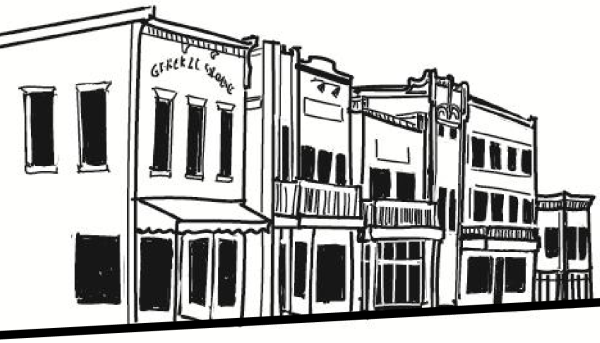
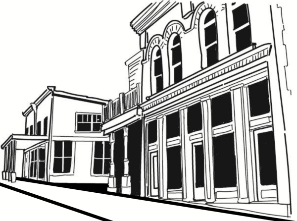
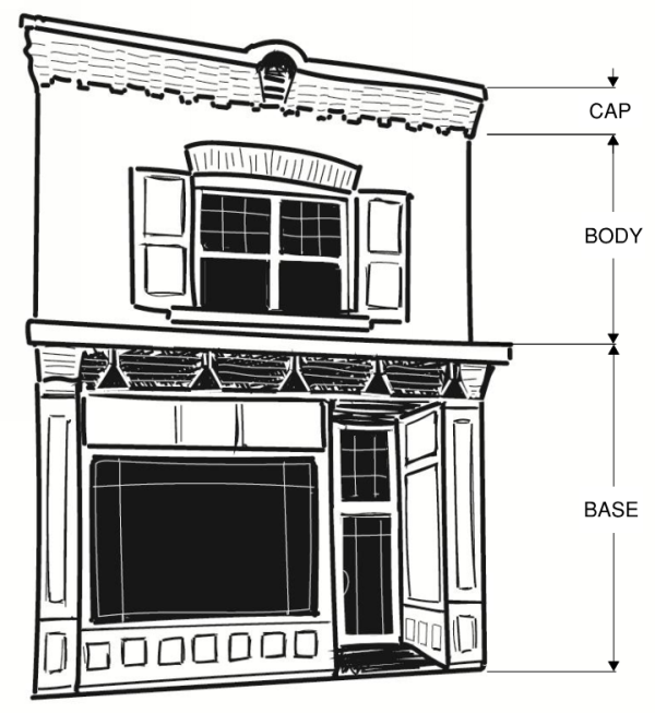
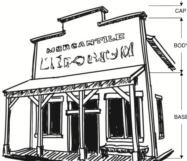
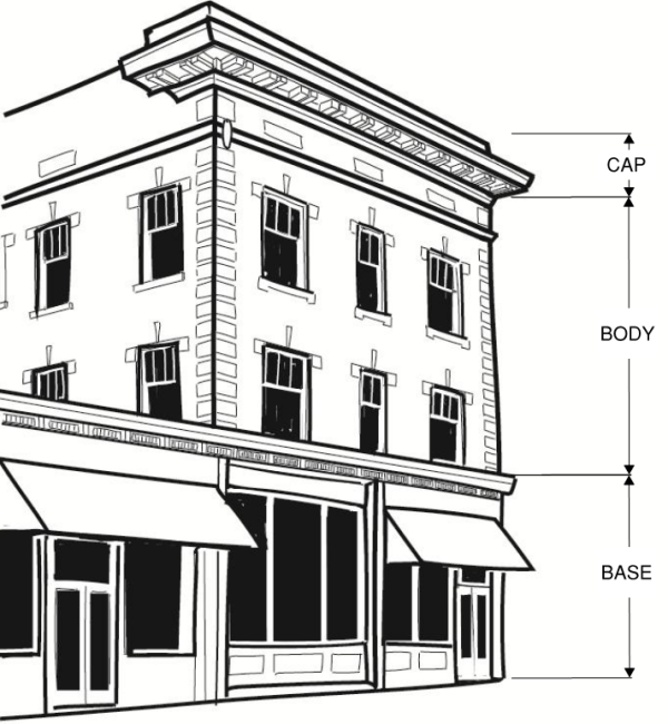
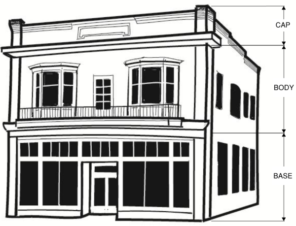
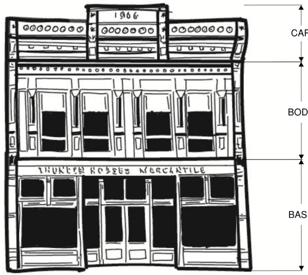
Editor's note: This Section 104-22-6.3 was a part of Section 104-22-6.2, as provided in Ord #2022-20. Due to data size, 104-22-6.2 was pulled into four separate sections within Section 104-22-6. Those sections are 104-22-6.2, 104-22-6.3, 104-22-6.4, and 104-22-6.5.
Adopted by Ord. 2022-04 on 1/18/2022
Amended by Ord. 2022-20 on 8/16/2022
Amended by Ord. 2023-09 on 5/16/2023
Amended by Ord. 2023-36 on 12/5/2023
- Design theme. Buildings shall have architectural styling and materials that implement agrarian-style architecture. Each building shall incorporate at least two of the following four options:
- Either a gable roof at a 6/12 or greater slope, a gambrel roof, or a monitor roof.
- A shed-roof at a 4/12 or greater slope that is attached to the side of the building but not attached to the main roof structure.
- A clerestory or cupola.
- Gable-style dormer windows.
- Building form. Each street-facing building façade shall be designed and constructed to have a building base, building body, and varying building roofline, each having varying building materials or design techniques. The base of the building shall be no less than one-tenth and no greater than one-third the height of the building.
- Rooflines. Rooflines shall be broken every 50 feet, with no less than a 12 inch shift between adjacent rooflines.
- Building massing. The wall massing of building facades shall be broken at least every 40 feet with no less than a six inch shift in the plane of adjacent walls.
- Building material. Building façade walls shall be finished with no less than two diverse types of material. The primary building material shall be wood siding or similar appearing siding. At least one of the building materials used on the building façade shall also be used on all other sides of the building.
- Brick or stone may be used in place of wood if approved by the Land Use Authority.
- Metal siding may be used on the building's body, as long as the building's base is made of brick or stone, and as long as the metal siding is broken horizontally by brick or stone every twenty feet, and is treated to create a natural-appearing aged patina.
- Colors. At least two muted earth-tone colors generally visible from the site are required. In the Eden area, no more than 70 percent of a building's facade shall be white.
- Examples. Examples of generally acceptable architectural features are depicted in the following images. Any conflict between details in the images and regulations in this chapter shall be interpreted in favor of the regulations in the chapter.
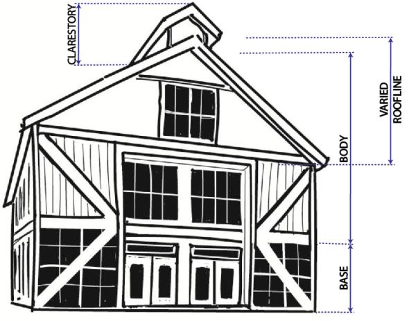
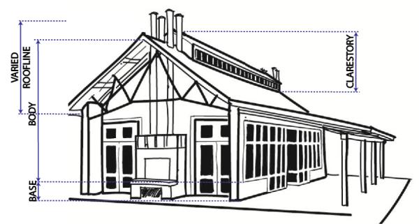
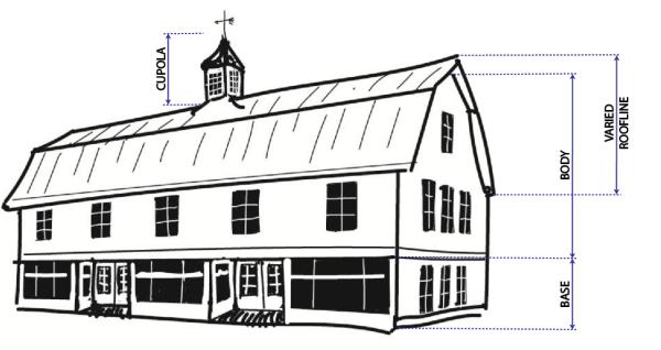
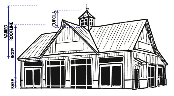
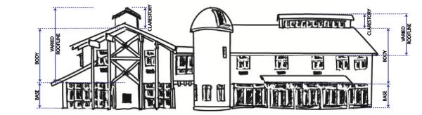
Adopted by Ord. 2022-04 on 1/18/2022
Amended by Ord. 2022-20 on 8/16/2022
Amended by Ord. 2023-09 on 5/16/2023
Amended by Ord. 2023-36 on 12/5/2023
- Design theme. All buildings shall have architectural styling and materials that implement a modern interpretation of European alpine design. A modern interpretation of European alpine design includes a balance between modern alpine and classical European alpine design features. The following design features are intended to provide minimum stylistic requirements to implement this design theme.
- Building form. A building’s street-facing façade shall be designed to have a base, body, and varying roofline, each of varying design features and building material.
- Rooflines. Buildings shall have varying rooflines of predominantly gabled roofs. Rooflines shall be broken every 100 feet, with no less than a 12 inch shift between adjacent rooflines that are on the same plane.
- Building massing. The wall massing of building facades shall be broken at least every 50 feet with no less than a six-inch shift in the plane of adjacent walls. Each street-facing façade shall be designed and constructed to have a building base, building body, and a varying building roofline.
- Building material. Building façade walls shall be finished with no less than two primary and one secondary type of building material. The primary building materials shall be real cut stone, glass, or wood siding or similar appearing siding with a natural wood finish. The secondary building materials include metal, wood, large-cut timbers, metal beams and columns, or concrete or other flat-surface building material which may be colored as allowed herein. At least one of the building materials used on the building façade shall also be used on all other sides of the building.
- Each building shall have at least 60 percent primary building material.
- The base of the building shall be at least 60 percent stone, except those areas occupied by transparent fenestration.
- Use of metal shall be limited to trim, balconies, railing, exposed structural components, and roofs.
- No more than ten percent of any building façade shall be exposed concrete.
- Colors. Muted earth-tone colors generally visible from the site are required. No more than 30 percent of a building's facade shall be white.
- Examples. Examples of generally acceptable architectural features are depicted in the following images. Any conflict between details in the images and regulations in this chapter shall be interpreted in favor of the regulations in the chapter.

Adopted by Ord. 2022-20 on 8/16/2022
Amended by Ord. 2023-09 on 5/16/2023
Amended by Ord. 2023-36 on 12/5/2023
- Design theme. All buildings shall have architectural styling and materials that implement mountain modern-style architecture. Mountain modern-style architecture shall incorporate at least three of the following five options:
- Either a gable roof at a 6/12 or greater slope, a flat roof, a shed roof, or a combination of the roof types.
- A shed-roof at a 2/12 or greater slope that is attached to the side of the building but not attached to the main roof structure.
- A prominent covered porch, deck element, chimney, or other unique architectural feature or features approved by the Land Use Authority.
- Vertical rectangular windows, single, paired, or in triples. Paired and tripled windows shall all be the same dimensions. The composition of all windows on a building’s façade shall be balanced.
- Appurtenances such as exposed roof rafter tails, decorative kickers, and exposed beams or column detailing.
- Building form. Each street-facing façade shall be designed and constructed to have a building base, building body, and varying building roofline, each having varying building materials or design techniques.
- Rooflines. Rooflines shall be broken every 50 feet, with no less than a 12 inch shift between adjacent rooflines.
- Building massing. The wall massing of building facades shall be broken at least every 40 feet with no less than a six inch shift in the plane of adjacent walls. Each street-facing façade shall be designed and constructed to have a building base, building body, and varying building roofline, each having varying building materials or design techniques.
- Building material. Building façade walls shall be finished with no less than two diverse types of material. The primary building material shall be wood siding or similar appearing siding. At least one of the building materials used on the building façade shall also be used on all other sides of the building.
- Brick or stone may be used in place of wood if approved by the Land Use Authority.
- Metal siding may be used on the building's body, as long as the building's base is made of brick or stone, and as long as the metal siding is broken horizontally by brick or stone every twenty feet, and is treated to create a natural-appearing aged patina.
- Stucco may be used as an accent material, but may not comprise more than 30% of a building’s facade
- Colors. Warm muted earth-tone colors generally visible from the site are required. No more than 70 percent of a building's facade shall be white.
- Examples. Examples of generally acceptable architectural features are depicted in the following images. Any conflict between details in the images and regulations in this chapter shall be interpreted in favor of the regulations in the chapter.
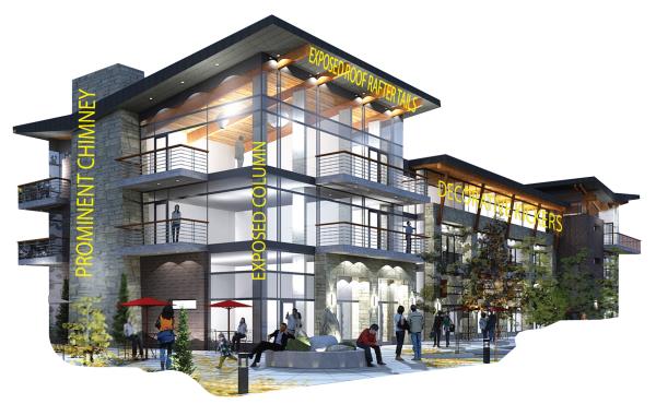
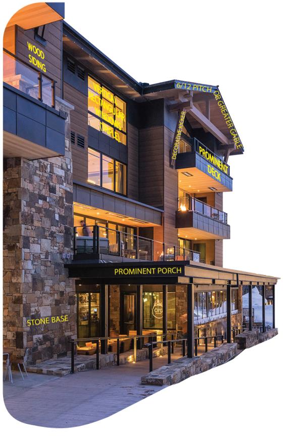
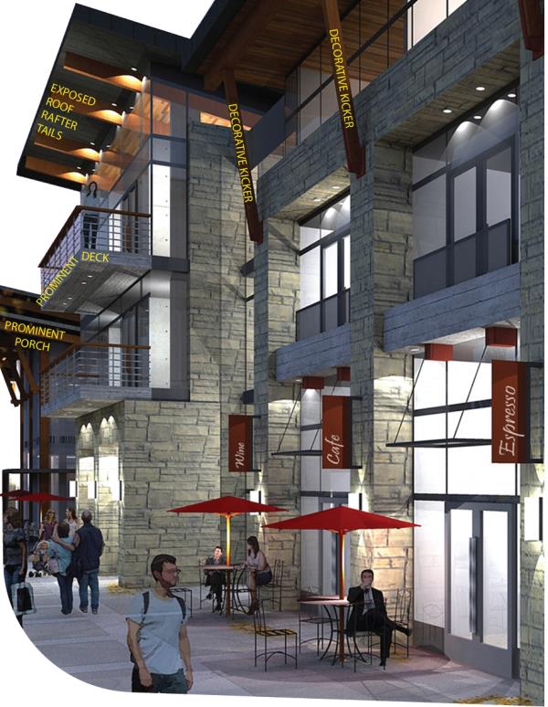
- Design theme. All buildings shall have architectural styling and materials that implement mountain rustic architecture. Mountain rustic architecture shall incorporate the following
- A gabled roof at a 6/12 or greater slope. An attached shed roof is permissible at a lower slope if it covers a porch, patio, window pop-out, or similar.
- Exposed beams and columns made of large rough-cut timbers; the columns having a stone base.
- A prominent covered porch, deck, or balcony, or a large prominent stone chimney.
- Building form. Each street-facing façade shall be designed and constructed to have a building base, building body, and varying building roofline, each having varying building materials or design techniques.
- Rooflines. Rooflines shall be broken every 50 feet, with no less than a 12 inch shift between adjacent rooflines.
- Building massing. The wall massing of building facades shall be broken at least every 40 feet with no less than a six inch shift in the plane of adjacent walls.
- Building material. Building façade walls shall be finished with no less than two diverse types of material. Building material shall appear distressed. The primary building material shall be either wood, log, or similar appearing siding, or natural stone. At least one of the building materials used on the building façade shall also be used on all other sides of the building.
- The building’s base shall be natural stone.
- Metal accents or trim may be used if it has been aged to have a patina.
- Colors. Muted earth-tone colors generally visible from the site are required.
Sec 104-22-7.020 Specific Street Design Standards
Sec 104-22-7.030 Pathway Location And Design Standards
- Right-of-way dedication. As development occurs on each Lot or Parcel, the owner shall dedicate area for public right-of-way with a width as depicted in the table below or as otherwise adopted, to form a Street-Block pattern as depicted in the applicable street regulating plan.
- Drawings required. Each application for development shall provide engineered construction drawings of the street improvements required herein.
- Street right-of-way design.
- Commercial street design. The dimensions and general design for a Governmental and Institutional street, Vehicle-Oriented Commercial street, Mixed-Use Commercial street, and Multi-Family Residential street is as follows:
- Typical three-lane village cross section. A three-lane village street is required for all arterial and collector streets, as designated by the applicable general plan or master street plan. The design dimensions shall be as follows:
- Typical two-lane village cross section. A two-lane village street is required for other streets. The design dimensions shall be as follows:
- Two-lane village cross section with challenging cross-slopes. Unless otherwise negotiated by development agreement, the design for a Governmental and Institutional street, Vehicle-Oriented Commercial street, Mixed-Use Commercial street, Multi-Family Residential street on a cross-slope that is greater than 10 percent shall provide a 50 foot right-of-way half width, with design dimensions as follows:
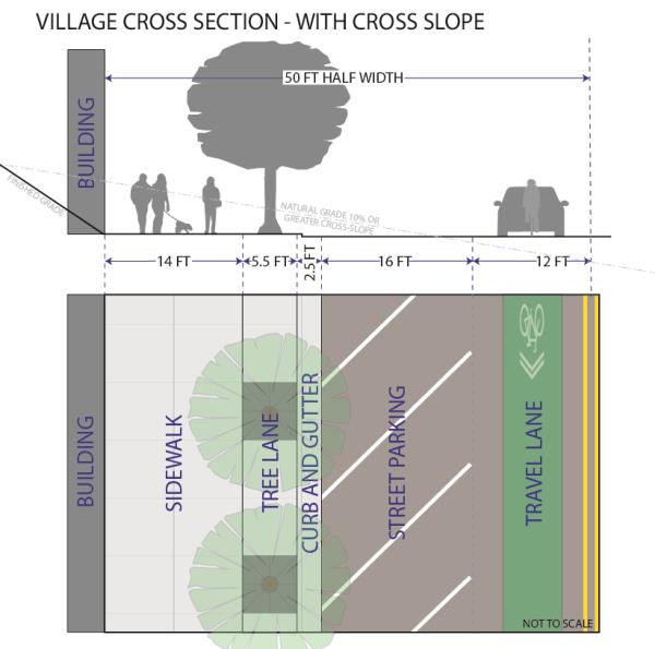
- Typical three-lane village cross section. A three-lane village street is required for all arterial and collector streets, as designated by the applicable general plan or master street plan. The design dimensions shall be as follows:
- Mid-Block Alleys. As development occurs along a Government and Institutional street, Vehicle-Oriented Commercial street, Mixed-Use Commercial street, or Multi-Family Residential street designation, one or more mid-Block Alley(s) shall be designed and constructed in accordance with the following:
- The general location of mid-Block Alleys are shown on each street regulating plan as lines with a lighter line weight than the lines that represent streets.
- A mid-Block Alley shall provide both vehicle and pedestrian access to and through the inside of a Street-Block. Specifically, they shall provide access to shared public parking lots, public or private parking garages, and other uses or buildings that are located in the middle of the Street-Block.
- When a mid-Block Alley connects through a Street-Block in which the Alley transitions to a residential street, the applicable design and construction standards shall also transition to a typical residential street standard.
- The Alley shall be dedicated for public use, but the operations and maintenance of it shall be the collective and equitable responsibility of all landowners whose parcels and/or parking areas gain access from it. An association of owners may be created to specify the details of the management thereof.
- Snow storage areas abutting an Alley shall be provided in the middle of each Street-Block of sufficient size and configuration to easily accommodate the Alley's snow storage needs, as determined by the County Engineer.
- Regardless of an Alley's configuration displayed on the street regulating plan map, a mid-Block Alley shall be located at a distance that is no greater than 330 feet and no less than 200 feet from a street intersection or other mid-Block Alley intersection.
- The mid-Block Alley's access to the street shall align with an existing or planned mid-Block Alley on the opposite side of the street. If there is no existing or planned mid-Block Alley on the opposite side of the street, then the subject mid-Block Alley's access to the street shall be located in a manner that provides reasonable opportunity for the creation of a future mid-Block Alley on the opposite side of the street.
- The width of the mid-Block Alley shall, at a minimum, be designed as follows:
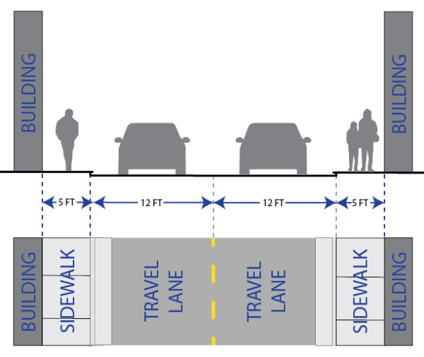
- The general location of mid-Block Alleys are shown on each street regulating plan as lines with a lighter line weight than the lines that represent streets.
- Residential street design. The design for all non-multi-family residential streets is as provided in Section 106-4-5.
- Commercial street design. The dimensions and general design for a Governmental and Institutional street, Vehicle-Oriented Commercial street, Mixed-Use Commercial street, and Multi-Family Residential street is as follows:
Adopted by Ord. 2022-04 on 1/18/2022
Amended by Ord. 2022-20 on 8/16/2022
Amended by Ord. 2023-09 on 5/16/2023
For all Government and Institutional, Vehicle-Oriented Commercial, Mixed-Use Commercial, or Multi-Family Residential street types, the following provisions shall apply. The following standards do not apply to non-multi-family residential streets unless explicitly stated herein. Otherwise, non-multi-family residential streets shall follow adopted residential street design standards.
- Pedestrian priority design. The street shall be designed to prioritize pedestrian use. At primary points of conflict between pedestrian uses and vehicle uses, the street facility shall be designed and constructed to promote pedestrian safety, comfort, and efficiency.
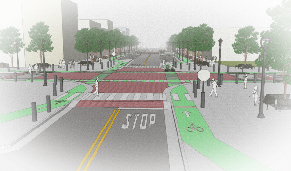
- Raised crosswalks. Where a pedestrian-way intersects with a vehicle-way, the pedestrian-way shall be raised at least six inches above the grade of the vehicle-way, or to the level of the adjoining pedestrian-ways, whichever is higher. This shall include but is not limited to the installation of crosswalks and intersections that are raised to the same plane as the sidewalk or adjoining pathways. An example of a raised crosswalk is illustrated as follows:
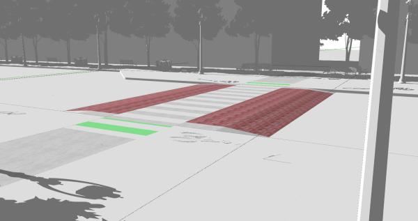
- Curb extension bulb-outs. In order to provide traffic calming and pedestrian safety, street improvements at intersections, pedestrian crossings, and mid-Block Alleys, if different, shall be constructed with curb extensions that bulb-out directly adjacent to the lane of travel. Bike lane widths shall not be obstructed or made narrower at any point along a curb extension bulb-out. Bulb-outs shall be designed to the specifications of this ordinance and the County Engineer, or as otherwise adopted. Where a bulb-out provides access to a raised pedestrian crosswalk, bollards or other permanent features shall be installed along the curve of the bulb-out to keep vehicles from entering the pedestrian-way. Examples of bulb-outs are depicted in the images above.
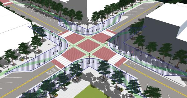
- Crosswalk contrast. For enhanced noticeability, in addition to white retroreflective striping, crosswalks shall be constructed of stamped and colored concrete to provide clear contrast between the street and crosswalk.
- Mid-Block crosswalk. A Street-Block that has a length that is greater than 330 feet, as measured from the center of each bounding intersection, shall be provided with a mid-Block crosswalk. User-activated rapid flashing beacons that are solar powered or connected to jurisdictionally controlled power, if available, shall be installed on mid-Block crosswalk signage.
- Raised crosswalks. Where a pedestrian-way intersects with a vehicle-way, the pedestrian-way shall be raised at least six inches above the grade of the vehicle-way, or to the level of the adjoining pedestrian-ways, whichever is higher. This shall include but is not limited to the installation of crosswalks and intersections that are raised to the same plane as the sidewalk or adjoining pathways. An example of a raised crosswalk is illustrated as follows:
- Sidewalk required. As part of the required street improvements within the FB zone, a sidewalk shall be installed in the designated sidewalk area, as depicted in Section 104-22-7.010 and as illustrated as follows, on the side of the street of the development and for the entire length of the development Lot's street frontage or width.
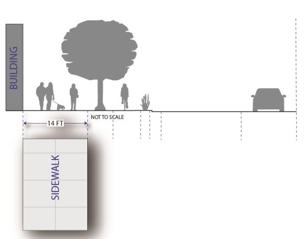
- Paved pathway alternative. A 10-foot wide paved pathway may be installed in lieu of the required sidewalk along any street that is very unlikely to have an adjacent building with first-floor street-level commercial space. The pathway shall be designed as provided in Section 104-22-7.030.
- Covered boardwalk alternative. The County Commission may, but is not obligated to, approve the encroachment of a covered boardwalk, or similar, by legislative approval of an encroachment and maintenance contract. The adjoining landowners shall bear full responsibility for the operations and maintenance of the boardwalk. The covered boardwalk shall comply with the overhead projections standards of this chapter.
- Street trees required. As part of the required street improvements within this zone, street trees shall be installed in the designated tree lane, as depicted in Section 104-22-7.1, on the same side of the street as the development and for the entire length of the development lot's street frontage. Tree species shall be approved by the Planning Director and County Engineer as part of the review of the development. A street tree plan shall be submitted as part of a development application and shall be accompanied by a letter from a certified arborist or landscape architect, certifying that the proposed tree type is suitable considering site conditions and local climate. The plan shall include planting methods that are specific to the site conditions. Planting methods shall provide means of protecting the longevity of the tree and the street infrastructure. Street trees shall be provided with a permanent watering method with irrigation infrastructure installed underground.
- Tree planting. No street tree shall be planted within the clear view triangle as provided in Section 108-7-7, Section 106-4-5, or the American Association of State Highway and Transportation Officials (AASHTO) standards. To provide continuous shade of the pedestrian areas, spacing between tree trunks shall equal the average diameter of the specific tree species' canopy at maturity. However, in the Nordic Valley Area, each street bounding a Street-Block shall have the same number of trees that is equal to one tree per every 50 linear feet of street on both sides of the street, and the trees may be grouped in clusters of no greater than ten trees, rather than equally spaced along the right of way.
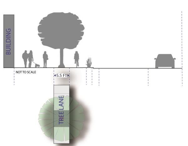
- Tree maintenance. Unless an association, district, or other collective funding and maintenance entity is approved by the County to provide tree maintenance, a street tree shall be maintained by the owner or proprietor of the property that is immediately adjacent to the street right-of-way where the tree is located. A tree maintenance plan shall be submitted as part of the development review for new development. Trees shall be pruned in a manner that gives at least a seven foot clearance above the sidewalk and a 12 foot clearance above a bike lane or parking area, as depicted by the following graphic:
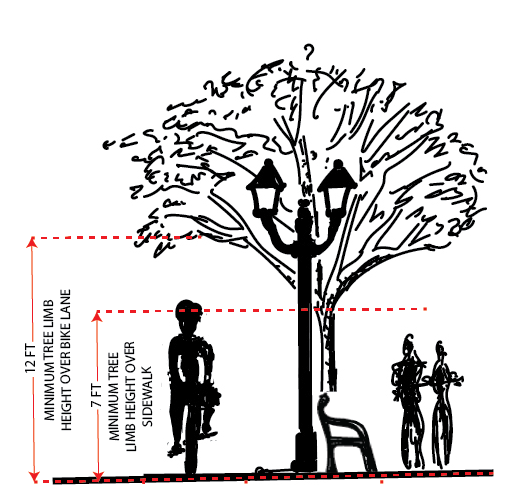
- Tree planting. No street tree shall be planted within the clear view triangle as provided in Section 108-7-7, Section 106-4-5, or the American Association of State Highway and Transportation Officials (AASHTO) standards. To provide continuous shade of the pedestrian areas, spacing between tree trunks shall equal the average diameter of the specific tree species' canopy at maturity. However, in the Nordic Valley Area, each street bounding a Street-Block shall have the same number of trees that is equal to one tree per every 50 linear feet of street on both sides of the street, and the trees may be grouped in clusters of no greater than ten trees, rather than equally spaced along the right of way.
- Bike facilities required.
- Separated bike lane. Unless provided otherwise herein, a concrete bike lane that is five feet in width shall be installed as part of the required street improvements. The bike lane shall be on the same plane as the sidewalk, and shall be separated from the pedestrian walkway by the tree lane.
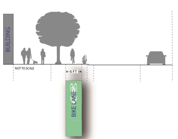
- Bike lane alternative. When topography results in the inability to safely create sufficient street right-of-way width, the County Engineer has discretion to allow a bike lane to occupy the street's vehicle travel lane. In these cases, a five-foot wide retroreflective green bike lane shall be applied to the center of the lane, and marked with retroreflective sharrows as depicted by the following graphic:
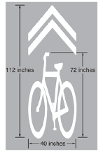
- Separated bike lane. Unless provided otherwise herein, a concrete bike lane that is five feet in width shall be installed as part of the required street improvements. The bike lane shall be on the same plane as the sidewalk, and shall be separated from the pedestrian walkway by the tree lane.
- Street parking required.
- 45-degree angle parking. Each street shall be designed and constructed to provide 45-degree angled parking.
- Street parking alternative. When topography results in the inability to safely create sufficient street width, the County Engineer has discretion to allow a parallel street-parking design instead.
- Parking bumper buffer. A three-foot parking buffer shall be provided between the bike lane and the curb for vehicle bumper overhang. Vegetation may be in this buffer.
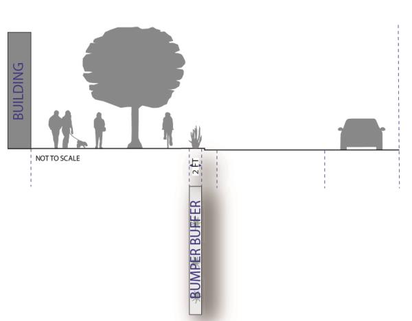
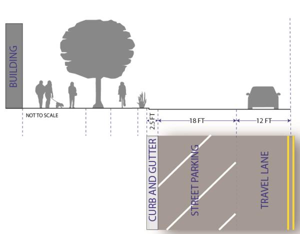
- Curb, gutter, and drainage facilities.
- Curb, gutter, and drainage facilities shall be installed along each street and internal Alley in accordance with the County's standard curb and gutter cross sections and in a manner that accommodates the street designs herein.
- Items in public right-of-way.
- Overhead projections. Overhead building projections such as but not limited to awnings, canopies, balconies, and cantilevers, are permitted within the public right-of-way, provided that they leave a vertical clearance over the sidewalk or walkway of no less than nine feet, and shall not project more than eight feet into the public right-of-way. Any support post beneath the building projection shall be no greater than seven feet from the building façade, be designed to offer minimal disruption to sidewalk traffic, and meet all ADA clearance requirements.
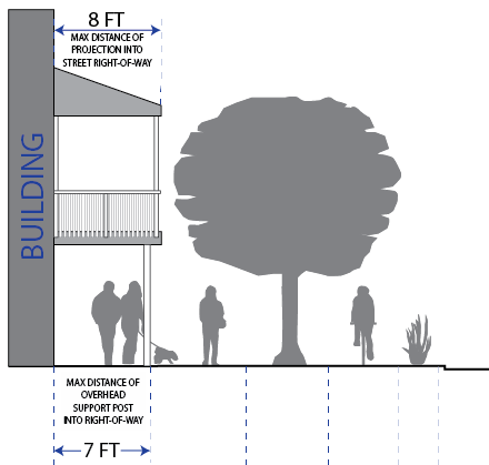
- Amenities and furniture. Non-permanent street amenities such as street furniture for outside dining, benches, bike racks, planters, and street sales and displays are permitted between street trees and along sidewalks as long as they do not cause any hazard to the use of the bike lane; and they are located in a manner that leaves a continuous seven-foot wide pedestrian walkway.
- Street Lighting. Street lighting shall be installed as part of the required street improvements within this zone. Street lighting shall complement the architectural design theme of the area.
- Overhead utilities. All new development shall move all existing overhead utilities underground, and install all new utilities underground as well.
- Overhead projections. Overhead building projections such as but not limited to awnings, canopies, balconies, and cantilevers, are permitted within the public right-of-way, provided that they leave a vertical clearance over the sidewalk or walkway of no less than nine feet, and shall not project more than eight feet into the public right-of-way. Any support post beneath the building projection shall be no greater than seven feet from the building façade, be designed to offer minimal disruption to sidewalk traffic, and meet all ADA clearance requirements.
- Round-a-bout. A round circle along any street intersection on the street regulation plan indicates a planned round-a-bout. As development occurs, street right-of-way shall be dedicated to the County to accommodate at least a 110-foot diameter round-a-bout. Round-a-bout improvements shall be installed when required by the County Engineer. Otherwise, all improvements installed shall be installed in a manner that does not create an undue burden on the construction of a future round-a-bout.
Adopted by Ord. 2022-04 on 1/18/2022
Amended by Ord. 2022-20 on 8/16/2022
Amended by Ord. 2023-09 on 5/16/2023
- Pathways and sidewalks, generally.
- Pathway and sidewalk layout shall be designed in a manner that prioritizes efficiency of non-motorized modes of transportation.
- Pathways shall connect using the shortest distance reasonably possible.
- Pathway and sidewalk layout shall provide for the continuation of existing pathways or sidewalks in the general area, and for future planned pathways, as shown on an adopted pathway plan, general plan, master trails plan, or other applicable adopted planning document.
- Except for development along a Rural Residential or Estate Lot Residential street, each development shall be configured so that the maximum pathway or sidewalk walking-distance between a pathway or sidewalk intersection is 400 feet.
- This distance may be increased for a segment of a pathway that travels through a permanently preserved open space area or an area very unlikely to ever develop.
- A pathway or sidewalk intersection is where a pathway or sidewalk intersects with another pathway, sidewalk, or street that has pedestrian facilities.
- A pathway or sidewalk stubbed from an adjacent property shall be connected to a pathway or sidewalk within the subdivision.
- Continuation of a pathway or sidewalk to adjacent undeveloped property shall be provided with a stub to the subdivision boundary.
- Pathway and sidewalk arrangement shall not cause any unnecessary hardship for creating convenient and efficient access to nearby parcels that are likely to eventually be developed.
- Street-adjacent pathway. Along each arterial, collector, and major neighborhood street, as provided in an adopted general plan, master streets plan, or similar adopted document, a 10-foot wide hard-surfaced pathway shall be installed.
- When determining which side of the street the pathway is required, preference shall be given to the side of the street that has optimal sun exposure during winter months.
- The Planning Director may require a pathway be located on the other side of the street to support pathway connectivity based on other factors such as existing or planned future pathways in the vicinity and potential pedestrian conflicts.
- The pathway shall be located within the street right-of-way unless expressly authorized otherwise by the County Engineer. If not located within the street right-of-way, a pathway easement is required.
- Unless required otherwise by the County Engineer, the pathway shall have an asphalt width of at least nine feet and be bounded on both sides by a six-inch concrete ribbon that is flush with the top of asphalt travel surface. The pathway shall be constructed of three inches of asphalt on eight inches of base-course. Greater thickness may be required where it intersects a vehicle-way.
- Example: Street-Adjacent Pathway
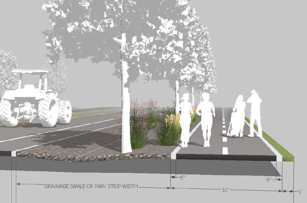
- Non-street-adjacent pathway. Where generally depicted on a map or in the text of an applicable street regulating plan, general plan, master streets plan, or when otherwise required herein or in a development agreement, a 10-foot wide hard-surfaced pathway shall be installed through the development.
- Where a pathway runs between buildings or fenced Lots, a minimum 30-foot pathway public right-of-way is required. The pathway shall run down the center of the 30-foot right-of-way.
- The pathway right-of-way may be reduced to 15 feet if both of the adjoining Lots or parcels are or will be single-family residential, and are deed-restricted to:
- Only allow a solid fence that is no greater than four-feet; or
- Only allow a fence that is 30 percent open with the openings evenly distributed.
- Only allow a solid fence that is no greater than four-feet; or
- The adjoining land owners are responsible for the maintenance and upkeep of vegetation and waste on the half of the pathway right-of-way that is adjacent to their Lot or Parcel.
- Example: Non-Street-Adjacent Pathway
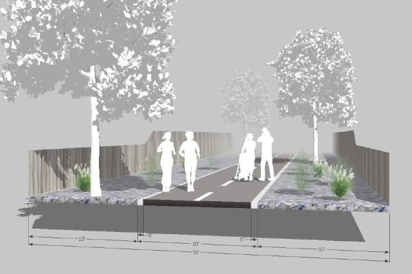
- Where a pathway runs between buildings or fenced Lots, a minimum 30-foot pathway public right-of-way is required. The pathway shall run down the center of the 30-foot right-of-way.
Sec 104-22-8.020 New Town Eden Area Street Regulating Plan Map
Sec 104-22-8.030 Nordic Valley Area Street Regulating Plan Map
Sec 104-22-8.040 West Weber's 4700 Area Street Regulating Plan Map
- The following maps depict the adopted Street Regulating Plans for their respective areas. The plans illustrate the intended street layout of the area and the designated street types. The plan is intended to be a guide for the placement of streets and mid-Block Alleys, and is not designed to survey-level accuracy. A street's placement shall be within 200 feet of the location depicted on these maps. A mid-Block Alley, denoted on the maps with thinner line types intersecting with Governmental and Institutional, Vehicle-Oriented Commercial, Mixed Use Commercial, and Multi-Family Residential streets, shall be provided as specified in Section 104-22-7.010. A land owner proposing development in an area that a street or Alley is planned shall be responsible for dedicating the land and constructing the street or Alley improvements.
- The legend for each street regulating plan is as follows:
STREET TYPES AND AMENITIES ABV. TDR SHORT DESCRIPTION 
General Open Space OS Sending Area planned for open space. 
Estate Lot Residential ELR Sending Single-family Lot as small as 3 acres. 
Rural Residential WWPA: RR Sending Single-family Lot as small as 40,000 square feet. OVPA: Receiving 
Large Lot Residential LLR Receiving Single-family Lot as small as 20,000 square feet. 
Medium-Large Lot Residential MLLR Receiving Single-family Lot as small as 12,500 square feet. 
Medium Lot Residential MLR Receiving Single-family Lot as small as 8,000 square feet. 
Small Lot Residential SLR Receiving Up to four-family lot as small as 3,000 square feet. 
Multi-Family Residential MFR Receiving Multi-family Lot, restricted height, no lot minimum. 
Mixed-Use Commercial MUC Receiving Commercial at street level, multi-family and other uses above and behind, restricted height, no lot minimum. 
Vehicle-Oriented Commercial VOC Receiving Same as MUC with special considerations for vehicle-oriented uses. 
Government and Institutional G&I Receiving Same as VOC with special considerations for government and institutional uses. 
Limited Access Arterial or Collector LTD. Not Applicable Access to street generally limited to planned intersections. 
Trails Not Applicable Required trail. 
Street Roundabout Not Applicable Planned roundabout. COMMUNITY FEATURES 
Long-Term Open Space Area desired for long-term open spaces. 
Park Area desired for long-term open space held as park. 
Trailhead Area desired for trailhead and/or trail access. 
Water Body A body of water.
Adopted by Ord. 2022-04 on 1/18/2022
Amended by Ord. 2022-20 on 8/16/2022
Amended by Ord. 2023-09 on 5/16/2023
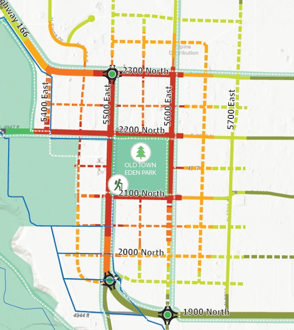

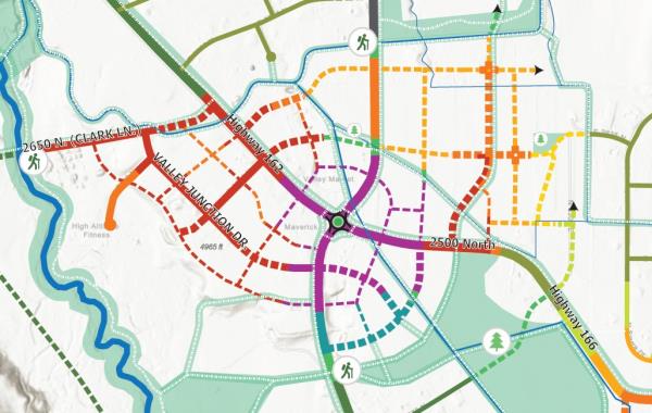
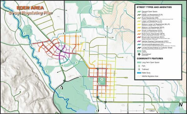
Amended by Ord. 2023-09 on 5/16/2023
Amended by Ord. 2023-36 on 12/5/2023
Amended by Ord. 2025-24 on 10/7/2025
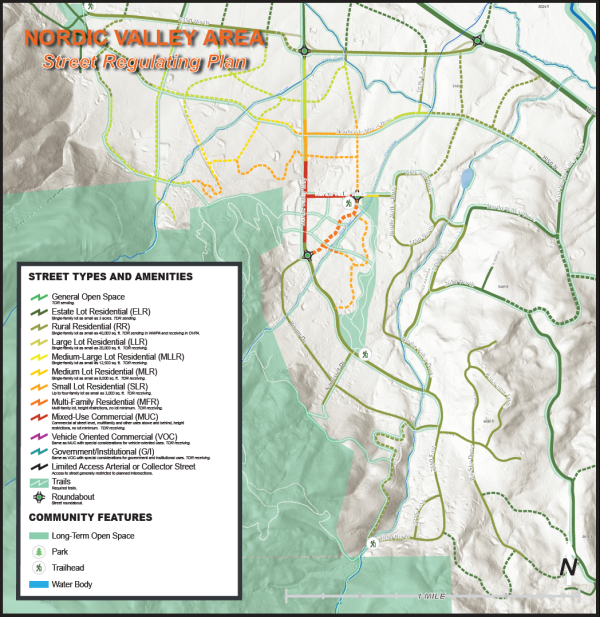
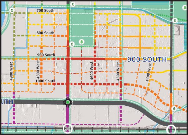
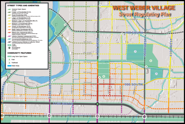
- Parking required. Each application for development shall include a parking plan that demonstrates that sufficient parking will be provided by the on-street parking immediately fronting the lot or an off-street parking lot or garage within 1000 feet of the building. On-street parking not adjacent to the Lot's street-frontage shall not be counted.
- Internal Street-Block shared public parking. Each business or use that will have patrons, customers, clients, or similar, shall provide an off-street public parking lot or garage.
- Use of this parking lot or garage shall be shared by all landowners and business owners within the Street-Block. In extremely inequitable circumstances, the Land Use Authority may allow a land or business owner to specifically exclude parking for patrons, customers, clients, or similar of other land or business owners if those other land or business owners within the Street-Block have not provided their own proportionate contribution toward shared public parking within the Street-Block.
- Each public parking area located within the Street-Block shall be designed to extend to the parcel boundary and shall provide a cross access easement along all sides of the parking area abutting the adjoining Lot(s) or Parcel(s) in a manner that allows the adjoining Lot or Parcel owner to extend that public parking area seamlessly into their parcel. Cross access and cross access easements are required pursuant to Subsection (h) of this section.
- Alternative to shared internal Street-Block public parking. If multiple land or business owners within a Street-Block create an alternative shared public parking plan that provides for equal or better off-street public parking for the same Street-Block than otherwise required by Subsection (a)(1) of this section, then the provisions of Subsection (a)(1) that run contrary may be waived. However, in no case shall parts of Subsection (a)(1) be waived in a manner that prevents or restricts an existing or future land or business owner’s opportunity and obligation to contribute to and enjoy the benefits of the shared public parking within the Street-Block at full buildout.
- Internal Street-Block private parking. Nothing in this subsection (a) shall be construed to prohibit a landowner from creating a private parking lot or garage as long as the shared public parking requirements, obligations, and opportunities specified herein are satisfied.
- Internal Street-Block shared public parking. Each business or use that will have patrons, customers, clients, or similar, shall provide an off-street public parking lot or garage.
- Employee and residential parking. On-street parking shall not be included toward minimum parking needed for employees or for any residential use. Employee parking and the minimum required residential parking shall be located off-street within the same Street-Block as the use.
- Parking lot surface. All parking lots shall be hard-surface asphalt or concrete, or other improved surface otherwise approved by the County Engineer and local fire authority.
- Parking flexibility. Except for residential uses, the Land Use Authority may reduce the minimum parking spaces required if sufficient evidence suggests that the required number of spaces is excessive for the building and proposed use or uses therein.
- Parking related to a change of use. If a change of use occurs, more parking may be required if the new use merits it, as determined by the Land Use Authority. The applicant proposing to change the use shall be required to provide the additional off-street parking within 1000 feet of the use.
- Parking lot trees. A surface parking lot shall have one tree for each four parking spaces, and a five-foot wide landscape planting area that runs the depth of the parking row shall be located at each end of a parking row.
- Parking structure design standards. When located adjacent to a vehicle-oriented commercial, mixed use commercial, or multi-family residential street, a parking structure shall have first-floor street-level commercial space along the street’s frontage. However, for a corner Lot, this requirement applies to the façade that is adjacent to the more prominent street, as determined by the land use authority; the other façade shall have the same for no less than fifty percent of that façade’s street frontage. The other fifty percent, and the area of the parking structure above the street level commercial space, shall have a street-facing facade that disguises the parking structure to generally look like other buildings in the area.
- Cross-access and cross-access easement. For all Lots or Parcels along a Governmental and Institutional street, Vehicle Oriented Commercial street, Mixed Use Commercial street, Multi-Family Residential street, , providing access to adjacent existing or future development without the need to access the public right-of-way is required. This access shall be provided by a mid-Block Alley , or other Alley or shared driveway as may be deemed necessary by the Land Use Authority. If not in conflict with mid-Block Alley requirements herein, when no new Alley access is deemed necessary because an Alley access or street access is already provided to the Lot or Parcel through another Lot or Parcel, then a cross-access easement shall be provided along adjoining lot lines, as follows:
- Inclusion of other landowners. A cross access easement shall provide an easement to all landowners in the Street-Block that develop along a Governmental and Institutional street, Vehicle Oriented Commercial street, Mixed Use Commercial street, Multi-Family Residential street that is framing the Street-Block. The easement shall allow ingress and egress to these other Lots or Parcels, including ingress and egress infrastructure.
- Multiple points of access. At a minimum, each developed Lot or Parcel shall have two points of ingress and egress, at least one of which shall be stubbed to adjacent property where practicable. Except that a private parking area is allowed to only provide a single access as long as it does not block the accessibility to other areas within the Street-Block that are or could be used for public parking.
- Coordination with adjoining landowners. When locating a cross-access easement or designing the cross-access infrastructure, good faith efforts shall be made to coordinate the location and design with the adjoining land owner.
- Location to optimize circulation. The Planning Director may require the cross-access to be located in a manner that optimizes traffic circulation within the Street-Block.
- Installation timing. Construction of the cross-access infrastructure shall be completed prior to the issuance of a certificate of occupancy for any structure on the Lot or Parcel, or a completion bond may substitute for completion if allowed by the County Engineer.
- Reciprocal easement when others exist. When a Lot or Parcel is being developed that abuts an existing cross-access easement or existing cross-access infrastructure, a reciprocal cross-access easement shall be provided on the same lot line or parcel line in the same location and of equal width. The reciprocal cross-access infrastructure shall be constructed to the same standard as, or better than, the existing cross-access infrastructure on the adjacent parcel. A cross-access easement shall be recorded on the title of all affected properties, along with a perpetual operation and maintenance agreement between the property owners that specifies, at a minimum, that the infrastructure will be operated and maintained by the property owners in a manner that is safe and usable for two-way vehicle traffic.
- Operations and maintenance. If property owners fail to operate or maintain cross-access infrastructure that was required by the County under this section, the County may pursue enforcement measures as provided in this Land Use Code.
In addition to the signage regulations in this Land Use Code, no signage shall be affixed to a building higher than the top of the second story.
- Transferable development rights, generally. To increase or decrease Residential Development Rights on a Lot or Parcel in the FB Zone, the following apply:
- Transferred density.
- Rights to be transferred, location. Additional Residential Development Rights are permitted to be transferred to any Lot or Parcel in the Form-Based zone, also known as the receiving property, that has street frontage on, or gains primary access from, any street type in the street regulating plan except an Estate Lot Residential street, a General Open Space street, and, in the Western Weber Planning Area, a Rural Residential street. In addition, no additional Residential Development Rights shall be transferred to a Lot or Parcel designated as open space on the street regulating plan.
- No right exists until transfer is complete. No additional Residential Development Right exists on the a receiving property until after the landowner has successfully completed the transfer of an equal number of Residential Development Rights from another Lot or Parcel that has the available number of Residential Development Rights being pursued.
- Rights available for transfer. A Residential Development Right is deemed available for transfer from a sending Lot or Parcel if the sending Lot or Parcel's Base Density calculation, together with adjustments for any previous Residential Development Right reduction or addition, demonstrates that the Residential Development Right could be developed on the lot or parcel in a manner that complies with the provisions of this Land Use Code. A Residential Development Right reduction or addition is any of the following:
- Use of the Residential Development Right for construction of a residential unit onsite.
- Transfer of a Residential Development Right to another Lot or Parcel.
- Receipt of a Residential Development Right from another Lot or Parcel.
- Restriction of the construction, development, or subdivision of or on the Lot or Parcel for residential purposes as provided in County laws not otherwise in this Land Use Code; State or Federal laws, regulations, or restrictions; private contracts, covenants, or restrictions; conservation or preservation easements or agreements; or any other lawful development restriction or prohibition that clearly and specifically makes the Residential Development Right unbuildable on the Lot or Parcel. This shall include any lawful development restriction or prohibition applied to the property on or before January 1, 2022, regardless of whether that restriction exists at present.
- Completing a transfer. The reallocation shall be completed by recording a Notice of Transfer Document to each affected Lot or Parcel.
- Each Notice of Transfer Document shall run with the land.
- Each Notice of Transfer Document shall document the applicable Lot or Parcel's estimated initial density; the number of Dwelling Units already developed on the Lot or Parcel; the number of Residential Development Rights subtracted from, or added to, the initial density by any other means; and the number of Residential Development Rights remaining for the Lot or Parcel.
- County review of transfer. A landowner may submit a request for approval of a transfer of Residential Development Rights at any time. Planning Division Staff shall review each request for compliance with applicable regulations. If the transfer is merited by this ordinance, Planning Staff shall prepare a Notice of Transfer Document for each affect Lot or Parcel in a form as approved by the County Attorney’s Office.
- A transfer is not complete until a notice of transfer has been signed by each affected landowner of record for each affected Lot or Parcel, the reviewing staff, and the Planning Division Director, and then recorded to each affected Lot or Parcel in the Office of the County Recorder.
- Approval of a Subdivision’s preliminary plat or a Design Review that is based on the receipt of transferred Residential Development Rights is conditioned, by reference herein, on the applicable transfers being completed. Approval is void if the transfer is not completed.
- No final plat application shall be approved or recorded and no building permit shall be submitted or approved until after the transfer(s) are complete.
- Banking of Residential Development Rights. A Lot or Parcel within the Form-Based Zone may be used to bank Residential Development Rights. These rights may be held on the Lot or Parcel until they are either constructed on the Lot or Parcel, or transferred to another eligible Lot or Parcel within the Form-Based Zone. There is no limit to the number of Residential Development Rights that can be transferred to a Lot or Parcel in the Form-Based Zone. However, the number of Residential Development Rights actually constructed on the parcel shall be limited by what can actually be constructed in compliance with the requirements and standards of this chapter, as well as any other applicable provision of this Land Use Code.
- Transferred density.
- Ogden Valley Planning Area Form-Based Zone transfers.
- Initial density. A Lot or Parcel rezoned to the Form-Based Zone from a zone that allow(s)(ed) dwelling units shall have an initial density that is equal to the Lot or Parcel’s Base Density, as defined in Title 101, Chapter 2, that was allowed in the prior zone.
- Transfer allowances and limitations. Residential Development Rights may be transferred to a Lot or Parcel in a FB Zone from any Lot or Parcel in the following zones within the Ogden Valley Planning Area: RE-15, RE-20, AV-3, F-5, FV-3, S-1, FR-1, FR-3, RMH-1-6, CVR-1, and FB.
- Transfer ratio. The transfer ratio shall be one to one. This means for every one Residential Development Right transferred from a sending Lot or Parcel in the Ogden Valley Planning Area, one is allowed to be constructed on a receiving Lot or Parcel within the FB Zone in the Ogden Valley Planning Area.
- Western Weber Planning Area Form-Based Zone transfers.
- Initial density. A Lot or Parcel rezoned to the Form-Based Zone from a zone that allow(s)(ed) dwelling units shall have an initial density that is equal to the Lot or Parcel’s gross area divided by 15,000 square feet.
- Transfer allowances and limitations. A Residential Development Right may be transferred to a Lot or Parcel in a FB Zone from any Lot or Parcel in the following zones within the West-Central Weber area: A-1, A-2, and A-3. Unless negotiated otherwise in a development agreement, a transfer from any Lot or Parcel is prohibited if the Lot or Parcel received a rezone after January 1, 2023 that increased the Base Density.
- Transfer ratio. The transfer ratio shall be one to three. This means for every one Residential Development Right transferred from a sending Lot or Parcel in the Western Weber Planning area, three are allowed to be constructed on a receiving Lot or Parcel within the FB Zone.
Participation in creating workforce housing is required as follows, except when developing along a Large Lot Residential, Rural Residential, or Estate Lot Residential Street.
- No transfer required. Workforce housing dwelling units will not be deducted from the Lot or Parcel’s Development Rights and are not required to be established through transferable development rights as long as the number does not equal more than 15 percent of the development’s total number of market-rate dwelling units.
- Lot development standard reduced.
- Unless the applicable lot development standards are more permissive, a structure that is exclusively devoted to, and deed restricted for, workforce housing may have a front yard setback of 20 feet, and a side and rear yard setback of five feet, and has no minimum area requirement.
- In the event the provision for the required workforce housing results in the inability to realize the number of dwelling units that would otherwise be allowed if workforce housing was not required, then the applicable minimum lot development standards in the development may be reduced to no less than half of the applicable minimum lot development standard.
- Workforce housing requirements. Unless otherwise negotiated by development agreement, one or more of the following workforce housing requirements shall be provided by the developer.
- Building and reservation of dwelling units. Dwelling units, in an amount that is equal to or greater than five percent of the non-workforce housing units being developed, shall be constructed and deed restricted for workforce housing;
- Fee in lieu. In lieu of building affordable housing units, a fee equaling up to two percent of the dwelling unit’s market value, shall be paid for each dwelling unit constructed. This shall be implemented by a covenant recorded on title of each dwelling unit, and shall be paid at the time a building permit is issued, or prior to the transfer of the property’s title after the dwelling unit has been completed;
- Buildable lot in lieu. In lieu of building affordable housing units, a lawfully subdivided lot or lots in a size and configuration that is capable of supporting dwelling units in an amount that is equal to or greater than 10 percent of the non-workforce housing units being developed, shall be donated, with stubbed utilities, to the Weber Housing Authority for the purpose of meeting this requirement; or
- Floor area in lieu. Along a Governmental and Institutional street, Vehicle Oriented Commercial street, Mixed Use Commercial street, Multi-Family Residential street, and Small Lot Residential street, floor area, in a size and configuration that is capable of supporting dwelling units in an amount that is equal to or greater than five percent of the non-workforce housing units being developed, shall be donated, with stubbed utilities, to the Weber Housing Authority for the purpose of meeting this requirement.
- Workforce housing location. The required housing Units, Lots, or floor area provided for workforce housing may be located outside of the proposed development as long as they are located along a Governmental and Institutional street, Vehicle Oriented Commercial street, Mixed Use Commercial street, Multi-Family Residential street, and Small Lot Residential street, Medium Lot Residential , or Medium-Large Lot Residential street designation in an area governed by the same street regulating plan map, or within one mile of a commercial or manufacturing zone in the same planning area.
- Weber housing authority. Eligibility and long-term monitoring of qualification for workforce housing is the responsibility of the Weber Housing Authority
Sec 104-23-2 Applicability
Sec 104-23-3 Land Use Tables
Sec 104-23-4 Special Regulations
Sec 104-23-5 Site Development Standards
Sec 104-23-6 (Reserved)
Sec 104-23-7 (Reserved)
Sec 104-23-8 Rezone And Development Agreement
Sec 104-23-9 Traditional Neighborhood (TN) Zones Established
Editors Note: Ord 2021-16, adopted May 25, 2021, merged the MV-1, M-1, M-2, and M-3 zones into a single chapter, removing them from Chapter 22, 23, 24, and 25, and placing them into Chapter 21. Any reference to them is a reference to Chapter 21.
The purpose of the Traditional Neighborhood (TN) zone is to promote a pedestrian-friendly, master-planned development that blends diverse residential, commercial, civic, and recreational uses. This zone emphasizes fine-grained design with distinct centers and edges, creating vibrant public realms shaped by thoughtful urban planning rather than relying solely on architectural complexity. Development within this zone will incorporate open spaces, recreational components, and well-designed, architecturally integrated structures that are appropriately landscaped and harmoniously buffered from surrounding land uses. This zone aims to balance local context, functionality, and aesthetic beauty to foster thriving, walkable communities through customized development requirements and approach.
- Effective date. The effective date of this chapter is January 8, 2026.
- Area of Applicability. The provisions of this Chapter are only applicable to property that has been rezoned to the Traditional Neighborhood (TN) zone.
- The minimum area required for an initial rezone to the Traditional Neighborhood (TN) zone shall be four hundred (400) contiguous acres.
Sec 104-23-3.020 Agricultural And Open Space Uses, Generally
Sec 104-23-3.030 Agricultural Uses, Animal Oriented
Sec 104-23-3.040 Amusement, Entertainment, And Recreation Uses
Sec 104-23-3.050 Animal Services And Uses
Sec 104-23-3.060 Food, Beverage, And Other Product Sales For Human Consumption
Sec 104-23-3.070 Government And Institutional Uses
Sec 104-23-3.080 Office Uses
Sec 104-23-3.090 Residential Uses
Sec 104-23-3.100 Sales With Retail Storefront
Sec 104-23-3.110 Sales Typically Without Retail Storefront
Sec 104-23-3.120 Services
Sec 104-23-3.130 Storage
Sec 104-23-3.140 Utility Uses
Sec 104-23-3.150 Vehicle-Oriented Uses
The following tables display the uses permitted, conditionally permitted, or not permitted in the Traditional Neighborhood (TN) zones. The letter "P" indicates a permitted use in the zones. The letter "C" indicates a use that requires a conditional use permit, as governed by Title 108, Chapter 4, in the zone. The letter "N" indicates a use that is prohibited in the zone. The letters SP indicate a use that requires a special permit as provided in Section 104-23-4.010. A use listed is a main use unless specifically listed as an accessory use. Each of the T1 - TS and SD columns included in these tables reflect the applicable ''Transect District(s)" that are determined or identified, and that may be established, by the development agreement required pursuant to Section 104-23-8.
| An accessory use is prohibited unless located on the same lot or parcel as the main use to which it is accessory. | Transect Districts | Special District | Special Regulations | |||||
| T1 | T2 | T3 | T4 | T5 | SD-1 | SD-2 | ||
| Accessory building. A building that is accessory and incidental to the use of a main building. | N | P | P | P | P | P | P | |
| Accessory dwelling unit. A living unit that is accessory to a primary dwelling unit. | N | P | P | P | P | P | P | |
| Accessory use. A use that is accessory and incidental to the main use. | P | P | P | P | P | P | P | |
| Agricultural hobby farm. A small-scale farm that is primarily for personal enjoyment and pleasure, rather than as a business. | N | P | P | P | P | N | P | |
| Bar. A bar or any other establishment where the primary purpose is the sales and onsite consumption of alcoholic beverages. | N | P | P | P | P | P | P | |
| Family food production. Family food production as an accessory use to a single-family dwelling residential use. | N | P | P | P | P | N | P | |
| Home occupation. A home occupation that is accessory to a residential use. | N | P | P | P | P | P | P | |
| Parking lot. A parking lot that is accessory to a main use allowed in the zone. | N | P | P | P | P | P | P | |
| Produce stand. For produce grown on the premises only. | SP | P | P | P | P | P | P | |
| Temporary building or use. A temporary building or use that is accessory and incidental to onsite construction work. | SP | P | P | P | P | P | P | |
| Vendor, short term. The siting of a temporary vendor booth or vehicle for the sales products, food, or other items. | SP | P | P | P | P | P | P | |
| Transect District | Special District | Special Regulations | ||||||
| T1 | T2 | T3 | T4 | T5 | SD-1 | SD-2 | ||
| Agriculture. Agriculture as a use of the property. | N | P | P | N | N | N | P | |
| Wildlife sanctuary. A wildlife sanctuary. | SP | P | P | P | P | N | P | Minimum 5 acres. See Section 104-23-4.010(c). |
| Agri-tourism. An agri-tourism use. | N | P | P | P | P | N | P | Minimum 5 acres. See Section 104-23-4.010(c). |
| Agriculture, community-oriented. A crop production operation for use by the broader public, such as a community garden, rental row operation, or you-pick operation. | SP | P | P | P | P | N | P | |
| Fruit and vegetable storage and packing plant, for produce grown on premises. | SP | P | P | P | P | P | P | |
| The following are animal-related uses that do not and shall not typically generate customer-oriented traffic to the lot or parcel. | Transect Districts | Special District | Special Regulations | |||||
| T1 | T2 | T3 | T4 | T5 | SD-1 | SD-2 | ||
| Animal grazing. Animal Grazing. | N | P | P | N | N | N | P | Minimum 5 acres. See Section 104-23-4.010(c). |
| Apiary. The keeping of bees. | N | P | P | N | N | N | P | |
| The following are uses oriented toward providing amusement or entertainment for patrons. | Transect Districts | Special District | Special Regulations | |||||
| T1 | T2 | T3 | T4 | T5 | SD-1 | SD-2 | ||
| Amphitheater. An outdoor open-air amphitheater with raising rows of spectator seating used for entertainment and performances. | P | P | P | P | P | P | P | |
| Entertainment facility, indoor. An Indoor Entertainment Facility. | N | P | P | P | P | P | P | |
| Entertainment facility, outdoor. An Outdoor Entertainment Facility. | SP | C | C | C | C | C | C | |
| Amusement park, temporary. An amusement park, circus, petting zoo, pony ring, or carnival that is conducted for no longer than one month. | N | P | P | P | P | P | P | |
| Campgrounds or picnic areas, commercial. A commercial Campground or picnic area. | SP | P | P | P | P | P | P | Minimum 5 acres. See Section 104-23-4.010(c). |
| Private park, playground or recreation area, noncommercial. A private park charging no fee or remuneration for use. | N | P | P | P | P | P | P | |
| Public park, recreation grounds. Recreation grounds that are owned and operated by a public entity. | P | P | P | P | P | P | P | |
| Recreational resort. A Recreation Resort | N | P | P | P | P | P | P | |
| Swimming pools, private. A private swimming pool. | N | P | P | P | P | P | P | |
| Trails. Trails for skiing, equestrian uses, hiking, biking, and similar. | P | P | P | P | P | P | P | |
| Special Regulations | ||||||||
| T1 | T2 | T3 | T4 | T5 | SD-1 | SD-2 | ||
| Animal groomery, small animal. Grooming for small animals. | N | P | P | P | P | P | P | |
| Dog or cat facility. Dog or cat breeding, kennels, lodging, or training school. | N | C | C | C | C | C | C | |
| Horse or equestrian event center. A horse or equestrian event center, including indoor concessions as an accessory use. | SP | P | P | P | P | P | P | Minimum 5 acres. See Section 104-23-4.010(c). |
| Horse or equestrian training facility and stabling, commercial. A commercial equestrian training facility or horse stable. | N | P | P | P | P | P | P | Minimum 5 acres. See Section 104-23-4.010(c). |
| Stable for horses, noncommercial. Horses shall be for noncommercial use only. | SP | P | P | P | P | P | P | Minimum 5 acres. See Section 104-23-4.010(c). |
| Stray animal shelter. A shelter for stray, lost, or seized animals. | N | C | C | C | C | C | C | |
| Veterinary facility. Veterinary facility. | N | C | C | C | C | C | C | |
| Special Regulations | ||||||||
| T1 | T2 | T3 | T4 | T5 | SD-1 | SD-2 | ||
| FOOD PREPARATION SERVICES | ||||||||
| Alcoholic beverage production. The production, manufacturing, brewing, and wholesale sales of alcoholic beverages. | N | N | P | P | P | P | P | |
| Bakery, delicatessen, or catering, large. Bakery or other food preparation services primarily intended for offsite consumption. | N | N | P | P | P | P | P | |
| Bakery, delicatessen, or catering, small. Bakery or small-batch food processing and retail sales of goods produced on premises. | N | N | P | P | P | P | P | Offsite catering allowed as an incidental and accessory use. |
| Butcher or other custom meat products, large. A shop in which meats are cut, prepared, cured, smoked, or wrapped for the purpose of sales onsite. | N | N | P | P | P | P | P | No slaughtering. |
| Butcher or other custom meat products, small. A shop in which meats are cut, prepared, cured, smoked, or wrapped for the purpose of sales onsite. | N | N | P | P | P | P | P | No slaughtering. |
| EATING AND DRINKING ESTABLISHMENTS FOR PRODUCTS PRIMARILY FOR ONSITE CONSUMPTION | ||||||||
| Bar. A bar or any other establishment where the primary purpose is the sales and onsite consumption of alcoholic beverages. | N | P | P | P | P | P | P | |
| Brewery or distillery with restaurant. A brewery or distillery in conjunction with a restaurant. | SP | P | P | P | P | P | P | |
| Restaurant with drive-up window. Restaurant, all food types, with drive-up windows. | N | N | P | P | P | P | P | |
| Restaurant. Restaurants, all food types, excluding those with drive-up windows. | SP | P | P | P | P | P | P | |
| RETAIL FOOD AND DRUG SALES OF PRODUCTS PRIMARILY FOR OFFSITE CONSUMPTION | ||||||||
| Candy or confectionary store. The sales of candy, sweets, snacks, and small batch bakery goods and desserts. | N | P | P | P | P | P | P | |
| Drugstore or pharmacy. A drugstore or pharmacy. | N | N | P | P | P | P | P | |
| Grocery store. A grocery story, including a store that specializes in the sales of any type of food normally found in a grocery store. | N | N | P | P | P | P | P | |
| Produce stand, commercial. A commercial produce stand intended for the sales of agricultural products. | SP | P | P | P | P | P | P | |
| Transect Districts | Special Districts | Special Regulations | ||||||
| T1 | T2 | T3 | T4 | T5 | SD-1 | SD-2 | ||
| Cemetery. A cemetery. | N | P | C | C | C | N | C | |
| Convalescent, rest home, or sanitarium. An establishment for long-term medical treatment of people. | N | N | P | P | P | P | N | |
| Child daycare. A daycare center operating in compliance with State regulation. | N | N | P | P | P | P | P | |
| Civic. A use related to a governmental entity. | N | N | P | P | P | P | P | |
| Fire station. A fire and emergency medical service station. | N | N | P | P | P | P | N | |
| Governmental offices. The offices of a governmental entity. | N | N | P | P | P | P | P | |
| Instructional facility. A facility in which instructional lessons are taught, such as a school or education center. | N | N | P | P | P | P | P | |
| Medical facility. A facility, such as a hospital or surgery center, that provides medical services that are typically unavailable from a medical or dental office. | N | N | P | P | P | P | P | |
| Museum or art gallery. A museum, art gallery, or similar space for historical or educational displays. | SP | P | P | P | P | P | P | |
| Post office. A post office. | N | N | P | P | P | P | P | |
| Preschool. A preschool operating in compliance with State regulation. | N | N | P | P | P | P | P | |
| Private recreation or community center. A recreation or community center owned and operated by a private entity. | SP | P | P | P | P | P | P | |
| Public library. A library owned and operated by a governmental entity. | N | N | P | P | P | P | P | |
| Public park. A public park and related recreation grounds and associated buildings and structures. | P | P | P | P | P | P | P | |
| Public recreation or community center. A recreation or community center owned and operated by a public entity. | SP | P | P | P | P | P | P | |
| Public schools. A public school or a private educational facility having a curriculum similar to that ordinarily given in public schools. | N | N | P | P | P | P | P | |
| Public storage facilities. Storage facilities used by a governmental entity. | N | N | P | P | P | P | P | |
| Visitor’s center. A tourism visitor’s center or offices. | SP | P | P | P | P | P | P | |
| Worship facility. A church, synagogue or similar building used for regular religious worship. | N | P | P | P | P | P | P | |
| Transect Districts | Special Regulations | |||||||
| T1 | T2 | T3 | T4 | T5 | SD-1 | SD-2 | ||
| Agency. An agency for real estate, travel, property rental or management, insurance, detective, employment, or similar based on frequency of visiting clientele. | N | N | P | P | P | P | P | |
| Bank or financial institution. A bank or other financial institution. | N | N | P | P | P | P | P | |
| Medical or dental office. A medical or dental office for routine out-patient care. | N | N | P | P | P | P | P | |
| Office, generally. Office or studio space for office or studio uses not otherwise listed herein, in which goods or merchandise are not commercially created, exchanged or sold, and that operates with typical office equipment in a relatively quiet and nonintrusive manner. | N | N | P | P | P | P | P | |
| Transect Districts | Special Districts | Special Regulations | ||||||
| T1 | T2 | T3 | T4 | T5 | SD-1 | SD-2 | ||
| Dwelling, single-family. A Single-Family Dwelling, also referred to as a Single-Family Detached Dwelling. | N | P | P | P | P | P | P | |
| Dwelling, two-family. A Two-Family Dwelling, also referred to as a Duplex. | N | N | P | P | P | P | P | |
| Dwelling, three-family. A Three-Family Dwelling, also referred to as a Triplex. | N | N | P | P | P | P | P | |
| Dwelling, four-family. A Four-Family Dwelling, also referred to as a Quadplex. | N | N | P | P | P | P | P | |
| Dwelling, multiple-family. A Multiple-Family Dwelling, also referred to as a Multi-Family Dwelling. | N | N | P | P | P | P | N | |
| Dwelling unit in commercial building. A portion of a commercial building which is constructed in compliance with the county’s adopted building codes and designed as a place for human habitation. | N | N | P | P | P | P | P | |
| Residential facility for elderly persons. A single-family or multifamily dwelling unit that meets the requirements of U.C.A. § 17-79-607, but does not include a health care facility as defined by U.C.A. 1953, § 26-21-2. | N | P | P | P | P | P | P | |
| Residential facility for disabled persons. A single-family or multiple-family dwelling unit, consistent with existing zoning of the desired location, that is occupied on a 24-hour-per-day basis by eight or fewer persons with a disability in a family type arrangement under the supervision of a house family or manager. | N | P | P | P | P | P | P | |
| Residential facility for troubled youth. A residential facility that is occupied on a 24-hour basis by no more than eight qualified youth in a family type arrangement that conforms with applicable standards of, and is inspected and licensed by the state department of human services. | N | P | P | P | P | P | P | |
| Transient lodging. A hotel, motel, lodging house, condominium rental apartment (condo-tel), or timeshare condominium. | N | P | P | P | P | P | P | |
| Workforce housing. Workforce Housing, dormitory, or residence hall, or portion thereof. | N | P | P | P | P | P | P | |
| Transect Districts | Special Districts | Special Regulations | ||||||
| T1 | T2 | T3 | T4 | T5 | SD-1 | SD-2 | ||
| Agricultural implement sales or service. A facility that sells or repairs agricultural implements. | N | N | P | P | P | P | P | |
| General retail sales. A building, property or activity, the principal use or purpose of which is the sale of physical goods, products or merchandise directly to the consumer. | N | P | P | P | P | P | P | |
| Nursery, commercial. A plant nursery, with associated greenhouses for retail sales of plants and accessory products. | N | P | P | P | P | P | P | |
| Transect Districts | Special Districts | Special Regulations | ||||||
| T1 | T2 | T3 | T4 | T5 | SD-1 | SD-2 | ||
| Vendor, short term. The siting of a temporary vendor booth or vehicle for the sales products, food, or other items. | SP | P | P | P | P | P | P | |
| Transect Districts | Special Districts | Special Regulations | ||||||
| T1 | T2 | T3 | T4 | T5 | SD-1 | SD-2 | ||
| Dry cleaning, laundry, or linen cleaning establishment. The professional cleaning of laundry and linens. | N | N | P | P | P | P | P | |
| Household item repair, large. The repair or service of devices that the average person cannot carry without aid of a moving device. | N | N | P | P | P | P | P | |
| Household item repair, small. The repair or service of devices that the average person can carry without aid of a moving device. | N | N | P | P | P | P | P | |
| Gathering facility, indoor. An indoor facility for rental to clubs, private groups, parties, and organizational groups for recreational activities, including dancing and reception centers. | N | N | P | P | P | P | P | |
| Laboratory. A laboratory for the scientific processing, testing, experimenting, etc., of samples in small enough quantities to not be explosive, toxic, or otherwise hazardous. | N | N | P | P | P | P | P | |
| Laundromat. A facility that provides washers and dryers for self-serve laundry service. | N | N | P | P | P | P | P | |
| Mortuary or funeral home. Mortuary or funeral home and related sales and services. | N | N | P | P | P | P | P | |
| Outdoor recreation guide base-operation. A location that provides a base of operations for an outdoor recreation guide service. | P | P | P | P | P | P | P | |
| Parcel drop-off service. A service for the collection and shipment of small parcels, and accessory sales or services. | N | N | P | P | P | P | P | |
| Personal service shop. A location where personal services related to the care and appearance, or cleaning, of the body are provided. Personal service shops include, but not limited to barbershops, hairdressers, beauty salons or shops, or massage salons. | N | N | P | P | P | P | P | |
| Printing and copying service with or without retail shop. Printing, lithographing, publishing or reproductions sales and services, including engraving and photo engraving. | N | N | P | P | P | P | P | |
| Tailor services. The altering, pressing, or repairing of articles of clothing. Creation of new articles of clothing is permitted as long as the clothing is sold in an onsite retail establishment. | N | N | P | P | P | P | P | |
| Transect Districts | Special Districts | Special Regulations | ||||||
| T1 | T2 | T3 | T4 | T5 | SD-1 | SD-2 | ||
| Outdoor storage. Outdoor Storage. | N | N | N | N | N | P | N | |
| Self-storage. Indoor storage units for personal or household items or vehicles, and without doors that face a public street. | N | N | P | P | P | P | P | |
| Warehouse storage. The storage of products or goods that are or will be for sale. | N | N | N | P | P | P | P | |
| Transect Districts | Special Districts | Special Regulations | ||||||
| T1 | T2 | T3 | T4 | T5 | SD-1 | SD-2 | ||
| Public utility substation. A Public Utility Substation. | P | P | P | P | P | P | P | |
| Quasi-public. A Quasi-Public use. | P | P | P | P | P | P | P | |
| Wastewater treatment or disposal facilities. The structures, equipment, and processes required to collect, transport, and treat domestic wastes and dispose of the effluent and accumulated residual solids. | P | P | P | P | P | P | P | |
| Water treatment or storage facility. any system, used for potable use, including but not limited to any municipal or private water treatment facility. | P | P | P | P | P | P | P | |
| Small wind energy system. A Small Wind Energy System. | N | P | P | P | P | P | P | |
| Small solar energy system. A Small Solar Energy System. | N | P | P | P | P | P | P | |
| Transect Districts | Special Districts | Special Regulations | ||||||
| T1 | T2 | T3 | T4 | T5 | SD-1 | SD-2 | ||
| Car wash. A car wash of any type that is not accessory to a gas or refueling station as regulated otherwise herein. | N | N | N | N | N | P | N | |
| Gas or refueling station. A gas or refueling station, which may include a convenience store and an automatic carwash as an accessory use. | N | N | N | N | N | P | N | |
| Parking lot or structure. A parking lot or parking structure. | N | N | N | N | P | P | P | |
| Passenger vehicle repair or service of any kind. The repair or service of any passenger automobile or any other motorized vehicle less than 10,000 lbs. gross vehicle weight. | N | N | N | N | N | P | N | |
| Trailer sales or rentals. Sale or rental of trailers. | N | N | N | N | N | P | N | |
| Transit terminal. A facility which is typically designed to accommodate passenger transfer activity between transit modes and other travel modes, and may include passenger pick-up and drop-off, and park and ride lots. | N | N | N | N | N | P | N | |
| Truck gas or refueling station. A gas or refueling station oriented toward large freight vehicles, which may include a convenience store and an automatic carwash as an accessory use. | N | N | N | N | N | P | N | |
Sec 104-23-4.020 (Reserved)
- All uses, generally. All uses listed in the land use table are indoor uses unless specifically stated otherwise. All indoor uses shall not generate noise, outdoor lighting, vibration, smoke, dust or airborne particulate matter, refuse, or anything else that is uncommon to the established character of the neighborhood to such a degree as to be perceptible to constitute a nuisance to the occupants of the immediate area.
- Special use permit. A special use permit shall be required for all uses designated with a “SP” in the land use table in set forth in Section 104-23-3. Applications and approvals of special use permits pursuant to this Section 104-23-4 shall be processed as a legislative land use regulation consistent with the requirements of the Code and Utah law.
- Special area and width requirements. Any use listed in the land use table that contains the phrase (min. [“n”] acre[s]) requires a Lot or Parcel area devoted to the use that is a minimum number of acres specified by “n” and have a width that is no narrower at any point than 100 feet.
Sec 104-23-5.020 (Reserved)
Sec 104-23-5.030 (Reserved)
Sec 104-23-5.040 (Reserved)
Sec 104-23-5.050 (Reserved)
Sec 104-23-5.060 (Reserved)
Sec 104-23-5.070 Building Height
Sec 104-23-5.080 (Reserved)
Sec 104-23-5.090 (Reserved)
Density for the Traditional Neighborhood (TN) zone shall be calculated by the entire Traditional Neighborhood (TN) zone area. The intensity of neighborhoods and where the residential units are allocated may be determined by the development agreement required pursuant to Section 104-23-8.
Buildings within the Traditional Neighborhood (TN) zone are limited to four (4) stories. In the Traditional Neighborhood (TN) zone, a “story” is the habitable level within a building except those area as follows:
- A basement, which are the interior part of a building (which may or may not include habitable space) below the ground of every story of main entry level, and which has a maximum of five feet (5’) of height above grade, measured from the average finished grade along the front façade.
- An attic, the part of a building contained within a pitched roof that, though it may be accessible, does not include habitable space.
- A rezone application and development agreement are required to create or modify the boundary of the Traditional Neighborhood (TN) zone. Approval of the rezone and development agreement shall follow the rezone provisions of Title 102, Chapter 5.
- A development agreement that is mutually agreeable between the developer and the county shall be prepared and readied, in compliance with Title 102, Chapter 6, for execution upon, or simultaneous to, adoption of the Traditional Neighborhood (TN) zone. The development agreement shall clearly document the county’s roles and responsibilities to the developer and the developer’s roles and responsibilities to the county, and shall, at a minimum, provide any other provision necessary to effectively execute this Chapter, or any other provision as may be proposed by the county commission, county attorney’s office, or the developer and agreed to amongst the parties in the development agreement, including but not limited to provisions for streets; parks, trails and open spaces; building and community design standards; infrastructure and utilities; and community amenities.
- Upon approval, each Traditional Neighborhood (TN) zone shall be given a unique name following the designation “TN:” and shall be independent of any other Traditional Neighborhood (TN) zone.
Sec 104-23-9.020 (Reserved)
- TN-Bennet zone established. The Traditional Neighborhood - Bennet Zone (TN-Bennet) is established as allowed by this chapter and pursuant to Ordinance 2025-20 and associated Bennet Development Agreement.
- Zone reversion and prior zone. The Bennet Development Agreement specifies zone reversion provisions in the event of expiration or termination.
Editors Note: Ord 2021-16, adopted May 25, 2021, merged the MV-1, M-1, M-2, and M-3 zones into a single chapter, removing them from Chapter 22, 23, 24, and 25, and placing them into Chapter 21.
Editors Note: Ord 2021-16, adopted May 25, 2021, merged the MV-1, M-1, M-2, and M-3 zones into a single chapter, removing them from Chapter 22, 23, 24, and 25, and placing them into Chapter 21.
Sec 104-26-2 Permitted Uses
Sec 104-26-3 Conditional Uses
Sec 104-26-4 Site Development Standards
Sec 104-26-5 Sign Regulations
The open space zone is specifically intended to encourage the preservation of a natural environment in an otherwise urban setting; to hold for future generations open space in which plants and animals can be protected and studied; to inhibit erection of unnecessary buildings on a floodplain, on areas of severe slope, areas of fault line and rock slides; to provide suitable areas for recreation and relaxation, and to alleviate stream pollution.
(Ord. of 1956, § 22E-1; Ord. No. 3-75)
The following uses are permitted in the Open Space Zone O-1:
- Accessory building incidental to the use of a main building; main building designed or used to accommodate the main use to which the premises are devoted; and accessory uses customarily incidental to a main use;
- Agriculture.
- Botanical or zoological garden.
- Cemetery.
- Conservation areas: botanical or zoological.
- Fishing ponds; private or public.
- Golf course, except miniature golf courses.
- Horse raising, provided conducted in a pasture of at least five acre size and with a maximum density of two horses per acre.
- Private park, playground or recreation area.
- Public park, public recreation grounds and associate buildings, but not including privately owned commercial amusement business.
- Public service buildings.
- Wildlife sanctuaries.
(Ord. of 1956, § 22E-2; Ord. No. 3-75; Ord. No. 2015-7, Exh. A, 5-5-2015)
The following uses shall be permitted only when authorized by a conditional use permit as provided in title 108, chapter 4 of this Land Use Code:
- Golf driving range in conjunction with a golf course.
- Public utility substations.
(Ord. of 1956, § 22E-3; Ord. No. 96-42; Ord. No. 2015-7, Exh. A, 5-5-2015)
The following site development standards shall apply to the open space zone:
- Minimum lot area: Five acres.
- Minimum lot width: 300 feet.
- Minimum yard setbacks for structures.
- Front: 30 feet.
- Side: 20 feet each side.
- Rear: 30 feet.
- Building height.
- Minimum: One story.
- Maximum: 35 feet.
(Ord. of 1956, § 22E-4)
The height, size, and location of the following permitted signs shall be in accordance with the regulations set forth in title 110, chapter 1, of this Land Use Code:
- Development.
- Directional.
- Flat.
- Freestanding.
- Identification and information.
- Temporary.
- Wall.
(Ord. of 1956, § 22E-5)
Sec 104-27-2 Applicability
Sec 104-27-3 Application Requirements
Sec 104-27-4 General Requirments
Sec 104-27-5 Use Permissions And Prohibitions
Sec 104-27-6 Area And Residential Density Regulations
Editor's note—Ord. No. 2016-17, Exh. A, adopted Nov. 8, 2016, repealed titl. 104, ch. 27, §§ 104-27-1—104-27-10, which pertained to natural hazards overlay districts and derived from §§ 38-1—38-10 of an ordinance adopted in 1956. Said ordinance enacted provisions pertaining to natural hazard areas in titl. 108, ch. 22, § 108-22-1 et seq.
- Purpose of master planned development. Traditional development requirements and standards provide an important level of predictability in the outcome of various different developments produced by various different developers offering various different development products. Without them, the variability in each development is likely to create less organized development patterns of multiple smaller scale developments. The purpose and intent of a master planned development is to provide a developer with voluntary alternatives to the traditional development requirements and standards of a zone while also giving the community the benefit of removing the unpredictability of unspecified alternatives by requiring a complete land development plan that comprehensively addresses the alternative development requirements and standards.
- Purpose of master planned development overlay zone. A master planned development overlay (MPDOZ) zone is intended to allow a legislatively adopted overlay zone that provides an avenue for the creation of a master planned development. The zone is intended to promote the diversification in the relationship of various uses and structures to their sites, to permit more flexible applicability of traditional zoning standards to those sites, and to encourage new and innovative concepts in the design of neighborhood and housing projects. To this end, the development should be planned and entitled as one complete land development plan, otherwise known as a master planned development. Phasing of the complete land development plan may occur over time if approved by the county commission and if in compliance with the entitlements of the complete land development plan.
- Deviations from requirements of underlying zone. The application of a master planned development overlay zone to a particular property should give deference to the purpose and intent of the property's underlying zone. However, when applying this master planned development overlay zone, the approval of a master planned development may allow deviations from the purpose and intent of the underlying zone, and any standard therein, if the proposed master planned development substantially advances the implementation of a significant and meaningful general plan goal, principle, or implementation strategy. Unless explicitly specified otherwise in a development agreement or in the approved complete land development plan, development of a master planned development shall adhere to the applicable regulations, standards, and other provisions of this Land Use Code.
- Conflicts. If any provision of an approved master planned development overlay zone or related development agreement creates an explicit conflict with any other part of this Land Use Code, the applicability of those other provisions shall be modified to the minimum extent that enables the master planned development overlay zone provisions to apply. An omission from a master planned development overlay zone shall not be construed to be an implicit conflict with any other part of this Land Use Code.
- Effective date. The effective date of this chapter is March 26, 2021.
- Allowed zones. A master planned development overlay zone may only be considered in the following zones:
- Residential estates zones;
- Agricultural and agricultural valley zones;
- Forest, forest residential, and forest valley zones;
- Single-family, two-family and three-family residential zones;
- Commercial valley resort recreation zone; and
- Residential manufactured home zone.
- Nonconforming PRUD. The adoption of this ordinance also repeals an ordinance governing the creation of a planned residential unit development (PRUD). A planned residential unit development for which an application was submitted prior to the date specified in Subsection (a) of this section is hereby a nonconforming planned residential unit development, provided the County has not adopted new regulations governing a planned residential unit development after this effective date. A nonconforming PRUD may be amended from time to time under the same rules that governed its creation, provided that the amendment is a de minimis change that is routine and uncontested. The Planning Director or the Planning Commission has independent authority to determine what constitutes a routine and uncontested de minimis decision. If it is determined to not be routine or uncontested, then the applicant shall pursue the creation and approval of a master planned development overlay zone pursuant to this chapter.
- Previously existing development agreements. Nothing in this chapter shall be construed to inhibit the entitlements of an approved development agreement executed prior to the date specified in subsection (a) of this section.
An application for a master planned development overlay zone and development agreement shall be submitted to the Planning Division in a form provided by the Planning Division, together with all accompanying documents, plans, and studies required by this chapter. The application shall contain authorization from all owners of land within the property’s legal description. The following are the minimum requirements necessary to submit a complete application:
- A complete land development plan, complying with the requirements of Section 104-27-4, including the following:
- A map of the general configuration of the development, together with land tabulations detailing the proposed uses of land for all areas of the project, and proposed lot or parcel development standards;
- An open space preservation plan, showing proposed uses and parcel development standards;
- A transportation plan that accommodates vehicular and pedestrian circulation, parking, etc.;
- Areas reserved for public uses such as schools and playgrounds, landscaping, and recreational facilities, if applicable;
- Proposed architectural design standards, including drawings and sketches demonstrating the proposed design, character, features, and color palette of the proposed development;
- A natural hazards map, if the development is in a natural hazards study area or a known natural hazard is present onsite;
- Any proposed mappable voluntary contributions, including those proposed in pursuit of density bonuses; and
- A development phasing plan, if applicable.
- A narrative clearly explaining the desired development. The narrative shall also clearly address the considerations listed in Section 104-27-4.
- A list of development commitments or other offerings the applicant is prepared to make to the county, and a list detailing what the development needs from the county. This list will be the initial basis for development agreement negotiation.
- Base density calculations, and a tabulation and explanation of requested bonus density.
- The legal description for all properties to be included in the overlay zone and development agreement, together with a general vicinity map of the rezone boundary.
- Additional information as may be necessary to assist in the county's determination regarding whether the proposed development and arrangement of uses provides for a better community outcome than developing the land using the traditional development requirements and standards of the applicable zone.
- An application fee.
- Rezone and development agreement required. Approval of a master planned development overlay zone shall follow the provisions and requirements specified herein in addition to the rezone provisions of Title 102, Chapter 5. Prior to the execution or validity of a master planned development overlay zone, a development agreement that is mutually agreeable between the developer and the county shall be prepared and readied, in compliance with Title 102, Chapter 6, for execution upon, or simultaneous to, adoption of the master planned development overlay zone. The development agreement shall clearly document the county’s roles and responsibilities to the developer and the developer’s roles and responsibilities to the county, and shall, at a minimum, provide any other provision necessary to effectively execute the flexible provisions of this chapter, or any other provision as may be required by the county commission or county attorney’s office. Nothing in this chapter shall be construed to entitle approval of a master planned development overlay zone or associated development agreement.
- Complete land development plan. The development agreement shall include an complete land development plan detailing the proposed development as specified herein. No changes or alterations to the approved complete land development plan shall be made without first obtaining an amendment to the development agreement, except for landscaping as provided in subsection (c) of this section. The complete land development plan shall provide a desirable layout or, if the specific layout is to be determined later, desirable standards for the following:
- Cluster development. All subdivisions within a master planned development overlay zone shall comply with Title 108, Chapter 3, Cluster Subdivisions, except those lot development standards as listed in paragraph (4) of this subsection. The complete land development plan shall demonstrate that the development can feasibly comply with the cluster subdivision requirements. Specific deviations from the cluster subdivision requirements may be granted by the county commission, after recommendation from the planning commission, if the deviation offers a better community outcome or better contributes to the implementation of a significant and meaningful general plan goal, principle, or implementation strategy.
- Land use configuration. The complete land development plan shall show the general locations of proposed land uses, including open space areas, and offer a land use inventory specifying approximate land acreage per use.
- Street configuration. The complete land development plan shall show, at a minimum, the general location of existing or proposed streets in the development. Streets shall offer efficient and convenient connectivity to existing street rights-of-way and shall be laid out to provide for safety, ease of use, and navigation throughout the development. Streets shall offer prioritization of non-motorized transportation. The complete land development plan shall show general location of streets stubbing into an adjacent vacant property in at least one location; and as otherwise required to comply with block-width or intersection distance requirements of this land use code. At least two points of access into the development are required if it contains more than 30 residences, or less if otherwise required by the local fire or emergency services authorities.
- Lot development standards. The complete land development plan shall propose lot or parcel area, lot or parcel width, lot or parcel yard setbacks, lot or parcel coverage and building height regulations for all lots, parcels, and open space areas that will contain development or structures.
- Architecture design. The complete land development plan shall provide the general architectural design of buildings and the design’s relationship to the site and to the development beyond the boundaries of the master planned development.
- Off-street parking. The complete land development plan shall provide for complete off-street parking standards in the event that the parking standards of this Land Use Code are insufficient to accommodate the flexible provisions of this overlay zone. The design of parking areas or parking lots shall prioritize the needs and use of non-motorized modes transportation.
- Lighting. The complete land development plan shall provide a lighting plan, or provisions for creating a lighting plan, that complies with all requirements of Title 108, Chapter 16.
- Natural hazards and other constraints. The complete land development plan shall show consideration for natural hazards and other environmental constraints, such as floodplains, wetlands, waterways, sensitive ecology, wildlife habitat, etc. If a natural hazard is known to exist onsite, or if the site is located in a natural hazards study area, as specified in Title 108, Chapter 22, or if other environmental constraints exist onsite, a natural hazards map and environmental constraints map, if applicable, shall be included as part of the complete land development plan submittal.
- Landscaping plan. The development agreement shall include a landscaping plan that meets or exceeds the landscaping requirements found elsewhere in this land use code.
- Landscape requirements. The landscape requirements of Title 108, Chapter 2 are hereby incorporated herein and applicable in all master planned development overlay zones.
- Financial guarantee. No money held in the financial guarantee for the completion of landscaping of any phase of a master planned development shall be released until all landscaping requirements are completed for that phase, with the exception of single-family dwelling lots. In the case of a single-family dwelling lot, that percentage of the guarantee that is equal to that area percentage of the phase that is the single-family dwelling lot, may be released upon completion of landscaping on that lot.
- Modifying approved landscape plan. The application of the development agreement’s landscape plan may be modified during the land use permit or building permit review process, provided that a more site-specific landscape plan is submitted with the site plan and is stamped by a licensed landscape architect, who shall certify the following:
- That the area of landscaping exceeds the approved landscape plan;
- That the number and quality of plants exceed the approved landscape plan;
- That the functional use of vegetation, such as shade from trees or site-screening from bushes, meet or exceed relevant landscaping requirements of the land use code and the intent of the approved landscape plan; and
- That the portion of landscaping per phase exceeds the portions per phase of the approved plan.
- General uses. All uses specified in the underlying zone are allowed in a master planned development, unless specifically prohibited in the development agreement.
- Other small-scale service uses. If a master planned development contains 100 dwelling units or more, other uses not otherwise allowed in the underlying zone may be approved by the county commission, after receiving recommendation from the planning commission, provided that evidence demonstrates that those uses are necessary for the provision of small-scale local neighborhood services to the residents of the development and the immediate surrounding neighborhood. The county commission has legislative discretion to determine what a small-scale local neighborhood service is. The development agreement shall contain provisions for the proposed uses, ownership, operational characteristics, and physical design to assure compliance with this section.
- Short-term rentals. Housing units to be used in whole or in part for short-term rentals shall only be allowed in neighborhoods that can support the transient use. Short-term rentals shall only be allowed when their existence substantially advances a general plan goal, principle, and implementation strategy. In the Western Weber Planning Area, short-term rentals require the owner of the property to reside and, for management purposes, be generally available onsite for the duration of the short-term rental. Master planned developments that permit short-term rentals shall be clearly declared and provided for in the development agreement.
- Area and base density. A development in a master planned development overlay zone shall contain at least 24 dwelling units and have an area sufficient to offer a base density, as defined in Section 101-2, of 24 dwelling units, but the area shall never be less than four acres in any residential zone and ten acres in all other allowed zones. The minimum number of dwelling units may be reduced to six if the master planned development contains a minimum area of 100 acres and provides a common open space easement, as defined in Section 101-2 , over at least 90 percent of the master planned development's gross acreage. The development agreement shall memorialize and entitle the base density calculation.
- Bonus density.
- Western Weber Planning Area bonus density. An increased number of residential lots or units in a master planned development may be allowed by awarding bonus density to those master planned developments within the Western Weber County Planning Area in exchange for meaningful public offerings. No more than 50 percent total bonus density shall be awarded to any master planned development.
- Bonus density table. The following table offers a guide to assist in prioritizing bonus density based on a development’s offerings. After receiving a recommendation from the Planning Commission, the County Commission has legislative authority to determine final bonus density awarded. At the County Commission’s discretion, these may be in place of or in addition to the bonuses already available in the cluster subdivision code. Regardless, the development’s offerings shall provide a public benefit proportionate to the final awarded bonus density. The development’s bonus density offerings and the county’s bonus density awards shall be clearly documented and tabulated in the development agreement:
OFFERING BONUS DENSITY Roadway landscape design plan. Implementation of an approved roadway landscape and design plan that includes, but is not necessarily limited to, vehicle and pedestrian circulation, lighting, and street trees of an appropriate species, size of at least a two-inch caliper, and quantity of not less than eight trees for every 100 feet of road length: 15 percent. Public access. A minimum of one approved public access to public lands: 5 percent. HOA park. An HOA park, open to the general public: 5 percent. Public park. A park donated to and with the consent of the county, local park district, or other county approved entity: 10 percent. Public building. Land, whether within the development or not, donated to the county for a public cultural or recreational facility, or for emergency services: 10 percent. Excess sewer capacity. Development of sewer infrastructure in excess of the capacity needs of the development: 3 percent for every 10 percent capacity increase over the development’s base density. Prime agricultural land. Permanent preservation of 20 or more contiguous acres of prime agricultural land, as defined by Section 101-2: One percent per acre up to 50 percent. Historic preservation. Permanent preservation of historical sites and buildings that have been identified by the state historic preservation office as having notable historical value: 5 percent. Wildlife habitat open space easement. A public open space easement that permanently preserves areas that have been identified by the state division of wildlife resources as having substantial or crucial wildlife habitat value: 15 percent. Small neighborhood commercial. Neighborhood small-scale commercial retail or non-drive-thru restaurant, in a master planned development with 100 or more dwelling units. 10 percent. - Moderate income housing bonus. The master planned development's base density may be increased by ten percent, regardless of the awarded bonus density as may otherwise be offered, if the development complies with the following:
- The ten percent additional density is permanently set aside for moderate income housing as defined by Utah State Code.
- The moderate income housingshalldensity be located in the interior of the development and completely surrounded by other single-family dwelling units within the development, except that open space may abut a part provided the open space is large enough to offer a sufficient buffer from existing single-family residential uses in the area. The moderate income housing shall be generally interspersed throughout the development, and the operations and maintenance of the grounds and exterior of the buildings shall be the responsibility of an HOA that applies to the entire development. This provision does not apply to a single-family dwelling or an accessory dwelling unit.
- The development agreement shall offer an effective, efficient, and industry best-practice supported method for guaranteeing and enforcing perpetual affordability. for moderate-income households Any method used, such as a moderate-income housing deed restriction, shall limit the sale or rental of the moderate income housing to a household with an income at or below 80 percent of the county median income;
- A final subdivision plat shall identify and label a lot or dwelling unit set aside for moderate-income housing, and provide a note on the final subdivision plat explaining the nature of the housing restriction and the method by which occupancy and moderate-income affordability will be regulated.
- Bonus density table. The following table offers a guide to assist in prioritizing bonus density based on a development’s offerings. After receiving a recommendation from the Planning Commission, the County Commission has legislative authority to determine final bonus density awarded. At the County Commission’s discretion, these may be in place of or in addition to the bonuses already available in the cluster subdivision code. Regardless, the development’s offerings shall provide a public benefit proportionate to the final awarded bonus density. The development’s bonus density offerings and the county’s bonus density awards shall be clearly documented and tabulated in the development agreement:
- Ogden Valley Planning Area bonus density. A master planned development overlay zone should create no new density entitlements in the Ogden Valley. A master planned development overlay zone may be designated as a receiving area for transferrable development rights or a similar density transfer program. The development agreement shall clearly specify the logistics of such a program.
- Western Weber Planning Area bonus density. An increased number of residential lots or units in a master planned development may be allowed by awarding bonus density to those master planned developments within the Western Weber County Planning Area in exchange for meaningful public offerings. No more than 50 percent total bonus density shall be awarded to any master planned development.
Sec 104-28-2 Stream Corridors, Wetlands, And Shorelines
Sec 104-28-3 Important Wildlife Habitat Areas
Sec 104-28-4 Scenic Corridors, Ridgelines, And Historical/Cultural Resources
- As directed by the Ogden Valley general plan, the purpose and intent of this chapter is to identify and coordinate the application of natural and scenic resource protection guidelines and standards; protect the health, welfare, and safety of Weber County citizens; and minimize the potential degradation of natural and humanmade resources by identifying the cumulative impact on known sensitive areas. This chapter is specifically applicable to new land uses, new structures, and new land development (including amendments to existing developments) in Ogden Valley. This chapter describes mitigation methods that may either be required or recommended. These mitigation methods apply specifically to new land uses, new structures and new land development (including amendments to existing developments). This chapter will apply to all zoning designations in the Ogden Valley.
- It is intended that the proposed development can be accomplished without substantial interference with or significant adverse effects upon identified sensitive or unique natural or ecological features, important wildlife habitats, or cultural and historic resources.
- The Ogden Valley Sensitive Lands Maps are available from Weber County.


(Ord. of 1956, § 43-1)
- Reports. At the request of the county an approved jurisdictional wetland delineation report and concurrence report from the United State Army Corps of Engineers shall be required.
- Development standards.
- Setbacks. No structure, accessory structure, road, or parking area shall be built within the required setback from a river or stream as measured from the high water mark of the river or stream. The high water mark shall be determined by the Weber County engineer. The areas within the setback shall be maintained in a manner that protects the quality of water in the river or stream and the habitat of native vegetation and wildlife along the river or stream.
- Structures, accessory structures, roads, or parking areas shall not be developed or located within 100 feet on both sides of the North Fork, South Fork, and Middle Fork of the Ogden River, from the high water mark of the river.
- Structures, accessory structures, roads, or parking areas shall not be developed or located within 75 feet on both sides of year-round streams, as determined from the high water mark of the stream.
- Structures, accessory structures, roads, or parking areas shall not be developed or located within 50 feet from the high water mark of a natural ephemeral stream.
- Structures, accessory structures, roads, or parking areas shall not be developed or located within 100 feet on all sides of Pineview Reservoir, as determined from the high water mark of Pineview Reservoir.
- Exceptions.
- Bridges or stream alterations approved by the Army Corps of Engineers and state department of natural resources, division of water rights.
- Trails built in conformance to chapter 40, Ogden Valley Pathways, of the Land Use Code.
- The Ogden River below Pineview Reservoir.
- All existing structures, accessory structures, roads, or parking areas prior to the adoption of Ordinance No. 2005-19 River and Stream Corridor Setbacks.
- Structures, accessory structures, roads, or parking areas proposed on a lot with a designated buildable area, building envelope, or river or stream corridor setback shown on the recorded subdivision plat, recorded prior to January 1, 2006.
- Stream flow. No work of any kind shall be allowed in a stream corridor or any change that would alter the flow of a stream without a stream channel alteration permit and/or an approved water right from the state department of natural resources, division of water rights.
- Setbacks. No structure, accessory structure, road, or parking area shall be built within the required setback from a river or stream as measured from the high water mark of the river or stream. The high water mark shall be determined by the Weber County engineer. The areas within the setback shall be maintained in a manner that protects the quality of water in the river or stream and the habitat of native vegetation and wildlife along the river or stream.
(Ord. of 1956, § 43-2)
- Preservation of important wildlife habitat and preventing the fragmentation of important wildlife habitat are encouraged. When new residential or commercial development is proposed within important wildlife habitat areas, mitigation methods shall be designed and implemented, such as those listed below:
- Development standards.
- Limitations in areas of wildlife habitat as shown on the Ogden Valley Sensitive Lands Wildlife Map. All development subject to this subsection shall incorporate the following principles in establishing the limits of disturbance and siting of buildings, structures, roads, trails, and other similar facilities to protect important wildlife habitat areas and their functions: Wildlife movement is facilitated across areas dominated by human activities by:
- Maintaining connectivity between open space parcels on adjacent and near-by parcels and subdivisions such that the result will be a larger contiguous area of open space;
- Locating roads and development away from natural travel corridors used by wildlife, such as riparian areas;
- Minimizing fencing types that inhibit the movement of big game species. Use of fencing within subdivisions or boundaries of subdivisions, commercial, industrial or multifamily development shall be minimized;
- Minimizing the visual contrast between human-dominated areas, including individual lots, and less disturbed terrain in surrounding areas, for example, by retaining or planting native vegetation and trees around a house or accessory building and maintaining consistent grading between developed and natural areas.
- Limitations in areas of wildlife habitat as shown on the Ogden Valley Sensitive Lands Wildlife Map. All development subject to this subsection shall incorporate the following principles in establishing the limits of disturbance and siting of buildings, structures, roads, trails, and other similar facilities to protect important wildlife habitat areas and their functions: Wildlife movement is facilitated across areas dominated by human activities by:
- Mimic features of the local natural landscape in developed areas by:
- Retaining as much pre-development, high quality habitat as possible, including large patches of natural, vegetated areas that have not yet been fragmented by roads or residential development;
- Minimizing levels of disturbance to trees, the under-story vegetation, and other structural landscape features during construction;
- Designing house lots in a fashion consistent with local natural habitats, for example, by preserving and landscaping with natural, native vegetation;
- Reclaiming disturbed areas, such as degraded landscapes, roadsides, and other infrastructure disturbances by using seed and other selective plantings.
- Development standards.
- When development occurs in mapped important wildlife habitat areas, the state division of wildlife resources (DWR) may provide written recommendations. These recommendations will be considered advisory only, however, the property owner is encouraged to review the recommendations and implement those that are feasible.
(Ord. of 1956, § 43-3)
- Scenic corridors of the Ogden Valley.
- Applicability to property within corridor areas. As directed by the general plan, the regulations contained in this subsection shall apply to all new commercial, industrial and residential structures on lots adjacent to or within 100 feet of the nearest right-of-way of scenic corridors in the Ogden Valley including:
- Highway 39. All of Highway 39 beginning at the Pineview Reservoir Spillway and ending at the Eagles Campground in Southfork Canyon with the exclusion of its boundary with Huntsville Town and existing commercial areas.
- Highway 166. All of Highway 166 except from the 1900 N. and 5500 E. intersection to the junction with Highway 162. Also the road from the "Y" east to the junction with 5500 E. is excluded.
- Highway 162. All of Highway 162 except from its intersection with Highway 158 north to the Wolf Mountain turnoff, and that portion abutting commercial lots in Liberty.
- Highway 158. All of Highway 158 from the Pineview Reservoir Spillway to the "Y" in Eden.
- Avon Road. All of Avon Road.
- Trappers Loop. All of Trappers Loop (Highway 167).
- Development standards.
- Access/traffic. Access points and driveways connecting directly to the scenic corridor roadways shall be minimized. Shared/common driveways between adjoining projects shall be encouraged.
- Fencing. Within the delineated boundaries of the scenic corridors, fences, except agricultural or stock fences, shall be of one of the following styles although commercial, manufacturing, and multifamily uses shall be compatible with requirements of Title 108, Chapter 2, Architectural, Landscape, And Screening Design Standards:
- Wooden rail;
- Architecturally compatible solid wood and natural or cultured stone; or
- Various forms of embossed steel or vinyl fencing that may be approved by the Ogden Valley planning commission upon submittal of sample material with the site plans. Chainlink fencing shall not be permitted.
- Applicability to property within corridor areas. As directed by the general plan, the regulations contained in this subsection shall apply to all new commercial, industrial and residential structures on lots adjacent to or within 100 feet of the nearest right-of-way of scenic corridors in the Ogden Valley including:
- Ridge lines. The intent of these provisions is to ensure that development near ridge lines blends with the natural contour of these land forms. Ridge line areas that skyline as viewed from any scenic corridor at a distance of less than 2.5 miles shall be retained in a predominantly natural state and shall incorporate the mitigation criteria listed below. Ridge line development should be sited in such a manner so as not to create a silhouette against the skyline.
- Development standards. All structures located within the ridge line area shall not exceed 35 feet in height from lowest elevation of finished or natural grade, whichever is most restrictive, to the top of the structure. All ridge line developments shall be designed to minimize visual impact. All buildings constructed shall make use of neutral, natural colors (white may be used only as an accent color) that blend in to the surrounding area, non-reflective glass, metal and roofing materials, and varied roof lines. A landscape plan shall also be required and shall make use of trees designed to reduce visual impacts.
- Methods to reduce scenic quality impact.
- Revegetation and reforestation to include the utilization of native or similar horticultural material and assurance that any such revegetation or reforestation will be completed during the first planting season after construction of required improvements, and maintained thereafter.
- Removing and stockpiling topsoil prior to any construction grading or excavation and replacement for post-construction revegetation.
- Location and installation of utilities in such a way that will cause the least damage to the natural environment.
- Review of road system impact on scenic quality.
- Historic, prehistoric, and cultural resources.
- All development proposals shall identify, preserve and promote any sites and structures determined to have historical or archaeological significance to the community, the region, or the state. This includes properties eligible for the National Register of Historic Places. Specific locations identified in the general plan as historical/cultural sites include, but are not limited to the Blacksmith Shop, Charde Property, Rhodes Property, Brick Kilns, and the Monastery.
(Ord. of 1956, § 43-4; Ord. No. 2015-22, Exh. A, 12-22-2015)
Sec 104-29-2 Development Standards
Sec 104-29-3 Transferable Development Right (TDR) Eligibility
Sec 104-29-4 Calculating Transferable Density
Sec 104-29-5 Transferable Development Right Procedure
Sec 104-29-6 Transferable Development Right Easement
Sec 104-29-7 Seasonal Workforce Housing
Sec 104-29-8 Land Uses
Sec 104-29-9 Second Kitchen
Sec 104-29-10 Miscellaneous Improvements
The purpose of this chapter is to provide flexible development standards to resorts that are dedicated to preserving open space and creating extraordinary recreational resort experiences while promoting the goals and objectives of the Ogden Valley general plan. It is intended to benefit the residents of the county and the resorts through its ability to preserve the valley's rural character, by utilizing a mechanism that allows landowners to voluntarily transfer development rights to areas that are more suitable for growth when compared to sensitive land areas such as wildlife habitats, hazardous hillsides or prime agricultural parcels. Resorts within an approved destination and recreation resort zone shall, by and large, enhance and diversify quality public recreational opportunities, contribute to the surrounding community's well-being and overall, instill a sense of stewardship for the land.
(Ord. of 1956, § 44-1; Ord. No. 2016-4, Exh. B2, 5-24-2016)
- General design and layout. A destination and recreation resort shall have a general design that concentrates a mixture of recreational, commercial and residential uses within and immediately adjacent to a village core which is surrounded by open landscapes and wildlife habitats. Areas outside of the village core may include recreational and resort supporting uses/facilities and intermittently dispersed/clustered employee, single-family and multifamily dwellings.
- Minimum area. The minimum area requirement for a Destination and recreation resort shall be 1,000 contiguous acres located within the Ogden Valley. The resort area may be made up of multiple property owners making application under one contiguous and cohesive plan including lands under contract or agreement with a local, state or federal agency. Lands under such contract or agreement shall not count towards the minimum area requirement.
- Maximum permitted units. Current zoning is not considered when determining the maximum number of dwelling units allowed within a destination and recreation resort zone. The maximum number of units allowed within the zone (resort) shall be dependent upon; (1) an applicant's willingness to acquire and/or transfer development rights to the resort; (2) an applicant's desire to accrue additional discretionary units in the form of transfer incentive matching units (TIMUs) and/or density bonus units (DBUs); and (3) an applicant's ability to demonstrate a substantial public benefit and exhibit an exceptional vision and development plan superior to that allowed by current or conventional zoning.
- The preservation of open space and the maintenance of the Ogden Valley's rural character and its natural systems are very important goals, therefore, it shall be required that an applicant make an initial transfer of development rights, to the resort, from elsewhere within the valley. This initial transfer will establish a base number of units, referred to as transferred base units (TBUs), that may be used in a request to receive additional transfer incentive matching units (TIMUs) and/or density bonus units (DBUs). These units, requested in addition to the TBUs, are an alternative source of development rights and are considered to be performance based units that may be awarded through a resort's voluntary participation in the transfer incentive and bonus unit options listed below. These options are intended to provide flexibility and the voluntary means of increasing resort development rights through thoughtful and effective mitigation of resort development impacts and supporting Ogden Valley community interests and objectives as specifically referred to in the Ogden Valley general plan. To be eligible to receive TIMUs and/or DBUs, the units transferred to the resort shall be from an elevation of 6,200 feet and below unless located within an important wildlife habitat area and/or ridgeline area as defined by the Weber County Zoning Ordinance. Units transferred from an elevation above of 6,200 feet are permitted; however, those units, excepting those located with an important wildlife area and/or ridgeline area, shall not be eligible to receive TIMUs and/or DBUs. Refer to sections 104-29-3, 104-29-4 and 104-29-5 of this chapter for transferable development right eligibility and procedures for calculating and transferring units to a destination and recreation resort zone.
- In the event that a previously approved master planned resort makes application to become (or makes application to amend) a destination and recreation resort zone, the resort may retain the remaining dwelling unit rights associated with a previously approved and executed zoning development agreement given that the resort can meet all other requirements of this chapter and demonstrate a substantial public benefit while exhibiting an exceptional vision and development plan superior to that allowed by current or conventional zoning. If a previously approved master planned resort chooses to increase densities beyond what remains as part of a previously approved and executed zoning development agreement, the resort shall be obligated to acquire and incorporate additional contiguous acreage into its boundary and/or acquire additional density in the form of transferable development rights, transfer incentive matching units and/or density bonus units.
- Density related to additional acreage, brought into the resort, shall be calculated in conformance with the standards found in section 104-29-4, with the exception of those in subsections 104-29-4(a)(6) and (7).
- Density related to additional acreage, brought into the resort, which is the subject of a previously approved master plan, zoning development agreement and/or other agreement with Weber County, relating to (or calculating) density, shall be calculated consistent with terms and conditions set forth in the previously approved master plan or agreement. Other (density and non-density) terms and conditions may, at the discretion of the Ogden Valley Planning Commission and Weber County Commission, be altered, modified or otherwise amended and included in any rezone approval in order to promote the health, safety and welfare of the residents of Weber County.
- Density related to transferable development rights shall be calculated in conformance with the standards found in sections 104-29-3 through 104-29-6.
- Transfer incentive matching units. Each transferred base unit (TBU) that qualifies to receive transfer incentive matching units shall only be applied to one of the following six categories:
- For every unit transferred to a resort from a parcel within the Shoreline (S-1) Zone and/or other parcels located in between Pineview Reservoir and the main roadway (Highways 158, 166, 39, and 2200 North Street) surrounding the Reservoir, Weber County may match that number at a rate ranging from 0.0—2.0 units to each transferred unit depending upon the percentage of units transferred as shown in the table below. To be eligible to receive the matching units associated with these parcels, the transferring parcel shall be configured as it was prior to the 2005 adoption of the Ogden Valley General Plan Recreation Element and shall be subject to the following table:
Percentage of Units Transferred from Parcel Match Less than 40% 0.0 40% to 55% 1.25 56% to 70% 1.5 71% to 85% 1.75 86% to 100% 2.0 - For every unit transferred to a resort from a CVR-1 Zone located adjacent to the shoreline of Pineview Reservoir, Weber County may match that number at a rate of three units to each transferred unit. To be eligible to receive the matching units associated with these parcels, the following two conditions must be met:
- All units, except one unit for every five acres within the parcel, shall be transferred.
- The subject CVR-1 parcel shall be configured as it was prior to the 2005 adoption of the Ogden Valley General Plan Recreation Element.
- For every unit (including those above an elevation above 6,200 feet) transferred to a resort from an area within the important wildlife area, as shown on the adopted Ogden Valley Sensitive Lands Map, Weber County may match that number at a rate of 2.0 units to each transferred unit.
- For every unit (including those above an elevation above 6,200 feet) transferred to a resort from an area within a ridge line area that skylines as viewed from any scenic corridor at a distance of less than 2.5 miles, (as described in the adopted Ogden Valley Sensitive Lands Ordinance), Weber County may match that number at a rate of 2.0 units to each transferred unit.
- For every unit transferred to a resort from an area not previously listed but lying below an elevation of 5,500 feet, Weber County may match that number at a rate of 1.5 units to each transferred unit.
- For every unit transferred to a resort from any other areas within Ogden Valley, with the exception of units transferred from an elevation of 6,200 feet and above, Weber County may match that number at a rate of 1.0 unit to each transferred unit.
- For every unit transferred to a resort from a parcel within the Shoreline (S-1) Zone and/or other parcels located in between Pineview Reservoir and the main roadway (Highways 158, 166, 39, and 2200 North Street) surrounding the Reservoir, Weber County may match that number at a rate ranging from 0.0—2.0 units to each transferred unit depending upon the percentage of units transferred as shown in the table below. To be eligible to receive the matching units associated with these parcels, the transferring parcel shall be configured as it was prior to the 2005 adoption of the Ogden Valley General Plan Recreation Element and shall be subject to the following table:
- Density bonus units. Any bonus units awarded by Weber County shall be calculated by multiplying the total of all TBUs plus the number of transfer incentive units earned, by a bonus percentage that is based upon an accumulation of each of the listed bonus options. The maximum bonus percentage shall not exceed 60 percent.
- Develop a resort that can demonstrate (based upon substantial evidence and by means of a professional and empirical study) how it meets the purpose and intent of this chapter (e.g., utilize sustainable design practices that mitigate development impacts, preserve open space and convey a sense of stewardship for the land, contribute to the surrounding community's character and economic well-being, diversify and enhance quality public recreational opportunities); up to a ten percent bonus may be granted.
- Develop a resort that can demonstrate, (based upon substantial evidence and by means of a professionally prepared traffic impact analysis) that, due to proposed transferring of development rights to the resort, an 80 percent reduction in (potential) future traffic congestion throughout the Ogden Valley and/or at key intersections such as the SR39/SR158 (spillway) intersection, SR158/Highway 162 (Eden four-way stop) intersection and the SR39/Highway 166 (Huntsville Crossroads) intersection will occur; up to a ten percent bonus may be granted.
- For an additional ten percent or more of conservation open space preserved within the resort in excess of the minimum required by this chapter; up to a one-time maximum of five percent bonus may be granted.
- Provide a developed and (public land agency) approved access to public lands; up to a five percent bonus may be granted.
- Preservation of an Ogden Valley agricultural parcel (within or outside of the resort boundary) through the recordation of an agricultural preservation easement and agricultural preservation plan proposed by the developer and approved by Weber County in consultation with the Utah State Agriculture Extension Office; up to a ten percent bonus may be granted for parcels containing 50 acres of more; however; a 20 percent bonus may be granted for preserving an agricultural parcel containing 100 acres or more.
- Preservation of an Ogden Valley historical site (within or outside of the resort boundary) through the recordation of a historical preservation easement and historical preservation plan proposed by the developer and approved by Weber County in consultation the Utah State Historic Preservation Office; up to a 20 percent bonus may be granted.
- Establishment, promotion and implementation of an innovative program or project that substantially furthers Ogden Valley community interests and objectives as specifically referred to in the Ogden Valley general plan; up to a 30 percent bonus may be granted.
- Donation and/or permanent preservation of a site determined to be desirable and necessary, to a local sewer, cemetery or other district, for the perpetual location and operation of a public facility; up to a five percent bonus may be granted.
- Donation and/or permanent preservation of a site determined to be desirable and necessary, to a local park or other county-approved entity, for the perpetual location and operation of a public cultural or recreational facility; up to a 20 percent bonus may be granted.
- [Calculating maximum permitted units.] The following formula demonstrates how to calculate the maximum permitted units at a destination and recreation resort:
Applicant's initial Transfer of Base Units (TBUs)
+ Transfer Incentive Matching Units (TIMUs) Awarded by Weber County
× Density Bonus Unit (DBUs) Percentage Awarded by Weber County
________________________________________________________
= Maximum Permitted Units- The maximum number of permitted units shall diminish as development occurs at a rate of one unit per one residential lot/unit developed and a rate of one unit for every 5,000 square feet of commercial space developed. Commercial area within hotel lobbies and conference rooms/facilities are excluded from this calculation.
- Buffer area. A buffer area, approved by the Ogden Valley Planning Commission, shall be provided at the perimeter of the resort boundary where commercial and/or multifamily buildings and associated parking are proposed to lie within close proximity to lands that are not a part of the resort, except where at the location of the use the developer (as defined in the applicable zoning development agreement) owns at least 200 feet of property extending from the resort boundary or where the developer has received approval from the owner of any property within 200 feet of the resort boundary. The following minimum standards shall apply:
- DRR-1 Zone abutting zones that allow residential uses with area requirements of one unit per three acres or larger: A minimum width of 200 feet with an additional ten feet of buffer for every one foot that a resort building exceeds the height of 35 feet.
- DRR-1 Zone abutting zones that allow residential uses with area requirements of less than one unit per three acres: A minimum width of 100 feet with an additional ten feet of buffer for every one foot that a resort building exceeds the height of 35 feet.
- DRR-1 Zone abutting commercial zones or zones that allow multifamily dwellings: No buffer required.
- No buffer area is required at or around a resort's interior lot or parcel boundaries or where a resort shares a common boundary with a local, state or federal agency that has entered into a contract or agreement for the use of adjacent local, state or federal lands.
- Site development standards.
(1) Minimum lot area a. Single-family residential/main building None b. Two, three, four and multi-family, commercial and mixed use structure None c. Public utility substation As provided in Section 108-10-2: Site development standards for public utility substation or structure d. Other As otherwise required by the Uniform Land Use Ordinance of Weber County (2) Minimum lot width a. Single-family residential/main building None b. Two, three, four and multi-family, commercial and mixed use structure None c. Public utility substation As provided in Section 108-10-2: Site development standards for public utility substation or structure d. Other As otherwise required by the Uniform Land Use Ordinance of Weber County (3) Site setbacks. Setbacks shall apply for the following specific uses: a. Front yard 1. Single, two, three and four-family dwelling None (0 feet) 2. Accessory building related to the above None (0 feet) 3. Multifamily, commercial and mixed use structure None (0 feet) 4. Accessory building related to the above None (0 feet) 5. Public utility substation As provided in Section 108-10-2: Site development standards for public utility substation or structure 6. Other As otherwise required by the Uniform Land Use Ordinance of Weber County b. Side yard 1. Single, two, three and four-family dwelling 5 feet 2. Accessory building 8 feet, except 3 feet when located at least 10 feet from the rear of the dwelling 3. Multifamily, commercial and mixed use structure None (0 feet); except where a destination and recreation resort parcel sides on an existing parcel in a commercial zone, lying outside of the destination and recreation resort zone. In this situation, the destination and recreation resort multifamily, commercial and/or mixed use structure(s) shall be setback in a manner that meets the requirements for the zone in which the adjacent parcel is located. 4. Accessory building None (0 feet); exception is the same as above 5. Public utility substation As provided in Section 108-10-2: Site development standards for public utility substation or structure 6. Other As otherwise required by the Uniform Land Use Ordinance of Weber County c. Rear yard 1. Single, two, three and four-family dwelling 10 feet 2. Accessory building 3 feet, except 8 feet where accessory building rears on side yard of a lot that lies adjacent to a corner lot 3. Multifamily, commercial and mixed use structure None (0 feet); except where a destination and recreation resort parcel rears on an existing parcel in a commercial zone lying outside of the destination and recreation resort zone. In this situation, the destination and recreation resort multifamily, commercial and/or mixed use structure(s) shall be setback in a manner that meets the requirements for the zone in which the adjacent parcel is located. 4. Accessory building None (0 feet); exception is the same as above 5. Public utility substation As provided in Section 108-10-2: Site development standards for public utility substation or structure 6. Other As otherwise required by the Uniform Land Use Ordinance of Weber County (4) Maximum building height a. Single, two, three and four-family dwelling 35 feet b. Multifamily, commercial and mixed use structure 55 feet at elevations lower than 6,200 feet above sea level. 75 feet at elevations of at least 6,200 feet above sea level. c. Public utility substation 35 feet, unless otherwise provided in Section 108-7-5: Exceptions to height limitations d. Other As otherwise required by the Uniform Land Use Ordinance of Weber County - Open space. A minimum of 60 percent of the net developable acreage, owned by the resort and located within the destination and recreation resort zone, shall be designated as open space. A portion of that open space shall consist of conservation open space in an amount equal to or greater than 30 percent of the resort's net developable acreage. The area designated as conservation open space shall be encumbered by an irrevocable conservation easement meeting the general/applicable requirements described in section 104-29-6 of this chapter and shall be granted prior to beginning any construction within an overall subdivision phase. The minimum number of acres encumbered by each easement shall be equal to or greater than the number of acres involved in each subdivision phase until the total number, of required conservation open space acres, is met. Areas dedicated (platted and recorded) as open space within residential and nonresidential subdivisions may count towards the minimum open space requirement.
- Alternative development standards. After recommendation from the planning commission, the county commission may approve alternative development standards than those found in this section provided the alternative standards are part of a legislatively approved development agreement with a master plan and assist with the implementation of the agreement or master plan.
(Ord. of 1956, § 44-2; Ord. No. 2016-4, Exh. B2, 5-24-2016; Ord. No. 2017-2, Exh. A1, 1-24-2017; Ord. No. 2017-11, Exh. A, 5-9-2017; Ord. No. 2018-6, Exh. A, 5-8-2018)
Real transfer from parcels contiguous or noncontiguous to the resort and not included as part of DRR-1 Zone. A landowner may transfer development rights from any lot of record or described parcel of land that is contiguous or noncontiguous to the resort and meets or exceeds the minimum (single-family dwelling) area requirement for the zone in which it located. A landowner may also transfer development rights from any parcel that has been described in a document (e.g., deed, sales contract or survey) and subsequently recorded in the office of the Weber County Recorder in between January 1, 1966 and June 30, 1992. This parcel must have complied with the zoning requirements in effect at the time of its creation but not necessarily undergone or successfully completed the county subdivision process. Development rights transferred from parcels, as described above, shall be considered eligible to receive TIMUs and DBUs as described in section 104-29-2(c) (Maximum permitted units). A resort that transfers development rights shall do so by conforming to the requirements of this chapter and shall finalize and record all necessary transfers (for a particular phase or part thereof) prior to submitting any application for subdivision or plan approval for any site within the destination and recreation resort zone.
- At the discretion of the resort, development rights required to be transferred in order to establish an initial number of transferred base units (TBUs), as described in section 104-29-2(c) (Maximum permitted units), may be acquired through a purchase of real property or through private negotiation and purchase of transferable development rights only.
- Refer to section 104-29-4 (Calculating transferable density) for transferable density calculation requirements. Refer to section 104-29-5 (Transferable development right procedure) and section 104-29-6 (Transferable development right easement) for procedural and content requirements relating to a transfer of development right easement.
(Ord. of 1956, § 44-3)
- Transferable density calculation for real transfers. Except for the circumstances and/or conditions listed below, every lot of record; and every described parcel of land exceeding the minimum (single-family dwelling) area requirement, for the zone in which it is located; and every parcel/lot that has been described in a deed, sales contract or survey that was recorded in the office of the county recorder, in between January 1, 1966, and June 30, 1992, and met the zoning requirements in effect at the time of its creation but has not necessarily undergone and successfully completed the county subdivision process shall be granted transferable development rights based upon the parcel/lot's record description/area and current or other applicable zoning. Transferable development rights shall be excepted from and/or not granted to the following:
- Areas within a described parcel of land containing slopes of 40 percent or greater in forest zones and 30 percent or greater in all other zones.
- Areas within a described parcel of land and/or proposed irrevocable transfer of development right easement (ITDRE) reserved for future development or designated as a reserved future development area (RFDA) on an approved transferable development right site plan.
- Areas within a described parcel of land or lot of record restricted by conservation easement or similar instrument restricting residential or commercial development.
- Areas or tracts of land owned by federal government and/or state government agencies.
- Areas or tracts of land lying outside of the Ogden Valley area as defined by the Ogden Valley general plan, recreation element project area map adopted December 27, 2005 (OVGPRE; Figure 1, pg 4).
- Lot of record subject to the payment of fees for operation and/or maintenance of common areas, open space, amenities and/or private facilities.
- Fractional and/or noncontiguous portions of a lot of record or parcel of land that does not meet or fully exceed the minimum (single-family dwelling) area requirement for the zone in which it is located.
- The following provides an example of calculating the development rights associated with a typical parcel of land that exceeds the minimum (single-family dwelling) area requirement.
(Ord. of 1956, § 44-4)
- Real transfer from parcels contiguous or noncontiguous to the resort but not included as part of DRR-1 Zone. At the discretion of the resort, development rights required to be transferred in order to establish an initial number of transferred base units (TBUs), as described in section 104-29-2(c) (Maximum permitted units), may be acquired through a purchase of real property or through private negotiation and purchase of transferable development rights only. In either situation, the property owner or his representative who wishes to transfer development rights shall complete the following:
- Registration. A property owner or his representative who is interested in transferring development rights from their property shall register to do so by declaring his intent and desire, to transfer development rights, on an official county request to register transferrable development rights form. The transferrable development right register shall be maintained by the county planning division and shall be made available to any resort upon request.
- Certification request. A property owner or his representative who has chosen/agreed to make a real transfer of development rights to a proposed DRR-1 Zone shall obtain an Ogden Valley certificate of transferable development rights by providing the county planning division with the following:
- Payment of a certification fee.
- Complete county request to certify transferrable development rights form.
- Map of the property in the form of a county recorder's plat or record of survey map filed in accordance with USC 17-23-17.
- Legal description, including total acreage, as it appears in the county recorder's office or as it is described on a record of survey map on file in the county surveyor's office.
- Transferable development right site plan, drawn to a scale no smaller than 100 feet to one inch, that demonstrates the location and dimensions of all important features including, but not limited to, reserved future development right areas, water bodies or courses, easements and buildings within the subject parcel (transferring parcel) of land.
- Slope analysis, performed by a professionally licensed engineer or land surveyor, that identifies developable acreage as described in the section 106-2-9 of this Land Use Code. This requirement may be waived by the county engineer upon finding that the subject parcel of land (transferring parcel) is not affected by steep terrain as defined in section 106-2-9.
- Preliminary title report demonstrating that the subject parcel of land (transferring parcel) has clear title; or a preliminary title report identifying any interested party making claim to the property and/or any beneficiary of an easement or encumbrance that exists in the form of a mortgage, deed of trust or other instrument that either secures the property and its unrestricted value as collateral or restricts development in any manner.
- Title report summary letter prepared by the property owner or his representative who has chosen/agreed to make a real transfer of development rights to a proposed DRR-1 Zone. The letter shall, in the form of an outline, list all interested parties and provide contact information and details describing interest and/or encumbrance types and order of subordination if applicable.
- Subordination agreement, provided by each and all interested parties with rightful claims and/or beneficiaries of existing encumbrances, that clearly states that the interested party and/or beneficiary acknowledges and agrees to a subordinate position to the grantee of an irrevocable transfer of development right easement (ITDRE) and the enforcement of its terms. The letter shall also clearly state that the interested party and/or beneficiary, by exercising any right granted to them under a mortgage, deed of trust or other instrument, cannot and will not modify, extinguish or affect the grantee's right to enforce the terms of the ITDRE.
- Proposed transfer of development right easement meeting the requirements of section 104-848.
- Proposed transfer of development rights deed.
- Certification. The county planning division, after consideration of all relevant information, shall issue a certificate of transferable development rights, based on an official request and its conformance to the standards of this chapter. The certificate shall state the number of transferable development rights approved and available for transfer and shall be valid for a period of time not to exceed 60 days from the date of issuance.
- Transfer. Prior to the expiration of a certificate of transferable development rights and prior to or at the time of application for a specific land use (e.g., subdivision or site plan approval) within a destination and recreation resort zone, all transfer documents, including an approved transfer of development rights deed and an approved transfer of development right easement, shall be executed by appropriated signature and recordation in the office of the county recorder. Recording of the transfer of development rights deed and a transfer of development right easement shall constitute a complete transfer, therefore, enabling resort land use applications to be accepted and processed through the county planning division.
(Ord. of 1956, § 44-5)
Irrevocable transfer of development right conservation easement. To ensure consistency and the perpetual protection and preservation of a parcel's conservation values, a parcel that is the subject of a proposed development right transfer shall be encumbered by an irrevocable transfer of development right conservation easement that meets the requirements described in section 57-18-1 et seq. of Utah Code and consists of but is not be limited to the following content and/or requirements:
- Title/form.
- The easement shall be entitled as an "Irrevocable Transfer of Development Rights (TDR) Conservation Easement."
- The easement shall be in a form considered appropriate and acceptable to the office of the Weber County recorder.
- Grantor/grantee. The easement shall name Weber County and one other qualified conservation organization, which is authorized to hold interest in real property, as the grantees. The qualified conservation organization, named as grantee, shall meet the requirements described in section 57-18-3 of Utah Code and shall require the approval of the county.
- Recital. The easement shall recite and explain all matters of fact, including a parcel/boundary description, which are necessary to make the transaction intelligible.
- Nature of easement. The easement shall explain its perpetual, irrevocable, inheritable and assignable nature.
- Purpose.
- The easement shall explain its purpose in terms of how it is intended to protect, preserve, enable the creation or continuation of an anticipated use and prevent certain conditions or uses upon the land that may diminish its open space qualities.
- It shall be acknowledged, within this section, that the above "statements of purpose" are intended to be a substantive provision of the easement and that any ambiguity or uncertainty regarding the application of the terms of the easement will be resolved so as to further its purpose.
- Permitted uses and activities.
- The easement shall list the property rights that have been retained by the grantor, including the right to allow or restrict public access, and shall acknowledge that these rights are consistent with the applicable zoning for the area in which the parcel is located.
- In the event that a residential development right has been retained on the subject parcel (transferring parcel), a statement shall be made, within this section, which explains the remaining number and type of development rights associated with the parcel. An exhibit shall also be referenced, within this section, which restricts and graphically demonstrates the general location of any future development.
- Prohibited uses and activities. The easement shall list the property rights that have been voluntarily relinquished by the grantor and acknowledge that any exclusion does not constitute an approved use or imply that uses may be inconsistent with the applicable zoning for the area in which the parcel is located.
- Water rights.
- Agricultural parcels, when the subject of an irrevocable transfer of development rights (TDR) conservation easement, shall maintain a sufficient right to water in order to preserve agricultural production, therefore, it shall be required that the easement state that the grantor is legally prohibited from conveying, transferring, encumbering, leasing or otherwise separating or changing any historic water use on the parcel.
- In the event that an agricultural parcel requires flexibility in its use of water to protect historic water rights, the grantor may make such statement that will allow the temporary lease of water rights for a period of time not to exceed two years. Such statement shall acknowledge that the temporary lease will conform to all state requirements and will not permanently separate any historic water right from the agricultural parcel. Such statement shall also acknowledge that the grantees of the easement shall be notified prior to entering into any short-term water lease.
- Monitoring and enforcement.
- The easement shall state that the grantee will have the right to enforce the terms of the easement by entering the property, provided that an advance notice of 24 hours is provided to the grantor, for the purpose of inspecting the property for suspected/reported violations. Additionally, it shall state that the grantee shall have the right to enter the property at least once a year, at a mutually agreed time for the purpose of inspection and compliance monitoring regardless of whether grantee has reason to believe that a violation of the easement exists. In order to establish a monitoring baseline, an exhibit shall also be referenced, within this section, which inventories, graphically demonstrates and photo documents relevant features and the existing condition of the parcel.
- For the purposes of correcting any violation, condition or circumstance that is not consistent with the terms of the easement, it shall be stated that the grantee or assigns may, at their discretion, use any available legal or equitable remedy to secure and restore compliance with the standards set forth in the easement. Legal and/or equitable remedies may include but not be limited to injunctive relief, entering the property to perform restorative activities and/or recorded lien.
- Termination and extinguishment. The easement shall state under which conditions and/or circumstances that the easement could be terminated. These conditions may include but not be limited to grantee consent, court action or eminent domain.
- Subordination. Prior to granting the easement the grantor shall submit a title report and certify, within this section, that the subject parcel of land (transferring parcel) has clear title and is not encumbered by a mortgage, deed of trust or other instrument securing the property and its unrestricted value as collateral. If the subject property (transferring parcel) has been encumbered by a mortgage, deed of trust or other instrument that has secured the property and its unrestricted value as collateral, the grantor shall declare all encumbrances, within this section, and reference an exhibit, provided by any and all beneficiaries, that acknowledges and agrees to their subordinate position as it relates to the easement and the enforcement of its terms. The agreement/exhibit shall also clearly state that the beneficiary, by exercising any right granted to them under a mortgage, deed of trust or other instrument, cannot and will not modify, extinguish or affect the grantee's right to enforce the terms of the easement.
- Costs and liabilities. The easement shall state that the grantor will continue to be responsible for and bear all costs and liabilities of any kind related to ownership, operation, upkeep and maintenance of the subject property (transferring parcel).
- Conveyance or transfer of property. The easement shall state that any document intended to transfer or convey the subject property (or any interest in the subject property) will specifically refer to the easement and disclose its perpetual nature and the fact that it runs with the land. It shall also state that any failure to comply with this requirement shall not adversely affect the grantee's right to enforce the terms of the easement in any way.
- General provisions. This section shall describe provisions for but not limited to easement amendments, controlling law and interpretation.
(Ord. of 1956, § 44-6)
- Seasonal workforce housing. A seasonal workforce housing plan shall be incorporated into the overall resort in order to provide a socially, economically and environmentally responsible development. To balance neighborhoods and promote a sense of community between visitors and working residents, the resort shall locate a majority of seasonal workforce housing units within the resort or on property that is contiguous to the resort (and properly zoned for seasonal workforce housing) and offer a total number of units at a rate that meets or exceeds the following requirements based on the land use categories and calculations below:
- A specific development site that proposes a land use that requires the resort developer to project the full-time equivalent employee (FTEE) generation, shall divide the FTEE by 1.65 to account for the average number of seasonal employees estimated to reside in a seasonal workforce housing unit. This number equals the seasonal employee housing demand. The seasonal employee housing demand shall then be multiplied by ten percent to calculate the required number of seasonal workforce housing units. Fractional housing units shall be rounded up to the nearest whole unit.
- A specific development site that has an assigned employee generation value shall use that value to establish a FTEEs generated. The number of FTEEs shall then be divided by 1.65 to account for the average number of seasonal employees estimated to reside in a seasonal workforce housing unit. This number equals the seasonal employee housing demand. The seasonal employee housing demand shall then be multiplied by ten percent to calculate the required number of seasonal workforce housing unit(s). Fractional housing units shall be rounded up to the nearest whole unit.
Seasonal Workforce Housing
for the Ogden Valley Destination and Recreation Resort Zone by Land UseDevelopment/Land Use Category Employee Generation Value (FTEE) Resort operations To be projected by resort Hotel, condo-tel & timeshare, etc. To be projected by resort Restaurant and drinking establishment 3.5 per 1,000 sf finished floor space Retail 2 per 1,000 sf finished floor space Commercial amusement and indoor/outdoor recreation 3 per 1,000 sf finished floor space
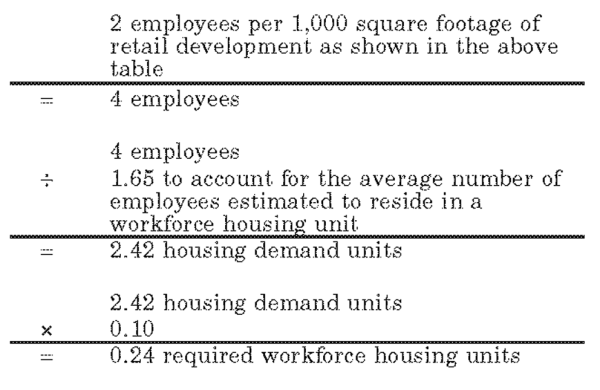
- Housing type. Workforce housing may consist of structures such as; single-, two-, three- and four-family dwellings, multifamily dwellings and rental units. Rental units may be apartments, dormitories, boardinghouses and/or residence halls.
- Housing affordability. An annual report shall be generated and presented to the county planning staff that outlines a previous year's employment level, workforce housing need, housing type/availability and occupancy. The report shall also outline the methods guaranteeing perpetual affordability and the rental and/or mortgage payments as they relate to housing types. Housing payments, including utilities, shall not exceed 30 percent of the upper valley moderate income as defined in the county moderate income housing plan.
- Density and affordable workforce housing. Any increases in density caused by the development of workforce housing requirements shall be in addition to the allowable density approved at the time of the DRR-1 Zone application.
(Ord. of 1956, § 44-7; Ord. No. 2016-4, Exh. B2, 5-24-2016)
Use | Permitted (P)
Conditional (C) | |
| Residential Uses | ||
| Single-family dwelling; including not more than two lockout sleeping rooms per dwelling | P | |
| Two-family dwelling (aka Duplex) | P | |
| Three-family dwelling | P | |
| Four-family dwelling | P | |
| Multi-family dwelling | P | |
| Recreation lodge | P | |
| Condominium dwelling unit and/or condominium rental apartment (condo-tel); including not more than two lockout sleeping rooms per unit or apartment. | P | |
| Private residence club | P | |
| Townhome | P | |
| Residential facility for persons with a disability meeting the requirements of section 108-7-13 | P | |
| Timeshare/fractional ownership unit | P | |
| Hotel | P | |
| Bed and breakfast dwelling/B&B inn/B&B hotel | P | |
| Accessory dwelling unit | P | |
| Workforce housing/dormitory/residence hall | P | |
| Hostel | P | |
| Campground (public or private tent/RV); meeting the requirements of the Forest Campground Ordinance of Weber County | P | |
| Short-term rental, pursuant to Title 108, Chapter 11. | P | |
| Commercial Uses | ||
| Bank/financial institution | P | |
| Bakery | P | |
| Drinking establishment | P | |
| Grocer/neighborhood market | P | |
| Delicatessen | P | |
| Boutique (gift, flower, antique, clothing, jewelry) | P | |
| Fueling station/gas station | P | |
| Conference/education center | P | |
| Wellness center (i.e., spa, fitness, etc.) | P | |
| Art gallery and studios | P | |
| Book store | P | |
| Beauty/barber shop | P | |
| Short-term vendor | P | |
| Package liquor Store | P | |
| Private club | P | |
| Restaurant; excluding drive-thru window | P | |
| Sporting goods/clothing store; including rental | P | |
| Other Uses | ||
| Arts theater and performance facility/auditorium/amphitheater | P | |
| Agriculture | P | |
| Childcare facilities | P | |
| Church/place of worship | P | |
| Clinic/medical facility | P | |
| Community center | P | |
| Developed recreation facility (i.e., swimming, golf course, ice skating, skate park, playground, tubing hill, tennis, etc.) | P | |
| Dude ranch; including horse rental | P | |
| Equestrian center | P | |
| Gun club/skeet/sporting clay | C | |
| Heliport, subject to the following standards: | C | |
| 1. | A heliport must be located at an elevation of at least 6,200 feet above sea level. | |
| 2. | A heliport must be located at least 200 feet from any resort boundary, except where the developer (as defined in the applicable zoning development agreement) owns at least 200 feet of property extending from the resort boundary at the planned location of the heliport or where the developer has received approval from the owner of any property within 200 feet of the resort boundary at the planned location of the heliport. The planning commission may grant exceptions to the setback requirement if it can be demonstrated that locating the heliport closer than 200 feet to the resort boundary provides a more beneficial situation for purposes of safety, noise abatement, access, or other valid reasons as determined by the planning commission. | |
| 3. | The heliport landing surface must be dust-proof and free from obstructions. | |
| 4. | Prior to issuance of a conditional use permit for a heliport, written approval from the Federal Aviation Administration (FAA) is required, if necessary. | |
| Home occupation; with no visiting clientele | P | |
| Home occupation; with visiting clientele | C | |
| Horses for private use, provided that not more than two are kept for each one acre of land exclusively devoted to the keeping of horses | P | |
| Trails (nordic, hiking, biking, equestrian) | P | |
| Laundromat | P | |
| Museums | P | |
| Nordic center | P | |
| Office; professional and resort administrative | P | |
| Office supply/shipping service | P | |
| Parking areas and structures | P | |
| Parks and playgrounds | P | |
| Pharmacy | P | |
| Public building | P | |
| Public utility substation and structure | C | |
| Real estate office | P | |
| Recreation centers | P | |
| Recreation vehicle storage | P | |
| School; public or private school having a similar curriculum as a public school | P | |
| Ski area and associated facilities; including lifts | P | |
| Ski lodge and associated services | P | |
| Small wind energy system; meeting the requirements of section 108-7-24 | C | |
| Solar energy installation; meeting the requirements of section 108-7-27 | P | |
| Telecommunications tower | C | |
| Yurt | P | |
| Cluster subdivision excluding bonus density; meeting the requirements of title 108, chapter 3 | P | |
| Welcome/information center | P | |
| Wastewater treatment facility; meeting the requirements of the state division of water quality | C | |
| Water pumping plants and reservoirs | C | |
| Accessory dwelling unit; accounting for one dwelling unit at a rate of 1:1 | P | |
| Greenhouse, nursery, or farm | P | |
| Transit facility | P | |
| Second kitchen | P | |
| Corral, stable, or building for keeping of animals or fowl | P | |
| Household pets | P | |
| Private stable | P | |
| Educational facility | P | |
| Liquor, wine, and beer manufacturing, bottling, blending, distilling, packaging, sales, and related activities | P | |
| Temporary building or use incidental to construction work. Such building shall be removed upon completion or abandonment of construction work | P | |
| Grazing and pasturing animals | P | |
| Detached lockouts | P | |
| Accessory building incidental to the use of a main building; main building designed or used to accommodate the main use to which the premises are devoted; and accessory uses customarily incidental to a main use | P | |
(Ord. No. 2012-1, § 4, 1-3-2012; Ord. No. 2015-7, Exh. A, 5-5-2015; Ord. No. 2016-4, Exh. B2, 5-24-2016)
Amended by Ord. 2020-27 on 12/22/2020
Amended by Ord. 2021-6 on 3/23/2021
Amended by Ord. 2023-01 on 1/10/2023
A kitchen covenant shall not be required when constructing less than three kitchens in a dwelling or condominium unit.
(Ord. No. 2016-4, Exh. B2, 5-24-2016)
"Miscellaneous improvements" means:
- Improvements with a height less than six feet such as walkways, steps, patios, decks, exterior railings, and similar exterior dwelling improvements;
- Exterior landscaping décor such as a planter, landscape curbing, or any other similar exterior landscaping décor or improvements;
- Hot tubs, barbeques, grills, firepits, firebowls, patio heaters, benches, picnic tables, and hammocks. In addition, without reference to height, overhangs, eves, decks, stairs, access ramps, and retaining walls that are connected or attached to the structure shall constitute "miscellaneous improvements." Miscellaneous improvements are permitted outside of the building envelope. Notwithstanding the foregoing, miscellaneous improvements on lots subject to hillside review (pursuant to chapter 14) or other supplementary review, are subject to hillside review or other supplementary reviews.
(Ord. No. 2016-4, Exh. B2, 5-24-2016)
Sec 104-30-2 Applicability
Sec 104-30-3 Permitted Uses
Sec 104-30-4 Prohibited Uses
Sec 104-30-5 Supplemental SOZ Adoption Procedures And Requirements
Sec 104-30-6 Site Development Standards
The solar overlay zone (SOZ) is intended to allow a legislatively adopted overlay zone that permits a large solar energy system. This chapter also establishes minimum requirements and regulations for the placement, construction, and modification of large solar energy systems, as defined in Title 101, Chapter 2, while promoting the safe, effective and efficient use of these energy systems.
(Ord. No. 2019-2, Exh. A, 2-5-2019)
The SOZ is an overlay zone only allowable in the M-3 and A-3 zones and in compliance with this chapter.
(Ord. No. 2019-2, Exh. A, 2-5-2019)
In addition to the uses allowed in the specific underlying zone, the following uses are permitted in the SOZ:
- Accessory building incidental to the use of a main building; main building designed or used to accommodate the main use to which the premises are devoted; and accessory uses customarily incidental to a main use.
- Large solar energy system.
- Public utility substation, in compliance with standards of title 108, chapter 10.
(Ord. No. 2019-2, Exh. A, 2-5-2019)
Any solar energy system that uses lenses or mirrors to focus or reflect sunlight is prohibited.
(Ord. No. 2019-2, Exh. A, 2-5-2019)
In addition to the rezone procedures found in title 102, chapter 5, the following supplemental rezone and development agreement procedures apply to the SOZ:
- Overlay zone termination. The SOZ shall terminate and be removed from the county zone map, and the development agreement shall also terminate, for any of the following reasons:
- The term of the development agreement expires and is not renewed;
- The large solar energy system use is discontinued or abandoned;
- The solar entity or landowner defaults on any part of the agreement, and the default is not resolved within the time specified by the development agreement; or
- The ownership of the large solar energy system or the ownership of the land changes. However, at the sole discretion of the county commission, an existing development agreement may be amended by legislative authority to apply to new owners without causing an expiration of the overlay zone.
- Development agreement. The SOZ requires special consideration related to site specific circumstances. As such, prior to adopting the SOZ for any particular property, a development agreement shall be negotiated by mutual agreement between the county, the solar entity, and, if different than the solar entity, the landowner.
- Execution of the development agreement shall be deemed a legislative action.
- The development agreement shall be in a form as approved by the county attorney, and shall be executed simultaneous with the adoption of the SOZ.
- The development agreement may address specific topics as deemed appropriate by the negotiating parties, but at a minimum, shall provide the following:
- All applicable provisions of this section;
- A site plan, showing location of all facilities, equipment, infrastructure, and screening and vegetation;
- A solar equipment treatment plan that demonstrates mitigation of detrimental effects of solar energy system on migratory fowl;
- Performance measures necessary to ensure proper site reclamation at the expiration or discontinuance of the use;
- Definitions and procedures regarding default, including the results of a default; and
- A property legal description, including all acreage necessary to meet the minimum site requirement of this chapter. The legal description shall include all new acreage in a SOZ overlay so that all area in a SOZ is regulated by a development agreement.
- As a baseline for negotiation, the standards applicable for conditional uses, as found in section 108-4-5(c), shall be addressed by the applicant prior to any action on the overlay zone. Actual implementation of a conditional use standard shall be at the discretion of the county commission and shall be executed as part of the development agreement. Use of a conditional use standard shall not constitute an administrative approval of a conditional use.
(Ord. No. 2019-2, Exh. A, 2-5-2019)
In addition to the development standards of the applicable underlying zone, the following site development standards apply to the SOZ. For the purpose of this chapter, the term "site" shall mean an entire contiguous area described in the applicable development agreement.
- Site area. The minimum contiguous site area shall be 100 acres.
- Site setbacks.
- Minimum setback of open-air solar equipment shall be:
- Thirty feet from the perimeter of the site.
- Five hundred feet from adjacent property containing a residential use. This may be reduced to 30 feet if the entire use is completely obscured from view from the adjacent property containing the residential use by berms, vegetation, or opaque fence or wall.
- One thousand feet from any zone in which the overlay zone is not permitted by this chapter. This may be reduced to 200 feet if the entire use is completely obscured from view from the properties in the other zone(s) by berms, vegetation, or opaque fence or wall.
- Minimum setback of accessory use shall be 30 feet from any street right-of-way and ten feet from the perimeter of the site.
- Minimum setback of open-air solar equipment shall be:
- Height.
- Maximum height of open-air main or accessory use shall be 15 feet.
- Maximum height of accessory building shall be 25 feet.
- Site design requirements. As applied to uses allowed by this overlay zone, the requirements of this chapter and any site design standard or requirement adopted in the development agreement constitute the entire design requirements for the site. No other design, architectural, landscaping, or screening requirements found elsewhere in this land use code shall apply.
(Ord. No. 2019-2, Exh. A, 2-5-2019)
Chapter 106-2 Subdivision Standards
Chapter 106-3 Condominium Projects
Chapter 106-4 Subdivision Improvements Required
Chapter 106-5 Enforcement And Permits
Chapter 106-6 Penalty, Validity And Repealer
Chapter 106-7 Owner's Dedication
Chapter 106-8 Signature Blocks
State Law reference—County Land Use, Development, and Management Act subdivision ordinances, U.C.A. 1953, § 17-27a-601 et seq.
Sec 106-1-2 (Reserved)
Sec 106-1-3 Applicability
Sec 106-1-4 Subdivision Application Requirements
Sec 106-1-5 Preliminary Plan/Plat Requirements And Approval Procedure
Sec 106-1-6 (Reserved)
Sec 106-1-7 Subdivision Time Limitations
Sec 106-1-8 Final Plat Requirements And Approval Procedure
Sec 106-1-9 Subdivision Lot Adjustment
The purpose and intent of this title is to promote the health, safety, convenience and general welfare of the inhabitants of the unincorporated planning areas of Weber County in subdivision of land and related matters. This title outlines the procedures for processing subdivisions and their approvals.
(Ord. of 1952, title 26, § 1-1; Ord. No. 2015-22, Exh. A, 12-22-2015)
(Ord. No. 2015-22, Exh. A, 12-22-2015)
- No person shall subdivide any tract of land except in compliance with this title. No person shall sell or exchange or offer to sell or exchange any parcel of land which is a part of a subdivision of a larger tract of land, nor offer for recording any deed conveying such a parcel of land, or any interest therein, unless such subdivision has been created in accordance with the provisions of this Land Use Code.
- No lot within an approved and recorded subdivision shall be further divided, rearranged, added to or reduced in area nor shall the boundaries of any lot be altered in any manner to create more lots than initially recorded without first obtaining the approval of the land use authority.
(Ord. of 1952, title 26, § 1-2; Ord. No. 2015-22, Exh. A, 12-22-2015)
Editor's note—Ord. No. 2015-22, Exh. A, adopted Dec. 22, 2015, renumbered and amended former § 106-1-2, "Scope," as § 106-1-3, "Subdivision required."
- Pre-application meeting. The County strongly suggests that each person who proposes to subdivide land shall confer with the county planning staff before submitting any plats, charts, or plans in order to become familiar with the county subdivision requirements and existing general plans and to discuss the proposed development of the tract. Additional required submittal information will be identified during the pre-meeting, such as sensitive lands, slope analysis, wetlands, wells, taxes, state roads, neighborhood circulation plan, landscape design, and water budget submittal.
- Subdivision application submittal. Subdivision applications shall be submitted to the planning division. Only complete applications will be accepted. A complete application shall include all applicable submittal requirements for subdivision review as required by this Land Use Code, including, but not limited to:
- Application form. A complete subdivision application form, signed by the property owners.
- Preliminary plat. A preliminary plat meeting the requirements. standards, codes, regulations, and all other specifications listed in this title and other applicable regulatory documents. This includes a phasing plan if phasing is proposed.
- Electronic documents. All documents submitted for the subdivision application shall be in a PDF file format. All plans (including but not limited to subdivision plats, improvement drawings, architectural drawings, phasing plans, etc.), and subsequent submittals and revisions, shall be in a PDF file format.
- Statement of culinary and secondary water feasibility. A written statement of feasibility, also known as a "will-serve letter," specifying culinary and secondary water provisions for each lot.
- The statement of culinary water feasibility shall come from the culinary water authority, pursuant to UCA Sec. 17-27a-603, as follows:
- The local health department for lots proposed to be served by a private well;
- An existing culinary water service provider; or
- If the culinary water authority is being newly formed, the statement shall come from the person with authority to sign on behalf of the newly formed water corporation. The applicant shall also submit written notification from the Utah Department of Environmental Quality indicating their acknowledgement of the new culinary water authority and the proposed system, and offer any other relevant information necessary for demonstrating system feasibility.
- The statement of secondary water feasibility shall come from the secondary water service provider.
- The statements from the culinary water authority and secondary water service provider shall contain:
- An acknowledgement of the number of lots proposed to be served;
- An acknowledgement of all intended uses of the water, including, but not limited to, culinary uses, fire suppression appurtenances, and secondary water uses, if applicable and as provided for in Section 106-4-2;
- The method of water delivery to each proposed lot;
- The proposed source of the water rights or shares necessary to serve the lots; and
- If applicable, any other requirement expected or necessary to attain the culinary water authority’s approval of the final subdivision plat.
- The statement of culinary water feasibility shall come from the culinary water authority, pursuant to UCA Sec. 17-27a-603, as follows:
- Statement of sanitary sewer or septic system feasibility. A written statement of feasibility, also known as a "will-serve letter," specifying wastewater provisions for each lot.
- The statement shall come from the sanitary sewer authority pursuant to UCA § 17-27a-603 as follows:
- The local health department for lots proposed to be served by a septic system:
- An existing sanitary sewer service provider; or
- If the sanitary sewer authority is being newly formed, the statement shall come from the body politic or manager of the system. The applicant shall also submit a written notification from the Utah State Department of Environmental Quality indicating their acknowledgement of the proposed system, and offer any other relevant information necessary for demonstrating system feasibility.
- The statement shall provide:
- An acknowledgment of the number of lots proposed to be served;
- The method of wastewater disposal for each applicable proposed lot;
- An assertion that there is sufficient capability for safe wastewater disposal using the proposed method; and
- Any other requirement expected or necessary to attain the sanitary sewer authority’s approval of the final subdivision plat.
- The statement shall come from the sanitary sewer authority pursuant to UCA § 17-27a-603 as follows:
- Preliminary title report. A preliminary title report for each tax parcel included within the preliminary subdivision boundary shall be included with the preliminary plat application. The preliminary title report(s) shall be no older than 30 calendar days prior to the submittal of the application. If the County Recorder's Office is backlogged more than 30 calendar days, then the preliminary title report(s) shall be no older than the current backlog date plus one day. The preliminary title report shall include a search of recorded documents back to patent and identify, at a minimum, the following items:
- All reference easements;
- Reference (the entry number and/or book and page number) to all deeds in chain of title;
- All boundary line agreements;
- All rights-of-way, whether the parcel is subject to or has reserve rights;
- All current owners;
- All outstanding liens, taxes, etc.
- Street connectivity proposal. If the proposed subdivision will create or extend a street, a street connectivity plan showing how the streets proposed in the subdivision might possibly connect to other streets existing or planned in the area. The plan shall show realistic connection opportunities that consider the actual lay of the land and environmental or physical constraints.
- An application fee. Full payment of the application fee is required at the time of application submittal. The payment of a partial application fee, or the submittal of plans for a pre-submittal review, does not constitute a complete application.
Adopted by Ord. 2021-17 on 5/25/2021
Amended by Ord. 2021-23 on 7/6/2021
Amended by Ord. 2024-03 on 1/16/2024
Sec 106-1-5.20 Agency Reviews And Determination Of Completeness
Sec 106-1-5.30 Approval Procedure
(Ord. of 1952, title 26, § 1-5; Ord. No. 2015-22, Exh. A, 12-22-2015)
Editor's note—Ord. No. 2015-22, Exh. A, adopted Dec. 22, 2015, retitled § 106-1-5 from "Preliminary plan requirements and approval procedure" to read as herein set out.
The preliminary plan shall be prepared in conformance with the requirements of this chapter and all other county codes and regulations governing the subdivision of land. The preliminary plan shall be drawn to a scale not smaller than 100 feet to the inch, unless specified otherwise by the county surveyor, and shall show:
- A subdivision name, approved by the county recorder, and the general location of the subdivision in bold letters at the top of the sheet. The township, range, and quarter section shall also be shown on the top of the plat.
- A north arrow, scale, and date.
- The individual or company names and addresses of the applicant, engineer and land surveyor of the subdivision.
- The surveyed boundary lines of the tract to be subdivided showing lot numbers, measured and/or recorded bearings, distances, and other controlling data with ties to section corners.
- Contour map with, unless specified otherwise by the county engineer, two-foot contour intervals.
- The existing location, widths and other dimensions of all existing or platted streets and other important features such as, but not limited to, railroad lines, sanitary sewers, storm drains, water supply mains, fire hydrants, water wells, land drains, culverts, watercourses, wetlands, stream corridor setbacks, floodplain, fence lines or other lines of occupation, exceptional topography, easements and buildings and structures within and immediately adjacent (within 30 feet) to the tract of land to be subdivided.
- The location, widths and other dimensions of proposed public streets, private streets, or private access rights-of-way, alleys, utility easements, pathways, parks, other open spaces and lots with proper labeling of spaces to be dedicated to the public or designated as private streets or private access rights-of-way.
- Road connectivity plan showing how future roads can connect to provide circulation to future neighborhoods.
- Lots classified as a "restricted lot" as defined in Section 101-2-13 by placing the letter "R" immediately to the right of the lot number.
- The location of percolation test holes on each lot.
- Proposed plans or written statements prepared by a licensed civil engineer regarding the width and type of proposed pavement, location, size, and type of proposed sanitary sewers or other sewage disposal facilities, proposed water mains and hydrants and other proposed stormwater drainage facilities and other proposed improvements such as sidewalks, planting and parks and any grading of individual lots. Improvement drawings as required by the county engineer may be required during preliminary approval in subdivisions where roads are proposed over ground that has an average slope of ten percent or greater.
- Open space and common area improvements, including but not limited to landscaping, structures, signs, parking, and other amenities.
- Agency review. The Planning Division shall distribute copies of the preliminary plat to other County divisions or departments. Any other reviews by agencies or organizations, outside the County's direct organization, as required by County or State Code, that are necessary to ensure thorough review of the proposed plat, shall be submitted to the County by the applicant.
- Application determination of completeness. Upon determination of a complete application, the County shall not require more than four review cycles, as outlined in Utah State Code Section 17-27a-604.2, unless mutually agreed upon otherwise by the County and the applicant. The County shall have 15 business days to review the preliminary plat and return detailed, itemized, and all other applicable information and recommendations to the applicant.
- UDOT corridor review. A subdivision proposed within a designated UDOT corridor preservation area shall be sent to the UDOT regional office for review and comment.
- Subdivision approval. After the applicable staff and agency reviews, the preliminary plan/plat, including the phasing plan, shall be presented to the Land Use Authority. The Land Use Authority shall review the preliminary plan/plat to verify compliance with applicable ordinances. After determining compliance with applicable ordinances, or determining compliance after adding conditions of approval to ensure compliance with applicable laws, the Land Use Authority shall approve the preliminary plan/plat. When considering conditions of approval, the Land Use Authority shall follow the decision requirements found in Section 108-4-4 of this Land Use Code, and the conditional use standards of Section 108-4-5. A decision on a subdivision that includes conditions of approval shall not constitute a conditional use or require a conditional use permit.
- Small subdivision review. Preliminary plan/plat approval of a small subdivision, as defined in Section 101-2-20 of this Land Use Code, is not required. The preliminary plan/plat required in this section shall be reviewed simultaneously with the final plat.
- Administrative Land Use Authority designated. The Administrative Land Use Authority for preliminary plat approval of a subdivision other than a small subdivision, as defined in Section 101-2-20 of this Land Use Code, is the applicable planning area Planning Commission. The Land Use Authority for preliminary plan/plat approval of a small subdivision is the Planning Division Director.
(Ord. of 1952, title 26, § 1-6; Ord. No. 2015-22, Exh. A, 12-22-2015; Ord. No. 2017-15, Exh. A, 5-9-2017)
- Time limitation for preliminary approval. Subdivision applications that have not received preliminary approval within 18 months from the date of submittal shall be void.
- Time limitation for final approval. Subdivisions that have received preliminary plan approval shall have 18 months from the date of the preliminary approval to receive final approval of the subdivision or the first phase if applicable. An extension of preliminary approval for an additional time of up to 18 months may be granted by the planning director upon repayment of the subdivision application fees and the plan being brought into compliance with county, state, and federal laws current at the time the extension is approved. The extension request shall be submitted and approved prior to the expiration of the original approval period. Only two time extensions for preliminary plan/plat extensions will be granted.
- Time limitation for plat recordation. A subdivision plat shall be recorded in the Office of the County Recorder within one year of final approval by the Land Use Authority. After that, the plat shall have no validity. Subdivisions with multiple phases must record a new phase within one year from the date the previous phase being recorded until the subdivision is completed or the plat shall have no validity. The planning director may grant a one-time extension for final subdivision approval, for a maximum of one year. A multiple phase subdivision may receive only one time extension, not one time extension per phase. One additional time extension may be granted if the hardship is determined to be a county caused delay.
- Nonconforming. Any subdivision that has received preliminary or final approval, including a subdivision with multiple phases in which all of the phases have received preliminary approval, but has become nonconforming in any manner due to changes in applicable ordinances shall be allowed to retain the density which it was approved, provided that the originally approved phasing plan is followed and the time limitations for preliminary and final approval are met.
(Ord. of 1952, title 26, § 1-7; Ord. No. 2015-22, Exh. A, 12-22-2015)
Sec 106-1-8.020 Final Plat Requirements
Sec 106-1-8.030 Final Plat Approval Process
Sec 106-1-8.040 Final Plat Recordation
(Ord. of 1952, title 26, § 1-8; Ord. No. 2012-2, § 2, 1-10-2012; Ord. No. 2014-6, § 3, 4-1-2014; Ord. No. 2015-22, Exh. A, 12-22-2015; Ord. No. 2016-17, Exh. A, 11-8-2016; Ord. No. 2017-15, Exh. A, 5-9-2017)
Amended by Ord. 2021-17 on 5/25/2021
Amended by Ord. 2021-23 on 7/6/2021
Amended by Ord. 2023-10 on 5/16/2023
- After compliance with the preliminary plat provisions of Section 106-1-5, the applicant shall digitally submit a draft final plat and draft improvement plans, meeting the remaining requirements of this Title and any additional conditions set by the Administrative Land Use Authority. The registered land surveyor's certification on such plats shall indicate all lots meet the requirements of the Land Use Code.
- Upon determination of a complete application submittal, the County shall not require more than four review cycles, as outlined in Utah State Code Section 27-27a-604.2. The County, in each review cycle, shall return detailed comments to the applicant within 20 days if submittal from the applicant. Reviews by the County shall be detailed, itemized, and complete.
Adopted by Ord. 2021-23 on 7/6/2021
Amended by Ord. 2023-10 on 5/16/2023
Amended by Ord. 2024-03 on 1/16/2024
The following are requirements for final plat consideration:
- Final plat preparation. The final plat shall be prepared to be printed on a 24-inch by 36-inch sheet of mylar. The border line of the plat shall be drawn in heavy lines, and shall leave a minimum one-half of an inch and a maximum one-and-one-half of an inch margin on all four sides of the sheet. The final plat shall be signed and stamped by a licensed land surveyor licensed in the state. All lines, dimensions and markings shall be made on the mylar with permanent ink meeting industry standards and created for long-term storage. The plat shall be made to a scale large enough to clearly show all details, but never smaller than 100 feet to the inch, unless specified otherwise by the County Surveyor. The workmanship on the finished drawing shall be legible having a text size of not less than three-thirty seconds of an inch. The plat shall contain the following information:
- Subdivision name. A subdivision name, approved by the County Recorder and the general location of the subdivision in bold letters at the top of the sheet. The township, range, and quarter section shall also be shown on the top of the plat.
- Where a subdivision complies with the cluster subdivision provisions of this Land Use Code, the final plat shall provide the following subtitle under the subdivision name: "A Cluster Subdivision."
- Where a subdivision complies with the Lot-Averaging Subdivision provisions specified in Section 106-2-4 of this Land Use Code, the final plat shall provide the following subtitle under the subdivision name: "A Lot-Averaged Subdivision."
- Where a subdivision complies with the connectivity-incentivized subdivision provisions specified in Section 106-2-4 of this Land Use Code, the final plat shall provide the following subtitle under the subdivision name: "A Connectivity-Incentivized Subdivision."
- North arrow and scale. A north point or arrow which shall make the top of the sheet either north or east, however, exceptions may be approved by the County Surveyor, the scale of the drawing and the date of the survey noted in the heading. (Meaning the date, year and month the survey markers were placed.)
- Legal description. A legal description of land included in the subdivision, including the overall acreage within the legal description.
- Linework. Accurately drawn boundaries, showing the distance and bearings of all lines retraced or established by the survey, including the lines of the subdivision. The boundary lines shall be slightly heavier than street lines, and street lines shall be slightly heavier than Lot lines. If such a line is a curve, the radius, arc length, and central angle must be shown or noted. If the curve is a non-tangent curve, the chord bearing and distance must be shown as well.
- Basis of bearing. The words "basis of bearings" must be shown on the plat between two existing, described government monuments. The government monuments may be section corners, city or county street monuments, or horizontal network stations maintained by a government agency. The Basis of Bearing sufficient for retracement shall be noted on the final plat, along with a measurable mathematical relationship between the property and the monument from which it is described. If that monument is not in place, its mathematical location must be shown as well as a mathematical relationship to a monument in place.
- Bearings and measurements. The State Plane Grid Bearings (where available, or using GPS surveys) shall be used in the survey and noted on the plat in accordance with U.C.A. 1953, Title 57, Chapter 10. All measured bearings or distances or bearings and distances calculated from measurements shall be separately indicated from those of record if not in agreement. The mathematical relationship between all monuments found or set shall be provided.
- Streets, Alleys, easements, and Lots. The names, widths, lengths, bearings and curve data on centerlines of proposed streets, alleys, and easements. All Lots are to be numbered consecutively under a definite system approved by the County Surveyor. All proposed streets shall be numbered consecutively under a definite system approved by the County Surveyor and conform as far as practicable to the adopted street numbering system of the county, unless there are street alignment situations where a street name may be better utilized as the primary identifier. The County Surveyor must approve these allowable situations. Where streets are given a number as the primary identifier a street name may be assigned as a secondary identifier.
- Public dedication. The boundaries, bearings and dimensions of all portions within the subdivision as intended to be dedicated to the use of the public.
- Reservations. The lines, dimensions, bearings, areas and numbers of all Lots, Blocks and parts reserved for any reason within the subdivision. Parcels of land to be dedicated as public park or to be permanently reserved for private and/or public common open space area shall be numbered and labeled in accordance with policies of the County Recorder.
- Address. A house number indicating the street address for each Lot in the subdivision shall be assigned by the County Surveyor marked on each Lot so as to face the street frontage. Corner Lots shall have a house number assigned for frontage. Homes that are built on approved Flag Lots or rights-of-way shall have the address assigned and posted at the access point from a county road or private road.
- Signature block. A signature block conforming to State Code and county ordinances shall be included on the plat for the following:
- Private licensed land surveyor's "certificate of survey";
- Owner's dedication certificate;
- Notary public's acknowledgment;
- County Administrative Land Use Authority's certificate of approval, to be signed by the Planning Director or designee;
- County Engineer's certificate of approval;
- County Attorney's certificate of approval;
- Board of County Commissioners' certificate of acceptance;
- County Clerk's certificate of attest;
- County Surveyor's certificate of approval;
- Local health department certificate of approval, if required by the local health department;
- Culinary water authority certificate of approval, if not the local health department; and
- Sanitary sewer authority certificate of approval, if not the local health department.
- In lieu of a signature block on the final plat for the culinary water authority or sanitary sewer authority, the applicant may furnish a final plat approval letter from either or both of these entities, if applicable. The final plat approval letter shall indicate the water or sewer authority's unconditioned approval of the final plat and the proposed improvements for their respective facilities, and shall include a copy of the final plat and final improvement drawings for which they are granting approval. A conditional letter of approval is not allowed.
- Recorder's block. A three-inch by three-inch space in the lower right-hand corner of the drawing for recording information.
- Subdivision boundary. The subdivision boundary corners, Lot corners and centerline street monuments shall be noted on the final plat in conformance with county ordinances.
- Map narrative. A map narrative that complies with U.C.A. 1953, § 17-23-17 and Section 45-3-4 of the Weber County Code of Ordinances.
- Occupation lines. All evidence of occupation such as fence lines, walls, curbs, etc. shall be shown on the dedication plat, as directed by the County Surveyor.
- Easements. All easements observed, recorded in the Office of the County Recorder, or included in a preliminary title report unless legally vacated by all easement holders.
- Subdivision name. A subdivision name, approved by the County Recorder and the general location of the subdivision in bold letters at the top of the sheet. The township, range, and quarter section shall also be shown on the top of the plat.
- Plat notes required. The following plat notes shall be placed on every page of the final plat, when applicable:
- Boundary and corners note. A note on the plat shall indicate the subdivision boundary and the Lot corners are set as required by state code and county ordinances.
- Hillside development plat note. Pursuant to Section 106-2-4, a Lot that has an average percent of slope that is greater than 25-percent shall provide the following on the final plat:
- A Buildable Area, as defined in Title 101, Chapter 2. The Buildable Area shall be delineated on the final plat by short dashed lines.
- A restricted area, if applicable. The restricted area shall be labeled as “restricted area. See note [enter note number here].” The note shall read as follows: “A Lot with a delineated “restricted area” shall not allow buildings within the designated restricted area.”
- Agricultural uses plat note. A subdivision located in an Agriculture A-1, A-2, A-3, or AV-3 Zone shall have the following plat note: "Agriculture is the preferred use in the agricultural zones. Agricultural operations as specified in the Land Use Code for a particular zone are permitted at any time including the operation of farm machinery and no allowed agricultural use shall be subject to restriction on the basis that it interferes with activities of future residents of this subdivision."
- Lot-averaged subdivision plat note. A Lot-Averaged Subdivision shall have the following plat note: "For each zone in this subdivision, the average area and average width of Lots within the zone equal or exceed the minimum area and minimum width allowed in the zone. A subdivision amendment within any part of the overall subdivision boundary shall comply with Section 106-2-4.020 of the Weber County Code."
- Connectivity-incentivized subdivision plat note. A connectivity-incentivized subdivision shall have the following plat note: "This subdivision was allowed flexible Lot Area and width in exchange for superior street connectivity. A subdivision amendment within any part of the overall subdivision boundary shall comply with Section 106-2-1.020 of the Weber County Code."
- Moderate income or workforce housing plat note. Pursuant to Section 104-22-12 or Section 104-27-6, a Lot or Unit set aside for moderate-income housing or workforce housing shall have a plat note explaining the nature of the housing restriction and the method by which occupancy and moderate-income or workforce affordability will be regulated.
- Privately operated and maintained street or shared private lane plat note.
- Private street. A Parcel dedicated to the county but intended for a privately operated and maintained street, pursuant to Section 106-2-2.020, shall be labeled as “Privately operated and maintained street. See note [enter note number here].” The note shall read as follows: “Use of a street labeled as "Privately operated and maintained street" is reserved for the exclusive and private use of the adjoining Lot owners until and unless the governing body assumes public responsibility for the street."
- Shared private lane. A shared private lane, pursuant to Section 106-2-2.030, shall be labeled as “Shared private lane.” If the shared private lane is temporarily in lieu of a street, then it shall be labeled as “Shared private lane. See note [enter note number here].” The note shall read as follows: “The shared private lane is also an easement held in favor of the County for possible conversion to a Public Street at a time the County deems it appropriate, if ever.”
- Alley operations and maintenance plat note. Pursuant to Section 106-2-2.100, an Alley shall be labeled as “Public Alley, see note [enter note number here].” The note shall read as follows: “An Alley is a dedicated public thoroughfare, but the operations and maintenance is the collective and equitable responsibility of all landowners whose Lots and Parcels and/or parking areas gain access from it.
- Landscaping and watering restrictions plat note. Pursuant to Section 106-4-2.010, a Lot that will have landscaping and watering restrictions shall have a note placed on the final recorded plat that generally explains the landscaping and watering restrictions per Lot, and references the recorded covenant or, if applicable, covenants, and specifies the automatic watering system requirements of Section 106-4-2.010, if applicable.
- Substitute monuments plat note. Pursuant to Section 106-4-2.110, substitute monuments, when used, shall be noted on the subdivision plat and must be durably and visibly marked or tagged with the registered business name or the letters "P.L.S." followed by the registration number of the surveyor in charge.
- Outdoor lighting in a cluster subdivision plat note. Pursuant to Section 108-3-8, a cluster subdivision plat shall contain a note stating that all Lots in the subdivision are required to comply with the outdoor lighting requirements of Title 108, Chapter 16.
- Natural hazard report disclosure plat note. If any lot in the subdivision is in a natural hazard study area, a note shall be placed on the subdivision plat as provided in Section 108-22-4.
- Floodplain. Floodplain and floodway boundaries shall be shown on the final plat. The plat shall also indicate the base flood elevations in one-foot increments within the floodplain area. In lieu of providing the base flood elevations, the floodplain shall be designated as non-buildable for residential and commercial structures. Any subdivision improvements constructed in the floodplain area will need to meet the requirements of Title 22, Flood Damage Prevention Ordinance.
- Setting boundary onsite prior to plat recording. The subdivision boundary and lot corners shall be set on the site prior to recording of the final plat. Lot corners shall be set prior to issuance of a residential building permit. In addition, front lot line corners may be permanently referenced in curbs after completion of the street's construction.
- Additional information. The plat shall contain all other notes, covenants, data, tables, or other information required to be placed on the final plat, as specified elsewhere in this Land Use Code.
Adopted by Ord. 2021-23 on 7/6/2021
Amended by Ord. 2023-10 on 5/16/2023
Amended by Ord. 2024-03 on 1/16/2024
- Final subdivision approval. After the applicable staff and agency reviews, the final plat shall be presented to the Land Use Authority. The Land Use Authority shall review the final plat to verify compliance with applicable ordinances. After determining compliance with applicable ordinances, or determining compliance after adding conditions of approval to ensure compliance with applicable laws, the Land Use Authority shall approve the final plat. If applicable, when considering conditions of approval, the Land Use Authority shall follow the decision requirements found in Section 108-4-4 of this Land Use Code, and the conditional use standards found in Section 108-4-5. A decision on a subdivision that includes conditions of approval shall not constitute a conditional use or require a conditional use permit.
- Land Use Authority designated. The Administrative Land Use Authority for final plat approval is the County Planning Division Director.
- Submittal of final plat and final improvement plans. After approval of the final plat, the applicant shall submit a final plat printed on a 24-inch by 36-inch mylar sheet that includes the required signatures of all non-county employees. With the mylar, the applicant shall submit final improvement plans to the County Engineer for final approval, pursuant to Title 106, Chapter 4. After the final plat mylar has all required official approval signatures, and after the final improvement plans have received final approval by the County Engineer, the final plat may be recorded in the Office of the County Recorder, at the expense of the applicant.
- Tax clearance. The county may withhold an otherwise valid plat approval until the owner of the land provides a tax clearance letter indicating that all taxes, interest, and penalties owing on the land have been paid.
- Record of survey. A copy of the subdivision mylar shall be filed as a record of survey in the county surveyor's Office, prior to the Weber County Surveyor signing the dedication plat.
Adopted by Ord. 2021-23 on 7/6/2021
Amended by Ord. 2023-10 on 5/16/2023
Amended by Ord. 2024-03 on 1/16/2024
- Exemption qualifiers. A subdivision amendment is exempt from typical preliminary and final plat review if it consists solely of one or more proposed Subdivision Lot Adjustments. For purposes of this section, a Subdivision Lot Adjustment is a subdivision amendment in compliance with the following:
- The purpose of the amendment is only to amend a common boundary between lots or to amend an internal lot restriction that is no longer applicable pursuant to this Land Use Code.
- Each affected lot shall be within the boundaries of the same platted subdivision, or within the boundaries of a phased subdivision platted with an approved preliminary plan.
- All lots proposed to be amended shall comply with each lot's zoning requirements, or, if applicable, comply with the provisions of Section 108-12-12 (Reconfiguring Nonconforming Lots).
- All lots proposed to be amended shall comply with any additional applicable standards as may have been adopted by previous approvals including but not limited to a Master Plan, a Development Agreement, a Planned Residential Unit Development, etc.
- Application. A Subdivision Lot Adjustment application shall be submitted in a form as approved by the Planning Division. The application shall include:
- An electronic copy of the proposed amended plat that complies with Utah Code Ann. Section 17-27a-608, prepared by a surveyor licensed in the State of Utah.
- All information from the original subdivision plat referenced on the amended plat.
- An application fee.
- Procedure.
- After all applicable review agencies have recommended approval of the proposed subdivision amendment, the applicant shall submit to the Planning Division a signed and notarized printed mylar copy.
- The County will send any notices required by statute.
- After collecting signatures from applicable review agencies, the Planning Division shall submit the proposed subdivision amendment for approval and signature by the Land Use Authority.
- The Land Use Authority for a Subdivision Lot Adjustment application is the Planning Division Director.
- Upon signature of the Land Use Authority, the applicant may submit the signed mylar to the County Recorder's Office for recordation.
Sec 106-2-2 Street Standards
Sec 106-2-3 Blocks
Sec 106-2-4 Lot Standards
Sec 106-2-5 Parks, School Sites And Other Public Places
Sec 106-2-6 (Reserved)
Sec 106-2-7 (Reserved)
Sec 106-2-8 Large Scale Excavation
Sec 106-2-9 Power And Telephone Utilities
Sec 106-2-1.020 Street Connectivity And Circulation
A subdivision shall be designed to follow the street configuration requirements herein and elsewhere in this Land Use Code. Where this code allows an applicant flexibility on street location or configuration, that flexibility shall not be construed to relieve the applicant from requirements of this section.
- General street configuration and alignment. The configuration of streets in a new subdivision shall:
- Ensure the continuation of existing streets that can logically and reasonably be connected along the same street alignment;
- Provide for the continuation of new streets into adjoining undeveloped land;
- Be designed to consider the block length specified in Section 106-2-3, as it relates to both the subject property and adjoining property;
- Not avoid the requirements of this section by shifting the responsibility of providing a street onto landowners of adjacent undeveloped or underdeveloped parcels; and
- Not create an unnecessary hardship to providing street connections on or to other parcels in the general area, as deemed appropriate by the Land Use Authority.
- Master planned street. A street shown in an applicable general plan, small area plan, master streets plan, development agreement, or similar adopted planning document, shall be installed by the applicant in the general location depicted in the planning document.
- Section line and quarter section line street. A street shall be installed by the applicant along the general alignment of a section line and quarter section line, in compliance with the following:
- Minor deviations from section lines. The alignment of a section line or quarter section line street may be adjusted up to 400 feet so the applicant may gain lots on both sides of the street; provided that the radii of the curves are appropriate for the type of street, as determined by the County Engineer. The street shall realign at some point downstreet with the same section line or quarter section line, or a previously created street or dedicated street right-of-way intended to be or become the same section line or quarter section line street.
- Alternative street alignment. The Land Use Authority may, but is not required to, allow a street's alignment to be rerouted or, if it does not violate the terminal street requirements of Section 106-2-2.4, terminated if strict compliance with this subsection is inappropriate for the following reasons:
- It will result in unreasonable public costs for operations or maintenance of the street;
- It will conflict with a railway, waterway, wetland, critical wildlife habitat, or other environmental concern that cannot be mitigated with reasonable effort;
- It will result in a conflict with another section of this Land Use Code; or
- It will advance a goal of a general plan, small area plan, or similar planning document applicable to the land.
- Angle of intersecting streets. Any street approaching an arterial or collector street shall approach at an angle of not less than 80 degrees.
- Half-street. A half-street shall be governed as follows:
- Within a subdivision. A half-street is not allowed within a subdivision except as more specifically provided in this Land Use Code.
- On a subdivision boundary. Where a subdivision's boundary shares a common line with undeveloped land, an approximate half-width street right-of-way is allowed as long as:
- The required street improvements include half of what is otherwise typically required for the type of street plus at least a 20-foot wide vehicle travel surface, designed to specifications of the County Engineer; and
- The street right-of-way within the bounds of the subdivision is wide enough to accommodate these street improvements.
- Intent. The intent of this section is to provide efficient, convenient, logical, and frequent street and pathway connections to, within, through, and out of a proposed subdivision in a manner that other provisions of this Land Use Code do not. In all allowed zones, in exchange for providing the additional infrastructure, the applicant may use the acreage otherwise occupied by streets and pathways as credit toward creating Lots.
- Mandatory and voluntary compliance.
- Mandatory compliance. The provisions of this section are mandatory in the R1, R2, and R3 zones.
- Voluntary compliance: connectivity-incentivized subdivision. In allowed zones, as listed in Subsection (b)(2)b. of this section, the provisions of this section offer a voluntary alternative to traditional and typical Lot development standards otherwise set forth in the applicable zone. An applicant shall not be allowed to use this section unless the applicant volunteers to comply with all provisions herein. Applying for a connectivity-incentivized subdivision constitutes the applicant’s agreement to be governed by this section, and constitutes the applicant’s acknowledgement that the discretionary authority this section offers to the Land Use Authority may result in a decision contrary to the applicant’s initial intent. The applicant accepts all risk, including lost time and money, for voluntarily applying for subdivision review under these provisions. Otherwise, the applicant shall use other development types authorized by this Land Use Code to subdivide their land.
- Maximum allowed density. If the applicant provides a street and pathway layout that complies with this section and is approved at the discretion of the Land Use Authority after receiving a favorable recommendation from staff, the applicant may use the Base Density calculation, as defined in Section 101-2-3, to compute the maximum allowed Lots in the subdivision. Further, when calculating the Base Density, the area of the subdivision proposed to be occupied by public improvements is not required to be omitted from the net developable acreage.
- Allowed zones. A connectivity-incentivized subdivision is allowed only in the following zones: S-1, F-5, AV-3, FV-3, A-3, A-2, A-1, RE-20, RE-15, FR-3, and CVR-1.
- Unless excepted in Subsection (b)(2)b.2. of the section, at no time shall the Lot Area and Lot Width of any residential Lot be less than provided in this table:
LOT WIDTH AND LOT AREA S-1 F-5 AV-3 FV-3 A-3 A-2 A-1 RE-20 RE-15 FR-3 CVR-1 Reduced minimum Lot area: 50-percent of the zone's minimum. 80-percent of the zone's minimum. No minimum. Reduced minimum Lot width: - The following are exceptions to the Lot Area and Lot Width provisions of Subsection (b)(2)b.1. of this section:
- A lot in a cluster subdivision shall not be reduced to less than 90 percent of the lot area and lot width standards of the cluster subdivision ordinance.
- A pre-existing nonconforming lot of record that is smaller than fifty-percent of the lot area or lot width may continue with smaller dimensions as long it is not made more nonconforming.
- Unless excepted in Subsection (b)(2)b.2. of the section, at no time shall the Lot Area and Lot Width of any residential Lot be less than provided in this table:
- Mandatory compliance. The provisions of this section are mandatory in the R1, R2, and R3 zones.
- Street layout. Nothing here shall waive the minimum street or pathway requirements as provided elsewhere in this Land Use Code. A subdivision shall be designed in a manner that prioritizes circulation efficiencies both within the subdivision and to adjacent neighborhoods. Priority shall be given to both vehicular and pedestrian connectivity. The following minimum standards are required:
- Street-Block. A Street-Block, as defined in Section 101-2-20, shall have a length of no greater than 800 feet. The Land Use Authority may, but is not obligated to, approve an exception to this rule if a Street-Block cannot be formed as a result of one or more of the following. However, in each case the applicant shall provide a Street-Block or a connection that will help form a future Street-Block as near as is otherwise reasonably practicable:
- The adjacent area to which a street could otherwise be extended is built-out such that no reasonable street connection can be made thereto;
- The adjacent area to which a street could otherwise be extended has characteristics that significantly reduce the likelihood the Street-Block will be needed, as determined by the Land Use Authority. These characteristics include, but are not limited to, sensitive lands such as geologic hazards, riverways, floodplains, wetlands, and slopes on which no reasonable street configuration can be created that complies with allowed street grades;
- The adjacent area to which a street could otherwise be extended has culturally or locally important lands that can, are, or will be permanently preserved in a manner that benefits the general public. The Land Use Authority may require the applicant to secure the permanent preservation in a manner satisfactory to the Land Use Authority;
- Adherence to the maximum Street-Block length will interrupt a regionally significant pedestrian pathway delineated in the area’s general plan or similar planning document; or
- Strict adherence to the maximum Street-Block length will result in a Street-Block that is less than 300 feet in length.
- Intersections. Street intersections shall be four-way intersections wherever possible.
- Directional continuity. A Major Neighborhood Street, Collector Street, and Arterial Street shall provide directional continuity. Regardless of how a street may wind through a subdivision, whenever possible it shall exit the subdivision in the same general direction it entered so that it provides users a consistent direction of travel along the same street.
- Permanently terminal streets. Cul-de-sac and dead end streets shall be avoided. A cul-de-sac or dead end street may be allowed in rare circumstances if the same or similar characteristics as specified in the exceptions of Subsection (c)(1) of this section are present.
- Alignment and connection to other streets. Whenever possible, streets shall connect or be aligned to provide a future connection to other existing streets in the general area, with special deference for connecting to existing stubbed streets.
- Street-Block. A Street-Block, as defined in Section 101-2-20, shall have a length of no greater than 800 feet. The Land Use Authority may, but is not obligated to, approve an exception to this rule if a Street-Block cannot be formed as a result of one or more of the following. However, in each case the applicant shall provide a Street-Block or a connection that will help form a future Street-Block as near as is otherwise reasonably practicable:
- Pathway location and design standards. Nothing here shall waive the minimum street or pathway requirements as provided elsewhere in this Land Use Code. A subdivision shall be designed in a manner that prioritizes circulation efficiencies both within the subdivision and to adjacent neighborhoods. Priority shall be given to both vehicular and pedestrian connectivity. The following minimum standards are required:
- Pathways and sidewalks, generally.
- Each development shall be configured so that the maximum pathway or sidewalk walking-distance between a pathway or sidewalk intersection is 400 feet.
- This distance may be increased for a segment of a pathway that travels through a permanently preserved open space area or an area very unlikely to ever develop, as determined by the Land Use Authority.
- A pathway or sidewalk intersection is where a pathway or sidewalk intersects with another pathway, sidewalk, or street that has pedestrian facilities, or an Alley or Shared Private Lane, provided each are perpetually open for use by the general public for non-automobile purposes.
- Pathway and sidewalk layout shall be designed in a manner that prioritizes efficiency of non-motorized modes of transportation.
- Pathways shall connect to each other using shortest distance reasonably possible.
- Pathway and sidewalk layout shall provide for the continuation of existing pathways or sidewalks in the general area, and for future planned pathways, as shown on an adopted pathway plan, general plan, master trails plan, or other applicable adopted planning document.
- A pathway or sidewalk stubbed from an adjacent property shall be connected to a pathway or sidewalk within the subdivision.
- Continuation of a pathway or sidewalk to adjacent undeveloped property shall be provided with a stub to the subdivision boundary.
- Pathway and sidewalk arrangement shall not cause any unnecessary hardship for creating convenient and efficient access to nearby Lots or Parcels that are likely to eventually be developed.
- Each development shall be configured so that the maximum pathway or sidewalk walking-distance between a pathway or sidewalk intersection is 400 feet.
- Street-adjacent pathway. Along each Arterial Street, Collector Street, and Major Neighborhood Street, as provided in an adopted general plan, master streets plan, or similar adopted document, or along a section line Street as provided in Section 106-2-1, a 10-foot wide hard-surfaced pathway shall be installed.
- When determining which side of the street the pathway is required, preference shall be given to the side of the street that has optimal sun exposure during winter months.
- The Planning Director may require a pathway be located on the other side of the street to support pathway connectivity based on other factors such as existing or planned future pathways in the vicinity and potential pedestrian conflicts.
- The pathway shall be located within the street right-of-way unless expressly authorized otherwise by the County Engineer. If not located within the street right-of-way, a pathway easement is required.
- Unless required otherwise by the County Engineer, the pathway shall have an asphalt width of at least nine feet and be bounded on both sides by a six-inch concrete ribbon that is flush with the top of asphalt travel surface. The pathway shall be constructed of three inches of asphalt on eight inches of base-course. Greater thickness may be required where it intersects a vehicle-way.
- Example of street-adjacent pathway:
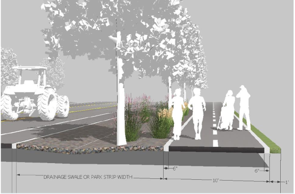
- Non-street-adjacent pathway. Where generally depicted on a map or in the text of an applicable street regulating plan, general plan, master streets plan, or when otherwise required herein or in a development agreement, a 10-foot wide hard-surfaced pathway shall be installed through the development.
- Where a pathway runs between buildings or fenced Lots, a minimum 30-foot wide pathway public right-of-way is required. The pathway shall run down the center of the 30-foot wide right-of-way. The width of the pathway right-of-way may be reduced to 15 feet if both of the adjoining Lots or Parcels are or will be used for Single-Family Dwellings, and are deed-restricted to:
- Only allow a solid fence that is no greater than four-feet; or
- Only allow a fence that is 30 percent open with the openings evenly distributed.
- The adjoining land owners are responsible for the maintenance and upkeep of vegetation and waste on the half of the pathway right-of-way that is adjacent to their Lot or Parcel.
- Example: Non-Street-Adjacent Pathway:
- Where a pathway runs between buildings or fenced Lots, a minimum 30-foot wide pathway public right-of-way is required. The pathway shall run down the center of the 30-foot wide right-of-way. The width of the pathway right-of-way may be reduced to 15 feet if both of the adjoining Lots or Parcels are or will be used for Single-Family Dwellings, and are deed-restricted to:
- Pathways and sidewalks, generally.
- Final plat note. Except for subdivisions in the R1, R2, or R3 zones, pursuant to Section 106-1-8.020, a subtitle and plat note regarding connectivity-incentivized subdivision shall be placed on the final plat.
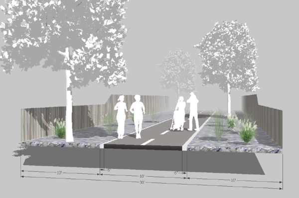
Sec 106-2-2.020 Private Street Option
Sec 106-2-2.030 Shared Private Lane Option
Sec 106-2-2.040 Terminal Streets
Sec 106-2-2.050 Arterial And Collector Streets
Sec 106-2-2.060 (Reserved)
Sec 106-2-2.070 (Reserved)
Sec 106-2-2.080 Street Cross Sections And Design
Sec 106-2-2.090 Street Grades
Sec 106-2-2.100 Alleys
Sec 106-2-2.110 Protection Strips
- (Ord. of 1952, title 26, § 2-2)
Amended by Ord. 2021-6 on 3/23/2021
Amended by Ord. 2021-18 on 5/25/2021
Amended by Ord. 2023-10 on 5/16/2023
The standard method of ensuring ease of access, efficient mobility, reduced response time for first responders, effective emergency management, strong neighborhood relationships through interconnectivity, and a more equitable means of access to community opportunities, is by requiring Public Streets and Public Street connectivity at the time new development is proposed. As such, the default requirement for each subdivision Lot is to provide Lot Frontage on a street dedicated to the County as a public right-of-way and thoroughfare.
- Public Street dedication. Each street in a subdivision shall be dedicated to the county as a Public Street, except when a Private Street is allowed or required as provided in this Section 106-2-2.
- Standard street cross-sections. All proposed Public Streets shall conform to the county street cross-section standards, unless explicitly specified otherwise.
Amended by Ord. 2021-18 on 5/25/2021
Amended by Ord. 2021-23 on 7/6/2021
Amended by Ord. 2023-10 on 5/16/2023
The provisions of Section 106-2-2.010 notwithstanding, the County, and in some cases the applicant, may find benefit from a street being temporarily or permanently private. In those cases, the Land Use Authority may require, or an applicant may volunteer, a proposed street to be privately owned or privately operated and maintained. Development of or along a Private Street shall comply with the following:
- Private Street open for general public use. A private street that is perpetually open to the public for use and through-passage is allowed only under the following circumstances:
- The Private Street shall never be closed to the public and no signage shall be erected to indicate or insinuate that the street is not open for public use or passage, except to allow for occasional and routine maintenance necessary to ensure the longevity of the street.
- The Private Street shall be owned, operated, and maintained in perpetuity by a homeowners association that has a least 40 Dwelling Units, as evidenced by an approved preliminary subdivision plat and recorded homeowners association declaration. If final plat recordation is phased, the homeowners association declaration shall be recorded to the entire legal description of the preliminary subdivision plat at the time the first plat is recorded. The declaration shall include the approved preliminary plat. Special provisions or deviations from this requirement may be approved in a development agreement.
- At not time shall a Private Street conflict with or create non-routine operations and maintenance demand on any Public Street.
- A Private Street that complies with this Subsection (a) shall be allowed to count as a Public Street for the purposes of creating a Street Block pursuant to Section 106-2-3 or other Street Block regulations in this Land Use Code.
- The Private Street shall never be closed to the public and no signage shall be erected to indicate or insinuate that the street is not open for public use or passage, except to allow for occasional and routine maintenance necessary to ensure the longevity of the street.
- Private Street not open for general public use.
- No entitlement. An applicant is not entitled to make a street private. The Land Use Authority has full discretion, subject to the regulations herein, to allow or require a street to be private.
- Prohibition. A Private Street shall not be allowed if:
- It creates a hardship for other landowners in the area to provide access to develop their land in accordance with the provisions of this Land Use Code, or
- A Public Street is needed in the location of the proposed Private Street, as determined by the Land Use Authority.
- It is in the Western Weber Planning Area and is not a permanently terminal street, as provided in Subsection (g) of this section.
- Responsibility for construction. The applicant shall pay for and construct the Private Street.
- Ownership. The final plat shall dedicate the land under the Private Street to the County for the purpose of future conversion to a Public Street at a time the governing body determines a Public Street is necessary, if ever.
- Street-Parcel dedication waiver. The Land Use Authority may waive this requirement if development or further development on adjacent Lots or Parcels to which the street could be extended is extremely unlikely, or to which future public access offers very little public benefit, or future development benefit, as determined by the Land Use Authority.
- No Street-Block waiver. A street needed to satisfy the Street-Block requirements of Section 106-2-3 is not eligible for this waiver unless there is no way in which that street can be configured in the subdivision to support the creation of the Street-Block.
- Pathway in lieu waiver. In circumstances where current or future public access by vehicle is unwarranted, the Land Use Authority may grant a waiver and in lieu require the dedication and installation of a 12-foot wide public easement and pathway or trail connection. The minimum pathway or trail design shall provide for either a 10-foot wide hard-surface pathway with a maximum average grade of 10 percent, or a single-track dirt trail with a maximum average grade of 18 percent.
- Waiver requires joint ownership. If a waiver is granted, the street-Parcel shall be held in joint ownership of the owners of all Lots that gain access from it.
- Street-Parcel configuration. The Parcel being dedicated to the county shall be the length of the Private Street and extend to adjacent developable land or another street regardless of whether the Private Street infrastructure does. The Parcel shall be the same width required for a Public Street right-of-way, and be configured at a grade that will not create an unreasonable burden for future street-building and connectivity given typical grading and construction methods.
- Transfer of street-Parcel. If adjacent Parcels to which the Private Street could connect reach full build-out or otherwise change in a manner that renders a future Public Street connection extremely unlikely, or if future public access to those Parcels offers very little public benefit, the County, at its sole option, may transfer the land, in accordance with all legal requirements, to the joint ownership of the owners of all Lots that gain access from it.
- Street-Parcel dedication waiver. The Land Use Authority may waive this requirement if development or further development on adjacent Lots or Parcels to which the street could be extended is extremely unlikely, or to which future public access offers very little public benefit, or future development benefit, as determined by the Land Use Authority.
- Operation, maintenance, and use. Except after the County assumes responsibility for the street, if ever, the operations and maintenance of the installed Private Street improvements shall be the sole responsibility of the owners of each Lot gaining access from the Private Street, or a homeowners association. The Land Use Authority may allow these owners to restrict access to the street by the general public, except county officials conducting official county business on a county-owned street-Parcel.
- Building setback standards. The minimum building setbacks shall be measured from the boundary of the County-owned street-Parcel.
- Private Street required. Unless the County Engineer or the Land Use Authority authorizes otherwise based on the public benefit outweighing the long term operations and maintenance expense, a Public Street is not allowed in the following circumstances:
- Permanent terminal street. A non-temporary terminal street;
- Geologic hazards. A street that traverses a geologic hazards study area shall be a Private Street, unless the hazards study, as required by Title 108, Chapter 22, provides compelling evidence that demonstrates the hazard risk to a Public Street is low.
- Construction standards. Unless otherwise required by the local Fire Authority or County Engineer, a Private Street shall be constructed to Public Street standards.
- Plat notes. On the final plat, the County-owned street-Parcel, where applicable, shall be labeled and noted as required by Section 106-1-8.020.
- Recording requirements. At the time of final plat recording, the applicant shall record a covenant to run with the land that provides that:
- The owners of all Lots that gain access from the Private Street are solely and equally responsible for operations and maintenance of the street.
- If applicable, that by purchasing a Lot that gains access from a Private Street, the owner acknowledges that the street-Parcel is owned in fee by the governing body for possible future Public Street purposes; but that the governing body assumes no responsibility or liability for the street or for the uses thereof or thereon until and unless, if applicable, the governing body assumes responsibility for it.
- The owner is responsible for disclosing the nature of the street to prospective purchasers, renters, or lessees.
- The landowner of record or authorized representative agree to pay a proportionate amount of the costs associated with improving or restoring the street to operational Public Street standards at the time the governing body assumes responsibility for it; and agrees to not protest the creation of a special assessment area or other similar revenue generating mechanism the governing body deems necessary to bring the Private Street to operational Public Street standards.
Amended by Ord. 2022-21 on 8/16/2022
Amended by Ord. 2023-10 on 5/16/2023
Amended by Ord. 2024-21 on 11/5/2024
Unless specified otherwise in this section a shared private lane is only allowed in locations where a street or street connection is not otherwise required or planned as provided in the applicable general plan, and where its placement will not violate the applicable Street-Block requirement of Section 106-2-3. Construction of a shared private lane is a subdivision improvement requirement and shall comply with the relevant sections of Title 106, Chapter 4 of this Land Use Code.
- Shared private lane design, configuration, and construction requirements. A shared private lane shall be:
- Design. Designed and constructed to have a minimum right-of-way width of 24 feet, with a minimum improved surface width of 20 feet. A greater right-of-way width may be required by the County Engineer for a cross-slope easement.
- Configuration. Configured and constructed so that any curve will safely facilitate the turning radius and weight of the Fire Authority’s largest fire apparatus.
- Construction. Constructed of all-weather material, have a grade of no greater than ten percent, and a clearance no less than 14 and a half feet. In a development with an average density that is greater than one unit per acre, the lane shall be hard-surfaced.
- Ownership requirements. Be on a Parcel that is held in common ownership by a homeowner’s association that governs the Lots that gain access therefrom, or be an easement recorded in favor of the owners of all Lots that gain access therefrom.
- Terminal length. If terminal, the shared private lane shall be no longer than
- 200 feet in the Western Weber Planning Area, and provide access to no more than seven Dwelling Units.
- 600 feet in the Ogden Valley Planning Area, and provide access to no more than 15 Dwelling Units. However, if longer than 200 feet in length it shall be designed with a fire apparatus turn-around approved by the local fire authority at the end.
- Shared private lane temporarily in lieu of street. As long as development on other properties in the general area to which a street could extend is not imminent, a private lane may be installed in place of a required public or Private Street, and in the Ogden Valley it may be longer than 600 feet in length, under the following circumstances:
- No interruption of street connectivity. Doing so shall not disrupt the orderly build-out or inhibit the future street connectivity of the area.
- Compliance with general plan. It shall not be contrary to the General Plan’s recommendations that are specifically applicable to the area.
- Easement required. With the final plat, an easement shall be given over the shared private lane to Weber County for the purpose of reserving an area that can become a future Public Street right-of-way at a time the governing body determines that a Public Street is necessary, if ever.
- The easement being dedicated to the county shall be the length of the Private Street and extend to adjacent developable land or another street regardless of whether the Private Street infrastructure does.
- The easement shall be the same width required for a Public Street right-of-way, and be configured at a grade that will not create an unreasonable burden for future street-building and connectivity given typical grading and construction methods.
- Operation, maintenance, and use. The operations and maintenance of the shared private lane shall be the sole responsibility of the owners of each Lot gaining access from it.
- Building setback standards. The minimum front building setback shall be 33 feet greater than otherwise required, and shall be measured from the centerline of the shared private lane.
- Plat note. On the final plat, the area of the county-owned easement shall be labeled and noted as required by Section 106-1-8.020.
- Recording requirements. At the time of final plat recording, the applicant shall record a covenant to run with the land that provides for the following:
- The owners of all Lots that gain access from the shared private lane are solely and equally responsible for operations and maintenance of the lane.
- If applicable, that by purchasing a Lot that gains access from a Shared Private Street, the owner acknowledges that the lane easement is owned by the governing body for possible future Public Street purposes, but that the governing body assumes no responsibility or liability for the lane or for the uses thereof or thereon until and unless, if applicable, the governing body assumes responsibility for it.
- The owner is responsible for disclosing the nature of the lane to prospective purchasers, renters, or lessees.
- The landowner of record or authorized representative agree to pay a proportionate amount of the costs associated with improving or restoring the street to operational Public Street standards at the time the governing body assumes responsibility for it; and agrees to not protest the creation of a special assessment area or other similar revenue generating mechanism the governing body deems necessary to bring the shared private lane to operational Public Street standards.
- Permanently terminal street.
- Maximum length and number of lots. A permanently terminal street (cul-de-sac or dead-end) or permanently terminal street-route shall:
- Serve no more than 15 subdivision lots or lots of record as defined by Section 101-2;
- Provide access to no more than 30 total dwelling units; and
- Have a maximum length of 750 feet. This length shall be measured from the point at which the street or street-route becomes terminal to the furthest extent along the terminal street or terminal street-route. If the terminal street or terminal street-route loops back onto itself, the furthest extent shall be the midpoint of the loop.
- Serve no more than 15 subdivision lots or lots of record as defined by Section 101-2;
- Alternative allowance due to constraints. If approved by the local fire authority, a permanently terminal street or street-route may serve a maximum of 30 subdivision lots or lots of record, and the maximum length of the street may be waived by the Land Use Authority, as long as the topography or other constraints of the land in the vicinity will not reasonably allow for a street connection to make the street or street-route non-terminal.
- Turn-around required. A terminal street shall be terminated by a turnaround of not less than 100 feet diameter, or as otherwise required by the local fire authority or the County Engineer. If stormwater drains into the turnaround, a stormwater catch basin and drainage easement shall be provided.
- Maximum length and number of lots. A permanently terminal street (cul-de-sac or dead-end) or permanently terminal street-route shall:
- Temporarily terminal street.
- Parameters. An applicant may extend a temporarily terminal street or street-route beyond the maximum length specified in Subsection (a) of this section if the extension:
- Can be defined as a temporarily terminal street or temporarily terminal street-route, as defined in Section 101-2 of this Land Use Code;
- Runs along the general alignment of a future street, as shown in an applicable general plan, small area plan, master streets plan, development agreement, or similar legislatively adopted planning document;
- Reduces the distance between the terminal street and the greater interconnected public street network, as measured along the general alignment of the planned street; and
- Complies with the requirements of the local fire authority.
- Can be defined as a temporarily terminal street or temporarily terminal street-route, as defined in Section 101-2 of this Land Use Code;
- Number of lots. A secondary emergency egress and fire access road, as approved by the local fire authority, shall connect the temporarily terminal street to the greater interconnected street network before more than 30 residential lots are allowed to gain sole-access from the street. Additionally, at no time shall more than 30 residential lots be allowed to gain sole-access from the street between the street's intersection with the nearest secondary emergency egress and the street's terminus.
- Turn-around required. A temporarily terminal street shall have a temporary turn-around at the end that complies with the minimum requirements of the local fire authority or the County Engineer. The temporary turn around shall remain available and usable by any users of the street so long as the dead-end condition exists.
- Parameters. An applicant may extend a temporarily terminal street or street-route beyond the maximum length specified in Subsection (a) of this section if the extension:
- Substandard terminal street. A subdivision that is proposed along a terminal street or terminal street-route that does not meet County right-of-way or construction standards at any point along the terminal street or terminal street-route shall not be allowed unless the County Engineer and Planning Director can mutually make the following findings:
- A traffic study, conducted by a certified professional traffic operations engineer (PTOE) and funded by the applicant, demonstrates that the existing single-access street or street route is adequate and safe, or can be made adequate and safe with improvements volunteered by the applicant, for the increased traffic demand of the new subdivision;
- That due to topographic, environmental, or other unique characteristics of the area, it is unlikely that another street or street route will be established that provides the new subdivision a second connection to the greater interconnected public street network within the next 10 years;
- That not providing the new subdivision with a standard single-access street or street-route does not conflict with an applicable general plan, small area plan, master streets plan, or similar adopted planning document;
- That not requiring a second connection to the greater interconnected public street network does not conflict with an applicable general plan, small area plan, master streets plan, or similar adopted planning document; and
- That compliance with Section 106-2-2.8 will be met.
- Unless specified otherwise in this Land Use Code, an Arterial or Collector Street shall be dedicated to conform to the right-of-way width designated in the general plan, master street plan, capital improvement or facilities plan, impact fee facilities plan, development agreement, or similar adopted planning or street design document. Setback from an Arterial and Collector Street shall be in compliance with Section 108-7-10.
- Both Arterial and Collector Streets are limited access streets. Subdivisions shall be designed to avoid providing Lots direct access from an Arterial or Collector Street, wherever possible. If a subdivision cannot be designed to avoid providing a Lot access directly from an Arterial or Collector Street, then access to the Lot shall follow the access provisions of Section 108-7-29. Residential access may be gained from the Arterial or Collector Street by sharing another previously existing residential access.
(Reserved)
(Reserved)
- Street cross section design. A proposed new street or street extension shall comply with the standards and specifications provided in Section 106-4-5 of this Land Use Code, as shall half of an existing street adjacent to the Lots in the subdivision, if applicable. The County Engineer is authorized to require the applicant to make offsite improvements on streets in the area if the impact of the subdivision on those streets necessitates the improvements. In the FB Zone, street design shall comply with the specific standards therein.
- Development on a substandard street. Development on a substandard street shall comply with the provisions of Section 108-7-19.
Except for rare and special circumstances, street grades over sustained length shall not exceed the following percentages: on Arterial Streets, eight percent; on Collector Streets, ten percent; on Major and Minor Neighborhood Streets, 12 percent; on Private Street or Shared Private Lanes, where allowed by this Land Use Code, 15 percent. All street grades shall be reviewed and approved by the Local Fire Authority and County Engineer.
- Alleys shall have a minimum width of 20 feet unless specified otherwise in this Land Use Code or the Local Fire Authority.
- An Alley shall be provided snow storage areas abutting the Alley of sufficient size and configuration to easily accommodate the Alley’s snow storage needs, as determined by the County Engineer.
- An Alley shall be dedicated for public use, as provided in Section 106-7-1, but the operations and maintenance of the Alley shall be the collective and equitable responsibility of all landowners whose Lots, Parcels or parking areas gain access from it.
- A note shall be placed on the final subdivision plat as provided in Section 106-1-8.020. An association of owners may be created to specify the details of the management thereof.
Where subdivision streets parallel contiguous property of other owners, the subdivider may establish a protection strip of not less than one foot in width located within the road right-of-way and lying next to the adjacent property. The said strip shall be deemed part of the dedicated right-of-way, provided that an agreement with the county and approved by the county attorney has been made by the subdivider. A land owner choosing to access property across the protection strip shall make payment to the original developer in an amount equal to the fair cost of the street improvements, plus the value of one-half the land in the street at the time of the agreement. This agreement shall expire ten years from the date the agreement was signed and shall become void.
- The maximum length of blocks generally shall be 1,300 feet and the minimum length of blocks shall be 500 feet. Blocks over 800 feet in length may, at the discretion of the planning commission, be provided with a dedicated walkway through the block at approximately the center of the block. Such walkway shall be not less than six feet in width.
- The width of blocks shall be sufficient to allow two tiers of lots or as otherwise approved by the planning commission because of design, terrain, or other unusual conditions.
- Blocks intended for business or industrial use shall be designed specifically for such purposes with adequate space set aside for off-street parking and delivery facilities.
(Ord. of 1952, title 26, § 2-3)
Sec 106-2-4.020 Lot-Averaged Subdivision
Sec 106-2-4.030 Connectivity-Incentivized Subdivision
(Ord. of 1952, title 26, § 2-4; Ord. No. 2018-11, Exh. A, 8-21-2018; Ord. No. 2019-4, Exh. A, 3-12-2019)
- Lot configuration. The Lot arrangement and design shall provide satisfactory and desirable sites for buildings, and be properly related to topography and to existing and probable future development conditions. The applicant shall demonstrate that each Lot intended for a building or other site improvements is buildable.
- Lot size and exceptions. Unless specifically allowed otherwise in this Land Use Code or a development agreement, all Lots shown on the subdivision plat must conform to the minimum area and width requirements of the Land Use Code for the zone in which the subdivision is located, as provided in the applicable zone pursuant to Title 104 of the Land Use Code.
- Lot frontage. Each Lot shall have frontage on a street or shared private lane that meets County standards, unless specifically provided otherwise in this Land Use Code. A Lot having double frontage is prohibited unless the rear of the Lot is abutting a Collector Street or Arterial Street, or a street planned to become a Collector Street or Arterial Street, or extreme topography makes other design inappropriate, as determined by the County Engineer. If allowed, the rear Lot Line of a Double Frontage Lot shall be labeled as "no access allowed."
- Side Lot Lines. Side lines of Lots shall be approximately at right angles, or radial to the street line, from the street line to at least the minimum required building setback.
- Flag Lot. A Flag Lot shall comply with the following provisions:
- Area. Regardless of any other alternative Lot Area provision of this Land Use Code, the area of the Lot shall be no less than twice the minimum Lot Area required by the zone, as specified in Title 104, but need not exceed three acres in a zone that has a minimum Lot Area less than three acres. A Flag Lot in a zone that has a minimum Lot Area of three acres or greater shall comply with the minimum Lot Area of the zone, as specified in Title 104.
- Avoiding street requirement not allowed. Unless otherwise allowed in this Land Use Code, a Flag Lot shall not be allowed if it avoids the installation of a street contemplated by this Land Use Code, an adopted general plan, master transportation plan, development agreement, or other adopted document intended to govern the placement, connectivity, or creation of a street or Street-Block.
- Access.
- Each Flag Lot shall gain access to a street by means of its own fee title access strip (the flag’s staff). Successive stacking of Lots on the same access strip is not permitted.
- No access strip shall exceed 800 feet in length.
- A maximum of two Flag Lot access strips may be located adjacent to each other.
- The access strip shall be configured in a manner that has the ability to support a future street if one is ever needed. The access strip shall be no less than 60 feet wide and extend from the street or shared private lane to the furthest extent of the Lot. This may be reduced to 30 feet if two Flag Lot access strips are adjacent to each other.
- The access strip shall be denoted on the plat as the access strip to the Flag Lot, and the Lot’s front shall be determined as facing this access strip. The front setback shall be measured from the access strip.
- A Flag Lot may be platted as long as an easement is platted over the entirety of the access strip in favor of the County for the purpose of creating a Public Street at a time the governing body determines a Public Street is necessary, if ever. However, the future street easement is not required in the following circumstances:
- The adjacent area to which a future street could otherwise be extended is built-out such that no reasonable street connection can be made thereto;
- The adjacent area to which a future street could otherwise be extended has characteristics that significantly reduce the likelihood the Street-Block will be needed, as determined by the Land Use Authority. These characteristics include, but are not limited to, sensitive lands such as geologic hazards, riverways, floodplains, wetlands, and slopes on which no reasonable street configuration can be created that complies with allowed street grades; or
- The adjacent area to which a future street could otherwise be extended has culturally or locally important lands that can, are, or will be permanently preserved in a manner that benefits the general public. The Land Use Authority may require the applicant to secure the permanent preservation in a manner satisfactory to the Land Use Authority.
- Remnant Parcel. A subdivision of land shall not exclude from its boundary any part or remainder of a Parcel affected by the subdivision unless the remnant Parcel is exempt from the definition of a subdivision under state and county code, or is exempt from platting requirements by state code.
- Remnant Parcel size. An allowed remnant Parcel shall be no smaller than five acres, and be recorded with the agricultural notice specified in UCA § 17-27a-605.
- Retroactive compliance. Any Parcel that was created as the result of being a remainder from a platted subdivision, including those that do not comply with the recorded notice provisions of UCA § 17-27a-605, that is later used for any use other than agriculture is no longer exempt from the requirements of this Title and shall retroactively be made to comply with this Titleand applicable state code.
- Multiple ownership. Where the land covered by a subdivision includes two or more Parcels in separate ownership and the Lot arrangement is such that a property ownership line divides one or more proposed Lots, the land in each Lot so divided shall be properly executed to correctly vest title to the owner or owners prior to recording the plat.
- Easements.
- Lot frontage public utility easements. Each Lot shall have a ten-foot public utility easement abutting a street right-of-way and spanning the Lot width. This ten-foot easement is not required in a zone that allows a zero front setback.
- Other public utility easements. Other public utility easements shall be provided if, and only if, authorized or required by the County Engineer or Land Use Authority, who shall specify the easement’s location and width, with a minimum width no less than five feet.
- Surface water drainage easements. If the applicant cannot demonstrate that surface water runoff onto other property will not exceed historic runoff rates, a land drain easement and drainage infrastructure shall be provided by the applicant in a manner that protects other properties in the area and public infrastructure. The land drain shall be installed as part of the subdivision improvements.
- Agricultural water drainage easements. When a subdivision is proposed on land to which irrigation water runoff has historically and lawfully drained from other property, a land drain easement and drainage infrastructure shall be provided by the applicant in a manner that protects the new Lots, public infrastructure, and historic irrigation flows from and to other property. The land drain shall be installed as part of the subdivision improvements.
- Taxing district annexation. Parcels that are split by a taxing district shall have the entire Parcel annexed into that taxing district prior to the recording of the subdivision. Exceptions will be made for bond obligations by the taxing district.
- Hillside development. A Lot that has an average percent of slope, as defined in Title 101, Chapter 2 of this Land Use Code, that is greater than 25-percent shall provideshallprovide for the following:
- Buildable area. If a Lot has a Buildable Area, as defined in Title 101, Chapter 2, a hillside development review is not required. The buildable area shall be delineated on the final plat by short dashed lines.
- Restricted Lot. Each Lot shall be configured, designed, and constructed in a manner that mitigates detrimental effects to future owners or the surrounding area. Each Lot shall provide a Buildable Area that can reasonably contain buildings typical for the zone. Each Lot that has area that has not been adequately studied and mitigated to prove buildability shall have the area clearly delineated and denoted on the final plat as “restricted area.” A Lot that has a restricted area may be amended to reduce or eliminate the restriction after appropriate studies and mitigation measures have been completed, as provided elsewhere in this Land Use Code. A note shall be placed on the final plat pursuant to Section 106-1-8.020.
- Sensitive lands restrictions. A Lot subject to development restrictions found in Title 104, Chapter 28 of this Land Use Code shall show the restrictions on the final plat. This shall include but may not be limited to wildlife habitat areas, ridgelines, slopes, and stream corridor setbacks.
Editor's Note: Ord 2023-10 incorrectly used the term "Lot Width" when it should have used "Lot Area" in Subsection (e)(1) of this section. This discrepancy has been corrected herein by the editor.
(Ord. of 1952, title 26, § 2-4; Ord. No. 2018-11, Exh. A, 8-21-2018; Ord. No. 2019-4, Exh. A, 3-12-2019)
In the A-1, A-2, A-3, and AV-3 zones, a Lot's area and width standards may be reduced in a Lot-Averaged Subdivision below the standard minimum Lot Area or minimum Lot Width as specified in the applicable zone or zones found in Title 104. A Lot-Averaged Subdivision shall comply with the following:
- The averaged area and width of all Lots to comply with zone standards. The averaged Lot Area and averaged Lot Width of all Lots located within a Lot-Averaged Subdivision shall be no less than the minimum Lot Area and minimum Lot Width found in the applicable zone or zones. A pre-existing nonconforming Lot of record that is smaller in Lot Area or Lot Width shall be excluded from the calculation, and may continue with the smaller dimensions as long is it is not made more nonconforming.
- Lot standards. The Lot Area and Lot Width of an individual Lot located within a Lot-Averaged Subdivision shall be no less than shown in the following table, provided that the averaged area and width of all Lots in the subdivision maintains compliance with Subsection (a) of this section.
A-1 and A-2 Zones A-3 and AV-3 Zones Lot Area 20,000 square feet 40,000 square feet Lot Width 80 feet 100 feet - Subdivision plat table. A table shall be provided with the subdivision application and on the final subdivision plat showing the area and width of each Lot within the overall subdivision boundary, the average area and width of all Lots within the overall subdivision boundary, and the average area and width of all Lots within each zone in the subdivision boundary. If platted in phases, the “overall subdivision boundary” shall mean the exterior boundary of all phases in the approved preliminary plat.
- Plat subtitle. Pursuant to Section 106-1-8.020, a subtitle and note referencing this provision shall be placed on the final plat.
Alternative minimum Lot standards for a connectivity-incentivized subdivision can be found in Section 106-2-1.020.
Adopted by Ord. 2021-23 on 7/6/2021
Amended by Ord. 2023-10 on 5/16/2023
Amended by Ord. 2024-21 on 11/5/2024
- In all subdivisions other than summer home subdivisions and subdivisions where there are no public streets, the planning commission may require the dedication to the county of not more than three percent of the gross area of the subdivision for parks, open spaces or other public uses in such location as approved by the planning commission as indicated on the approved preliminary plan, unless the subdivision is approved as part of a cluster subdivision.
- Where it is determined that a greater amount of land is required for parks and open spaces to meet the general plan requirements for that area of the county, or a school site is required, the planning commission after so apprising the appropriate agency, shall so indicate the open space or school site requirements to the subdivider on the approved preliminary plan.
- The subdivider, at the time of filing the final plat with the planning commission, must offer to sell at a fair market price to the county or other appropriate public agency, within one year immediately following the recording of the final plat, any land so designated for school sites or any land designated for park or open space in excess of the three percent of land area required to be dedicated in accordance with subsection (a) of this section.
- If any such proposed public areas or school sites have not been purchased by the appropriate public agency within one year after the recording of the final plat, such areas may be subdivided into lots and blocks in accordance with the requirements of this chapter.
(Ord. of 1952, title 26, § 2-5)
Editor's note—Ord. No. 2014-20, pt. 2, adopted Dec. 23, 2014, repealed former § 106-2-6 and renumbered subsequent sections 106-2-7—106-2-10 as 106-2-6—106-2-9. Prior to Ord. No. 2014-20, § 106-2-6 pertained to cluster subdivisions; special provisions, and derived from Ord. of 1952, title 26, § 2-6. After Ord. No. 2014-20, § 106-2-6 pertained to mountain subdivisions, special provisions. Later, Ord. No. 2021-23, adopted July 6, 2021, repealed mountain subdivisions, special provisions, and reserved § 106-2-6 for future provisions.
(Reserved)
No large scale excavation (more than 5,000 square feet), grading, or regrading shall take place on any land for which a preliminary subdivision plan has been submitted, until thesuch plan has been given preliminary approval by the Land Use Authority and County Engineer.
Editor's note—Ord. No. 2019-15, Exh. A, adopted Aug. 6, 2019, repealed § 106-2-8, which pertained to general land development and derived from Ord. of 1952, title 26, § 2-9 and Ord. No. 2014-20, pt. 2, adopted Dec. 23, 2014. Ord. 2021-23, adopted July 6, 2021, moved large scale excavation from § 106-1-5 to this section, and modified the language.
All electric power, television cable and telephone utility extensions to and in new subdivisions shall be installed underground to utility company specifications, except in those locations where the utility companies determine, and the planning commission concurs that it is impractical due to steep terrain, inaccessible location, or other physical deficiency with the land.
(Ord. of 1952, title 26, § 2-10; Ord. No. 2014-20, pt. 2, 12-23-2014)
Editor's note— See editor's note following § 106-2-6 regarding renumbering of sections.
Sec 106-3-2 Condominium Projects; Subdivision
Sec 106-3-3 Condominium Projects To Comply With Local Ordinances
Sec 106-3-4 Approval Of Condominium Declaration
Sec 106-3-5 Installation Of Improvements
State Law reference—Condominium Ownership Act, U.C.A. 1953, § 57-8-1 et seq.
A condominium project shall be considered to be a subdivision, and a record of survey map or supplement thereto prepared pursuant to the Condominium Ownership Act, U.C.A. 1953, § 57-8, as amended, shall be considered to be a subdivision map or plat with respect to such real property or improvements that are to be dedicated to the use of the public, and to those units which are not contained existing or proposed buildings.
(Ord. of 1952, title 26, § 3-2)
- Condominium projects shall comply with all the provision of the Weber County Land Use Code, the building, health and similar development regulations and ordinances of the county, and with Weber County subdivision regulations and shall follow the procedure outlined in such regulations for processing subdivisions.
- The standards and criteria for geographical layout of a condominium project, the facilities of utility lines and roads, the percentage of the project to be devoted to common or recreational use shall comply with the provisions of the ordinances and regulations in the subsections of this chapter.
(Ord. of 1952, title 26, § 3-3)
A copy of the preliminary condominium declaration prepared pursuant to U.C.A. 1953, § 57-8 as amended, shall be submitted to the planning commission along with the preliminary record of survey, for review and approval with respect to the standards for the maintenance, upkeep and operations of roads, the facilities of utility lines and roads, recreational areas, and open spaces in the project.
(Ord. of 1952, title 26, § 3-4)
The developer of a condominium project shall at his own expense install the improvements listed in the "Subdivision Improvements Required" chapter of this Code. In addition, proposed recreation facilities, clubhouses, recreation vehicle parking areas and landscaping materials in accordance with an approved plan shall be included in the guarantee of improvements provided by the developer to Weber County prior to final approval by Weber County or except as provided in the "Subdivision Improvements Required" chapter of this chapter, in accordance with the plans and specifications of approved by the county.
(Ord. of 1952, title 26, § 3-5)
Sec 106-4-2 Specific Requirements
Sec 106-4-3 Guarantee Of Improvements
Sec 106-4-4 Inspection Of Improvements
Sec 106-4-5 Public Works Standards And Technical Specifications
- Improvement plans, submittal and approval process. Pursuant to Section 106-1-8.30, with the final subdivision plat submittal, the applicant shall submit a complete set of draft improvement plans. The County Engineer is authorized to approve the improvement plans after determining the plan's compliance with all applicable standards and specifications, and after receiving approval of the improvement plans from the culinary water, secondary water, and sanitary sewer service providers, if applicable. The approvals from those service providers shall include a copy of the version of improvement plans for which they are offering approval. The applicant shall submit a copy of the final approved improvement plans with the final subdivision plat mylar. The final approved improvement plans shall be signed and stamped by a state licensed civil engineer for all streets, existing and proposed, and all utilities to be constructed within the subdivision.
- Approval of final improvement plans prior to final plat approval, if allowed. The applicant may submit improvement plans prior to final plat approval, but not before preliminary plan/plat approval by the Land Use Authority. The County Engineer, in his sole discretion, may approve final improvement plans prior to final plat approval. No subdivision improvements or utilities shall be installed until after approval of the final improvement plans by the County Engineer. The County Engineer's approval of final improvement plans prior to final plat approval, or the County Engineer's authorization to commence construction of the improvements, shall not constitute entitlement or vesting of any particular final plat design. The applicant bears all risk associated with pursuing approval of final improvement plans and commencement of construction of improvements prior to final plat approval.
- Improvements to comply with standards and specifications. All improvements shall comply with the standards and specifications referenced in Section 106-4-5, and the standards and specifications of relevant utility service providers.
- Improvements to be installed prior to issuance of permits.
- All required subdivision improvements shall be installed and pass inspection, pursuant to Section 106-4-3, prior to issuance of any land use permit in a subdivision.
- This shall not apply to the required chip and seal, street monuments, street trees, and other required landscaping (and associated irrigation and controls) as long as a sufficient financial guarantee of improvements exists or is provided as required by Section 106-4-3 for the incomplete improvements.
- A certificate of occupancy shall not be issued until the missing improvements are installed and pass inspection or an updated financial guarantee has been provided as required by Section 106-4-3.
- For the purpose of ensuring that improvements are not damaged or neglected during construction, in the event that a property is not granted certificate of occupancy outside of the warranty guarantee period, a separate landscaping, sidewalk, and curb and gutter bond shall be posted in the amount for those improvements where the lots have not been given certificate of occupancy, as determined by the county. The county shall retain this bond until certificate of occupancy is granted to each subsequent lot.
- Improvements under street asphalt. All public and private utilities within the road right-of-way shall be installed prior to the road being asphalted. Cuts within one year of asphalt placement on a new road will require a special permit and include requirements for special backfill and asphalt replacement.
- Monumentation improvement agreement. The applicant shall sign a survey monumentation improvement agreement and pay applicable fees associated prior to the County Surveyor signing the final subdivision plat mylar.
- As-built plans required. Upon completion of the construction of roads and utility lines, the developer's engineer shall prepare and submit as-built plans for all improvements for the approval of the County Engineer. As-built plans shall include a digital plan (dwg format) and one set of reproducible mylars prior to county acceptance for maintenance of roads.
- Phased subdivisions. Whenever the applicant develops a subdivision a phase at a time, such development shall be in an orderly manner and in such a way that the required improvements will be made available to the buyers of the lots. The applicant shall be responsible for coordinating the installation of utilities, streets, water lines, fire hydrants, and all other required improvements with the buyers of lots.
(Ord. of 1952, title 26, § 4-1; Ord. No. 3-82, 1-26-1982; Ord. No. 2012-2, § 1(26-4-1), 1-10-2012; Ord. No. 2017-27, Exh. B, 7-25-2017)
Editor's note—Ord. No. 2017-27, Exh. B, adopted July 25, 2017, amended the catchline of § 106-4-1 from "Owner of subdivision responsible for costs" to read as herein set out.
Sec 106-4-2.020 Sewage Disposal
Sec 106-4-2.030 Stormwater
Sec 106-4-2.040 Street Grading And Surfacing
Sec 106-4-2.050 Curbs And Gutters
Sec 106-4-2.060 Sidewalks And Pathways
Sec 106-4-2.070 Street Monuments
Sec 106-4-2.080 Street Trees
Sec 106-4-2.090 Street Signs
Sec 106-4-2.100 Ditch Or Canal Improvements
Sec 106-4-2.110 Staking Subdivision Corners
Sec 106-4-2.120 Peripheral Fencing
Sec 106-4-2.130 Fire Protection
(Ord. of 1952, title 26, § 4-2; Ord. No. 6-73, 4-17-1973; Ord. No. 3-82, 1-26-1982; Ord. No. 4-86, 3-10-1986; Ord. No. 22-87 12-14-1987; Ord. No. 19-90, 10-24-1990; Ord. No. 17-91, 8-27-1991; Ord. No. 2002-11, 6-18-02; Ord. No. 11-2005, 8-16-05; Ord. No. 2012-2, § 1(26-4-2), 1-10-2012; Ord. No. 2017-27, Exh. B, 7-25-2017)
- Culinary and secondary water supply and delivery system required. The applicant is responsible for providing a culinary and secondary water supply and delivery system to or on each lot. The system shall provide sufficient quantity, flow, rights or shares, and storage, if applicable, to accommodate all intended uses of the water. The standard method for accomplishing this, and the default requirement, is for the applicant to connect to an existing public culinary water service provider’s system and to connect to an existing secondary water service provider’s system. However, to benefit applicants in certain circumstances, connection to a new water service provider’s system or a private well may be allowed as an alternative, as described in this Section. Water supply and delivery systems shall comply with the following:
- Water service provider connection.
- Connection to existing water supply and delivery system, requirement qualifiers.
- Connection requirements and qualifiers. If any lot within the subdivision is located within a distance of 50 feet multiplied by the number of proposed lots from a public culinary water service provider's existing and functional main delivery line, or that of a secondary water service provider, and the service provider is willing and able to serve the subdivision, then in accordance with the service provider's standards and any applicable County standards, each lot within the subdivision shall be connected to the service provider's water delivery system;
- Multiple local systems. If multiple existing culinary water delivery systems are available, connection to the culinary system that will yield the best organization of culinary water infrastructure in the area is required. The same shall be required for the secondary water delivery system. If conflict arises in making such a determination, the County Engineer shall make the final determination. Overlapping culinary or secondary water infrastructure should be avoided whenever possible.
- Connection to new water supply and delivery system.
- Creation of and connection to new system. Where outside the required connection distance of a water service provider’s existing and functional main delivery line pursuant to Subsection (a)(1)a. of this Section 106-4-2.1, and where a private well will not be proposed or cannot be approved pursuant to Subsection (a)(2) of this Section 106-4-2.1, a new water source, supply, and delivery system may be created by the applicant, in compliance with state law, to serve the subdivision. Each lot within the subdivision shall be connected to the water supply and delivery system.
- Ownership, operation, and management of new system. Unless the new system will be owned, operated, and managed by an existing local water service provider, a new water service provider shall be created pursuant to state law to own, operate, and manage the new system.
- New system in existing water service provider’s planned expansion area. If any part of the subdivision is situated within the expansion area of an existing culinary or secondary water service provider’s water delivery system, then the following are required unless the existing service provider specifies otherwise in writing:
- Existing service provider’s ownership of new system. At the existing service provider’s sole option, upon written request, the applicant shall transfer ownership of the new system, including but not limited to, the piping, conveyances, easements, sources, any other infrastructure, and the related water rights, contracts and shares, to the existing service provider at no cost, unless negotiated by the entities otherwise.
- New system to conform to existing system. The new system shall be constructed pursuant to the requirements and standards of the existing service provider.
- New system’s future consolidation into existing system. The new system shall be created in a manner and with sufficient rights or shares to enable easy and efficient future consolidation of the new and existing systems.
- Contract. A contract shall be executed between the applicable existing service provider and the new service provider, obligating the new service provider to consolidate with the existing service provider. Unless negotiated by the entities otherwise:
- The contract shall provide for the conveyance of applicable ownership and operation rights, necessary water rights or shares, and infrastructure access or easement rights, at a time of the existing service provider’s choosing; and
- The infrastructure expense required to consolidate systems shall be borne by the existing service provider and any debt obligation incurred by the newer service provider shall remain the responsibility of the users of the system for which the debt was incurred.
- Service provider maps required. An existing service provider intending to use this provision for future expansion shall submit documentation to the County showing its current operating area and adopted future expansion area in an accurate geographically-referenced format.
- Multiple local systems. If multiple service providers' expansion areas include portions of the subdivision, then the applicant shall furnish written verification to the County of each provider’s intent to eventually serve the development. The existing system that will yield the best organization of services and long-term performance of water infrastructure in the area shall be used to satisfy this part, as determined by the County Engineer.
- Connection to existing water supply and delivery system, requirement qualifiers.
- Private well connection. Unless required otherwise by Subsection (a)(1)a. of this Section 106-4-2.1, culinary and secondary water may be provided by private well, in compliance with the standards and requirements of the local health department, Utah Division of Water Rights, and, if applicable, Weber Basin Water Conservancy District. If secondary water is provided by private well, the applicant shall comply with Subsection (b)(2)b. of this Section 106-4-2.1. The applicant shall simultaneously submit all wells proposed in the subdivision, including all phases if applicable, for well approval to the Utah Division of Water Rights.
- Water service provider connection.
- Required water quantity. Each developable lot shall be connected to a system that provides sufficient water quantity, quality, flow, rights or shares, and storage, if applicable, to accommodate all intended uses of the water.
- Culinary water quantity and quality. The quantity and quality of culinary water shall meet the minimum standards required by the culinary water authority, applicable agency, or applicable service provider.
- Secondary water quantity. Sufficient secondary water shall be provided so that all areas of the lot that will be landscaped with living plant materials can be regularly watered. At a minimum, the annual duty for crop irrigation, as prescribed by the Utah Division of Water Rights, is required for all areas of the lot that will contain non-drought tolerant vegetation.
- Secondary water by service provider. If secondary water is provided by a culinary or secondary water service provider, then the service provider is responsible for ensuring compliance with this part. As a baseline, each secondary water provider is encouraged to adopt water-wise landscaping requirements as provided in Subsection (b)(2)b. of this Section 106-4-2.1.
- Secondary water by private well. If secondary water will be provided by a private well, then by default, a water allocation sufficient to water 30 percent of the lot is required unless specifically provided otherwise herein. This percent shall be increased to the actual area watered if more than 30 percent of the lot is or will be watered. This percent may be reduced to the actual percentage of the lot covered by vegetation that is not drought-tolerant or non-native wildland if:
- All areas with drought-tolerant vegetation are provided sufficient water allocation for the vegetation type and an automatic watering system is installed that has separate valves and stations on which vegetation with similar watering needs shall be grouped, if applicable;
- A restricted-landscape covenant is recorded to the lot that restricts the area of non-drought tolerant vegetation to the actual area allowed by the lot's water allocation, water rights, or water shares, given the water duty for crop irrigation as prescribed by the Utah Division of Water Rights, and specifies the automatic watering system requirements herein, if applicable;
- A note is placed on the final recorded plat as required in Section 106-1-8.20; and
- The approved Exchange Application from the Utah Division of Water Rights is submitted to the County for each well. It shall demonstrate the total acre-feet approved for each well, and demonstrate that all proposed wells within the subdivision, including all phases, were simultaneously submitted to the division for approval.
- Secondary water exemption. A subdivision lot that is completely covered by pre-existing native wildland vegetation, and will remain so, is exempt from the secondary water requirements of this section as long as the pre-existing native wildland vegetation remains undisturbed in perpetuity, and is well-established in a manner that makes it relatively unlikely for noxious weed propagation. Clearing minimal area needed for buildings, driveways, accessory uses, wildfire defensible space, and similar uses is allowed under this exemption as long as it does not result in the need for outdoor watering. The following shall be provided with the final plat:
- A restricted-landscape covenant is recorded to the lot. The covenant shall restrict the removal or addition of living vegetation from the lot unless the owner acquires the secondary water required by this section; and
- A note shall be placed on the final recorded plat as required in Section 106-1-8.20.
- Capacity assessment. Prior to final plat approval by the planning commission, the applicant shall provide the county with a written capacity assessment for the culinary and secondary water supply and delivery system.
- Water service provider capacity assessment. For the creation or expansion of a water service provider’s water supply and delivery system, the capacity assessment shall include:
- Written verification from the water service provider. The assessment shall verify:
- That the system is, or will be at the time the subdivision improvements are complete, capable of serving the culinary or secondary water needs of each applicable subdivision lot;
- For a culinary water provider, that adequate culinary water flow and storage is available, or will be available at the time the subdivision improvements are complete, for all intended or proposed uses of culinary water including, but not limited to, applicable secondary water uses and fire suppression appurtenances;
- For a secondary water provider, that adequate secondary water flow and storage is available, or will be available at the time the subdivision improvements are complete, for all intended or proposed uses of secondary water; and
- The specific details regarding the requirements or conditions for the water service of which the county should be aware during the approval or construction process.
- For a culinary water supply and delivery system, evidence that a state construct permit has been secured from the Utah Department of Environmental Quality’s Division of Drinking Water.
- Written verification from the water service provider. The assessment shall verify:
- Private well capacity assessment. For a private well’s water supply and delivery system, the capacity assessment shall include:
- Written verification from the Utah Division of Water Rights that authorization to drill has been obtained for each proposed private well.
- The following items, if secondary water is provided by contract with Weber Basin Water Conservancy District:
- Written verification from the District that an adequate allocation of water has been secured for each proposed well;
- Evidence that the annual cost for the District’s allocation is, or will be, attached to the tax notice of each lot; and
- Proof of adequate allocation of water shall be demonstrated for all intended uses of the well water, including, but not limited to, applicable secondary water uses and fire suppression appurtenances.
- Water service provider capacity assessment. For the creation or expansion of a water service provider’s water supply and delivery system, the capacity assessment shall include:
- Water supply and delivery system improvements required.
- Improvements required for water service provider. The following requirements are a minimum. The applicable culinary or secondary water service provider may have additional requirements.
- Main delivery line extents. Culinary and secondary water main delivery lines shall be provided to the furthest extent of the subdivision boundary within a public street right-of-way or a public utility easement, and laterals shall be stubbed to each lot.
- Infrastructure capacity. Infrastructure shall be designed with sufficient capacity for the system service area as determined by the water service provider, or as may otherwise be required by the County Engineer.
- Metering. All culinary and secondary water connections shall be metered.
- Improvements operational before permit. Water lines and fire hydrants shall be operational before building permits are issued for any structures.
- New source. If the service provider determines the source is needed to serve the new lots, a new water source shall be provided, with all needed rights or shares, and connected to the service provider’s water delivery system in compliance with the provider’s requirements and standards.
- Conflicting requirements. The County Engineer has discretion to waive or modify any of the foregoing requirements in Subsection (d)(1) of this Section 106-4-2.1 if in conflict with the service provider’s requirements.
- Prior to County's final acceptance. The applicant shall submit to the county written approval and acceptance of new culinary and secondary water infrastructure from the culinary water service provider and secondary water service provider prior to final acceptance of the subdivision’s improvements by the County.
- No obligation to County. Acceptance of the subdivision’s improvements shall not constitute an obligation to the county for the ownership or operation of the water facilities.
- Improvements required for private well.
- Private well drilling and testing. Prior to final plat recording, each well shall be dug and pump-tested for a minimum of 48 hours, and a sample of water analyzed according to applicable agency requirements. A copy of pump-test results shall be submitted to the County and the local health department. The pump test results shall demonstrate that adequate flow and quality exists to serve all intended uses of the well. An inadequate pump-test shall result in that subdivision's approval being void unless another lawfully approved water source can be provided.
- Metering. The applicant shall install a radio-meter, or other automated usage-reporting meter, pursuant to the standards and specifications of the Weber Basin Water Conservancy District, if applicable.
- Improvements required for water service provider. The following requirements are a minimum. The applicable culinary or secondary water service provider may have additional requirements.
- Culinary water conditioned on secondary water. If a culinary water service provider has conditioned its service on adequate access to a secondary water service, the following apply:
- Verification. A culinary water service provider bears full responsibility for verifying a secondary water system’s capability to satisfy the culinary water service provider’s conditions and requirements before it will offer culinary water service to the subdivision.
- Culinary water restrictions. Unless expressly authorized by the culinary water provider, no culinary water is authorized for watering vegetation using sprinklers or other irrigation methods. A culinary water provider has the authority to take appropriate action if unauthorized use of culinary water for an outdoor application is found.
- Exactions and denials of water service provider. A water service provider, whether culinary or secondary, shall not use this section to require an unlawful exaction or an unlawful subdivision denial, pursuant to state law. Requirements for secondary water shall be reasonable and in accordance with industry best practices.
- Irrigation water exemption in small subdivisions. In the Ogden Valley, a small subdivision, as defined in Section 101-2-20, may use existing irrigation water to meet the secondary water requirements of this Section if irrigation water has been consistently used on the land prior to the subdivision, and is being proposed to be used to irrigate the same general area. Each resulting lot shall be given sufficient water rights, shares, or stock to irrigate the area specified in Subsection (b)(2) of this Section 106-4-2.1.
- Transfer of rights or shares and penalty for removal. If required by the water service provider, all necessary culinary or secondary water rights or shares required for each lot shall be transferred to the culinary or secondary water service provider, respectively. The culinary water service provider, or when the subdivision is located in a secondary water service provider's expansion area, the secondary water service provider, is authorized to require sufficient secondary water rights or shares to be transferred to them to be held in trust until the secondary water service provider's system has been extended to the subdivision. Otherwise, the rights or shares required shall be recorded to the lot for an individual well, or a governing owner’s association or entity for a shared private well, at the time of subdivision recordation. Removal or reallocation of required rights or shares shall constitute a violation of this land use code, with all associated enforcement measures being at the County’s disposal. The County is also authorized to void the recorded plat or withhold any further land use approvals for the affected lot or lots, as determined by the Planning Director or County Engineer.
Adopted by Ord. 2021-17 on 5/25/2021
Amended by Ord. 2021-23 on 7/6/2021
Amended by Ord. 2023-10 on 5/16/2023
- Where any part of a building situated within the unincorporated areas of the county is within 300 feet of any street, alley, court, passageway or area in which a public sewer or sewer owned or operated by any special improvement sanitary sewer district is in existence and use, or where the building is close enough in the determination of the county health officer to require a connection, the applicant shall connect sanitary sewer and provide adequate lateral lines to the property line of each lot. Sewer systems shall be approved by the county health official, and connections shall comply with the public work standards of the county. Where the construction of a sewer trunk line is required to serve the subdivision, the applicant shall be required to construct the trunk line in accordance with plans and specifications approved by the county and sewer improvement district. The new trunk line shall be designed with sufficient capacity for the service area as determined by the county engineer. The applicant may be entitled to reimbursement for the oversized costs through impact fee or development agreement within the service area for a period of ten years from the date of acceptance by the county.
- Where a public sanitary sewer is not accessible, the applicant shall obtain approval from the county health officer for individual sewage disposal for each of the lots. Written approval from the county health officer shall be submitted to the planning division at the time the subdivision application is submitted. Septic tanks shall be installed according to the specifications and under the inspection of the county health officer. Where a sewer treatment facility is being approved by the State of Utah Department of Environmental Quality Division of Water Quality, a letter of feasibility is required for preliminary approval and a construct permit from the state is required before final approval can be granted by the planning commission.
- The county engineer shall require the applicant to dispose of stormwater, if such provision is deemed necessary, and provide drainage structures so that runoff from the subdivision does not exceed the runoff under undeveloped or natural conditions. If easements are required across abutting property to permit drainage of the subdivision, it shall be the responsibility of the applicant to acquire such easements.
- When drainage structures such as storm water detention and/or retention facilities are required by the county engineer, the county, at its option, may require the facility to be dedicated or otherwise transferred to Weber County or its designee. Weber County may also require the developer of the subdivision which the detention and/or retention facility serves, to form a homeowners association of all homes in the subdivision with articles of incorporation and by-laws filed with the department of commerce. Provision shall be made in said association for the contracting with the county engineer to do periodic inspections and maintain the drainage facilities. The purpose of the association shall be to own and maintain the detention and/or retention facility in satisfactory condition as specified by the county engineer. In such cases, the county shall be granted an easement over the detention/retention facilities to guarantee such facilities will remain and be used as intended for stormwater detention purposes.
All public and private streets and private access rights-of-way shall be graded and surfaced in accordance with the public work standards.
- Curb and gutter. Curbs and gutters shall be installed on existing and proposed streets by the applicant. The County Engineer may allow curb and gutter to be deferred to a later time if it is in the best interest of the street system. Deferrals shall be documented by recorded agreement, in a form as approved by the County Attorney, between the County and the owner. Curb and gutter shall be installed by the applicant in subdivisions along abutting Utah State Highways unless specified in writing by the Utah State Department of Transportation.
- Driveway aprons. The applicant shall install driveway aprons to each Lot that has a Lot Width of 60 feet or less. These driveway aprons shall be provided on construction drawings. No such driveway apron shall be of greater width than 20 feet and no lot shall have more than one driveway apron. Driveway aprons shall be constructed of concrete. Installation of a driveway apron for a Lot that has a Lot Width greater than 60 feet may be postponed until after the approval of a site plan.
Renumbered by Ord. 2021-17 on 5/25/2021
Amended by Ord. 2023-10 on 5/16/2023
Amended by Ord. 2024-03 on 1/16/2024
- Sidewalk. Five foot wide sidewalks are required on both sides of the street, unless specified otherwise in this Land Use Code or other adopted street right-of-way standard. Regardless of any other provision otherwise, all sidewalks are required to be six (6) inches in depth. Where no sidewalk currently exists in the area, or where a subdivision's required sidewalk is premature given existing conditions, the required sidewalk may, at the sole discretion of the County Engineer, be deferred to a later time by recording a deferral agreement to each lot in a form as approved by the County Attorney, County Engineer, and County Planning Director.
- Pathway. A pathway, either paved or concrete as determined by the County Engineer given site conditions, shall be substituted for a sidewalks along routes that are delineated on an adopted trail or pathway plan or map, or as may be required in this Land Use Code. Otherwise, at the option of the developer, a pathway may be substituted for a sidewalk as long as it is constructed of a material as determined by the County Engineer.
Amended by Ord. 2021-17 on 5/25/2021
Amended by Ord. 2023-10 on 5/16/2023
Amended by Ord. 2024-03 on 1/16/2024
Permanent street monuments shall be accurately set at points necessary to establish all lines of the street. Street monuments shall be of a type specified by the county surveyor.
The purpose of this section is to provide guidance for the development and maintenance of landscaped areas, both natural and enhanced, and recognize the importance of trees within the community. The County has adopted and implemented landscaping standards to address both aesthetics and conservation concerns for new development. These provisions are included in various chapters of this Code relating to but not limited to water connection/development fees for residential and commercial development, master planned development and subdivision applications, and construction projects subject to sensitive lands criteria. Trees add to the beauty of the community, stabilize surface drainage and soil erosion, and mitigate siltation of streams. A well-designed landscape planting can reduce air and sound pollution, mitigate impacts due to urban heat islands, increase shady areas for pedestrians, and regulate solar radiation and wind control.
- Street trees required. All new development shall submit a landscaping plan showing areas to be landscaped, including street cross sections and park strips, common areas, and other landscaped areas. Trees, shrubs, and other plantings shall be shown on the plans in accordance with the appropriate regulations and as noted herein. Street trees shall be included in the Financial Guarantee as outlined in Section 106-4-3.
- Regulations for planting trees and landscaping in the County's right-of-way. Tree planting on public ways shall be coordinated with required open or landscaping areas on private property so as to achieve the most effective use of these areas and to accomplish the purposes of aesthetics and conservation. All trees planted in the public rights-of-way and all tree planting spaces shall be approved by the Planning Division Director who shall supervise such locating and planting according to approved plans and in a manner meeting the following considerations:
- Replacement. Trees that must be removed shall be replaced by a new planting except in circumstances which the Planning Director deems impractical.
- Spacing. Unnatural regularity of spacing and arrangement shall be avoided; staggered or irregular locations are preferred, depending upon tree type.
- Distance from curb and sidewalk, street corners, fire hydrants, utilities, and snow storage. The County shall give special consideration to locations and species of plantings from curb and sidewalk, street corners (clear view triangle areas, as defined in Sec 108-7-7.030 Clear View of Intersecting Streets), fire hydrants, utilities and for snow removal. Determinations will be based on health and safety issues and will be based in what is best for the County’s needs.
- Irrigation required. The installation of street trees in the County’s right-of-way shall be accompanied by an appropriate irrigation system providing water to the street trees. These irrigation systems shall be the responsibility of the developer to maintain until the adjacent property is sold, after which time it shall be the responsibility of the adjacent property owner. All irrigation systems shall be reviewed by the Planning Division Director and installed by the developer at the time the street trees are planted.
- Species list. A list of plant materials and trees is hereby adopted and maintained separately [as Resolution 04-2024, or as may be amended from time to time]. These plant materials and trees are approved for use in the County's rights-of-way and public spaces. Any deviation from this list must be approved by the Planning Division Director. Information for each plant regarding botanical name, mature size, light exposure, foliage color, flower season, fruit, and if the plant is native or Water Wise is available through contacting the Planning Division.
- Additions to required landscaping. Any deviation from the required landscaping plans may be reviewed and approved by the Planning Commission, provided the proposed plans meet the minimum standards stated in this Section and other Sections of this Code.
Renumbered by Ord. 2021-17 on 5/25/2021
Amended by Ord. 2023-10 on 5/16/2023
Amended by Ord. 2024-06 on 2/6/2024
Street signs shall be installed by the applicant at locations designated by the county engineer. Signs shall be a type and material prescribed by the county engineer. The county commissioners shall have the option to install signs and charge the costs to the applicant.
- All canals, ditches, or other irrigation conveyance infrastructure on the land or within an adjoining street right-of-way shall be piped as part of the subdivision improvements, unless the owner of the infrastructure notifies the County in writing that they will not allow the piping of the infrastructure, or unless the County Engineer requires otherwise. The piping of the infrastructure shall not restrict the flow of water greater than the existing infrastructure unless otherwise allowed by the owner of the infrastructure.
- A solid board, chain link, or other non-climbable fence not less than six feet in height shall be installed on both sides of existing irrigation ditches or canals which carry five second feet or more of water, or bordering open reservoirs, railroad rights-of-way or non-access streets, and which are located within or adjacent to the subdivision. The Planning Commission may determine that park areas, including streams or bodies of water, shall remain unfenced. Fencing or piping of canals, etc., shall not be required on subdivisions of four or fewer lots, or where canals are located 600 feet from the homes.
Renumbered by Ord. 2021-17 on 5/25/2021
Amended by Ord. 2022-21 on 8/16/2022
Amended by Ord. 2023-10 on 5/16/2023
Survey markers shall be placed at all subdivision corners and lot corners to completely identify the boundaries on the ground. This shall be performed and confirmed by the surveyor's office before the subdivision is recorded.
- The minimum standard for a boundary or lot corner monument shall be a number five rebar 24 inches in length and visibly marked or tagged with the registered business name or the letters P.L.S. (Professional Land Surveyor) followed by the registration number of the surveyor in charge. Where ground conditions do not permit such monumentation, substitute monuments shall be noted on the subdivision plat and must be durably and visibly marked or tagged with the registered business name or the letters "P.L.S." followed by the registration number of the surveyor in charge.
- If the monument is set by a public officer, it shall be marked with the official title of the office.
The planning commission may require fencing along the periphery of a subdivision in an agricultural zone to provide protection to adjacent farming lands from the adverse effects of residential living and vice versa.
- A letter from the Weber Fire District approving the fire protection method shall be provided prior to final approval of the subdivision by the planning commission. Before a land use permit is issued, the fire protection method shall be operational, and a letter to that effect will be required from the Weber Fire District.
- Subdivisions located in the Forest and Forest Valley Zones shall have requirements in the Subdivision Covenants, Conditions, and Restrictions on Wildfire Mitigation as outlined by the Weber County Fire District.
- Financial guarantee for the completion of improvements. An applicant who desires to record any subdivision plat prior to the completion of subdivision improvements shall provide a financial guarantee to assure completion of incomplete improvements within a two year period.
- Financial guarantee cost estimate. The applicant shall furnish and file with the county an escrow agreement or a letter of credit in an amount equal to 100 percent of the estimated future cost of the installation of incomplete improvements, plus a ten percent warrantee guarantee. The estimated future cost shall include a ten percent construction contingency that is separate from the ten percent warranty guarantee. The estimated cost shall be provided by the applicant's engineer and verified by the County Engineer.
- Financial guarantee expiration and default. If the subdivision is not complete within two years, the financial guarantee is in default unless an extension of the financial guarantee is requested, in writing, by the applicant and approved by the County Engineer. An extension shall not be granted unless the applicant provides an updated estimated future cost for remaining improvements to be installed. At this time, the financial guarantee shall be reassessed and increased to reflect cost increases, if any.
- Allowed financial guarantees.
- Escrow agreement. An escrow agreement, and the associated funds, requires the approval of the County Engineer and County Attorney. Escrow funds shall be deposited with the County Treasurer at the time the escrow agreement is executed.
- Letter of credit. An applicant may only use a letter of credit if the following conditions are met:
- The engineer's cost estimate for installation of the improvements exceeds $1,000,000.00;
- The applicant and, if applicable, the applicant's subsidiaries and the applicant's members or shareholders has a history of positive performance, with no incidences of negative performance, in its development related contractual obligations in the State of Utah, and has a history of positive performance, with no incidences of negative performance, in completing developments in the State of Utah. The Planning Director or County Engineer may require the applicant to provide a performance history from other jurisdictions;
- The applicant's financial institution has a history of positive performance in fulfilling its financial obligations, as determined by the county treasurer and based on typical conventions of the financial industry;
- The applicant's financial institution provides the letter of credit on a standard letter of credit form supplied by Weber County or in a form that provides equal or greater financial protection to the county, as determined by the County Attorney;
- The County Attorney, County Treasurer, and County Engineer approve the letter of credit, which they shall do if all of the conditions above are met unless they have reasonable, objective indications of a substantial risk that either the applicant or the applicant's financial institution will not fulfill its obligations related to the completion of improvements or the financial guarantee; and
- A cash escrow is deposited with the county treasurer at the time the letter of credit is executed equal to the full cost to revegetate any removed vegetation in the event the applicant, his successors or heirs, or his financial institution fails to perform.
- Acceptance of financial guarantee. A financial guarantee under this section is accepted when the County Engineer signs a standard subdivision improvement agreement and an escrow agreement or letter of credit. After the subdivision improvement agreement is approved and executed, the applicant may record the subdivision, as long as all other recording requirements have been met. The recording of the subdivision will allow the developer to sell the lots, but not allow building and/or land use permits to be issued until all improvements are installed, except as listed in this Title.
- Partial release of financial guarantee. Unless otherwise specified by the terms of the subdivision improvement agreement, the county is only obligated to offer a partial release of the financial guarantee for an independent improvement system that is completed to the satisfaction of the County Engineer. An independent improvement system includes, but is not limited to, those improvements specified in Section 106-4-2. At no time shall the balance of the financial guarantee be reduced below the actual cost to complete an incomplete improvement system, regardless of the engineer's cost estimate. If, in the opinion of the County Engineer, costs are increasing or have increased greater than anticipated by the initial engineer's cost estimate, the guarantee shall be reassessed and increased to reflect cost increases, if any.
- Warranty guarantee, and conditional acceptance of improvements.
- Upon satisfactory completion of all improvements, as determined by the County Engineer, the improvements shall enter a conditional acceptance period. At this time, remaining financial guarantee funds may be released except those necessary for the warranty guarantee, as specified in Subsection (c)(2) of this section. If street trees or other required landscaping, or driveway aprons, for lots with a Lot Width greater than 60 feet, are not installed by the time the rest of all the other required improvements meet satisfactory completion, then, at the discretion of the County Engineer, all other improvements may enter the conditional acceptance period.
- Ten percent of the estimated cost of all improvements, using current market costs as approved by the County Engineer, shall be remitted or retained by the county for a warranty guarantee, for a period as defined by U.C.A. 1953, § 17-27a-103. If any improvement fails within the warranty guarantee period, the failure shall be remediated by the developer, and the warranty guarantee period shall restart. At the discretion of the County Engineer, the warranty guarantee period, and conditional acceptance, may be restarted for individual improvements needing replacement or repairs, rather than restarting the entire warranty guarantee period.
- Final acceptance of improvements. After the warranty guarantee period has expired, if the improvements have performed to the County Engineer's satisfaction, the County Engineer shall release the warranty guarantee. At this time the County Engineer may also offer final acceptance of the improvements. Final acceptance may be withheld if circumstances unforeseen at the time of conditional acceptance become known that expose the county or the public to unreasonable financial or safety risk. The county is not responsible for operations or maintenance of public improvements that have not received final acceptance. At the time of final acceptance of all other improvements, if street trees or other required landscaping is not satisfactorily installed or has not satisfactorily performed through the minimum warranty period, then the appropriate amount of financial guarantee shall be retained by the County in an amount sufficient to satisfactorily install the trees or other landscaping, and to ensure proper performance of the trees or other required landscaping through the duration of the minimum required warranty period. If the amount of remaining financial guarantee and warranty guarantee is not sufficient to pay for the County's current cost to install the street trees, an updated engineer's cost estimate and financial guarantee shall be retained by the County.
- County's authority under default. If a financial guarantee authorized by this section is defaulted, the County shall have the authority, in its sole discretion, to use the remaining defaulted funds to make whatever improvements the County deems necessary to bring the subdivision into or closer to compliance with the requirements of this Land Use Code. For any subdivision that has a defaulted financial guarantee, the County is authorized, but not obligated, to release financial guarantee funds to a third party that performs the work that the County has deemed necessary.
(Ord. of 1952, title 26, § 4-3; Ord. No. 3-85, 4-17-1985; Ord. No. 13-91, 6-26-1991; Ord. No. 2002-11, 6-18-2002; Ord. No. 11-2005, 8-16-2005; Ord. No. 2009-32, 12-22-2009; Ord. No. 2012-2, § 1(26-4-3), 1-10-2012; Ord. No. 2017-27, Exh. B, 7-25-2017)
The county engineer, building inspector, county surveyor, and county health officer shall inspect all buildings, structures, streets, street monuments, fire hydrants, water supply, and sewage disposal systems in the course of construction, installation or repair, etc. Excavations for fire hydrants, water and sewer mains, and laterals shall not be covered over or back-filled until such installations have been approved by the county engineer, or utility owner's representative. If any installation is covered before being inspected and approved, it shall be uncovered after notice to uncover has been issued to the responsible person by the county engineer.
(Ord. of 1952, title 26, § 4-4; Ord. No. 3-82, 6-26-1982; Ord. No. 2002-11, 6-18-2002; Ord. No. 11-2005, 8-16-2005; Ord. No. 2012-2, § 1(26-4-4), 1-10-2012; Ord. No. 2017-27, Exh. B, 7-25-2017)
The County hereby adopts the requirements of the APWA 2012 Manual of Standard Plans and Manual of Standard Specifications, along with the “Public Works Standards and Technical Specifications” prepared in August 1982 by James M. Montgomery Consulting Engineers. The County Engineer shall have the authority to approve alternative designs and standards when there is compelling evidence that an alternative design or standard would be best under the circumstances. From time to time, the County may adopt or replace these documents, in whole or in part, by resolution.
Sec 106-5-2 Subdivision Processing Fee; Definitions
The county building inspector and planning director shall not issue any permit unless the plans for the proposed erection, construction, reconstruction, alteration or use fully conform to all provisions of this title. No county officer shall issue any permit or license for the use of any building, structure, or land when such land is a part of a subdivision as defined herein until such subdivision has been approved and recorded in the county recorder's office. Any license or permit issued in conflict with this title shall be null and void.
(Ord. of 1952, title 26, § 5-1)
When used in this chapter, the following words and phrases have the meaning ascribed to them in this section, unless the context indicates a different meaning:
Planning processing means the procedure followed by the staff of the Weber County planning commission in accordance with this title in checking and reviewing proposed subdivisions leading to final approval by the county.
Engineering checking and improvement inspection means the work performed by the county engineer in checking the plans for road construction and utility installation as proposed by the subdivider and the on-site inspection of the actual construction to ensure conformance with county standards.
Rural subdivisions means subdivisions in a primarily agricultural, rural, or mountain area and in which the requirements of curb, gutter, and sidewalk have been waived by the county in accordance with sections section 106-4-2(f) and (h).
Urban subdivisions means subdivisions with lots of less than 40,000 square feet and 150 foot frontage which are required by the county to have installed curb, gutter and/or sidewalk in accordance with section 106-4-2(f) and (h).
(Ord. of 1952, title 26, § 5-2)
Any person who shall violate any of the provisions of this title shall, upon conviction thereof, be punished by a fine not exceeding $750.00 or imprisonment in the county jail for a period not exceeding 90 days or by both fine and imprisonment.
(Ord. of 1952, title 26, § 6-1)
Each subdivision plat shall provide dedication language that clearly explains what the dedication is, to what public entity it is being dedicated, and for what purpose the dedication is intended. The actual dedication language may vary for each plat based on the circumstances of the subject property, but the following ample language, or language substantially similar, shall be used, to the extent applicable. The terms in brackets indicate a verbiage choice that shall reflect the actual circumstances of the subject property.
“We the undersigned owners of the herein described tract of land, do hereby set apart and subdivide the same into lots and streets as shown hereon and name said tract [name of subdivision].”
“We hereby dedicate, grant and convey to the governing body all those parts or portions of said tract of land designated as”
For public streets. “[public streets, the same to be used as public thoroughfares],”
Parcel for future public street. [“privately operated and maintained streets, the same to be held in fee by the governing body and reserved for future conversion to a public street at a time of the governing body’s choosing],”
For public trails. “[public trails, the same to be used by the public for nonmotorized transportation and recreation],”
For public parks. “[parks, the same to be used as public open space],”
and do further dedicate, grant, and convey to Weber County, Utah, a perpetual right and easement over, upon, and under the lands designated herein as”
For public utility easements. “[public utility easements, the same to be used for the installation, maintenance, and operation of public utility service lines, storm drainage facilities, irrigation canals, or any other utility or street-related facility as authorized by the County],”
For public drainage easement. “[drainage easement, the same to be used for the perpetual preservation of water channels in their natural state],”
For perpetual open space easement. “[a perpetual open space right and easement on and over the common areas and open space areas to guarantee to Weber County that the common areas and open space areas remain open and undeveloped except for approved recreational, parking, and open space purposes].”
If applicable for private reservations. “Further, we reserve unto the subdivision [[lot] [unit] owners association, whose membership consists of the owners, their grantees, successors, or assigns of said tract of land] [lot owners individually, their grantees, successors, or assigns], all those parts or portions of said tract of land designated as,”
For private streets, rights of way, or common area. “[[private streets] [private rights-of-way] to provide access to the individual lots and to be maintained by the [lot owners] [[lot] [unit] owners association], [common areas to be used for recreational and open space purposes] for the benefit of each [lot] [unit] owners association member in common with all others in the subdivision,]”
For private land drain easement. “[reserve unto all owners of lots upon which private land drains are constructed or which are otherwise dependent upon such land drains, an easement over such land drains for the purpose of perpetual maintenance and operation.]”
(Ord. of 1956)
The following signature blocks are for various forms required by this title:
- Weber County Attorney:
I have examined the financial guarantee and other documents associated with this subdivision plat and in my opinion they conform with the County Ordinance applicable thereto and now in force and affect.
Signed this ___ day of ________, 20___.
___________ Signature - Weber County Surveyor:
I hereby certify that the Weber County Surveyor's Office has reviewed this plat and all conditions for approval by this office have been satisfied. The approval of this plat by the Weber County Surveyor does not relieve the Licensed Land Surveyor who execute this plat from the responsibilities and/or liabilities associated therewith.
Signed this ___ day of ___________, 20___.
___________ Weber County Surveyor - Weber County Engineer:
I hereby certify that the required public improvement standards and drawings for this subdivision conform with County standards and the amount of the financial guarantee is sufficient for the installation of these improvements.
Signed this ___ day of ___________, 20___.
___________ Signature - Weber County Planning Commission approval:
This is to certify that this subdivision plat was duly approved by the Weber County Planning Commission on the ___ day of ________, 20___.
___________ Chairman, Weber County Planning Commission - Weber County Commission acceptance:
This is to certify that this subdivision plat, the dedication of streets and other public ways and financial guarantee of public improvements associated with this subdivision, thereon are hereby approved and accepted by the Commissioners of Weber County, Utah this ___ day of ___________, 20___.
___________ Chairman, Weber County Commission
Attest: ___________
Title: ___________ - Condominium:
(Corporation) Owner's Certificate of Consent to Record
Know all men by these presents: ___________, President of ___________ Inc., a Utah Corporation, which is the owner of the tract of land described hereon and the ___________, a condominium project located on said tract of land, do hereby make this certificate for and on behalf of said Corporation by authority of a resolution of the Board of Directors of said Corporation, that said Corporation has caused a survey to be made, and this record of survey map, consisting of ___ sheets to be prepared; that said Corporation has consented to and does hereby consent to the recordation of this Record of Survey Map in accordance with the Utah Condominium Ownership Act.
In witness whereof I have set my hand and affixed the Corporate Seal this ___ day of ___________, 20___. - (Individual) owner's certificate of consent to record:
Know all men by these presents: ___________ being the owners of the tract of land described hereon and the ___________, a condominium project located on said tract of land, do hereby make this certificate that said owners have caused a survey to be made, and this record of survey map, consisting of ___ sheets to be prepared; that said owners have consented to and do hereby consent to the recordation of this Record of Survey Map in accordance with the Utah Condominium Ownership Act.
Signed this ___ day of ___________, 20___.
___________ Signature
(Ord. of 1956; Ord. No. 2026-01, 1-20-2026)
Chapter 108-2 Architectural, Landscape, And Screening Design Standards
Chapter 108-3 Cluster Subdivisions
Chapter 108-4 Conditional Uses
Chapter 108-5 (Reserved)
Chapter 108-6 Time Share
Chapter 108-7 Supplementary And Qualifying Regulations
Chapter 108-8 Parking And Loading Space, Vehicle Traffic And Access Regulations
Chapter 108-9 Motor Vehicle Access
Chapter 108-10 Public Buildings And Public Utility Substations
Chapter 108-11 Short-Term Rentals
Chapter 108-12 Noncomplying Structures, Nonconforming Uses, And Nonconforming Lots
Chapter 108-13 Home Occupation; Short Term Vendors; Temporary Outdoor Sales; Farmer's Markets
Chapter 108-14 Hillside Development Review Procedures And Standards
Chapter 108-15 Standards For Single-Family Dwellings
Chapter 108-16 Outdoor Lighting
Chapter 108-17 Ogden Valley Pathways
Chapter 108-18 Drinking Water Source Protection
Chapter 108-19 Accessory Dwelling Units
Chapter 108-20 Forest Campgrounds
Chapter 108-21 Agritourism
Chapter 108-22 Natural Hazard Areas
Sec 108-1-2 Application And Review
Sec 108-1-3 Exceptions
Sec 108-1-4 Considerations In Review Of Applications
Sec 108-1-5 Conditions
Sec 108-1-6 Planning Commission Approval
Sec 108-1-7 Agreement For Improvements
Sec 108-1-8 Time Limitations On Approval
Sec 108-1-9 Transfer Of Approval Upon Change In Use
Sec 108-1-10 Conformance To Approval
Sec 108-1-11 Modification
- The purpose and intent of design review by the planning commission is to secure the general purposes of this chapter and the master plan and to ensure that the general design, layout and appearance of buildings and structures and the development of property shall in no case be such as would impair the orderly and harmonious development of the neighborhood or impair investment in and occupation of the neighborhood.
- It shall not be the intent of this chapter to restrict or specify the particular architectural design proposed or to specify the exterior detail or design, color, or materials proposed by the applicant, except as such detail is of such magnitude as to affect the general appearance and compatibility of the development with its surroundings or as guided by the Ogden Valley Architectural and Landscape chapter.
(Ord. of 1956, § 36-1; Ord. No. 2009-3; Ord. No. 2014-6, § 1, 4-1-2014)
- All applications for occupancy permits or building permits for all multifamily (over eight) dwellings, recreation resort uses, public and quasi-public uses, business, commercial and manufacturing buildings, structures and uses and their accessory buildings, shall be accompanied by architectural elevations and site development plans to scale, which shall show building locations, major exterior elevations, exterior building materials and color schemes, landscaping, prominent existing trees, ground treatment, fences, off-street parking, vehicle and pedestrian circulation, adjacent buildings, streets and property lines, and existing grades and proposed new grades. All plans shall be reviewed and approved by the planning commission with the exception that small buildings or additions with a total footprint of less than 10,000 square feet, and which impact an area of less than one acre may be reviewed and approved by the planning director after meeting the requirements of all applicable ordinances. In the Ogden Valley Destination and Recreation Resort Zone at elevations of at least 6,200 feet above sea level, the buildings with a total footprint of less than 75,000 square feet may be reviewed and approved by the planning director after meeting the requirements of all applicable ordinances and/or the intent of the applicable master plan. All of the above required architectural and site development plans shall be reviewed and approved prior to the issuing of any land use, occupancy or building permit.
- All documents submitted in the application shall be accompanied by a PDF file of the respective document. All plans (including but not limited to site plans, architectural elevations/renderings, etc.), and subsequent submittals and revisions, shall be accompanied by a full scale set of PDF files of the respective plans.
- The applicability of the provisions of this chapter may be waived or modified by the County Commission by means of an executed and recorded development agreement. The specific waiver or modification shall be explicitly stated in the development agreement. The specific waiver or modification is subject to a public hearing with, and recommendation from, the Planning Commission prior to County Commission final decision.
(Ord. of 1956, § 36-2; Ord. No. 2009-3; Ord. No. 2014-6, § 1, 4-1-2014; Ord. No. 2016-4, Exh. C2, 5-24-2016)
For buildings and uses covered by conditional use permits or planned unit development approval, design review shall be incorporated within such conditional use permit or planned unit development approval and need not be a separate application, provided the requirements of this chapter are met.
Agricultural uses, including agri-tourism, shall be exempt from meeting the landscaping requirements as set forth in section 108-1-4.
(Ord. of 1956, § 36-3; Ord. No. 2012-19, pt. 12(§ 36-3), 12-18-2012; Ord. No. 2014-6, § 1, 4-1-2014)
The planning commission and/or the planning director shall consider the following matters and others when applicable, in their review of applications and where the plan is found deficient, the plan design shall be amended or conditions imposed to mitigate such deficiencies when considering:
- Considerations relating to traffic safety and traffic congestion.
- The effect of the development on traffic conditions on abutting streets.
- The layout of the site with respect to locations and dimensions of vehicular and pedestrian entrances, exits, drives, and walkways.
- The arrangement and adequacy of off street parking facilities to prevent traffic congestion.
- The location; arrangement, and dimensions of truck loading and unloading facilities. In the case of a commercial or industrial development which includes an on-site owner/employee residential use, all residential windows should face away from loading docks.
- The circulation patterns within the boundaries of the development. In the case of a commercial or industrial development which includes an on-site owner/employee residential use, a separate ingress/egress may be required, depending on the size and/or type of use, and for any multiple use complex.
- The surfacing and lighting of off street parking facilities.
- Considerations relating to outdoor advertising. The number, location, color, size, height, lighting, and landscaping of outdoor advertising signs and structures in relation to the creation of traffic hazards, the blanketing of adjacent property signs and the appearance and harmony with other signs and structures with the project and with adjacent development.
- Considerations relating to landscaping.
- Screening. The location, height, and materials of walls, fences, hedges, and screen plantings to ensure harmony with adjacent development, or to conceal storage areas, utility installations, or other unsightly development.
- Ground cover. The planting of ground cover or other surfacing, such as bark or colored/natural gravel, as described in subsection (c)(7) of this section, to prevent dust and erosion and provide a visual break from the monotony of building materials, concrete and asphalt.
- Drought tolerant plants. A minimum landscape space of ten percent of the project area shall be provided with consideration of drought resistant and water conserving landscape materials, or as required in Title 108, Chapter 2.
- Size and number of plants. The number and type of mature and planted size of all landscape plantings.
- Watering. All landscaped areas containing living plant material shall be provided with an automatic watering system except as authorized by the land use authority. An automatic watering system shall provide unique watering stations, each with their own valve, whereon vegetation with similar watering needs are grouped. Low emitting watering devices shall not be located on the same station as sprinkler heads.
- Removing trees. The location, type, and size of any existing trees over four-inch caliper that are to be removed.
- Landscape standards. Plant sizes at the time of installations shall be as follows:
- Deciduous trees shall have a minimum trunk size of two inches caliper.
- Evergreen trees shall have a minimum height of six feet as measured from top of root ball.
- All woody shrubs shall have a minimum height or spread of 18 inches, depending upon the plant's natural growth habit, unless otherwise specified. Plants in five-gallon containers will generally comply with this standard.
- Vines shall be five-gallon minimum size.
- Turf grass species, if used, shall be hardy to the local area. Application rates shall be high enough to provide even and uniform coverage within one growing season.
- Turf grass, if used, shall be limited to no more than 50 percent of the landscaping requirement. If the project is located in the Western Weber Planning Area, see Section 108-7-12 for the maximum area that may be irrigated turf grass.
- Areas where erosion is expected to occur under normal conditions, such as drainage swales, berms and/or slopes greater than 30 percent shall be planted with deep-rooting water-conserving plants for erosion control and soil conservation.
- Ground cover may consist of natural or colored gravel, crushed rock, stones, tree bark, or similar types of landscaping materials.
- Plants to be hardy. Plants used in conformance with the provisions of this section shall be hardy and capable of withstanding the extremes of individual site microclimates. The use of drought tolerant and native plants is preferred within areas appropriate to soils and other site conditions. All irrigated non-turf areas shall be covered with a minimum layer of three inches of mulch to retain water, inhibit weed growth and moderate soil temperature. Non-porous material shall not be placed under mulch.
- Maintenance. The owner of the premises shall be responsible for the maintenance, repair, and replacement, within 30 days of removal, of all landscaping materials on the site. In cases where the 30-day time limit for replacement extends beyond the normal growing season, replacement shall be made at the beginning of the following growing season.
- Considerations relating to buildings and site layout.
- Consideration of the general silhouette and mass of buildings including location of the site, elevations, and relation to natural plant coverage, all in relationship to adjoining buildings and the neighborhood concept.
- Consideration of exterior design and building materials in relation to adjoining structures in height, bulk, and area openings, breaks in facade facing on a street or streets, line and pitch of roofs, and the arrangements or structures on the parcel.
- Considerations relating to utility easements, drainage, and other engineering questions. Provision within the development shall be made to provide for adequate storm water and surface water drainage, retention facilities, and for utilities to and through the property.
- Considerations relating to prior development concept plan approval associated with any rezoning agreement, planned commercial or manufacturing rezoning, or planned residential unit development approval.
- Does any proposed phase or phasing sequence of an approved concept or preliminary development plan provide for logical workable independent development units that would function adequately if the remainder of the project failed to materialize?
- Is this plan or phase thereof a more detailed refinement of the approved concept plan?
- Are any modifications of a significant nature that first need to follow the procedure for amending the approved concept plan?
(Ord. of 1956, § 36-4; Ord. No. 19-94; Ord. No. 2002-5; Ord. No. 2003-13; Ord. No. 2009-3; Ord. No. 2014-6, § 1, 4-1-2014)
Design approval may include such other conditions consistent with the considerations of this, and/or any other chapter of the Weber County Land Use Code, as the commission or planning director deem reasonable and necessary under the circumstances to carry out the intent of the Land Use Code.
(Ord. of 1956, § 36-5; Ord. No. 2002-5; Ord. No. 2014-6, § 1, 4-1-2014)
The Planning Commission, or the Planning Director, shall determine whether the proposed architectural and site development plans submitted are consistent with this chapter and with the general objectives of this chapter, and shall give or withhold approval accordingly. Denial of approval by the Planning Commission or Planning Director may be appealed to the appropriate Appeal Authority.
(Ord. of 1956, § 36-6; Ord. No. 2009-3; Ord. No. 2014-6, § 1, 4-1-2014)
Upon the grant of design approval, the developer shall enter into an agreement with the county detailing the public and private improvements to be constructed on and off site and acknowledging his responsibility for such installation within the time allowed. Financial guarantees for completing improvements shall be deposited into an escrow account with the Weber County Engineering Division when and where so required. Financial guarantees of $25,000.00 or less may be approved by the county engineer. Occupancy shall not occur until all improvements have either been installed or guaranteed.
(Ord. of 1956, § 36-7; Ord. No. 2014-6, § 1, 4-1-2014)
If construction of any development for which design approval has been granted has not been commenced within 18 months from date of design review approval, the approval shall be deemed automatically revoked. Upon application, an extension of time may be granted by the planning commission.
(Ord. of 1956, § 36-8; Ord. No. 2014-6, § 1, 4-1-2014)
Design approval shall be deemed revoked if the buildings erected or the classification of their use or the classification of the use of land for which the approval was granted is changed, unless the approval is transferred by the planning commission. The planning director may authorize the transfer of design approval provided that all requirements of the Weber County Land Use Code are met for the new use. If a conflict arises concerning the interpretation of the Land Use Code, the planning director shall refer the change in use to the planning commission for review and approval.
(Ord. of 1956, § 36-9; Ord. No. 2014-6, § 1, 4-1-2014)
Development for which design approval has been granted shall conform to the approval and any conditions attached thereto.
(Ord. of 1956, § 36-10; Ord. No. 2014-6, § 1, 4-1-2014)
Upon request of the applicant, modifications in the approved plan may be made by the planning commission or the planning director.
De minimis revisions. The planning director may approve revisions to an approved design review plan that he/she determines are de minimis. Proposed revisions shall be considered de minimis if the planning director determines the changes to be slight, inconsequential, and not in violation of any substantive provision of this Code. The planning director's written approval of a de minimis revision(s) shall be appended to the written decision of the planning commission. Revisions that are de minimis shall not require public notice.
The planning commission may revoke or modify a design approval which does not conform to any requirement of the approved permit.
(Ord. of 1956, § 36-11; Ord. No. 2014-6, § 1, 4-1-2014)
Sec 108-2-2 Definitions
Sec 108-2-3 Applicability
Sec 108-2-4 Minimum Standards; Architectural
Sec 108-2-5 Minimum Standards And Guidelines; General Landscaping
Sec 108-2-6 Minimum Standards--Off-Street Parking
Sec 108-2-7 Screening And Buffering
Sec 108-2-8 Clear Sight Distance For Landscaping And Screening
Sec 108-2-9 Site Plan Supplemental Requirements
Editor's note—Ord. No. 2019-5, adopted March 12, 2019, amended the title of Ch. 2 to read as herein set out. The former Ch. 2 title pertained to Ogden Valley architectural landscape and screening design standards.
The purpose and intent of the architectural, landscape and screening design standards is to preserve the rural, natural landscape that exists in the unincorporated areas of Weber County, and also accommodate new growth in commercial and industrial uses. The design standards include the following specific purposes:
- Provide for commercial, industrial development that is aesthetically pleasing and compatible with the rural nature and natural setting of the area.
- Provide a variety of colors, textures and forms in the environment that blend together in a harmonious manner.
- Protect and preserve the appearance, character and public health, safety and welfare of the area.
- Minimize the harmful impacts of noise, dust and other debris, motor vehicle headlight glare and other objectionable activities or impacts conducted or created by an adjoining or nearby uses.
- Help control erosion, absorb solar radiation, divert and control winds, provide shade, frame views and reduce heating and cooling costs.
- Provide visual cues for circulation, screen unsightly or undesired views, and help minimize the adverse effects of large expanses of paving.
- Promote the efficient use of water and conservation of natural resources.
(Ord. of 1956, § 18C-1; Ord. No. 2019-5, Exh. A, 3-12-2019)
The following words, terms and phrases, when used in this chapter, shall have the meanings ascribed to them in this section, except where the context clearly indicates a different meaning:
Hedge means a single or multi-row arrangement of continuous shrubs, designed to act as a screen or buffer. Hedges may be formal, requiring a uniform species, regular spacing, and uniform maintenance, or informal, variety of species, irregular spacing, maintenance specific to the shrubs used.
Landscaping means improvements made to enhance the appearance of the land by planting, grading, and outdoor constructions. Planting materials shall include, but not be limited to, grass, perennials, herbs, ground covers, shrubs, vines, hedges, and trees. Other landscaping materials may include rocks, pebbles, sand, organic and inorganic mulches, top soil, gravel, timbers and mowstrips. Paving for sidewalks, parking and roads is not included.
Mowstrip means divider material used to separate turf grass from other landscape types, often made of wood, concrete, brick, plastic or metal.
Mulch means organic or inorganic matter used as a landscape covering over bare earth. Organic matter often used is chipped or shredded bark. Inorganic materials include gravel, rock or other rock products. Erosion matting, weed barriers or geotextile fabrics are not considered mulches.
Parkstrip means, if curb and gutter is present, the area within the street right-of-way which lies between the back of curb and the sidewalk or, if the sidewalk is adjacent to the curb and gutter, it is the area between the sidewalk and the property line. In areas where no curb and gutter is present, it is the area between the edge of pavement and the property line.
Shrubs means self-supporting, woody plant species without a trunk.
Turf grass means a contiguous area of grass and the surface layer of earth held together by the grass roots.
Trees means self-supporting woody plants having a trunk and canopy.
Vines means woody and herbaceous plants that generally grow by rambling over the ground or climbing on some structure for support.
(Ord. of 1956, § 18C-2; Ord. No. 2006-20; Ord. No. 2013-31, § 3, 12-10-2013; Ord. No. 2019-5, Exh. A, 3-12-2019)
- Applicability. The architectural, landscape and screening design standards, as set forth in this chapter, shall only apply to the following:
- All commercial, and public or quasi-public uses, except public park facilities;
- Multi-family dwellings of three or more units, including townhouses, condominiums, apartments and bed and breakfast inns;
- Industrial and manufacturing uses, except those uses located in an M-T, M-1, M-2, or M-3 zone; and
- Yurts, except the standards of Section 108-2-4(b) if this chapter shall not apply.
- Specific considerations in the DRR-1 zone. In the Ogden Valley Destination and Recreation Resort Zone at elevations of at least 6,200 feet above sea level, where a master plan has been approved by the planning commission, the land use authority may modify the applicability of any provision of this chapter by approving a landscape, buffering, and screening plan created by the developer if the land use authority determines that the plan is consistent with the approved master plan. For the purposes of this section, the term "developer" refers to the signatory, successors, or assigns of a development agreement, or as otherwise defined in an applicable development agreement.
(Ord. of 1956, § 18C-3; Ord. No. 2003-6; Ord. No. 2006-20; Ord. No. 2012-19, pt. 8(§ 18C-3), 12-18-2012; Ord. No. 2013-31, § 4, 12-10-2013; Ord. No. 2016-4, Exh. D2, 5-24-2016; Ord. No. 2017-33, Exh. A, 11-28-2017; Ord. No. 2019-5, Exh. A, 3-12-2019)
The following architectural design standards shall apply to exteriors of new and remodeled structures:
- Color. External surfaces shall be predominantly natural, muted earth tones. White may only be used as an accent color. The roof of an addition to an existing structure, when matching existing colors, shall be exempt.
- Exposed fronts and street sides of buildings. Exposed fronts and street sides of buildings shall be constructed of non-reflective materials and shall be textured concrete, brick, stone and/or natural wood/wood-like materials. Concrete masonry units or block CMUs shall not be considered acceptable materials unless it is specially colored and textured to give an appearance of natural rough stone. Vinyl and/or aluminum siding shall not be acceptable.
- Glass. Use of glass for displays and to allow visual access to interior spaces shall be allowed. Mirrored glazing is prohibited on any building. Tinted or solar absorption glazing may be used.
- Exposed metal. Exposed metal shall be painted, stained, or anodized in permitted colors and shall be non-reflective. Copper, brass and wrought iron may remain untreated and allowed to develop a natural patina.
- Metal windows. Metal as a window framing support or mounting material shall be painted, stained, anodized or vinyl-clad in approved colors.
- Architectural detail. Architectural detail shall be provided at focal points on all building facades, such as doorways, balconies, roof overhangs and dormers, such that monotonous horizontal lines greater than 50 feet do not occur.
(Ord. of 1956, § 18C-4; Ord. No. 2019-5, Exh. A, 3-12-2019)
- Minimum landscaped area. Sites shall have a minimum of 20 percent of the total lot area landscaped and, if the site is in the Ogden Valley Planning Area, a minimum of 80 percent of the landscaping shall be living plant materials.
- Maximum turf grass area. A maximum of 50 percent of the total landscaped area shall be planted in turf grass. If the site is in the Western Weber Planning Area, see Section 108-7-12 for the maximum area that may be irrigated turf grass.
- Front and side property lines adjacent to a street. Sites shall provide a planting area, excluding sidewalk, of at least 20 feet in width along front and side property lines adjacent to a street right-of-way. If a lesser building setback is allowed by the applicable zone, then the width of the planting area shall be the distance from the street right-of-way to the building provided the street frontage meets the complete street requirements of Section 104-20-4(c), incorporated herein by reference.
- Side and rear property lines. Side and rear property lines not adjacent to a street right-of-way shall have a planting area of not less than eight feet in width, except if a lesser building setback is allowed by the applicable zone, then the width of the planting area shall be the distance from the street right-of-way to the building.
- Side and rear of building. Minimum planting areas of at least five feet in width shall be provided along the sides and rear of the building except where service areas, docks and entrance points are located. If a lesser building setback is allowed by the applicable zone, then the width of the planting area shall be the distance from the street right-of-way to the building.
- Parkstrips. All parkstrips shall be landscaped in a manner that complies with the following:
- All parkstrips shall be landscaped with angular rock no less than two inches in size. The parkstrip may be interspersed with drought tolerant shrubs, ornamental grasses, or flowering plants.
- All plantings shall be maintained by the [adjoining] landowner in compliance with [Section 108-7-7.020 and] Section 108-7-7.030 Clear View of Intersecting Streets.
- In subdivisions where trees are required to be installed within parkstrips, the [adjoining] landowner is required to install a drip system with drip emitters rated at 5 gallons per hour or less.
- Other areas. All areas within the site which are not occupied by the primary and accessory uses, structures or parking areas, shall also be landscaped. This includes future expansion areas for either building or parking, except that the living plant material requirement of part (a) of this section shall be waived if replaced with mulch underlaid with industrial-grade weed barrier.
- Compliance; financial guarantee. All elements of the landscape plan, including planting, watering, screening, and paving shall be installed as approved. If landscaping improvements are not to be completed until after the occupancy of the primary building, a financial guarantee, not to exceed one year, shall be posted and approved by the county attorney and the county commissioners.
- Plant material. Plant material shall be as follows:
- Quality. Initial plantings used in conformance with the provisions of this chapter shall be in good health and capable of flourishing.
- Size. Plant sizes at the time of installation shall be as follows:
- Deciduous trees. All deciduous trees shall have a minimum trunk size of two inches caliper.
- Evergreen trees. All evergreen trees shall have a minimum height of six feet.
- Shrubs. Woody shrubs shall have a minimum height or spread of 18 inches, depending upon the plant's natural growth habit. As a point of reference, plants in five-gallon containers will usually comply with this standard.
- Vines. Vines shall be five-gallon size minimum.
- Groundcover. Groundcover may be used to meet landscaping area requirements provided it is planted densely enough that it will grow into reasonably full and even coverage within two growing seasons after planting.
- Turf grass. Turf grass species shall be hardy to the site and be of the type normally specified for the area. Turf may be planted by sodding, plugging, sprigging or seeding. Application rates for plugs, sprigs and seed shall be high enough to provide even and uniform coverage of turf within one growing season after planting.
- Erosion control. Areas where erosion is expected to occur under normal conditions, such as drainage swales and/or slopes greater than 30 percent, shall be planted with deep-rooting water-conserving plants in close enough proximity to provide for erosion control and soil conservation.
- Selection. Plants used in conformance with the provisions of this chapter shall be hardy and capable of withstanding the extremes of the climate of the site. The use of drought tolerant and native plants is strongly encouraged where site conditions can support them.
- Installation. All plant materials shall be installed in accordance with the current professional planting procedures.
- Watering. All landscaped areas containing living plant material shall be provided with an automatic watering system except as authorized by the land use authority. An automatic watering system shall provide unique watering stations, each with their own valve, whereon vegetation with similar watering needs are grouped. Low emitting watering devices shall not be located on the same station as sprinkler heads.
- Maintenance. Plant maintenance shall be as follows:
- Responsibility. The owner of the premises shall be responsible for the maintenance, repair, and replacement of all landscaping materials on the site. Each owner is also responsible for maintenance of the parkstrip in front or to the side of the property.
- Materials. All plant materials shall be maintained in good condition so as to present a healthy, neat and orderly appearance. All landscaped areas shall be kept free from weeds, dead plant material, refuse and/or debris.
- Replacement. All dead or removed plants shall be replaced with the same type and size of plant material as originally specified on the approved landscape plan. No substitutions shall be allowed without prior approval of the land use authority. Replacement shall be made within 30 days of the plant's demise or removal. In cases where the 30-day time limit for replacement extends beyond the normal growing season, replacement shall be made at the beginning of the following growing season.
- Fences, walls and hedges. Fences, walls and hedges shall be maintained in good repair.
- Watering systems. IWatering systems shall be maintained in good operating condition to promote water conservation.
- Design guidelines. Landscaping design shall be as follows:
- Scale. The scale and nature of landscaping materials shall be appropriate to the size of the structures to be landscaped. Large buildings should generally be complemented by larger plants and planting beds.
- Selection. Plants shall be selected for form, texture, color, habit and adaptability to local conditions.
- Evergreens. In the Ogden Valley, evergreen plant materials shall be incorporated into the landscape to provide some year round structure and enhance screening and buffering.
- Softening. Plants shall be placed intermittently against building walls, fences and other barriers longer than 50 feet to create a softening effect and add variety.
- Mulch. Planting beds may be mulched with bark chips, decorative stone or similar materials. Mulch shall not be used as a substitute for plant material unless specifically allowed in this chapter. Mulched areas shall be underlaid with an industrial-grade weed barrier.
- Water conservation. All watering systems shall be designed for efficient use of water. Turf grass areas and other planting areas shall be on separate watering valve systems and adjusted to generally support the minimum watering needs of the plant types being watered.
- Energy conservation. Placement of plant materials shall be designed to reduce the energy requirements for heating and cooling of the development. Summer shade and blocking of winter winds should be considered.
- Berming. Earth berms and existing topographic features shall be incorporated into the proposed landscape, where appropriate, to enhance screening and provide variety in the ground plane.
- Pedestrian access and area connectivity. Landscape and site design shall provide for the most efficient and direct pedestrian accessibility and connectivity practicable given typical pedestrian traffic patterns.
- Connection to main entrance. Except for a building with a zero setback from the street right-of-way, at least one five-foot-wide pedestrian connection shall be provided from the street right-of-way to the most prominent public entrance onsite. Additional five-foot-wide pedestrian connections shall be provided for other public entrances if they are located greater than 200 feet from another entrance with a designated pedestrian connection. The connections shall:
- Offer the most efficient and direct path practicable; and
- Be buffered on at least one side with landscaping to protect from automobile cross-traffic, except that a pedestrian crossing no greater than 24 feet in width may be provided where a pedestrian connection crosses vehicle accessways. This width may be increased to up to 40 feet if the pedestrian crossing is raised at least six inches above the grade of the vehicle accessway. A pedestrian crossing shall be either painted on the parking lot surface or be colored concrete.
- Connection to adjacent land. Pedestrian connections shall be made to pedestrian facilities stubbed to the property from an adjacent site. Pedestrian connections to adjacent undeveloped land shall be provided when the land use authority has a reasonable anticipation of impending development on the adjacent site. These connections shall align along the most efficient and direct path practicable given reasonably anticipated alignment of adjacent facilities and site conditions.
- Pathway dedication. When roughly proportionate and essentially linked to the development of the site, public street right-of-way dedication or a public easement shall be provided across the front of a lot or development project adjacent to a street. The dedication or easement shall be of a width sufficient to support a 10-foot-wide multi-use pathway, including area necessary to operate and maintain the pathway. A six-foot-wide sidewalk may be substituted based on site conditions and public facility needs at the discretion of the land use authority after consultation with the county engineer. The pathway or sidewalk shall be installed as a condition of site plan approval if any of the following circumstances apply:
- A pedestrian pathway or sidewalk exists along the street right-of-way on the same side of the street within 500 feet of the site's street frontage;
- An informal pedestrian trail exists on the street's shoulder as a result of the lack of sidewalk or pathway along the street right-of-way; or
- The nature or scale of the development merits it.
- Pathways and pedestrian access maintenance. It shall be the responsibility of the owner of the land to ensure a pathway or pedestrian access running over the land or running in a public easement or public right-of-way generally parallel and adjacent to the land is continuously maintained. It shall be kept clear for safe pedestrian use, including, but not limited to, the removal of debris, refuse, ice, snow, weeds or other unwanted vegetation, and carts, vehicles, or any other object that may disrupt safe pedestrian access.
- Connection to main entrance. Except for a building with a zero setback from the street right-of-way, at least one five-foot-wide pedestrian connection shall be provided from the street right-of-way to the most prominent public entrance onsite. Additional five-foot-wide pedestrian connections shall be provided for other public entrances if they are located greater than 200 feet from another entrance with a designated pedestrian connection. The connections shall:
- Noise, dust, and transportation mitigation. In addition to the general landscape requirements and where a proposed use creates noise or dust emissions greater than surrounding uses, a landscaped buffer shall be required along the affected area accommodating such uses.
- Berming and trees. A landscaping buffer shall consist of a four-foot or taller earthen berm incorporated into a 20-foot wide landscape area/strip. The berm shall be planted with a minimum of three evergreen and three deciduous trees per 50 lineal feet and shall be sized at a minimum of six feet in height for evergreen trees and three-inch caliper for deciduous trees.
- Berming and shrubs. A mixture of shrubs shall also be planted on the berm with a minimum of 15 shrubs per 100 lineal feet of berm and have a minimum height of 36 inches at the time of installation.
Editor's note: In the adopting ordinance, paragraph (f) herein incidentally omitted the term "adjoining" when describing which landowner is responsible for maintenance and irrigation. Section 108-7-7 provides for this.
(Ord. of 1956, § 18C-5; Ord. No. 2007-32; Ord. No. 2011-5, § 2, 3-15-2011; Ord. No. 2019-5, Exh. A, 3-12-2019)
- Landscaping between parking and street. A continuous landscape area shall be provided between the edge of an off-street parking area or other vehicular use area and an adjacent street right-of-way. The minimum landscaping shall consist of the following:
- Trees. Trees shall be planted and spaced at the equivalent of one tree per 40 lineal feet or fraction thereof along the length of the landscape area, unless a greater distance is allowed by the land use authority based on the species ability to offer a wide canopy.
- Shrubs and groundcover. In addition to trees, the landscape area shall be planted with low shrubs or groundcovers. The total combined height of earthen berms and plant materials, excluding trees, shall not be less than 18 inches and not more than 48 inches.
- Screening. A fence, permanent screen, or wall may also be installed within the landscaping area; however, the non-living screening device shall not exceed four feet in height, and shall not replace the plant material requirement. The minimum plantings specified shall be installed on the street side of the screen. Additional plant materials may be planted on the parking area side of the screen.
- Berms. For off-street parking or other vehicular use areas that are greater than 20 feet from a street right-of-way, an earthen berm shall be constructed along the landscape area to provide screening. Berm height may vary between 18 inches and 36 inches, provided that at least 75 percent of the entire length of the landscape area shall maintain a berm height of 36 inches.
- Landscaping between parking and side or rear lot line. Parking areas within 12 feet of a side or rear lot line shall have a continuous landscape area consisting of an evergreen and deciduous shrub border or hedge planted along the entire length of the landscaped area. The minimum width of this landscape area shall be eight feet as specified in this chapter. Shrubs used shall not be less than three feet in height at maturity. Combinations of shrubs and permanent fences or screens may also be considered by the land use authority.
- Access ways. Necessary access ways from the public right-of-way through the continuous landscape area to the parking or other vehicular use areas shall be permitted. The width of said access ways, measured from back of curb to back of curb, or edge of pavement to edge of pavement if no curb is present, may be subtracted from the overall linear dimension used to determine the number of required trees.
- Landscape exceptions. The following are exceptions to landscaping requirements:
- Existing hedges may be used to satisfy this landscaping requirement, provided they meet the specified requirements of this chapter.
- Areas where the clear sight distance regulations of this title apply, pursuant to Section 108-7-7.
- Internal parking lot landscape standards. Parking areas having more than 15 spaces shall be required to provide interior landscaping within the boundaries of the parking lot or area that meets the following criteria:
- Minimum parking lot landscape area. A minimum of five percent of the interior area shall be landscaped. Landscaped areas located along the perimeter of the parking area beyond the curb or edge of pavement shall not be included as interior landscaping.
- Calculating parking lot area. Interior parking area shall be calculated by adding the total area of all parking stalls and adjacent driveway aisles. Excluded are access entrances/driveways and drop-off or service zones and their accompanying driveway aisles.
- Parking lot landscape islands. Each separate interior landscape island shall contain a minimum of 120 square feet and shall have a minimum dimension of five feet as measured from back of curb to back of curb, or from edge of pavement to edge of pavement. Landscape islands shall be dispersed throughout the parking area to effectively break up the expanse of paving.
- Parking lot trees and shrubs. Landscape treatment shall consist of one tree per each 120 square feet of the minimum required interior landscape area. In the Western Weber County Planning Area, man-made shade canopies may replace up to 50 percent of the trees required by this part provided the color is a muted natural earth tone commonly found in the area. A minimum of 50 percent of the minimum required interior landscape area shall be planted with shrubs or groundcovers at the appropriate density to achieve complete coverage within two years. Mature shrub or groundcover height shall not exceed four feet as measured from the parking surface.
- Parking lot landscape island protection barriers. Interior landscaped areas shall be protected by some type of permanent barriers.
(Ord. of 1956, § 18C-6; Ord. No. 2019-5, Exh. A, 3-12-2019)
- Screening device materials. Screening device materials shall be as follows:
- A non-plant material screening device may be constructed of textured, non-reflective metal, concrete, vinyl, wood, brick or stone. If painted or stained, the screening devices shall be of a neutral, muted earth tone color and have a nonreflective finish. This color shall be approved along with other colors during the site plan review or conditional use permit. A chainlink fence shall not be used as a screening device in the Ogden Valley Planning Area. In the Western Weber Planning Area, a chainlink fence used for screening shall be powder or vinyl coated, shall have interlocking slats, and shall be of a muted earth-toned color observable in the general area.
- A combination of earth berming or mounds and plant materials may be used as a screening device, and is recommended, unless otherwise required herein, where practicable.
- Screening parking area. Parking areas shall be obscured from view along any property line, which is contiguous to a residential use or zoning district, or along those separated by an alley, as specified in this chapter.
- Screening height. The side and rear screens or buffers of parking areas, whether plant material or non-living device shall be a minimum of size six feet in height as measured from the parking surface. The first 25 feet of the side lot line screen or buffer, as measured from the street right-of-way, shall not exceed four feet in height.
- Screening of staging areas. Loading, delivery and service docks or bays shall be located in the rear or side yards of the property and shall be screened from view from the street right-of-way by a screening device at least six feet in height.
- Screening mechanical equipment. Mechanical equipment, whether roof or ground mounted shall be screened from street and residential district view by a screening device.
- Screening trash dumpsters. Trash dumpsters shall be located in an area shown on the approved site plan, and shall comply with the following:
- All trash dumpsters shall be completely screened from street or public view by a six foot screening device on three sides. The fourth side shall be a gate constructed of opaque materials.
- The screening device for a metal dumpster shall be placed adjacent to or on a concrete pad six inches in thickness. The concrete pad shall match the adjacent grade and paving and provide for positive drainage.
- All dumpster enclosures or screens shall be illustrated and submitted with the site plan for review and approval.
(Ord. of 1956, § 18C-7; Ord. No. 2019-5, Exh. A, 3-12-2019)
The requirements of Section 108-7-7 apply for all landscaping and screening.
(Ord. of 1956, § 18C-8; Ord. No. 2019-5, Exh. A, 3-12-2019)
- Color copies required. In addition to site plan requirements specified elsewhere in this Land Use Code, colored architectural elevations, colored signage plans, and landscape plans shall be included with all site plan submittals.
- Landscape plan requirements. A landscape plan shall be required whenever landscaping or alteration of landscaping is required by this chapter. Such landscape plans shall be drawn in conformance with the requirements specified in this chapter. Landscape plans shall be approved by the land use authority prior to the issuance of a building permit. All landscape plans submitted for approval shall contain the following information, unless specifically waived by the planning director:
- The location and dimensions of all existing and proposed structures, property lines, easements, parking lots and drives, roadways and rights-of-way, sidewalks, bicycle and/or equestrian paths, ground signs, refuse disposal and recycling areas, bicycle parking areas, fences, freestanding electrical equipment, tot lots and playground equipment, all recreational facilities, and other freestanding structural features deemed necessary to accurately portray existing and proposed site characteristics.
- The location, quantity, size and name (both botanical and common names) of all proposed plant material. Plant symbols representing trees and shrubs shall be shown on the plan at 75 percent of mature size.
- The location, size and common names of all existing plant material (including trees and other plants in the parkstrip) and whether they are to be retained or removed.
- The location of existing buildings, structures, and trees on adjacent property within 20 feet of the site. Where adjacent trees are growing in native or natural clumps or groves such that showing individual tree locations is impractical, canopy outlines are acceptable.
- Existing and proposed grading of the site, indicating contours at a minimum of two-foot intervals. Show any walls or retaining structures proposed, along with their respective elevations. Proposed earth beaming shall be indicated using one-foot contour intervals.
- Water-efficient landscape watering system (separate plan required). This system shall indicate the locations and types of all equipment, including sprinkler heads, control valves, quick-coupling valves, backflow prevention devices, time clock or controller, lateral lines, and main lines.
- Summary data table indicating the area of the site in the following classifications:
- Total area of the site.
- Total area and percentage of the site in landscape area.
- Total area and percentage of the site in turf grass.
(Ord. of 1956, § 18C-9; Ord. No. 2019-5, Exh. A, 3-12-2019)
Editor's note—Ord. No. 2019-5, Exh. A, adopted March 12, 2019, amended the title of § 108-2-9 to read as herein set out. The former § 108-2-9 title pertained to landscape plan.
Sec 108-3-2 Allowed Zones
Sec 108-3-3 Supplemental Subdivision Procedural Requirements
Sec 108-3-4 Residential Cluster Subdivision Design And Layout Standards, Generally
Sec 108-3-5 Open Space Preservation Plan
Sec 108-3-6 (Reserved)
Sec 108-3-7 Lot Development Standards
Sec 108-3-8 Bonus Density
Sec 108-3-9 Homeowners Association
Sec 108-3-10 Guarantee Of Improvements
Editor's note—Ord. No. 2018-6, Exh. A, adopted May 8, 2018, amended Titl. 108, Ch. 3 in its entirety to read as herein set out. Former Titl. 108, Ch. 3, §§ 108-3-1—108-3-9, pertained to similar subject matter, and derived from Ord. of 1956, § 22B-1—22B-9; Ord. No. 10-65; Ord. No. 8-72; Ord. No. 2000-18; Ord. No. 2001-34; Ord. No. 8-2006; Ord. No. 2009-15; Ord. No. 2014-20, pt. 1, adopted Dec. 23, 2014; Ord. No. 2015-22, Exh. A, adopted Dec. 22, 2015.
The purpose of this chapter is to provide flexible development standards to landowners that are committed to developing safe, attractive, conservation oriented neighborhoods that:
- Are designed and arranged in a manner that considers, gives deference to, and ultimately protects natural topography, environmentally sensitive areas, wildlife habitat, and agriculturally productive lands;
- Offer predictable support and encouragement in agricultural areas for a wide variety of long-term agricultural operations on open space parcels;
- Benefit those that create cluster subdivisions by offering an inherent gain in the form of reduced infrastructure costs and the possibility for an increase in residential density in the Western Weber Planning Area;
- Benefit the residents of Weber County by promoting public welfare through the reduction of long-term infrastructure maintenance costs; and
- Permanently preserve the county's functional open spaces, picturesque landscapes, and rural character.
(Ord. No. 2018-6, Exh. A, 5-8-2018)
Subject to the requirements of this chapter, cluster subdivisions are permitted in all zones except for the commercial, manufacturing, gravel, residential mobile home, open space, and shoreline zones.
(Ord. No. 2018-6, Exh. A, 5-8-2018)
- Subdivision procedures and requirements apply. All procedures and requirements of title 106 shall apply to a cluster subdivision unless there is a conflict or supplement in this chapter, in which case the provisions of this chapter shall prevail.
- Conceptual sketch plan. In addition to the subdivision approval procedure in Title 106, the cluster subdivision approval procedure requires a conceptual sketch plan endorsement from the planning commission prior to the submission of a formal subdivision application. An application for a conceptual sketch plan endorsement must demonstrate compliance with applicable standards contained within the Weber County Code. The completed application must be submitted at least 21 calendar days prior to the planning commission meeting at which the applicant wishes to be heard. Endorsement from the planning commission is only a means to assist in the creation of a complete subdivision application and shall not create any vested right except the right to apply for preliminary subdivision review. The application is complete upon submission of the following:
- Payment of a fee, as required by title 16, chapter 2 of the Weber County Code of Ordinances, and submission of a complete sketch plan endorsement application on a form provided by the county planning department.
- One 8.5-inch by 11-inch vicinity map, underlain by an aerial photo, showing the subject property, surrounding streets, and relevant landmarks.
- One 11-inch by 17-inch conceptual plan, drawn at a reasonable scale, that demonstrates in a suitable manner compliance with all applicable codes. The plan shall include, but not necessarily be limited to, a north arrow and scale, subdivision boundary according to county records, approximate locations of proposed streets, lots with approximate area calculations, common areas and open space parcels with approximate area calculations, easements, waterways, suspected wetlands, floodplains, existing structures, and contour lines. Information related to topography and contour lines may be submitted on a separate map. Contour information may be omitted if the planning director or his designee determines that the subject property lacks topographic characteristics that warrant representation.
- An electronic copy of all forms, documents, materials, and information submitted as part of the application.
- Preliminary and final cluster subdivision application.
- Submission for preliminary cluster subdivision approval. A submission for preliminary cluster subdivision approval shall:
- Conform to the endorsed sketch plan;
- Comply with all applicable preliminary plan requirements of Title 106;
- Contain an open space preservation plan, as required in Section 108-3-5.
- Submission for final cluster subdivision approval. A submission for final cluster subdivision approval shall conform to the approval of the preliminary cluster subdivision approval and comply with all applicable final plat requirements of Title 106. If applicable, submission shall also include final conditions, covenants, and restrictions or a homeowner's association declaration that clearly explain the maintenance method for each common area parcel, as required by this chapter or any condition of preliminary cluster subdivision approval. Submission shall also include drafts of any other relevant instrument required for the execution of applicable provisions of this Land Use Code.
- Submission for preliminary cluster subdivision approval. A submission for preliminary cluster subdivision approval shall:
(Ord. No. 2018-6, Exh. A, 5-8-2018)
- Overall configuration. A cluster subdivision's general design shall concentrate residential building lots, with their adjoining street rights-of-way and any approved alternative access, if applicable, together in accordance with the following:
- In all zones. In all zones, a cluster of residential lots, as defined in Section 101-2, shall be designed to avoid, to the extent possible, lands that have characteristics generally valuable for preservation or conservation, including but not limited to viewsheds, ridgelines, canyons, waterways, stands or groupings of mature vegetation, wildlife habitat, and other sensitive ecology identified as being of importance by the applicable general plan or some other land preservation or conservation plan adopted by the county, state, or federal government and that is applicable within the county. Preservation or conservation shall be tailored to execute the goals, objectives, or policies of the relevant plan. The application shall provide sufficient detailed information to clearly verify compliance.
- In agricultural zones. In an agricultural zone, only one cluster of residential lots is allowed unless more are necessary to avoid development on prime agricultural land, as defined in Section 1012, or2or sensitive lands as provided in Section 108-3-5(b)(4). The cluster or clusters of residential lots shall be organized in a manner that supports viability of crop production on the open space lands including optimizing ease of access and maneuverability, to and on the open space lands, of large equipment commonly used to support crop production. A cluster of residential lots shall be configured to support the required open space design and layout standards of this chapter. Subdivision phasing that avoids this requirement shall not be allowed.
- Street configuration. Streets shall have logical and efficient connections, with block lengths or intersection distances no less than provided in Section 106-2-3.
- Western Weber Planning Area streets. In the Western Weber Planning Area, streets shall generally follow existing street grid design.
- Section line streets are mandatory and shall not be waived except where the County Engineer and Planning Director can mutually determine that no street is reasonably practical on the particular section line due to topographic, environmental, or other unique characteristics of the area; and when not in conflict with a planned street as shown in a general plan, small area plan, master streets plan, or similar adopted planning document .
- When practicable, quarter section lines shall denote the general location of other through streets.
- The planning commission may waive this requirement for the following:
- Environmental constraints exist that render a through-street, or a stubbed-street that will become a through-street, unreasonable and unnecessary; or
- Agricultural open space that is or would otherwise be permanently preserved as provided in this Land Use Code would be interrupted by the street in a manner that creates a hardship for crop production.
- In allowing a waiver under this subsection the planning commission may require the street to be placed in another location to offer optimal compensation for the lack of the connection required herein.
- The planning commission may waive this requirement for the following:
- If the configuration of the subject parcel or parcels, or other parcels in the area, do not make a section line or quarter section line street possible, a through-street, or stubbed-street that will become a through-street in the future, shall be located as closely parallel to the section line as otherwise reasonably possible.
- Section line streets are mandatory and shall not be waived except where the County Engineer and Planning Director can mutually determine that no street is reasonably practical on the particular section line due to topographic, environmental, or other unique characteristics of the area; and when not in conflict with a planned street as shown in a general plan, small area plan, master streets plan, or similar adopted planning document .
- Ogden Valley Planning Area streets. In the Ogden Valley Planning Area, a street shall generally follow the proposed street width and alignment displayed on the Streets and Roads map of the 2016 Ogden Valley General Plan, or other newer adopted transportation plan, if applicable. Otherwise connectivity shall comply with Section 106-2-3.
- Street infrastructure. Any infrastructure or vegetation placed, or altered, in the street right-of-way shall be in accordance with adopted right-of-way standards or shall be to the satisfaction of the county engineer. Operation and maintenance of street lighting and any right-of-way vegetation shall be the responsibility of the homeowners, unless the county has adopted a policy otherwise.
- Western Weber Planning Area streets. In the Western Weber Planning Area, streets shall generally follow existing street grid design.
- Pathways. In lieu of a five-foot concrete sidewalk on both sides of the street, with a four-foot wide concrete sidewalk on the other, a ten foot wide asphalt pathway shall be allowed on one side of the street. If only developing a half width street, where otherwise allowed by this Land Use Code, the pathway shall be located on that side; otherwise, preference shall be given to the side that could best support pathway connectivity based on other factors such as existing or planned future pathways in the vicinity and potential pedestrian conflicts. Pathway and sidewalk layout shall be designed in a manner that prioritizes efficiency of non-motorized modes of transportation.
- The cluster subdivision's pathway or sidewalk infrastructure layout shall provide a route or combination of routes that offer ingress and egress from any given point along a street within the subdivision within the subdivision to the subdivision boundary in at least three generally opposing directions. Regardless of the actual pathway or sidewalk layout, "three generally opposing directions" shall be determined with a straight line beginning from any given point along a street and ending where the route exits the subdivision boundary. Each pathway or sidewalk shall offer the most direct walking route practicable.
- Within a cluster of residential lots, the maximum pathway or sidewalk walking-distance between pathway or sidewalk intersections shall be 500 feet. A pathway or sidewalk intersection is where a pathway or sidewalk intersects with another pathway, sidewalk, or street. Pathways shall connect using shortest distance reasonably possible.
- Pathway and sidewalk layout shall provide for the continuation of existing pathways or sidewalks in the general area, and for future planned pathways, as shown on an adopted pathway plan. A pathway or sidewalk shall connect to any pathway or sidewalk stubbed from adjacent developed property. Continuation of a pathway or sidewalk to adjacent undeveloped property shall be provided with a stub to the subdivision boundary. Pathway and sidewalk arrangement shall not cause any unnecessary hardship for creating convenient and efficient access to future adjoining developments.
- In an agricultural zone, pathways in open space areas greater than five acres shall be located as close to the outer boundaries of the open space area as reasonably possible so as not to disrupt the contiguity of the open space area.
- The planning commission may waive any of the above pathway requirements for a pathway or sidewalk pathway or sidewalk that is not intended to be a parallel part of the general street transportation system.
- The waiver may be granted for the following reasons:
- Environmental constraints exist that render the connection unreasonable and unnecessary; or
- Agricultural open space that is, or would otherwise be, permanently preserved as provided in this Land Use Code would be interrupted by the pathway or sidewalk in a manner that creates a hardship for crop production.
- In allowing a waiver under this subsection the planning commission may require the pathway or sidewalk to be placed in another location to offer optimal compensation for the lack of the connection required herein.
- The waiver may be granted for the following reasons:
(Ord. No. 2018-6, Exh. A, 5-8-2018)
- Open space preservation plan procedure.
- Initial open space preservation plan approval. An open space preservation plan shall accompany an application for preliminary subdivision approval or an application for an open space preservation plan amendment. Preliminary subdivision approval constitutes approval of the open space plan. A final plat shall comply with the approved open space plan.
- Open space preservation plan amendment. After submittal of a new application and application fee an open space preservation plan may be amended, from time to time in accordance with the standards of this chapter. If an amendment of an open space preservation plan affects any part of the recorded subdivision plat, or if an amendment to a subdivision plat affects any part of an approved open space preservation plan, then the two shall be amended together and final approval of the amended subdivision plat shall constitute final approval of the amended open space preservation plan. Otherwise, each may be amended independently. Submission for an independently amended open space preservation plan shall be in compliance with the open space plan submittal requirements of this chapter and shall require the approval of the planning commission.
- Open space preservation plan submittal requirements. The open space preservation plan submittal shall include the following:
- An overall cluster subdivision map identifying all open space areas and open space area amenities.
- An open space site plan that:
- Identifies the open space parcel ownership types specified in subsection (c)(9) of this section;
- Identifies each proposed ownership type with a unique color;
- Shows the locations of existing and proposed future structures and other open space amenities; structures housing a subdivision utility or serving as a subdivision amenity shall be subject to all applicable standards including all design review and applicable architectural standards found in title 108 of the Weber County Land Use Code; and
- Includes all park improvements and is accompanied by a letter of approval from the local park district for open space that will be gifted as a park parcel to a local park district.
- A narrative describing all proposed open space parcels, their proposed method of ownership, their proposed method of maintenance, their proposed uses, and any proposed building envelopes.
- The phasing of open space parcels and their relationship to the overall subdivision phasing plan, if any.
- Open space development standards and ownership regulations. All open space area proposed to count toward the minimum open space area required by this chapter shall be clearly identified on the open space site plan. The following standards apply to their creation. Open space area in excess of the minimum required by this chapter is exempt from these standards.
- Minimum required open space area. A cluster subdivision requires a minimum percentage of its net developable acreage, as defined in Section 101-2, to be preserved as open space, as follows:
Zone Required Open Space F-40 zone: 90 percent F-5 and F-10 zones: 80 percent AV-3, FV-3, and DRR-1 zones: 60 percent Zones not listed: 30 percent - Non-agricultural preservation open spaces. In all nonagricultural zones, and except as provided otherwise in parts (4) or (5) of this subsection (c), open space parcels shall preserve, to the extent possible, lands that have characteristics generally valuable for preservation or conservation, including but not limited to viewsheds, ridgelines, waterways, stands or groupings of mature vegetation, wildlife habitat, and other sensitive ecology. Open space parcels shall be organized into one contiguous open space area, except contiguity may be interrupted if preservation or conservation of those characteristics is best accomplished by allowing the interruption. The applicant bears the burden of proving the social or environmental value of the preservation or conservation based on specific objectives found in the general plan or based on objectives of some other land preservation or conservation plan, or other preservation or conservation policy as adopted by the county, state, or federal government, and applicable within the county.
- Agricultural open spaces to be contiguous and useful. In all agricultural zones, open space parcels shall be arranged to create future long-term agricultural opportunities in the following ways:
- By creating parcels of a sufficient size and configuration to support large-scale crop-producing operations. The area or areas of the subdivision that contains prime agricultural land, as defined by Section 101-2, shall first and foremost be used to satisfy the open space requirements of this chapter. Only then may any portion of the prime agricultural land be used for other development purposes.
- Open space parcels shall be organized into one contiguous open space area. Contiguity may only be interrupted if preservation of long-term agricultural opportunities is best accomplished by allowing the interruption. The applicant bears the burden of proving this based on soil sampling, irrigation capabilities, parcel boundary configuration, and industry best practices.
- The exterior boundary of a contiguous open space area that is intended to satisfy the open space requirements of this chapter shall be configured so a 50-foot-wide farm implement can reach all parts of the area with three or more passes or turns. Generally, this requires the area to be at least 450 feet wide in any direction at any given point to be considered contiguous. This three turn standard may be reduced by the planning commission for portions of the parcel affected by the following:
- The configuration of the existing exterior boundary of the proposed subdivision makes it impossible;
- A street required by Section 108-3-4 constrains the width of the parcel or bisects what would otherwise be one contiguous open space area if the street did not exist;
- Natural features, or permanent man-made improvements onsite that cannot be moved or realigned, cause an interruption to crop producing capabilities; or
- Due to existing or reasonably anticipated future conditions, not offering the reduction will inhibit long-term agricultural opportunities onsite or on adjacent permanently preserved agricultural parcels.
- Open space area necessary to meet the requirements of part (4) or (5) of this subsection, or open space areas never previously used for crop-production that currently contain areas valuable for preservation or conservation as specified in part (2) of this subsection may be exempt from this part provided they comply with those applicable parts.
- Small open space parcels within a cluster of residential lots. In order to maximize the contiguous open space acreage as required in part (2) and (3) of this subsection, an open space parcel or portion thereof that is located within a cluster of residential lots, as defined in Section 101-2, or that interrupts contiguity of a cluster of residential lots and is not intended to satisfy part (2), (3), or (5) of this subsection (c), shall be constrained in area and width to provide the minimum acreage and width reasonably necessary for the functionality, operation, and maintenance of the intended open space use. The open space preservation plan shall offer sufficient information regarding the use and any proposed structures to allow the planning commission to verify compliance. See also part (6) and part (8) of this subsection (c) for additional applicable area and coverage regulations.
- Sensitive lands requirements. Cluster subdivisions in or on sensitive lands shall be governed as follows:
- Lands that can be mitigated such as floodplain and wetlands are considered developable for the purpose of calculating net developable acreage, as defined in Section 101-2.
- Acreage consumed by a lake, floodway within a river corridor, or a naturally occurring pond area is acreage unsuitable for development, as otherwise defined in Section 101-2. When any of these is offered as a community amenity on an open space parcel with public access and a blanket public access easement, the subdivision shall receive 25 percent of the acreage credited to the net developable acreage for the purpose of calculating base density.
- Regardless of developability, the following areas shall be located within a cluster subdivision's open space area:
- Areas designated as floodplain, as defined by the Federal Emergency Management Agency or other qualified professional determined appropriate by the county engineer; and
- Rivers and streams, with and including their designated river or stream corridor setbacks, as defined by the Weber County Land Use Code.
- Open space parcel area. The minimum area for an open space parcel located within a cluster subdivision is as follows:
- Common area. An open space parcel designated as common area is not subject to minimum area requirements.
- Park area. An open space parcel conveyed to a local park district shall be of a sufficient size to adequately accommodate park infrastructure, amenities, and parking.
- Public utility area. An open space parcel conveyed to a culinary or secondary water service provider or a sewer service provider is not subject to minimum area requirements in a cluster subdivision.
- Individually owned open space parcel area. An open space parcel designated as an individually owned preservation parcel shall contain an area of not less than five acres and shall be part of a contiguous area of open space consisting of not less than ten acres in total; and shall be in compliance with the following:
- The ten acre minimum contiguous area does not need to be platted in the same subdivision.
- Each individually owned open space parcel shall be provided clear and perpetual legal access from a public or private street right-of-way.
- Drainage detention or retention facilities intended to accommodate subdivision improvements may be located on an individually owned preservation parcel and counted toward the subdivision's overall open space area, but the acreage of the facility shall not be included as part of the parcel's agricultural use, and the acreage of the facility shall be in addition to, not a part of, the minimum parcel area requirement.
- Estate lot area. Up to 80 percent of an estate lot, as defined in Section 101-2, may count towards the open space acreage requirement provided the following standards are applied:
- The area of the lot designated as open space shall contain an area of not less than five acres and shall be part of a contiguous area of open space consisting of not less than ten acres in total.
- The estate lot shall contain a survey-locatable building envelope on the recorded plat that shares a common boundary with a neighboring residential lot, or in the case of a neighboring estate lot, shares a common boundary with the neighboring estate lot's building envelope.
- Drainage detention or retention facilities intended to accommodate subdivision improvements may be located on an estate lot and counted toward the subdivision's overall open space area, but the acreage of the facility shall not be included as part of the lot's agricultural use, and the acreage of the facility shall be in addition to, not a part of, the minimum parcel area requirement.
- Parcel width, frontage, and access. Open space parcels located within a cluster subdivision are not subject to frontage requirements and do not have a minimum width standard. Section 106-2-4(c) notwithstanding, all open space parcels without street frontage shall be provided an access easement, recordable at the time of plat recordation, across other parcels and connecting to a public or private street.
- Parcel coverage.
- Coverage of common area or open space parcels under five acres by any roofed structures or any structures or facilities that require a building permit shall not exceed ten percent of the total parcel area.
- Coverage of individually owned preservation parcels by roofed structures or any structures or facilities that require a building permit shall not exceed two and a half percent of the total parcel area.
- Coverage of the open space area of an estate lot of five and one-quarter acres or greater by roofed structures or any structures or facilities that require a building permit shall not exceed two and a half percent of the lot's platted open space preservation easement area.
- Open space lot or parcel ownership.
- Common area parcel. An open space parcel that is common area shall be commonly owned by an appropriate homeowner's association established under U.C.A. 1953, § 57-8a-101 et seq., the Community Association Act.
- Park parcel. An open space parcel may be owned by a local park district.
- Individually owned open space parcel. An open space parcel may be owned as an individually owned preservation parcel by any person, regardless of whether the person owns a residential lot within the subdivision. In order to keep an individually owned preservation parcel from becoming unconducive to multiple-acreage preservation uses, an individually owned preservation parcel shall not be sectioned into sub-areas less than five acres by fencing or other physical barriers unless the sectioning is intended for the rotation of grazing animals provided consistent rotation occurs for the purpose of vegetation regrowth. The planning commission may modify this requirement for uses that support the longevity of the preservation, maintenance, and large-acreage use of the parcel.
- Estate lot. An estate lot, as defined in Section 101-2, may be owned by any person. In order to keep an estate parcel from becoming unconducive to multiple-acreage preservation uses, the preserved open space area shall not be sectioned into sub-areas less than five acres by fencing or other physical barriers unless the sectioning is intended for the rotation of grazing animals provided consistent rotation occurs for the purpose of vegetation regrowth. The planning commission may modify this requirement for uses that support the longevity of the preservation, maintenance, and large-acreage use of the parcel.
- Minimum required open space area. A cluster subdivision requires a minimum percentage of its net developable acreage, as defined in Section 101-2, to be preserved as open space, as follows:
- Open space phasing. If development phasing is proposed and approved during preliminary cluster subdivision approval, the percent of open space of the overall platted acreage shall at no time be less than the percent of proposed open space approved in the open space plan.
- Maintenance. The open space parcel owner, whether an individual or an association, shall use, manage, and maintain the owner's parcel in a manner that is consistent with an approved open space preservation plan or the agriculture, forest, or other type of preservation easement executed under subsection (f).
- Preservation.
- Open space parcels shall be permanently preserved in a manner that is consistent with the approved open space preservation plan.
- Language shall be included in the dedication of the subdivision plat that substantially reads as follows; final language is subject to approval from the county surveyor and county attorney:
… and additionally dedicate and convey to Weber County a perpetual open space easement on, under, and over all parcels and areas denoted as open space parcels or areas to guarantee to the public that those parcels and areas remain open and undeveloped in a manner consistent with the approved open space plan; … - An agreement, in a form acceptable to the county attorney, shall be recorded with the final plat to the title of all open space preservation parcels, including estate lots, that details the open space preservation plan and any related conditions of approval necessary to execute the open space preservation plan. The approved site plan shall be included in the agreement. If the plat recordation is also the means of conveyance of any open space parcel, the agreement shall also specify the name and tax notification mailing address if the new owner.
- If a cluster subdivision contains open space intended to preserve substantial or crucial wildlife habitat, as defined by the Utah Division of Wildlife Resources, a wildlife habitat easement meeting the requirements of the Utah Division of Wildlife Resources shall be offered to the division.
- If a cluster subdivision contains an individually owned preservation parcel or estate lot with an open space area, the applicant shall:
- Identify all open space preservation areas on the final plat with a unique hatch or shading;
- Further identify each individually owned preservation parcel with a unique identifying letter;
- For an estate lot, delineate on the plat with survey locatable bearings and calls the area of the lot being preserved as open space.
- The planning commission may impose any additional conditions and restrictions it deems necessary to reasonably ensure maintenance of the open space and adherence to the open space preservation plan. Such conditions may include a plan for the disposition or re-use of the open space property if the open space is not maintained in the manner agreed upon or is abandoned by the owners.
- A violation of the open space plan or any associated conditions or restrictions shall constitute a violation of this Land Use Code.
(Ord. No. 2018-6, Exh. A, 5-8-2018)
Unless otherwise provided for in this section, residential building lots shall be developed in a manner that meets all applicable standards, including but not limited to those found in the Weber County Land Use Code and the requirements and standards of the Weber-Morgan Health Department, if applicable. The following specific site development standards apply to lots in cluster subdivisions:
- Lot area. Unless otherwise regulated by the Weber-Morgan Health Department, a lot located within a cluster subdivision shall contain an area of not less than 9,000 square feet, unless otherwise provided in section 108-3-8.
- Lot width. Unless otherwise regulated by the Weber-Morgan Health Department, the minimum lot width in a cluster subdivision is as follows:
Zone Lot Width F-40 and F-10 zones: 100 feet FR-1, F-5, and AV-3 zones: 80 feet RE-15, RE-20 zones: 60 feet A-1, A-2, and A-3 zones: 60 feet FR-3 zone: 50 feet DRR-1 zone: 50 feet - Yard setbacks. The minimum yard setbacks in a cluster subdivision are as follows:
- Front yard setbacks:
Setback Front: 20 feet - Side yard setbacks:
Side: Setback Dwelling or other main building: 8 feet Accessory building: 8 feet; except one foot if located at least six feet in rear of dwelling Accessory building over 1,000 square feet: See section 108-7-16 Corner lot side facing street: 20 feet - Rear yard setbacks:
Rear: Setback Dwelling or other main building: 20 feet Accessory building: 1 foot; except 10 feet where accessory building on a corner lot rears on side yard of an adjacent lot.
- Front yard setbacks:
- Building height. The maximum height for a building in a cluster subdivision is as follows:
Building Height Dwelling: 40 feet Accessory building: 30 feet
(Ord. No. 2018-6, Exh. A, 5-8-2018)
- Western Weber Planning Area bonus density. In the Western Weber Planning Area, bonus density shall be awarded as a percentage increase over base density for subdivisions that meet the conditions in this subsection (a). No bonus shall be awarded for a subdivision with a gross acreage of less than ten acres. For subdivisions with a gross acreage of ten acres or more, the bonus density percentage shall equal the gross acreage of the subdivision, up to a maximum of 50 percent. To qualify for bonus density, a subdivision shall:
- Provide a minimum 50 percent open space of the net developable acreage, as defined in Title 101, Chapter 2.
- Provide one street tree of at least two-inch caliper, from a species list as determined by county policy, every 50 feet on both sides of each street within the subdivision boundaries. In the event infrastructure or a driveway approach makes a tree's placement impossible, that tree shall be located as close to the 50-foot spacing as otherwise reasonably possible, provided compliance with the clear view triangle as defined in section 108-7-7.
- Comply with all provisions of title 108, chapter 16: Ogden Valley Outdoor Lighting Ordinance, which is incorporated by reference herein as applicable to a cluster subdivision in the Western Weber Planning Area that receives bonus density. A note shall be place on the final subdivision plat indicating this requirement.
- Ogden Valley Planning Area bonus density. A cluster subdivision shall create no new density entitlements in the Ogden Valley.
(Ord. No. 2018-6, Exh. A, 5-8-2018)
In order to provide for proper management and maintenance of commonly owned areas and private improvements, all cluster subdivisions with such areas or improvements are required to have a homeowners association. The applicant, prior to recording a final plat of the cluster subdivision, shall:
- Establish a homeowners association and submit for the county's review the necessary articles of incorporation, bylaws, and declaration of covenants, conditions, and restrictions that provide for:
- Compliance with Utah State Code;
- The reason and purpose for the association's existence;
- Mandatory membership for each lot or home owner and their successors in interest;
- The perpetual nature of the easements related to all dedicated open space parcels;
- Responsibilities related to liability, taxes, and the maintenance of recreational and other infrastructure and facilities;
- Financial obligations and responsibilities, including the ability to adjust the obligations and responsibilities due to change in needs;
- Association enforcement remedies; and
- A notification of the county's ability to enforce the terms of the owner's dedication on the subdivision dedication plat.
- Register the homeowners association with the state of Utah, Department of Commerce.
(Ord. No. 2018-6, Exh. A, 5-8-2018)
- Guarantee of improvements. The county shall require an applicant to deposit a guarantee of improvements, as provided in section 106-4-3, for all improvements required by this chapter or as otherwise volunteered by the applicant that are incomplete at the time of subdivision plat recording. This includes improvements on open space parcels unless otherwise specified in subsection (b) of this section.
- Improvements requiring certificate of occupancy. The county shall not require an applicant to deposit a financial guarantee for open space improvements that require a certificate of occupancy and that remain incomplete at the time of final approval of the proposed cluster subdivision by the board of county commissioners. The applicant or developer shall complete the improvements according to the approved phasing component of an open space preservation plan. If the applicant fails to complete improvements as presented in the open space preservation plan, the county may suspend final plat approvals and record an instrument notifying prospective lot buyers that future land use permits may not be issued for any construction.
(Ord. No. 2018-6, Exh. A, 5-8-2018)
Sec 108-4-2 Conditional Use Permit
Sec 108-4-3 Application And Review Procedure
Sec 108-4-4 Decision Requirements
Sec 108-4-5 Conditional Use Standards
Sec 108-4-6 Appeal
Sec 108-4-7 Permit And Improvement Guarantee
Sec 108-4-8 Revocation And Expiration
Sec 108-4-9 Abandoned Use
Editor's note—Ord. No. 2015-13, Exh. A, adopted Aug. 25, 2015, amended ch. 4 in its entirety to read as herein set out, including the addition of a new § 108-4-5 and renumbering of the former §§ 108-4-5—108-4-8 as §§ 108-4-6—108-4-9 as set out herein. Former ch. 4, §§ 108-4-1—108-4-8, pertained to similar subject matter. Prior legislative history has been retained as applicable in the history notes following sections.
- The purposes of this chapter are to:
- Provide for the purpose and intent of the respective zones, and to provide for the vision, goals, and objectives of the respective general plans, by specifying general standards that may be applied by the land use authority to a use listed as a conditional use in this Land Use Code; and
- Provide a reasonable process for the application for, and timely review of, a conditional use permit.
- The intent of providing conditional use regulations is to provide allowance for additional uses in each zone and give the land use authority flexibility in applying reasonable conditions to effectively manage unique characteristics or detrimental effects of those uses, on a case-by-case basis. Conditions shall be related to the standards of this chapter, or other applicable requirements of this Land Use Code.
(Ord. of 1956, § 22C-1; Ord. No. 4-71; Ord. No. 2010-26, 11-16-2010; Ord. No. 2015-13, Exh. A, 8-25-2015)
- A conditional use permit shall be required for all uses listed as a conditional use in this Land Use Code.
- In the event a change is anticipated from the originally approved proposal or conditions of the original approval, an amendment to the original conditional use permit shall be required as provided herein.
- A conditional use permit shall run with the property unless the permit has expired or has been revoked or the use has been abandoned.
(Ord. of 1956, § 22C-2; Ord. No. 4-71; Ord. No. 2010-26, 11-16-2010; Ord. No. 2015-13, Exh. A, 8-25-2015)
Applications for a conditional use permit shall be submitted to the planning division.
- Application requirements. The application shall include the information in the following list; for those applications where no changes are proposed to an existing site or structure, or where the application requirements are unnecessary to demonstrate compliance with applicable ordinances and standards, the application requirements may be modified or consolidated by the planning director or designee:
- A completed application form signed by the property owner or certified agent;
- An application fee. The payment of a partial application fee, or the submittal of plans for a pre-submittal review, does not constitute a complete application;
- A written narrative explaining the proposal. The narrative shall include, at a minimum, the following information:
- The name of the project;
- The name, home address, and, if applicable, business address of the applicant;
- As applicable, the name and business address of the project designer or engineer; and
- A written explanation of how the proposal complies with the applicable standards of section 108-4-5, and those applicable standards of title 108, chapter 1, and title 108, chapter 2;
- A detailed vicinity map. The map shall include, at a minimum, the following information:
- The name of the project;
- A north arrow;
- All significant natural and manmade features and existing structures within 200 feet of any portion of the proposed project area;
- The property boundaries of the proposal; and
- The names and site addresses of adjacent property owners;
- A site plan of the proposal. The site plan shall be designed to provide, at a minimum, the following information:
- The name of the project;
- The name, home, and, if applicable, business address of the applicant;
- If applicable, the name and business address of the project designer or engineer;
- A scale, which shall be sized appropriately to make the site plan easily and clearly legible;
- A north arrow pointing to the left or top of the sheet;
- The boundary of the site, including any building pad, public and private easements, and other areas affected by the proposal;
- The existing uses and ownership information for adjacent parcels;
- Existing zoning;
- Total acreage of the entire affected property and, if the property is split by zoning, the total acreage of property in each zone;
- The location and width of existing and proposed roads, driveways, and parking areas, as may be applicable;
- The location of any existing and proposed manmade features, including, but not limited to, bridges, railroad tracks, trails and pathways, structures, and fences;
- The existing and, if applicable, proposed culinary water, secondary water, irrigation water, and sanitary sewer or septic infrastructure;
- The existing and proposed topographic contours, including, if applicable, any details necessary to explain proposed grade changes, fills or excavations, or any other earth work, together with any applicable drainage plans, stormwater pollution prevention plans, and revegetation plans;
- The location and type of existing landscaping and vegetation, and proposed changes thereto, if any. If applicable, location and type of new landscaping and vegetation;
- The location of flood plain boundaries, if applicable; and
- Any other proposed site improvements showing details and other applicable design and architectural requirements specified in title 108, chapter 1, and title 108, chapter 2;
- Culinary water and sanitary sewer or septic verification, as may be applicable for the specific use. Culinary water and sanitary sewer or septic verification shall include feasibility letters from the applicable water and sanitary sewer or septic entity or agency;
- Applicable impact studies or other technical studies that may be necessary to provide evidence of anticipated detrimental effects of the proposal or evidence of compliance with the applicable standards, as may be required by the planning director or county engineer; and
- Any additional pertinent information needed to adequately describe the proposal, or provide evidence of compliance with the applicable standards, as determined by the planning director.
- Application submittal and review.
- Review of a conditional use permit application is intended to verify compliance with applicable ordinances and provide appropriate and reasonable mitigation of anticipated detrimental effects.
- The application review procedure is as follows:
- Pre-application meeting. Prior to submission of a complete application, a pre-application meeting is required to be held with planning division staff, in which the applicant will provide preliminary plans for planning division staff to review and discuss with the applicant. This meeting is intended to provide the applicant with a better understanding of the conditional use process and requirements in order to assist with the submission of a complete application.
- Complete application submission. Upon assembling a complete application, the applicant shall submit it for substantive review. Incomplete applications shall not be accepted. Staff will review the application for completeness. In the event the application is incomplete, staff will return it to the applicant with a list of deficiencies.
- Referral of the application to reviewers. Upon acceptance of an application, planning staff shall transmit it to applicable reviewers as may be determined necessary to verify compliance with the standards of this chapter, or any other relevant requirements of this Land Use Code.
- Reviewer's recommendations. Within a reasonable time frame, applicable reviewers shall forward to planning division staff reasonable recommendations for conditions necessary to substantially mitigate the reasonably anticipated detrimental effects of the proposed use in accordance with applicable standards.
- Planning staff review and recommendation. Planning staff shall review the application, together with any reasonable recommendations from applicable reviewers, to determine compliance with this Land Use Code. Planning staff shall assemble a staff recommendation, with conditions and findings, for the application, then forward the recommendation with the application to the land use authority for a final decision.
- Land use authority review and decision. Upon receipt of the application and staff recommendation, the land use authority shall make final decision on whether the application complies with this Land Use Code, in accordance with the requirements of section 108-4-4. Final decisions shall be accompanied by any applicable conditions and relevant findings.
- Land use authority. The planning commission is the land use authority for conditional use permits. De minimis revisions to a previously approved conditional use permit may be approved by the planning director provided it can be determined that the changes are slight, inconsequential, and not in violation of any substantive provision of this Code. The planning director's written approval of a de minimis revision shall be appended to the written decision of the planning commission. Revisions that are de minimis shall not require public notice.
(Ord. of 1956, § 22C-3; Ord. No. 4-71; Ord. No. 2002-20; Ord. No. 2010-26, 11-16-2010; Ord. No. 2015-13, Exh. A, 8-25-2015)
Editor's note—Ord. No. 2015-13, Exh. A, adopted Aug. 25, 2015, amended the catchline of § 108-4-3 from "Review procedure" to read as herein set out.
- A conditional use shall be approved if reasonable conditions are proposed, or can be imposed, to substantially mitigate the reasonably anticipated detrimental effects of the proposed use in accordance with the standards of this chapter, or relevant standards or requirements of any other chapter of this Land Use Code. When considering any of the standards, the land use authority shall consider the reasonably anticipated detrimental effects of the proposed use in the context of current conditions and, to the extent supported by law, the policy recommendations of the applicable general plan.
- If the reasonably anticipated detrimental effects of a proposed conditional use cannot be substantially mitigated by the proposal or the imposition of reasonable conditions to achieve compliance with applicable standards, the conditional use may be denied.
(Ord. of 1956, § 22C-4; Ord. No. 4-71; Ord. No. 2010-26, 11-16-2010; Ord. No. 2015-13, Exh. A, 8-25-2015)
Editor's note—Ord. No. 2015-13, Exh. A, adopted Aug. 25, 2015, amended the catchline of § 108-4-4 from "Criteria for issuance of conditional use permit" to read as herein set out.
- Conditions of approval; credible evidence. The land use authority may apply conditions of approval related to any of the standards of this section, provided that credible evidence exists that:
- The application of the standard is relevant to the use; and
- The conditions are reasonable and necessary to substantially mitigate detrimental effects of the use as specified in the standard.
- Consideration from qualified professionals. The land use authority shall consider the expertise and experience of applicable reviewers and qualified professionals to help determine credible evidence, relevant standards, and reasonable conditions.
- Standards. Conditional use standards are as follows:
- Standards relating to safety for persons and property.
- Mitigate injury, loss of life, property damage, or other disproportionate demand for services on applicable fire fighting agencies.
- Mitigate injury, loss of life, or other disproportionate demand for services on applicable emergency medical service agencies.
- Mitigate injury, loss of life, property damage, criminal activity, the need for added peace keeping activities, or other disproportionate demand for services on the county sheriff's office.
- Mitigate injury, loss of life, or property damage of any known geologic hazard or flood hazard, if credible evidence of such a detrimental effect is present.
- Mitigate the creation of traffic hazards and right-of-way conflicts, including mitigation of traffic hazards caused by:
- The location, massing, size, or height of buildings, structures, and other facilities, including signage, fencing, and landscaping;
- The frequency of heavy truck traffic to and from the site (i.e. import and export of materials, deliveries, etc.) to minimize right-of-way conflicts with regular vehicle and pedestrian traffic.
- Substantially mitigate the likelihood that the proposed use or facility may cause bodily injury or property damage to potential persons or property in the area.
- Standards relating to infrastructure, amenities, and services.
- Mitigate undesirable vehicle or pedestrian traffic patterns or volumes.
- Mitigate internal vehicle or pedestrian circulation inefficiencies onsite, and provide for adequate onsite parking given the unique specificities of the proposed use or the proposed site plan.
- Mitigate material degradation of the level of service of any street.
- Mitigate material degradation of the level of service of any storm water drainage facility or infrastructure, and adequately provide for storm water drainage from the site.
- Mitigate material degradation of the level of service of any culinary, secondary, or irrigation water facility or infrastructure, and, if applicable, provide adequate culinary, secondary, orand irrigation water service to the site. To help determine adequacy of culinary water provisions, the land use authority may require, but are not limited to, the following as a condition of approval of the conditional use permit:
- Written verification that the culinary water source of any new public water system can meet the requirements of the Utah Division of Drinking Water and/or the Weber Morgan Health Department; or
- A capacity assessment letter from the Utah Division of Drinking Water for additional connections to any existing public water system; or
- Written verification that the source of any non-public well providing culinary water for the use meets the requirements of the Weber Morgan Health Department. This verification shall be based on a test of a new or existing well.
- Mitigate material degradation of the level of service of any sanitary sewer service, and, if applicable, provide adequate sanitary sewer service to, or septic system on, the site.
- Mitigate material degradation of the level of service of any other utility, and, if applicable, adequately provide such utility services to the site.
- Mitigate material degradation of the level of service, functionality, capacity, or usability of the existing open spaces, public features, or recreational amenities in the area, and, if applicable, adequately provide additional open spaces, public features, or recreational amenities.
- Mitigate any disproportionate demand for government services, generally.
- Standards relating to the environment.
- Mitigate detrimental effects on the natural features of the site, and the surrounding affected areas, if credible evidence of such a detrimental effect is present; including, but not limited to, rivers and creeks, lakes, ponds, reservoirs, wetlands, drainage ways, groundwater protection, and slopes.
- Mitigate detrimental effects on the natural environment of the site, and the surrounding affected areas, if credible evidence of such a detrimental effect is present; including, but not limited to, wildlife, air quality, water quality (including erosion control), local natural resources, natural vegetation (including protection against noxious or invasive species), and wildland areas.
- Standards relating to the current qualities and characteristics of the surrounding area and compliance with the intent of the general plan.
- Provide buffering, screening, or fencing of the use or site, or provide other landscape features, sufficient to mitigate the proximity of incompatible uses, objectionable site features, and disharmony with existing and future land uses in the area.
- Provide hours of operation appropriate for the general nature and character of existing land uses in the area to mitigate conflict or incompatibility with surrounding uses.
- Provide reclamation, restoration, cleanup, or beautification of the site as the use evolves, or as the use is terminated, in order to mitigate aesthetic and nuisance effects.
- Mitigate nuisance factors, including, but not limited to, light and glare, noise, vibrations, smoke, dust, dirt, odors, gases, noxious matter, heat, electromagnetic disturbances, and radiation, if credible evidence of such a nuisance is present.
- Mitigate detrimental effects of the use considering the combined effect of it and other main uses on the property.
- To the extent supported by law, mitigate other general detrimental effects in a manner that sustains the objectives and intentions of the county's general plan, future land use map (or proposed land use map), and this Land Use Code.
- Standards relating to performance.
- Mitigate potential noncompliance or poor performance by providing appropriate performance measures, including, but not limited to, completion or performance bonds, completion agreements, and development agreements.
- Mitigate potential noncompliance or poor performance by requiring regular review or monitoring of certain specified detrimental effects by an appropriately qualified professional.
- Standards generally.
- Mitigate unsustainable effects on the economy of the surrounding area or county, generally, if credible evidence of such negative effects is present.
- Provide appropriate mitigation of detrimental effects as required in standards found elsewhere in this Land Use Code in a manner that complies with this Land Use Code, and any other federal, state, or local regulation, as may be applicable.
- Voluntary contributions providing satisfactory compliance with applicable standards. When considering a conditional use, the land use authority has discretion to determine satisfactory compliance with any applicable standard, requirement, provision, or restriction of this chapter if the applicant has voluntarily offered a more desirable alternative to mitigate the reasonably anticipated detrimental effects of the use than those otherwise specified here. The land use authority may require a development agreement to execute the voluntary alternative.
- Standards relating to safety for persons and property.
(Ord. No. 2015-13, Exh. A, 8-25-2015)
The Final Written Decision of the Land Use Authority for a Conditional Use Permit may be appealed to the appropriate Appeal Authority, in accordance with Title 102, Chapter 3 of this Land Use Code.
(Ord. of 1956, § 22C-5; Ord. No. 4-71; Ord. No. 2010-26, 11-16-2010; Ord. No. 2015-13, Exh. A, 8-25-2015)
- Prior to the issuance of a conditional use permit the applicant shall submit the appropriate required letters and/or permits from the appropriate review agencies.
- Prior to the issuance of a certificate of occupancy permit, a business license or any other permit required by the county, the developer shall deposit funds into an escrow account with the county engineering division for all off-site improvements and on-site landscaping, as may be allowed by law, as per the approved site plan, and for the completion of any incomplete improvements or conditions of approval.
(Ord. of 1956, § 22C-6; Ord. No. 4-71; Ord. No. 21-83; Ord. No. 2002-20; Ord. No. 2010-26, 11-16-2010; Ord. No. 2015-13, Exh. A, 8-25-2015)
- A conditional use permit may be revoked by the land use authority upon failure to comply with the applicant's approved proposal, or any applied standard, or applicable requirement, provision, restriction, or condition of approval. Violation of any condition of approval of a conditional use permit shall constitute a violation of this Land Use Code. Rules for revocation are provided in section 102-4-3.
- Unless there is substantial action under a conditional use permit within a maximum period of one year of its approval from the land use authority, the conditional use permit shall expire. The land use authority may grant a maximum extension of six months. Upon expiration of any extension of time granted by the land use authority, the approval for the conditional use permit shall expire and become null and void.
(Ord. of 1956, § 22C-7; Ord. No. 4-71; Ord. No. 2010-26, 11-16-2010; Ord. No. 2015-13, Exh. A, 8-25-2015)
Editor's note—Ord. No. 2015-13, Exh. A, adopted Aug. 25, 2015, amended the catchline of § 108-4-8 from "Expiration" to read as herein set out.
When an approved conditional use has been discontinued and/or abandoned for a period of one year, the conditional use permit becomes null and void. In order to restore the conditional use, a new application shall be filed for review and consideration by the land use authority.
(Ord. of 1956, § 22C-8; Ord. No. 4-71; Ord. No. 2010-26, 11-16-2010; Ord. No. 2015-13, Exh. A, 8-25-2015)
Editor's note—Ord. No. 2015-13, Exh. A, adopted Aug. 25, 2015, amended the catchline of § 108-4-9 from "Discontinued use" to read as herein set out.
Sec 108-6-2 Use Regulations
Sec 108-6-3 Establishing Time Share
When used in this chapter, the following words and phrases have the meaning ascribed to them in this section, unless the context indicates a different meaning:
Time share means a form of residential real estate ownership in which separate housing unit ownership is represented as shares in a corporation, a partnership interest or any other individually owned transferable property right or interest and which grants housing unit ownership, use and occupancy rights to each owner for an annually recurring part or parts of a calendar year only as specified in a condominium declaration or other ownership document.
Time share building means a residential building which is wholly devoted to "time share" housing units. Because of the unique operational characteristics, individual transient usage resembling a resort hotel operation and impact on a normal residential environment, a time share building is classified as a separate use category.
(Ord. of 1956, § 22F-1; Ord. No. 9-81)
No ownership interest in a dwelling unit, dwelling apartment or condominium project shall be conveyed or transferred by deed or contract for a specified annually recurring period or periods of time unless such unit, dwelling or project is located in a zone which allows time share buildings as a permitted or conditional use.
(Ord. of 1956, § 22F-2; Ord. No. 9-81)
No unit in a dwelling, apartment or condominium building shall be established as or converted to time share unless all of the units in the building are likewise established or converted at the same time.
(Ord. of 1956, § 22F-3; Ord. No. 9-81)
Sec 108-7-2 Projections
Sec 108-7-3 Fencing Requirements
Sec 108-7-4 Area Of Accessory Building
Sec 108-7-5 Building Or Structure Height Requirements
Sec 108-7-6 Garbage, Junk, And Weeds Unlawful
Sec 108-7-7 Supplemental Street, Access, And Right-Of-Way Standards
Sec 108-7-8 Setbacks For Animals And Fowl
Sec 108-7-9 Water And Sewage Requirements
Sec 108-7-10 Required Building Setback From Designated Collector Or Arterial Streets
Sec 108-7-11 Group Dwellings
Sec 108-7-12 Water-Wise Landscaping
Sec 108-7-13 Residential Facility For Persons With A Disability Facility Requirements
Sec 108-7-14 Residential Facility For Troubled Youth; Facility Requirements
Sec 108-7-15 Residential Facility For Elderly Persons; Facility Requirements
Sec 108-7-16 Large Accessory Buildings (1,000 Square Feet Or Larger)
Sec 108-7-17 New Construction In Residential And Commercial Developments
Sec 108-7-18 Swimming Pools
Sec 108-7-19 Development On A Substandard Street Or Public By Right-Of-Use Road
Sec 108-7-20 Occupying Recreational Vehicles
Sec 108-7-21 No Obstruction Of Irrigation Ditches, Drains And/Or Canals
Sec 108-7-22 Temporary Real Estate Sales Office
Sec 108-7-23 River And Stream Corridor Setbacks - Western Weber County
Sec 108-7-24 Supplemental Energy Generation Standards
Sec 108-7-25 (Reserved)
Sec 108-7-26 Land Use Applications Involving Lots/parcels With Existing Violations
Sec 108-7-27 (Reserved)
Sec 108-7-28 Garage Sales/Yard Sales
Sec 108-7-29 Access And Standards For A Land Locked Residential Lot Or Parcel
Sec 108-7-30 (Reserved)
Sec 108-7-31 (Reserved)
Sec 108-7-32 Access To A Lot/Parcel At A Location Other Than Across The Front Lot Line
Sec 108-7-33 Building Parcel Designation
Sec 108-7-34 Cannabis Production Establishment
Sec 108-7-35 Agricultural Building Exemption
The regulations hereinafter set forth in this chapter qualify or supplement, as the case may be, the zoning regulations appearing elsewhere in this title.
(Ord. of 1956, § 23-1; Ord. No. 2009-14; Ord. No. 2017-18, Exh. A, 5-9-2017)
- Projections permitted into a required yard setback. Every part of a required yard setback shall be open to the sky, unobstructed except for accessory buildings meeting the required setbacks of the zone in which the building is located. Setbacks for all buildings are measured from the property line to the outermost surface of a building's foundation wall. However, the following projections into the required yard setbacks are permitted for single-family dwellings (including attached garages) only:
- Belt courses, sills, and lintels may project 18 inches into required front, rear and side yard setbacks.
- Cornices, eaves and gutters may project three feet into a required front yard setback, five feet into a required rear yard setback, and two feet into a required side yard setback.
- Outside stairways, fire escapes, flues, chimneys and fireplace structures not wider than eight feet measured along the wall of a building, may project not more than five feet into a required front yard setback, ten feet into a required rear yard setback, and three feet into a required side yard setback.
- Unwalled porches including roof-covered patios, terraces, and balconies may project five feet into a required front yard setback. Where the required rear yard setback is 30 feet or greater, a projection of ten feet into the rear yard setback is allowed. Where the required rear yard setback is less than 30 feet, a five-foot projection into the rear yard setback is allowed.
- Cantilevers may project no more than two feet into the required front and rear yard setback. Cantilevers are not allowed in the required side yard setback.
- Projections permitted into a private street right-of-way. When a two-family dwelling, three-family dwelling, four-family dwelling, multi-family dwelling, condominium, or commercial structure is proposed to be built, and where the County's development standards allow a zero front yard setback, projections into private street rights-of-way may be permitted when the following limitations, requirements and standards are met:
- Projections shall be defined as and limited to architraves, awnings, balconies, bay windows, belt courses, canopies, columns, cornices, eaves, footings, gutters, lintels, marquees, pedestrian walkways, pediments, pilasters, railings, signs, sills, steps, and terraces.
- As determined by Weber County review agencies, the appropriate codes shall be applied and all projections shall be demonstrated as compliant with those codes.
- The Weber County building official shall apply International Building Code standards related to encroachments into public rights-of-way.
- Where a public utility easement does not strictly prohibit the location of a structure immediately adjacent to or within a private road right-of-way, a letter approving the projection(s), whether above grade or below, shall be provided by all utility service providers that have located utilities on the related side of the right-of-way or have plans, within two years, to locate utilities on the related side of the right-of-way.
- A letter approving the projection(s), whether above grade or below, shall be provided by the owner of the right-of-way.
- In addition to all required street improvements, high-back curb or other barrier, determined appropriate by the Weber County engineer, shall be installed to separate and sufficiently protect pedestrian areas or sidewalks from dangers associated with street travel lanes.
- Pedestrian areas or sidewalks shall not be less than four and one-half feet in width.
(Ord. of 1956, § 23-2; Ord. No. 1-2008; Ord. No. 2009-14; Ord. No. 2017-18, Exh. A, 5-9-2017)
- A wall, fence or hedge not exceeding four feet in height may be located and maintained anywhere on a lot except as required by section 108-7-7. A wall, fence, or hedge not more than six feet in height may be located anywhere on an interior lot except within the area comprising the required front yard setback. A wall, fence, or hedge not more than six feet in height may be located anywhere on a corner lot except within the areas comprising the required front yard setback and the required side yard setback which faces the street. A wall, fence, or hedge on a corner lot shall comply with the requirements of section 108-7-7.
- Notwithstanding the requirements of subsection (a) of this section, residential subdivisions and projects may be encompassed in whole or in part by a perimeter fence of not more than six feet in height, subject to design review and provided that access to lots is allowed only from approved interior public or private streets that are part of the approved subdivision or project. In addition, a permanent means of landscaping and maintaining the parking strip between the fence and the street curb shall be provided.
- Where a retaining wall protects a cut below the natural grade, such retaining wall may be topped by a fence, wall or hedge of the same height that would otherwise be permitted at the location if no retaining wall existed. Where a retaining wall contains a fill, the height of the retaining wall built to retain the fill shall be considered as contributing to the permissible height of a fence, solid wall, or hedge, provided that in any event a protective fence or wall not more than four feet in height may be erected at the top of the retaining wall. These provisions shall comply with the requirements of section 108-7-7.
- Fences for uses such as tennis or sport courts may be a maximum of 12 feet high, provided the fence meets all of the required setbacks for an accessory building in the zone in which it is located and a land use and building permit are obtained.
- The provisions of this section shall not apply to fences required by state law to surround and enclose public utility subdivisions and public schools.
- In the Ogden Canyon, a fence that is greater than four feet in height shall not be located within 50 feet of the centerline of Highway 39.
(Ord. of 1956, § 23-3; Ord. No. 18-90; Ord. No. 2009-14)
No accessory building or group of accessory buildings in any residential estates zone, cluster subdivision, or PRUD shall cover more than 25 percent of the rear yard.
(Ord. of 1956, § 23-4; Ord. No. 2009-14)
- Measuring height. For the purpose of determining "height of building," as defined in Title 101, Chapter 2, the following shall apply:
- Average elevation. Average elevation shall be determined by averaging the highest elevation and the lowest elevation at the exterior footprint of the building or structure, including any support posts that require a footing. An alternative means of calculating average elevation may be approved by the planning director for an individual building if it follows industry best practices and is proposed by a licensed surveyor, engineer, or architect.
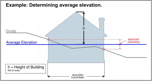
- Fill affecting building height. Except as provided in this subsection, when grading a site to obtain the finished grade, as defined in section Title 101, Chapter 2, no fill may exceed five vertical feet at any point from the site's natural grade, as also defined in section Title 101, Chapter 2.
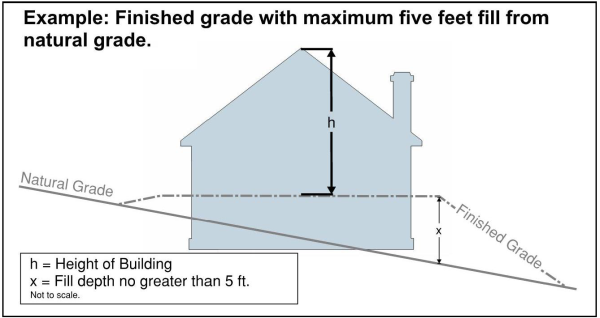
- Additional fill is allowed if required by county, state, or federal law, or to meet the standards of the National Flood Insurance Program. In this case the fill shall be no higher than the minimum of the other regulation or standard; or
- In the Western Weber County Planning Area, if the building or structure is within 75 feet of a public or private street upon which its lot or parcel has frontage, fill is allowed that will provide an average elevation of finished grade that is equal to the elevation of the street. In this case, the street's elevation shall be determined to be at the midpoint of the lot's front lot line. If on a corner lot the elevation of both streets at the midpoint of each lot line shall be averaged.
- Driveway slope. The slope of a driveway shall not exceed 15 percent. The planning director may modify the applicability of this if it can be demonstrated that there is no other reasonable configuration of a driveway to avoid slopes over 15 percent.
- Site plan submittal requirements. A site plan shall contain both existing and proposed topographic contours at two foot intervals for the entire limits of disturbance, unless more is required by another section of this Land Use Code or by the planning director or county engineer for the purpose of determining compliance with other laws or standards. Grading that is proposed across lot or parcel lines shall require the consent of all affected owners. Building elevation drawings shall display natural grade and finished grade, and shall present the finished grade's elevation at each corner of the building. This requirement may be waived by the planning director or county engineer for sites that are relatively flat, or if evidence is presented that clearly show the proposed structures will not exceed the maximum height of the zone.
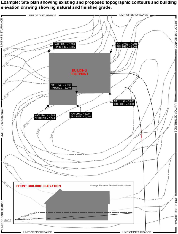
- Average elevation. Average elevation shall be determined by averaging the highest elevation and the lowest elevation at the exterior footprint of the building or structure, including any support posts that require a footing. An alternative means of calculating average elevation may be approved by the planning director for an individual building if it follows industry best practices and is proposed by a licensed surveyor, engineer, or architect.
- Roof structure height exception. Penthouse or roof structures for the housing of elevators, stairways, tanks, ventilating fans or similar equipment required to operate and maintain the building, and fire or parapet walls, skylights, cupolas, solar panels, steeples, flagpoles, chimneys, smokestacks, water tanks, wireless or television masts, theater lofts, silos or similar structures may be erected above the height limit of the zone in which they are located, but no space above the height limit shall be allowed for the purpose of providing additional floor space, and at no time shall the height be greater than 15 feet higher than the maximum height of the zone. All exceptions to height shall be subject to applicable design review requirements and all mechanical equipment shall be screened by materials consistent with those used on the exterior of the main building.
- Air traffic height conflicts. If in proximity to an airport, no building or structure or other appurtenance is permitted above the maximum height allowed by the Federal Aviation Administration, or other applicable airport or airspace regulation.
- Minimum height of a dwelling. Unless on a lot or parcel five acres or greater, no dwelling shall be erected to a height less than one story above natural grade.
(Ord. of 1956, § 23-5; Ord. No. 2009-14; Ord. No. 2018-5, Exh. A, 5-1-2018)
Editor's note—Ord. No. 2018-5, Exh. A, adopted May 1, 2018, retitled § 108-7-5 from "Exceptions to height limitations" to read as herein set out.
- Garbage, inoperable or abandoned vehicles, and junk. It is unlawful for any owner or occupant of land to permit garbage, inoperable or abandoned vehicles, or junk to accumulate or remain on or about the premises whenever it is unsightly and in public view, or whenever it is dangerous to the health, safety, and welfare of the people of the county. Every owner or occupant of land is hereby required to remove, or provide for the removal of, such garbage, inoperable or abandoned vehicles, and junk before the same become unsanitary, dangerous, or a nuisance.
- Weeds and unkempt yards. Landowners are responsible for clearing all weeds from their property, including their property's perimeter and any adjacent sidewalk, trail or pathway, parkstrip, or unimproved portions of public rights-of-way. A yard, and any adjacent sidewalk, trail or pathway, parkstrip, or unimproved portion of public rights-of-way that are visible from a public right-of-way shall be maintained so that the property's appearance does not detract from the appearance of the neighborhood. Weeds, except noxious or invasive weeds which shall be removed promptly, and turf grasses shall be maintained at a height of not more than eight inches at any time, and the cuttings shall be promptly disposed of in an organized manner or mulched in place. Native vegetation,including grasses,and wildflowers, and shrubs, maintained in a natural state are exempt from the eight-inch regulation. Where a street has curbing, or where a deferral agreement for curbing was required, it is the responsibility of the property owner, not the County, to maintain, cut, or remove any vegetation that is between the edge of the travel surface within the public right-of-way and the edge of the public right-of-way adjoining the owner's property.
- Exemptions. This section shall not apply to items which are clearly accessory and incidental to any agricultural use permitted in the zone, or to items completely and lawfully enclosed within a building or enclosure where it is not visible from a public or private way or other public or private property and which does not constitute a nuisance, endanger or adversely affect the health or welfare of the community, or the keeping of which does not violate any other law or ordinance.
- Owner or occupant responsibility. Any owner or occupant of land that allows for the violation of this section shall make proper arrangements for the correction of the violation.
- Public streets and other public property.
- It is unlawful for any person to place or deposit in or upon any public street, right-of-way, or other public property in unincorporated areas of the county any garbage, inoperable or abandoned vehicles, junk, weeds, or any other vegetation, if the deposited items or materials may interfere with pedestrian or vehicular traffic or may in any way be dangerous to the health, safety, and welfare of the people of the county.
- It is the responsibility of owners or occupants of land adjoining a public right-of-way, pedestrian pathway, or sidewalk to ensure continual removal of vegetation overgrowth.
- In addition to the requirements of section 32-8-2, owners or occupants of a platted building lot, or a lot of record with an existing residential, commercial, or manufacturing use, that adjoins a paved pedestrian pathway and is less than five acres shall also be required to ensure continual removal of snow from the pathway.
(Ord. No. 2019-14, Exh. A, 7-30-2019)
Sec 108-7-7.020 Vegetation And Snow Removal - Pedestrian Right's Of Way
Sec 108-7-7.030 Clear View Of Intersecting Streets
Sec 108-7-7.040 Public Tree Care
To ensure deposited items or materials do not interfere with pedestrian or vehicular traffic or in any way be dangerous to the health, safety, and welfare of the people of the county, it is unlawful for any person to place or deposit in or upon any Public Street, right-of-way, or other public property in unincorporated areas of the county any garbage, inoperable or abandoned vehicles, junk, weeds, or any other vegetation.
- It is the responsibility of owners or occupants of land adjoining a public right-of-way, pedestrian pathway, or sidewalk to ensure continual removal of vegetation overgrowth.
- In addition to the requirements of Section 32-8-2 of the Weber County Code, owners or occupants of a platted building Lot, or a Lot of record with an existing residential, commercial, or manufacturing use, that adjoins a paved pedestrian pathway and is less than five acres shall also be required to ensure continual removal of snow from the pathway.
When an access way intersects with a public right-of-way, or when the subject property abuts the intersection of two or more public rights-of-way, the triangular areas described below shall provide unobstructed cross-visibility at a level between two and eight feet in height. Trees may be planted inside the triangular areas, but shall be trimmed such that no limbs or foliage extend into the cross-visibility zone, and placed so as not to create a traffic hazard. Plant materials, excepting turf grass, shall not be located closer than three feet from the edge of any access way pavement. No other obstruction to view in excess of three feet in height shall be allowed. The triangular areas referred to above are defined as follows:
- The area of property on either side of an access way formed by the intersection of each side of the access way and the public right-of-way line. The two sides of the triangle shall be ten feet in length measured from the point of intersection and the third side (hypotenuse) being a line connecting the ends of these two sides.
- The area of property located at a corner formed by the intersection of two or more public rights-of-way. The two sides of the triangle shall be formed by the street rights-of-way lines for a length of 40 feet back from their intersection and the third side being a line connecting the ends of these two sides.
(Ord. of 1956, § 23-7; Ord. No. 2009-14; Ord. No. 2019-5, Exh. A, 3-12-2019)
- Illegal to cut trees and/or top trees.
- It is unlawful for any person to remove trees situated on County property, including streets and roadways of the County, without obtaining permission from the Planning Division Director for that purpose.
- It is unlawful as a normal practice for any person, firm, or County department to top any tree within the County’s right-of-way. Topping is the severe cutting back of limbs to stubs larger than three inches (3”) in diameter within the tree's crown to such a degree as to remove the normal canopy and disfigure the tree. Trees severely damaged by storms or other causes, or certain trees under utility wires or other obstructions where other pruning practices are impractical, may be exempted from this section at the determination of the Planning Division Director.
- Pruning and corner clearance. Subject to the provisions of subsection (d), every owner of any tree or shrub overhanging any street, sidewalk, or right-of-way within the County shall prune the branches so that such branches shall not severely obstruct the light from any street lamp, obstruct the view of any street intersection, or obstruct or create a hazard on a street, sidewalk, or right-of-way. Said owners shall remove and replace all dead, diseased, or dangerous trees and shrubs, or broken or decayed limbs, which constitute a hazard to the safety of the public. The County shall have the right to prune any tree or shrub on private property when it severely obstructs the light from any street lamp, obstructs the view of any street intersection, or obstructs or creates a hazard on the street, sidewalk, or right-of-way. Any costs incurred by the County will be collected from the owner of the tree or shrub.
- Removal and replacement of dead and/or hazardous trees/plantings on the county's right-of-way; property owner responsibility. The removal of any tree, living or dead, is subject to the permit process, as outlined in subsection (d). Plantings and dead trees on the County's right-of-way that are determined by the County to be a hazard shall be removed and, if appropriate, replaced at the adjacent property owner's expense. If the adjacent property owner refuses to cooperate with the removal of a hazardous planting or dead tree, it shall be removed and, if appropriate, replaced by the County and any costs incurred will be collected from the adjacent property owner. Except for routine trimming, pruning, and watering, the County accepts responsibility for maintenance of planted areas on public property and the County's rights-of-way for County installed projects, which are regularly maintained by County staff.
- Permit to remove trees or vegetation from county property. Any person desiring to cut and remove trees or vegetation from County property, including the County's rights-of-way, shall first make written application to the Planning Division Director. The application shall contain the following information:
- The exact number of trees to be removed and the location of each with reference to street designations.
- A statement that the applicant will cut and remove the trees at his/her own cost and expense within thirty (30) days of the date of the permit.
- A statement that the applicant will restore the County property to the satisfaction of the County and will replant such trees as the County may require and where the County may specify.
- That the applicant will indemnify the County against any damage to the County property or to the adjacent property owners and against any injury to persons or property sustained in cutting and removing the trees.
- [County tree care.] The County shall have the right, as determined by its sole discretion, to plant, prune, maintain, and remove trees, plants, and shrubs within rights-of-way, streets, and public property as may be necessary to ensure public safety or to preserve or enhance public grounds.
Editors note: Some of the formatting and terminology within this section has been modified from the original text to provide consistency with with other provision herein.
No animals or fowl shall be kept or maintained closer than 40 feet from any dwelling and not closer than 75 feet from any dwelling on an adjacent lot. Any barn, stable, coop, pen, corral, or enclosure for the housing or keeping of animals or fowl shall be kept, constructed, or maintained not less than 100 feet from a property line adjacent to a street and not less than 25 feet from any lot line.
(Ord. of 1956, § 23-8; Ord. No. 2009-14)
- In all cases, where a proposed building or use will involve the use of sewage facilities, and a public sewer is not available, and in all cases where a proposed supply of piped culinary water is not available, the sewage disposal and the domestic culinary water supply shall comply with requirements of the county board of health and/or state board of health and the application for a building and land use permit shall be accompanied by a certificate of approval from the board of health.
- Building permits shall not be issued by the building inspector or county official unless private water supply and private sewage disposal is approved in accordance with the requirements of subsection (a) of this section.
(Ord. of 1956, § 23-9; Ord. No. 4-83; Ord. No. 2009-14)
Where a street is designated on the master street plan of the county as a Collector Street or Arterial Street, and where the existing street right-of-way requires widening to meet the right-of-way standards of the Collector Street or Arterial Street, the minimum front and side yard setback for all buildings shall be based upon the future designated right-of-way width as shown on the county master plan and shall be measured from the future street right-of-way line of the Collector Street or Arterial Street instead of the existing Lot Line of the present street right-of-way.
(Ord. of 1956, § 23-10; Ord. No. 15-72; Ord. No. 2-89; Ord. No. 2009-14)
- Yard regulations. Group dwellings shall be considered as one building for the purpose of front, side, and rear yard requirements, the entire group as a unit requiring one front, one rear, and two side yards as specified for dwelling structures. The minimum distance between structures shall be ten feet for single-story buildings, 15 feet for two-story buildings and 20 feet for three- or more story buildings.
- Group dwelling PRUD. A group dwelling complex shall be developed as a PRUD if the area of the complex is equal to or exceeds the minimum number of units or area required for a PRUD for the zone in which the complex is located. (See section 108-5-5(a))
(Ord. of 1956, § 23-11; Ord. No. 7-78; Ord. No. 2009-14)
- Landscape standards. The following water-wise landscaping standards apply to all new development in the Western Weber Planning Area:
- In single-family residential developments, no more than 35 percent of the front and side yard of a lot or parcel, or no more than 3,000 square feet of the entire lot or parcel, may be irrigated turf grass, whichever is greater; and
- In commercial, industrial, institutional, and multi-family developments, no more than 15 percent of the total landscaped area may be irrigated turf grass. This provision shall not apply to active recreational areas that meet the design and landscape standards of Weber Basin Water Conservancy District; and
- Irrigated turf grass in a parkstrip, and any other yard area with a width of less than eight feet, is prohibited.
- Amortizing nonconforming landscaping. After the effect of this section, which is September 26, 2023, all landscaping that does not comply with the requirements of this section shall be considered nonconforming landscaping. All nonconforming landscaping shall be phased out in accordance with the following schedule:
- Landscaping replacement. The replacement of any nonconforming landscaping shall comply with the requirements of this chapter;
- Site improvements. When a site improvement, including the expansion of a building, which requires a land use permit, conditional use permit, or design review approval, modifies an area that exceeds the threshold established in this subsection, whether by a single modification project or by an accumulation of separate modification projects, all nonconforming landscaping on the premises shall be brought into compliance with the requirements of this section. The established threshold of modification shall be the smaller of the following:
- Twenty-five percent of the site area; or
- Twenty thousand square feet.
Editor's note—Ord. No. 2018-5, Exh. A, adopted May 1, 2018, repealed § 108-7-12, which pertained to towers and derived from Ord. of 1956, § 23-12; Ord. No. 2008-8; Ord. No. 2009-14.
- The facility shall meet all county building, safety, and health codes applicable to similar dwellings.
- The operator of the facility shall provide assurances that the residents of the facility will be properly supervised on a 24-hour basis.
- Shall be licensed or certified by the department of human services under Title 62A, chapter 2, Licensure of Programs and Facilities (U.C.A. 1953, § 62A-1-101 et seq.).
- A minimum of two off-street parking spaces plus one off-street parking space for each staff member other than the resident manager or house parents shall be provided.
- The facility shall be capable of use as a residential facility for persons with a disability without structural or landscaping alterations that would change the structure's residential character.
- The facility shall meet all requirements and definitions by reference to either the Federal Fair Housing Amendments Act (42 USC 3602) or its successor statutes or the Utah Fair Housing Act (U.C.A. 1953, § 57-21-1 et seq.) or its successor statutes.
- No person being treated for alcoholism or drug abuse shall be placed in a residential facility for persons with a disability.
- No person who is violent shall be placed in a residential facility for persons with a disability.
- Placement in a residential facility for persons with a disability shall be on a strictly voluntary basis and not a part of or in lieu of, confinement, rehabilitation, or treatment in a correctional facility.
- The land use permit and business license granted in accordance with the provisions of this chapter, is nontransferable and terminates if the structure is devoted to a use other than as a residential facility for persons or, if the structure fails to comply with the county's building, safety, and health codes or the requirements of this section.
- These facilities must be licensed by the county's business licensing department with the original license and any renewals thereof subject to the inspection and prior approval of the county health and building departments.
- No residential facility for persons with a disability shall be made available to any individual whose tenancy therein would constitute a direct threat to the health or safety of other individuals or would result in substantial physical damage to the property of others.
(Ord. of 1956, § 23-13; Ord. No. 17-87; Ord. No. 99-26; Ord. No. 2009-14)
State Law reference— Residences for persons with a disability, U.C.A. 1953, § 17-27a-519.
- A residential facility for troubled youth shall:
- Be owned or leased by the residents or an immediate family member of the residents, or by a charitable, or beneficial organization, or by the state or a licensee thereof;
- Be consistent with existing zoning of the desired location;
- Be occupied on a 24-hour basis by no more than eight qualified youth in a family-type arrangement;
- Conform with applicable standards of the state department of human services and be inspected and licensed by that department.
- The facility shall meet all applicable building, safety, zoning and health codes and ordinances applicable to similar dwellings.
- The facility shall be capable of use as a residential facility for troubled youth without structural or landscaping alterations that would change the structure's residential character and the structure shall not be used as a lock-down facility for the incarceration of the youth that it houses.
- No residential facility for troubled youth shall be established within five miles of another residential facility for troubled youth as defined in this chapter.
- Troubled youth who qualify for placement in the facility shall:
- All be of the same gender within any one facility;
- Be no less than ten years of age and no more than 18 years of age;
- Not be convicted of or charged with any sexual offence, arson or aggravated assault;
- Not be individuals with such severe psychiatric problems that they present a danger to themselves or others;
- Attend school classes and matriculate in local area schools.
- No home for troubled youth shall house children whose respective ages span more than four years. For instance, if the home houses children ten years of age, the oldest child in the home can be no more than 14 years of age.
- The land use permit and any other license granted in accordance with the provisions of this chapter, is not transferable and terminates if the structure is devoted to a use other than a residential facility for troubled youth or if the structure fails to comply with the county's building, safety and health codes or the requirements of this chapter.
- No residential facility for troubled youth shall occupy a lot in a recorded subdivision of four or more lots, including all subdivision phases.
- The facility shall be permanently occupied by a married couple who will serve as house parents to the youth who reside therein. Their duties will be as follows:
- To offer counseling and guidance to the youth under their care;
- To supervise the orderly functioning of the household;
- To provide meals to the youth who occupy the home;
- To assign the duties, chores and other tasks to each of the youth who occupy the home;
- Supervise the preparation of homework and studies each of the youth is required to complete for their education in local schools;
- To immediately report to the appropriate state agency any difficulties, problems, breaches of the peace or violations of law engaged in by any of the youth under their care;
- To also report the same conduct to the organization who employs them directly.
- The house parents living within the home must meet the standards of the department of human services and obtain all licenses, permits or certificates required by the state before undertaking their duties as house parents.
- In the event that the house parents terminate their employment without first training suitable replacements, the facility must replace them with trained house parents within 30 days, or the home for troubled youth must cease operating.
(Ord. of 1956, § 23-14; Ord. No. 6-92; Ord. No. 2-93; Ord. No. 2009-14)
- A residential facility for elderly persons may not operate as a business.
- A residential facility for elderly persons shall:
- Be owned by one of the residents or by an immediate family member of one of the residents, or by a charitable, or beneficial organization, including a facility for which the title has been placed in trust for a resident;
- Be consistent with existing zoning of the desired location;
- Be occupied on a 24-hour-per-day basis by eight or fewer elderly persons in a family-type arrangement; and
- Conform with applicable standards of the state department of human services and be licensed and inspected by that department.
- A residential facility for elderly persons may not be considered a business because a fee is charged for food or for actual and necessary costs of operation and maintenance of the facility.
- The owner of a residential facility for elderly persons may not charge residents administrative costs or salaries greater than 15 percent of that fee.
- A person charging a fee shall:
- Keep a record of all expenses and costs related to the fee; and
- Make that record available for inspection by any resident of the facility, the state department of human services, and county building or zoning officials.
- The facility shall meet all applicable building, safety, zoning and health codes and ordinances applicable to similar dwellings:
- A minimum of one off-street parking space for each adult resident person or married couple shall be provided;
- The facility shall be capable of use as a residential facility for elderly persons without structural or landscaping alterations that would change the structure's residential character;
- No person being treated for alcoholism or drug abuse shall be placed in a residential facility for elderly persons;
- Placement in a residential facility for elderly persons shall be on a strictly voluntary basis and not a part of, or in lieu of, confinement, rehabilitation, or treatment in a correctional facility;
- The land use permit and business license granted in accordance with the provisions of this chapter, is nontransferable and terminates if the structure is devoted to a use other than a residential facility for elderly persons or if the structure fails to comply with the county's building, safety and health codes or the requirements of this chapter; and
- The decision by the county regarding an application for a conditional use permit for a residential facility for elderly persons shall be based upon legitimate land use criteria and shall not be based upon a general discrimination against the grouping of elderly persons in such a facility or because of age and its attendant characteristics. Upon application for a conditional use permit in any area where residential dwellings are allowed, the county shall determine only whether or not the facility conforms to this Land Use Code. If the county determines that the facility complies with the ordinances, it shall grant the requested permit.
(Ord. of 1956, § 23-15; Ord. No. 12-91; Ord. No. 99-26; Ord. No. 2009-14)
State Law reference—Residential facilities for elderly persons, U.C.A. 1953, § 17-27a-515; county ordinances governing elderly residential facilities, U.C.A. 1953, § 17-27a-516; county approval of elderly residential facilities, U.C.A. 1953, § 17-27a-517; elderly residential facilities in areas zoned exclusively for single-family dwellings, U.C.A. 1953, § 17-27a-518.
- Accessory buildings 1,000 square feet or larger in area that accommodate uses meeting zoning requirements shall:
- Be located at least six feet from the rear of a dwelling in the residential estates zones and at least ten feet from the rear of a dwelling in the agricultural and forest zones.
- Have a side yard setback of at least ten feet on an interior lot and 40 feet on a corner lot where the side property line is adjacent to a street.
- Have a maximum height of 25 feet.
- One accessory building which is subordinate to the dwelling in area and height may be located in front or to the side of the dwelling provided:
- It is located not less than 40 feet from any property line adjacent to a street.
- The large accessory building conforms to the dwelling in architectural style and materials on all sides of the building and the roof. Large accessory buildings on agricultural parcels containing at least 5.25 acres and a single-family dwelling shall be exempt from this requirement provided that the accessory building is located at least 100 feet from a property line adjacent to a street.
- It meets the side yard requirement for a main building in the zone in which the building is located, and it is located at least 40 feet from a dwelling on an adjacent parcel.
- In no case shall the front yard setback be less than the required front yard setback for a main building in the zone in which the building is located.
- Accessory buildings that exceed the dwelling in area by more than double as measured by the footprint of the dwelling shall require approval by the planning commission as a design review.
- Accessory buildings used for the keeping of animals and fowl shall also meet the requirements of section 108-7-8. Accessory buildings shall also meet the requirements of section 108-7-4.
(Ord. of 1956, § 23-16; Ord. No. 14-91; Ord. No. 99-26; Ord. No. 2004-19; Ord. No. 1-2008; Ord. No. 2009-14)
In approved residential and commercial developments, where developers may have up to two years to complete utility, road and other improvements, land use permits and building permits shall not be issued until all utility improvements requisite for residential occupancy are installed, except for the asphalt, curb, gutter, and sidewalk on the road.
(Ord. of 1956, § 23-17; Ord. No. 14-91; Ord. No. 99-26; Ord. No. 2002-9; Ord. No. 2009-14)
An outdoor, permanent, in ground swimming pool shall be permitted to the side or rear of a dwelling or private/public facility as an accessory use provided the requirements listed below are met. This section does not apply to outdoor, temporary, above ground pools.
- The location of the outdoor, permanent, in ground swimming pool or accessory machinery shall not be less than ten feet from any property line; however, if a zone requires a larger setback, the more restrictive requirement shall apply. Structures that enclose pool accessory machinery are permitted with the same setbacks required for other accessory buildings in the zone in which they are located.
- An outdoor, permanent, in ground swimming pool shall be completely enclosed by a substantial fence of not less than six feet in height, or by a power safety cover meeting the requirements of the International Building Codes. The term "substantial fence" shall mean any fence that will not allow normal passage by any person except through an otherwise locked gate.
- Lights used to illuminate the pool or its accessories shall be so arranged as to reflect the light away from adjoining premises.
(Ord. of 1956, § 23-18; Ord. No. 14-92; Ord. No. 2008-1; Ord. No. 2009-14)
- Section definitions. For purposes of this section, the following definitions apply:
- “Development activity” means:
- any construction or expansion of a building, structure, or use that creates additional demand and need for public facilities;
- any change in use of a building or structure that creates additional demand and need for public facilities; or
- any change in the use of land that creates additional demand and need for public facilities.
- “Greater public street network” means the network of public streets that are interconnected, with multiple street routes available to and from any location, not including terminal streets or street-routes that have a single point of access connecting to and from the public street network.
- “Substandard” means not meeting minimum public street standards that are adopted by the county or required by law, including standards related to improvements and standards related to public right-of-way width.
- A “substandard street,” with reference to proposed development activity, means a public or private street or street-route that is substandard at any location along the street or street-route between the proposed development activity and the greater public street network, or that is substandard at any location adjacent to the proposed development activity.
- A “standard street,” with reference to proposed Development Activity, means a public or private street or street-route that is not Substandard at any location between the proposed Development Activity and the Greater Public Street Network.
- “Development on a substandard street” means any development activity for which one of the following conditions is true:
- The existing street adjacent to at least one of the Lots or Parcels being developed, from which the Lot or Parcel will be accessed, is Substandard at any location adjacent to that Lot or Parcel; or
- At least one of the Lots or Parcels being developed cannot access the Greater Public Street Network via an existing Standard Street.
- “Development activity” means:
- Compliance required. Development on a substandard street is not permitted unless in compliance with this section. New or improved accesses exclusively used for agricultural vehicles are exempt from these requirements.
- Roughly proportionate contribution. An application for a permit, subdivision, or any other approval authorized by this Land Use Code that proposes to provide, add, or increase the intensity of access to a Lot or Lots from a Substandard Street shall not be approved unless the Substandard nature of the street or street-route is cured. However, if curing the Substandard nature of the street or street route is not roughly proportionate to the increased impact of the proposal, then the following provisions shall apply:
- Right-of-way dedication or conveyance. In all cases, the applicant shall dedicate, by subdivision plat or deed conveyance, to the County the minimum required street right-of-way width that abuts the applicant’s subdivision, lot, or parcel being developed.
- Street frontage improvements. The applicant shall be financially responsible for the improvement of the applicant’s own street frontage. However, at the discretion of the County Engineer, a Lot that is not fully developed to the maximum potential of the zone’s minimum Lot Width and Lot Area may be allowed to have this reduced to no less than a width that is three times the applicable minimum Lot Width allowed in the zone, or the Lot’s entire frontage, whichever is less. The County Engineer has full authority and discretion to determine which improvements are installed, and which may be deferred to a later time.
- Paying proportionate share. As part of a "project improvement," as defined in UCA 11-36a-102, the applicant shall pay the cost of a proportionate share of street design, street improvements, and, if applicable, street right-of-way acquisition to bring that street into or closer to compliance with County standards. The cost of the proportionate share shall be determined as follows:
- Engineer's cost estimate. Estimate the cost to improve the substandard street or street-route to County standards from the point it becomes substandard, or from the nearest intersection with a non-terminal street or street-route, whichever is closer, to the furthest extent of the applicant's proposed development adjacent to the street.
- This shall be furnished by the applicant in the form of an engineer's cost estimate. The estimate shall use up-to-date market costs for engineering and design, surveying, construction material, labor, and any other expense necessary to improve the street to County standards. The added expense of an intersection or other street component that is not related to providing a standard street to the applicant's subdivision shall be excluded from the calculation;
- The County Engineer may require the applicant to furnish engineered drawings of the street and an itemized cost-estimate in order to substantiate the estimated cost;
- The County Engineer has the discretion to adjust the cost-estimate for inflation or market fluctuations during the duration of construction of the applicant's obligations; and
- A subdivision improvement that is required of the applicant by the Land Use Code regardless of the condition of the street shall not be included in this calculation, and shall be provided as otherwise required by this Title.
- Determine street's estimated buildout potential. Find the street’s estimated buildout potential, which is the sum of the estimated number of lots expected along the street at buildout plus the applicant's proposed number of lots, as follows:
- Measure the length of the substandard street or street-route from the point it becomes substandard to the furthest extent of the applicant's subdivision along the substandard street or street-route;
- Divide the length of the street, the result of Subsection (c)(3)b.1. of this section, by the standard minimum lot width of the zone, as found in Title 104 of this Land Use Code. Do not use alternative lot widths, such as those allowed in a cluster subdivision or a lot-averaged subdivision, even if the applicant's subdivision has them; then
- Combine the estimated number of lots expected along the street at buildout, the results of Subsection (c)(3)b.2. of this section with the applicant's proposed number of subdivision lots.
- Final proportionate share calculation. Divide the cost to improve the street or street-route to County standards, the result of Subsection (c)(3)a. by the sum of the street’s estimated buildout potential plus the applicant's proposed number of lots, the results of Subsection (c)(3)b.
- Engineer's cost estimate. Estimate the cost to improve the substandard street or street-route to County standards from the point it becomes substandard, or from the nearest intersection with a non-terminal street or street-route, whichever is closer, to the furthest extent of the applicant's proposed development adjacent to the street.
- Required improvements, escrow, and allowed deferral. The County Engineer shall:
- Required improvements. Require the applicant to make improvements to the substandard street or street-route in an amount up to but not exceeding the applicant's cost of the proportionate share, as determined herein. The County Engineer has full authority and discretion to determine the specific improvements required of the applicant;
- Escrow. Require this cost to be deposited with the County for the County to add a street's needed improvements into scheduled road maintenance and improvements; or
- Deferral. If the County Engineer determines that the funds that would be made available are insufficient to provide meaningful project improvements along the substandard street or street-route, a substandard road agreement may be allowed in lieu of the project improvements required in this section. In this case, the applicant, and all owners having interest in the subject Lot or Lots shall execute a substandard road agreement and notice to new owners. The content of the substandard road agreement and notice shall be as specified by the County, but at a minimum it shall:
- For a terminal substandard street or street route, explain that the subject Lot or Lots has or have only a single street access connecting it to the greater interconnected Public Street network, and the single street access is not built to the adopted minimum design and safety standards;
- Require a deferral agreement that specifies that the owners or successors and heirs are responsible, at a time the governing authority deems it necessary, to pay for their proportionate share of curing the substandard nature of the street or street-route;
- Allow the governing authority, at its option to withhold any written protest filed by the owners or their successors or heirs under the State Code's Assessment Area Act, Provisions For Local Districts, or any similar government revenue generation mechanism, from the final tally of collected protests, provided, however, that the revenue generated by the mechanism is used to improve access to the Lot or Lots; and
- Be recorded to the property at the time of subdivision recordation or sooner for subdivision approval, or prior to the issuance of a land use permit or final approval for other types of approvals.
(Ord. of 1956, § 23-19; Ord. No. 2-89; Ord. No. 2009-14)
- Occupying any parked, self contained, recreational vehicle within the county is allowed as a temporary use in the following locations:
- Forest zones.
- Recreational vehicle parks.
- Mobile home parks with recreational vehicle provisions.
- Occupying a parked recreational vehicle, by the property owner, may be permitted for a period of six months on the property where a home is under construction, provided that the recreational vehicle is hooked up to an approved wastewater disposal system.
- Recreation vehicles lawfully parked at a private residence are allowed to be used exclusively by the owner or guests, if self contained, for a period not to exceed 30 days in a calendar year or more than 14 consecutive days. A copy of the land use permit shall be clearly displayed in a window of the recreational vehicle being so used.
(Ord. of 1956, § 23-20; Ord. No. 2009-14)
No development shall obstruct the flow of water from an irrigation ditch, drain and/or canal. Any alteration or diversion of such waterways shall be approved by the county engineer and the irrigation company.
(Ord. of 1956, § 23-21; Ord. No. 2002-9; Ord. No. 2009-14)
A temporary real estate sales office may, by conditional use permit, be allowed within a model home or the garage area of a model home located within a residential subdivision development of ten or more lots or phase of more than ten lots, for the sale of real estate within that specific subdivision or phase subject to the following conditions:
- Prior to use of the structure as a temporary real estate office, it shall have a certificate of occupancy.
- The front yard of a model homes with a temporary sales offices shall be landscaped, as approved by the planning commission.
- If the sales office is established in the garage, the garage door may be temporarily replaced with French doors, sliding glass doors or as approved by the planning commission. Permanent changes to the site are prohibited. When the temporary use expires, the applicant shall restore the structure to its originally intended use as a residence and/or garage.
- Permanent signs are prohibited. The size and location of signs shall be in compliance with applicable provisions of the Land Use Code for the zone in which the use will be conducted and as approved with the conditional use permit. All signs shall be removed when the permit expires. Any zoning requirements for lighting shall be complied with.
- A temporary real estate sales office may operate daily between 8:00 a.m. and 8:00 p.m.
- A conditional use permit for a temporary sales office in a model home shall be limited to a five-year time period from the time that the certificate of occupancy is issued. Time extensions may be considered by the planning commission on a case-by-case basis.
- If construction of the model home temporary sales office is not completed within one year of the conditional use approval by the planning commission, the permit shall be considered null and void.
(Ord. of 1956, § 23-22; Ord. No. 2003-8; Ord. No. 2009-14)
- No structure, accessory structure, road, or parking area shall be built within the required setback from a river or stream as measured from the high water mark of the river or stream. The high water mark shall be determined by the county engineer. The areas within the setback shall be maintained in a manner that protects the quality of water in the river or stream and the habitat of native vegetation and wildlife along the river or stream.
- Structures, accessory structures, roads, or parking areas shall not be developed or located within 300 feet on both sides of the Weber River from the high water mark of the river.
- Structures, accessory structures, roads, or parking areas shall not be developed or located within 75 feet on both sides of year round streams, as determined from the high water mark of the stream.
- Structures, accessory structures, roads, or parking areas shall not be developed or located within 50 feet from the high water mark of the natural ephemeral stream.
- Exceptions.
- Bridges and the Public Streets that lead to them, provided those streets intersect the corridor at an approximate 90 degree angle.
- Stream alterations approved by the Army Corps Of Engineers and Utah Department of Water Resources, Division of Water Quality.
- Trails.
- The Ogden River below Pineview Reservoir to its confluence with the Weber River.
- Streams are those areas where surface waters flow sufficiently to produce a defined channel or bed. A defined channel or bed is indicated by hydraulically sorted sediments or the removal of vegetation littler or loosely rooted vegetation by action of moving water. The channel or bed need not contain water year round. This definition is not meant to include stormwater runoff devices or entirely artificial watercourse unless they are used to store or convey pass-through stream flows naturally occurring prior to construction of such devices. Stream watercourses where the definition may apply are those that appear on the U.S.G.S. Quad maps.
- See Title 104, Chapter 28 (Ogden Valley Sensitive Lands Overlay Districts) for Ogden Valley River and Stream Corridor Setbacks.
(Ord. of 1956, § 23-23; Ord. No. 2008-4; Ord. No. 2009-14)
- Small Wind Energy System. The intent of this section is to regulate the placement and installation of small wind energy conversion systems in the county while providing for the safe, effective, and efficient use of such systems. These systems will be used primarily to produce clean energy and reduce on-site consumption of utility power for individual properties. The following regulations shall apply to all small wind energy conversion systems:
- The minimum lot size required for a small wind energy system shall be 20,000 square feet.
- Small wind energy systems shall be set back a distance equal to 110 percent of the tower height plus the turbine blade length from all property lines and a distance equal to 150 percent of the tower height plus the turbine blade length from any Dwelling on adjacent property. Small wind energy systems shall not be located within the minimum front yard setback of any lot, nor within the minimum side yard setback facing a street on a corner lot, nor on the roof of a residential structure.
- The maximum height of a small wind energy system (including tower and blades) shall not exceed 70 feet. Small wind energy systems proposed to be over 70 feet will require approval from the planning commission as part of the conditional use permit. The minimum distance between the ground and any protruding blades utilized on a small wind energy system shall be 15 feet as measured at the lowest point of the arc of the blades.
- Small wind energy systems must comply with applicable Federal Aviation Administration (FAA) regulations, including any necessary approvals for installations close to airports.
- Small wind energy system towers shall maintain either a galvanized steel finish or a finish in a color approved by the planning commission as part of the conditional use, and shall not be artificially lighted unless required by the FAA.
- Small wind energy systems shall not exceed 60 decibels as measured at the closest property line except during short term severe wind events. A manufacturer's sound report shall be required with an application for a small wind energy system.
- Manufacturer specifications for components and installation shall be required with an application for a small wind energy system.
- Solar energy systems.
- Small solar energy system. A small solar energy system, as defined in Title 101, Chapter 2, is allowed in any zone, and shall meet the setback and height requirements for an accessory building in the zone in which the system is located. Setbacks shall be measured to the outermost edge of the system nearest the property line. Solar energy systems which are attached to a building shall meet the same setbacks that are required for the building.
- Large solar energy system. A large solar energy system, as defined in Title 101, Chapter 2, is regulated by Title 104, Chapter 30 of this Land Use Code.
(Ord. of 1956, § 23-24; Ord. No. 2008-8; Ord. No. 2009-14)
(Ord. of 1956, § 23-25; Ord. No. 2009-14; Ord. No. 2014-18, Exh. A, 6-17-2014)
No land use application shall be approved for any lot/parcel until all unresolved zoning, building, business license, nuisance, or other violations on any such lot/parcel, or on any parcel included in any manner as part of the application are resolved, unless approval of the application will resolve all of the existing violations. A land use application submitted for approval, which will resolve all of the existing violations, must be accompanied by a letter from the applicant stating what the existing violations are, and how the proposed land use application will resolve them.
(Ord. of 1956, § 23-26; Ord. No. 2009-14)
- (Ord. of 1956, § 23-27; Ord. No. 2009-14)
Garage sales/yard sales of personal used items from a single-family dwelling shall not be held more than once every three months.
(Ord. No. 2011-17, § 2(23-28), 10-11-2011)
- Access. Unless otherwise allowed in this Land Use Code, the provisions of this section shall not be allowed if it avoids the installation of a street contemplated by this Land Use Code, an adopted general plan, master transportation plan, development agreement, or other adopted document intended to govern the placement, connectivity, or creation of a street or Street-Block. Otherwise, a land-locked Lot or Parcel intended for residential use shall have an access road or driveway that extends from a public right-of-way to the area of the Lot that will be developed. The access road or driveway shall be:
- Designed and constructed to have a minimum right-of-way width of 24 feet, with a minimum improved surface width of 20 feet. A greater right-of-way width may be required by the County Engineer for a cross-slope easement.
- Configured and constructed so that curves can safely facilitate the turning radius and weight of the Fire Authority’s largest fire apparatus.
- Constructed of all-weather material, have a grade of no greater than ten percent, and a clearance no less than 14 and a half feet.
- Be on a Parcel that is held in common ownership by a homeowner’s association that governs the Lots that gain access therefrom, or be an easement recorded in favor of the owners of all Lots that gain access therefrom.
- If terminal, no longer than 600 feet.
- If terminal and longer than 200 feet in length, designed with a fire apparatus turn-around approved by the local fire authority at the end.
- Other requirements.
- The address of the Lot or Parcel shall be displayed in a prominently visible location at the street entrance to the Lot or Parcel’s access from a public right-of-way.
- A fire hydrant or other suppression method may be required by the fire district.
- A site plan showing the location of the home, any proposed access roads and driveways, along with the location of and distance to the nearest fire hydrant (if available) shall be submitted to the fire district for review.
- Buildings shall be set back a minimum of 63 feet from the center of the Lot’s access right-of-way.
- Conditions may be imposed by the Land Use Authority to ensure safety, accessibility, or privacy, or to maintain or improve the general welfare of the immediate area.
Adopted by Ord. 2012-07 on 5/1/2012
Amended by Ord. 2013-32 on 12/10/2013
Amended by Ord. 2023-10 on 5/16/2023
Adopted by Ord. 2012-07 on 5/1/2012
Amended by Ord. 2012-19 on 12/18/2012
Repealed by Ord. 2023-10 on 5/16/2023
Access to a Lot or Parcel at a location other than across the Front Lot Line is not allowed unless otherwise specifically provided elsewhere in this Land Use Code or if the applicant can demonstrate that:
- Special or unique boundary, topographic, or other physical conditions exist which would cause an undesirable or dangerous condition to be created for property access across the Front Lot Line; and
- Appropriate and legal alternative access exists due to historic use, court decree, or the execution of an easement, right-of-way, or other instrument capable of conveying or granting such right.
- Separate adjoining lots within an approved subdivision plat may be combined for building purposes without filing a formal subdivision plat amendment. The original lot lines, as recorded, do not change.
- A building parcel designation shall be approved provided that:
- An application shall be submitted on a form approved by the planning director;
- The application shall include a copy of the subdivision plat;
- All lots proposed to be combined shall be under the same ownership;
- No additional lot shall be created; and
- The existing lots shall conform to the current zoning or be part of a platted cluster subdivision or PRUD. Existing lots that do not conform to current zoning shall require an amended subdivision plat.
(Ord. No. 2016-17, Exh. A, 11-8-2016)
In addition to any other site development standard or use regulation, a cannabis production establishment, where allowed by the zone, is governed as follows:
- The establishment shall sufficiently clean waste gasses or exhaust air so that no cannabis odor or other foul odor is exhausted.
- In the M-1 and M-2 zones, a cannabis production establishment shall not include cannabis cultivation, as defined by state code.
- In the A-2 and A-3 zones, the following standards shall apply to the cannabis production establishment:
- In the A-2 zone, a cannabis production establishment is restricted to only a cultivation facility, as defined by state code.
- In the A-2 and A-3 zones combined, no more than one cannabis production establishment is allowed to be in operation at any one time.
- The minimum lot area required is 20 acres.
- The minimum setback from any lot line is 100 feet.
- The architectural, landscape, and screening design standards of Title 108 Chapter 2 are applicable to the use.
- The establishment shall be located on land that has access from a street that meets currently adopted street standards.
- As defined by state code, if a residential use exists, or is later located within, 500 feet of the facility, the site shall have a six-foot land berm or an eight-foot masonry wall constructed to shield the view of the facility from the residential properties, except where interruption is necessary to provide vehicle access to the facility.
- Outdoor cultivation of plants, as defined by state code, is prohibited.
- In the A-2 zone, a cannabis production establishment is restricted to only a cultivation facility, as defined by state code.
Agricultural buildings are exempt from the permit requirements of the state construction codes, except plumbing, electrical, and mechanical permits may be required when that work is included in the structure.
Editors note: The adoption ordinance incorrectly refers to this section as Section 108-7-34.
Sec 108-8-2 Parking Spaces For Dwellings
Sec 108-8-3 Access To Lots In Subdivisions
Sec 108-8-4 Parking Space For Non-Dwelling Buildings And Uses
Sec 108-8-5 Adjustments For Unusual And Unique Conditions
Sec 108-8-6 Computation Of Parking Requirements
Sec 108-8-7 Parking Lot Design And Maintenance
Sec 108-8-8 Off-Street Truck Loading Space
Sec 108-8-9 Business Requiring Automobile Access
Sec 108-8-10 Vehicular Traffic To Commercial Or Manufacturing Zones
Sec 108-8-11 Regulations Governing Accessory Vehicle Off-Street Parking Within Required Side Yard Areas
Sec 108-8-12 Off-Site Improvements Required
Sec 108-8-13 Ogden Valley Destination And Recreation Resort Zone
The purpose of this chapter is to regulate parking and loading spaces, vehicle traffic and access in order to provide orderly and adequate development of these needed amenities and in so doing, promote the safety and well being of the citizens of the county. Subsequently, there shall be provided at the time of the erection of any main building or at the time any main building is enlarged or increased, minimum off-street parking space with adequate provisions for ingress and egress by standard sized automobiles.
(Ord. of 1956, § 24-1; Ord. No. 27-80; Ord. No. 2011-3, § 24-1, 2-15-2011)
In all zones, the following number of parking spaces measuring no less than nine feet by 20 feet shall be provided:
| Single-family dwelling | Two side-by-side parking spaces |
| Accessory dwelling unit | Two parking spaces in addition to any other required parking |
| Two-family dwelling | Four side-by-side parking spaces |
| Three-family dwelling | Six parking spaces |
| Four-family dwelling | Seven parking spaces |
| Other multiple-family dwellings | |
| Mixed bachelor, bachelorette and family | 1¾ parking spaces per unit. Building permit will stipulate maximum number of persons per unit and number and type of unit. |
| Bachelor and/or bachelorette | (Presence of resident manager does not make this type a mixed complex.) One parking space for each person in each unit. Building permit will stipulate maximum number of persons per unit and number and type of unit. |
| Housing exclusively for elderly | One parking space per unit for the first 30 units, 0.75 space per unit for the next 20 units and 0.5 space per unit for each unit in excess of 50 in the development. |
| Increase occupancy | If any dwelling unit is increased by occupant use after the original building permit is issued, the parking requirements shall reflect that increase. |
(Ord. of 1956, § 24-2; Ord. No. 27-80; Ord. No. 9-81; Ord. No. 2011-3, § 24-2, 2-15-2011; Ord. No. 2014-18, Exh. A, 6-17-2014)
Access to lots in subdivisions shall be across the front lot line abutting a public or private street or as otherwise approved by the land use authority.
(Ord. of 1956, § 24-2A; Ord. No. 27-80; Ord. No. 96-26; Ord. No. 2011-3, § 24-2A, 2-15-2011; Ord. No. 2012-7, § 3, 5-1-2012)
For new buildings and uses or for any enlargement or increase in seating capacity, floor area or guest rooms of any existing building there shall be provided:
| Apartment hotel | One space per two sleeping units |
| Auditorium | One space per five fixed seats |
| Auto repair shop | One space per employee plus five spaces for client use |
| Bank | Not less than 30 spaces |
| Beauty shop | Two spaces per staff member |
| Beautician shop | Three spaces per staff member |
| Boardinghouse | Three spaces per four persons to whom rooms will be rented |
| Bed and breakfast inn | One space per each rental sleeping room and bed and breakfast hotel in addition to the owner/host required two spaces |
| Business office | One space per employee on highest shift |
| Cafe | One space per eating booth and table plus one space per three stools |
| Cafeteria | One space per eating booth and table plus one space per three stools |
| Car wash | Four spaces in approach lane to each wash bay |
| Chiropractor office | Four spaces per professional staff plus one space per subordinate staff |
| Church | One space per five fixed seats |
| Clinic | Four spaces per professional staff plus one space per subordinate staff |
| Club, private | At least 20 client spaces |
| Dance hall | One space per 200 square feet of floor space |
| Day care center | One space per employee plus one space per ten children |
| Dental office | Four spaces per professional staff plus one space per subordinate staff |
| Drive in food | One space per 100 square feet of floor establishment space but not less than ten spaces |
| Dry cleaner | One space per employee plus five spaces for client use |
| Educational institution (private) | Two spaces per three student capacity plus one space per staff member |
| Employment | One space per employee plus six spaces for client use |
| Finance office | One space per staff member plus three spaces for client use |
| Fraternity | Two spaces per four persons whom the building is designed to accommodate |
| Hospital | One space per two bed capacity |
| Hotel | One space per two sleeping units |
| Insurance office | One space per two staff members plus four spaces for client use |
| Laboratory | One space per employee on highest shift |
| Laundromat | One space per three coin operated machines |
| Legal office | One space per professional staff plus four spaces for client use |
| Library | At least 30 spaces |
| Lodginghouse | Three spaces per four persons to whom rooms will be rented |
| Lounge | At least 20 client spaces |
| Liquor store | At least 20 spaces |
| Medical office | Four spaces per professional staff plus one space per subordinate staff |
| Mortuary | At least 30 spaces |
| Motel | One space per sleeping or living unit |
| Museum | At least 30 spaces |
| Night club | At least 20 client spaces |
| Nursery for children | One space per employee plus four spaces for client use |
| Nursing home | One space per 2.5 bed capacity |
| Optometrist office | Four spaces per professional staff plus one space per subordinate staff |
| Photo studio | At least six spaces |
| Post office | At least 20 client spaces |
| Psychiatric office | Four spaces per professional staff plus one space per subordinate staff |
| Real estate office | One space per two employees plus four spaces for client use |
| Reception center | At least 30 spaces |
| Recreation center | One space per 200 square feet of recreation area |
| Rental establishment | At least four client spaces |
| Restaurant | One space per eating booth or table |
| Retail store | One space per 200 square feet of floor space in building |
| Retail store with drive-in window | One space per 200 square feet of floor space in building plus storage capacity of four cars per window on the property |
| Sanitarium | One space per two bed capacity |
| Service repair shop (general) | At least four client spaces |
| Stadium | One space per five fixed seats |
| Sorority | Two spaces per four persons whom the building is designed to accommodate |
| Tavern | At least 15 spaces |
| Terminal, transportation | At least 30 spaces |
| Theater | One space per five fixed seats |
| Travel agency | One space per employee plus four spaces for client use |
| Upholstery shop | One space per employee plus three spaces for client use |
| Used car lot | One space per employee plus four spaces for client use |
| Warehouse | Two spaces per three employees |
| Wedding chapel | At least 30 spaces |
| Wholesale Business | Two spaces per three employees plus three spaces for client use |
| For other uses not listed above | Where uses not listed above, the parking requirements shall be established by the planning commission based upon a reasonable number of spaces for staff and customers, and similar requirements of like businesses |
(Ord. of 1956, § 24-3; Ord. No. 27-80; Ord. No. 2011-3, § 24-3, 2-15-2011)
The planning commission may adjust the required number of spaces listed in this chapter if it determines that unusual or unique circumstances or conditions relating to the operational characteristics of the use exist in a manner or to such a degree that such adjustment is equitable and warranted. This section does not apply to the circumstances described in section 108-8-13.
(Ord. of 1956, § 24-4; Ord. No. 27-80; Ord. No. 2011-3, § 24-4, 2-15-2011; Ord. No. 2017-33, Exh. A, 11-28-2017)
When measurements determining number of required parking spaces result in a fractional space, any fraction up to one-half shall be disregarded, and fractions including one-half and over shall require one parking space.
(Ord. of 1956, § 24-5; Ord. No. 27-80; Ord. No. 2011-3, § 24-5, 2-15-2011)
- Parking space location. Parking space(s) as required by this chapter shall be on the same lot with the main building or, in the case of buildings other than dwellings, may be located no farther than 500 feet therefrom.
- Public parking lot standards. Every parcel of land hereafter used as a public parking area shall be paved with an asphalt or concrete surface. Exceptions to this requirement will be made for seasonal, temporary, or transient uses, including, but not limited to, a fair, festival, short-term vendor, park and ride lots, and legitimate agricultural uses and agriculturally related uses, including, but not limited to, a petting farm, corn maze, green house, garden plant sales, and/or approved agri-tourism operations.
As determined by the planning commission, parking lots shall have appropriate bumper guards or curbs where needed, in order to protect property and/or pedestrians. - Maximum yard area to be used for parking and vehicle access lanes. For all uses permitted in a residential zone, none of the front yard area required by the respective zones shall be used for parking but shall be left in open green space, except that access across and over the required front yard is allowed to the side or rear yards. In the case of multiple-family dwellings and nonresidential uses in a residential zone, not more than 50 percent of the required side and rear yards shall be used for parking. Any said yard area used in excess of said limits shall be provided in an equivalent amount of land elsewhere on the same lot as the building as open green space, patios, play areas or courts.
- Additional provisions. The design and maintenance of off-street parking facilities shall be subject to the following provisions:
- Each parking space shall encompass not less than 180 square feet of net area. Each parking space shall be not less than nine feet wide, the width being measured at a right angle from the side lines of the parking space.
- Adequate automobile access to and from parking area for interior block developments shall be provided. Minimum size of the access right-of-way shall be as follows based on the number of units to be served:
- Up to and including four dwelling units, 16 feet.
- Five or more dwelling units, one 24-foot two-way access right-of-way or two 16-foot one-way access rights-of-way.
- A greater size of access right-of-way shall be required as deemed necessary by the planning commission, especially in cases where access right-of-way will create corner lots from otherwise interior lots.
- All off-street parking spaces and associated access lanes shall be effectively screened on any side adjoining any property in a residential zone by a masonry wall or fence not less than four feet nor more than seven feet high, except that some type of hedge-row shrubs may be used in place of a wall or fence provided the hedge is continuous along adjoining property and at maturity is not less than five feet nor more than seven feet high. Hedge-row shrubs shall be maintained and replaced where necessary so that the hedge may become an effective screen from bordering property within a maximum five-year period. Front yard and corner lot fences or plantings shall maintain height requirements of their respective zones.
- Lighting and signs shall conform to the requirements set forth in this Land Use Code.
- Parking requirements for dwellings will be located on the same lot with the dwelling.
- All private parking facilities must be improved with a hard surface such as concrete or asphalt and must be sloped and graded to prevent drainage of stormwater onto adjacent properties.
(Ord. of 1956, § 24-6; Ord. No. 27-80; Ord. No. 2011-3, § 24-6, 2-15-2011; Ord. No. 2012-19, pt. 10(§ 24-6), 12-18-2012)
- On the same premises with every building or use involved in the receipt or distribution by vehicles of materials or merchandise, there shall be provided and maintained on the lot adequate space for standing, loading and unloading services in order to avoid undue interference with public use of streets or alleys.
- Such space, unless otherwise adequately provided, shall include a ten-foot by 25-foot loading space with 14 feet height clearance, for every 20,000 square feet or fraction thereof in excess of 3,000 square feet of building floor area used for purposes in subsection (a) of this section, or for every 20,000 square feet or fraction thereof in excess of 3,000 square feet of land use for purposes in subsection (a) of this section.
(Ord. of 1956, § 24-7; Ord. No. 27-80; Ord. No. 2011-3, § 24-7, 2-15-2011)
- Service stations, roadside stands, public parking lots, and all other businesses requiring motor vehicle access shall meet the following requirements:
- Access to the station or other structure or parking lot shall be by not more than two roadways for each 100 feet or fraction thereof of frontage on any street;
- No two of said roadways shall be not more than 34 feet in width and shall not be closer than 20 feet to the point of intersection of two property lines or at any street corner; and
- A curb, hedge or fence of not more than two feet in height shall be provided by the owner to limit access to the permitted roadway.
- Exception. Service stations in commercial zones and uses in manufacturing zones may have a maximum roadway width of 50 feet.
(Ord. of 1956, § 24-8; Ord. No. 27-80; Ord. No. 20-8; Ord. No. 14-92; Ord. No. 2011-3, § 24-8, 2-15-2011)
Privately owned land within an area zoned for residential purposes shall not be used as a regular means of vehicular passage to and from property in commercial or manufacturing zones.
(Ord. of 1956, § 24-9; Ord. No. 27-80; Ord. No. 2011-3, § 24-9, 2-15-2011)
One concrete or asphalt slab for the purpose of providing additional off-street parking may be constructed in one required side yard of a dwelling provided that:
- The dwelling unit has the minimum number of required off-street parking spaces as stipulated by section 108-8-2.
- The slab is at least eight feet wide and is of sufficient length to accommodate the vehicle with no portion of the vehicle extending forward of the front face of the dwelling.
- The appurtenant driveway to the slab must be tapered to use the existing driveway approach or a new approach must be installed for the new driveway.
- Any slab constructed must remain open and unobstructed to the sky.
- No vehicle shall be parked in the required side yard unless the parking area is improved with hard surface material such as concrete or asphalt.
- Any slab constructed for vehicle parking must be screened by a non-see through fence of not less than six feet in height along the length of the slab behind the front yard setback.
- All stormwater run off from the hard surface of slab must be directed so as to prevent drainage onto adjacent properties.
(Ord. of 1956, § 24-10; Ord. No. 27-80; Ord. No. 2011-3, § 24-10, 2-15-2011)
- The applicant for a use permit for all residential, commercial or industrial structures, all other business and uses, and public and semi-public buildings shall install high back curb, gutter and sidewalk and entrance ways to county public works standards and location, within public or private streets along the entire property line which abuts the street, except in agricultural, shoreline and forestry zones, and where county regulations exempt such curb, gutter or sidewalk installation.
- The planning commission may defer or exempt the installation of high back curb and gutter and/or sidewalk where topographies, timing or other unusual or special conditions exist, provided that the public health, safety and welfare is preserved.
(Ord. of 1956, § 24-11; Ord. No. 27-80; Ord. No. 13-86; Ord. No. 2011-3, § 24-11, 2-15-2011)
Within the Ogden Valley Destination and Recreation Resort Zone at elevations of at least 6,200 feet above sea level, where a master plan has been approved by the planning commission, the land use authority may modify the applicability of any provision of this chapter by approving a parking plan created by the developer if the land use authority determines that the plan is consistent with the approved master plan. Such plan shall include provisions applying sufficient mitigation for parking and will provide a mechanism for revocation where the plan is not operating as presented.
For the purposes of this section, the term "developer" refers to the signatory, successors, or assigns of a development agreement, or as otherwise defined in an applicable development agreement.
(Ord. No. 2016-4, Exh. E2, 5-24-2016; Ord. No. 2017-33, Exh. A, 11-28-2017)
Sec 108-9-2 Roadways And Curbs
Sec 108-9-3 Location Of Gasoline Pumps
Sec 108-9-4 Location Of Service Station Canopies
Service stations, roadside stands, public parking lots, and all other businesses requiring motor vehicle access shall meet the requirements as hereinafter provided.
(Ord. of 1956, § 25-1)
Access to the station or other structure or parking lot shall be controlled as follows:
- Access shall be by not more than two roadways for each 100 feet or fraction thereof of frontage on any street.
- No two of said roadways shall be closer to each other than 12 feet; and no roadway shall be closer to a side property line than three feet.
- Each roadway shall be not more than 36 feet in width for roadside stands, public parking lots, and all other businesses requiring motor vehicle access, except service stations in commercial and uses in manufacturing zones may have a maximum width of 50 feet.
- No roadway shall be closer than 20 feet to the point of intersection of two property lines at any street corner.
- In all cases where there is an existing curb and gutter or sidewalk on the street, the applicant for a permit shall provide a safety island along the entire frontage of the property except for permitted roadways. Concrete curbs shall be constructed and height, location and structural specifications shall be approved by the county engineer.
- Where there is no existing curb and gutter or sidewalk, the applicant shall install such safety island and curb, or, in place thereof, construct along the entire length of the property line, except in front of the permitted roadways, a curb, fence, or pipe rail not exceeding two feet or less than eight inches in height.
(Ord. of 1956, § 25-2; Ord. No. 20-82)
Gasoline pumps shall be set back not less than 18 feet from any street line to which the pump island is vertical and 12 feet from any street line to which the pump island is parallel, and not less than ten feet from a residential or agricultural zone boundary line. If the pump island is set at an angle on the property, it shall be so located that automobiles stopped for service will not extend over the property line. (See section 108-8-9 for more restrictive requirement.)
(Ord. of 1956, § 25-3)
Service station canopies may extend into the required front yard of a service station site to cover pump islands and the adjacent vehicle service areas, provided such canopies are located not closer than five feet to the front property line.
(Ord. of 1956, § 25-4; Ord. No. 5-71)
Sec 108-10-2 Site Development Standards For Public Utility Substation
Sec 108-10-3 (Reserved)
Sec 108-10-4 (Reserved)
Sec 108-10-5 Public Building--Minimum Lot Area
Sec 108-10-6 Same--Minimum Yards
Sec 108-10-7 Same--Width Of Lot
Sec 108-10-8 Same--Frontage
Editor's note—Ord. No. 2018-5, Exh. A, adopted May 1, 2017, retitled ch. 10 from "Public Buildings and Public Utility Substations or Structures" to read as herein set out.
The location and arrangement of public buildings and public utility substations will comply with requirements set forth in this chapter and will be in accordance with construction plans submitted to and approved by the planning commission.
(Ord. of 1956, § 26-1; Ord. No. 14-73; Ord. No. 2017-11, Exh. A, 5-9-2017; Ord. No. 2018-5, Exh. A, 5-1-2018)
- Lot area, width, setback, and street frontage regulations. The lot area, width, setback, and street frontage regulations for a public utility substation, as defined in Title 101, Chapter 2, are as follows:
- Lot area and lot width. No minimum lot area or width, provided that the lot or parcel shall contain an area and width of sufficient size and dimension to safely accommodate the utility facility or use, any necessary accessory use, any landscaping required by this Land Use Code, the required setbacks, and space to park two maintenance vehicles.
- Front yard setback. Front yard setback requirement may be reduced to no less than ten feet if the lot does not directly front on a public or private street right-of-way, provided that no substation shall be located closer to a public or private street right-of-way than the minimum front yard setback of the zone, or 20 feet, whichever is more restrictive.
- Side yard setback. The side yard setback requirement shall comply with the typical setback specified in the applicable zone regulating the property.
- Rear yard setback. The rear yard setback requirement may be reduced to the following:
- In a residential zone: five feet.
- In an agricultural zone: ten feet.
- In a forest zone: 20 feet.
- In a zone not specifically listed above: typical zone setback as provided in the chapter for that zone.
- Street frontage. No frontage is required along a public right-of-way if clear and legal access exists from a public right-of-way to the site for the purpose of the utility use.
- Co-location. Co-location of a public utility substation with other existing public utility substations is required provided that the co-location does not cause interference with any public utility, or the reasonable operation of the public utility substation.
- Towers. The following regulations govern the installation of public utility substation towers:
- Tower distance from overhead power. The height of a tower shall be one foot less than the linear distance between the base of the tower and the nearest overhead power line, or lesser height.
- Tower setbacks. In all zones, except in commercial and manufacturing zones, a tower shall not be located within the minimum front yard setback of any lot, nor within the minimum side yard setback facing a street on a corner lot, nor on the roof of a residential structure.
- Tower building permit. A building permit shall be required for a tower. An application for a permit shall include construction drawings showing the method of installation and a site plan depicting structures on the property and on any affected adjacent property and a structural engineering certification by a registered structural engineer from the state.
- Tower disguise. A public utility substation tower may exceed the maximum height allowed in the zone. A public utility substation tower that exceeds 35 feet and which cannot be reasonably co-located on an existing tower shall be disguised so that the average person cannot discern that it is a public utility substation from a distance greater than 200 feet.
- With the exception of part b.1. herein, the disguise shall be constructed of painted, stained, sandblasted or carved wood, log timbers, brick, stone, textured concrete or similar material. Glass, metal, or metallic leaf, which is painted, anodized, or otherwise treated to prevent reflective glare may also be used. Copper, brass, wrought iron, and other metals may remain untreated and allowed to develop a natural patina. Support structures shall use natural, muted earth-tone colors including browns, black, grays, rusts, etc. White shall not be used as a predominant color, but may be used as an accent.
- The disguise shall be designed by a licensed architect and shall:
- Replicate natural features found in the natural environment within 1000 feet such that the average person cannot discern that it is not a natural feature from a distance greater than 200 feet. If it replicates vegetation it shall be located no greater than 20 feet from, and be no greater than ten feet taller than, three other native non-deciduous plants of the same species. Any proposal for new vegetation intended to satisfy this requirement shall:
- Be located no more than 1,000 feet from the same species naturally occurring in the area;
- Cluster the new planting around the tower in a natural-appearing manner; and
- Demonstrate sufficient availability of soil nutrients and soil moisture necessary for species survival. A planting that dies shall be replaced no later than fall or spring, whichever comes first, with a plant of equal or greater size as the originally proposed planting.
- Architecturally replicate structures that are commonly accessory to onsite agricultural uses;
- If in a village area as depicted in the Ogden Valley General Plan's Commercial Locations and Village Areas map, architecturally replicate structures that were commonly found in historic old-west or western mining towns prior to 1910, excluding poles, structures, or other features that were used for overhead utilities; or
- If in an area governed by a master plan or development agreement that contains a specific architectural theme, replicate architectural structures that support the architectural theme.
- Replicate natural features found in the natural environment within 1000 feet such that the average person cannot discern that it is not a natural feature from a distance greater than 200 feet. If it replicates vegetation it shall be located no greater than 20 feet from, and be no greater than ten feet taller than, three other native non-deciduous plants of the same species. Any proposal for new vegetation intended to satisfy this requirement shall:
- The requirement for the disguise may be waived by the appropriate land use authority in cases where the disguise is inconsistent with existing or future-planned land uses onsite or in the area.
(Ord. of 1956, § 26-2; Ord. No. 96-42; Ord. No. 2017-11, Exh. A, 5-9-2017; Ord. No. 2018-5, Exh. A, 5-1-2018)
Editor's note—Ord. No. 2017-11, Exh. A, adopted May 9, 2017, amended the catchline of § 108-10-2 from "Public utility substations—Minimum lot area" to read as herein set out.
Editor's note—Ord. No. 2017-11, Exh. B, adopted May 9, 2017, repealed § 108-10-3, which pertained to public utility substations—minimum yards, and derived from Ord. of 1956, § 26-3.
Editor's note—Ord. No. 2017-11, Exh. B, adopted May 9, 2017, repealed § 108-10-4, which pertained to public utility substations—street access, and derived from Ord. of 1956, § 26-4.
Each public building shall be located on a lot of not less than 20,000 square feet in all residential estate, agriculture, and forest zones.
(Ord. of 1956, § 26-5)
Each public building shall meet the minimum yard requirements for a public building in the zone in which it is located.
(Ord. of 1956, § 26-6)
Each public building shall have a minimum width of lot of 100 feet.
(Ord. of 1956, § 26-7)
Each public building shall have frontage on a public street.
(Ord. of 1956, § 26-8)
Sec 108-11-2 Applicability
Sec 108-11-3 Prohibitions
Sec 108-11-4 Application Procedure
Sec 108-11-5 Property Inspection
Sec 108-11-6 Applicable Taxes And Remittance
Sec 108-11-7 Responsible Agent
Sec 108-11-8 Operating Standards
Sec 108-11-9 Complaints And Violations
Sec 108-11-10 Administrative Penalty
Sec 108-11-11 License Revocation
There are benefits to allowing owners of a residential unit within the County to rent their dwelling unit for short periods of time. Short-term rental of a dwelling unit also brings capacity and diversification to the visitor-accommodation market. However due to the potential for adverse impacts, a short-term rental must be regulated by the County to protect the health, safety, and welfare of owners, neighbors, and visitors. The intent of this Chapter is to establish procedures and standards by which a residential short-term rental can be provided to visitors and tourists in a manner that protects both the quality of their experience, and the communities in which they are located.
This chapter applies to a short-term rental use in the unincorporated area of Weber County, where allowed by the zone. The following requirements apply to all short-term rentals.
- Approval required. Except where specifically allowed otherwise in this Land Use Code, it is unlawful for an owner to rent any property for a time period of less than 30 days within the unincorporated area of Weber County without short-term rental approval pursuant to this chapter.
- Licenses, land use permits, and other applicable law. A short-term rental use requires a short term rental license, as provided herein, a commercial business license, as provided in Title 14, and shall only be conducted in a residential unit with all appropriate land use permits, building permits, certificates of occupancy, and any other approval as required by this Land Use Code, other County codes, and State and Federal law.
A short-term rental license will not be issued for any of the following:
- Building not approved for residential occupancy. A short-term rental is not allowed in any building unless it has received approval for a residential use, and has a certificate of occupancy.
- Accessory dwelling unit. A short-term rental is not allowed in an accessory dwelling unit.
- Restricted housing. A short-term rental is not allowed in a dwelling unit that has been reserved for workforce housing.
- Private covenants. A short-term rental license is invalid if issued for any property that is subject to private covenants that prohibit the property’s availability for short-term rentals. This applies regardless of how the private covenants are labeled, and regardless of whether or not the private covenants are enforced by a homeowners association or committee.
Application for short-term rental business license. The application and review procedure for a short-term rental license shall include the requirements outlined in the business license procedure and as follows:
- Application submittal requirements.
- Proof of ownership of the lot;
- A site plan drawn accurately to scale that shows property lines and dimensions, and that includes the following:
- Driveway;
- Parking plan demonstrating compliance with the parking standards established in Section 108-11-8, and any other relevant parking standard found in Chapter 108-8;
- Existing fencing or perimeter screening, if applicable;
- Trash disposal and collection plan demonstrating compliance with the trash disposal and collection standards established in Section 108-11-8; and
- Outdoor lighting plan showing compliance with Chapter 108-16, including the replacement of all nonconforming outdoor lighting on the property;
- Detailed floor plan of the building or buildings to be used for short-term renting, indicating all areas allowed to be occupied or used by short-term rental occupants;
- Commitment to serve, also known as a will-serve letter, from the utilities providing culinary water and sanitary sewer services, or, if the short term rentalwill be served by a well or septic system, the local health department. The will-serve letter shall specify the maximum occupancy or number of sleeping rooms allowed to be associated with the short term rental use.
- Submission of a building permit and associated land use permit, unless no building modifications are required in order to attain compliance with building codes, in which case certificates of occupancy shall be submitted;
- Submission of the name and contact information associated with the individual or management company being designated as the Responsible Agent and any other back-up Responsible Agent, as required by Section 108-11-7;
- Signed acknowledgement by the owner and Responsible Agent that they have read this short-term rental ordinance and understand the licensing, operational standards, and violation and revocation provisions; and
- An application fee as set forth by the County.
- Complete Application Required. A license shall not be issued unless each of the County’s requirements are completed in full, as determined by the County Planning Department.
- Review procedure.
- Staff review. Upon submittal of a complete short-term rental application, Planning Division staff will review the application to verify compliance with this chapter and any other relevant component of this Land Use Code.
- Agency reviews. Planning Division staff will route the application to the local Fire Authority and Building Official, for verification of compliance, determination of need for application modifications, and for the submittal of other applications or reviews necessary to obtain their approval of a license, if applicable. The short-term rental shall comply with local regulations and ordinances for a residential dwelling. Approval is required from the aforementioned authorities, departments, and agencies.
- License issuance. If the application complies with relevant land use laws and receives all required department and agency approvals, the license shall be issued after the initial property inspection, pursuant to Section 108-11-5, finds that the proposed short-term rental is in compliance with the requirements of this chapter.
- Conditions of approval. The Land Use Authority may apply conditions of approval based on the standards listed in Section 108-4-5.
- Short-term rental business license required. A short-term rental business license is required to operate a short-term rental on each property where a short-term rental is located.
- License Renewal. Existing licensees must submit for license renewal and pay the required fee by no later than December 1st of each year, regardless of the date of the initial license issuance. Owners wishing to renew a license must provide the following:
- License renewal application;
- Inspection report, if required by Section 108-11-5;
- Evidence of tax remittance from the year prior; and
- Any other documentation required by the County.
- Initial property inspection. Properties applying for their first short-term rental license shall be inspected for compliance with the provisions of this chapter and other applicable sections of this Land Use Code. The Planning Division shall have the option of designating a county inspector or may allow a 3rd party building inspector, at the applicant's expense. Any code deficiencies applicable to the structure at the year of construction and occupancy found during this initial inspection, as well as any health, safety, and welfare issues identified during inspection, shall be resolved to the satisfaction of the inspector prior to the issuance of a short-term rental license.
- License renewal property inspection. The County, at its discretion, may require that a property be inspected prior to the renewal of an existing license. The Planning Division shall have the option of designating a county inspector or a third-party building inspector, at the applicant's expense. Should the property fail the inspection, the owner shall have 90 days to bring their property into compliance or the license will be suspended. A license may be immediately suspended if life/safety concerns arise during the inspection. If a license is suspended, the property owner must rectify the concerns that led to the suspension prior to the license reinstatement.
- Property inspection after violation. If the County receives complaint or notice of violation of any applicable County regulations at any time, the Planning Division may request an inspection to determine compliance with the regulations. Failure to allow the inspection and/or comply with the results of the inspection may result in additional minor or major violations (see Sections 108-11-9 through 108-11-10, below).
An owner of a short-term rental is responsible for collecting and remitting all applicable state and local taxes, either through a third-party agency or individually. Owners who fail to collect and remit applicable taxes shall not be eligible for annual license renewal. The County reserves the right to conduct routine tax audits to verify appropriate tax remittance of any short-term rental at any time, or prior to license renewal.
- Appointment of agent. The owner of a short-term rental shall appoint a Responsible Agent for the rental property. This appointed Agent may be the owner or designee, independent property manager, or a professional property management company. The appointed Responsible Agent shall be on-call to manage the property during any period within which the property is occupied. This Agent must be able to respond, in person if needed, within 60 minutes of receiving notification of the complaint to address any complaints that may arise from the operation of the short-term rental. Designating one or more back-up agents is strongly advised to ensure this responsibility is fulfilled. The failure of a Responsible Agent to respond constitutes a major violation, pursuant to Section 108-11-9.
- Safety. A Responsible Agent is not required to, and should not, place themselves in a situation that could cause them physical harm in order to attempt to address a complaint.
- Notification of agent change. The owner shall notify the Planning Division within seven calendar days of a modification to the appointed Responsible Agent and shall provide the name, address, and telephone number of any newly appointed agent. It is the owner’s responsibility to update this information throughout the term of the license.
- Information Dissemination Requirements. The owner shall post the following information in a prominent and visible location on the property:
- Internal posting. Each licensed short-term rental property shall have the following information posted in a conspicuous location where it can be easily viewed by tenants:
- Short-Term Rental License number;
- Contact information for the owner and responsible agent, including a phone number for 24-hour response to emergencies;
- The property’s maximum occupancy;
- The property-specific parking plan including the maximum number of vehicles allowed to be parked on the property, the location of parking for large vehicles or trailers, the prohibition of parking in the public right-of-way, and all other applicable parking rules;
- Map and description of the locations of fire extinguishers and emergency egress routes;
- Generally applicable requirements regarding noise, parking, trash pickup, and fire restrictions that will foster good neighbor relations;
- Current fire restriction information, as disseminated through the Weber County Fire District website; and
- Any other information deemed necessary by the reviewing agencies to ensure the public’s health and safety.
- Street addressing. Each licensed short-term rental property shall have its assigned street address posted externally in a conspicuous location where it can be easily viewed day or night from the adjacent street or access way.
- Internal posting. Each licensed short-term rental property shall have the following information posted in a conspicuous location where it can be easily viewed by tenants:
- Advertising requirements. As provided in UCA 17-50-338, the following advertising requirements are not intended to prohibit an individual from listing a property for short-term rental on any short-term rental website. All advertising for a short-term rental property shall include the following information in searchable plain text:
- The property’s short-term rental license number.
- The property’s maximum permitted occupancy.
- Maximum parking capacity, including the availability for parking of large vehicles or trailers.
- A digital link to the County’s short-term rental regulations.
- The following language shall be included verbatim in a prominent location of the advertisement: “Any advertisement for a short-term rental property in unincorporated Weber County, Utah, that does not provide a unique license number is unlikely to be a lawfully licensed short-term rental.”
- Occupancy.
- Occupancy Limits. The maximum occupancy for a short-term rental property shall be no more than two people per bedroom, plus four people, for up to a maximum of 10 people per short-term rental, and is subject to the following:
- A property’s maximum occupancy may be reduced due to a property’s unique characteristics, including, but not limited to, parking constraints or septic/sewer system capacity; and
- A greater maximum occupancy may be approved following additional review and approval of applicable reviewing agencies and the provision of additional components that would otherwise limit capacity including, but not limited to, fire suppression systems, parking capacity, septic/sewer capacity, culinary water rights, and the number of available sleeping rooms.
- Single Contract. With exception to condominiums approved to allow a short-term rental within a lockout sleeping room, owners shall not concurrently rent individual rooms or areas to more than one unrelated party for the same night or nights.
- External sleeping accommodations prohibited. All sleeping accommodations must be maintained internal to the licensed dwelling unit as indicated by the floorplan that was submitted and approved during the licensing process. External accommodations such as yurts, teepees, tents, recreational vehicles/travel trailer, other temporary structures, or any similar accommodation may not be used for sleeping accommodations or as a means to increase the maximum permitted occupancy. Recreational vehicles belonging to renters may be brought onto sites large enough to allow space for parking. Such parking shall be on improved, hard surface areas.
- Duration. No licensed short-term rental unit may be rented for less than two consecutive nights, with exception to property in the DRR-1 zone.
- Occupancy Limits. The maximum occupancy for a short-term rental property shall be no more than two people per bedroom, plus four people, for up to a maximum of 10 people per short-term rental, and is subject to the following:
- Parking. In addition to the parking requirements for dwellings, as outlined by Section 108-8-2, the following parking regulations are also required for all licensed short-term rental properties.
- At least one parking space measuring a minimum of nine feet by 20 feet shall be provided for each two sleeping rooms offered, but never less than two parking spaces.
- All vehicles of occupants and visitors of a short-term rental property shall be parked only within the property’s boundary lines and in accordance with the approved parking plan. Additionally, up to, but no greater than, 25% of the property’s front or side yard setbacks may be used for parking.
- No parking is allowed within the property’s adjacent rights-of-way.
- No vehicles shall be parked on the lawn or landscaped areas of the property.
- No vehicles with a passenger capacity of greater than sixteen (16) persons may be parked at the property.
- Trailers and oversized vehicles shall be parked in the locations designated on the approved parking plan. Trailers and oversized vehicle parking shall be a minimum ten feet by 45 feet and area for reasonable access and maneuvering to the space shall be provided.
- A map of the property, showing parking locations and property lines, shall be provided.
- Noise. Between the hours of 10:00 pm and 8:00 am, no sound exceeding 50 dB, and no amplified or reproduced sound, shall be allowed as measured from the property line.
- Nature of use. The short-term rental shall remain consistent with the residential nature of the area. As such, no commercial operations shall be permitted in the home or on the property in connection with the short-term rental. This shall include large events that exceed the normal occupancy of the stated limit (see Section 108-11-8 (c) above) at any time on the property. Prohibited uses/events shall include, but are not limited to, receptions, luncheons, weddings, retreats, and similar commercial uses or events. Catering of food, erection and use of temporary shelters, tents, canopies, and other similar structures, and outside employees and/or staff are expressly prohibited.
- Trash disposal and collection. All short-term rental properties shall provide a trash disposal and collection plan at the time of license application to ensure that trash containers are not left outdoors where they can cause issues for wildlife, snow removal operations, or cause unsightliness. With exception to the property’s assigned trash pick-up day, trash containers must be stored behind the property’s front setback line and positioned next to the house. All trash shall be placed within appropriate receptacles. The designated responsible agent shall ensure that any trash generated that exceeds the typical pick-up schedule is collected and removed from the property as needed. Properties with larger maximum permitted occupancies may require the procurement of additional trash cans to accommodate the volume of anticipated trash being generated.
- Outdoor lighting. Incorporated herein for all properties located in unincorporated Weber County desiring a short-term rental license, all outdoor lighting associated with a short-term rental shall at all times comply with the exterior lighting requirements set forth in Chapter 108-16 of the Land Use Code. All nonconforming outdoor lighting shall be replaced with conforming lighting prior to the issuance of a short-term rental license.
- Signage. On-site signage intended to advertise the property as a short-term rental is not permitted anywhere on the property or adjacent right-of-way.
- Fire safety.
- The property must have primary access along a public right-of-way or access easement that meets the fire marshal’s requirements for a fire access road.
- The property must have a fire prevention system as approved by the fire marshal.
- Outdoor fire pits must be permanently affixed with concrete or hard-surface aprons, or as otherwise approved by the fire authority. Only natural gas or propane gas fire pits are allowed within the Wildland-Urban Interface.
- Smoke and carbon monoxide detectors must be installed and maintained per current building and fire codes.
- Fire extinguishers must be placed in an approved location on each level of the property and adjacent to outdoor fire pits.
- An emergency egress plan must be posted in a conspicuous location on each level of the property.
- Properties located within the Wildland-Urban Interface (WUI) area shall comply with the current Wildland-Urban Interface code requirements.
- Animals.
- Animals shall be kept on leash while outdoors on the property.
- No animal shall be allowed to roam freely without supervision.
- Complaints. The following sets the minimum requirements for short-term rental complaint resolution.
- Making an initial complaint. An initial complaint concerning the use or occupancy of a licensed short-term rental unit may be made to the County or designee by a means as established by the Planning Division. Anonymous complaints will not be processed.
- Notification to Responsible Agent. When a complaint concerning a short-term rental has been received, contact to the responsible agent will be attempted by a County designee using the telephone number on file with the County. If the Responsible Agent does not respond to the County designee within sufficient time for the responsible agent to address the complaint within the timeframe specified in Section 108-11-7, this constitutes a major violation as provided in Subsection (b) of this section.
- Attempt to resolve complaint. The Responsible Agent is required to resolve the issue within 60 minutes of receiving notification of the complaint. The Responsible Agent shall promptly notify the County or its designee if the Agent believes a complaint has been successfully resolved. If the County or designee does not receive notification from the Responsible Agent that a complaint has been successfully resolved within the 60 minute timeframe, it shall be presumed that the complaint has not been successfully resolved.
- Contacting law enforcement. If a complaint involves the immediate health and safety of any person or property, or if, despite good faith efforts, the problem that was the subject of a complaint cannot be resolved, the Responsible Agent shall immediately contact law enforcement, and follow any direction(s) given by any law enforcement official.
- County investigation. The County shall investigate a formal complaint received, in order to determine if it is a substantiated complaint that represents a documented violation of any provision(s) of this Chapter.
- Violations. For the purposes of this chapter violations for licensed short-term rental properties shall be classified as either a Minor Violation or a Major Violation. Violations for unlicensed rental properties shall be classified as an Unlicensed Violation.
- Minor violations. A Minor Violation shall be any violation of the short-term rental operational standards as provided in Section 108-11-8.
- Owners will be given one warning following their first Minor Violation within any consecutive 12 months. If this warning is subject to a static and prevailing concern, owners shall be given three calendar days to correct the issue or the warning will become a documented Minor Violation.
- After three Minor Violations within 12 consecutive months, the owner shall be issued a Major Violation on the fourth and subsequent occurrences.
- Each Minor Violation shall be subject to an administrative penalty as provided in Section 108-11-10.
- Major Violation. A Major Violation shall consist of the failure of the Responsible Agent to perform their responsibilities as provided in this chapter, or the fourth and subsequent Minor Violations within a 12 month consecutive time frame.
- Owners will be given one warning in the event of a responsible agent failing to perform their responsibilities within each calendar year.
- Each major violation shall be subject to administrative penalties as provided in Section 108-11-10.
- Unlicensed violation. An unlicensed violation is committed upon the rental of an unlicensed property on a short-term basis. Owners will be given one warning. Each violation thereafter shall be subject to administrative penalties as provided in Section 108-11-10.
- Minor violations. A Minor Violation shall be any violation of the short-term rental operational standards as provided in Section 108-11-8.
- Any person found in violation of any provision(s) of this Chapter is liable for an administrative penalty in the form of a monetary fine based on the property’s average nightly rate, not to exceed the maximum allowed by state statute. The average rental rate of the property shall be determined through the advertised nightly rental rate. After the first day the violation occurs, each day that the violation remains unresolved shall carry an additional daily administrative penalty in the same amount. The amounts shall be determined as follows:
- Minor violations. Monetary fines shall be 50 percent of the advertised nightly rental rate up to the maximum state allowance on the date(s) of the violation.
- Major violations. Monetary fines shall be 100 percent of the advertised nightly rental rate on the date(s) of the violation up to the maximum state allowance.
- Unlicensed violations. Monetary fines shall be 200 percent of the advertised nightly rental rate on the date(s) of the violation up to the maximum state allowance.
- In the event the County cannot determine the average nightly rental rate of a specific rental, the average rental rate of the violation dates within the planning area shall be used.
- Revocation due to minor violations.
- If a short-term rental unit has four minor violations within three consecutive months, or six minor violations within twelve consecutive months, the short-term rental license shall be revoked in accordance with the provisions of Section 102-4-3.
- If a short-term rental license is revoked due to an accumulation of minor violations, for a minimum of one year following the revocation, the County shall not accept an application for a new license for the same short-term rental unit; with the exception that a new application by a new property owner, proven to be unaffiliated with the property owner whose license was revoked, may be considered.
- Revocation due to major violations.
- If a short-term rental unit has two major violations within three consecutive months, or four major violations within twelve consecutive months, the short-term rental license shall be revoked in accordance with the provisions of Section 102-4-3.
- If a short-term rental license is revoked due to major violations, for a minimum of two years following the revocation, the County shall not accept an application for a new license for the same short-term rental unit; with the exception that a new application by a new property owner, proven to be unaffiliated with the property owner whose license was revoked, may be considered.
- Revocation process. In addition to the process explained herein, license revocation shall follow the procedure specified in Section 102-4-3.
Sec 108-12-2 Maintenance, Repairs, And Alterations
Sec 108-12-3 Additions And Enlargements
Sec 108-12-4 Alteration Where Parking Insufficient
Sec 108-12-5 Moving Noncomplying Structures
Sec 108-12-6 Restoration Of Damaged Buildings
Sec 108-12-7 One-Year Vacancy Or Abandonment
Sec 108-12-8 Change Of Use
Sec 108-12-9 Expansion Of Nonconforming Use
Sec 108-12-10 Legal Use Of Nonconforming Lots
Sec 108-12-11 Subdivision Plat Requirements For Nonconforming Lots; Exemptions
Sec 108-12-12 Reconfiguring Nonconforming Lots
Sec 108-12-13 Setback Requirements For Nonconforming Lots
Sec 108-12-14 Parcels Previously Combined For Tax Purposes
Sec 108-12-15 Effect Of Public Right-Of-Way Expansion
Editor's note—Ord. No. 2015-8, Exh. A, adopted May 5, 2015, substantially amended portions of ch. 12 to add provisions for nonconformities due to public right-of-way expansions, including retitling ch. 12 from "Noncomplying Structures and Nonconforming Uses/Parcels" to read as herein set out.
The purpose and intent of this chapter is to provide standards for the development and use of noncomplying structures, nonconforming uses, and nonconforming lots. These structures, uses, and lots are considered legal, despite not meeting the current requirements of the zone in which they are located.
(Ord. of 1956, § 28-1; Ord. No. 2010-22, § 1, 9-14-2010; Ord. No. 2015-8, Exh. A, 5-5-2015)
- Maintenance, repairs, and structural alterations may be made to noncomplying structures on lots of record.
- Dwellings or other structures built on lots or parcels which were once legal, but have since been modified in a manner that is in violation of applicable laws, shall not be issued land use or building permits, unless the structure is being strengthened or restored to a safe condition, or the lot or parcel is made to conform to current zoning regulations. In restoring the structure to a safe condition, no expansion of the structure is allowed.
(Ord. of 1956, § 28-2; Ord. No. 2009-2; Ord. No. 2010-22, § 1, 9-14-2010; Ord. No. 2015-8, Exh. A, 5-5-2015)
- Except as provided in subsection (c), a structure which is occupied by a nonconforming use shall not be added to or expanded in any manner, unless such expansion is made to conform to all yard and use regulations of the zone in which the structure is located.
- Except as provided in subsection (c), a noncomplying structure (main or accessory) shall not be added to or enlarged in any manner, unless such addition or enlargement conforms to all the regulations of the zone in which it is located, or conforms to the reduced yard setbacks as allowed in section 108-12-13.
- A legally constructed dwelling or other structure on a lot of record, which has yard setbacks that are less than the required yard setbacks for the zone in which it is located, shall be allowed to have an addition, provided that:
- The addition does not encroach into the required yard setbacks further than the existing dwelling or other structure; and
- The addition is located completely on the same property as the existing structure and does not encroach into a road right-of-way or on to adjacent property.
- A legally constructed dwelling or other structure on a lot of record, which is located within a stream corridor setback (as defined by the Weber County Land Use Code sections 108-7-23 and/or 104-28-2), may be added to or enlarged, provided that:
- The addition does not encroach into the stream corridor setback further than the existing dwelling or other structure; and
- The addition meets the yard setback requirements of the zone in which it is located or conforms to the reduced yard setbacks as allowed in section 108-12-13; or
- The addition does not encroach into the required yard setbacks further than the existing dwelling or other structure.
(Ord. of 1956, § 28-3; Ord. No. 2008-7; Ord. No. 2009-2; Ord. No. 2010-22, § 1, 9-14-2010; Ord. No. 2015-8, Exh. A, 5-5-2015; Ord. No. 2018-2, Exhs. A, B, 2-6-2018)
A structure lacking sufficient automobile parking space as required by this chapter may be altered or enlarged, provided additional automobile parking space is supplied to meet the requirements of the Weber County Land Use Code.
(Ord. of 1956, § 28-4; Ord. No. 2010-22, § 1, 9-14-2010)
A noncomplying structure shall not be moved in whole or in part to any other location on a lot or parcel, unless every portion of such structure is made to conform to all regulations of the zone in which it is located, or made to conform to the reduced yard setbacks as allowed in section 108-12-13.
(Ord. of 1956, § 28-5; Ord. No. 2008-7; Ord. No. 2009-2; Ord. No. 2010-22, § 1, 9-14-2010; Ord. No. 2015-8, Exh. A, 5-5-2015)
A noncomplying structure which is damaged or partially destroyed by fire, flood, wind, earthquake, or other calamity, act of God, or the public enemy, may be restored and the occupancy or use of such structure or part thereof, may be continued or resumed, provided that such restoration is started within a period of one year, by obtaining a land use permit, and is diligently pursued to completion.
(Ord. of 1956, § 28-6; Ord. No. 2010-22, § 1, 9-14-2010)
- A legal structure, or portion thereof, which is occupied by a nonconforming use, and which is or hereafter becomes vacant and remains unoccupied for a continuous period of one year, except for dwellings and structures to house animals and fowl, shall not thereafter be occupied except by a use which conforms to the use regulations of the zone in which it is located. Wherever a nonconforming use has been discontinued for a period of one year, such use shall not thereafter be re-established and any future use shall be in conformance with the current provisions of the Weber County Land Use Code.
- Any building or structure for which a valid building permit has been issued and actual construction was lawfully begun prior to the date when the structure became noncomplying, may be completed and used in accordance with the plans, specifications and permit on which said building permit was granted. The term "actual construction" is hereby defined to be the actual placing of construction materials in their permanent position, fastened in a permanent manner, actual work in excavating a basement or the demolition or removal of an existing structure begun preparatory to rebuilding; provided that in all cases actual construction work shall be diligently carried on until the completion of the building or structure involved.
(Ord. of 1956, § 28-7; Ord. No. 2008-7; Ord. No. 2010-22, § 1, 9-14-2010)
The nonconforming use of a legal structure may not be changed except to a conforming use. Where such a change is made to a conforming use, the use shall not thereafter be changed back to a nonconforming use.
(Ord. of 1956, § 28-8; Ord. No. 2008-7; Ord. No. 2010-22, § 1, 9-14-2010)
A nonconforming use may be extended to include the entire floor area of the existing legal structure in which it was conducted at the time the use became nonconforming; provided, however, that a land use permit is first obtained for such extension of use.
(Ord. of 1956, § 28-9; Ord. No. 2009-2; Ord. No. 2010-22, § 1, 9-14-2010; Ord. No. 2015-8, Exh. A, 5-5-2015)
Development on a nonconforming lot is permitted. Development on a nonconforming lot is limited to only those permitted and conditional uses allowed on the smallest minimum lot size for the applicable zone. A new use on a nonconforming lot is prohibited if the proposed use requires a lot size larger than the smallest lot size permitted in the zone. A legally established use may continue on a nonconforming lot regardless of the lot size requirements of the use.
(Ord. of 1956, § 28-10; Ord. No. 2001-9; Ord. No. 2008-7; Ord. No. 2010-22, § 1, 9-14-2010; Ord. No. 2015-8, Exh. A, 5-5-2015)
Editor's note—Ord. No. 2015-8, Exh. A, adopted May 5, 2015, retitled § 108-12-10 from "Legal use of parcels" to read as herein set out.
All lots and parcels shall be platted as part of a subdivision in conformance with the requirements of title 106 of this Land Use Code, unless otherwise exempted by state code or this Land Use Code. The platting of nonconforming lots, and the amendment to a platted subdivision containing nonconforming lots are governed as follows:
- The following rules govern the treatment of an unplatted lot that does not conform to the current lot standards and may not have complied with the requirements of the subdivision code in effect at the time of the lot's creation:
- If the existing lot can be defined as a lot of record, as defined in Title 101, Chapter 2, the lot shall be exempt from subdivision platting requirements.
- If the existing lot was created prior to July 1, 1992 and contained a lawfully permitted single family dwelling unit, then the lot shall be exempt from subdivision platting requirements, and is a nonconforming lot.
- If the existing lot was created prior to July 1, 1992, and does not qualify for the provisions of subsections (a)(1) and (a)(2), then the lot shall be platted in accordance with title 106 of this Land Use Code. Lot standards applicable for such subdivision lot may be reduced to meet the minimum standards of the zone in effect at the time of the lot's creation so long as it does not create any more lots than currently exist, and the current lot size is not materially reduced from its current acreage, except for minor adjustments necessary to facilitate a more accurate legal description. All such platted lots that do not conform to current zoning standards shall thereafter be considered nonconforming lots. A lot that does not meet the minimum standards of the zone in effect at the time of the lot's creation may be reconfigured upon platting to comply with such standards as long as the reconfiguration does not cause any other lot to become nonconforming or more nonconforming. A lot platted pursuant to this subsection may be further reduced in size to accommodate any right-of-way dedication as may be required by title 106 of this Land Use Code. No unplatted lot or parcel governed by this subsection shall be granted a land use permit prior to subdivision platting.
- Any lot legally platted within the bounds of a subdivision that was created pursuant to the standards of the zoning code and subdivision code in effect at the time of its creation, but no longer complies due to subsequent changes to these codes, may be amended pursuant to the minimum standards in effect at the time of its creation. The amendment shall not create any new lots. An amended plat shall be required.
(Ord. of 1956, § 28-11; Ord. No. 2003-17; Ord. No. 2008-7; Ord. No. 2008-19; Ord. No. 2010-22, § 1, 9-14-2010; Ord. No. 2015-8, Exh. A, 5-5-2015; Ord. No. 2018-2, Exhs. A, B, 2-6-2018)
Editor's note—Ord. No. 2015-8, Exh. A, adopted May 5, 2015, retitled § 108-12-11 from "Parcels in areas subjected to change in zoning" to read as herein set out.
Nonconforming lots may be reconfigured in a manner that complies with the standards of the zone in effect at the time of the lot's creation if the reconfiguration does not create any more lots than currently exist. The reconfiguration shall not cause any other lot to become nonconforming or more nonconforming. If the nonconforming lot is part of a platted subdivision an amended subdivision plat is required.
(Ord. of 1956, § 28-12; Ord. No. 2007-4; Ord. No. 2008-7; Ord. No. 2009-2; Ord. No. 2010-22, § 1, 9-14-2010; Ord. No. 2015-8, Exh. A, 5-5-2015; Ord. No. 2018-2, Exhs. A, B, 2-6-2018)
Editor's note—Ord. No. 2018-2, Exhs. A, and B, adopted Feb. 6, 2018, retitled § 108-12-12 from "Enlarging nonconforming lots" to read as herein set out.
A nonconforming lot that has a smaller width than is required for the zone in which it is located may be developed in a manner that does not exceed the following allowed reduction in side yard setbacks:
- A nonconforming lot's actual width (v) may be divided by the current required frontage/width (w) in order to formulate a ratio or proportional relation (x). (Formula: "v" divided by "w" equals "x".)
- The ratio may then be multiplied by the current zone's side yard setback requirement (y) in order to establish a reduced setback (z). (Formula: "x" multiplied by "y" equals "z".)
- The reduced side yard setback is subject to the conditions listed below.
- Under no circumstances shall an interior lot be allowed to reduce the side-yard setback requirement below five feet on one side and eight feet on the other.
- Under no circumstances shall a corner lot be allowed to reduce the side-yard requirement below ten feet when the side yard fronts on a street.
(Ord. of 1956, § 28-13; Ord. No. 2009-2; Ord. No. 2010-22, § 1, 9-14-2010; Ord. No. 2015-8, Exh. A, 5-5-2015)
Editor's note—Ord. No. 2015-8 Exh. A, adopted May 5, 2015, retitled § 108-12-13 from "Small lots/parcels created prior to zoning" to read as herein set out.
- Parcels that have been combined by the county recorder's office for tax purposes shall be allowed to separate one or more of the combined parcels on an approved and recorded form if:
- The parcels that are being separated were originally created prior to July 1, 1992;
- The properties as configured prior to the combination met area and frontage/width requirements for the zone in which they were created, or were considered nonconforming lots;
- The combination was done by the current owner or same owner acting as trustee, and was done by a quit claim, combination form, or other instrument, which states the consolidation of parcels is for tax purposes;
- No new lots are being created; and
- The separation of parcels results in a configuration consistent with the original parcels and conforms to the ordinance that was in place prior to the recording of the combination form, and the resulting lots conform with the provisions of section 108-12-11.
- The separation of combined parcels authorized under this section does not authorize a change in the configuration of an approved and recorded subdivision or lots within such subdivision. Any change to the configuration of a subdivision must comply with title 106 of the Land Use Code, and any applicable state law.
(Ord. No. 2015-8, Exh. A, 5-5-2015)
- Any structure that legally existed with conforming or nonconforming setback prior to the expansion of a public right-of-way where the expansion of such public right-of-way makes the structure noncomplying or more noncomplying to the setback requirements of this Land Use Code shall be deemed a legal, noncomplying structure.
- Any lot that legally existed in a conforming or nonconforming status prior to the expansion of a public right-of-way where the expansion of such public right-of-way makes the lot nonconforming or more nonconforming to the standards of this Land Use Code shall be deemed a legal, nonconforming lot.
- This section does not excuse or exempt any past or future action that creates or modifies a lot in a manner that is in violation of applicable laws.
(Ord. No. 2015-8, Exh. A, 5-5-2015)
Sec 108-13-2 Home Occupations
Sec 108-13-3 Short-Term Vendors
Sec 108-13-4 Temporary Outdoor Sales
Sec 108-13-5 Farmer's Markets
Editor's note—This chapter originally pertained solely to home occupations and was derived from Ord. of 1956, chapter 34. It was replaced in its entirety by Ord. No. 2011-17, passed 10-11-2011.
- The purpose and intent of this chapter is to allow persons residing in dwellings in zones in which home occupations are permitted to provide a service, operate certain kinds of small businesses, or maintain a professional, or business office while not changing the character of the neighborhood.
- This chapter also addresses short term vendors, temporary outdoor sales, and farmers markets.
(Ord. No. 2011-17, § 1(34-1), 10-11-2011; Ord. No. 2015-14, Exh. A, 8-25-2015)
- Use regulations. Unless otherwise prohibited herein, a home occupation is allowed as specified in respective zones provided it maintains compliance with the requirements and standards listed in this chapter.
- [Prohibited uses.] The following uses are prohibited as home occupations:
- Tanning salons;
- Body piercing, body art, or tattoo parlor;
- Clinic or hospital;
- Animal and veterinary clinic;
- Restaurant;
- Auto, truck, or recreational vehicle repair or sales;
- Ambulance service; or
- Sexually oriented business.
- Requirements. A home occupation shall comply with the following requirements:
- An application for a land use permit with a site plan depicting the site boundaries and relevant buildings or facilities onsite shall be required in order to verify zoning requirements.
- The property owner's written authorization shall be submitted as part of the application for the home occupation.
- The home occupation shall obtain an annual business license.
- Standards. A home occupation shall comply with the following standards:
- A home occupation shall be conducted by the resident(s) who reside on the premises. Up to two additional persons may be employed by the home occupation provided the residence is on a lot with a minimum of one acre in area.
- The home occupation shall retain the general character and appearance of a residential dwelling and not change the general character of the neighborhood except for approved signage and vehicle parking.
- Except as specified herein, the home occupation shall only be carried on inside a dwelling unit. The home occupation shall not use any space in an attached or unattached garage, accessory building, yard, or any space on the premises outside of the dwelling. This does not apply for the following:
- A child day care or preschool, or an adult day care may use outdoor facilities for outdoor recreation or leisure.
- Instructional activities may be conducted outdoors or in an accessory building provided that the instruction is limited to lessons and lesson-related equipment, materials, or objects in such a manner that maintains compliance with subsection (d)(2) of this section. Instructional activities conducted outdoors or in an accessory building shall not involve any of the following:
- Manufacturing, industrial processes, or the use of heavy equipment or machinery;
- Commercial scale assembly or creation of goods or materials;
- Commercial scale construction or contractor activities; or
- Outdoor storage.
- The extent of a home occupation shall be incidental and secondary to the use of the property for residential purposes. The part of the residence occupied by the home occupation shall not be more than 500 square feet or 25 percent, whichever is less, of the total floor area of the home.
- The home occupation shall not substantially increase the demand for public services in excess of those usually and customarily provided for residential uses. It shall not substantially increase foot and vehicular traffic, parking, noises, lighting, vibration, smoke, dust or airborne particulate matter, refuse, or anything else that is uncommon to the established character of the neighborhood to such a degree as to constitute a nuisance to the residents of the immediate area.
- The home occupation shall not create noise in excess of 60 decibels as measured from the property line.
- Outdoor lighting used for the home occupation shall be downward directional and 100 percent shielded from view from adjacent properties. Reflected light resulting from lighting used for the home occupation shall not be in excess of two foot-candles of illumination over ambient light levels, when measured at the property line at three feet above the ground.
- The home occupation shall not be open to the public at times earlier than 8:00 a.m. or later than 9:00 p.m. The hours of operation for child day care shall not begin any earlier than 6:00 a.m., or operate later than 10:00 p.m. seven days a week.
- Home occupations with visiting clientele will be subject to the following standards:
- No more than one home occupation with visiting clientele shall be permitted on any property.
- No home occupation with visiting clientele shall be allowed in multifamily dwelling units consisting of four units or more.
- Home occupations shall provide adequate off-street parking for residential dwellings, as specified in title 108, chapter 8 of this Land Use Code, and in compliance with the following:
- One parking space shall be required for each driver-age patron or clientele, or one space per two nondriver-age patrons or clientele.
- One parking space shall be required for each non-resident person employed by the home occupation.
- Delivery or pickup in a 14,001 pound or greater truck (Class 4 GVWR or greater, pursuant to 49 CFR 565.15), except for package delivery service at times and in intervals typical for a normal residential use, shall be limited to one delivery or pickup per week between the hours of 8:00 a.m. and 5:00 p.m., Monday through Friday. A loading and unloading area, adequately sized to accommodate the type of truck and the size of the delivery or pickup, shall be provided on the site. No loading or unloading shall be permitted in the right-of-way.
- There shall be no storage or parking on the premises or on the adjacent streets in the vicinity of the premises of tractor trailers, semi-trucks, or other heavy equipment used for an off-premises business for which the dwelling is being used as a home occupation office except that not more than one 14,000 pound or less truck (Class 3 GVWR or less, pursuant to 49 CFR 565.15) may be parked on-premises during off work hours at night. A work trailer up to 22 feet in length may be parked at night as part of the home occupation business. All trucks and trailers used as part of the home occupation business shall be licensed and registered, and parked in accordance with title 108, chapter 8 of this Land Use Code.
- Barber or beautician services shall be limited to two stations per residence.
- Child day care or preschool, adult day care, or instructional activities shall be limited to eight pupils or participants at any one time. Any instructional activity, except child day care or preschool, or adult day care, that is conducted outdoors or in an accessory building shall require a minimum lot size of three acres. Instructional activities shall not include recitals, competitions, tournaments, shows or performances that may draw spectators.
- The home occupation shall maintain compliance with all applicable local, state, and federal regulations.
- Home occupation sign. One flat sign or name plate not exceeding two square feet attached to the house or mail box may be permitted. A land use permit is required for the sign. Any modification made to the permitted sign requires a new land use permit. No freestanding or banner signs shall be permitted.
- Inspections. Inspection during reasonable hours by county officials may occur as necessary to assure compliance with these regulations.
- Revocation. A home occupation approval may be revoked pursuant to section 102-4-3.
(Ord. No. 2011-17, § 1(34-2), 10-11-2011; Ord. No. 2015-14, Exh. A, 8-25-2015)
- Short-term vendor consists of the sales of goods and/or services from a trailer, yurt, mobile store, or kiosk on a commercially zoned property or property located within a ski resort boundary. Application for a short-term vendor is subject to the following requirements:
- A design review application.
- Site plan.
- Required application fees. (Fees are the same for design review application for a home occupation with visiting clientele.)
- Water and sanitation facility plans to be approved by the health department.
- Signage plan.
- A building permit for temporary power.
- A land use permit shall be obtained for a short-term vendor.
- A short-term vendor's business license expires 120 consecutive days after the date of issuance.
(Ord. No. 2011-17, § 1(34-3), 10-11-2011; Ord. No. 2013-31, § 1, 12-10-2013)
Temporary outdoor sales site consist of the sale of seasonal goods (e.g. Christmas tree lot, pumpkins, or fireworks), that are associated with a recognized holiday, on a commercially zoned property. An application for a temporary outdoor site is subject to the following requirements:
- A design review application.
- Site plan.
- Required application fees. (Fees are the same for design review application for a home occupation with visiting clientele.)
- Water and sanitation facility plans to be approved by the health department.
- Signage plan.
- The sales lot area shall not exceed ten percent of the parking area on an improved commercial lot.
- The period of operation for a sales site shall be as per state code, if established, and in no case shall be more than 30 days from the date of the holiday. The sales site shall be cleared of all debris and restored within five days after the day of the holiday.
- Temporary fencing, including chain link, up to six feet in height.
- A building permit for temporary power.
- All outdoor lighting, including temporary lighting, shall comply with chapter 39, Ogden Valley Lighting, for outdoor sale sites located within the Ogden Valley Planning Area.
- A land use permit shall be obtained for a temporary outdoor sale site.
(Ord. No. 2011-17, § 1(34-4), 10-11-2011; Ord. No. 2015-22, Exh. A, 12-22-2015)
A farmer's market consists of a group of local farmers and other vendors who gather to sell fresh produce, other food products, and craft items on a commercially zoned property, at a public park, or an approved agri-tourism operation. A farmer's market may function June through October; however, a farmer's market, approved as a part of an agri-tourism operation, may function June through December.
An application for a farmer's market that is a part of an agri-tourism operation shall be subject to a conditional use permit review as well as title 108, chapter 21 (agri-tourism). An application for a farmer's market, located on a commercially zoned property or within a public park shall be subject to the following requirements:
- A design review application.
- Site plan.
- Required application fees. (Fees are the same for design review application for a home occupation with visiting clientele.)
- Water and sanitation facility plans to be approved by the health department.
- The property owner(s) shall sign the application.
- The vendors at these markets are limited to local farmers/growers selling products from their own farms or gardens, crafters selling their own crafts and food vendors.
- A building permit for temporary power.
- All vendors planning to sell or dispense food or beverages at public events shall have permits from the health department prior to the start of the event.
- A land use permit shall be obtained for a farmer's market.
(Ord. No. 2011-17, § 1(34-5), 10-11-2011; Ord. No. 2012-19, pt. 11(§ 34-5), 12-18-2012)
Sec 108-14-2 (Reserved)
Sec 108-14-3 Applicability
Sec 108-14-4 Procedure
Sec 108-14-5 (Reserved)
Sec 108-14-6 Restricted Lot Requirements And Lots Requiring A Buildable Area
Sec 108-14-7 Streets And Roads
Sec 108-14-8 Excavation, Grading And Filling
Sec 108-14-9 (Reserved)
Sec 108-14-10 Landscaping
Sec 108-14-11 Appeals
Sec 108-14-12 Lot; Size Requirements
- It is recognized that the general provisions, definitions, procedures, improvements and design requirements, standards and principles set out in the Land Use Code of Weber County require supplementation to protect and preserve the public health, safety, and welfare in regard to hillside terrain and environmentally sensitive areas. When areas are subdivided or developed on sensitive areas, such features as special soil conditions, steep terrain, highly combustible native vegetation, and other conditions may pose serious potential consequences such as increased fire, flood or erosion hazards, traffic circulation problems, sewage disposal problems, property damage from extensive soils slippage and subsidence, and adverse effects from destruction of natural scenic beauty and unsightly developments. Such consequences may be avoided if special consideration is given to areas where one or more such conditions exist.
- In the administration of the provisions of this chapter, the County will strive to achieve the objective of preserving the natural contours of the hillside areas by encouraging and requiring, where necessary, the following:
- A minimum amount of grading which preserves the natural contours of the land.
- Retention of trees and other native vegetation (except in those cases where a high fire hazard results) which stabilizes steep hillsides, retains moisture, prevents erosion and enhances the natural scenic beauty.
- Construction of roads on steep hillsides in such a way as to minimize scars from cuts and fills and avoid permanent scarring of hillsides.
- Placement of building sites in such a manner as to permit ample room for adequate defensible area as defined by the fire code, landscaping and drainage between and around the buildings.
- Grading which will eliminate the sharp angles at the top and toe of cut and fill slopes, both with respect to building sites and to road cross-sections.
- Lot and structure designs and location which will be appropriate in order to reduce grading and natural topographic disturbance.
- Cluster type development or other new concepts and techniques, where appropriate, in order to eliminate, as far as possible, construction on steep, sensitive or dangerous terrain.
- Early temporary or permanent planting, or other materials, wherever appropriate to maintain necessary cut and fill slopes in order to stabilize them with plant roots or other materials, thereby preventing erosion and to conceal the raw soil from view.
(Ord. of 1956, § 36B-1; Ord. No. 2009-20; Ord. No. 2016-17, Exh. A, 11-8-2016)
- All parcels, subdivision lots, roads and accesses, where the natural terrain has average slopes at or exceeding 25 percent shall be reviewed as part of an application request for a land use permit and building permit. Hillside review is required as part of preliminary subdivision review.
- The Planning Division shall not issue any land use permits, and the Building Official shall not issue any building permits, until detailed plans and engineered drawings have been reviewed for compliance with this chapter. Any condition attached to an approval shall be a condition required with the issuance of land use permit. Other circumstances may warrant a review as found in Title 108, Chapter 22 Natural Hazard Areas.
(Ord. of 1956, § 36B-3; Ord. No. 2009-20; Ord. No. 2016-17, Exh. A, 11-8-2016)
Where this chapter is applicable, plans of a proposed development, and any relevant information regarding building and excavation of the site, are to be submitted with a development application. Information shall include, but not be limited to the following:
- Detailed engineering plans and profiles for retaining wall, cuts, filling and/or excavating of land.
- Site plan with two-foot contours or less.
- Cross sections of improvements.
- Retaining wall designs with engineers stamp (if applicable).
- Geotechnical report (site-specific for structures) and, if applicable, verification of compliance with the requirements of title 108, chapter 22 Natural Hazard Areas.
- Other studies and/or information deemed necessary by the members of the board.
- Utah pollution discharge elimination system (UPDES) permit with stormwater pollution prevention plan (SWPPP) shall be required at the time of application. Erosion control landscaping on cuts, fills and other locations, considered necessary by the review board, shall be provided in order to prevent erosion.
- A landscape plan as per section 108-14-10.
(Ord. of 1956, § 36B-4; Ord. No. 2009-20 Ord. No. 2016-17, Exh. A, 11-8-2016)
(Reserved)(Ord. of 1956, § 36B-5; Ord. No. 2009-20; Ord. No. 2015-22, Exh. A, 12-22-2015)
Each lot or parcel of land meeting the definition of a "restricted lot" or that requires a buildable area as defined by Section 101-2 shall have an increased lot area and lot width as the lot or parcel slope percentage increases, as determined from the tables in Section 108-14-12. Such lots shall also have sufficient area for the buildings, setbacks, yards, septic tank and drain fields, wells and any necessary cuts and fills, drainage facilities and stabilization areas.
(Ord. of 1956, § 36B-6; Ord. No. 2009-20; Ord. No. 2015-22, Exh. A, 12-22-2015)
Editor's note— Ord. No. 2015-22, Exh. A, adopted Dec. 22, 2015, retitled § 108-14-6 from "Restricted lot requirements" to read as herein set out.
The County Engineer shall review and approve detailed engineering plans for all streets and roads requiring cut and/or fill, on all lands with slopes of 25 percent or more, prior to preliminary approval of the subdivision.
(Ord. of 1956, § 36B-7; Ord. No. 2009-20)
- All excavation shall conform to the county excavation ordinance (title 18 of this Code). No extensive grading shall occur that detracts from the aesthetics and is detrimental to the soils stability and erosion.
- No excavation shall be made with a cut face steeper in slope than 1½ horizontal to one vertical, except under the following conditions through a soils engineering report and grading plan, as approved by the County Engineer.
- That the material making up the slope of the excavation and the underlying earth material being used is capable of standing on a steeper slope; or
- An engineered retaining wall or other support is provided to support the face of the excavation.
- An excavation, with a cut face flatter in slope than 1½ horizontal to one vertical may be required if the material in which the excavation is made is such that the flatter cut slope is necessary for stability or safety.
- No excavation shall be made close to the property line which may endanger any adjoining public or private property or structures without supporting and protecting such property or structures from settling, cracking or other damage which might result.
- No cut slope shall exceed a height of 15 feet. The County Engineer may modify this requirement if it determines erosion and visual impacts are mitigated as identified in the landscaping plan, pursuant to Section 108-14-10.
- No fill shall be made which creates any exposed surface steeper in slope than two horizontal to one vertical, except where a retaining wall is provided for support or where the developer shows that the strength characteristics of the material to be used in the fill are such as to produce a safe and stable slope and that the areas on which the fill is to be placed are suitable to support the fill.
- The County Engineer may require that the fill be constructed with an exposed surface flatter than two horizontal to one vertical if such flatter surface is necessary for stability or safety.
- Fill slopes shall not exceed 20 feet in height, however this may be modified by the County Engineer with findings of extenuating circumstances.
- Toes of fill slopes shall not be made nearer to a lot boundary than one-half the height of the fill, but need not exceed 20 feet.
- The natural ground surface shall be prepared to receive fill by removing organic material noncomplying fill, and top soil, where natural slopes are five horizontal to one vertical or steeper, the natural ground surface shall be prepared to receive fill by benching into sound bedrock or other competent material.
- No organic material shall be permitted in fills. No rock or similar irreducible material with a maximum dimension greater than eight inches shall be buried or placed in fills within two feet of the final grade.
- Building foundations shall be set back from the top of slopes a minimum distance of five feet for all cut slopes steeper than two horizontal to one vertical. No buildings shall be constructed on cut or fill slopes steeper than two horizontal to one vertical.
(Ord. of 1956, § 36B-8; Ord. No. 2009-20)
Editor's note—Ord. No. 2016-17, Exh. A, adopted Nov. 8, 2016, repealed § 108-14-9, which pertained to geologic and other environmental considerations and derived from § 36B-9 of an ordinance adopted in 1956; Ord. No. 2009-20.
For parcels, subdivisions, lots, roads and accesses within the construction boundaries that have disturbed soil surfaces, a landscape plan shall be required. Such landscape plans shall be drawn in conformance with the requirements specified in this chapter. The planting design should coordinate with the existing vegetation and adapted fire resistant erosion control cover. A list of acceptable vegetation is available from the USU Extension Office. Landscaping shall be an integral part of the overall project design. All landscape plans submitted for approval shall contain the following information:
- The location, quantity, size and name (both botanical and common names) of all proposed plant material. Plant symbols representing trees and shrubs shall be shown on the plan at 75 percent of mature size. Plants and materials may include lawn, ground cover, trees, shrubs, and other live plant materials. Landscaping may also include accessory decorative outdoor landscaping components such as paved or decorated surfaces. Considerations should given to appearance, height, spread growth rate, slope function and decreased maintenance when the phases are complete.
- The location of existing buildings, structures, and trees on adjacent property within 20 feet of the site. Where the adjacent trees are growing in native or natural clumps or groves such that showing individual tree locations is impractical, canopy outlines are acceptable.
- Existing and proposed grading of the site, indicating contours at a minimum of two-foot intervals. Show any walls or retaining structures proposed, along with their respective elevations. Proposed earth berming shall be indicated using one-foot contour intervals.
- Water-efficient landscape watering system. This system shall indicate the locations and types of all equipment, including sprinkler heads, areas to be served by drip emitters, control valves, quick-coupling valves, backflow prevention devices, time clock or controller, lateral lines, and main lines.
- Pathways, walkways, and common access shall be considered in the landscaping design plan, including plants and trees that should not interfere with the pedestrian's ability to view the pathways to ensure safety.
- Graded areas that are intended for development in a later phase shall be planted with annual grasses.
- A proposed schedule for implementing the landscape plan and for any replacement materials that may need time to take hold shall be included in the landscaping plan.
- Summary data table indicating the area of the site in the following classifications:
- Total area of the site.
- Total area and percentage of the site in landscape area.
- Total area and percentage of the site in turf grass.
(Ord. of 1956, § 36B-10; Ord. No. 2009-20)
- Except as allowed in subsection (b) of this section, an appeal of any Final Written Decision in the application of this chapter shall be appealed in accordance with Title 102, Chapter 3, Appeal Authority, of this Land Use Code.
- Pursuant to Utah Code § 17-79-1003, when a written decision provided under this chapter contains technical aspects, an applicant may request the county to assemble a panel of qualified professionals to serve as the Appeal Authority for the sole purpose of determining those technical aspects.
- The technical aspects of the administration and interpretation of this chapter are decisions related to:
- The acceptance or rejection of scope, techniques, methodology, conclusions or specific types of information presented in a study or report;
- The review and recommendation of an acceptable study or report for the land use authority's consideration; or
- The interpretation or application of any technical provisions of a study or report that is required by this chapter.
- Unless otherwise agreed by the applicant and county, if an applicant makes a request under this subsection, the county shall assemble the panel consisting of:
- One qualified professional designated by the county;
- One qualified professional designated by the applicant; and
- One qualified professional chosen jointly by the county's designated qualified professional and the applicant's designated qualified professional.
- A member of the panel may not be associated with the application that is the subject of the appeal.
- The applicant shall pay for one half the cost of the panel in addition to the county's appeal fee.
- The panel shall be governed by the same appeal provisions of the Appeal Authority provided in Title 102, Chapter 3 Appeal Authority, of this Land Use Code.
(Ord. of 1956, § 36B-11; Ord. No. 2009-20; Ord. No. 2016-17, Exh. A, 11-8-2016)
Pursuant to section 108-14-6, the following tables shall be used to determine the area and width of a lot, parcel or tract of land that meets the definition of a "restricted lot," or is required to contain a buildable area as defined in Title 101, Chapter 2:
TABLE 1. "RESTRICTED LOT" SIZE REQUIREMENTS
- 5,000 square foot minimum lot.
Average
Percent
of SlopeSquare
Feet
MinimumLot Width
MinimumTo 25 5,000 50 25—30 6,500 65 31—35 8,150 80 36—40 10,000 90 41 and over 12,500 100 - 6,000 square foot minimum lot.
Average Percent of Slope Square
Feet
MinimumLot Width
MinimumTo 25 6,000 60 25—30 7,800 80 31—35 9,800 90 36—40 12,000 100 41 and over 15,000 105 - 8,000 square foot minimum lot.
Average Percent of Slope Square
Feet
MinimumLot Width
MinimumTo 25 8,000 65 25—30 10,200 95 31—35 12,500 100 36—40 15,200 110 41 and over 18,800 115 - 10,000 square foot minimum lot.
Average Percent of Slope Square
Feet
MinimumLot Width
MinimumTo 25 10,000 80 25—30 12,400 100 31—35 15,000 110 36—40 18,000 120 41 and over 22,000 125 - 15,000 square foot minimum lot.
Average Percent of Slope Square
Feet
MinimumLot Width
MinimumTo 25 15,000 100 25—30 18,000 110 31—35 21,500 120 36—40 25,500 130 41 and over 30,750 140 - 20,000 square foot minimum lot.
Average Percent of Slope Square
Feet
MinimumLot Width
MinimumTo 25 20,000 110 25—30 23,500 115 31—35 27,500 130 36—40 32,000 145 41 and over 38,000 155 - 25,000 square foot minimum lot.
Average Percent of Slope Square
Feet
MinimumLot Width
MinimumTo 25 25,000 125 25—30 28,700 135 31—35 33,000 145 36—40 37,500 155 41 and over 43,750 165 - 40,000 square foot minimum lot.
Average Percent of Slope Square
Feet
MinimumLot Width
MinimumTo 25 40,000 150 25—30 46,000 165 31—35 52,500 180 36—40 60,000 195 41 and over 70,000 210 - 43,560 square foot minimum lot.
Average Percent of Slope Square
Feet
MinimumLot Width
MinimumTo 25 43,560 150 25—30 50,000 165 31—35 57,000 180 36—40 65,000 195 41 and over 75,500 210 TABLE 2. LOT SIZE REQUIREMENTS FOR LOTS WITH A REQUIRED "BUILDABLE AREA"
Non-Restricted Lots with Buildable Areas - 15,000 square foot minimum lot.
Average Percent of Slope Square
Feet
MinimumLot Width
MinimumTo 25 15,000 100 25—30 15,750 100 31—35 17,250 110 36—40 19,500 115 41 and over 22,500 120 - 20,000 square foot minimum lot.
Average Percent of Slope Square
Feet
MinimumLot Width
MinimumTo 25 20,000 100 25—30 20,800 100 31—35 22,400 115 36—40 24,800 125 41 and over 28,000 135 - 25,000 square foot minimum lot.
Average Percent of Slope Square
Feet
MinimumLot Width
MinimumTo 25 25,000 125 25—30 25,750 125 31—35 27,250 135 36—40 29,500 140 41 and over 32,500 145 - 40,000 square foot minimum lot.
Average Percent of Slope Square
Feet
MinimumLot Width
MinimumTo 25 40,000 150 25—30 41,200 150 31—35 43,600 150 36—40 47,200 160 41 and over 52,000 170 - 43,560 square foot minimum lot.
Average Percent of Slope Square
Feet
MinimumLot Width
MinimumTo 25 43,560 150 25—30 44,800 150 31—35 47,400 160 36—40 51,300 170 41 and over 56,500 180
(Ord. of 1956, § 36B-12; Ord. No. 2009-20; Ord. No. 2015-22, Exh. A, 12-22-2015)
Sec 108-15-2 Other Standards And Requirements
Sec 108-15-3 Exceptions
Any structure that is designed to be lived in by one family, and is located outside of a mobile or manufactured home park, camp, court, subdivision, or planned residential unit development (PRUD), shall meet all applicable standards and requirements including the International Building Code and those others listed below. If a structure, designed to be lived in by one family, is constructed as a mobile or manufactured home, it shall also meet all applicable standards and, if appropriate, be certified as meeting the U.S. Department of Housing and Urban Development's (HUD) Manufactured Home Construction and Safety Standards including the clear display of all necessary signage, insignias, labels, tags, and data plates.
(Ord. of 1956, § 37-1; Ord. No. 2017-17, Exh. A, 5-9-2017)
The following standards and requirements shall be met for the use of a single-family dwelling:
- A single-family dwelling shall:
- Be attached to a site-built permanent foundation which meets all applicable codes; and
- Have all installation and transportation components, consisting of but not limited to, lifting shackles or hooks, axles, wheels, brakes, or hitches removed or hidden from view; and
- Have an exterior finish made of wood, engineered wood, masonry, concrete, fiber cement, stucco, Masonite, metal, or vinyl; and
- Be permanently connected to all required utilities; and
- Be taxed as real property. If the dwelling is a mobile or manufactured home that has previously been issued a certificate of title, the owner shall follow and meet all applicable Utah State Code titling provisions that result in the mobile or manufactured home being converted to an improvement to real property.
- A single-family dwelling, except for those located within a mobile or manufactured home park, camp, court, subdivision, or PRUD or those located within a non-mobile or non-manufactured home PRUD, a county approved master planned community, or the Ogden Valley Destination and Recreation Resort Zone, that have exterior walls or surfaces, that enclose or create a crawlspace area shall have those walls anchored to the perimeter of the dwelling. The walls shall be constructed of or faced with the following:
- Concrete or masonry materials; or
- Weather resistant materials that aesthetically imitate concrete or masonry foundation materials; or
- Materials that are the same as those used on the portion of the dwelling's exterior walls that enclose and create the habitable space of the dwelling.
- Single-family dwellings, except for those located within a mobile or manufactured home park, camp, court, subdivision, or PRUD, or those located within a non-mobile or non-manufactured home PRUD, a county approved master planned community, or the Ogden Valley Destination and Recreation Resort Zone, shall have:
- A roof pitch of not less than a 2:12 ratio; and
- Eaves that project a distance of not less than one foot as measured from the vertical side of the building. Eaves are not required on exterior bay windows, nooks, morning rooms, or other similar architectural cantilevers; and
- A width, not including garage area, of at least 20 feet or more. The width of the dwelling is determined by identifying the lesser of two dimensions when comparing a front elevation to a side elevation.
- A single-family dwelling, together with its accessory buildings, shall have only one kitchen except:
- When otherwise specifically allowed by this Land Use Code;
- That a single additional kitchen may be located within an accessory dwelling unit that complies with Title 108, Chapter 19; or
- When the owner has signed and recorded a notarized covenant to run with the land, as prescribed by Weber County, which provides that it is prohibited to use the additional kitchen for an additional dwelling unit. The covenant shall be recorded prior to the issuance of a building permit. The owner may be released from this covenant at a later time by the County upon recordation of a notice of release of covenant, provided the second kitchen is then used in a manner otherwise allowed by this Land Use Code, as evidenced by the issuance of a land use permit.
- When otherwise specifically allowed by this Land Use Code;
(Ord. of 1956, § 37-2; Ord. No. 2008-6; Ord. No. 2017-17, Exh. A, 5-9-2017; Ord. No. 2018-12, Exh. A, 8-28-2018)
The planning director, or his/her designee, may waive any of the above architectural and/or massing standards if the dwelling owner can provide a letter, from a professionally licensed architect, that:
- Explains his/her agreement to the waiver of any particular standard; and
- Certifies that, in the absence of the subject standard(s), the dwelling will be considered architecturally compatible with the surrounding neighborhood due to the integration and use of compensating materials and/or architectural features.
(Ord. No. 2017-17, Exh. A, 5-9-2017)
Sec 108-16-2 Applicability
Sec 108-16-3 General Standards
Sec 108-16-4 Specific Standards
Sec 108-16-5 Exemptions
Sec 108-16-6 Procedures For Compliance
Sec 108-16-7 Required Replacement Of Nonconforming Outdoor Lighting
Sec 108-16-8 Violations, Enforcement, And Implementation
Sec 108-16-9 Examples Of Direct Artificial Light
Sec 108-16-10 Examples Of Unshielded And Shielded Light Sources
Sec 108-16-11 Example Of Light Trespass
Sec 108-16-12 Standard Kelvin Temperature Chart
Sec 108-16-13 Example Of Canopy Lighting
Sec 108-16-14 Example Of Parking Lot Lighting
Sec 108-16-15 Example Of Recreation Facility Lighting
Editor's note—Ord. No. 2017-24, Exh. B, adopted June 27, 2017, effectively repealed the former titl. 108, ch. 16, §§ 108-16-1—108-16-10, and enacted a new ch. 16 as set out herein. The former ch. 16 pertained to Ogden Valley lighting and derived from §§ 39-1—39-10 of an ordinance adopted in 1956; Ord. No. 2000-3; Ord. No. 2003-18.
The purpose and intent of this chapter is to promote the community character of the Ogden Valley, as provided for in the Ogden Valley general plan, and other areas of the County as may be applicable, by providing regulations and encouragement for the preservation of a dark sky. This chapter is also intended to promote the health, safety, and general welfare of Ogden Valley and other County residents and visitors by:
- Reducing, eliminating, or preventing light trespass;
- Reducing, eliminating, or preventing unnecessary or inappropriate outdoor lighting;
- Reducing, eliminating, or preventing the effects of outdoor lighting on wildlife;
- Preventing unsightly and unsafe glare;
- Promoting energy conservation;
- Maintaining nighttime safety, utility, and security;
- Encouraging a minimal light footprint of land uses in order to reduce light pollution; and
- Promoting and supporting astrotourism and recreation, including the pursuit or retention of accreditation of local parks by the International Dark-Sky Association.
(Ord. No. 2017-24, Exh. B, 6-27-2017)
In the Ogden Valley, and other areas of the County as may be provided in this Land Use Code, the following apply:- New outdoor lighting. All outdoor lighting installed after August 1, 2017, shall conform to the requirements established by this chapter.
- Existing outdoor lighting. Except as provided in subsection (c) below, all existing outdoor lighting that does not meet the requirements of this chapter and is not exempted by this chapter shall be considered a nonconforming use and as such shall be phased out as outlined in section 108-16-7 of this chapter.
- Lighting for residential use. Except as may be provided in section 108-16-7, the lighting standards of this chapter are not mandatory for a single-family, two-family, or three-family dwelling in existence or approved on or before August 1, 2017. The county shall employ educational methods and incentives to encourage voluntary compliance for these residential uses.
- Conflict. Should this chapter be found to be in conflict with other sections of this code, the more restrictive shall apply.
(Ord. No. 2017-24, Exh. B, 6-27-2017)
- Light shielding and direction. Unless specifically exempted in section 108-16-5, all outdoor lighting shall be fully shielded and downward directed in compliance with the following, examples of which are graphically depicted in section 108-16-10:
- No artificial light source shall project direct artificial light into the nighttime sky.
- No artificial light source shall be placed at a location, angle, or height that creates a light trespass, as defined in section 101-2 and graphically depicted in section 108-16-11.
- The shielding shall be made of completely opaque material such that light escapes only through the bottom. Shielding that is translucent, transparent, has perforations or slits of any kind, or allows light to escape through it in any other manner is not permitted.
- Shielding may be attained by light fixture design, building design, or other site design features such as fencing, walls, landscaping, or other screening, provided it is in strict compliance with subsections (a)(1) through (3) of this section.
- To ensure light does not trespass on neighboring property, light fixtures that comply with the shielding provisions of this section may also require additional or extended shielding elements to further mitigate its angle of light travel to ensure the direct artificial light source does not trespass on neighboring property. This concept is graphically depicted in section 108-16-11.
- Light color. Unless otherwise specified in this chapter, the color of any outdoor artificial light source shall be equal to or less than 3000K, in accordance with the standard Kelvin temperature chart, as graphically depicted in section 108-16-12.
(Ord. No. 2017-24, Exh. B, 6-27-2017)
In addition to the general standards of section 108-16-3, the following are specific standards that apply to all commercial, industrial, manufacturing, public and quasi-public, institutional, recreation, and resort uses, and multiple-family dwellings as defined in Title 101, Chapter 2:
- Light curfew. Unless exempt in section 108-16-5, outdoor lighting shall be turned off by 10:00 p.m., or, if applicable, within one hour after the close of business, whichever is later, except the following, so long as they are activated by a motion sensor controller that is set to extinguish the light source within two minutes after the last detection of motion:
- Lighting to illuminate the building's point of entry only;
- Safety lighting of parking lots and pedestrian areas;
- Limited lighting that is absolutely necessary for after-hours business.
- Flashing or flickering light. No flickering or flashing lights shall be permitted.
- Canopy lighting. All direct artificial light sources shall be sufficiently recessed so as not to project direct light greater than five feet from the outside perimeter of the canopy, and shall not produce more than a ratio of eight lumens per square foot of canopy area. This ratio shall be calculated by combining the total lumen output of each artificial light source and dividing by the square footage of the canopy. See section 108-16-13 for a graphic depiction.
- Parking lot lighting. All artificial light sources in open-air parking lots shall not exceed a ratio of two lumens per square foot of parking lot area. This ratio shall be calculated by combining the total lumen output of each artificial light source divided by the square footage of the parking lot area. See section 108-16-14 for a graphic depiction.
- Recreation facility lighting. Recreation facility lighting, as defined in Title 101, Chapter 2, shall comply with the following:
- The lighting for the recreation activity area shall only be directed onto the area where the recreation activities are occurring. It shall not be allowed to illuminate surfaces that are not essential to the function of the recreation activity.
- The lighting shall not exceed a ratio of 10 lumens per square foot of recreation activity area. This ratio shall be calculated by combining the total lumen output of each artificial light source divided by the square footage of the recreation activity area. See section 108-16-15 for a graphic depiction.
- The recreation activity area shall be lit only when it is in use.
- The light color standard of 108-16-3 does not apply to lighting for the recreation activity area.
- The lighting for the recreation activity area shall only be directed onto the area where the recreation activities are occurring. It shall not be allowed to illuminate surfaces that are not essential to the function of the recreation activity.
- Sign lighting. Sign lighting shall comply with the requirements of 110-2-12.
(Ord. No. 2017-24, Exh. B, 6-27-2017)
The following artificial light sources are exempt from the requirements of this chapter:
- Agricultural lighting. Lighting for agricultural uses;
- Federal and state flag lighting. The outdoor lighting of a United States or State of Utah official flag, provided it is in compliance with the following:
- The light shall be downward directed from the top of the flag pole;
- The light shall be as narrow a beam as possible and aimed and shielded to illuminate, to the best effort practicable, only the area which the flag occupies in all wind conditions; and
- The light level shall be minimized to create the least amount of impact on the dark sky, while still offering noticeable illumination of the flag;
- Federal and state facilities lighting. Federal and state facilities are exempt from the requirements of this chapter. However, they are encouraged to cooperate and to coordinate with the county during the construction of their facilities to be in compliance with this chapter;
- Fossil fuel lighting. Fossil fuel light, produced directly by the combustion of natural gas or other utility-type fossil fuels;
- Holiday or festive lighting. Holiday or festive outdoor lighting for residential uses, provided it is in compliance with the following:
- That the lighting shall not create a hazard or glare nuisance; and
- That the lighting shall be temporary in nature and not permanently installed. It shall be removed within a reasonable time after the end of the holiday or festive event, but at least once per year;
- Low output light source. An artificial light source having an output equal to or less than 105 lumens, provided that the cumulative lumen output of all low output light sources shall not exceed a ratio of one and one-half lumens per square foot of cumulative area intended to be illuminated. This ratio shall be calculated by combining the total lumen output of each low output light source divided by the square footage of the area intended to be illuminated. The low output light sources shall be distributed across the area intended to be illuminated and not organized in a focused location. Low output light sources are exempt from the requirements of this chapter so long as they comply with the definition and use outlined in this section, except that a low output light source may not be integrated into a new or replacement outdoor light fixture that is either:
- rated to produce a lighting output that exceeds 105 lumens; or
- does not conform to the shielding requirements of section 108-16-3(a);
- Mobile lighting. Lighting affixed to a vehicle, provided the lighting is not intended for the stationary illumination of an area;
- Motion sensor controlled light source with an integrated camera system. A motion controlled artificial light source with an integrated camera system, provided it is in compliance with the following:
- The light output is equal to or less than 1,800 lumens;
- The color temperature of the light source does not exceed 5,000 degrees kelvin;
- The motion sensor is set to turn the artificial light source off two minutes after the last detection of motion;
- Lighting shall not be triggered by any activity outside the property boundary; and
- The artificial light source is sufficiently shielded in a manner that prevents light trespass;
- Safety or security lighting. For the sole purpose of mitigating legitimate and verifiable safety or security hazards, the land use authority may exempt an artificial light source if it is shown to be necessary. The land use authority may apply reasonable conditions to ensure optimal compliance with the purpose and intent of this chapter. Evidence demonstrating that it is necessary shall be one or both of the following:
- Submitted proof of lighting requirements from a property insurance company that demonstrates that compliance with this chapter will render the property uninsurable. The minimum amount of lighting required by the property insurance company shall be considered the maximum for the purposes of this chapter; or
- Submitted reasonable research findings, from a qualified professional, as defined by Title 101, Chapter 2, that offer a compelling argument for the need for the exemption. However, if the land use authority is aware of other research findings that refute what is submitted, then the land use authority must determine which research findings are more persuasive under the circumstances. If the land use authority grants the exemption, then the minimum amount of lighting necessary to ensure appropriate safety or security, as recommended by the qualified professional, shall be considered the maximum for the purposes of this chapter;
- Occasional event lighting. Outdoor lighting intended for an occasional event, such as a wedding, party, social gathering, or other similar event that occurs on an occasional basis, provided it is in compliance with the following:
- Occasional event lighting shall be turned off by 10:30 p.m. and any remaining lighting shall comply with this chapter; and
- Occasional events shall not occur more than twice per month;
- Underwater lighting. Underwater lighting in a swimming pool or other water feature provided it is not intended to illuminate features above water;
- Temporary public agency lighting. Temporary outdoor lighting in use by law enforcement or a government agency or at their direction;
- Tower lighting. Tower lighting required by the FAA or the FCC, provided that it shall not exceed the minimum requirements of those agencies. Collision markers shall have a dual mode for day and night to minimize impact to the night sky and migrating birds; and
- Traffic control devices. Traffic control devices and signals.
(Ord. No. 2017-24, Exh. B, 6-27-2017)
- Applications. Any application for a permit or approval required by this Land Use Code shall contain evidence that the proposed work complies with this chapter.
- Contents of application or submittal.
- In addition to the specific application requirements elsewhere in this Land Use Code, the application submittal shall contain the following:
- Plans indicating the location of all artificial light sources on the premises, including their height above the ground.
- Description of each artificial light source device, and supporting structure. This description may include, but is not limited to, device specifications from the manufacturer, drawings, details, and cross sections, when available.
- The required plans and descriptions set forth in subsection (b)(1) of this section shall be complete and shall be presented in a manner that clearly demonstrates compliance with this chapter. The land use authority may require the applicant to submit photometric schematics and attestation from a qualified professional that the submittal complies with this chapter.
- In addition to the specific application requirements elsewhere in this Land Use Code, the application submittal shall contain the following:
(Ord. No. 2017-24, Exh. B, 6-27-2017)
After the effect of this chapter, which is August 1, 2017, all outdoor lighting that does not comply with the requirements of this chapter shall be considered nonconforming outdoor lighting. All nonconforming outdoor lighting shall be phased out in accordance with the following schedule:
- Lighting conversion. Except for outdoor lighting for a single-family, two-family, or three-family dwelling in existence or approved on or before August 1, 2017, any nonconforming outdoor artificial light source shall be terminated, replaced, or retrofitted to conform to the requirements of this chapter within ten years after the effect of this chapter. The county shall provide periodic public notice of the effect, of this chapter. The county shall employ educational methods and incentives to encourage voluntary compliance prior to this 10-year period and to assist the public in understanding and complying with this chapter;
- Lighting replacement. The replacement of any nonconforming outdoor artificial light source shall comply with the requirements of this chapter;
- Building exterior modification. When the replacement of a building's exterior materials exceeds 25 percent of the building's exterior area, excluding roof area, whether by a single modification project or by an accumulation of separate modification projects, all nonconforming outdoor lighting on the premises on or within 25 feet of the building shall be brought into compliance with the requirements of this chapter. This shall not include repainting or re-roofing.
- Building expansion. When a building's expansion exceeds the threshold established in this subsection, whether by a single expansion project or by an accumulation of separate expansion projects, all nonconforming outdoor lighting on the premises on or within 25 feet of the building shall be brought into compliance with the requirements of this chapter. The established threshold of expansion shall be the smaller of the following:
- Twenty-five percent of the total area of the building as it exists on August 1, 2017; or
- Two thousand five hundred square feet; and
- Site improvements. When a site improvement which requires a land use permit, conditional use permit, or design review approval, modifies an area that exceeds the threshold established in this subsection, whether by a single modification project or by an accumulation of separate modification projects, all nonconforming outdoor lighting on the premises shall be brought into compliance with the requirements of this chapter. The established threshold of modification shall be the smaller of the following:
- Twenty-five percent of the site area; or
- Twenty thousand square feet.
(Ord. No. 2017-24, Exh. B, 6-27-2017)
- Violations. The following constitute violations of this chapter:
- The installation, maintenance, or operation of any outdoor artificial light source not in compliance with the provisions of this chapter.
- The alteration of any outdoor artificial light source after outdoor lighting plan approval without the review and approval of the land use authority when such alteration does not conform to the provisions of this chapter.
- Failure to shield, correct, or remove lighting that is installed, operated, maintained or altered in a manner that does not comply with this chapter.
- Enforcement. Violations of this chapter are subject to enforcement and penalties as outlined in Section 102-4-4.
- Creation of dark sky committee. In the Ogden Valley, the county will create an Ogden Valley dark sky committee to include representatives as follows: one planning division employee, two unincorporated Ogden Valley residents at-large, two unincorporated Ogden Valley business owners, one from the Weber County Parks and Recreation Office, and one from Visit Ogden. The committee's purpose shall be to advise the county on dark sky best practices, implementation strategies, incentive programs, public/private partnerships, and anything else as the county commission deems necessary.
(Ord. No. 2017-24, Exh. B, 6-27-2017)

(Ord. No. 2017-24, Exh. B, 6-27-2017)


(Ord. No. 2017-24, Exh. B, 6-27-2017)


(Ord. No. 2017-24, Exh. B, 6-27-2017)

(Ord. No. 2017-24, Exh. B, 6-27-2017)

(Ord. No. 2017-24, Exh. B, 6-27-2017)

(Ord. No. 2017-24, Exh. B, 6-27-2017)

(Ord. No. 2017-24, Exh. B, 6-27-2017)
Sec 108-17-2 General Categories Of Pathways
Sec 108-17-3 Locating Pathways
Sec 108-17-4 Pathway Types And Development Standards
Sec 108-17-5 Landowner Relations
The pathway element of the Ogden Valley general plan (Ogden Valley pathways master plan) was developed to promote, plan and protect non-motorized public pathways in order to maintain and enhance the Ogden Valley's beauty, pastoral atmosphere, rural lifestyle, outdoor recreational opportunities and sense of community. The vision is to establish a network of pathways linking all of Ogden Valley and to enable residents, visitors and their children to travel in safety on foot, bicycle, horseback, skates, snowshoes or skis, to a wide variety of destinations throughout the valley.
(Ord. of 1956, § 40-1)
Pathways shall be designated for non-motorized use only except as used for law enforcement officers and other authorized personnel in the course of their duties. There are two general categories of pathways:
- A valley-wide pathway network as shown in the Ogden Valley pathways master plan, referred to subsequently as the master pathways map.
- Pathways to connect individual neighborhoods or subdivisions to the network.
(Ord. of 1956, § 40-2)
- Wherever possible, pathways shall be located in corridors that have been or will be preserved as natural or green space, thus creating a "greenway" and not a standard sidewalk or alley. The master pathways map is adopted as a guide, and is not intended to define the exact route of every pathway.
- Each pathway, as shown on the master pathways map, as well as other pathways which may be proposed in the future, shall be constructed or designated for public use in one or a combination of the following locations:
- On currently existing public rights-of-way.
- On rights-of-way or easement corridors acquired from willing landowners, who may grant or sell a portion of their property, an easement, or a license for use.
- Sidewalks developed as part of a subdivision shall provide access to the pathway network. The provision of the pathway fulfills what is a county sidewalk requirement.
- Greenways.
(Ord. of 1956, § 40-3)
Pathways in the Ogden Valley will be used by a wide variety of non-motorized user groups; therefore multiple-use pathways can often provide the greatest benefit to the most users. In some cases, a pathway suitable for one user group may be unsuitable for another, due to inherent conditions such as surface or location.
- Pathways; types.
- Unpaved trails. Typically located in parks or undeveloped areas, these pathways are suitable for equestrians, hikers, walkers, joggers, and mountain bikes. They shall be a minimum of four feet in width, except in the back country, where they shall conform to USDA Forest Service standard trail specifications for desired and expected user types. Unpaved trails shall be constructed of native material or surfaced with crushed rock or similar material when necessary to prevent erosion or mud conditions. Where unpaved trails parallel a roadway trails shall be separated from the roadway by a barrier open space or landscaping of minimum of ten feet. The typical unpaved trails section is shown in figure 1.
- Bike paths. Also called "shared use paths" or "Class I Bikeways," these pathways are suitable for walkers, joggers, skaters, and others, as well as children and casual bicyclists. Bike paths shall be paved with asphalt, concrete, or a compacted surface such as roto-mill or crushed rock and shall be separated from roadways by a minimum ten-foot barrier, open space or landscaping. Certain trails may be designated as unpaved trails with the agreement/expectation that they will later be converted to bike paths as funds become available. Bike paths shall be a minimum ten feet in width and designed to AASHTO (American Association of State Highway Transportation Officials) standards for shared use paths, as shown in figure 2.
- Bollards or gates may be placed at the entrance to a bike path in order to prevent unauthorized use by motor vehicles. Bollards, when used, shall be placed a minimum of five feet apart, with one bollard on the centerline of the bike path in order to show two-way traffic directions. Approved signs shall be installed to designate the purpose and use of the bike path.
- Side paths. Side paths are designed to run alongside a roadway and are intended primarily for pedestrian use. Side paths shall be paved with concrete, asphalt, road base or crushed rock, with a minimum of five-foot width, and located a minimum of ten feet from the roadway, where feasible. The ten-foot open space shall preserve the naturally occurring vegetation or shall be landscaped with grass or other plants. See figures 3 and 4.
- Shared roadways. Shared roadways are minor or dead-end streets, typically local roads, loop roads and cul-de-sacs which are no more than 800 feet in length and serve no more than 14 dwelling units, where it is safe to walk or bike in the roadway, with no requirement for a separate pathway. Shared roadways are not appropriate for highways, areas of high motor vehicle speeds or commercial areas.
- Bike lanes. Bike lanes are roadway lanes which shall be striped, marked and signed for the use of bicycles and are also known as "Class II Bikeways" designed to AASHTO standards, with a bike lane on each side of the roadway. All county roads in the Ogden Valley with an actual or expected average daily traffic count of 1,000 or more shall, when undergoing reconstruction or alteration over two miles or more, be constructed with bike lanes of a minimum five feet in width, as shown in figure 5. Where terrain precludes a minimum five-foot width, the county shall widen highway shoulders as much as practical.
- The design of grates for stormwater catchbasins is also critical to bicycle safety on all roadways. Grates with parallel bars pose a special danger to bicyclists, whose tires can easily slip between the bars. Other types of grates have been designed that effectively carry away stormwater and are also safe for bicycles. The county shall adopt a "bicycle-safe" grate such as that shown in figure 6.
- Because of safety concerns, side paths and sidewalks shall not be designated as bikeways.
- Development.
- Pathways shall be required in all subdivisions, although some pathways may be of the shared roadway type described in subsection (a)(4) of this section. The planning commission shall consider the master pathways map and determine whether a pathway corridor should be set aside and what the exact route and width of the corridor should be. Land set aside in this manner shall count toward the provision of open space for clustering and other requirements.
- Trail heads shall be located so as to minimize impact on the local community and complement the rural setting, while maintaining access to the general public.
- A proposed local pathway system that is not shown on the master pathways map, but serves a particular development and is designed to tie into the general pathway network, shall also be considered by the planning commission for acceptance.
- Unpaved trails may be used to link a development to forest service or other recreational land. Analysis shall be made by the developer during the approval process as to which pathway types are most appropriate and their location, with emphasis on safety, aesthetics and design that is tailored to the local topography and conditions.
- Signage and facilities.
- Standard and consistent signs shall be used to designate trail heads, pathway uses, directional information, educational information and historical information along the pathways. Signs shall conform to the Ogden Valley sign ordinance which requires the use of natural materials.
- Vehicle and bicycle parking, restrooms, drinking water, trail information and hitching posts shall be provided at the direction of the planning commission at the time of review and approval process, as not all facilities will be necessary and/or required.
- Roadway crossing shall be accomplished by means of a signed and "zebra" striped crosswalk for most effective vehicular visibility. Tunnels or bridges may be constructed under/over high-traffic roads with county commission approval after a recommendation from the planning commission. Tunnels shall conform to AASHTO standards.
- Utilities.
- Any digging and filling of utility trenches on or along a pathway by utility, construction and excavation companies shall require restoration of the pathway to its original condition or better.
- Utility lines running parallel to the pathway shall be installed under the trail bed in order to minimize site disturbance. Laterals and lines perpendicular to the pathway shall be located to minimize site disturbance and removal of significant vegetation. Physical obstructions shall be located away from the pathway and access points such as manhole covers shall be located flush with the pathway surface to avoid hazards. A financial guaranty may be required by the board of county commissioners to ensure pathway restoration.
- If a utility line of any significant distance is proposed to be trenched, the planning commission shall determine whether or not the utility route could reasonably be used for a pathway as described in this chapter, the general plan or the master pathways map. If it is determined that the utility easement would be a desirable pathway, the utility company shall, in their restoration of the contours, restore to a level surface and grade which would be usable as a pathway.
- Maintenance.
- Prior to construction of a pathway, the entity to be responsible for maintenance shall sign a maintenance agreement to be approved by the county attorney and the county commissioners. Privately owned pathways, such as one in a gated community, shall be the sole responsibility of the homeowner's association. Maintenance of a pathway on privately owned land over which a public easement is granted shall be determined by agreement between the county and the landowner.
- Volunteers from the Ogden Valley chapter of Weber Pathways and from other trail-advocacy organizations shall monitor the pathway system to report necessary maintenance issues to the county. In addition, volunteer efforts, by groups such as the Boy Scouts and various trail users, may be used for simple maintenance tasks. An adopt-a-trail program may be initiated.
- Environmentally sensitive areas.
- The presence of wildlife is part of the heritage and charm of the Ogden Valley, and the protection of wildlife habitat and environmentally sensitive areas is an important value to the community. The state division of wildlife resources (DWR) has identified three types of critical wildlife habitat in the Ogden Valley area:
- Winter range, primarily for deer and elk, in the Middle Fork-Monastery area.
- The Class I fishery in Ogden Canyon.
- Small areas of wetlands and Class 3 fisheries in the Ogden Valley.
- Habitat items 1 and 2 are shown on the master pathway map. Wetlands have not been mapped on the master pathways map, but along with riparian areas, or the corridors of vegetation along streambanks, are habitats of great importance to local wildlife. The development of wetlands is regulated by the U.S. Army Corps of Engineers, and trails along streambanks are regulated by the state division of water rights.
- Impacts of pathways on wildlife can be positive or negative and shall be determined by the planning commission during the review and approval process. In order to minimize negative effects on critical habitat, the following shall be considered:
- Pathways on public land in the critical winter range area shall be closed seasonally during such dates as recommended by the DWR. Locked gates, with signage explaining the importance of the habitat and the reason for the closure, shall be installed at the trail heads or other appropriate locations.
- Any pathway near a river or stream shall be constructed so as not to adversely affect the water quality or riparian vegetation of the stream or to impair the natural processes of the stream, such as spring flooding.
- When any pathway is planned for a designated wetland area, the Corps of Engineers shall be contacted for a 404 Permit.
- Pathways shall not be routed through the middle of large undisturbed areas of natural vegetation, but shall be located on the edge of such areas or in places already disturbed by human activities.
- Pathways shall not be routed continuously along stream banks, depriving wildlife of important undisturbed habitat, but shall provide a reasonable number of access points to the stream, so that the public will not be tempted to create unauthorized or "social" trails to reach the water.
- Where appropriate, pathways shall be used to improve habitat through the consolidation of many "social" trails into one well-designed pathway. The "social" trails shall be revegetated with species native to the Ogden Valley or beneficial to wildlife.
- The county leash laws shall be strictly enforced.
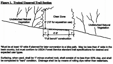
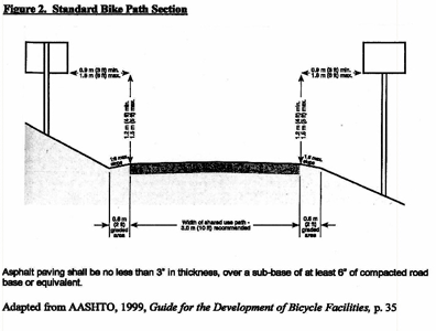
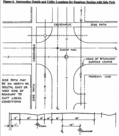
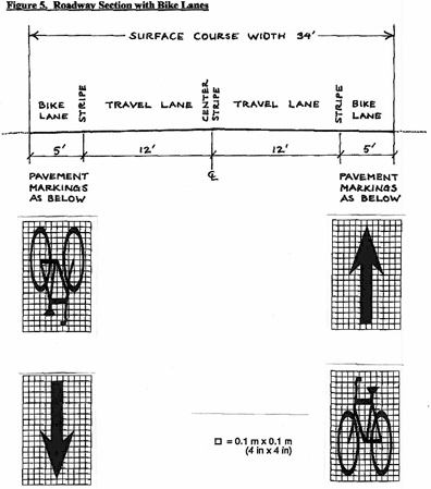
- The presence of wildlife is part of the heritage and charm of the Ogden Valley, and the protection of wildlife habitat and environmentally sensitive areas is an important value to the community. The state division of wildlife resources (DWR) has identified three types of critical wildlife habitat in the Ogden Valley area:
(Ord. of 1956, § 40-4)
- Respect for private property rights is an essential aspect of the pathways program. As shown on the master pathways map, the scenarios under which pathways are to be constructed or designated for public use invite the cooperation of private property owners and the expression of their opinions and concerns. Furthermore, whenever a pathway is constructed along a pre-existing corridor formerly used for a different purpose, such as a canal or a power line, any pre-existing rights held by adjacent landowners concerning drainage, ditch maintenance, crossing and access, and other matters will continue to be honored.
- Trespassing and liability are of concern to property owners adjacent to trails. While trespassing from pathways, just as trespassing from roadways, cannot be absolutely prevented, signs shall be posted at all trail heads reminding users to respect private property by staying on the trail. Access shall not be allowed or provided from a pathway onto private property without the permission of the landowner. Landowners adjacent to a pathway may, and are encouraged to create their own access paths to connect to the pathway.
- The question of liability cannot be solved by the Ogden Valley pathways master plan or by this chapter; however, it should be emphasized that the potential liability incurred by property adjacent to a pathway is no greater than that experienced adjacent to a roadway. Furthermore, the State of Utah has adopted a Limitation of Landowner Liability Public Recreation Act (section 57-14-1 et seq.). This act specifically protects landowners who allow the public onto their property free of charge for recreational purposes.
(Ord. of 1956, § 40-5)
Sec 108-18-2 Definitions
Sec 108-18-3 Establishment Of Drinking Water Source Protection Zones
Sec 108-18-4 Identification Of Public Water Systems And Their Drinking Water Source Protection Zones
Sec 108-18-5 Allowed Uses
Sec 108-18-6 Prohibited Uses
Sec 108-18-7 Sewers Within Drinking Water Source Protection Zones And Management Areas
Sec 108-18-8 Drinking Water Source Protection Requirements
Sec 108-18-9 Transition
Sec 108-18-10 Administration
The purpose of this chapter is to ensure the provision of a safe and sanitary drinking water supply to the residents of the county who receive water for culinary and domestic use from public water systems in the county by the establishment of drinking water source protection zones surrounding the wellheads and springs for all wells and springs used by public water systems in the county and by the designation and regulation of property uses and conditions that may be maintained within such zones.
(Ord. of 1956, § 41-1)
The following words, terms and phrases, when used in this chapter, shall have the meanings ascribed to them in this section, except where the context clearly indicates a different meaning:
Best management practices means a practice or combination of practices determined to be the most effective practicable means of conducting a land use activity to minimize the potential for becoming a pollution source (including technological, economic, and institutional considerations).
Design standard means established state or national standards for the design, construction, placement, or maintenance of a potential contamination source to prevent discharges to the groundwater. (See also Secondary containment. ) A control that is implemented by a potential contamination source to prevent discharges to the groundwater. Spill protection is an example of a design standard.
Drinking water source protection (DWSP) zone means the surface and subsurface area surrounding a groundwater source of drinking water supplying a public water system through which contaminants are reasonably likely to move toward and reach such groundwater source.
Groundwater source means any well, spring, tunnel, adit, or other underground opening from or through which groundwater flows or is pumped from subsurface water-bearing formations.
Pollution source means point source discharges of contaminants to groundwater or potential discharges of the liquid forms of "extremely hazardous substances" which are stored in containers in excess of "applicable threshold planning quantities" as specified in SARA Title III. Examples of possible pollution sources include, but are not limited to the following: storage facilities that store the liquid forms of extremely hazardous substances, septic tanks, drain fields, class V underground injection wells, landfills, open dumps, landfilling of sludge and septage, manure piles, salt piles, pit privies, drain lines, and animal feeding operations with more than ten animal units. The following definitions clarify the meaning of the term "pollution source:"
Animal feeding operation means a lot or facility where the following conditions are met: animals have been or will be stabled or confined and fed or maintained for a total of 45 days or more in any 12-month period, and crops, vegetation forage growth, or post-harvest residues are not sustained in the normal growing season over any portion of the lot or facility. Two or more animal feeding operations under common ownership are considered to be a single feeding operation if they adjoin each other, if they use a common area, or if they use a common system for the disposal of wastes.
Animal unit means a unit of measurement for any animal feeding operation calculated by adding the following numbers; the number of slaughter and feeder cattle multiplied by 1.0, plus the number of mature dairy cattle multiplied by 1.4, plus the number of swine weighing over 55 pounds multiplied by 0.4, plus the number of sheep multiplied by 0.1, plus the number of horses multiplied by 2.0.
Extremely hazardous substances means those substances which are identified in the Sec. 302(EHS) column of the "Title III List of Lists - Consolidated List of Chemicals Subject to Reporting Under SARA Title III," (EPA 560/4-91-011). A copy of this document may be obtained from: Section 313 Document Distribution Center, P.O. Box 12505, Cincinnati, OH 41212.
Hazardous waste means a waste with properties that make it dangerous or potential harmful to human health or to the environment.
Potential contamination source means any facility or site, which employs an activity or procedure, which may potentially contaminate groundwater. A pollution source is also a potential contamination source. Such term includes collection, treatment, storage and distribution facilities under control of the operator and used primarily in connection with the system. Additionally, the term "potential contamination source" includes collection, pretreatment or storage facilities used primarily in connection with the system, but not under such control.
Sanitary landfill means a disposal site where solid wastes, including putrescible wastes, or hazardous wastes, are disposed of on land by placing earth cover thereon.
Sanitary sewer line means a pipeline that connects a residence or other building with a sanitary sewer.
Septic tank/drain field system means a system which is comprised of a septic tank and a drain field which accepts domestic wastewater from buildings or facilities for subsurface treatment and disposal. By their design, septic tank/drain field system discharges cannot be controlled with design standards.
Source protection zone means the specified surface and subsurface area surrounding a groundwater source of drinking water supplying a public water supply, through which contaminants are reasonably likely to move toward and reach such groundwater source. These zones shall have the approval of the state division of drinking water as described in R309-600 Source Protection Drinking Water Source Protection for Ground-Water Sources and as stated in section 108-18-3.
Spring means the ground surface outlet of a natural underground spring, including Spring collection and control boxes, valves, piping and other attachments.
Stormwater infiltration structure means a structure that is intended to discharge stormwater so that it infiltrates groundwater.
SARA Title III means the Superfund Amendment and Reauthorization Act section found in 40 CFR 300-302, pertaining to emergency response and right-to-know.
Time of travel distance means the distance that groundwater will travel in a specified time. This distance is generally a function of the permeability and slope of the aquifer. Time of travel is determined from hydrological studies and is approved by the state department of environmental quality, division of drinking water.
Underground storage tanks means underground tanks used for the storage of gas, oil, or other hazardous substances.
Wellhead means the physical structure, facility, or device at the land surface from or through which groundwater flows or is pumped from subsurface, water-bearing formations.
Public water system means a system, either publicly or privately owned, providing water for human consumption and other domestic uses, which:
- Has at least 15 service connections; or
- Serves an average of at least 25 individuals daily at least 60 days out of the year.
Secondary containment means a type of system that is used to provide release detection prevention, such as trays under containers, floor curbing or other systems designed to hold materials or liquids that may discharge from containers holding regulated substances. Examples include a double-walled tank, a double-walled integral piping system, or a single-walled tank or integral piping system that is protected by an enclosed concrete vault, liner, or an impervious containment area.
(Ord. of 1956, § 41-2)
- There are hereby established use districts to be known as Zones One, Two, Three, and Four, of the drinking water source protection area, or alternatively the management area. These zones shall have the approval of the state division of drinking water as described in R309-600 Source Protection: Drinking Water Source Protection for Ground-Water Sources and are identified and described as follows:
- Zone One is the area within a 100-foot radius from the wellhead or margin of the collection area.
- Zone Two is the area within a 250-day groundwater time of travel to the wellhead or margin of the collection area, the boundary of the aquifer which supplies water to the groundwater source, or the groundwater divide, whichever is closer.
- Zone Three is the area within a three-year groundwater time of travel to the wellhead or margin of the collection area, the boundary of the aquifer which supplies water to the groundwater source, or the groundwater divide, whichever is closer.
- Zone Four is the area within a 15-year groundwater time of travel to the wellhead or margin of the collection area, the boundary of the aquifer which supplies water to the groundwater source, or the groundwater divide, whichever is closer.
- Management area means the area outside of Zone One and within a two-mile radius where the optional two-mile radius delineation procedure has been used to identify a protection area, as described in the state division of drinking water R309-600 Source Protection: Drinking Water Source Protection for Ground-Water Sources. This area shall be treated as for Zone Two.
- In some cases, such as bedrock areas, Zones Two, Three, and Four are overlapping due to the inability to determine time of travel. These are sensitive areas. In these cases, the zone should be protected as for Zone Two.
(Ord. of 1956, § 41-3)
- After a public water system in the county submits its drinking water source protection plan to the state division of drinking water, pursuant to the division's drinking water source protection regulations, as amended, and the division provides written notice to the public water system of its approval of the plan, the public water system shall, at its sole cost and expense, provide the county building division, county planning division, county health department and surveyor's office with a map, and additional information required by the office, identifying the four drinking water source protection zones the public water system designates for each of its sources of groundwater for drinking water in the plan approved by the division.
- The county planning division shall then incorporate this information on a map of the county that it shall prepare and maintain, which identifies each public water system's sources of groundwater for drinking water and the four drinking water source protection zones for each source of groundwater.
- It shall be the duty of each public water system, at its sole cost and expense, to submit any updated information as necessary to the county planning division and the county health department.
(Ord. of 1956, § 41-4)
- In Zones One, Two, Three, and Four, each use established before the effective date of the ordinance from which this chapter is derived, and uses incidental and accessory to such use, may be continued in the same manner thereafter, provided that such use is not determined by any court of competent jurisdiction to be a nuisance under the provisions of federal, state, and/or local laws or regulations.
- In addition to the uses permitted under subsection (a) of this section, the following uses, including uses incidental and accessory to that use, shall be allowed within the respective drinking water source protection zones:
- Zone One. No uses in addition to that allowed under subsection (a) of this section are allowed in Zone One.
- Zone Two. Use of single- or multiple-family residential dwellings, commercial, or institutional uses established on or after the effective date of the ordinance from which this chapter is derived, provided that such uses are connected to a sanitary sewer system.
- Zone Three. Use of single- or multiple-family residential dwellings, commercial, or institutional uses established on or after the effective date of the ordinance from which this chapter is derived.
- Zone Four.
- Use of single- or multiple-family residential dwellings, commercial, or institutional uses established on or after the effective date of the ordinance from which this chapter is derived.
- The tilling of the soil and the raising of crops provided that the use of fertilizers and pesticides is accomplished within applicable federal, state, and/or local requirements.
- The pasturing of livestock provided all forage is raised on the pastured area.
- In addition to the permitted uses specified in subsections (a) and (b) of this section, certain of the uses prohibited in Zones Two, Three, and Four pursuant to section 108-569 may be allowed in Zones Two, Three, and Four, respectively, if design standards are implemented for the specific use that will prevent contaminated discharges to groundwater.
(Ord. of 1956, § 41-5)
Subject to section 108-18-5, the following uses are prohibited within the following drinking water source protection zones:
- Zone One. All uses that fall within the definition in this chapter of "pollution source" or "potential contamination source," including the following, are prohibited in Zone One:
- Surface use, storage, or dumping of hazardous waste or material, expressly including industrial or commercial uses of agricultural pesticides (except when such pesticides are used in farming applications within strict compliance of the manufacturer's recommendations of use, subject to inspection by local officials).
- Sanitary landfills.
- Hazardous waste or material disposal sites.
- Septic tanks/drain field systems.
- Sanitary sewer lines within 150 feet of a wellhead or spring collection area.
- Underground storage tanks.
- Stormwater infiltration structures.
- Any pollution source as defined herein or in Rule 309-113-101, as amended, of the division of drinking water's drinking water source protection regulations.
- Agriculture industries including, but not limited to, intensive feeding operations such as feedlots, dairies, fur breeding operations, poultry farms, etc.
- Zone Two.
- Surface use, storage, or dumping of hazardous waste or material, expressly including industrial or commercial uses of agricultural pesticides (except when such pesticides are used in farming applications within strict compliance of the manufacturer's recommendations of use, subject to inspection by local officials).
- Sanitary landfills.
- Hazardous waste or material disposal sites.
- Septic tanks/drain field systems.
- Sanitary sewer lines within 150 feet of a wellhead or spring collection area.
- Underground storage tanks.
- Stormwater infiltration structures.
- Any pollution source as defined herein or in Rule 309-113-101, as amended, of the division of drinking water's drinking water source protection regulations.
- Agriculture industries including, but not limited to, intensive feeding operations such as feedlots, dairies, fur breeding operations, poultry farms, etc.
- Zone Three.
- Surface use, storage, or dumping of hazardous waste or material, expressly including industrial or commercial uses of agricultural pesticides (except when such pesticides are used in farming applications within strict compliance of the manufacturer's recommendations of use, subject to inspection by local officials).
- Sanitary landfills.
- Hazardous waste or material disposal sites.
- Agriculture industries including, but not limited to, intensive feeding operation such as feedlots, dairies, fur breeding operations, poultry farms, etc.
- Zone Four.
- Surface use, storage, or dumping of hazardous waste or material, expressly including industrial or commercial uses of agricultural pesticides (except when such pesticides are used in farming applications within strict compliance of the manufacturer's recommendations of use, subject to inspection by local officials).
- Sanitary landfills.
- Hazardous waste or material disposal sites.
(Ord. of 1956, § 41-6)
Sanitary sewer lines may not be located within Zones One and Two or a management area unless the criteria identified below is met. If sewer lines are located or planned to be located within Zones One and Two or a management area, the developer must submit a preliminary evaluation report demonstrating that they comply with this criteria. Sewer lines that comply with these criteria may be assessed as adequately controlled potential contamination sources.
- Zones One and Two. If the conditions specified in subsections (a)(1) and (2) of this section are met, all sewer lines within Zones One and Two shall be constructed in accordance with state requirement and must be at least ten feet from the wellhead.
- There is at least five feet of suitable soil between the bottom of the sewer lines and the top of the maximum seasonal groundwater table or perched water table. (Suitable soils contain adequate sand/silt/clay to act as an effective effluent filter within its depth for the removal of pathogenic organisms and fill the voids between coarse particles such as gravel, cobbles, and angular rock fragments); and
- There is at least five feet of suitable soil between the bottom of the sewer line and the top of any bedrock formations or other unsuitable soils. Bedrock formations include formations that have such a low permeability that they prevent the downward passage of effluent. Bedrock formations that have open joints or solution channels, which permit such rapid flow that effluent is not renovated, are also considered unacceptable. Other unsuitable soils include those with coarse particles such as gravel, cobbles, or angular rock fragments with insufficient soil to fill the voids between the particles. Solid or fractured bedrock such as shale, sandstone, limestone, basalt, or granite are unacceptable.
- Zones One and Two. If the conditions identified in R309-600-13(3)(a)(i) and (ii) cannot be met, any sewer lines within Zones One and Two or a management area shall be constructed in accordance with R309-515-6(4) and must be at least 300 feet from the wellhead or margin of the collection area.
(Ord. of 1956, § 41-7)
Except as provided in this section, following the effective date of the ordinance from which this chapter is derived, no building permit or other form of approval from the county to develop or use real property within the county shall be issued until the applicant establishes that its proposed development or use of real property complies with the requirements of this chapter.
(Ord. of 1956, § 41-8)
- Until such time that a public water system submits its drinking water source protection plan to the state division of drinking water, the division provides written notice to the public water system of its approval of the plan, and the public water system provides the county building division, county health department, county planning division and surveyor's office with a map and any additional information required by the office identifying the public water system's sources of groundwater for drinking water and the four drinking water source protection zones for each of the sources, no building permit or other form of approval from the county to develop or use real property within the county shall be issued unless the applicant establishes that its proposed development or use of real property complies, with the source protection plan.
- After a public water system submits its drinking water source protection plan to the state division of drinking water, the division provides written notice to the public water system of its approval of the plan, and the public water system provides the county building division, county health department, county planning division and surveyor's department with a map and any additional information required by the office identifying the public water system's sources of groundwater for drinking water and the four drinking water source protection zones for each of the sources, no building permit or other form of approval from the county to develop or use real property within the county shall be issued unless the applicant establishes that its proposed development or use of real property complies with the requirements of this chapter.
(Ord. of 1956, § 41-9)
- The policies and procedures for administration of any source protection zone established under this chapter, including without limitation those applicable to existing nonconforming uses, enforcement and penalties, shall be the same as provided in the existing Land Use Code, as presently enacted, except that the county technical committee may grant a variance. The technical committee consists of a member from the county building division, county engineering, and the county health department. The county planning division shall provide support to the technical committee. If it is necessary to have additional expertise evaluate the variance, it shall be at the expense of the entity requesting the variance. The recommendation relative to the requested variance shall be documented and filed with the county planning division, and a copy returned to the requester.
- The policies and procedures or administration of any drinking water source protection established under this chapter authorize a retail water supplier or wholesale water supplier to seek enforcement of the ordinance in a district court located within the county as permitted by U.C.A. 1953, § 19-4-113, or as subsequently amended. This chapter shall take effect 15 days after its adoption and first publication. Adoptions of a drinking water source protection ordinances by a cities or town, shall supersede the county's source drinking water source protection ordinance.
(Ord. of 1956, § 41-10)
Sec 108-19-2 Applicability
Sec 108-19-3 General Provisions
Sec 108-19-4 Standards And Requirements
Sec 108-19-5 Application Procedure
Sec 108-19-6 Moderate Income Housing Provision
Sec 108-19-7 Enforcement
The purpose of this chapter is to provide regulations for accessory dwelling units that are incidental and accessory to a single-family dwelling, where allowed by the zone. Accessory dwelling units are intended to assist in providing housing types that meet the needs of populations of various income levels, ages, and stages of life.
(Ord. of 1956, § 42-1)
- Applicability. The provisions set forth in this chapter apply to an accessory dwelling unit, where allowed by the zone.
- Ogden Valley detached accessory dwelling unit. In the Ogden Valley, a detached accessory dwelling unit shall only be allowed in one of the two following circumstances:
- Double acreage. The lot has a base density, as defined in Chapter 101-2, of at least two. The lot owner shall record a covenant that runs with the land and is between the lot owner and the County. The covenant shall document the lot's calculated base density; the number of dwelling units developed on the lot, including the detached accessory dwelling unit; the number of residential development rights subtracted from the base density by any other means; and the number of residential development rights remaining for the property.
- Transferable development right. A landowner has successfully negotiated the reallocation of a second residential development right from another lot or parcel, and is in compliance with the following:
- The reallocated residential development right may only be transferred from a lot or parcel that:
- Is located in one of the following zones: RE-15, RE-20, AV-3, FV-3, and S-1; and
- Has an available residential development right. Available residential development rights are determined by the lot or parcel's base density and adjusted for any previous residential development right reduction or addition.
- The reallocation shall be made by recording a covenant to each affected lot or parcel. Each covenant shall run with the land and be between the owner and the County. Each covenant shall document the applicable lot or parcel's calculated base density; the number of dwelling units developed on the lot or parcel, including the accessory dwelling unit, if applicable; the number of residential development rights subtracted from, or added to, the base density by any means; and the number of residential development rights remaining for the lot or parcel.
- The reallocated residential development right may only be transferred from a lot or parcel that:
Adopted by Ord. 2020-27 on 12/22/2020
Amended by Ord. 2022-14 on 5/25/2022
Amended by Ord. 2023-01 on 1/10/2023
The following provisions shall apply:
- Number of accessory dwelling units per parcel. No more than one accessory dwelling unit shall be allowed on a lot containing a single-family dwelling, unless explicitly specified otherwise in this Land Use Code.
- Amenities. An accessory dwelling unit shall contain sufficient amenities to be definable as a dwelling unit.
- Parking. Parking shall be as provided in Chapter 108-8 for an accessory dwelling unit, and shall be on a hard-surfaced area prepared to accommodate vehicle parking.
- Occupancy. Either the accessory dwelling unit or the primary dwelling shall be owner-occupied. While away, the owner shall not offer the owner-occupied dwelling unit for rent. The non-owner-occupied unit is limited to no more than one family.
- Short-term rentals not allowed. Neither the single-family dwelling unit, nor the accessory dwelling unit, shall be used or licensed as a short-term rental, otherwise known as "nightly rental" elsewhere in this Land Use Code, unless specifically allowed elsewhere in this Land Use Code.
- Relevant authority approvals. The accessory dwelling unit shall comply with local regulations and ordinances for a single-family dwelling. Approval is required from the Fire Authority, Addressing Official or similar, Culinary Water Authority, Sanitary Sewer Authority, and Building Official.
(Ord. of 1956, § 42-3)
- Standards same as single-family dwellings. The provisions of Subsection (c) of this section notwithstanding, if new construction for an accessory dwelling unit is proposed or will occur, the standards for single-family dwellings, as provided in Title 108 Chapter 15, shall apply, except that an accessory dwelling unit shall not have more than one kitchen.
- Size. The size regulations for an accessory dwelling unit are as follows:
- The footprint of an accessory dwelling unit, as determined by the exterior perimeter of all levels when viewed from above, shall not be less than 400 square feet and shall not exceed 1,500 square feet. In no case shall the gross floor area of the accessory dwelling unit be greater than 2,000 square feet. However, an accessory dwelling unit located entirely within a basement of a single-family dwelling may consume the entire basement area regardless of square footage.
- Except as provided in Subsection (b)(3) of this section, the height of a detached accessory building that houses an accessory dwelling unit shall be no greater than 35 feet.
- For a lot that has 20,000 square feet or less:
- The height of a detached accessory building that houses an accessory dwelling unit shall be no greater than 90% of the height of the single-family dwelling.
- The total area of the footprint of a detached accessory building that houses an accessory dwelling unit combined with the total area of the footprint of the single-family dwelling, if different, shall not cover more than 25 percent of the total lot area.
- Relationship to the primary dwelling; appearance. The exterior design of an accessory dwelling unit, or the building that contains an accessory dwelling unit, shall compliment the primary dwelling in a manner that preserves the appearance of the lot's single-family use.
- The exterior of the accessory dwelling unit shall either:
- Conform to the primary dwelling in architectural style and materials on all sides of the building and roof;
- Be designed by a licensed architect in a manner that gives the appearance of a barn or other similarly styled agricultural outbuilding; or
- Be designed by a licensed architect in a manner that provides the architectural features of historic buildings from the general area.
- An accessory dwelling unit located in a building that is only connected to the single-family dwelling by means of a continuous roofline, such as a breezeway, shall be determined to be a part of the single-family dwelling provided that the distance between them is no greater than 15 feet.
- The exterior of the accessory dwelling unit shall either:
- Location. An accessory dwelling unit shall comply with the same lot development standards as a single-family dwelling in the respective zone.
- Access. The main access into the accessory dwelling unit shall be on the side or rear of the building, as viewed from the front lot line. Each accessory dwelling unit shall have direct access to the exterior of the building in a manner that does not require passage through any other part of the building.
- Undivided ownership. Ownership of an accessory dwelling unit shall not be transferred separate from the single-family dwelling to which it is an accessory, unless the transfer is part of a lawfully platted subdivision that complies with all applicable lot standards of this Land Use Code, including building setbacks and access across the front lot line. A notice shall be recorded to the title of the lot that states that ownership may not transfer except in these circumstances.
- Converting existing dwelling unit. An existing single-family dwelling unit, lawfully established at least 5 years prior to the date of application for an accessory dwelling unit, may be converted to an accessory dwelling unit and is exempt from the standards of this section.
Approval of an accessory dwelling unit requires a land use permit. The application and review procedure for a land use permit is as follows:
- Application submittal requirements.
- A completed application form signed by the property owner or assigned agent.
- An application fee. The payment of a partial application fee, or the submittal of plans for a pre-submittal review, does not constitute a complete application.
- A site plan drawn accurately to scale that shows property lines and dimensions, the location of existing buildings and building entrances, any proposed building and its dimensions from buildings and property lines, and the location of parking stalls.
- Detailed floor plans, including elevations, drawn to scale with labels on rooms indicating uses or proposed uses.
- A statement of feasibility, also known as a will-serve letter from the utilities providing culinary water and sanitary sewer services, or, if the accessory dwelling unit will be served by a well or septic system, the local health department.
- Written verification that the applicant is the owner of the property and has permanent residency in the existing single-family dwelling where the request is being made. In order for an accessory dwelling unit to be permitted, the verification also requires the applicant to acknowledge that they are the owner-occupant and will remain an owner-occupant.
- Review procedure.
- Upon submittal of a complete accessory dwelling unit application, Planning Division staff will review the application to verify compliance with this chapter and any other relevant component of this Land Use Code.
- Planning Division staff will route the application to the local fire authority, the County Building Division, and any other relevant review department or agency for verification of compliance, determination of need for land use permit application modifications, and for the submittal of other applications or reviews necessary to obtain their approvals of an accessory dwelling unit.
- If the land use permit application complies with relevant land use laws, and receives all required department and agency approvals, a land use permit shall be issued. If the application requires submittal of other applications or reviews necessary to attain the approvals of other required departments or agencies, but otherwise complies with relevant land use laws, the application shall be given conditional approval by Planning Division staff, conditioned on approval of other reviewers. The accessory dwelling unit shall maintain compliance with the approved permit.
- If the application does not comply, Planning Division staff shall notify the applicant using the notification method typical for similar Planning Division correspondence. The applicant shall be given the opportunity to revise the application to bring it into compliance. If the application cannot be brought into compliance, the applicant may either withdraw the application, forfeiting the fee, or pursue a final land use decision by the Planning Division, which shall be denial of the land use application.
- Upon receipt of an approved land use permit, the applicant shall submit for a building permit, if needed, prior to building or using any space as an accessory dwelling unit. The County may combine the land use permit and building permit application process.
- If the accessory dwelling unit is rented, a business license is required. If the business license is addressed to the site, it shall be reviewed as a home occupation business license, as provided in Title 108 Chapter 13, but the area regulations and confinement to one single-family dwelling onsite shall not apply.
(Ord. of 1956, § 42-4; Ord. No. 2015-22, Exh. A, 12-22-2015)
In accordance with the goals of the general plan, and state law, providing tools and methods for the creation of moderate income housing is necessary in the planning advisory areas of unincorporated Weber County. Accessory dwelling units created in accordance with this chapter will assist in providing for this need.
(Ord. of 1956, § 42-5)
Violations of this chapter are subject to enforcement and penalties as outlined in Title 102 Chapter 4. Noncompliance with the standards of this chapter shall be just cause for the denial of a business license application or renewal, or revocation of an existing business license, if the original conditions are not maintained that allow for long term rental of the accessory dwelling unit.
Article 108-20-II Permit And Application
Article 108-20-III License Requirement And Application
Article 108-20-IV General Requirements
Article 108-20-V General Site Development Standards
Article 108-20-VI Electrical Service, Wiring, Fuel And Fire Protection
Article 108-20-VII Accessory Structures And Dwelling Units
Article 108-20-VIII Administration And Enforcement
Sec 108-20-2 Definitions
The purpose of the chapter is to provide regulations for the development and construction of forest campgrounds in the mountain and canyons areas of the unincorporated portion of the county in order to ensure that all such development will guarantee the public health, safety and general welfare, and represent, to the greatest extent possible, efforts to preserve the natural amenities of the landscape and ensure harmony with the overall environment.
(Code 1985, § 13-1-2)
When used in this chapter, the following words and phrases have the meaning ascribed to them in this section, unless the context indicates a different meaning:
Building inspector means the building inspector of Weber County.
Campsite means an area within a campground designed or used to accommodate one party in a single travel trailer, recreational vehicle or tent.
County health department means the Weber-Morgan Health Department.
Fire chief means fire chief of the Weber Fire District or any member of his staff authorized to represent him.
Forest campground means an area used or designed to accommodate three or more automobile campers, travel trailers of not more than eight feet in width, motor recreational vehicles or tents for use of periodic overnight accommodations expressly for temporary outdoor recreational activities. There are four categories of forest campgrounds, as follows:
- Public campground. A forest campground owned and operated by a public agency.
- Semi-public organization campground. A forest campground owned and operated by a semi-public nonprofit organization for the exclusive temporary use and enjoyment of its members.
- Private campground. A forest campground owned and operated by a private organization for the exclusive temporary use and enjoyment of those sharing in the ownership of the campground and/or of those holding a purchased membership in the organization.
- Commercial campground. A forest campground owned and operated expressly for the purpose of renting space in the campground on a transient basis for profit to the general public.
Health officer means the director of the Weber-Morgan Health Department, or any member of his staff authorized to represent him.
Planning commission means the planning commission of Weber County.
Spur means a graded and graveled projection from a road within the campground designed specifically for parking a travel trailer, recreational vehicle, or automobile and serving a single camp unit.
Trailer loop means a graded and graveled projection extending from and connecting to a road within the campground specifically for parking a travel trailer and serving a single camp unit.
(Code 1985, § 13-1-3)
Sec 108-20-20 Building Code
Sec 108-20-21 Application; Site Plan Review
Sec 108-20-22 Denial Of Permit; Review
Sec 108-20-23 Unlawful To Vary From Approved Plans And Specifications
It is unlawful for any person to construct, enlarge, alter, improve any forest campground, or to cause the same to be done, unless such person holds a valid and existing permit issued for the performance of such work by the building inspector.
(Code 1985, § 13-2-1)
The procedure prescribed by the Uniform Building Code as adopted by the county and as amended shall be followed in applying for permits for the construction or alteration of a forest campground.
(Code 1985, § 13-2-2)
- In addition to other requirements, there shall be submitted to the planning commission with the application a comprehensive site plan drawn to scale showing the area and dimensions of the campground number and location of camp sites and group picnic areas location and dimensions of parking spurs, loops, and other parking areas width and arrangement of roads and the location and description of all camp facilities to include table, fireplaces, hydrants, toilet facilities, other accessory buildings and a design plan for supplemental planting, if proposed. An additional statement shall be submitted which indicates the suitability of the soils and general slope characteristics of the site to accommodate proposed development.
- Additionally there shall be included on the submitted site plan, contour lines at five foot intervals in vertical distance except where slope on the site is excessively steep or flat, such being the case, the contour interval may be increased or decreased to better depict overall topography location and description of dominant ground cover and other natural features including streams, ponds, and lakes; and attached to the site plan a brief statement indicating actions to be taken to preserve the natural environment.
- The planning commission shall promptly review the site plan, and if it shall appear therefrom that the plan complies with all applicable ordinances and regulations and represents in the opinion of the planning commission an acceptable overall design plan conducive to promoting public convenience, health, safety and general welfare and preservation, to the greatest extent possible, of the natural amenities of the area, it shall endorse their approval thereon and authorize the issuance of a land use permit.
- The planning commission may in its discretion, propose recommendations and impose conditions for the improvement of said plan to provide for the safety and protection of the users and preservation of the environment. If the planning commission shall find that said plan does not comply with applicable ordinances and regulations, it shall disapprove said plan and return same to the applicant with a statement in writing indicating reasons for disapproval. Any action of the planning commission to impose conditions, reduce the actual number of campsites or deny the request for a conditional use permit shall be based on criteria in the Land Use Code which is the basis for issuance of conditional use permits. No permit shall be issued if the planning commission disapproves said site plan.
(Code 1985, § 13-2-3)
Any person, firm or corporation whose application for a permit under the provisions of this section has been denied by the Land Use Authority may appeal such decision to the appropriate Appeal Authority upon filing an appeal pursuant to this Land Use Code.
(Code 1985, § 13-2-4)
It is unlawful for any person to do any work in and about the construction, alteration, repair, improvement or enlargement of any forest campground or any structure thereon, for which a permit is required, which varies in any substantial particular from the approved plans and specifications submitted with the application for such permit and which were approved and/or upon which the permit issued is or was based.
(Code 1985, § 13-2-5)
Sec 108-20-41 Application For Issuance Of License
It shall be unlawful for any person, firm or corporation to operate, maintain, or offer for use any forest campground without first making application to the license department and obtaining a license to do so.
(Code 1985, § 13-3-1)
No new application for license shall be considered until the plans for such use shall have first been approved by the planning commission and a land use permit has been issued as required by the Land Use Code, and no such license shall be issued until such approval has been obtained. Any license issued without such approval shall be null and void. Each applicant, in making application for a license shall specify the exact number of campsites which shall be offered for use. Any enlargements, increase in capacity, or modification of an existing use shall be construed to be a new application of the purpose of this regulation, and no existing license shall be modified and no land use or building permit for such enlargement, increase in capacity or modification shall be issued until the application for the same shall be approved by the planning commission as required for a new application. Licenses for existing uses may be modified for increased use or expansion during the license year, but such license shall show thereon the additional facilities provided.
(Code 1985, § 13-3-2)
Sec 108-20-59 Signs
Sec 108-20-60 Periodic Recreational Usage Only
Sec 108-20-61 Duration Of Campsite Occupancy
Sec 108-20-62 Restrictions Relating To The Erection Of Structures
In addition to the requirements as set forth in this chapter, all uses shall be established and constructed in compliance with all existing state and local statutes, ordinances, codes and regulations, including the rules and regulations of the county health department and/or state department of health, local county and state law enforcement agencies and fire department.
(Code 1985, § 13-4-1)
All signs shall be in accordance with requirements of the zone in which the campground is to be located.
(Code 1985, § 13-4-2)
- No automobile camper, travel trailer, motor recreational vehicle or other similar vehicle or structure shall be located in a forest campground for full-time or year round use as a permanent dwelling habitation, and shall not be used for such purposes, but shall be used solely for periodic, four season, part-time recreational living purposes and shall be maintained in a readily movable condition.
- The county building inspector shall have the power to require the disuse and removal of any such vehicle or structure if, in his determination, such vehicle or structure is not being used solely for part-time, periodic recreational living purposes.
(Code 1985, § 13-4-3)
Commercial campground sites shall be occupied no longer than two consecutive weeks by the same camp party.
(Code 1985, § 13-4-4)
No structure of any type shall be erected in a forest campground except those accessory structures as permitted in section 108-20-126.
(Code 1985, § 13-4-5)
Sec 108-20-80 Maximum Number Of Campsites Allowed
Sec 108-20-81 Density And Spacing Requirements
Sec 108-20-82 Traffic Circulation
Sec 108-20-83 Parking
Sec 108-20-84 Water Supply
Sec 108-20-85 Wastewater Disposal
Sec 108-20-86 Solid Waste Disposal
Sec 108-20-87 Fireplaces And Tables
Sec 108-20-88 Group Picnic Sites
Sec 108-20-89 Individual Camp And Picnic Sites
The minimum area for a forest campground shall be determined by the lot area requirements of the Land Use Code for the zone in which the campground is to be located, provided no campground shall have an area of less than five acres except in the FRC-1 and CR-l zones such campgrounds shall have a minimum area of one acre.
(Code 1985, § 13-5-1)
- The maximum number of campsites allowed in a forest campground shall be as follows:
- In a public, commercial or semi-public organization campground: five campsites per acre of land designated and developed for camping purposes.
- In a private campground, the same area for each two campsites as required for a main use in the zone in which the campground is located.
- The planning commission, in reviewing the site plan and attached statements, shall determine if the site is capable of accommodating the proposed maximum number of campsites allowed and shall thereupon determine whether the number of campsites per acre will be reduced below the maximum permitted. Such determination shall be based upon the land cover, percentage of land area with a slope in excess of 30 percent and other resource limitations.
(Code 1985, § 13-5-2)
Campsites shall be spaced in such a manner so that not more than five individual campsites shall occupy less than one acre of land. Clusters of campsites should consist of approximately 20 campsites and should be separated by natural barriers such as ridges, valleys, heavy timber, or similar natural features or by a sufficient distance to assure compatibility with the natural landscape.
(Code 1985, § 13-5-3)
- There shall be safe access into the campground through a single entrance where possible.
- Acceleration and deceleration lanes shall be provided when the campground entrance is in close proximity to a heavily traveled highway. The lanes shall be 300 feet in length.
- The surface width for two-way roads shall be at least 16 feet and at least 12-foot widths shall be provided for one-way roads.
- All roads in the campground shall be graded and graveled and shall not exceed a grade of more than 15 percent.
- Turn-around loops shall be constructed to provide at least a 45-foot turning radius measured to the centerline of the road.
- A minimum distance of 200 to 300 feet shall separate roads within the campground.
(Code 1985, § 13-5-4)
- Spurs on one-way roads shall not exceed a 45-degree angle measured to the centerline of the road.
- Spurs for automobiles and campers shall be at least 30 feet long, measured on the short side of the spur from the edge of the road.
- Spurs for trailers shall be at least 55 feet long, measured on the short side of the spur from the edge of the road.
- Spurs shall be a minimum of 12 feet wide.
- The rear half of a spur and midsection of a loop shall not exceed two percent grade in order to provide a near level pad on which trailers and campers may be satisfactorily leveled. The rest of the spur or slope shall not exceed six percent grade; cross sections of loops and spurs shall be level or near level.
- Trailer loops shall be a minimum of 60 feet local, measured along the edge of the adjoining interior road from centerline or entrance to centerline of exit.
- Group parking located to serve picnic areas shall be arranged to permit adequate ingress and egress to individual spaces. Wheel stops shall be provided for each parking space.
- Group parking facilities shall not be located more than 200 feet from the picnic area they are intended to serve. There shall be a minimum of one parking space per picnic table.
(Code 1985, § 13-5-5)
- Source. Water supplies shall be from a public water supply or from another source meeting requirements of "Rules and Regulations Relating to Public Water Supplies" as adopted by the state board of health.
- Water. There shall be a minimum of one hydrant per five camp units.
(Code 1985, § 13-5-6)
- There shall be a minimum of two flush-type water closets for each campground, one designated for female and the other for male. Campgrounds having in excess of 15 camp units shall have two additional flush-type water closets for each additional 15 camp units or fractions thereof.
- Toilet facilities for males and females if located in the same building shall be separated by a sound-resistant wall.
- All toilet facilities must be located at least 75 feet from the farthest family unit and at least 100 feet from all lakes, streams or wells.
- A toilet facility shall be located no further than 500 feet from the farthest family unit it is intended to serve.
- Adequate access paths shall be provided from camp areas to toilet facilities and shall include an appropriate number of directional signs.
- Where a site is developed to accommodate self-contained camping units, provisions shall be made to incorporate sewage disposal stations with the flush toilet system. Constructed in accordance with the state division of health, code of "waste disposal regulations."
- All wastewater shall be disposed of into a public sewer system whenever available. Where connection to a public sewer system is not possible, wastewater shall be discharged into wastewater disposal system meeting requirements specified in "Code of Water Disposal Regulations", as adopted jointly by the state board of health and water pollution committee.
(Code 1985, § 13-5-7)
- Solid wastes, including garbage, originating from any camp shall be stored in approved, conveniently located, leak-proof, non-absorbent water-tight containers provided with approved type lids, and shall be disposed of as often as necessary to prevent a nuisance.
- There shall be one refuse container for each campsite.
- There shall be provided at least one refuse container for every picnic area designed to accommodate up to 15 people. The containers shall be located in a rack or on a concrete base near a service road.
(Code 1985, § 13-5-8)
- Fireplaces shall be located at least five feet from any table.
- Table should be located in shaded areas.
- A five-foot radius cleared of all flammable material shall be maintained around fireplaces and grills.
(Code 1985, § 13-5-9)
- Group picnic areas should be approximately 300 feet from camp units and other picnic areas.
- There should be appropriate grading and graveling or paving of group picnic sites where tables and fireplaces are clustered for group use.
(Code 1985, § 13-5-10)
- Individual camp and picnic sites shall be at least 75 feet apart. Minimum distance in aspen cover should be 150 feet apart.
- Sites should be approximately 50 feet from the edge of interior roads, when served by spurs, and 30 feet when served by trailer loops. There should be at least 200 feet between camp and picnic sites and a main road.
- Sites shall be at least 50 feet from fences and should be located far enough away from lakes and streams to permit public access.
- Camps and picnic sites should be located within ten to 20 feet from trailer spurs or loops and 40 feet from car spurs wherever possible.
(Code 1985, § 13-5-11)
Sec 108-20-107 Fire Protection
All electric wiring shall be installed to conform with the requirement of all state and county electrical codes and ordinances. No person shall make any electrical connection without obtaining a permit and approval of the building inspector; except that a previously approved electrical connection system may be employed without obtaining such permit. No power line shall be permitted to lie on the ground, or to be suspended less than 18 feet above the surface of the ground.
(Code 1985, § 13-6-1)
- All forest campgrounds shall be subject to the rules and regulations of the Weber Fire District and be in accordance with the county fire prevention code and requirements as herein specified.
- Flammable materials. Forest campgrounds shall be kept free of litter, rubbish and other flammable materials.
(Code 1985, § 13-6-2)
Sec 108-20-127 Dwelling Units
Sec 108-20-128 Other Land Uses
Accessory structures built within the campground shall be used for the housing of sanitary facilities, equipment used for the upkeep of the campground and for the control of the campground facilities. All accessory structures shall be a permanent type and shall be used only as incidental uses to a forest campground. Any accessory structure as permitted herein shall be constructed of materials which blend well with and are complimentary to the natural setting of the area.
(Code 1985, § 13-7-1)
All dwelling units shall be considered a primary use of the land and shall meet all the requirements of the Land Use Code of Weber County and the standards contained therein for the particular zone in which the land use is proposed. None of the area nor any of the facilities in a forest campground may be used to satisfy any of the requirements for a dwelling, as such use related to any applicable ordinances of the county.
(Code 1985, § 13-7-2)
All other lands uses to be established in conjunction with a forest campground shall comply with all the requirements of the respective zones of the Land Use Code of Weber County.
(Code 1985, § 13-7-3)
It shall be the duty of the county building inspector, health officer, county fire chief, and such other officials as may be designated by the board of county commissions to enforce this title.
(Code 1985, § 13-8-1)
Sec 108-21-2 Applicability And Qualifications
Sec 108-21-3 General Development And Operational Standards
Sec 108-21-4 Agricultural Operation Designation
Sec 108-21-5 Use Table
Sec 108-21-6 Site Development Standards
Sec 108-21-7 Special Regulations
The County desires to create a culture that supports and celebrates its agrarian heritage and open spaces in the unincorporated areas. This chapter’s purpose is to do this by providing owners of agricultural operations the ability to generate additional income from land uses that are not otherwise allowed in the zone, provided those uses are accessory, incidental, and inextricably related to the an onsite agricultural operation. The intent of this chapter is to create allowances and regulations that govern agriculture-oriented land uses that cater to tourists and other visitors coming to the site for recreational, educational, gastronomical, or similar agriculture-oriented attraction.
(Ord. No. 2012-19, pt. 1(§ 46-1), 12-18-2012)
- Applicability. The standards found in this chapter shall apply to all agritourism operations. Application and review provisions for an agritourism conditional use permit are set forth in Title 108, Chapter 4 of this Land Use Code. Any additional detail required by this chapter shall supplement the conditional use permit application. An agritourism use that operates outside of approved hours of operation, or that involves crowds in a number greater than that which can be served by existing facilities, shall obtain a Special Event Permit pursuant to Title 38 of the Weber County Code.
- Primary use. All agritourism operations shall clearly be accessory and incidental to a primary agricultural use of the property. To this end, unless the agritourism use is a routine part of cultivating or harvesting an agricultural product onsite, at no time shall the agritourism use occupy an area that is larger than 20 percent of the agricultural operation’s gross acreage, as described in Subsection (c) of this Section 108-21-2.
- Qualifications. An agricultural operator seeking an agritourism permit shall demonstrate at the time of application, as well as throughout the duration of the agritourism use, the following:
- Ownership. Demonstrate that the agricultural operator has owned the subject property for the last two years.
- Actively devoted to Agriculture. Demonstrate that the agricultural operation’s gross acreage has been actively devoted to an agricultural use for at least the last two years. An agricultural operation’s gross acreage shall be determined to be the area actively devoted to an agricultural use that is routinely maintained in an agriculturally productive manner, including barns and similar buildings or structures intended to serve the agricultural operation, and including temporarily nonproductive land if the land is temporarily nonproductive due to crop or animal rotation, crop immaturity, or other similar accepted agricultural practices.
- Minimum acreage. Demonstrate that the agricultural operation’s gross acreage is equal to or greater than is required for the specific agritourism use or uses being pursued, as specified in Section 108-21-4 and Section 108-21-5. However, if an apiary is the primary agricultural operation:
- The subject property shall be at least two acres; and
- The agritourism use associated with the apiary shall be limited to only that which is listed as allowed for a Garden Operation, as specified in the Table in Section 108-21-5 herein.
- Proof of production, if necessary.
- If not already obvious to the Land Use Authority, demonstrate:
- That the agricultural operation’s gross acreage being claimed to be actively devoted to an agricultural use produces enough to meet or exceed 50 percent of either the production levels reported in the current publication of the Utah Agricultural Statistics, or the current crop budgets developed and published by Utah State University; or
- That 80 percent or more of the agricultural operation owner’s income is derived from agricultural products produced on the subject property.
- This provision is not applicable for use in the Western Weber Planning Area.
- If not already obvious to the Land Use Authority, demonstrate:
- Private covenants. If the property is governed by private covenants that prohibit or restrict agritourism, then any approval otherwise is void.
- Modifications of applicability. Land use authority may waive applicability if it advance an agricultural operation's ability to function.
- Permit enforcement. An agritourism permit includes all conditions of approval as may be applied by the Land Use Authority. At no time shall an agritourism operation be conducted in a manner that conflicts with the details of the agritourism permit application or the conditions of approval. If a condition or finding of approval conflicts with any detail provided in the application, the condition or finding shall prevail.
- Supplemental application narrative. In addition to the application requirements listed in Title 108, Chapter 4 of this Land Use Code, all agritourism applications shall be accompanied by a detailed narrative describing the agricultural operation and the overall vision for the proposed agritourism operation. The narrative shall also include the following:
- History. The history of the agricultural operation along with evidence that demonstrates the operation meets the minimum qualifications herein.
- Description of anticipated changes. A description of any plans for changes to the agricultural operation, its general functions, maintenance, product(s), and customer base.
- Description of use’s incidental and accessory nature. A description of how the agritourism operation is incidental and accessory to the agricultural operation, and a plan for how the owner will ensure the agritourism operation remains incidental and accessory in perpetuity.
- Description of new infrastructure and buildings. A description of all intended new infrastructure, including streets, driveways, parking lots, buildings, and utilities.
- Description of operation. An explanation or description of the agritourism operation including:
- Products. Products that will be sold onsite.
- Activities. Activities offered onsite.
- Intended customer base and typical anticipated behavior. The type of customer or clientele base that is expected to patronize the operation, categorized based on the intensity of their visitation and the specific product or activity for which they are or will be visiting. For example, the customer base for onsite produce sales may be the general public with customers coming and going many hours throughout the day; the clientele for a barn dance might be a private party of a specified number of people that come and go once on the day of the party; and the customers or clientele for a lodging house might be pre-registered or reserved individuals or small groups.
- Facilities and equipment. Agriculturally related and non-agriculturally related types of facilities and equipment to be used and their maintenance plan(s).
- Vehicle accommodations. Traffic, circulation, and parking plan that accommodates the parking needs of both employees and patrons.
- Hours and visitor volume. Hours of operation and number of patrons:
- Normal and routine hours of operation, and anticipated events, dates, and times, or examples of anticipated events, dates, and times, that operations may go beyond those normal and routine hours.
- Anticipated number of normal and routine daily patrons, employees, and vehicles, and anticipated number of patrons, employees, and vehicles at times or for events that go beyond what is normal and routine.
- For the purpose of this subsection, the phrase “normal and routine” means the time or amount specified in the application, or if different, the approval. If the application or approval does not specify;
- As it relates to time, this shall mean the hours of operation specified in Section 108-21-3.
- As it relates to patrons or employees, this phrase means 25 people or fewer, or ten or fewer typical passenger vehicles onsite at any one time.
- Normal and routine hours of operation, and anticipated events, dates, and times, or examples of anticipated events, dates, and times, that operations may go beyond those normal and routine hours.
- Products. Products that will be sold onsite.
- History. The history of the agricultural operation along with evidence that demonstrates the operation meets the minimum qualifications herein.
(Ord. No. 2012-19, pt. 1(§ 46-2), 12-18-2012)
The development standards imposed by this section do not alter, supersede, or nullify any codes, ordinances, statutes, or other applicable standards which may also regulate these same land uses.
- Access and frontage. An agritourism operation shall provide customers access from an Arterial Street or Collector Street. It is not required to have actual frontage on a street, but the access from the Arterial Street or Collector Street to the operation shall be owned either in fee or by recorded easement by the agricultural operation. The access from the public right-of-way to the operation shall meet the requirements of Section 108-7-29 unless specified otherwise by the local fire authority. The Land Use Authority may allow access from a Major Neighborhood Street or Minor Neighborhood Street as long as the street is public and as long as the agritourism operation does not increase traffic beyond that which is typical for the type of street. Evidence of this shall be submitted with the application.
- General site and building design/layout. An agritourism operation shall have a general layout that concentrates all tourism uses into distinct area(s). Newly constructed buildings and facilities intended to serve the agritourism operation shall reflect an architectural vernacular that is consistent with the area's rural character. Temporary sanitary facilities are discouraged; however, if found necessary, they shall be discreetly incorporated into the agritourism operation and completely screened from street and adjacent property view.
- Ownership. An agricultural operation to which an agritourism operation is accessory may consist of multiple properties. All properties shall have identical and common ownership and shall be contiguous except where contiguity is interrupted by a public street right-of-way.
- Hours of operation. Not including residential overnight lodging accommodations, and unless specified otherwise in an approved application or other conditions of approval, the hours of operation shall be limited to between 8:00 a.m. and 8:00 p.m., except if the use or activity is restricted to an area of the property that is at least 500 feet from an existing dwelling unit located on another property. The Land Use Authority may, but is not obligated to, allow other hours of operation if the applicant can demonstrate mitigation of detrimental effects.
(Ord. No. 2012-19, pt. 1(§ 46-3), 12-18-2012)
This section establishes a categorical designation for agricultural operations based on acreage. In all cases, the minimum area of the affected Lot or Parcel shall meet the minimum area requirements of this Land Use Code:
- Garden agricultural operation. A garden agricultural operation is when an agricultural operation’s gross acreage, as described in Section 108-21-2(c)(2), is three acres or more, but fewer than nine acres in the Ogden Valley Planning Area, or two acres or more, but fewer than five acres in the Western Weber Planning Area.
- Small agricultural operation. A small agricultural operation is when an agricultural operation’s gross acreage, as described in Section 108-21-2(c)(2), is nine acres or more, but fewer than 20 acres in the Ogden Valley Planning Area, or five acres or more, but fewer than 20 acres in the Western Weber Planning Area.
- Medium agricultural operation. A medium agricultural operation is when an agricultural operation’s gross acreage, as described in Section 108-21-2(c)(2), is 20 acres or more, but fewer than 40 acres.
- Large agricultural operation. A large agricultural operation is when an agricultural operation’s gross acreage, as described in Section 108-21-2(c)(2), is 40 acres or more, but fewer than 80 acres.
- Ranch. A ranch is when an agricultural operation’s gross acreage, as described in Section 108-21-2(c)(2), is 80 acres or more.
(Ord. No. 2012-19, pt. 1(§ 46-4), 12-18-2012)
If an applicant can demonstrate appropriate mitigation of detrimental effects, as specified in Chapter 108-4, the following uses and activities shall be allowed for an agritourism operation when marked with an “A” under their corresponding agricultural operation designation. The use is not allowed if marked with an “N.”
| USES OR ACTIVITIES | AGRICULTURAL OPERATION DESIGNATION | SPECIAL REGULATIONS | |||||
|---|---|---|---|---|---|---|---|
| GARDEN | SMALL | MEDIUM | LARGE | RANCH | |||
| Agricultural arts center: | N | A | A | A | A | ||
| Agricultural Product Processing and Packaging: | N | A | A | A | A | Onsite retail sales of processed and packaged products is only allowed as otherwise specified herein. | |
| Agritourism Events Facility: | N | A | A | A | A | ||
| Agritourism Farm Tour: | A | A | A | A | A | ||
| Agritourism Fee Fishing: | A | A | A | A | A | ||
| Agritourism Health Farm: | N | A | A | A | A | Limited to wellness, nutrition, and cooking education, and exercise and yoga classes, and meditation, and massage therapy. A health farm may serve meals only when served to participating clientele. | |
| Agritourism Hunting Preserve: | N | N | N | N | A | See Section 108-21-7 | |
| Agritourism You-Pick Operation: | A | A | A | A | A | ||
| Agro-ecology research and education center: | N | A | A | A | A | Lodging, if any, is limited to accommodations for faculty, staff, and students. | |
| Barn dance: | N | A | A | A | A | ||
| Camping: | Glamorous camping area: | N | N | A | A | A | No more than two tents, cabins, recreational vehicles, or combination thereof, per each five acres of gross agricultural operation, and no more than six people per tent or cabin. Tent and cabin area shall be completely screened from the view of adjoining properties. |
| Recreational Vehicle area: | N | N | N | A | A | ||
| Conference or Education Center: | N | A | A | A | A | Conferences and educational topics shall relate to agriculture, agritourism, vegetation management, or similar. | |
| Day Camp: | A | A | A | A | A | The camp shall be based on an agricultural theme and provide agriculturally related activities. | |
| Dude Ranch: | N | N | N | A | A | ||
| Educational classes: | A | A | A | A | A | All courses of study or subject matter shall incorporate and consist of an agricultural or ecological component related to an Agricultural Product produced onsite. | |
| Farm museum: | N | A | A | A | A | ||
| Farmers Market. A farmer’s market where multiple agricultural operators may sell their products: | N | N | A | A | A | ||
| Food Prep: | Bakery or café: | N | A | A | A | A | At least one type of the onsite agricultural operation’s products shall be continuously offered for sale. It may be combined into another product. |
| Food concessions stand: | N | A | A | A | A | ||
| Restaurant: | N | N | A | A | A | At least one type of the onsite agricultural operation’s products shall be continuously offered for sale. | |
| Greenhouse or Nursery: | N | A | A | A | A | Sales are limited to plants produced on the premises. | |
| Lodging House: | with up to 2 guest rooms: | N | N | A | A | A | No more than two guest rooms per each acre of the agricultural operation’s gross acreage as defined in Section 108-21-2(c)(2). See Section 108-21-7 |
| with 3 to 7 guest rooms: | N | N | A | A | A | ||
| with 8 to 16 guest rooms: | N | N | N | A | A | ||
| Petting zoo: | N | A | A | A | A | ||
| Rental garden or garden row(s): | A | A | A | A | A | ||
| Seasonal amusement, such as haunted house, corn maze, hay stack slide or climbing area, and similar seasonal amusement uses: | N | A | A | A | A | ||
| Sleigh or hay ride: | N | A | A | A | A | ||
| Store: | Onsite Agricultural Produce Sales: | A | A | A | A | A | The sales shall only be operated by the owner or manager of the onsite agricultural operation, and are limited to Agricultural Products, at least one of which must be produced onsite. |
| Gift shop: | |||||||
| Market: | A | A | A | A | A | At least one type of the onsite agricultural operation’s products shall be continuously offered for sale. It may be combined into another product. Products shall be limited to those commonly offered by a small grocer. | |
The following table contains certain uses listed in the Use Table in Section 108-21-5. Each use shall comply with the development standards provided in the table.
| SETBACK STANDARDS | MAXIMUM ALLOWED BUILDING FOOTPRINT | |||
|---|---|---|---|---|
| FROM AGRICULTURAL OPERATION'S EXTERIOR BOUNDARY | FROM EXISTING DWELLING ON AN ADJACENT LOT | |||
| Agroecology Research and Education Center: | 100 feet1 | 200 feet1 | Not applicable | |
| Agricultural Product processing and packaging: | 100 feet1 | 200 feet1 | 0.025 Percent of the agricultural operation’s gross acreage. | |
| Camping: | Glamorous camping area: | 300 feet1 | 500 feet1 | Not applicable |
| Recreational Vehicle area: | ||||
| Conference or education center: | 300 feet1 | 500 feet1 | Not applicable | |
| Educational classes: | 100 feet1 | 200 feet1 | Not applicable | |
| Food Prep: | Bakery or café: | 200 feet1 | 400 feet1 | Not applicable |
| Restaurant | ||||
| Market, farmers: | 200 feet1 | 400 feet1 | Not applicable | |
| Lodging House: | 2 guest rooms | 100 feet1 | 200 feet1 | Not applicable |
| 3 to 7 guest rooms | 200 feet1 | 400 feet1 | ||
| 8 to 16 guest rooms | 400 feet1 | 600 feet1 | ||
| Petting zoo. | 400 feet1 | 600 feet1 | Not applicable | |
| Store: | Onsite Agricultural Produce Sales: | 100 feet1 | 200 feet1 | 0.025 Percent of the agricultural operation’s gross acreage. |
| Gift shop: | 100 feet1 | 200 feet1 | ||
| Market: | 150 feet1 | 200 feet1 | ||
| 1 The setback distances listed in this table shall be reduced by up to one-half when a six-foot high landscape berm is installed that screens the potential visual or audible impacts to neighboring properties. | ||||
(Ord. No. 2012-19, pt. 1(§ 46-6), 12-18-2012; Ord. No. 2015-22, Exh. A, 12-22-2015; Ord. No. 2018-6, Exh. A, 5-8-2018)
Amended by Ord. 2020-27 on 12/22/2020
Amended by Ord. 2023-01 on 1/10/2023
Amended by Ord. 2023-35 on 12/5/2023
The uses listed below correspond with certain uses listed in the Use Table in Section 108-21-5. Due to their nature, each shall be further regulated as follows.
- Agricultural product processing and packaging.
- Agricultural Product processing and packaging shall be limited to fowl, livestock, dairy, apiculture, aquaculture, and botanical products produced by the onsite agricultural operation.
- Agricultural Product processing and packaging shall be limited to an agricultural operation with a gross area, as provided herein, of five acres or greater. The planning commission may allow up to a two-acre reduction to this limitation if it is found that the Agricultural Product processing and packaging will take place in a completely enclosed building and will emit no perceivable smoke, dust, vibration, noise, or objectionable smell at the agricultural operation’s property boundary.
- Agritourism Hunting Preserve.
- Limited to the Western Weber County Planning Area.
- Limited to upland game and waterfowl hunting only.
- Subject to Utah Division of Wildlife Resource standards.
- Lodging House. For an agritourism operation, a Lodging House is governed as follows:
- The Lodging House shall be owned and managed by the same owner or manager as the agritourism operation.
- The agritourism operator or manager shall be onsite at all times that Lodging House guests are onsite.
- No more than one Lodging House shall be operated on an agritourism operation.
(Ord. No. 2012-19, pt. 1(§ 46-7), 12-18-2012)
Sec 108-22-2 Potential Hazards
Sec 108-22-3 Studies And Reports Required
Sec 108-22-4 Disclosure Required
Sec 108-22-5 Exemptions From Natural Hazard Study And Report
Sec 108-22-6 Costs To Be The Responsibility Of The Developer/Applicant
Sec 108-22-7 Change Of Use
Sec 108-22-8 Conflict Between Boundaries Of Study Area Or Identified Hazard
Sec 108-22-9 Appeals
- The purpose and intent of this chapter is to coordinate the application of natural hazards guidelines and standards, in order to protect the health, welfare and safety of the citizens of the county, and to minimize potential effects of natural and manmade hazards by identifying known hazardous areas. This portion of the chapter specifies the areas for which an environmental analysis shall be performed prior to development, the content of the analysis and the procedure by which development applications requiring the analysis are reviewed and processed.
- The county recognizes individual property rights and shall make every effort to balance the right of the individual property owner with the health, welfare, safety and the common good of the general public.
(Ord. No. 2016-17, Exh. A, 11-8-2016)
The following potential hazards have been identified:
- Surface-fault ruptures.
- Surface faulting has been identified as a potential hazard in the county. Maps have been produced delineating the known area where a hazard may exist from surface fault ruptures. Broad subsidence of the valleys accompanying surface faulting may affect areas several miles away from the fault. These effects are not considered here, but are covered in subsection (c) of this section.
- Studies along the Wasatch fault have indicated that during a "characteristic" earthquake which produces surface faulting, offsets of six feet or more may occur on the main trace of the fault zone. This offset will result in formation of a near-vertical scarp, generally in unconsolidated surficial deposits, that begin to ravel and erode back to the material's angle of repose (33—35 degrees) soon after formation. Antithetic faults west of the main trace may also form, generally exhibiting a lesser amount of offset, but sometimes as much as several feet. The zone between these two faults may be complexly faulted and tilted with offset along minor faults of several inches or more.
- Based upon this data, it is difficult, both technically and economically, to design a structure to withstand six feet or more of offset through its foundation. Thus, avoidance of the main traces of the fault is the principal risk reduction technique that can be reasonably taken.
- No critical facility (excluding transportation lines or utilities which by their nature may cross active faults) or structure designed for human occupancy shall be built astride an active fault. If a fault is discovered in the excavation for such a structure, a geologic hazard study and report, as provided in section 108-22-3 of this Land Use Code, is required. In some areas adjacent to the main trace but still within the zone of deformation, avoidance may not be necessary. Less damaging (smaller) offsets of less than four inches and tilting may occur, and structural measures may be taken to reduce casualties and damage. However, structural damage may still be great, and buildings in the zone of deformation may not be safe for occupants following a large earthquake.
- Due to the scale used to map these zones, there is not enough detail to delineate all fault traces and zones of deformation at a particular location; therefore, site-specific plans, studies, and reports shall be required, as provided in section 108-22-3 of this Land Use Code, for development in or adjacent to the delineated areas.
- Building setbacks shall be a minimum of 50 feet from an active fault trace. A reduction in the setback may be considered if the report presents evidence to justify a reduction acceptable to the land use authority, after recommendation from the county engineer.
- Landslide.
- Landslides, historically, have been one of the most damaging geologic processes occurring in Weber County. Most active landslides, and most older slides, have been mapped. The maps identify areas of landslides and slopes which are potentially unstable under static (non-earthquake) conditions, and are especially vulnerable under conditions of high to abnormally high precipitation, heavy snowmelt, or excessive water application due to landscape watering, irrigation, or septic system discharge. Landslides can damage structures, roads, railroads and power lines. Furthermore, landslides may rupture canals, aqueducts, sewers and water mains, all of which can add water to the slide plane and promote further movement. Flooding may also be caused.
- Many methods have been developed for reducing a landslide hazard. Proper planning and avoidance is the least expensive measure, if landslide-prone areas are identified early in the planning and development process. Care in site grading with proper compaction of fills and engineering of cut slopes is a necessary follow-up to good land use planning. Where avoidance is not feasible, various engineering techniques are available to stabilize slopes, including de-watering (draining), retaining structures, piles, bridging, weighting or buttressing slopes with compacted earth fills and drainage diversion. Since every landslide and unstable slope has differing characteristics, any development proposed within an identified landslide hazard area shall require the submittal and review of a study and report, as provided in section 108-22-3. The study and report shall address slope stability (including natural or proposed cut slopes), evaluate slope-failure potential, effects of development and recommendations for mitigative measures. Slope stability analysis shall include potential for movement under static, development-induced and earthquake-induced conditions as well as likely groundwater conditions.
- Tectonic subsidence.
- Tectonic subsidence, also called seismic tilting, is the warping, lowering and tilting of a valley floor that accompanies surface-faulting earthquakes on normal (dip slip) faults such as the Wasatch fault zone. Inundation along the shores of lakes and reservoirs and the ponding of water in areas with a shallow water table may be caused by tectonic subsidence. Certain structures which require gentle gradients or horizontal floors, particularly wastewater treatment facilities and sewer lines, may be adversely affected.
- Because subsidence may occur over large areas (tens of square miles), it is generally not practical to avoid the use of potentially affected land except in narrow areas of hazard due to lake shoreline flooding. For gravity-flow structures such as wastewater treatment facilities that are within areas of possible subsidence, it is advisable to consider the tolerance of such structures to slight changes in gradient. Some structures may have to be releveled after a large-magnitude earthquake. Critical facilities which contain dangerous substances should have safety features to protect the structure, its occupants and the environment from both tilting and flooding.
- Flooding problems along lakes from tectonic subsidence shall be reduced using standard techniques such as raising structures above expected flood levels and dikes can be built. Development adjacent to lakes or reservoirs shall be prohibited within three feet of elevation above projected lake levels to protect against natural rises from wet periods, storm waves and earthquake-induced seiching, as well as hazards associated with tectonic subsidence.
- Rises in the water table accompanying tectonic subsidence may cause water to pond, flood basements and disrupt buried facilities in areas of shallow groundwater adjacent to the fault on the down dropped side.
- The principal application of the identified tectonic subsidence areas is to make the public aware of the hazard and to indicate those areas where further study may be necessary. Site-specific tectonic subsidence reports and studies are recommended only for critical facilities in areas of potential lake-margin and ponded shallow groundwater flooding. However, certain vulnerable facilities such as high cost wastewater treatment plants and hazardous waste facilities should also consider potential tilting.
- Rock fall.
- Rock falls are a naturally occurring erosional process in mountain areas in Weber County. As development advances higher onto the bench areas and into the canyons the risk from falling rocks becomes greater. A primary mechanism responsible for triggering rock falls is water in outcrop discontinuities. Rock falls present a hazard because of the potential damage a large rock mass, traveling at a relatively high velocity, could cause to structures and personal safety. When new developments cannot be designed around a rock fall path, and hazard reduction measures must be considered, a study and report as provided in section 108-22-3, is required. Mitigation shall require design by a Utah licensed geotechnical engineer, and may include rock stabilization techniques such as bolting, cable lashing, burying, and grouting discontinuities, removal or break-up of potential rock clasts, as well as deflection berms, slope benches, and rock catch fences to stop or at least slow down falling rocks. Strengthening a structure to withstand impact is an example of modifying what is at risk. Mitigation problems can arise when rock source areas are located on land not owned by the developer.
- In areas where the rock fall hazard is present but very low, disclosure of a potential hazard to land owners and residents with an acknowledgment of risk and willingness to accept liability may be an acceptable alternative to avoidance or mitigation for single-family residences.
- Debris flows.
- Debris flows are mixtures of water, rock, soil and organic material (70—90 percent solids by weight) that form a muddy slurry much like wet concrete and flow down slope, commonly in surges or pulses, due to gravity. They generally remain confined to stream channels in mountainous areas, but may reach and deposit debris over large areas on alluvial fans at and beyond canyon mouths.
- The county debris flow hazard maps were constructed from the boundaries of active alluvial fans and areas with slopes steeper than 30 percent. Any proposed development in areas identified as debris flow hazard areas shall be evaluated prior to approval of the proposed development. A study and report, as provided in section 108-22-3, shall be prepared by an engineering geologist for any development proposed in or adjacent to a debris flow hazard area and shall include:
- An analysis of the history of debris flow at the site based on subsurface exploration to determine the nature and thickness of debris flow and related alluvial fan deposits. If, in the engineering geologist's professional opinion, geologic conditions have changed enough to render a debris flow inactive, the analysis may estimate the nature and approximate thickness of the debris flow and related alluvial fan deposits in lieu of subsurface exploration.
- An analysis of the drainage basin's potential to produce debris flows based on the presence of debris slides and colluvium-filled slope concavities, and an estimate of the largest probable volumes likely to be produced during a single event.
- An analysis of the stream channel to determine if the channel will supply additional debris, impede flow, or contain debris flows in the area of the proposed development.
- An analysis of manmade structures upstream that may divert or deflect debris flows.
- Recommendations concerning any channel improvements, flow modifications and catchment structures, direct protection structures or floodproofing measures, if necessary, in order to protect the development.
- Liquefaction areas.
- Earthquake ground shaking causes a variety of phenomena which can damage structures and threaten lives. One of these is termed soil liquefaction. Ground shaking tends to increase the pressure in the pore water between soil grains, which decreases the stresses between the grains. The loss of intergranular stress can cause the strength of some soils to decrease nearly to zero. When this occurs, the soil behaves like a liquid. When liquefaction occurs, foundations may crack, buildings may tip, buoyant buried structures such as septic tanks and storage tanks may rise, and even gentle slopes may fail as liquefied soils and overlying materials move down slope.
- Areas of potential liquefaction have been delineated and the following regulations and mitigation measures have been adopted in order to reduce the hazard and consequences. Areas of moderate to high liquefaction potential need not be avoided. Structural measures and site modification techniques are available to reduce a hazard. A site-specific liquefaction study and report shall be required pursuant to section 108-22-3, and shall be prepared by an engineering geologist and/or a state licensed geotechnical engineer and shall comply with the following:
- Standard soil foundation study, for the proposed development, shall include liquefaction potential evaluation based upon depth to groundwater, soil types and ground failure hazard.
- If liquefiable soils are present, standard penetration tests and/or cone penetration tests shall be required to determine critical accelerations needed to induce liquefaction.
- The study and report shall include an accurate map of the area showing any proposed development, the location of bore holes and/or test pits, the site geology, and location and depths of any liquefiable soils noted, along with the probability of critical accelerations needed to induce liquefaction in these soils being exceeded for appropriate time periods.
- The report shall include recommendations for hazard reduction techniques.
- Flood.
- The floodplain standards are written to minimize the loss of life and property when floods do occur, not to ban development outright from the floodplain. In the event the following provisions conflict with those in title 22 of the Weber County Code, the most restrictive shall apply. The Federal Emergency Management Agency (FEMA) has produced official floodplain maps, depicting areas of potential stream flooding for major drainages in Weber County.
- FEMA recommends that no new development be permitted in the 100-year floodplain unless:
- Detailed engineering study and reports, as required by section 108-22-3, prepared by a state-licensed engineer, show that the proposed development will not increase the flood hazard to other property in the area. Recommendations shall be made for floodproofing or other mitigation techniques for development within flood hazard areas. (Site investigations for proposed development in lake-flooding areas near Great Salt Lake need only indicate the site elevation. Development proposals in areas with elevations less than 4,218 feet will be reviewed with respect to lake-flooding potential and compatibility of proposed use.)
- The proposed development is elevated above the 100-year flood base elevation.
- For federally-insured loans, flood insurance is purchased from a company participating with the Federal Insurance Administration or a like private carrier.
- The study and report, as may be required by section 108-22-3, shall consider the following:
- [Alluvial fans.] Alluvial fan flooding, which is not mapped under the FEMA program, may be a hazard on all active alluvial fans identified on debris flow hazard maps. The hazard from such flooding shall be addressed and appropriate hazard reduction measures taken.
- Sheet flow. Certain areas of the Ogden Valley have been identified and mapped as areas of sheet flow flooding. The hazard from such flooding shall be addressed and appropriate hazard reduction measures taken.
- Other hazards.
- As in many counties in the Western United States, development in the county is constrained by the presence of natural and manmade hazards. These hazards include, but are not limited to, avalanche, slope movement, soils categorized as having severe building limitations and slopes exceeding 30 percent.
- Not all hazardous sites and conditions have been identified in the county. As a hazard or potential hazard becomes known, the county has discretion to require any study and report that is necessary to understand how the hazard or potential hazard may impact development. The study or report shall provide appropriate hazard mitigation measures.
(Ord. No. 2016-17, Exh. A, 11-8-2016)
- Requirement for a study and report. Unless exempted in section 108-22-5, any application for development on a parcel of land within a natural hazard study area shall be submitted to the planning division with two hard copies and one electronic (pdf) copy of a site-specific natural hazard study and report, where required for such development according to the following chart:
Land Use (Type of Facility) Liquefaction Potential High/ Moderate Landslide/ Rock Fall/ Debris Flow Study Area Surface Fault Rupture Study Area Tectonic Subsidence Study Area Flood Study Area Other Hazardous Areas Critical facilities Yes Yes Yes Recommended Yes As determined by the county engineer Industrial, commercial, or multifamily (4 or more units) Yes Yes Yes No Yes As determined by the county engineer Residential subdivisions No** Yes, unless otherwise provided by section 108-22-2(d)(2). Yes No Yes As determined by the county engineer Residential, single lots/multifamily (less than 4 units) No** Yes, unless otherwise provided by section 108-22-2(d)(2). Yes No Yes As determined by the county engineer ** Although no study and report is required, disclosure is required as described in section 108-22-4. - Each natural hazard study and report shall be prepared by an engineering geologist. In the case of a snow avalanche hazard, the study and report shall be prepared by an experienced avalanche expert. The study and report shall be signed by the preparer and shall also include the qualifications of the preparer.
- Each natural hazard study and report shall be site-specific and identify, to the extent practicable, all known or suspected potential natural hazard(s) originating on-site or off-site which present a reasonable likelihood of adversely affecting the particular property.
- Each natural hazard study and report shall include a detailed site map (scale: one inch equals 200 feet or larger), showing the location and type of hazard with delineation of the recommended setback distances from the hazard and the recommended location for structures.
- Each natural hazard study and report shall address the potential adverse effects of the hazard on the proposed development and occupants thereof in terms of the reasonable likelihood of potential damage.
- Each natural hazard study and report shall contain recommendations for avoidance or mitigation of the identified adverse effects of the hazard consistent with the purposes set forth in section 108-22-1 of this chapter. The evidence on which recommendations and conclusions are based shall be clearly stated in the report.
- Trench logs (scale: one inch equals five feet or larger), trench photos, aerial photographs, references with citations, and other supporting information, as applicable, shall also be included in each natural hazard study and report.
- Review of the study and report. In order to fulfill the purposes of this chapter, the land use authority shall review any proposed development which requires preparation of a natural hazard study and report under this chapter to determine the possible risks to the safety of persons or property from a natural hazard.
- Prior to consideration by the land use authority of any such development, the county engineer may submit the study and report, and, if applicable, site-specific plan, to outsourced qualified professionals for review and recommendation. Any cost for the review shall be paid by the applicant prior to any land use authority action.
- The county engineer has discretion to reject the scope, techniques, methodology, conclusions, or specific types of information presented in the study and report if industry standards of care were not used. All conclusions of the study and report shall be supported by adequate data.
- The county engineer shall prepare a final review and recommendation of an acceptable study and report, and, if applicable, site-specific plans, for the land use authority's consideration.
- Whenever the land use authority determines that an area is subject to a natural hazard which presents an unreasonable risk to the safety of persons or property, including public streets, such area shall not be approved for development unless the applicant can demonstrate that such a risk can be reduced to a reasonable and acceptable level in a manner which has a minimum effect on the natural environment.
- The land use authority may set requirements or conditions necessary to reduce the risks from a natural hazard as a condition to the approval of any development which requires preparation of a natural hazard study and report.
- Study and report verification. The project engineering geologist shall submit with the study a signed and sealed verification letter stating that the study was conducted in accordance with industry standards of care, and that it complies with this Land Use Code and all other applicable laws. Written verification shall be provided from the issuer of professional errors and omissions liability insurance, in the amount of $1,000,000.00, which covers the engineering geologist, and which is in effect on the date of preparation of all required studies and reports.
- Development design verification. Whenever possible, avoidance of development in an area with an identified natural hazard is strongly encouraged. However, pursuant to requirements of this chapter, development in an area with an identified natural hazard shall be permitted when it is designed to mitigate, and is reasonably safe from, the identified hazard. Final design of the development shall not be accepted by the county unless:
- The development's state licensed engineer, or, if applicable, engineers, provide(s) the county with a signed and sealed verification letter stating that, pursuant to the considerations, findings, recommendations, and conclusions of the development's engineering geologist's study and report, the development has been designed to mitigate, and is reasonably safe from, the identified hazard.
- The development's engineering geologist submits a signed and sealed verification letter stating that the final design of the development adequately provides for the considerations, findings, recommendations, and conclusions of the study and report, and is reasonably safe from the identified hazard.
- Written verification is provided from the issuer(s) of professional errors and omissions liability insurance, in the amount of $1,000,000.00, which covers the engineering geologist and state licensed engineer(s), and which is in effect on the date of preparation of all required reports and certifications.
(Ord. No. 2016-17, Exh. A, 11-8-2016)
- When a natural hazard report shows that a hazard exists which affects a particular parcel:
- A copy of the report shall be kept for public inspection in the county planning division office.
- A notice that runs with the land shall be recorded, and, if applicable, a note on the subdivision plat shall be required, which provide:
- Notice that the parcel is located within a natural hazard study area;
- Notice that a natural hazard study and report is available for public inspection in the county planning division office;
- Notice that a hazard has been identified on the parcel and the type and severity of the hazard;
- The professional who prepared the report, with his or her contact information; and
- Any restrictions on the use of the parcel required within the natural hazard report, or by the land use authority.
- When a natural hazard report is not required, but where the parcel is located within a natural hazard study area, notice that the parcel is located within such an area shall be recorded running with the land and noted on the subdivision plat (if applicable), and shall be written in a form satisfactory to the county engineer and county attorney.
- The natural hazard ordinance codified in this chapter and natural hazard map represent only those potentially hazardous areas known to the county, and shall not be construed to include all possible potential hazard areas. The natural hazards listed in this chapter may be amended as new information becomes available. The provisions of this chapter do not in any way assure or imply that areas outside its boundaries will be free from the possible adverse effects of a natural hazard. This chapter shall not create liability on the part of the county, any officer or employee thereof for any damages from a natural hazard that result from reliance on this chapter or any administrative requirement or decision lawfully made thereunder.
(Ord. No. 2016-17, Exh. A, 11-8-2016)
The following are exemptions from natural hazard study and report requirement:
- A proposed structure that is not a structure designed for human occupancy shall not be required to provide a natural hazard report; except a report shall be provided for a critical facility if required by section 108-22-3, or when otherwise required by the planning director or county engineer due to natural hazards conditions known to be in the area.
- When clear evidence exists that no study and report is necessary, the planning director or county engineer may waive the requirement.
(Ord. No. 2016-17, Exh. A, 11-8-2016)
Any of the above described technical reports and/or studies shall be performed by qualified professionals on behalf of the applicant. The cost of outsourced qualified professionals used by the county to aid in the review required in section 108-22-3 is the responsibility of the applicant. Any other costs incurred in providing technical reports or testimony by qualified professionals or expert witnesses shall be solely the responsibility of the applicant and not the county.
(Ord. No. 2016-17, Exh. A, 11-8-2016)
No change in use which results in the conversion of a building or structure not designed for human occupancy to one designed for human occupancy shall be permitted unless the building or structure complies with the provisions of this chapter.
(Ord. No. 2016-17, Exh. A, 11-8-2016)
Where there is a conflict between the boundaries of an identified natural hazard study area and actual field conditions, or where detailed investigations show that the identified hazard is not present within a particular area, the conflict shall be settled as follows:
- The person disputing the natural hazard study area boundary shall submit technical and geologic evidence to support such claim to the county engineer in the form of a site-specific natural hazard report.
- The county engineer may request outsourced qualified professionals to review the evidence and make a recommendation prior to making a final written decision concerning the dispute. The cost of the outsourced qualified professional's review shall be paid by the person disputing the boundary.
- The county engineer may allow modifications to the boundary only if the evidence clearly and conclusively establishes that the natural hazard study area boundary location is incorrect, or that the identified hazard is not present within a particular area.
(Ord. No. 2016-17, Exh. A, 11-8-2016)
- Except as allowed in subsection (b) of this section, an appeal of any Final Written Decision in the application of this chapter shall be appealed in accordance with Title 102, Chapter 3, Appeal Authority, of this Land Use Code.
- Pursuant to Utah Code § 17-79-1003, when a written decision provided under this chapter contains technical aspects, an applicant may request the county to assemble a panel of qualified professionals to serve as the Appeal Authority for the sole purpose of determining those technical aspects.
- The technical aspects of the administration and interpretation of this chapter are decisions related to:
- The acceptance or rejection of scope, techniques, methodology, conclusions or specific types of information presented in a study or report;
- The review and recommendation of an acceptable study or report for the land use authority's consideration;
- The interpretation or application of any technical provisions of a study or report that is required by this chapter; or
- The modification of a natural hazard study area boundary.
- Unless otherwise agreed by the applicant and county, if an applicant makes a request under this subsection, the county shall assemble the panel consisting of:
- One qualified professional designated by the county;
- One qualified professional designated by the applicant; and
- One qualified professional chosen jointly by the county's designated qualified professional and the applicant's designated qualified professional.
- A member of the panel may not be associated with the application that is the subject of the appeal.
- The applicant shall pay for one half the cost of the panel in addition to the county's appeal fee.
- The panel shall be governed by the same appeal provisions of the Appeal Authority provided in Title 102, Chapter 3 Appeal Authority, of this Land Use Code.
- The technical aspects of the administration and interpretation of this chapter are decisions related to:
(Ord. No. 2016-17, Exh. A, 11-8-2016)
Chapter 110-2 Ogden Valley Signs
Sec 110-1-2 General Provisions
Sec 110-1-3 Special Provisions
Sec 110-1-4 Exempt Signs
Sec 110-1-5 Design Standards
Sec 110-1-6 Specialty Signs Prohibited
Sec 110-1-7 Sign/Zone Regulations
Editor's note—Ord. No. 2013-16, pt. 1, adopted June 18, 2013, amended the title of title 110, chapter 1 to read as herein set out. The title of chapter 1 formerly read "General Provisions."
The purpose and intent of the sign standards is to provide for reasonable display of all signage in the Western Weber Planning Area to identify and advertise products, services, institutions, events, and business establishments for the information and convenience of the general public. These standards and criteria are designed to protect and promote the public health, safety, and general welfare of persons within the community. The standards are also designed to aid in the orderly development and promotion of business by providing regulations, which encourage aesthetics, effectiveness, and flexibility in the display and use of signs while protecting and enhancing community character in the unincorporated portion of the Western Weber Planning Area. It is the county's policy to regulate signs in a manner that is consistent with the free speech protections and provisions of the United States Constitution and of the Constitution of the State of Utah by enacting regulations which do not restrict speech on the basis of its content, viewpoint or message; and do not favor one form of speech over another.
(Ord. of 1956, § 32-1; Ord. No. 7-75; Ord. No. 2013-16, pt. 1, 6-18-2013; Ord. No. 2015-22, Exh. A, 12-22-2015)
- Conformity. All signs must meet the requirements of this chapter.
- Clearance. There shall be a minimum clearance of ten feet between the ground or sidewalk and any part of projecting sign, with the exception of public necessity signs and nameplates.
- Copy area. Copy area of a building facade signs or multiple copy signs shall not exceed 40 percent of the background facing to which it is applied.
- Height of signs. No sign shall exceed the height limitations established for each zone as set forth in this chapter.
- Lighting of signs. Signs may be illuminated by indirect lighting, floodlights, or luminous tubes only. No lighting shall be installed in any way which will permit direct rays of such light to penetrate onto any adjoining property used for residential purposes, or in any manner constituting a nuisance. Animated signs are prohibited except as expressly provided herein.
- Location of signs. No part of any sign shall be permitted to extend across any property line or located in any required front or side yard except as follows:
- Business and identification signs attached to a building may project into a required front or side yard not more than six feet and not less than ten feet above the ground or sidewalk.
- Ground business signs, including all portable type signs for conforming uses only, shall not be located closer than ten feet to a front or side property line for that portion of the sign lower than ten feet and not closer than three feet for that portion of the sign greater than ten feet in height.
- Property identification signs shall not be located closer than ten feet to any property line.
- Nameplates may be located anywhere on the property.
- Maintenance of signs. Signs regulated by this chapter shall be maintained in good visual appearance and structural condition at all times. The county and its agents shall in no way be liable for negligence or failure of the owner or the person responsible for maintaining any sign, to keep such sign in good condition, or be responsible for any damage caused by defective conditions.
- Noise prohibited. It shall be unlawful to use in connection with any sign or to use for advertising purposes any radio, phonograph, whistle, bell or any other sound or noisemaking or transmitting device or instrument for the purpose of commercial advertising.
- Nonconforming signs. A sign may be reinstalled which duplicates the original nonconforming sign in dimensions and location. Any changes in size or location shall require conformance to this chapter.
- Painting, pasting, gluing prohibited. No sign shall be painted, pasted or glued directly on any wall or roof or affixed directly to any wall or roof by means of any similar adhesive substance. No paper or cloth sign shall be tacked directly on any wall or roof except as provided in section 110-1-3, special provisions.
- Permit required. It shall be unlawful to erect or maintain or remodel any sign upon or over public or private property until a land use permit has been obtained, except as exempted in section 110-1-3, special provisions.
- Refusal of owner to remove dangerous signs; removal by chief building official. Where immediate action is deemed necessary to protect limb, life or property and where the owner of a sign or the owner of the property on which the sign is erected fails to remove such sign pursuant to notice from the chief building official within a specified time fixed in such notice, the chief building official may proceed in any manner deemed necessary to cause the immediate removal of such sign. The chief building official shall certify a statement of the expenses incurred in such removal. Unless said assessment is paid within 90 days after and from the date of notice thereof, the same shall become a lien upon the real estate whereon the sign is erected and collectible in the same manner as general taxes.
- Removal of conforming signs. Any person occupying a building or portion of a building, who owns or maintains a sign in connection therewith shall, upon vacating the premises, or discontinuing the business advertises, cause the sign to be removed. Any person who owns and maintains a sign which is maintained for the benefit of another person who occupies a building or part of a building whereon the sign is located shall cause the sign to be removed if the person for whom the sign is maintained vacates t he premises. Failure of the owner of the sign or of the person responsible for maintaining same to remove the sign within 30 days after notice from the county shall be considered as a violation of this chapter and shall subject the owner of the sign and the owner of the property to the penalties herein.
- Sign on private property. It shall be unlawful for any person to fasten or attach, paint or place any sign as defined in this chapter upon any private wall, window, door, gate, fence or sign or upon any other personal property without the consent of the owner, or lessee, or someone authorized to act on behalf of such owner or lessee.
- Sign on public property. It shall be unlawful for any person to fasten or attach, paint or place any sign, handbill, poster, advertisement or notice of any kind or sort, whether political or otherwise, or to cause the same to be done in or upon the curbstone, lamp post, telephone pole, electric light or power pole, hydrant, bridge or tree, or in or upon any portion of any sidewalk or street. It shall be unlawful to paste, place, paint or attach any sign defined in this chapter on any building, street or property of the county. No sign shall be erected on or project over public property, except as permitted in section 110-1-3, special provisions.
- Sign over street prohibited. It shall be unlawful to erect and/or maintain any sign over any street or alley, except as herein expressly provided.
- Sign setback. For purposes of this chapter, the entire sign must comply with the specified setback regulations.
- Signs, zones permitted and controls. It is unlawful for any person to erect or otherwise install a sign having a size or height greater than allowed in this chapter. It is unlawful for any person to erect or otherwise install a sign located on a site or in a zone in violation of the regulations specified in section 8.
- Signs not to constitute traffic hazard. No light, sign, or other advertising structure as regulated by this chapter shall be erected at the intersection of any street in such a manner as to obstruct free and clear vision; or at any location where by reason of the position, shape, or color, it may interfere with, obstruct the view of, or be confused with any authorized traffic sign, signal or device; or which makes use of the words, "STOP," "LOOK," "DANGER," or any other word, phrase, symbol or character in such a manner as to interfere with, mislead or confuse traffic.
(Ord. of 1956, § 32-2; Ord. No. 7-75; Ord. No. 2009-14; Ord. No. 2013-16, pt. 1, 6-18-2013)
The following special provision shall apply to signs:
- Animated signs. No animated signs shall be erected or maintained in, nor closer than 75 feet from any residential zone. Revolving animated signs are limited to six revolutions per minute and may not have flashing lights attached thereto.
- Blanketing. To prevent blanketing, no projecting or marquee sign shall be erected to project more than 24 inches. Projection shall be measured from the facing of the building and/or structure to which the sign is attached.
- Electric signs. All signs which utilize or are illuminated by electricity shall comply with the adopted electrical code and fire prevention code of the county.
- Marquee signs. Marquee signs may be placed on, attached to, or constructed in a marquee. For the purpose of determining height, projection and clearance, the standards as specified in the Uniform Building Code for Marquee shall govern.
- Shopping center signs. In shopping centers, frontage for each separate store shall be based on the width of the front of each business, and signs for such businesses shall be attached to the front of each store. One detached or attached sign for each street frontage may be used to designate the name of the shopping center. In no instance may shopping center name signs be multiple copy to advertise any business in the center.
- Temporary signs. Temporary signs shall be permitted in accordance with standards set forth below, unless specified otherwise in this ordinance:
- Setback standards for temporary signs.
- Temporary signs must be located completely on private property, except as exempted in section 110-1-3, special provisions.
- Signs must be placed ten feet behind the sidewalk, including those with grass strips between the street and the sidewalk, except for special event banners and special event directional signs.
- On streets with no sidewalks and where it is not clear where the property line is located, signs must be placed ten feet behind the curb or pavement and not hang into the street; and
- At intersections, they must be placed beyond the site distance triangle section 108-7-7, clear view of intersecting streets.
- Temporary signs. Temporary signs in this section shall in no way regulate the content of speech, only the place and manner in which it is permitted.
- Additional standards.
- Setback standards for temporary signs.
Table 1
| Sign Type | Display Period | Removal Required 3 Days After | Land Use Permit or Special Event Permit Required |
| Occasion Signs | |||
| Campaign signs | 60 days prior to the election | Completion of the election | N |
| Construction signs | Duration of construction | Completion of construction | N |
| Property/real estate sign | Duration of listing | Closing/lease commencement date | N |
| Short-term vendors § 108-13-3 | 120 days | End of event | Y/LUP |
| Temporary outdoor sales § 108-13-4 | Per state code if applicable or 30 days prior to the event | End of event | Y/LUP |
| Temporary real estate sales office | Duration of construction | Completion of construction | Y/LUP |
| Temporary real estate sales office wall sign | Duration of construction | Completion of construction | Y/LUP |
| Seasonal Signs | |||
| Farmer's Market § 108-13-5 | June through October | End of event | Y/LUP |
| Fruit and vegetable stand § 104-5-3(h) | June through October | End of event | Y/LUP |
| Political sign | No limit | No limit | N |
| Event Signs | |||
| Public event sign | 30 days prior to the event | End of event | Y/SEP |
| Public event banner (on public property, over public streets or sidewalks) | 30 days prior to the event | End of event | Y/SEP |
| Public event directional sign | 30 days prior to the event | End of event | Y/SEP |
| Special event sign | 60 days prior to the event | End of event | Y/SEP |
| Special event banner (on public property) | 30 days prior to the event | End of event | Y/SEP |
| Special event directional sign | 1 day prior to the event | End of event | Y/SEP |
Table 2
| Types of Temporary Signs Permitted in
Agricultural and Residential Zones | Maximum Area per Sign Face | Maximum Height of Freestanding Signs (includes support
structure) | Number of Signs Permitted per Sign Type |
| Occasion Signs | |||
| Campaign sign | 32 square feet | 6 feet | No limit |
| Construction sign | 32 square feet | 6 feet | 1 per street frontage |
| Property/real estate sign | 8 square feet | 6 feet | 1 per street frontage |
| Temporary real estate sales office | 32 square feet | 6 feet | 1 per street frontage |
| Temporary real estate sales office wall sign | 20 square feet | N/A | 1 sign attached to the office |
| Seasonal Signs | |||
| Farmer's market | 32 square feet | 10 feet | 1 per street frontage |
| Fruit and vegetable stand | 16 square feet | 10 feet | 1 per street frontage |
| Political sign | 16 square feet | 10 feet | 1 per street frontage |
| Event Signs | |||
| Public event sign | 4 square feet | 3 feet | 1 per street frontage |
| Public event banner (on public property, over public streets or sidewalks) | 12 square feet | N/A | 1 per street frontage |
| Public event directional sign | 8 square feet | 4 feet | No limit off-premises directional signs |
| Special event sign | 16 square feet onsite | 6 feet | No limit on-site signs, either ground or banner signs |
| Special event banner (on public property) | 12 square feet | N/A | 1 per street frontage |
| Special event directional sign | 8 square feet off-site | 4 feet | No limit off-premises directional signs |
Table 3
| Types of Temporary Signs Permitted in
Commercial and Manufacturing Zones | Maximum Area per Sign Face | Maximum Height of Freestanding Signs | Number of Signs Permitted per Sign Type |
| Occasion Signs | |||
| Campaign sign | 32 square feet | 8 feet | No limit |
| Construction sign | 64 square feet | 12 feet | 1 per street frontage |
| Property/real estate sign | 64 square feet | 12 feet | 1 per street frontage |
| Short-term vendors | 16 square feet | 6 feet if set in the ground or anywhere on the building | 2 total per frontage, either a ground sign or on vendor trailer, mobile store, tent, or kiosk |
| Temporary outdoor sales | 16 feet | 6 feet if set in the ground or anywhere on the building | 2 per street frontage |
| Seasonal Signs | |||
| Farmer's market | 32 square feet | 10 feet | 1 per street frontage |
| Fruit and vegetable stand | 32 square feet | 10 feet | 1 per street frontage |
| Political sign | 32 square feet | 10 feet | 1 per street frontage |
| Event Signs | |||
| Public event sign | 4 square feet | 3 feet | 1 per street frontage |
| Public event banner (on public property, over public streets or sidewalks) | 12 square feet | N/A | 1 per street frontage |
| Public event directional sign | 8 square feet | 4 feet | No limit off-premises directional signs |
| Special event sign | 16 square feet on-site | 6 feet | No limit onsite signs, either ground or banner signs |
| Special event banner (on public property) | 12 square feet | N/A | 1 per street frontage |
| Special event directional sign | 8 square feet offsite | 4 feet | No limit off-premises directional signs |
(Ord. of 1956, § 32-3; Ord. No. 7-75; Ord. No. 2013-16, pt. 1, 6-18-2013)
The following signs shall be exempt from zoning regulations:
- Memorial tablets or tablets containing the names of buildings and date of the erection and use of the building when built into the walls of the building and constructed of bronze, brass, marble, stone or other noncombustible material.
- Nameplates not to exceed two square feet. Any nameplates exceeding two square feet are prohibited in all zones.
- Nonilluminated and nonfloodlights flat signs, wall signs, and freestanding signs having an area not in excess of 36 square feet announcing the destruction or construction or remodeling of a building or announcing the enterprise to be located in a building under construction or announcing the name and address of the architect or contractor of the building, or the owner thereof, provided that no more than one such sign shall be erected on each street frontage and also provided that said signs are not erected more than 30 days prior to construction and are removed not more than 30 days after completion.
- Nonilluminated and nonfloodlighted religious, charitable and educational ground signs having an area not in excess of 12 square feet.
- Nonilluminated and nonfloodlighted signs having an area not in excess of four square feet, that advertise the place of business of a doctor, dentist, or other profession or home occupation.
- Traffic and other municipal signs, house numbers, legal notices, railroad crossing signs and danger signs and warning signs.
- Painting, repainting or cleaning or an advertising structure, or the changing of the advertising copy of the message thereon shall not be considered an erector or alteration which requires a sign permit unless structural change is made thereto
(Ord. of 1956, § 32-4; Ord. No. 7-75)
All design standards shall be in accordance with the latest adopted revision of the Uniform Building Code.
(Ord. of 1956, § 32-5; Ord. No. 7-75)
The following specialty signs are prohibited in the county: wind sign, banner sign, portable sign, A-frame sign and any other similar specialty signs.
(Ord. of 1956, § 32-6; Ord. No. 7-75)
Signs are permitted in their applicable zones together with size, location and height regulations as listed in the following tables:
| Type of Sign | Zone in Which Sign Is Permitted | Maximum Size of Sign; Total Area of All Signs on Property | Location of Sign on Site; Lineal Spacing of Signs | Maximum Height Regulations |
| 1. BUSINESS SIGNS | ||||
| Flat
Freestanding
Projecting
Wall
Legal nonconforming commercial or industrial use | RE-15, RE-20,
S-1G, S-2G,
A-1, A-2, A-3,
F-1, F-5, F-10, F-40,
S-1,
R-1-12, R-1-10, R-2, R-3,
RMHP, RMH-1-6 | 1 or more signs not exceeding 2 sq. ft. for each 1 lineal ft. of street frontage occupied by a nonconforming commercial or industrial use; provided the combined total area of such signs shall not exceed 100 sq. ft.; such uses not occupying frontage may have 1 or more signs not exceeding 40 sq. ft. in combined total area. | Signs shall not be located in any required front or side yard except that signs attached to a building may project not more than 6 feet into a required yard, not less than 10 feet above the ground. | No freestanding signs shall be permitted with a maximum height of more than 25 feet above the street level immediately adjoining said sign, except in C-2, C-3, M-1, M-2, and M-3 Zones, where the maximum height of such signs shall be 50 feet. No sign shall be erected higher than the height of the main building to which it is attached. |
| Exception allowed as a conditional use:
Parcels in the RE-15 and RE-20 Zones which meet the following standards may have one or more signs not exceeding a combined total of 400 square feet, with a maximum of 150 square feet per sign:
• The parcel must have an area of at least 10 acres.
• The parcel must have at least 500 feet of frontage on a road with an existing right-of-way width of at least 80 feet, or on a road projected to have a right-of-way width of at least 80 feet as shown on the Western Weber County Transportation Plan. | ||||
| Flat
Freestanding
Projecting roof
Roof
Wall | M-1, M-2, M-3 | Not exceeding in area 5 sq. ft. for each foot of street frontage with a maximum of 650 sq. ft., provided that business signs adjacent to and within 666 feet on an Interstate Freeway or Federal Aid Primary Highway may have a maximum size of 1,000 sq. ft. for each sign. | No freestanding sign shall be located closer than 10 feet to any property line. When a building setback is required from a property line, no sign shall project across such property line or be attached to a building or other structure in such a way as to project closer than 10 feet to such property line. Projecting signs shall not be less than 10 feet above the ground or sidewalk. | No sign shall be erected higher than the height of the building to which it is attached. No freestanding sign shall be permitted with a maximum height above the street level immediately adjoining said sign, of more than 25 feet in a C-1 Zone and 50 feet in a C-2 or C-3, M-1, M-2, M-3 Zone. |
| Exception as a Conditional Use:
A freeway-oriented freestanding sign located within 660 feet of the centerline of an interstate freeway may have a maximum height of 65 feet provided further that the height of the freeway-oriented ground sign located within 1,500 feet from the centerpoint of a freeway interchange either along the freeway or fronting the approach highway may be measured from the highest road level of the interchange. | ||||
| Flat
Freestanding
Projecting
Roof
Wall | C-1, C-2, C-3 | 1 or more signs not exceeding in total area 3 sq. ft. for each 1 lineal ft. of street frontage occupied by a commercial or industrial use. No 1 sign shall exceed 400 sq. ft. in area and the combined total area of business signs for each separate use shall not exceed 600 sq. ft. Where such use does not occupy frontage on a street, said use may have 1 or more signs not exceeding 50 sq. ft. in combined total area. | ||
| Exception allowed as a Conditional Use:
A freeway-oriented sign, when located within 660 feet of the centerline of an interstate freeway, or fronting on an approach highway to and within 1500 ft. of the centerline of a freeway interchange, may have an area based upon street frontage up to, but not exceeding 1,000 sq. ft. and the combined total area of business signs for each separate use and the combined total area of business signs for each separate use shall not exceed 1,200 sq. ft. | ||||
| Flat
Freestanding
Wall | N/A | |||
| 2. NAMEPLATES | ||||
| Flat
Wall | All Zones | One nameplate for each dwelling unit, not exceeding 2 sq. ft. in area, indicating the name of the occupant and/or a permitted home occupation. | May be located anywhere on the property, but not closer than 10 ft. to a property line. (Sec. 23-19-1) | No roof sign shall be erected higher than the height of the main building to which it is attached. |
| No freestanding sign shall be erected higher than 25 ft. | ||||
| 3. IDENTIFICATION AND INFORMATION | ||||
| Directional
Flat
Freestanding
Projecting
Wall | All Zones | 1 sign, not exceeding 8 sq. ft. in area for conforming buildings or conforming uses other than dwellings, boardinghouse, or lodginghouse, and multiple dwellings except for in the M-3 Zone in which case the area allowed is 20 sq. ft. | No part of any sign shall be permitted to extend across any property line or into any required front or side yard except herein specifically provided. | No signs shall be permitted with a maximum height of more than 25 ft. above the street level immediately adjoining said sign. No sign shall be erected higher than the height of the main building to which it is attached. |
| In commercial and manufacturing zones, signs may be permitted in a required yard but not closer than 10 ft. to any property line. | ||||
| 4. PROPERTY SIGNS | ||||
| Directional
Flat
Freestanding
Projecting
Wall | All Zones | 1 or more signs not exceeding 8 sq. ft. in combined total area for each street frontage of the lot, appertaining to lease or sale of the property. | Signs attached to a building may project not more than 6 ft. into a required yard, not less than 10 ft. above the ground. | |
| Property signs shall be located no closer than 10 ft. to any property line in any zone. | ||||
| 5. SERVICE SIGNS | ||||
| Directional
Flat
Freestanding
Projecting | All zones except:
FR-1, FR-3,
O-1 | 1 or more service signs not exceeding 24 sq. ft. in combined total area for each residential or commercial use lawfully occupying the premises provided no 1 sign shall exceed 8 sq. ft. in area | May be located anywhere on the property, subject to clear view of intersection requirements for corner lots. | 3 feet |
| 6. ANIMATED | ||||
| Flat
Freestanding
Projecting wall
Roof | C-2 | 3 sq. ft. per lineal ft. of frontage with a maximum of 300 sq. ft. | No sign shall be located closer than 10 ft. to a property line. No sign shall be placed in any required yard except that a sign attached to a building may project not more than 6 ft. into a required yard. (Sec. 108-7-19(b) | No roof sign shall be erected higher than the height of the main building to which it is attached. Freestanding signs may not exceed 40 ft. in height in a C-2 Zone and (50) ft. in height in a C-3, M-1, M-2 and M-3 Zone. |
| C-3, M-1, M-2, M-3 | 4 sq. ft. per lineal ft. of frontage with a maximum of 400 sq. ft. | |||
| C-1 only time and temperature type | 12 sq. ft. | Must not be placed on public property or extend over public property. | No sign shall extend above roof line or parapet wall. No freestanding signs shall be permitted with a maximum height of more than 25 ft. | |
| 7. OFF-PREMISES SIGNS | ||||
| A. Billboards:
Directional
Flat
Freestanding
Projecting
Roof
Wall | C-3, M-1, M-2, M-3 | 1,000 sq. ft. maximum area. | Must not be placed on public property or extend over public property. No projecting sign may extend more than 24" from the building to which it is attached. No freestanding sign shall be located closer than 10 ft. to any property line. Signs shall not be less than 10 ft. above the ground or sidewalk. | 50 ft. unless attached to a building and then no more than 40 ft. above roof or parapet wall. In the A-2, A-3, & C-3 Zones no sign shall be erected higher than the height of the main building to which it is attached. |
| B. Advertising:
Directional
Flat
Freestanding
Projecting
Roof
Wall | A-2, A-3, C-3,
M-1, M-2, M-3 | 20 sq. ft. maximum area | The minimum distance between any 2 billboards adjacent to and facing a freeway or highway shall be 500 ft. A minimum distance of 500 ft. must exist between any billboard and the beginning of the pavement widening for an entrance or exist ramp on freeway. In addition, billboards adjacent to freeways shall comply with State of Utah Outdoor Advertising Regulations. | |
| 8. ATHLETIC FIELD SCOREBOARD SIGNS | Allowed in All Zones | 120 sq. ft.
400 sq. ft. | The planning commission shall approve the location of all scoreboard signs in all zones except Commercial or Manufacturing Zones. | Zoning Ordinance Limit by Applicable Zone |
| 9. EDUCATIONAL INSTITUTIONAL IDENTIFICATION SIGN | Allowed as a Conditional Use in All Zones | 2 signs with a total maximum area of 100 sq. ft. | 10 feet from the property line. | 35 feet |
NOTE—Ordinances containing Signs and Sign Amendments:
- Original Uniform Zoning Ord. adopted 12-30-58.
- Ord. 8-67.
- Ord. 7-75.
- Ord. 2-77.
- Ord. 11-79.
- Ord. 6-80.
Also see title 108, chapter 723-19 "Signs and Lighting."
(Ord. of 1956, § 32-7; Ord. No. 7-75; Ord. No. 2012-15, 8-28-2012; Ord. No. 2013-16, pt. 1, 6-18-2013; Ord. No. 2015-3, 2-17-2015)
GUIDE TO DETERMINING WEBER COUNTY ZONING ORDINANCE SIGN REGULATIONS
| Zones with Sign Types and Regulations Contained in Its Own Chapter | Zones Which Refer to Chapter 32 (Sign Chapter) for Sign Regulations |
| F-1, F-5, F-10, & F-40
FR-1, FR-3
M-1, M-2, M-3 | RE-15 & RE-20
G-1 & G-2
A-1, A-2 & A-3
S-1 (Permitted Use 9A-2-10)
RE- Zones
R-1,R-2, R-3
RMHP
RMH-1-6
C-1, C-2 & C-3
O-1 |
For Sign Types and Standards: Where different, most restrictive shall apply | For Sign Types and Standards:
Compare:
1) Title 108, chapter 7, section 7(a)
2) Title 108, chapter 7, Chart
Where different, most restrictive shall apply |
Sec 110-2-2 Applicability
Sec 110-2-3 Master Signage Plan
Sec 110-2-4 Nonconforming Signs
Sec 110-2-5 Allowable Signs By Zoning District
Sec 110-2-6 Optional And Alternative Signs
Sec 110-2-7 Window Signs
Sec 110-2-8 Prohibited Signs And Sign Devices
Sec 110-2-9 Other Allowed Signs
Sec 110-2-10 Special Purpose Signs
Sec 110-2-11 Temporary Sign Usage
Sec 110-2-12 Sign Materials And Display Standards
Sec 110-2-13 Dangerous Or Defective Signs
Sec 110-2-14 Construction Standards
Sec 110-2-15 Examples Of Sign Illumination
The purpose and intent of the sign standards is to provide for reasonable display of all signage in the Ogden Valley to identify and advertise products, services, institutions, events, and business establishments for the information and convenience of the general public. These standards and criteria are designed to protect and promote the public health, safety, and general welfare of persons within the community. The standards are also designed to aid in the orderly development and promotion of business by providing regulations, which encourage aesthetics, effectiveness, and flexibility in the display and use of signs while protecting and enhancing community character in the unincorporated portion of the Ogden Valley in Weber County, as described in the Ogden Valley General Plan.
It is the county's policy to regulate signs in a manner that is consistent with the free speech protections and provisions of the United States Constitution and of the Constitution of the State of Utah by enacting regulations which do not restrict speech on the basis of its content, viewpoint or message; and do not favor one form of speech over another.
(Ord. of 1956, § 32B-1; Ord. No. 2009-30; Ord. No. 2013-17, 6-18-2013)
- Permit required. No person shall erect, alter or relocate any sign without first obtaining a land use permit, and meeting the standards set forth in this section. Signs conforming to the requirements of this section which identify seasonal business may be removed for the seasons during which the business is not in operation, and may be reinstalled without a new permit. All applications for land use permits shall be accompanied by plans, designs, specifications and drawings stating specifically all dimensions, lighting (see also section 108-16-6), colors and plan of installation stating clearances and setbacks. Land use permits expire six months after issuance if the sign is not erected or altered pursuant to the permit.
- Exemptions. The following are exemptions from the requirements of this chapter:
- Maintenance and repainting. The repainting, changing of parts, and general maintenance of signs located on the site shall not be deemed alterations requiring a permit, except for nonconforming signs as set forth in section 110-2-4, Nonconforming signs.
- Flags. A flag, as defined in Title 101, Chapter 2, is not a sign provided it complies with the following:
- It shall not be mounted on a roof, atop any sign, or higher than the maximum building height allowed in the zone as measured from the top of the flag to the finished ground directly below;
- It shall be a rectangle, mounted or affixed on only one edge to a support that angles no less than 45 degrees above the horizontal, except during a government-sponsored half-staff period at which time it may be flown full horizontal;
- The length of the edge of the flag that is mounted or affixed shall be less than or equal to the length of an intersecting edge and shall be mounted or affixed in a manner so that it hangs or drapes when no wind is present; and
- The area of the flag in square feet shall be no greater than 1.15 times the linear feet of the flag height as measured from the top of the flag to the finished ground directly below.
- Examples of non-sign flags:
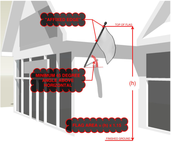
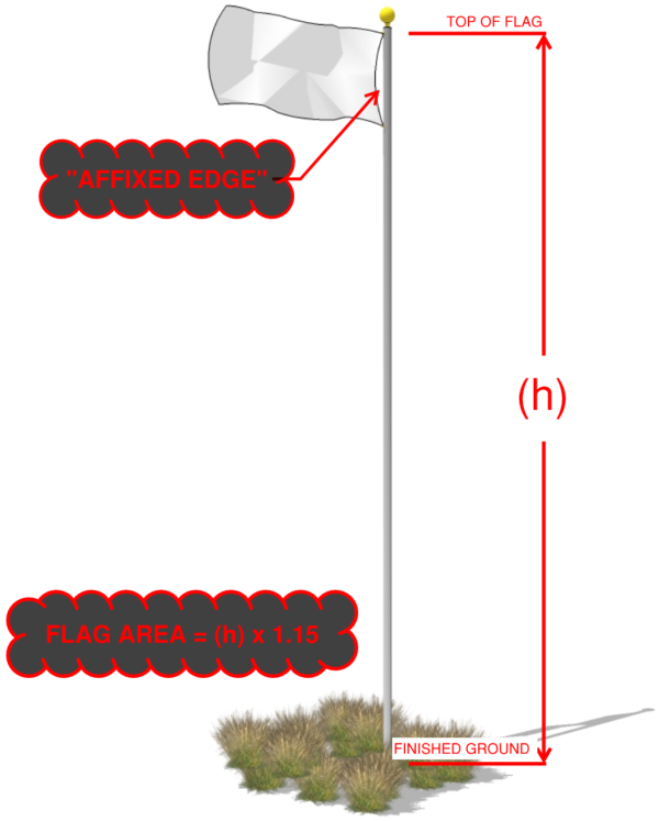
(Ord. of 1956, § 32B-2; Ord. No. 2009-30; Ord. No. 2017-24, Exh. B, 6-27-2017; Ord. No. 2017-31, Exh. A, 10-31-2017)
A master signage plan shall be required to ensure compliance with standards and requirements of this Land Use Code when multiple signs are allowed and/or multiple tenants, businesses or other entities occupy a single building or storefront.
- Approval of the master signage plan. The master signage plan is subject to site plan approval, and once approved, all individual land use permits shall comply therewith.
- Requirements. Each master signage plan shall clearly indicate the location, size, illumination details, type and all dimensions, including height, of each sign on the property, as well as the distribution or allowed signage among multiple tenants, businesses or entities within a building or complex.
(Ord. of 1956, § 32B-3; Ord. No. 2009-30)
After the effect of this chapter, which is August 1, 2017, any sign that does not comply with the requirements of this chapter shall be considered a nonconforming sign. A nonconforming sign that is not defined as a billboard under U.C.A. 1953, § 17-27a-103 shall be phased out in accordance with the following schedule:
- Sign replacement. The replacement of any nonconforming sign shall comply with the requirements of this chapter;
- Building exterior modification. When the replacement of a building's exterior materials exceeds 25 percent of the building's exterior area, excluding roof area, whether by a single modification project or by an accumulation of separate modification projects, all nonconforming signs on the premises on or within 25 feet of the building shall be brought into compliance with the requirements of this chapter. This shall not include repainting or re-roofing.
- Building expansion. When a building's expansion exceeds the threshold established in this subsection, whether by a single expansion project or by an accumulation of separate expansion projects, all nonconforming signs on the premises on or within 25 feet of the building shall be brought into compliance with the requirements of this chapter. The established threshold of expansion shall be the smaller of the following:
- Twenty-five percent of the total area of the building as it exists on August 1, 2017; or
- Two thousand five hundred square feet; and
- Site improvements. When a site improvement which requires a land use permit, conditional use permit, or design review approval, modifies an area that exceeds the threshold established in this subsection, whether by a single modification project or by an accumulation of separate modification projects, all nonconforming signs on the premises shall be brought into compliance with the requirements of this chapter. The established threshold of modification shall be the smaller of the following:
- Twenty-five percent of the site area: or
- Twenty thousand square feet.
(Ord. of 1956, § 32B-4; Ord. No. 2001-32; Ord. No. 2009-30; Ord. No. 2013-17, 6-18-2013; Ord. No. 2017-24, Exh. B, 6-27-2017)
- Valley Commercial CV-1, CV-2 and the Manufacturing MV-1 Zoning Districts.
- Wall signs. Each freestanding building or complex of buildings is allowed one wall sign per street frontage which shall not exceed five percent of the square footage of the front of the building (linear footage of the front of the building, multiplied by the height of the building; multiplied by five percent) not including false fronts. If multiple units, each unit to be allowed five percent of width of the unit multiplied by the height.
- Ground/monument sign. Each freestanding building or complex having primary or secondary entry from a street, shall be allowed one ground sign per frontage, not to exceed eight feet in height and 12 feet in width. The sign may be placed on a landscaped, mounded berm up to two feet from grade. Each individual building within the project area may have a ground monument sign and shall meet the requirements of this chapter, with the signs being approved as part of the master signage plan.
- Entrance ground sign. One entrance ground sign on a multiple building/tenant project may have a maximum sign height of 14 feet and a maximum width of 12 feet. This sign replaces the ground monument sign that is allowed for one of the buildings in a multiple building/tenant project. The entrance ground sign shall be approved as part of the master signage plan.
- Conditional use. As a conditional use, commercial or manufacturing developments of multiple lots that are developed on an interior section of ground with lots having no frontage along major roads (collector or arterial) will be allowed an entrance ground sign meeting the requirements of this chapter, at the location where the local roads intersect the major road, which lead directly to the development. The entrance ground sign will announce the businesses within the development. Hotels/motels will be allowed "Vacancy/No Vacancy" on this sign.
- Commercial Valley Resort Recreation Zone (CVR-1), Agricultural Valley (AV-3), Forest Valley (FV-3), FR-1, FR 3, F-5, F-10, and F-40.
- Nonresidential uses.
- Wall signs. Each freestanding building or complex of buildings is allowed one wall sign per street frontage which shall not exceed five percent of the square footage of the front of the building (linear footage of the front of the building, multiplied by the height of the building; multiplied by five percent) not including false fronts. If multiple units, each unit to be allowed five percent of width of the unit multiplied by the height.
- Ground/monument sign. Each freestanding building or complex having primary or secondary entry from a street, shall be allowed one ground sign per frontage, not to exceed eight feet in height and 12 feet in width. The sign may be placed on a landscaped, mounded berm up to two feet from grade.
- Entrance ground sign. One entrance ground sign on a multiple building project may have a maximum sign height of 14 feet and a maximum width of 12 feet. This sign replaces the ground monument sign that is allowed for one of the buildings in a multiple building/tenant project. The entrance ground sign shall be approved as part of the master signage plan.
- Residential uses.
- Single-family and residential units of less than eight units. One wall sign identifying the name of the owner and/or property, not to exceed six square feet is permitted.
- Multifamily residential uses of eight units or more. One wall sign not to exceed 20 square feet in area is permitted.
- Subdivision entry signs (monument sign). Each subdivision may be allowed one monument sign, not to exceed six feet in height and ten feet in width. The sign may be placed on a landscaped, mounded berm up to two feet from grade.
- Nonresidential uses.
- Destination and recreation resort zone.
- Nonresidential uses.
- Wall signs. Each freestanding building or complex of buildings is allowed one wall sign per street frontage which shall not exceed five percent of the square footage of the front of the building (linear footage of the front of the building, multiplied by the height of the building; multiplied by five percent) not including false fronts. If multiple units, each unit to be allowed five percent of width of the unit multiplied by the height.
- Ground/monument sign. Each freestanding building or complex having primary or secondary entry from a street, shall be allowed one ground sign per frontage, not to exceed six feet in height and ten feet in width. The sign may be placed on a landscaped, mounded berm up to two feet from finished grade. The planning commission may approve up to two ground/monument signs at each main resort entrance/portal when presented as part of a master signage plan as described in section 110-2-3.
- Portable signs. A-frame or sandwich signs not exceeding nine square feet may be placed outside of a particular subdivision, project or event site; however, the sign must remain within the resort boundary.
- Banners not to exceed 21 square feet each. Each sign shall be safely secured to a permanent fixture and extend no closer than eight feet to the ground.
- Changeable copy signs. Manual signs only meeting the requirements as listed in section 110-2-10(b) (Special purpose signs—destination and recreation resort manual changeable copy signs).
- Residential uses.
- Single-family and residential units of less than eight units. One wall sign identifying the name of the owner and/or property, not to exceed six square feet is permitted.
- Multifamily residential uses of eight units or more. One wall sign not to exceed 20 square feet in area is permitted.
- Subdivision entry signs (monument sign). Each subdivision may be allowed one monument sign, not to exceed six feet in height and ten feet in width. The sign may be placed on a landscaped, mounded berm up to two feet from grade.
- Sign plan. Within any Ogden Valley recreation and resort zone, at elevations of at least 6,200 feet above sea level, where a master plan has been approved by the planning commission, the planning commission may modify any provision of this chapter by approving a sign plan created by the developer (as defined in the applicable zoning development agreement) if the planning commission determines that the plan is consistent with the approved master plan.
- Nonresidential uses.
(Ord. of 1956, § 32B-6; Ord. No. 2006-6; Ord. No. 2009-30; Ord. No. 2016-4, Exh. G2, 5-24-2016)
- Canopy signs. Canopy signs may be substituted for wall signs, subject to approval of the master signage plan. Any approved canopy sign shall have a minimum vertical clearance of eight feet from any walking surface.
- Projecting signs. Projecting signs that are perpendicular to a building may be substituted for wall signs, subject to approval of the master signage plan. No sign face of a projecting sign may project more than four feet from the wall to which it is mounted. Any projecting sign shall have a minimum vertical clearance of eight feet from any walking surface.
- Entrance/exit signs. Entrance/exit signs are limited to two signs for each approved driveway opening for commercial uses and multi-tenant dwellings, and shall be limited to a maximum of three square feet per side, and shall be no higher than five feet above the ground at the top of the sign. Setbacks shall be ten feet from right-of-way. Content is limited to "Entrance" and "Exit."
(Ord. of 1956, § 32B-7; Ord. No. 2009-30)
Signs displayed in windows of buildings or storefronts are allowed in all zoning districts. A land use permit for a sign is not required for their display, provided they comply with the following:
- Size limit of window sign. The cumulative sign area for window signage shall occupy no more than 25 percent of the area of the window in which the signage is displayed. Signage necessary to fulfill a governmental regulation or requirement is exempt.
- Illumination of window sign. Despite the provisions of Title 108, Chapter 16, one window sign, measuring no greater than four square feet in area, may be illuminated in a manner visible from outside the building, provided it shall only be illuminated during business hours and only to an illumination level reasonably necessary to communicate the message to the nearest street right-of-way.
- Prohibited features of window sign. No window sign or any other sign within a building or structure shall move, flash, blink, rotate, or be animated in any way that is visible from outside the property's boundaries.
- Example of window signs:
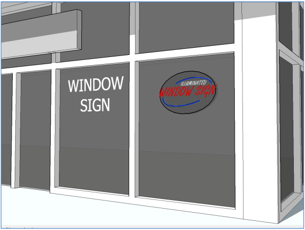
(Ord. of 1956, § 32B-8; Ord. No. 2009-30; Ord. No. 2017-31, Exh. A, 10-31-2017)
All signs not specifically listed as allowed are prohibited, including:
- Moving signs. Animated, flashing, blinking, fluttering, undulating, swinging, changing, rotating or otherwise moving signs, pennants, tethered "party or weather-type" balloons, holograms, light beams, lasers or other like decorations.
- Moving appurtenances. Moving mechanical or electrical appurtenances attached to a sign or otherwise intended to attract attention to a sign.
- Rotating beacon lights.
- Inflatable advertising devices or signs. (Does not refer to passenger-type hot air balloons being used for passenger flight.)
- Flags. Flags not exempted in section 110-2-2.
- Banners. Banners, unless specifically provided otherwise in this chapter.
- Changeable copy signs. Electronic changeable copy signs, except as permitted in section 110-2-9(b)(13). Manual changeable copy signs except as permitted in section 110-2-10.
- Off-site signs. All off-site, off-premises and directional signs which advertise businesses, establishments, activities, facilities, goods, products, or services not made, produced, sold or present on the premises or site where the sign is installed and maintained are prohibited, except as exempted in section 110-2-9, Other signs. Notwithstanding the foregoing, where access to a parcel is via an adjacent parcel, signs may be located on such adjacent parcel.
- Signs on motor vehicles, except for student driver signs. Vehicle signs may be allowed on vehicles, but they may not be illuminated or parked on a long-term basis to be used as a sign for the purpose of advertising a product or directing people to a business activity as listed in section 110-2-9, Other signs.
- Luminous tube signs. External gas filled luminous tubes, such as neon, argon or fluorescent, signs or valances, unless inside a building or in a window and not to exceed four square feet in area, except as listed in section 110-2-12, Sign materials and display standards, and may not flash or blink.
- Other temporary signs. Any other device in the form of a sign, which is of a temporary nature, or mobile, and not permanently affixed to a building or an upright support affixed firmly to the ground, except as permitted in section 110-2-11, Temporary sign usage.
- Roof signs. Signs mounted on a roof or atop a parapet wall.
- Billboards.
- Pole signs. Except one pole sign per public, private, and charter school, consisting of not more than a six-foot tall by ten-foot wide changeable reader board sign, located not less than ten feet and not more than 15 feet above the sidewalk, may be permitted.
- Public property signs. It shall be unlawful for any person to fasten or attach, paint or place any sign, handbill, poster, advertisement or notice of any kind or sort, whether political or otherwise or to cause the same to be done in or upon the curbstone, lamp post, telephone pole, electric light or power pole, hydrant, bridge or tree, or in or upon any portion of any sidewalk or street. It shall be unlawful to paste, place, paint or attach any sign defined in this chapter on any building, street or property of the county. No sign shall be erected on or project over public property, except as permitted in section 110-2-9, other signs, and section 110-2-11, temporary sign usage.
(Ord. of 1956, § 32B-9; Ord. No. 2009-30; Ord. No. 2013-17, 6-18-2013; Ord. No. 2016-4, Exh. G2, 5-24-2016; Ord. No. 2017-24, Exh. B, 6-27-2017; Ord. No. 2017-31, Exh. A, 10-31-2017)
- The following signs are allowed in all zoning districts in the Ogden Valley of Weber County:
- Conservation property sign. A conservation property sign, as defined in Title 101, Chapter 2, may be erected on any property complying with the minimum provisions of the definition. The sign shall either be a monument sign or a freestanding sign (pole sign) in compliance with the following:
- Monument sign. For a monument sign, the width shall be no greater than ten feet and the height shall be no greater than eight feet, with a sign face no greater than 24 square feet.
- Freestanding sign (pole sign). For a freestanding sign (pole sign), the width shall be no greater than eight feet and the height shall be no greater than ten feet with a sign face no greater than 24 square feet. The sign face shall be mounted between the sign poles, which shall be constructed of timbers that measure at least eight inches by eight inches and extend from the ground to the top of the sign face. The top of the sign face and the bottom of the sign face shall be completely bounded by timbers that have a minimum vertical height of eight inches. When placed adjacent to a street with shoulders that slope downward toward the sign base, a freestanding sign may be installed atop a rock or earthen-berm base that is no greater than three feet in height.
- Example. The following images are examples of each:
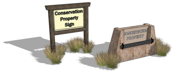
- Gate or arch sign. A gate or arch sign situated over the primary entry of a lot or parcel of land, provided that the sign face does not exceed 30 square feet and that the sign provides a vertical clearance of at least 14.5 feet from the driving surface, not to exceed 18 feet in height and a minimum passable width of 20 feet, not to exceed 30 feet pole to pole. Depth of the arch shall not exceed two feet. A land use permit, to verify compliance with applicable standards, and a building permit to verify proper installation of footings and to ensure wind tolerance, is required.
- Subdivision entry signs. An approved, recorded subdivision may locate one sign at each entrance. The sign shall be a ground or monument sign, and shall meet all specifications/requirements for monument signs in section 110-2-5. In the event the location of the subdivision entry sign is in a zone not governed by section 110-2-5, the dimensions of the sign shall be no greater than allowed in the AV-3 zone. The planning commission shall approve location and design style. A double entry sign may be approved by the planning commission where there is a divided center island entry street.
- Conservation property sign. A conservation property sign, as defined in Title 101, Chapter 2, may be erected on any property complying with the minimum provisions of the definition. The sign shall either be a monument sign or a freestanding sign (pole sign) in compliance with the following:
- The following signs are allowed in all zoning districts in the Ogden Valley of Weber County, and are exempt from the standards of section 110-2-12(a):
- Addressing numbers. Addressing numbers shall be no more than 12 inches in height. An addressing number sign is also exempt section 110-2-12(b)(8).
- Athletic field scoreboard signs. An athletic field scoreboard sign shall not exceed 120 square feet in any zone. An athletic field scoreboard sign is also exempt from section 110-2-12(b)(3).
- Business signs. No more than one "Open/Closed" and one "Vacancy/No Vacancy" sign, one "Hours of Operation" sign, and one "Credit Card Acceptance" sign, not to exceed a total of four square feet in area, displayed for each business.
- Grand opening signs. On a one-time basis, a business establishment shall be permitted one banner not to exceed 12 square feet, to be displayed for a period of not more than 30 days.
- Guidance signs. Guidance and other informational signs authorized by the Utah Department of Transportation or other governmental agency. A guidance sign is exempt from all of the standards of section 110-2-12.
- Historical signs. Historical name signs for sites and/or structures designated by the board of county commissioners as having historical significance to the county (and as identified in the Ogden Valley Master Plan).
- Murals. Murals, when depicted on the sides or rear of a building or storefront, provided that the mural has no connection or advertising context to any business conducted or any product or service offered therein.
- Nameplate signs. Nameplate signs not to exceed four square feet that identify the occupants/owners and/or home occupation of a residential property.
- Portable sign. The only portable signage allowed, excluding temporary signs regulated by 110-2-11, is an a-frame sign, also known as a sandwich board sign, in compliance with the following:
- Number, location, and timing for a portable sign. One portable sign per commercial business is permitted on site. Up to two portable signs are permitted per commercial business offsite, provided the offsite portable signs comply with the following:
- The commercial business shall have a physical location within the Ogden Valley planning area, or Huntsville Town, and a valid business license;
- The portable sign shall be located outside any public street right-of-way;
- The portable sign shall be located no closer than ten feet from any other portable sign;
- If located outside a commercial, manufacturing, or resort zone, the portable sign shall only be located adjacent to a collector or arterial street right-of-way;
- The business shall receive landowner permission for the specific location of the portable sign;
- The portable sign shall be properly placed and anchored to the ground in a manner that keeps it in place, upright, and level; and
- The portable sign shall only be on display outside during the hours of operation of the business.
- Standards for a portable sign. The maximum sign area shall be nine square feet with a width and height when folded of no greater than three feet each. Both sides of the sign shall have a four-sided frame of natural, stained, rustic, or antiqued-painted wood or similarly appearing faux wood, or natural antiqued metal; and the same applies to the sign supports. The sign background shall be at least 50 percent darker than the sign message, as discerned using industry best practices, and shall only use earth-toned colors that are clearly visible, without instruments, from the sign location.
- Permit and expiration. A land use permit is required for a portable sign pursuant to section 110-2-2. A land use permit for an offsite portable sign shall expire annually at the time the business license for the commercial business to which it belongs expires or on December 31. An offsite portable sign shall not be included as a part of a master signage plan.
- Examples. The following are examples of allowed portable signs:
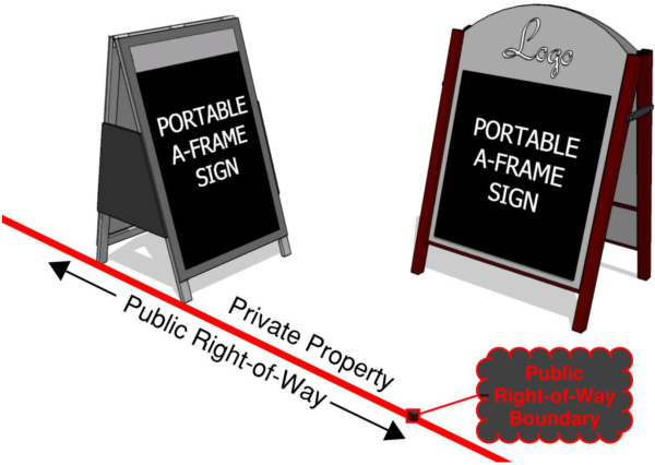
- Number, location, and timing for a portable sign. One portable sign per commercial business is permitted on site. Up to two portable signs are permitted per commercial business offsite, provided the offsite portable signs comply with the following:
- Private warning signs. Private warning signs, provided they do not exceed four square feet.
- Signs on vehicles. Signs for business identification which may include name, address, and telephone number, not to exceed two feet by three feet upon the side door of a vehicle.
- Statuary and sculptures. Freestanding statuary and sculptures which are considered to be works of art and which are placed on private property clearly for the benefit and interest of the general public.
- Traffic signs. All signs erected in or adjacent to a public right-of-way by a public agency or in a private road right-of-way for the purpose of controlling or directing traffic. A traffic sign is exempt from all of the standards of section 110-2-12.
(Ord. of 1956, § 32B-10; Ord. No. 2001-25; Ord. No. 2009-30; Ord. No. 2013-17, 6-18-2013; Ord. No. 2017-24, Exh. B, 6-27-2017; Ord. No. 2017-31, Exh. A, 10-31-2017)
- Manual changeable copy signs. One reader board or changeable copy sign per business is permitted to be displayed, at one square foot of sign area per linear foot of building frontage, and may be either ground or wall sign by the following types of businesses:
- Theaters. Motion picture theaters and playhouses.
- Auditoriums and performing arts facilities.
- Convention facilities. Businesses with convention facilities.
- Gasoline stations. Businesses which sell motor fuels at retail cost, dispensed from pumps on premises.
- Grocery stores.
- Public, private or charter schools.
- Destination and Recreation Resort Zone manual changeable copy sign. One reader board or changeable copy sign, not exceeding 16 square feet, is permitted and may be displayed within a resort village area when the village area consists of six or more commercial buildings.
- Movie poster signs. Motion picture theaters, facilities for performing arts, and retail stores whose primary business is the sale and/or rental of pre-recorded video tape and/or discs to the general public shall be permitted to display a maximum of two poster signs. Movie posters shall be displayed in a display case which shall be permanently affixed to the wall of the building or storefront. Movie posters shall not be affixed directly to a wall as a temporary sign. Movie poster display cases may be lighted as long as they comply with the sign illumination standards found in Section 110-2-12 of this chapter. Movie poster display cases shall not exceed 12 square feet in area. The area of any movie poster sign conforming to this section shall not count toward the total signage allowed by section 110-2-5, Allowable signs by zoning district.
(Ord. of 1956, § 32B-11; Ord. No. 2009-30)
Temporary signs shall be permitted in accordance with standards set forth below, unless specified otherwise in this ordinance:
- Setback standards for temporary signs.
- Temporary signs must be located completely on private property, except as exempted in section 110-2-9, other signs.
- Signs must be placed ten feet behind the sidewalk, including those with grass strips between the street and the sidewalk, except for special event banners and special event directional signs.
- On streets with no sidewalks and where it is not clear where the property line is located, signs must be placed ten feet behind the curb or pavement and not hang into the street; and
- At intersections, they must be placed beyond the site distance triangle as found in section 108-7-7, clear view of intersecting streets.
- Temporary signs. Temporary signs in this section shall in no way regulate the content of speech, only the place and manner in which it is permitted.
- Additional standards. The following table applies to temporary sign use:
Sign Type General Standards in All Zones Specific Standards for the Agricultural, Forest and Residential Zones Specific Standards for the Commercial, Manufacturing and Resort Zones Display Period
Removal Required 3 Days After Land Use Permit or Special Event Permit Required Maximum Area per Sign Face Maximum Height of Freestanding Signs (includes support structure) Number of Signs Permitted per Sign Type Maximum Area per Sign Face Maximum Height of Freestanding Signs Number of Signs Permitted per Sign Type Occasional Signs: Campaign signs 60 days prior to the election Completion of the election N 32 square feet 6 feet No limit 32 square feet 8 feet No limit Construction signs Duration of construction Completion of construction N 32 square feet 6 feet 1 per street frontage 64 square feet 12 feet 1 per street frontage Property/real estate sign Duration of listing Closing/lease commencement date N 8 square feet 6 feet 1 per street frontage 64 square feet 12 feet 1 per street frontage Short-term vendors
§ 108-13-3120 days End of event Y/LUP Not Applicable Not Applicable Not Applicable 16 square feet 6 feet if set in the ground or anywhere on the building 2 total per frontage, either a ground sign or on vendor trailer, mobile store, tent, or kiosk Temporary outdoor sales § 108-13-4 Per state code if applicable or 30 days prior to the event End of event Y/LUP Not Applicable Not Applicable Not Applicable 16 feet 6 feet if set in the ground or anywhere on the building 2 per street frontage Temporary real estate sales office Duration of construction Completion of construction Y/LUP 32 square feet 6 feet 1 per street frontage Not Applicable Not Applicable Not Applicable Temporary real estate sales office wall sign Duration of construction Completion of construction Y/LUP 20 square feet N/A 1 sign attached to the office Not Applicable Not Applicable Not Applicable Seasonal Signs: Farmer's markets
§ 108-13-5June through October End of event Y/LUP 32 square feet 10 feet 1 per street frontage 32 square feet 10 feet 1 per street frontage Fruit and vegetable stand § 104-5-3 (8) June through October End of event Y/LUP 16 square feet 10 feet 1 per street frontage 32 square feet 10 feet 1 per street frontage Political sign No limit No limit N 16 square feet 10 feet 1 per street frontage 32 square feet 10 feet 1 per street frontage Event Signs: Public event sign 30 days prior to the event End of event Y/SEP 4 square feet 3 feet 1 per street frontage 4 square feet 3 feet 1 per street frontage Public event banner (on public property, over public streets or sidewalks) 30 days prior to the event End of event Y/SEP 12 square feet N/A 1 per street frontage 12 feet N/A 1 per street frontage Public event directional sign 30 days prior to the event End of event Y/SEP 8 square feet 4 feet No limit off-premises directional signs 8 square feet 4 feet No limit off-premises directional signs Special event sign 60 days prior to the event End of event Y/SEP 16 square feet on-site 6 feet No limit onsite signs, either ground or banner signs 16 square feet onsite 6 feet No limit on-site signs, either ground or banner signs Special event banner (on public property) 30 days prior to the event End of event Y/SEP 12 square feet N/A 1 per street frontage 12 square feet N/A 1 per street frontage Special event directional sign 1 day prior to the event End of event Y/SEP 8 square feet offsite 4 feet No limit off-premises directional signs 8 square feet offsite 4 feet No limit off-premises directional signs Special event off-site sign 30 days prior to the event End of event Y/SEP 32 square feet 10 feet 2 offsite per event either a ground sign or banner 32 square feet 10 feet 2 offsite per event either a ground sign or banner
(Ord. of 1956, § 32B-12; Ord. No. 2009-30; Ord. No. 2013-17, 6-18-2013; Ord. No. 2017-24, Exh. B, 6-27-2017)
- Sign materials. All materials used to construct signs, supports or fasteners shall conform to the following standards:
- Signs may be constructed of painted, stained, sandblasted or carved wood, brick, stone, textured concrete or similar material. Glass (including plexi-glass), metal, or metallic leaf, which is painted, anodized, or otherwise treated to prevent reflective glare may also be used. Copper, brass, wrought iron, and other metals may remain untreated and allowed to develop a natural patina.
- Support structures may be constructed of painted, stained, sandblasted or carved wood, brick, stone, textured concrete or similar material. Glass, metal, or metallic leaf, which is painted, anodized, or otherwise treated to prevent reflective glare may also be used. Copper, brass, wrought iron, and other metals may remain untreated and allowed to develop a natural patina. Support structures shall use natural, muted earth-tone colors including browns, black, grays, rusts, etc. White shall not be used as a predominant color, but may be used as an accent.
- Display standards. The display of all signs regulated by this Land Use Code shall conform to the standards of this section.
- No obstruction permitted. No sign shall obstruct a clear view to and from traffic along any street right-of-way, entrance or exit.
- No projection within right-of-way. No signs, except traffic signs and similar regulatory notices shall be allowed to project or be located within a public right-of-way.
- Illumination. An illuminated sign, as defined in Title 101, Chapter 2. shall comply with the requirements of chapter 108-16 and the following provisions, examples of which are graphically depicted in section 110-2-15.
- Unless otherwise specified in this subsection (b), all exterior lighting of a sign shall be downward directed from the top of the sign, and oriented so as to illuminate only the sign area, as defined in Title 101, Chapter 2, excluding the supports.
- No direct artificial light, as defined in Title 101, Chapter 2, shall be projected from the sign area or beyond the sign area, including by means of diffusion or refraction through a translucent or transparent surface. However, direct artificial light, excluding diffused or refracted light, for a sign area that does not have a frame or separate background, as in the case of a logo or individual lettering mounted to a wall without a defined sign perimeter, may illuminate or reflect onto a background surface, such as a wall, beyond the exterior perimeter of the sign area, provided that:
- It shall not exceed six inches beyond the sign area;
- It shall be shielded so as not to project light onto any other surface.
- Exterior lighting of a sign shall not exceed a ratio of 75 lumens per square foot of sign area. This ratio shall be calculated by combining the total lumen output of each artificial light source divided by the square footage of the sign area. See section 110-2-15 for a graphic depiction.
- The land use authority may require the applicant to submit photometric schematics and attestation from a qualified professional that the submittal complies with this chapter.
- Wall signs mounted on parapets. A wall sign mounted on a parapet wall shall be mounted six inches or more below the top of the parapet wall.
- No imitation of traffic signs. Signs shall not resemble, imitate or approximate the shape, size, form or color of traffic signs, signals or devices. Signs shall not obstruct or interfere with the effectiveness of traffic signs, signals or devices, not be lighted in a way that can cause glare or impair driver visibility upon roads.
- No prevention of ingress/egress. Signs shall not be erected, relocated or maintained in such a way that prevents free ingress or egress from any door, window or fire escape, and no sign shall be attached to a standpipe or fire escape.
- No mounting on natural features. No signs shall be painted or mounted on trees. No land-form or naturally occurring land feature (rocks, cliff faces, etc.) shall be defaced for purposes of displaying a sign.
- Clearance. The clearance of a projecting, canopy or wall sign shall be measured from the lowest edge of the overhang eight feet to the driving or walking surface below.
- Sign setbacks.
- Monument and/or ground signs. Any monument sign or ground sign shall be set back a minimum of ten feet from any property line. Signs fronting on state highways shall be set back ten feet from the right-of-way.
- Projections into public right-of-way. Projections into the public right-of-way are not allowed, except for signs set by public agencies for safety purposes, such as the state department of transportation.
- Clear view triangle. Signs shall not be placed within the clear view triangle as defined in title 108, chapter 7 of the Weber County Land Use Code.
- Landscaping. The ground area around the base of all ground/monument signs shall be landscaped in accordance with the requirements of applicable chapters of the Weber County Land Use Code. The planning commission may exempt some monument/ground signs from this standard where it is demonstrated, by the owner/developer, that the landscaping would unduly interfere with pedestrian or vehicular traffic, interfere with traffic visibility or for other reasons be impractical.
- No street frontage. When a freestanding building, complex or storefront does not face a public street or approved private road, and is accessed via a pedestrian area or common parking and driveway area, the linear footage of building or storefront facing the pedestrian area or common parking area shall substitute for purposes of determining allowable signage.
- Sign area. The area of a sign shall be measured as provided in the definition of "sign area" as provided in Title 101, Chapter 2.
- Directional or circulation signs not visible offsite. Directional or circulation signs that are not visible from any point outside of the property boundary are not subject to the illumination requirements of this subsection (b) or the outdoor lighting requirements of chapter 108-16. An applicant wishing to install such an exempt illuminated directional or circulation sign shall have the burden of proof by communicating the proposed sign height, location, and visibility from any point outside of the property boundaries through the submission of an outdoor lighting plan to the land use authority. Directional or circulation signs claiming exemption from the illumination requirements of this chapter or chapter 108-16 shall not allow their illumination to extend past the horizontal plain of the upper sign boundary into the night sky.
(Ord. of 1956, § 32B-13; Ord. No. 2009-30; Ord. No. 2017-24, Exh. B, 6-27-2017)
- Removal or repair by owner. Any sign which is found to be in a dangerous or defective condition shall be removed or repaired by the owner of the premises or the owner of the sign. Upon failure of the owner to remove or repair a dangerous or defective sign, the planning director shall proceed with enforcement measures.
- Removal by planning director. The planning director may cause the removal of any sign that endangers the public safety or a sign for which no sign permit has been issued, if, after giving notice the owner has not remedied the violation.
- Cost of removal. The cost associated with the removal of a sign by the planning director shall be paid by the owner of the property on which the sign is located. If the cost is not paid within 30 days, the unpaid balance shall be considered a lien against the property and said lien shall be filed by the county attorney.
(Ord. of 1956, § 32B-14; Ord. No. 2009-30)
Signs and sign structures shall be designed and constructed to resist wind and seismic forces as specified in the uniform building code, as adopted by the county. A building permit for the sign structure shall be required, as well as a land use permit. If there is any indication, in the opinion of the county engineer, that the proposed structure may not resist wind, seismic forces or other loads or stresses, a state registered engineer's certificate on the sign's structural plans shall be required.
(Ord. of 1956, § 32B-15; Ord. No. 2009-30)
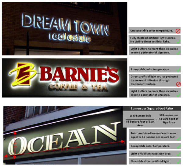
(Ord. No. 2017-24, Exh. B, 6-27-2017)